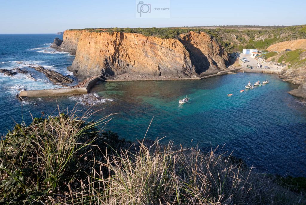
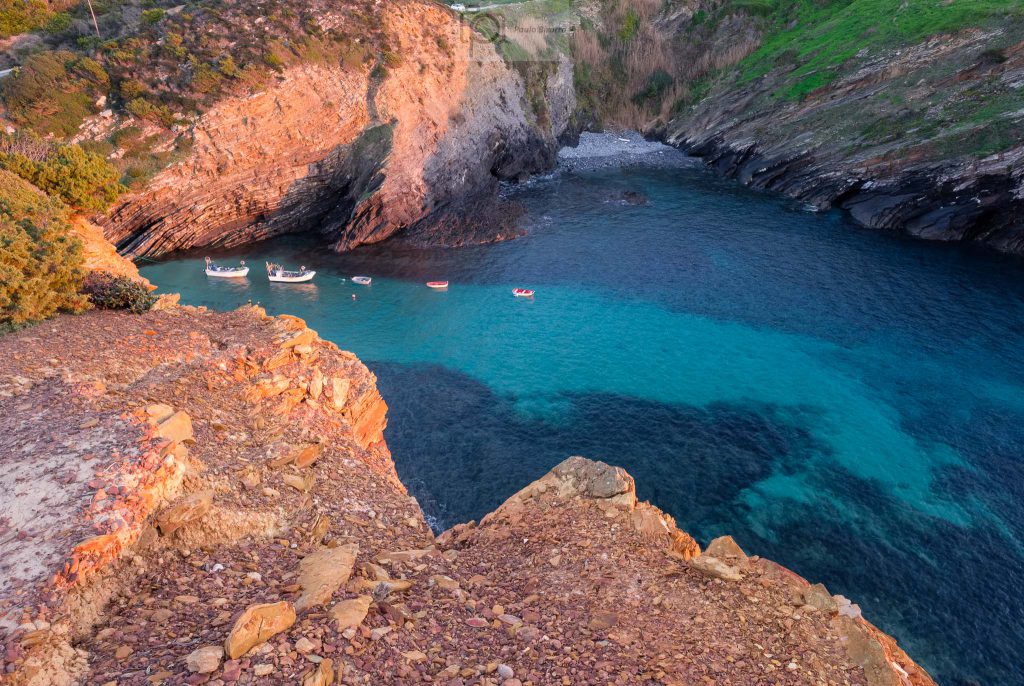
Along the southwest coast of Alentejo, in Portugal, there are several small fishing harbors that are still used today by local fishermen. The livelihood of this region is still based on two main activities: farming and fishing. These harbors provide shelter for the small boats that venture in the coastal areas when the weather conditions permit. On a recent sunny afternoon I visited the Entrada da Barca harbor, which is located close to the town of Zambujeira do Mar.
This is a very picturesque location, with nice views from the top of the cliffs. After making a few photos, I walked all the way down to the water, exploring the little bay. There were a few boats in the water, plus other ones on the concrete landing. I had with me a new lens, the Fujinon 70-300mm f/4 – f/5.6 zoom, which I wanted to try out. My preference when photographing in the area is for wide – angle and standard lenses, but a telephoto zoom is also very useful to photograph details and subjects that are far away. After this initial tryout, my conclusion is that the lens is very good and will be a valuable addition to my kit.
General overview of the fishing harbor of Entrada da Barca.Fishing boat.
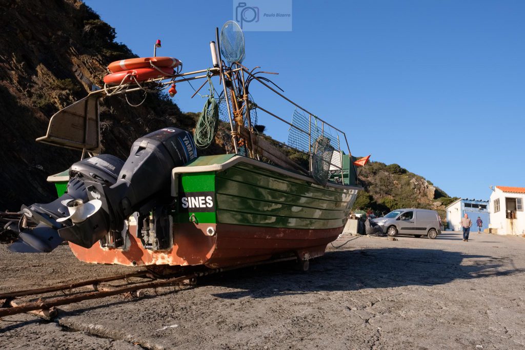
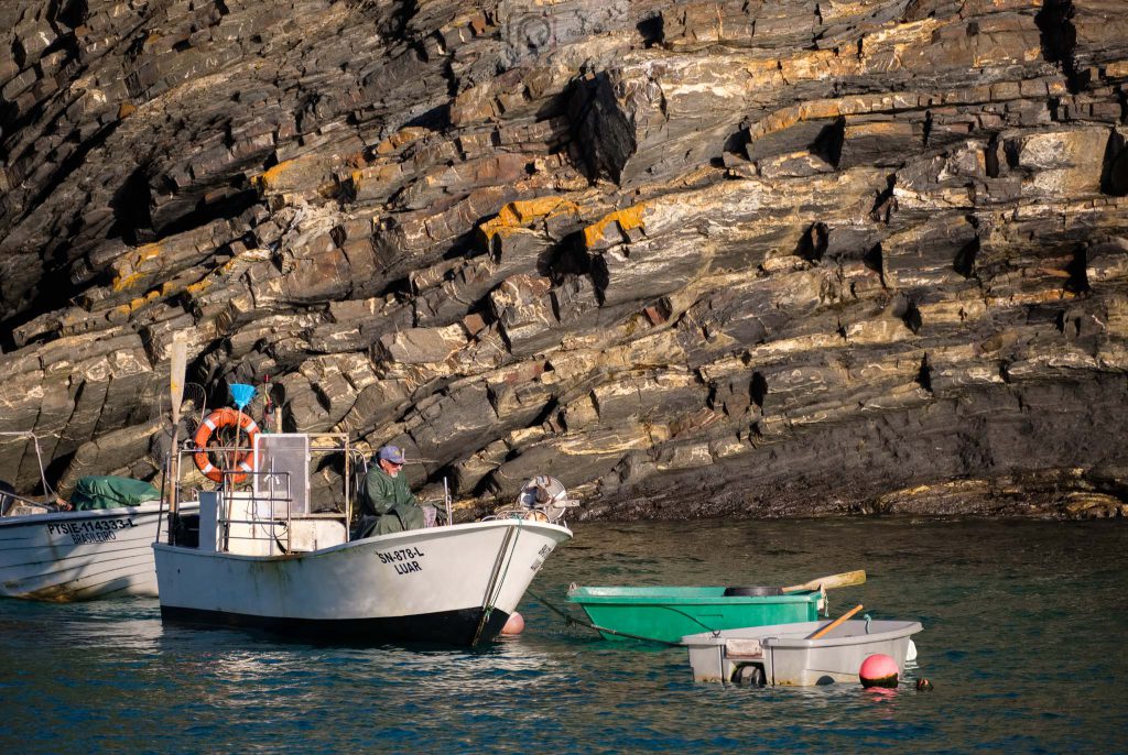
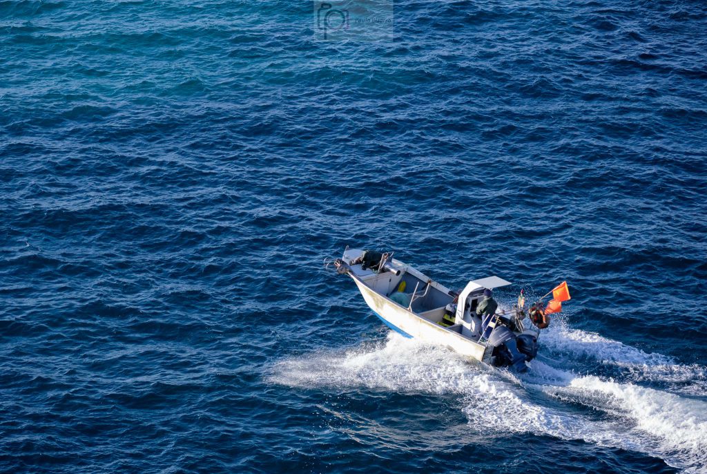
I walked along the concrete pier that was built to protect the harbor from the sea. Once you reach the end of it, you can appreciate the transition between the sheltered area and the open water. I admire the fishermen that regularly go out into the ocean in these tiny boats.
Getting ready.Going out.
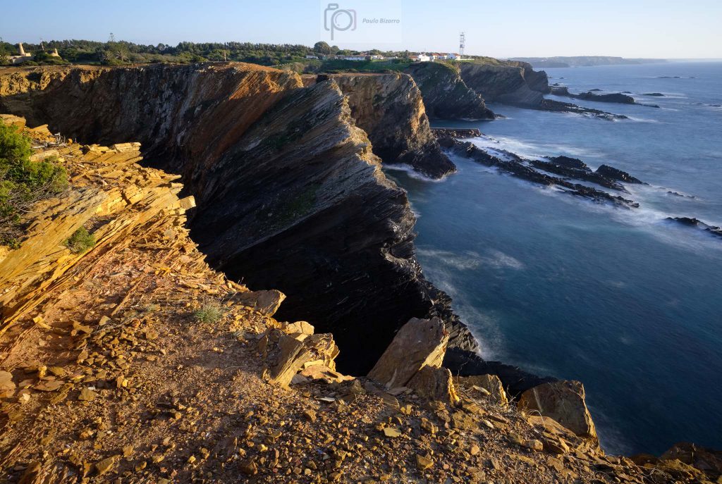
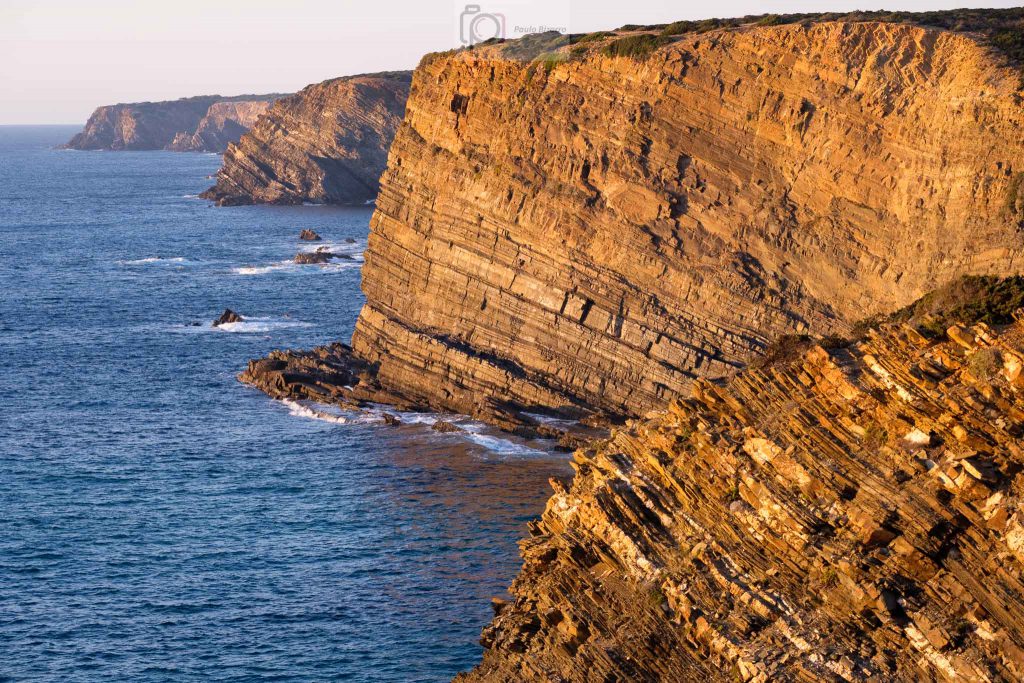
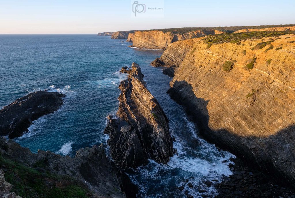
After a while I left the harbor and walked along the coastal path, which climbs the northern face of the small bay. This path belongs to the Rota Vicentina trail section that connects the towns of Zambujeira do Mar and Almograve, about 20 km away. The weather was clear and sunset time was approaching, bathing the coastal cliffs with a golden light. It is interesting to see the succession of small coves formed by the erosion of the rocks.
Looking south towards Zambujeira do Mar.
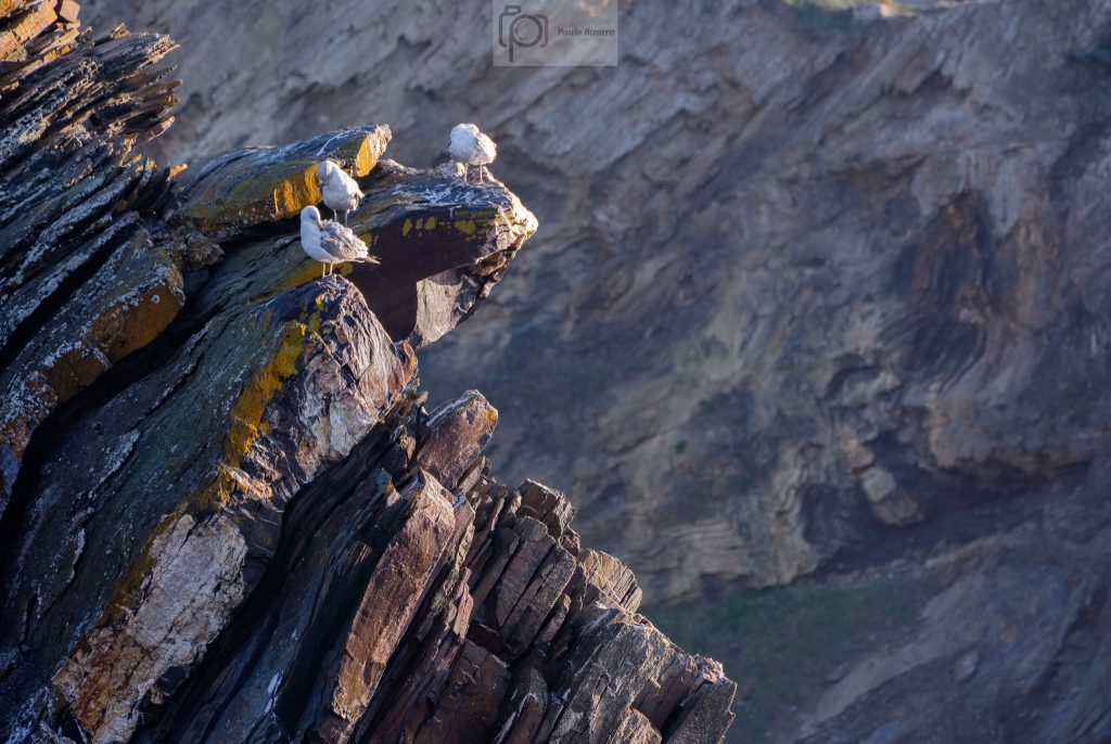
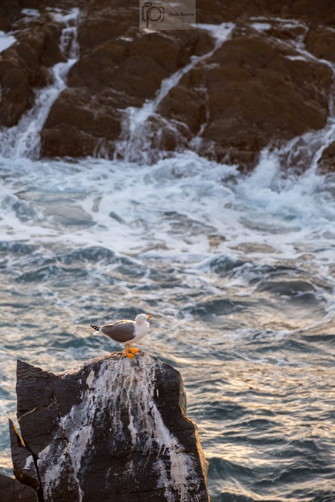
Walking along the trail, I chose a few spots that provided views over the coast, set up the tripod, and took a few more photos. The silence was only disturbed by the seagulls and the waves below. I use the telephoto zoom to photograph the distant bird nests, and also some of the cliffs, to highlight the layered nature of the rocks.
Seagulls.Seagull.Coastal cliffs.Looking north along the coastal trail.The harbor at sunset.
At the end of the day, enjoying the sunset, I was happy with this small walk in the area, where there are so many interesting aspects to explore. If you want, you can even stay longer and have a nice dinner in the typical restaurants near the harbor, where you can taste the fresh fish that was probably captured in the waters below.
The Vicentina coast in southwest Portugal is considered one of the remaining “wild coasts” in Europe. Together with the Alentejo coast to the north, it is part of a Natural Park. I wrote about it before, for example in this previous post from April 2021:
This coastal region is famous, amongst other things, for its beaches (many of them only accessible by footpaths or 4WD vehicles), the majestic tall cliffs dropping into the ocean, and the many species of birds. It is also very popular with surfers, who visit the area all year round. There are several walking paths that belong to the Rota Vicentina network, which are one of the best ways to explore the region. I have recently walked along route 24, a circular trail path the connects the town of Vila do Bispo to the coast and back. Along the way, it is possible to visit some of the most beautiful beaches in the area, like Barriga, Cordoama, and Castelejo. The distance is 15.5 km, which takes around 5 hours to walk at a normal pace.
Map showing trail number 24 of the Rota Vicentina (in orange color).
I normally do not carry much photo gear in these walks, but this time it was different. I knew I was going to need a wide-angle lens, besides my normal standard lens. I also wanted a tripod, for some late afternoon shots. So I packed my Fujinon 14mm and 35mm lenses, plus the Fujifilm X-PRO3 and X-T30 cameras. Still, the whole gear was still pretty light and fitted in my trekking backpack nicely.
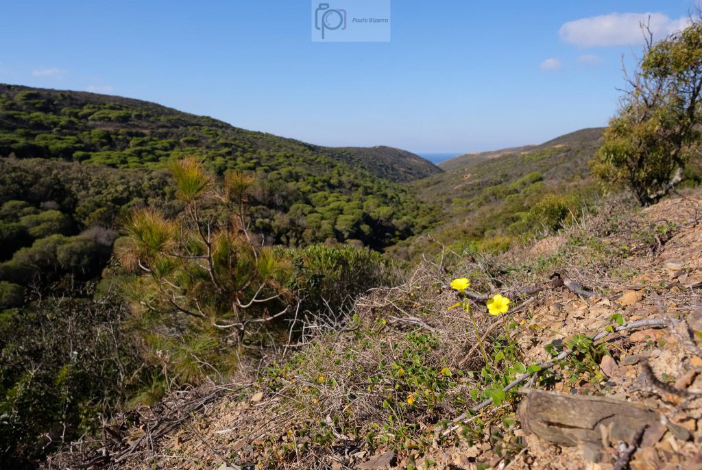
The landscape in this coastal area is characterized by a large plateau at around 120 m above sea level. However, this flat terrain is a bit misleading, because there are several creeks that have, through time, cut deep and narrow valleys in the topography. The first few kilometres of the trail cross this plateau, along rural countryside, and where the vegetation is short. The winds are strong here, so the trees do not grow very tall. Pine trees and shrubs are common.
The countryside, and the sea in the distance.
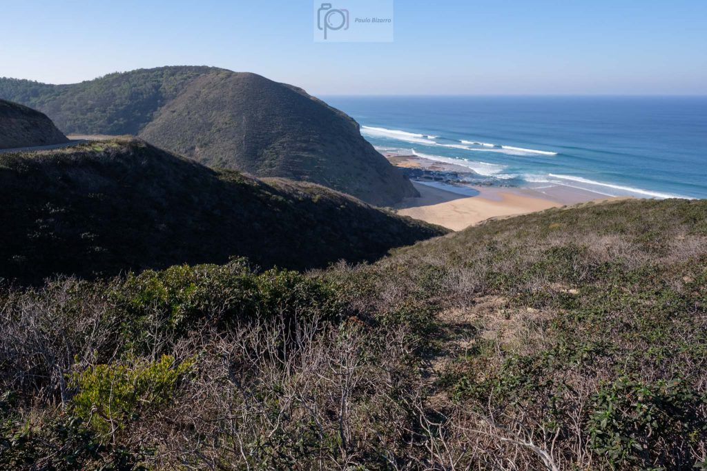
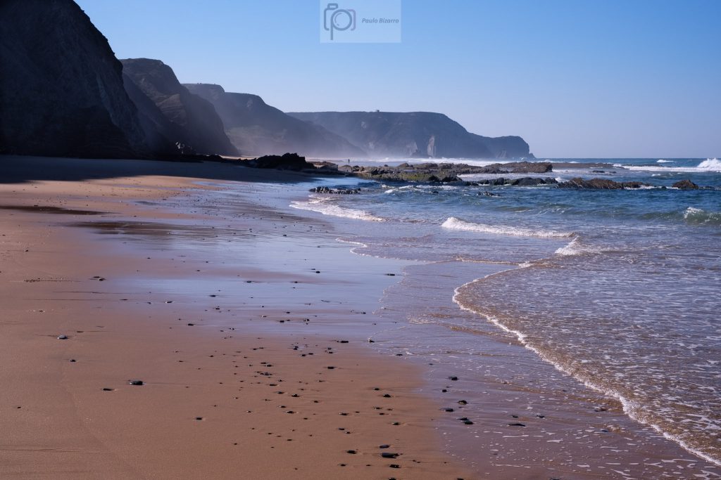
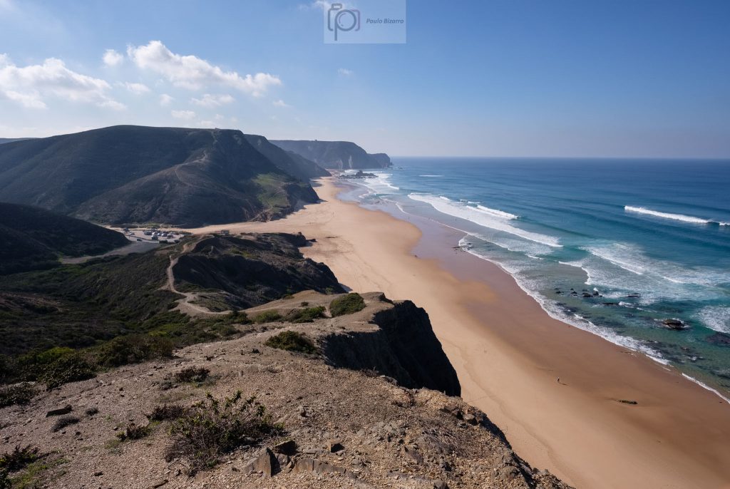
After a while, the path turns westwards, towards the sea, before arriving at Barriga beach. This part of the walk is wonderful, as the coastal plateau abruptly descends to the beach. The vertical cliffs are made of black Paleozoic rocks, in strong contrast with the light colored sand and the deep blue of the ocean water.
View of Barriga beach.Along the trail.On the Barriga beach.
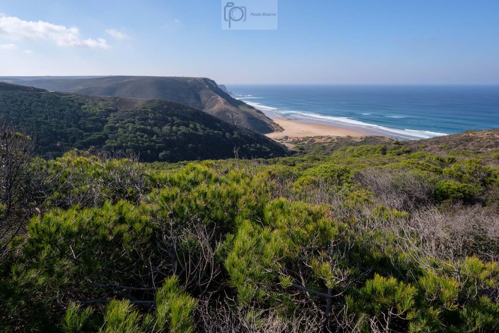
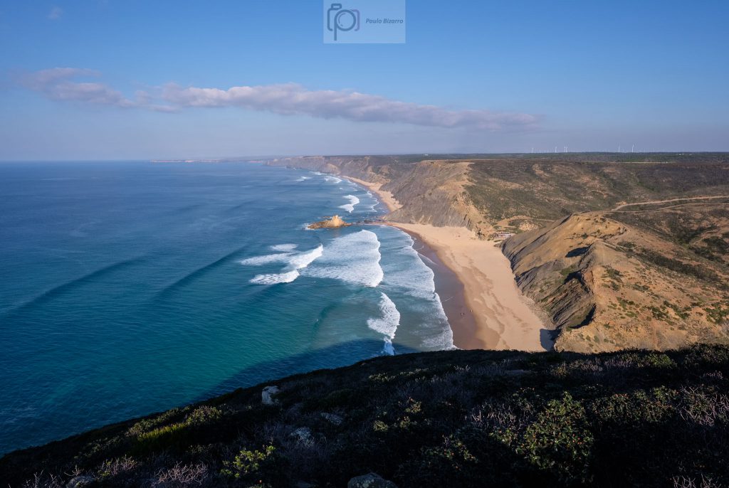
When the tide is low, it is possible to walk from Barriga to Cordoama, as the beaches are connected. But today I wanted to keep to the trail, so after visiting Barriga, I turned back inland. This was the first steep ascent in the walk, going back to the top of the plateau, but the view is wonderful. One of the highlights of this route is when the path reaches the coast again, affording a fantastic view of Cordoama and Castelejo beaches to the south, and the Carrapateira headland to the north.
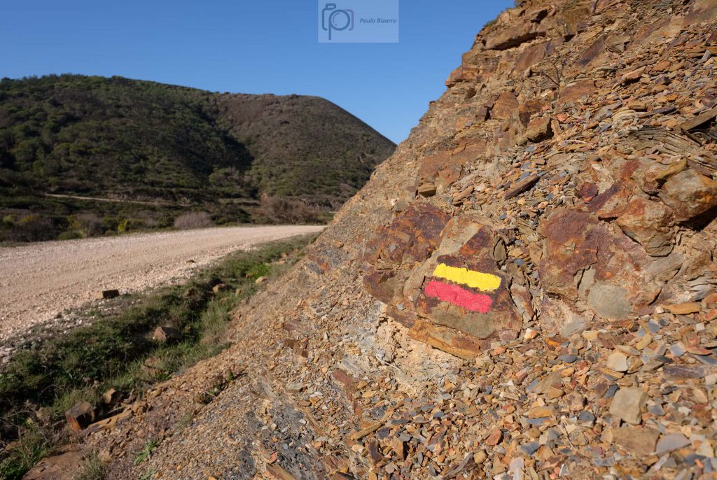
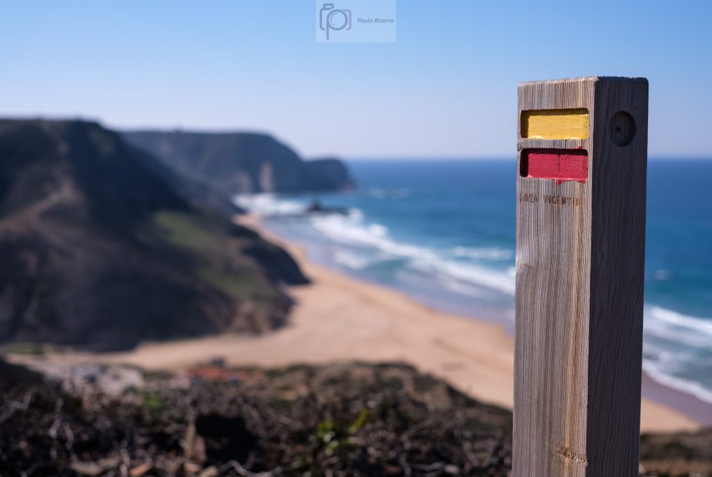
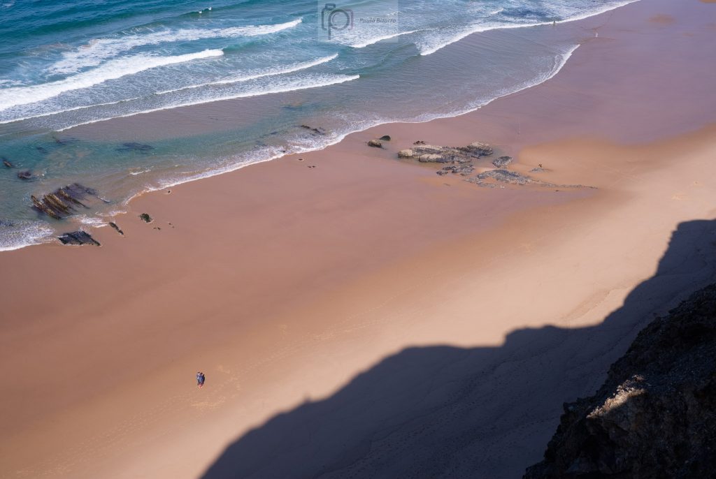
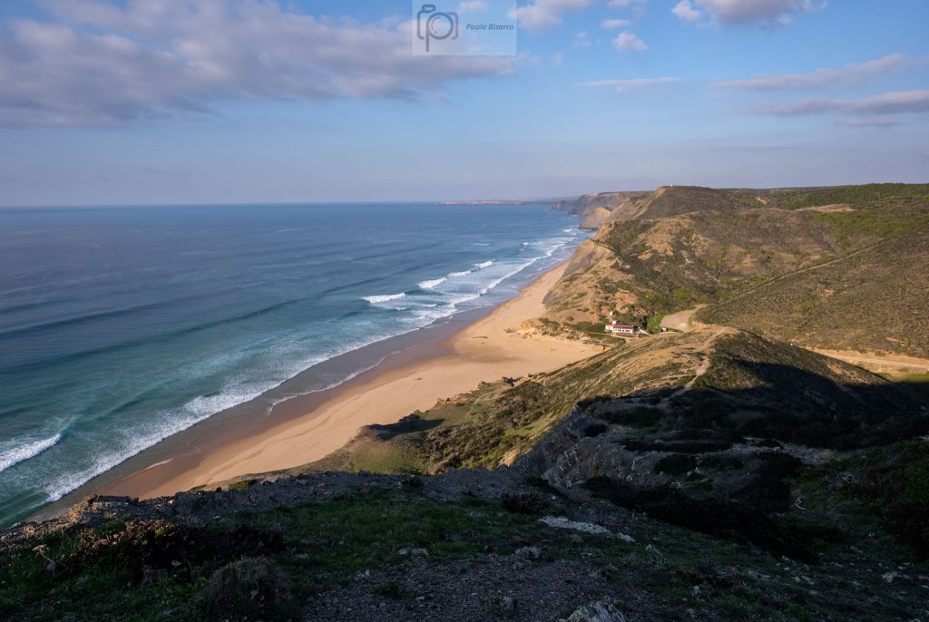
Trail marker at the top of the Cordoama cliff.View of Cordoama beach from the top of the cliff.The trail reaches the coast at Cordoama.Tall cliffs, small people.
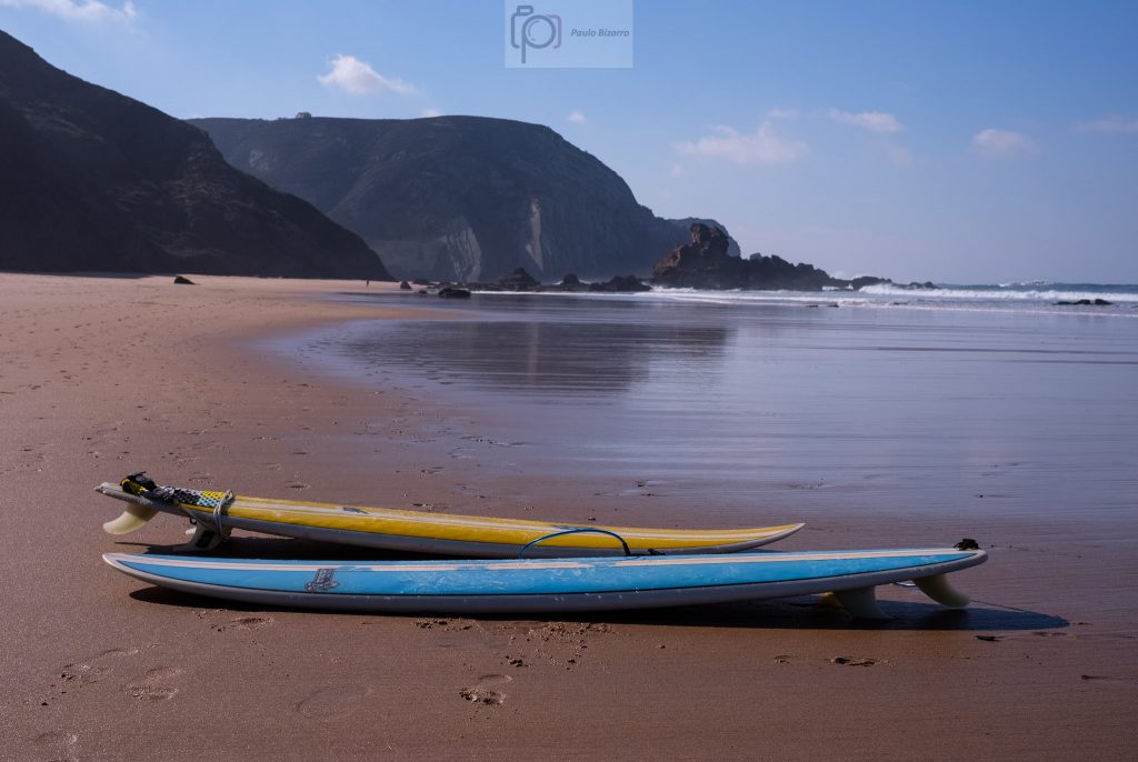
The beach is a good place to rest and have a picnic lunch. A few surfers are around, trying the waves. This is a long stretch of connected beaches, which in the past was only accessible by dirt roads. Today, there are narrow tarmac roads that start in Vila do Bispo and come to Cordoama and Castelejo.
Surfboards.
From here, the trail goes up again to the top of the cliff, in a steep ascent. There are some rough parts with loose rocks, so be careful. Once in the top, you will be in the Cordoama viewpoint, where there is a small car park. My plan was to complete the trail and come back at sunset for a few more photos. From this point onwards, the walk is easy, leaving the tarmac road a few hundred meters away, to cross the Castelejo pine forest. This part of the trail is also nice, because this forest is a preserved area, with relevant local fauna and flora species.
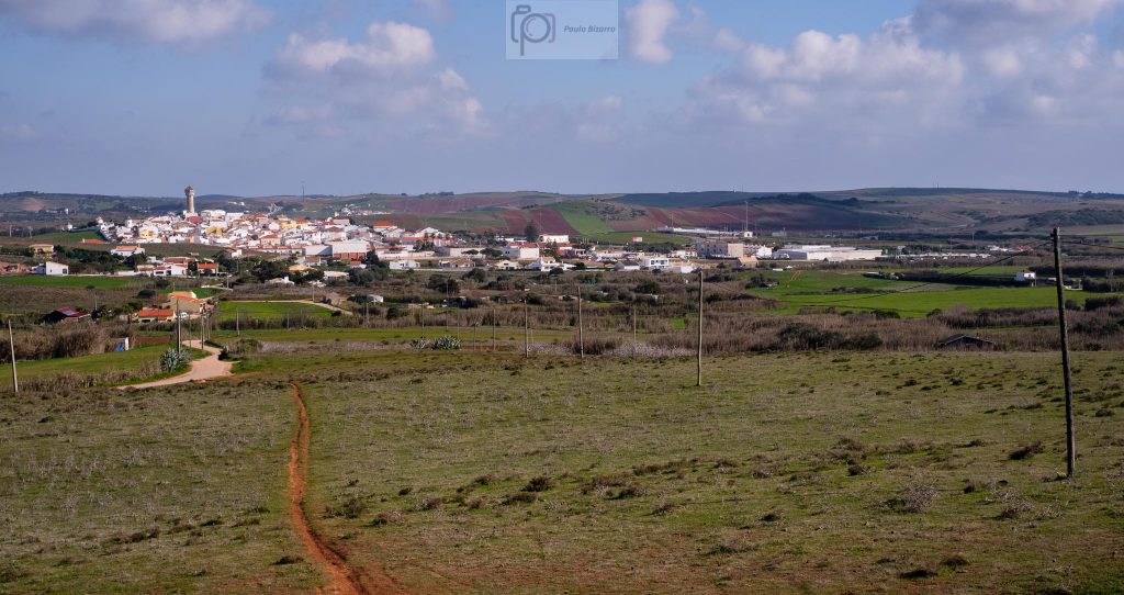
The town of Vila do Bispo at the end of the route.
Returning to Vila do Bispo, I rested a few minutes in the nice café near the market. If you are hungry I can recommend a local delicious pie, made with three regional ingredients: carob, figs, and almonds. After this resting stop, I drove to another local landmark, Torre da Aspa, the highest place of the Algarve coast, at 140 m above sea level. You need to drive along a dirt road, which may not be in a very good condition, so after a while I parked and decided to walk. It is an easy walk, so soon I was again looking at the ocean below. There is also a curious abandoned house, which belonged to the coastal police a few years ago. I explored the area for some time, being careful when approaching the edge of the cliffs. In several places, there is a sheer vertical drop into the sea.
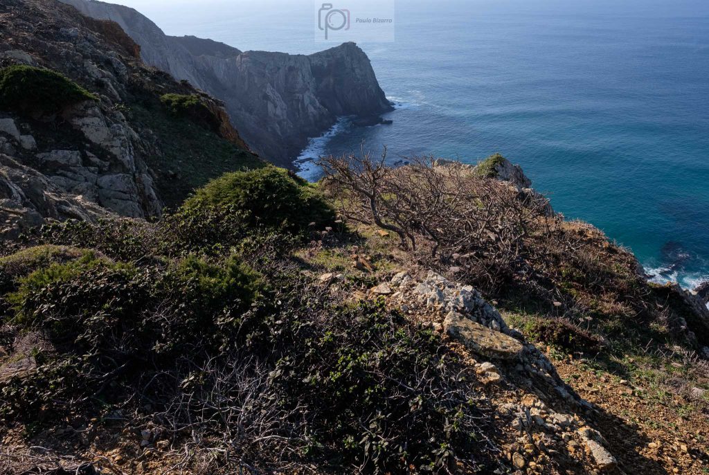
Coastal cliffs neat Torre da Aspa.Coastal cliffs near Torre da Aspa.
From this location, if you look south, you will see the Sagres headland, with the lighthouse of Cabo São Vicente, and the Sagres fort. From here, facing the endless ocean, Henry the Navigator coordinated the beginning of the Age of Discoveries many centuries ago. Looking north, I saw below the better part of the iconic Vicentina coast. It is a wonderful place to spend some time enjoying the view, and to use your binoculars if you have them. You will even be able to see the Arrifana beach about 30 km to the north. It was funny to realize that I was above the cliffs that I had crossed earlier, during the trail. In fact, it was possible to see the entire area that I had walked earlier.
View of Cordoama beach from Torre da Aspa, the highest point in the Algarve coast.
I still wanted to catch the sunset at the Cordoama viewpoint, so I returned to the car and drove back there. During the last couple of hours, a few clouds had appeared, which added interest to the sky in the photos. At the end of the day, I was happy to have visited this region again, and for sure I will be back to walk a few more trail routes.