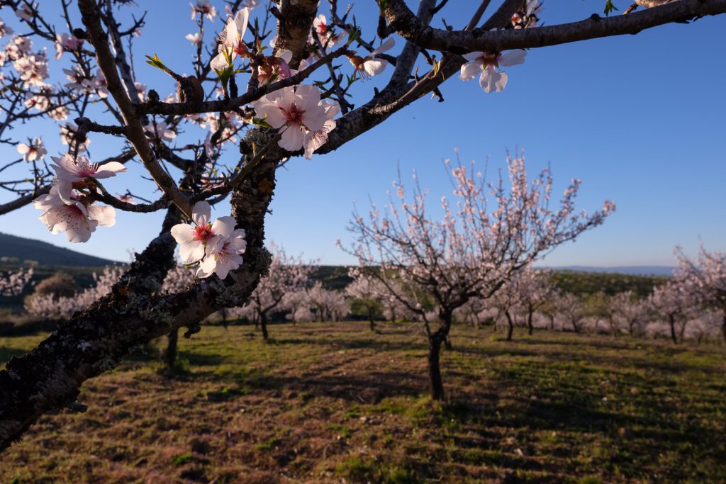
Given the current health crisis and the need to stay home, I am taking this opportunity to write a bit about this Fujinon lens which I have been using for a little over a month now. I like to make some macro photos while hiking on trails, should the situation arise. Given it’s focal length, this lens is also suitable for portraits, and some landscape photos with a tighter field of view.
During my time with the lens, I already used it in my 4 day trip to Northeast Portugal, and in a couple of weekends in the Southwest coast (Longueira). As a macro lens, it only goes to 0.5x magnification, but that is why it is small. Other lenses that reach to 1x (or life size) magnification are larger. I do not mind this limitation, as for what I normally photograph (flowers, details, some insects), it is enough. Below are some examples.
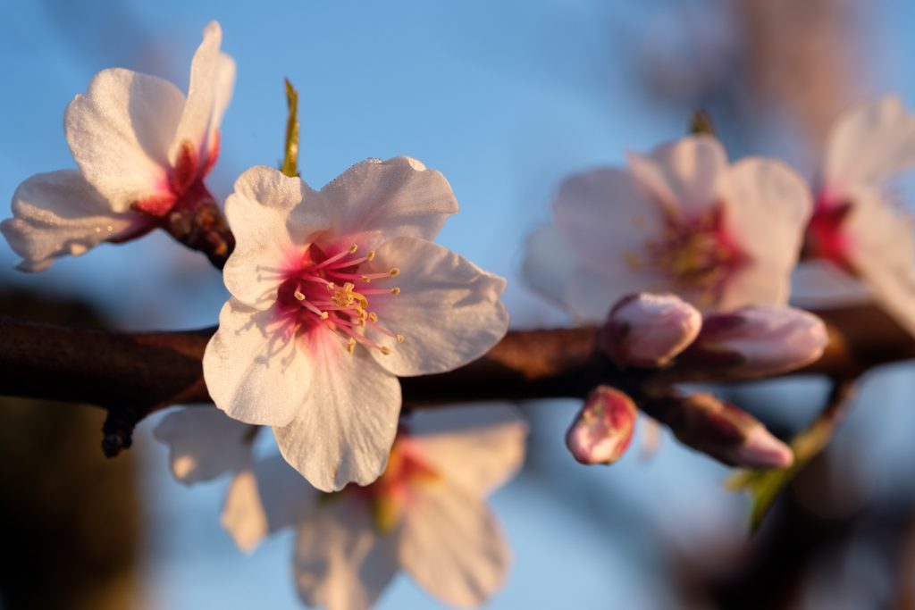
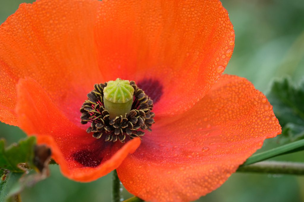
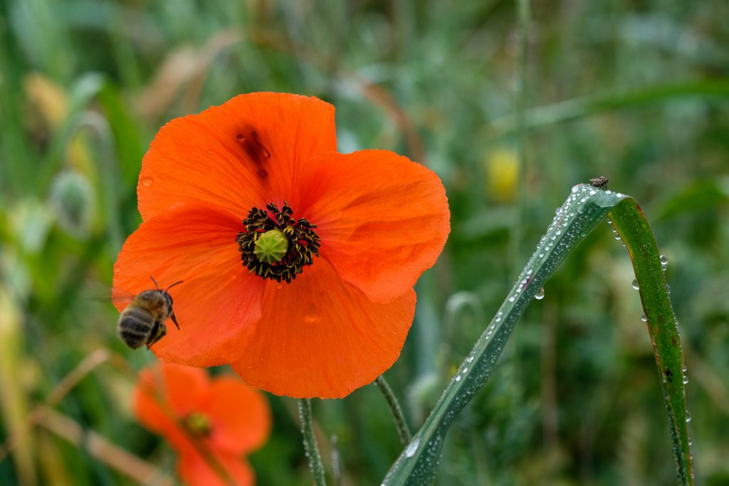
Almond blossomsPoppyApproach
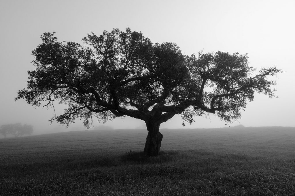
I also use the lens for landscapes, when I want to achieve a narrower angle of view, or isolate a particular element of the scenery. I show some examples in the ensuing photos.
Field in fogFog over river Côa valley Fog over river Côa valley
Optically, the lens is superb, with plenty of sharpness even from wide open, nice bokeh, and the typical excellent Fujifilm colours and contrast. Here is one of my first shots with the lens, the obligatory cat shot.
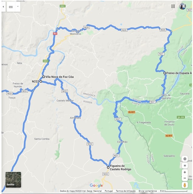
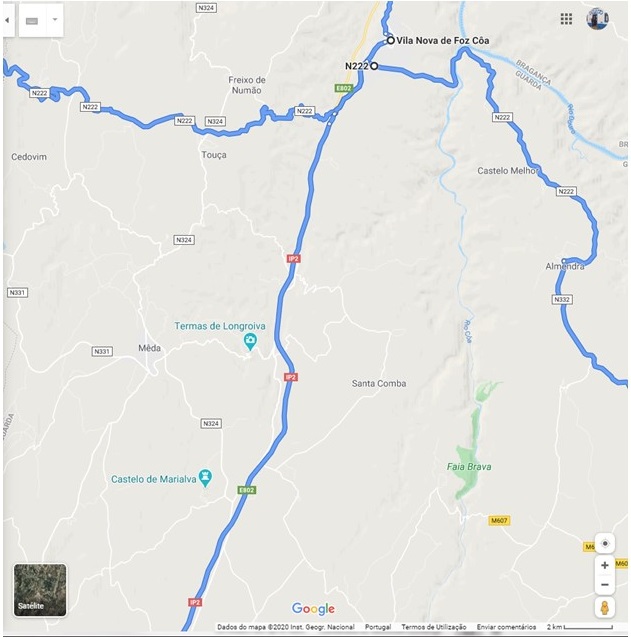
We departed VNFC early in the morning and started the
journey to Freixo de Espada a Cinta (FEC), several km to the North. The road
passes through a beautiful area of Portugal, limited to the East by the Douro
river, which marks the border with Spain. This is a high altitude granitic and
schist plateau, part of the geographic feature known as Iberian Meseta. The
first village is Castelo Melhor, which I have alluded to before. From there,
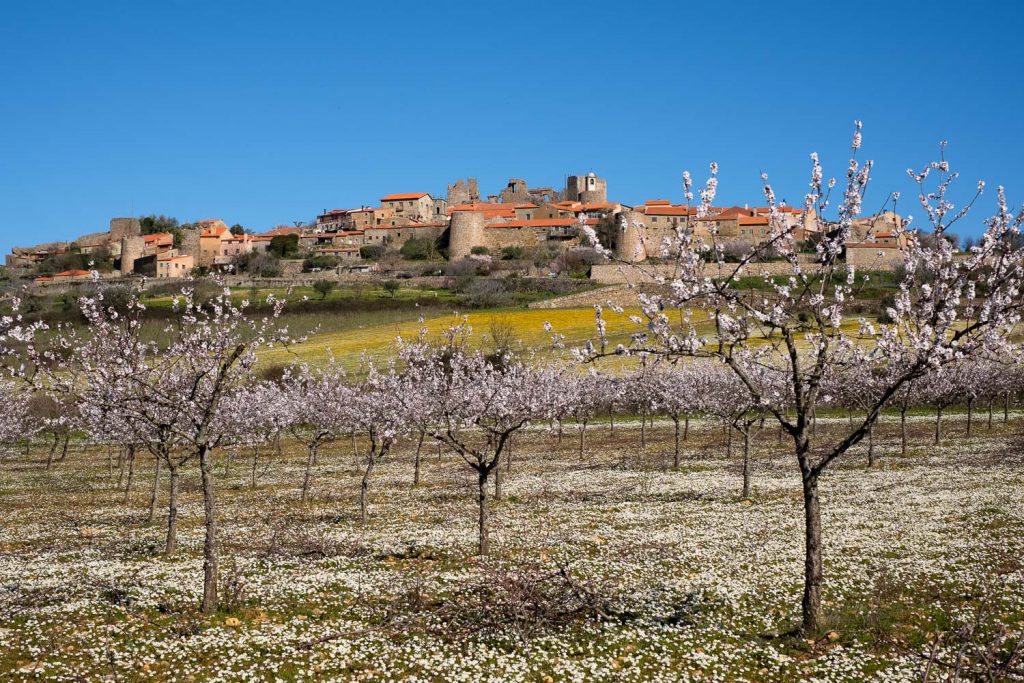
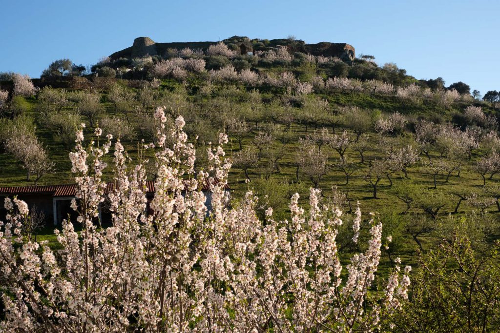
only a few km away, lies Almendra, considered one of the most beautiful
historical villages in Portugal.
Road map between VNFC and FEC.
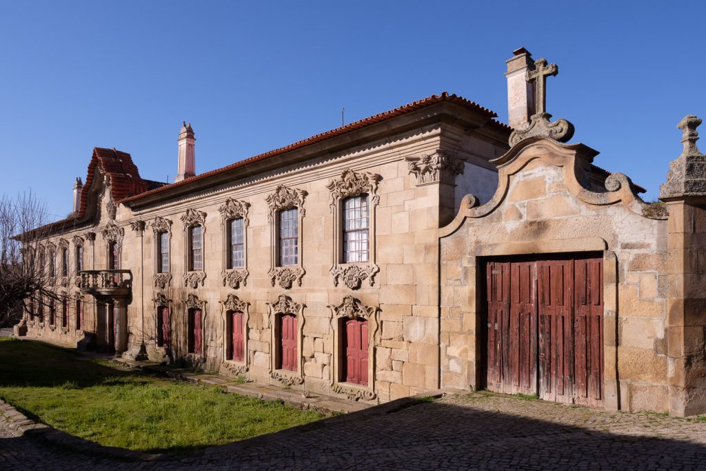
Its name comes from the Arabic word for almond, and it is
obvious why; once more, the almond trees are conspicuous in the surrounding
fields and farms. The village has several historic buildings, like the Manor
(“Solar”) that for generations belonged to the Almendra Viscount. It is a
palace from the XVIII century, built in the baroque style. Even though it lies
in ruin today, its grandeur is still very apparent, with imposing granite
facades. A long time before that, in the year 569 AC, the region was under
Visigoth domain. The other important building is the Church of Our Lady of
Angels, which was built in the XVI century; it has an imposing profile, and its
large size and strongholds attest its relevance in these frontier lands.
Almendra – old manor house.Almendra – church.
From Almendra, the road leads to Castelo Rodrigo, even
closer to Spain. The landscape in between is characterized by granitic plateaus
and sparse vegetation, with isolated boulders that have resulted from erosion
by wind and water. Today it is quite warm for February, but it is not difficult
to imagine the cold winter winds whistling thorough the region. Castelo Rodrigo
sits atop a hill, which at this time of the year is surrounded by blooming
almond trees; this makes a very picturesque scenery, so I had to stop to make a
few photos. The entire medieval town is enclosed inside the castle walls, as a
fortification, which was required, given its tribulated history that tells of
many frontier wars with Spain.
Castelo Rodrigo.
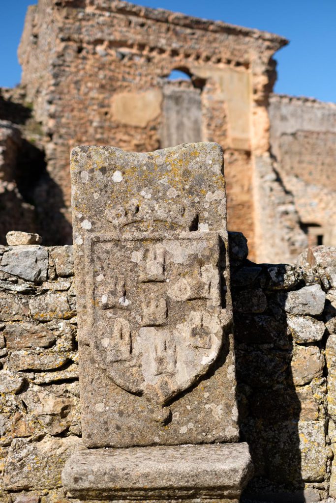
However, the history of the place goes well into the past, from pre-historic times to romans and Arabs; finally, in 1297 it was incorporated in Portugal. It is well worthwhile to spend some time walking along the narrow streets, feeling the history of the place. Also spend some time tasting the delicacies in the shops, particularly the almonds and almond liqueur. Inside the castle, note the “defamed upside down coat of arms”, a punishment by the King of Portugal imposed on the local nobility, who sided at the time with the opposing Spanish party in the war.
Castelo Rodrigo – defamed coat of arms.
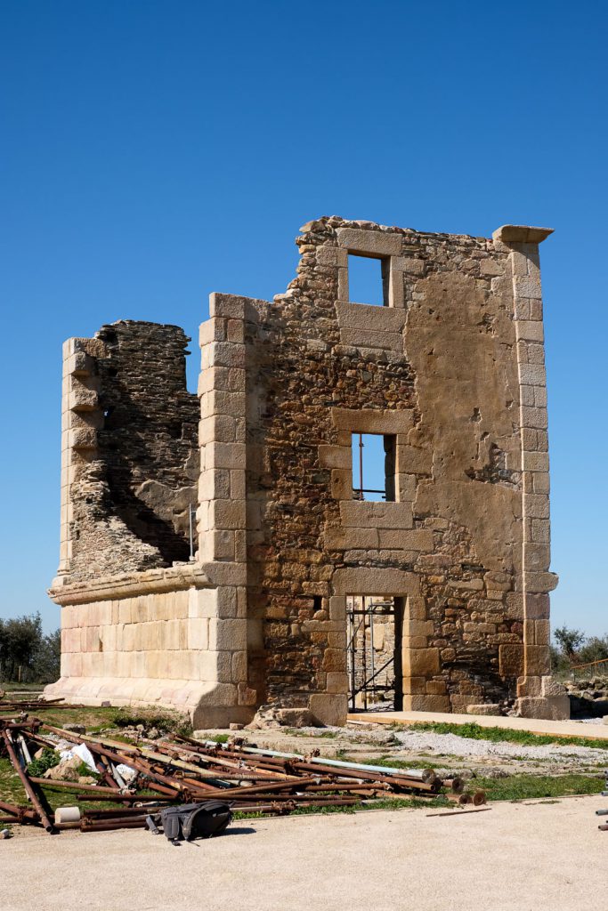
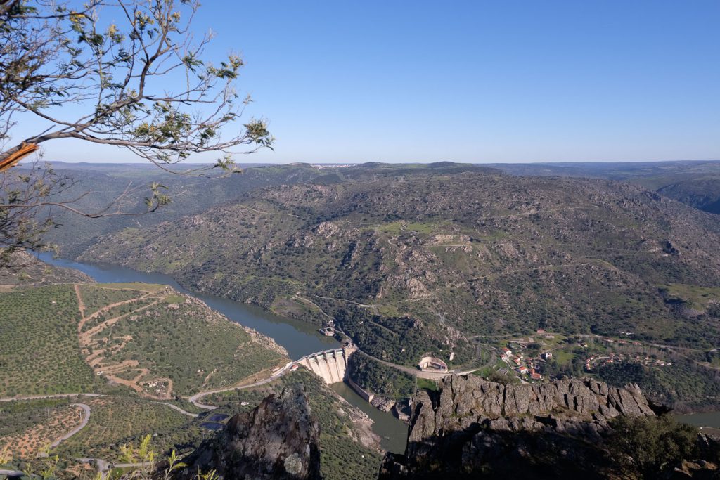
The next leg of our trip would take us to Barca de Alva, one
of the entry points of the International Douro Natural Park. Before getting
there, be sure to stop in the roman villa of Almofala, with its well-preserved
tower. Given that it was lunch time, we had a picnic in a small resting area by
the side of the road, under the shade of a willow tree, and close to a small
creek. I even made a few long exposures of the running water, just for fun.
Almofala roman tower.
Approaching Barca de Alva, it is interesting to notice that
the topography starts to change; in fact, the plateau area we had been crossing
since morning, transitions into a rougher terrain, that descends precipitously
towards the Douro valley. This is an important location, as it marks the end of
the 200 km long train route that starts in Porto in the coast and goes along
the Douro river upstream. Unfortunately, part of the route has been deactivated
and is in disuse. It also marks the point up to which the Douro is navigable.
The Mediterranean microclimate of the region, and how it affects the Douro
valley, becomes apparent here: there are many fields cultivated with vineyards,
almonds, orange and olive trees. This is where the region of Port wine truly
begins.
Barca de Alva – a nice viewpoint before the road descends into the Douro valley. This is a 13 shot panorama.Barca de Alva – another panorama.
The rest of our trip will follow the road along the border
with Spain, and it is impossible not to stop along the way to admire the
landscape from several viewpoints. The most famous one is located just before
arriving at FEC and is called Penedo Durão. This is a rocky spur that juts out
over the Douro valley, at an altitude of around 700m. From this vantage point,
and in the right season, many birds that are typical of this Natural Park can
be observed: griffin, Egyptian vulture, peregrine falcon, amongst others. It is
a great place to stop and appreciate the surrounding nature.
View from the road over the Douro river. Border with Spain.View over the Douro river from Penedo Durão.
By the time we arrive at FEC, the sun is going down behind
the mountains. This is another town rich in history, and whose foundation is
lost in the mist of time. The origin of its name “Freixo” (Ash tree) and
“Espada Cinta” (sword at waist) is not clear, and there are several legends.
One story says that a goth nobleman whose name was “Espadacinta” took a nap
under a Freixo after battling the Arabs in the Douro river. Another tells how
king D. Dinis, when passing through this land, lied down to rest under the
shade of a Freixo tree, but not before placing his mighty sword against it. While
sleeping, the tree’s spirit guided the king to establish wise guidelines for
the future. Regardless of the story, the town is full of interesting places to
visit.
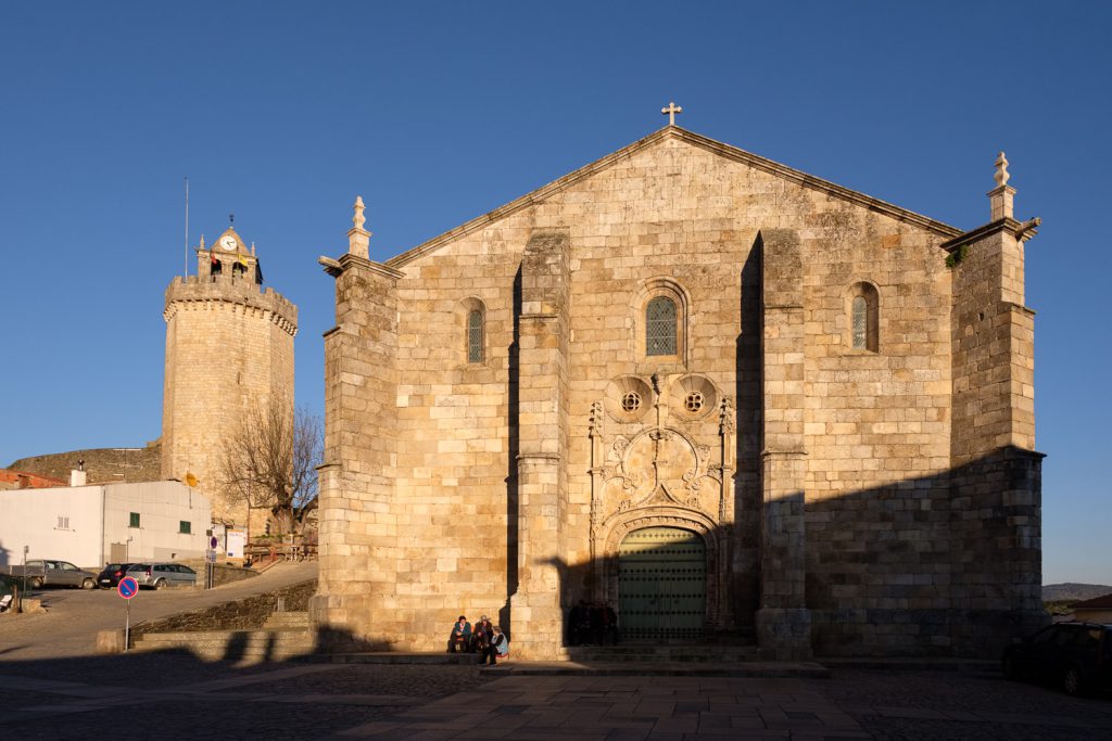
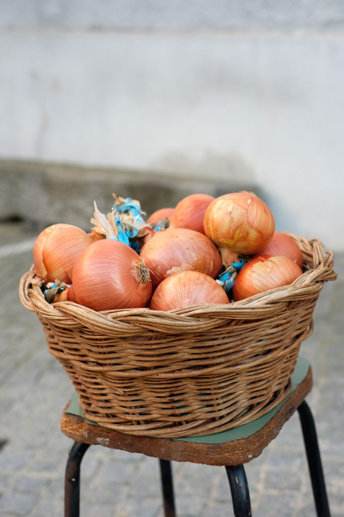
Freixo de Espada a Cinta – main square with church and castle.Freixo de Espada a Cinta – onion basket.
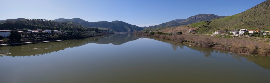
From FEC to the fluvial beach of Congida is a quick and
short drive. This is a great place to spend the night, in peaceful tranquillity
by the river Douro. The light of the setting sun reaches the banks of the
river, bathing them in golden hues. I make haste with my tripod and camera to
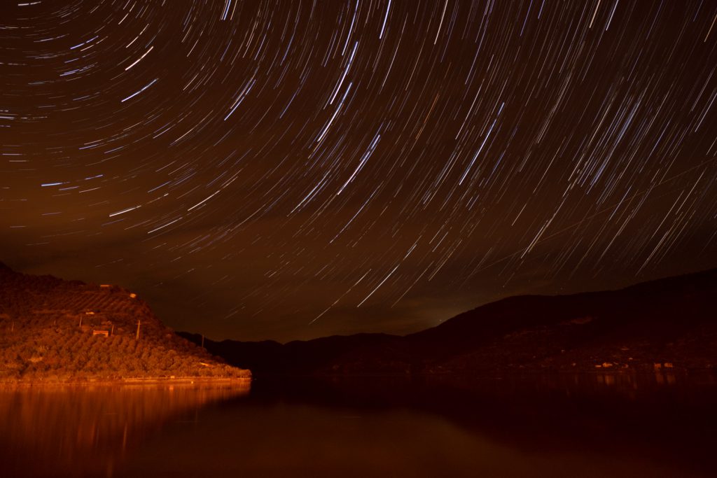
take a few shots of the surrounding scenery. At night, I went out to make a
star trail session. As the river runs North to South, pointing the camera to
the North will ensure a nice star trail rotating around Polaris. Fujifilm cameras
make this extremely easy to set up, with their built in intervalometer. I
programme the camera to shoot 100 frames of 30 seconds each, this will give me
a total of 50 minutes of movement.
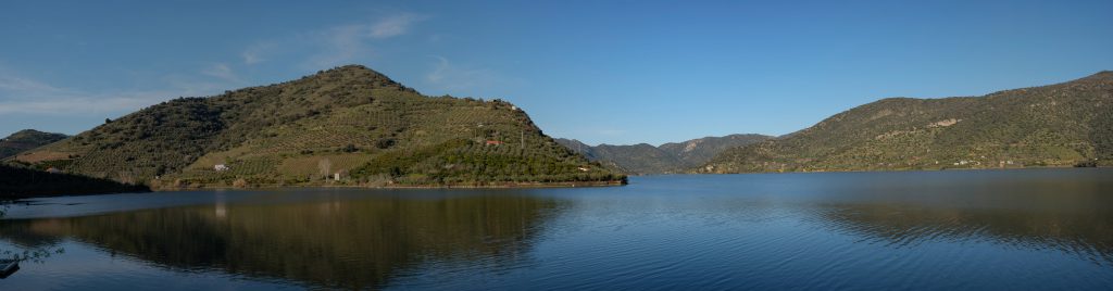
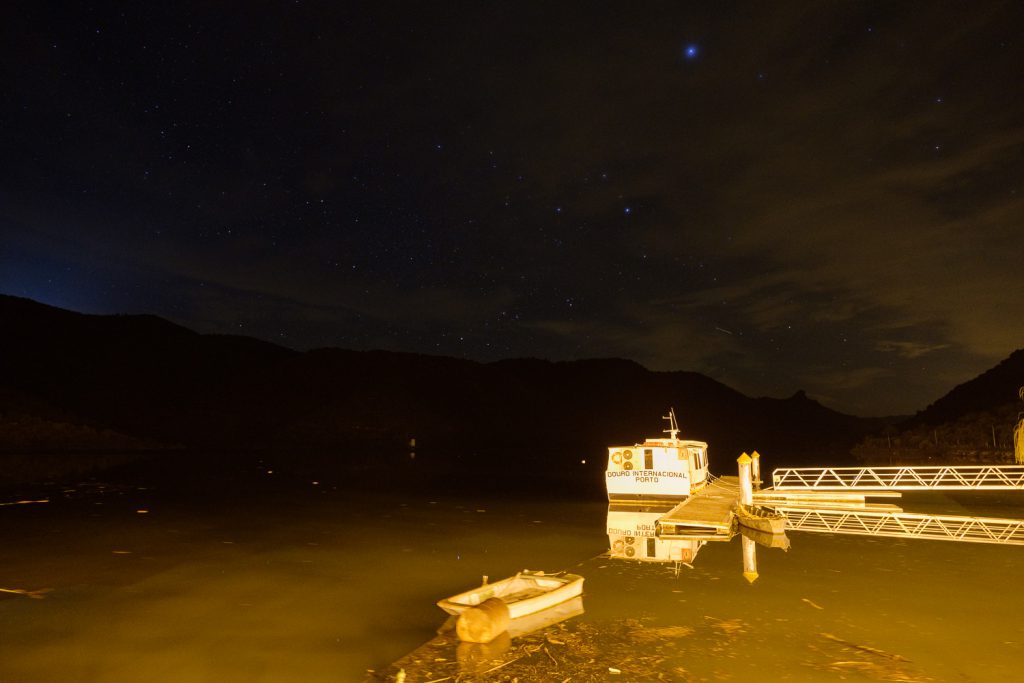
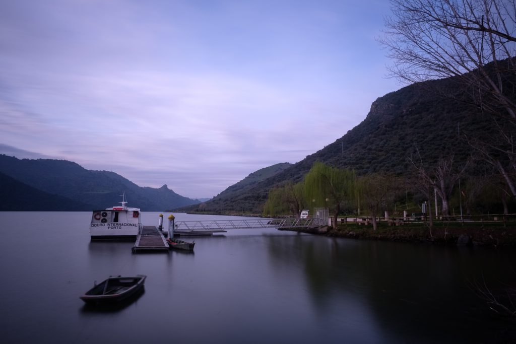
Congida fluvial beach. Panorama of 16 shots of the Douro river.Star trail.Night photo.
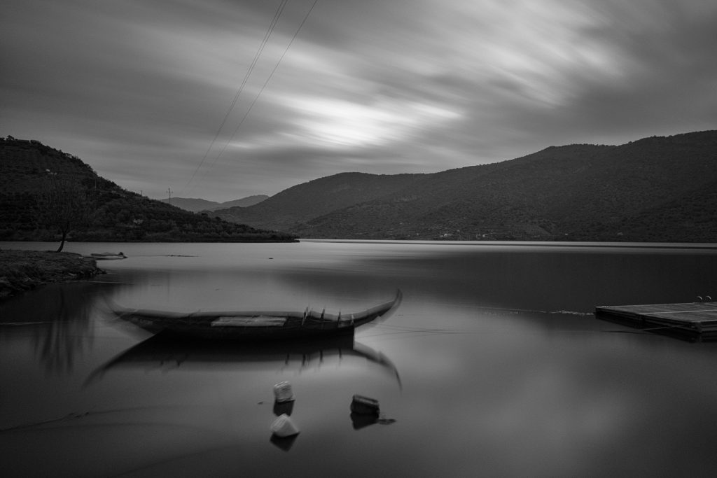
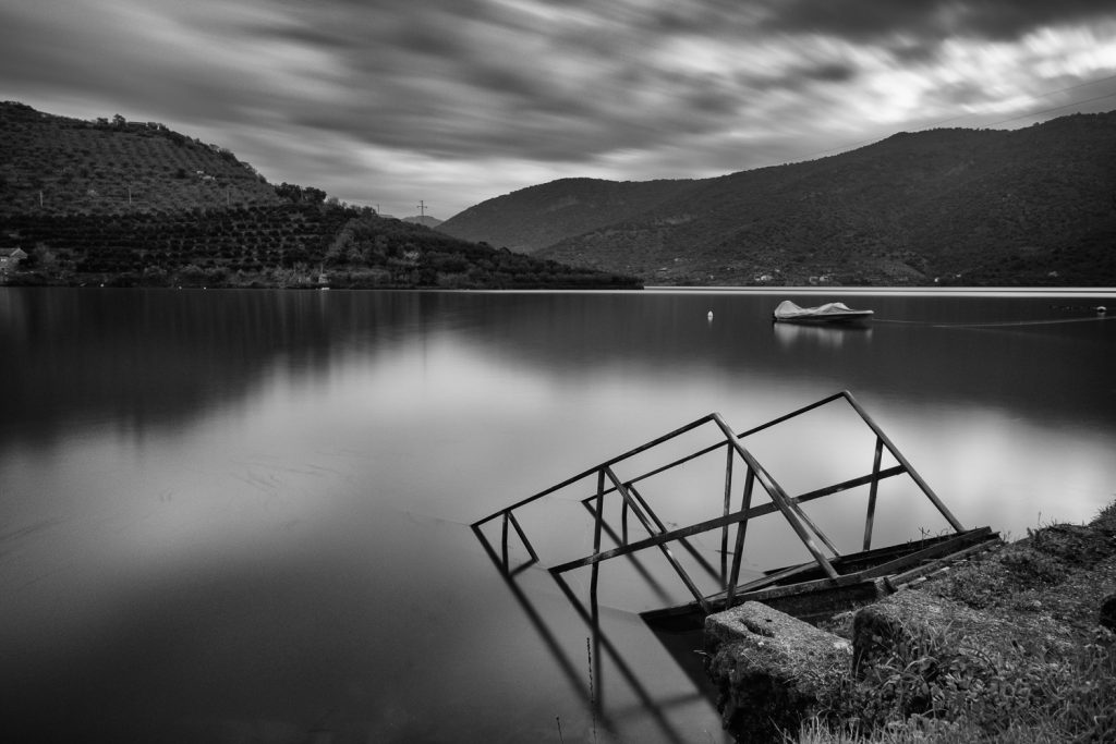
The following morning, I was out of the room before sunrise; the weather had turned cloudy, but that was good, as it added some more interest in the sky area for the photos. I walked around the beach, trying out different foregrounds such as boats and willow trees. I also opted for some long exposures, between a few seconds and 2 minutes; this has resulted in some interesting movement effects in the clouds. In the end, I decided to convert some of the photos to black and white, for added visual drama.
Congida before dawn.Congida before dawn.Congida before dawn.
It was with a sad feeling that we left the area and returned home, after a few very fulfilling days in a beautiful part of the country. But we left with our hearts and minds richer, after experiencing all the culture, history, and landscape of the region.
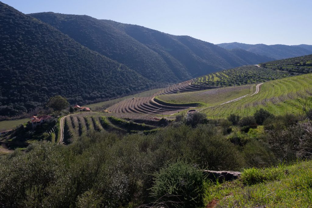
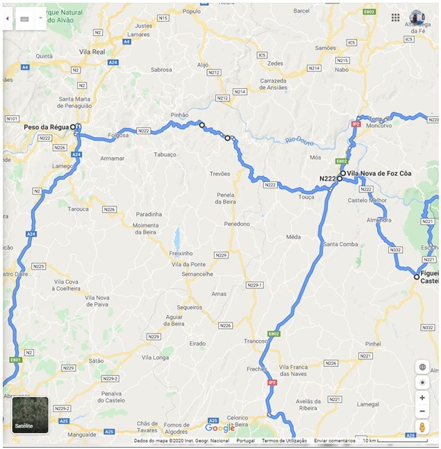
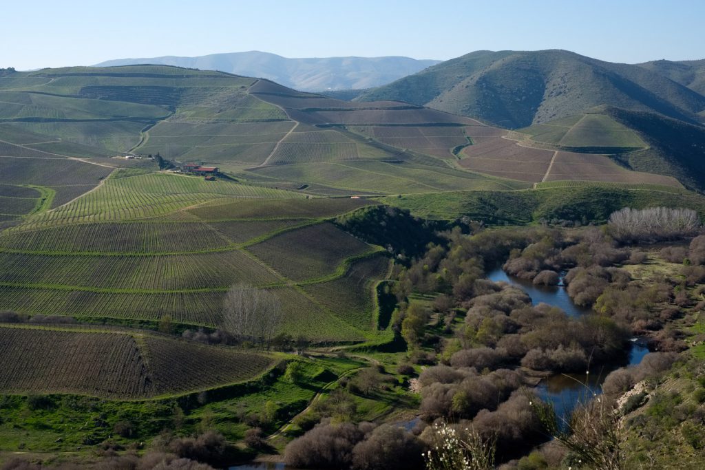
Between VNFC and Peso da Régua. Route 222 follows the Unesco World Heritage site, for the Douro wine country landscape.Douro valley near Peso da Régua.
For the first full day in VNFC, we had booked a visit to two
of the Upper Paleolithic (22,000 – 10,000 BC) rock art sites located along the
Côa river valley. In the mid- 1990’s, archaeologists working in the area
discovered several open – air rock art sites, and soon their importance was
recognized. At the time, there were plans to build a dam in the Côa river,
which would have drowned them. A big public discussion went on with arguments
from both sides; at the end of it, the dam was cancelled, and a large part of
the area was classified by UNESCO as World Heritage. Rightly so, if you ask me.
These sites constitute the oldest record of human engraving
activity in the world, being also unique in the fact that they exist in the
open, not in caves, as it was more typical of the time. 20,000 years ago, man
engraved thousands of drawings depicting horses and cattle on the schist rocks
of the Côa valley, a tributary of the Douro river, in northeastern Portugal. The
engravings essentially portray animalistic figures, although a human
representation is known. The most represented animals are horses and bovines
(aurochs, which are now extinct).
Since 2018, Arte do Côa (which includes the Vale do Côa
Museum and Archaeological Park) has become part of the Council of Europe’s
Cultural Itinerary, where sites such as Lascaux, Chauvet, Niaux (France),
Altamira (Spain) or Valcamónica are represented (Italy).
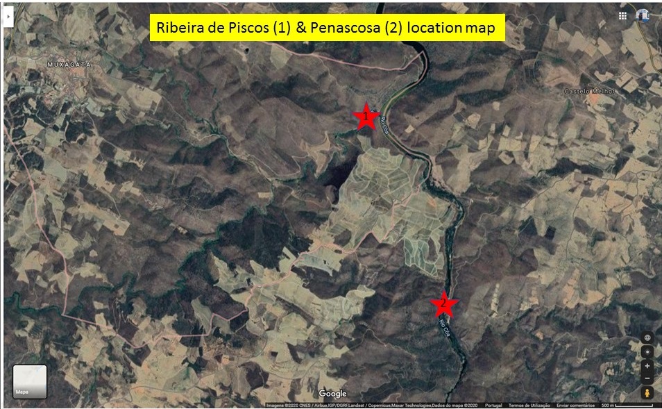
There are three sites open to the public for visiting, with
guided tours departing from the dedicated museum in VNFC, and the village of
Castelo Melhor. Depending on the exposure to sunlight, two of the sites have
morning visits (Ribeira de Piscos and Canada do Inferno), while the third one
can be visited in the afternoon (Penascosa). For more details, please see here:
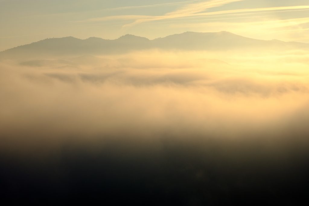
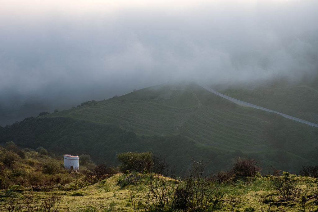
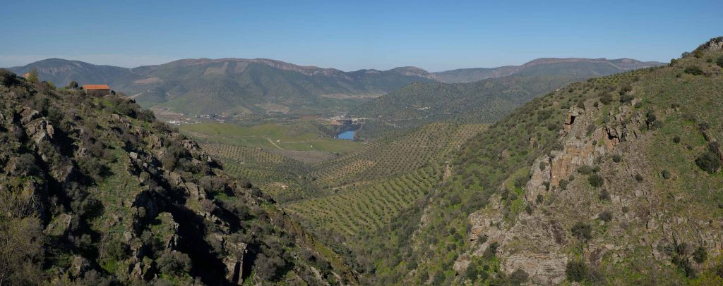
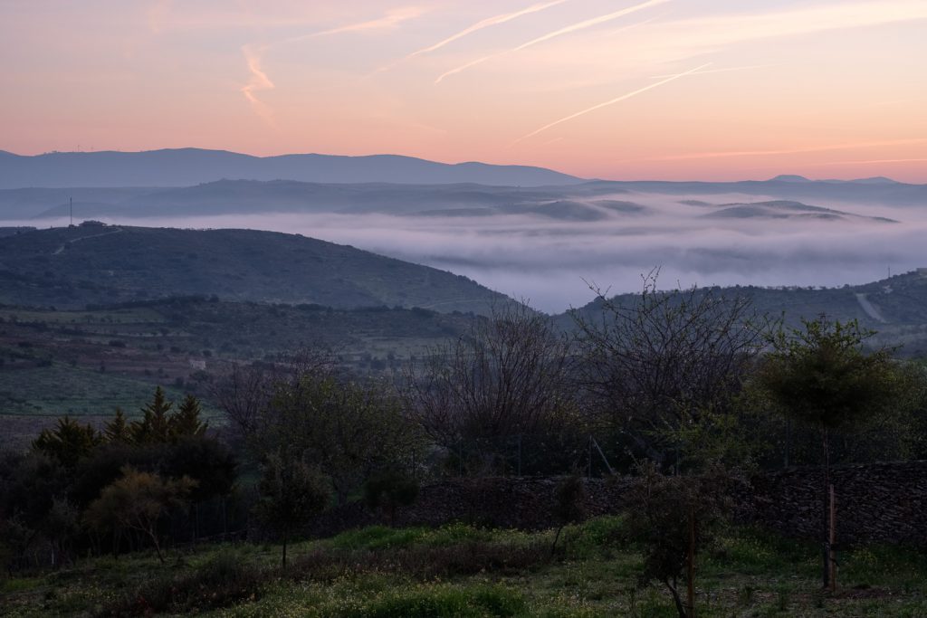
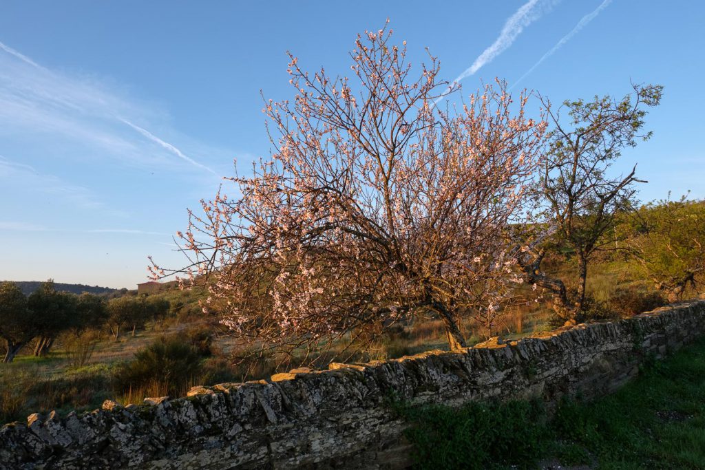
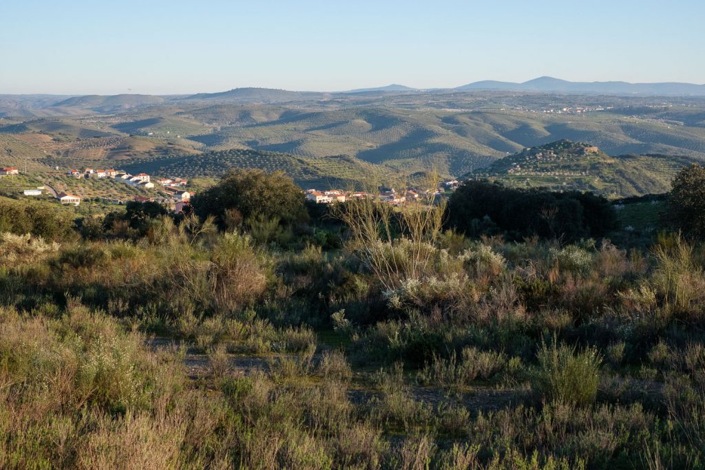
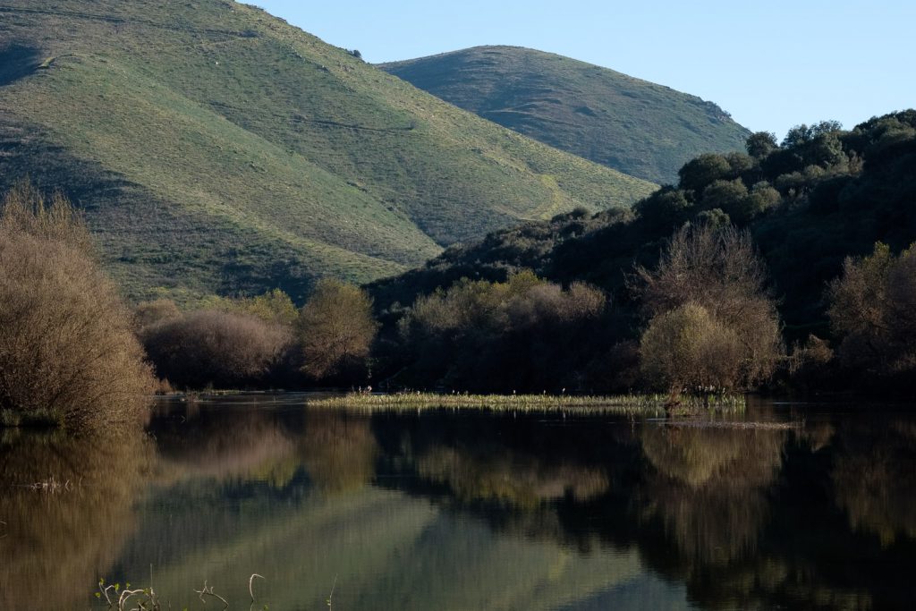
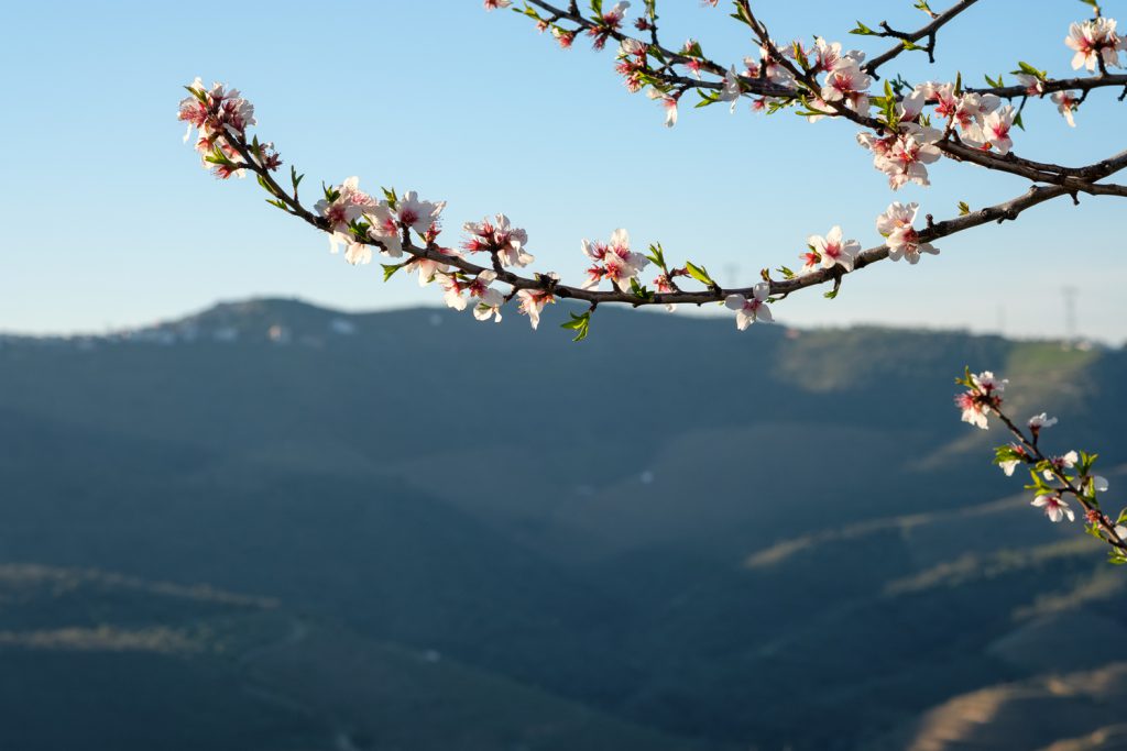
The museum in VNFC is located about 3 km away from the town,
along a road that this time of the year is full of blooming almond trees. I
made an early start, before sunrise, to make some photos of the landscape. It
is simply a beautiful landscape, with the soft rolling mountains and steep
hills descending into the Côa and Douro valleys. The terraced hills are a
testimony to the perseverance of man to try and tame Nature for centuries. Today,
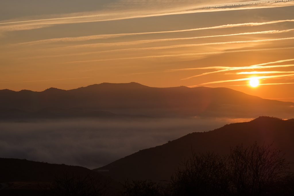
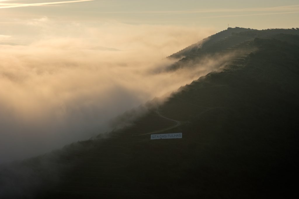
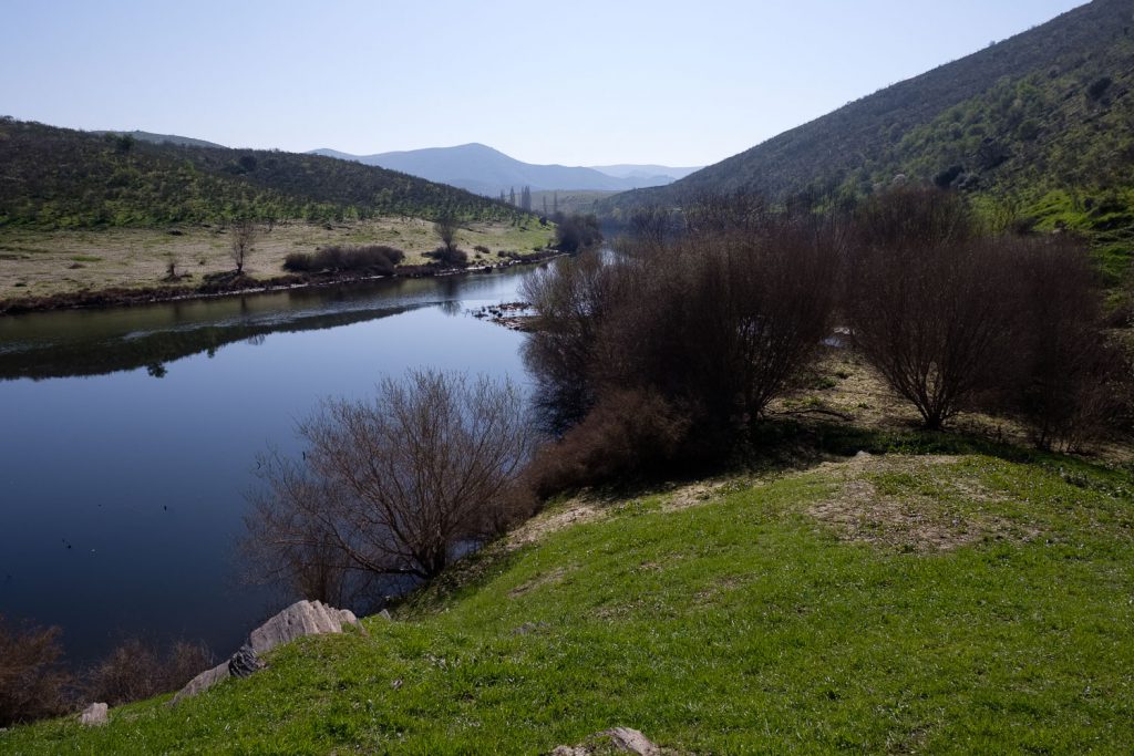
the almond and olive trees dominate. So early in the morning, the river valleys
are covered with fog, which adds mystery and beauty to the landscape. The
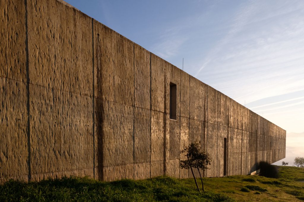
museum’s building itself is quite interesting, as it was built to resemble a
large block of schist lying in the ground.
Before sunrise.Before sunrise.Almond blossoms.Almond blossoms.Museum building.Fog over the river Côa valley.Fog over the river Côa valley.
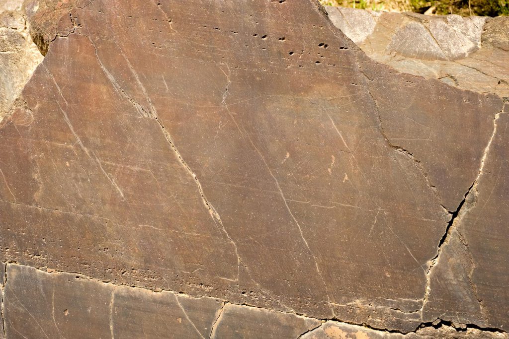
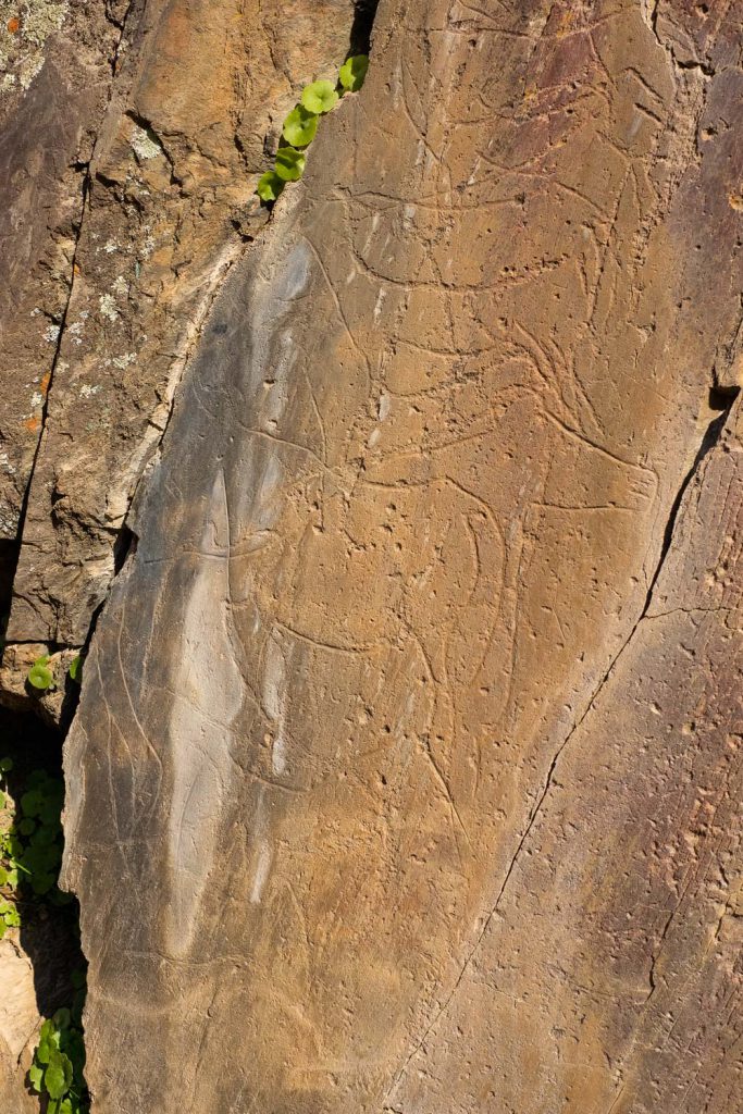
The first visit was to the Ribeira de Piscos site, a small
creek that is a tributary on the left bank of the Côa. As all visits, it
requires driving in a 4WD along some rough dirt tracks, but our guide, Marina,
handled that smoothly. One of the main attractions – besides the rock art
itself – is being able to experience the surrounding landscape and the
peacefulness of the area. The highlight of this visit is the engraving of a
human figure, the famous “Man of Piscos”. There is also a small rock with four
small horses finely engraved with an amazing level of detail, including ears
and hooves. The last rock panel holds a near – life size aurochs’ depiction,
that would have been visible from the opposite bank of the Côa river. Closing my
eyes, it was easy to imagine being here 20,000 years ago and picture our first
ancestors living in the vicinity and hunting these animals. At the time, an Ice
Age was on, but today, in late February and at the bottom of the valley, it is well
over 20 Celsius, quite warm for the season.
Côa river near Ribeira de Piscos.Ribeira de Piscos rock art.
It was with some regret that we had to return to VNFC, where
we had lunch. In the afternoon, we would visit the Penascosa site, meeting our
guide in the village of Castelo Melhor. Again, the drive from VNFC to this
small village afforded impressive views over the landscape, with the bonus of
the ever-present almond trees in bloom. Castelo Melhor is an old village, with
a small castle in ruins at the top of a hill. Its history goes back to
pre-roman times. It’s first “foral” or charter, was granted in the year 1209 by
king Afonso IX of Leon. In 1297, the village became part of Portugal.
Castelo Melhor – castle at top of the hill.Castelo Melhor.Castelo Melhor.Castelo Melhor.Castelo Melhor seen from afar.
From here, a short drive takes visitors to the Penascosa
archaeological site, located on the right bank of the Côa river. This is a busy
place with more visitors than in the morning, because there are more rock
panels and engravings to see. Still, the silence in the landscape along the way
is only perturbed by chirping birds and buzzing bees. Before descending to the
site, it is mandatory to stop and admire the view, including the Erva Moira
winery and farm on the opposite bank of the river. Again, this is typical Douro
wine terraced landscape, but with a significant area where almond and olive
trees are cultivated.
Erva Moira – Côa valley and wine country.Côa river at Penascosa.
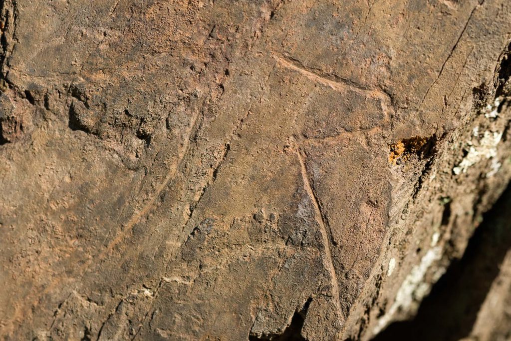
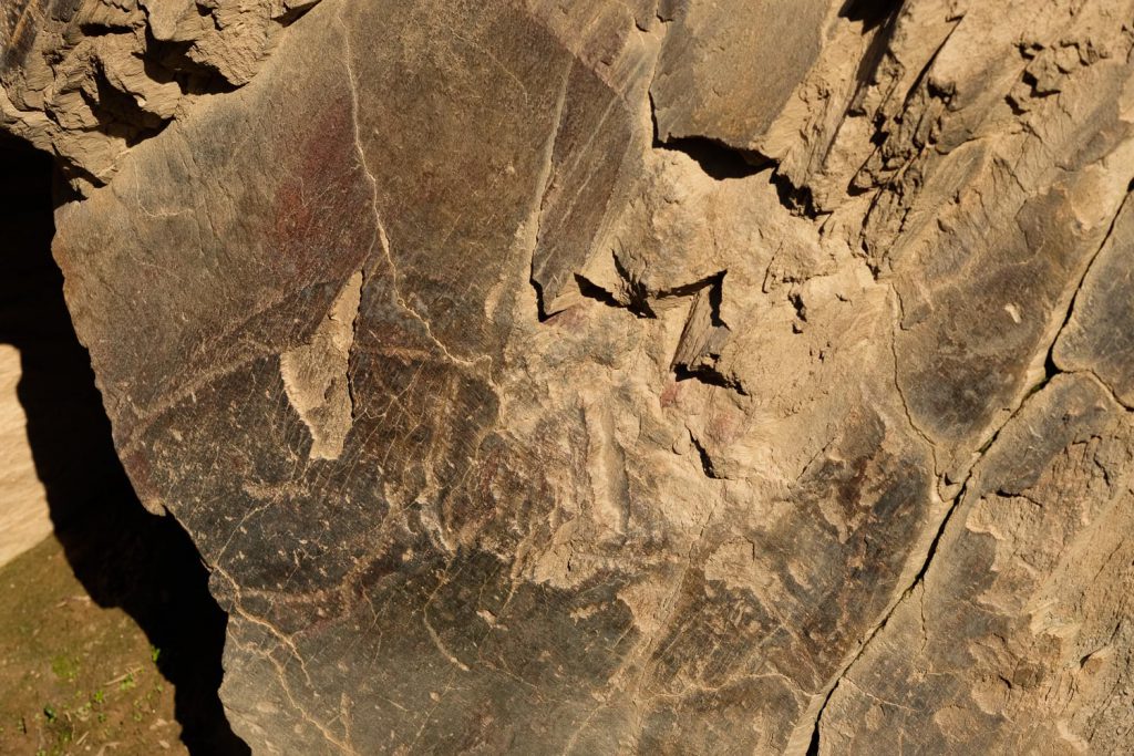
Arriving at the site, indeed several 4WD vehicles are
parked, attesting to the popularity of the place. Still, the groups are split
between the several rock panels, and everything proceeds at a leisurely pace,
as befits the location. A few meters behind us, the river Côa glides smoothly,
surrounded by the mountainous terrain. Pre-historic man has left us a
significant number of engravings (36 engraved rocks), depicting several
animals. In some instances, a sensation of movement is transmitted by having
the same animal’s head in three different positions. Also unique to this site
is the representation of a fish.
Penascosa rock art.Penascosa rock art.Penascosa rock art – fish.
At the end of this very full day, we were all left with a
profound respect and admiration for our ancestors of the Côa valley. They were
true artists, and they were the first to bring art from inside the darkness of
the caves to the full light of day.
In terms of photos, there are no restrictions, except it is
not allowed to touch the rocks, of course. I found it useful to have a small
macro lens like the Fujinon 60 f/2.4 to be able to achieve some close-up
details of the engravings. Plus, some macro photos of the almond blooms. Other
than that, a wide angle is mandatory for the sweeping landscapes.
On part 3 of this series, we will depart VNFC and will go to
Freixo de Espada a Cinta, crossing one of the most beautiful areas of Portugal.
We will end the day right at the border with Spain in a fluvial beach at
Congida, well inside the International Douro National Park.
A few days ago, I returned from a trip to Northeast Portugal,
particularly to the region of Vila Nova de Foz Côa (VNFC). It was a family
vacation trip, that I had been planning for some time; finally, during the
Carnival holyday break, we managed to go there for a few days. I have family
roots in VNFC, as my grandparents were from there, and I used to visit for
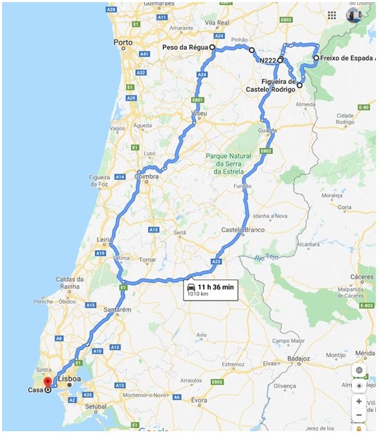
vacations when I was a child. The trip was split into several days:
Day 1 – drive to VNFC (around 400 km), of course with a few
stops along the way, in medieval villages (Belmonte and Marialva).
Day 2 – visit the Upper Paleolithic rock art sites in the
region, which since 1998 have been classified by UNESCO as a World Heritage
site.
Day 3 – drive from VNFC to Freixo de Espada a Cinta (FEC),
visiting a few other old villages along the way, such as Castelo Melhor,
Almendra, and Castelo Rodrigo.
Day 4 – drive back home, in part along route 222, that
follows the Douro river and its many vineyards. A landscape that is also
classified as World Heritage.
The entire trip.
This region of Portugal is extremely rich in history, with
numerous cultural and landscape places to visit. It is characterized by several
mountain chains that surround the Douro and Côa rivers and is close to the
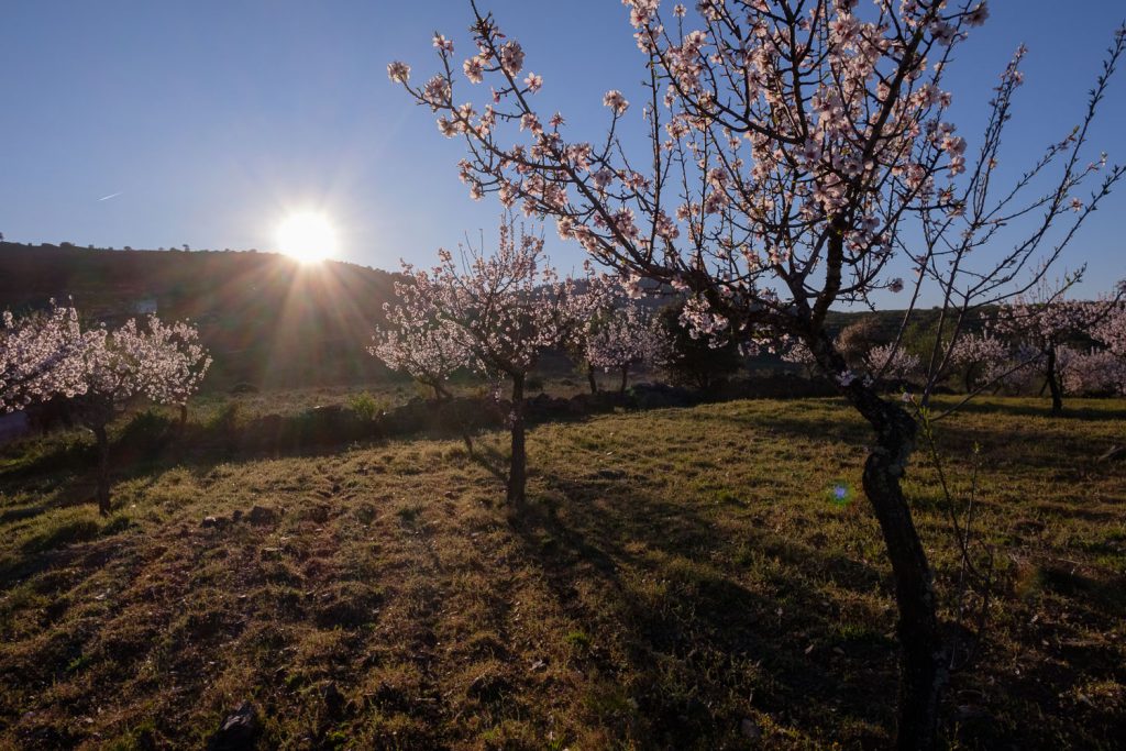
border with Spain. During February and March, the almond trees are in bloom,
adding a beautiful character to the landscape. We were lucky that in many
places, these trees were still in bloom; it is quite an experience to see the
steep hills covered with the white blossoms. When the wind is strong enough,
the flowers falling from the trees resemble snow.
Of course, I made a lot of photos, who wouldn’t right? I
thought it better then to split this piece into several parts, following the
several days, as indicated above. I will start with the first day of the trip,
where the highlights were the medieval villages of Belmonte and Marialva.
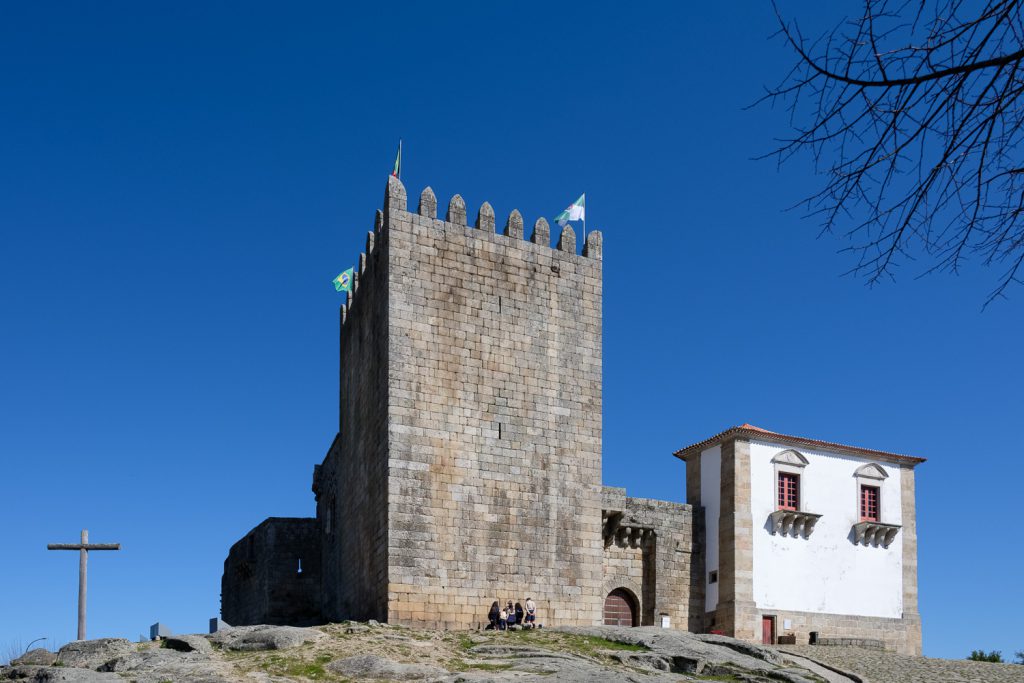
Belmonte is located near Serra da Estrela, the highest
mountain in continental Portugal, in the Beira Baixa province. As many other
villages in the region, Belmonte´s history goes back to very early times of
Portugal’s foundation as a country. In fact, the establishment of Belmonte as a
village was granted by king D. Sancho in the year 1211. Today, there are many
interesting sites to visit, like the castle and medieval Jewish neighbourhood.
This is also the birthplace of Pedro Álvares Cabral, who discovered Brasil in
the year 1500. Arriving there at lunch time, we had a picnic and did some
sightseeing around the castle and old town.
Belmonte – castle.Belmonte – general view.
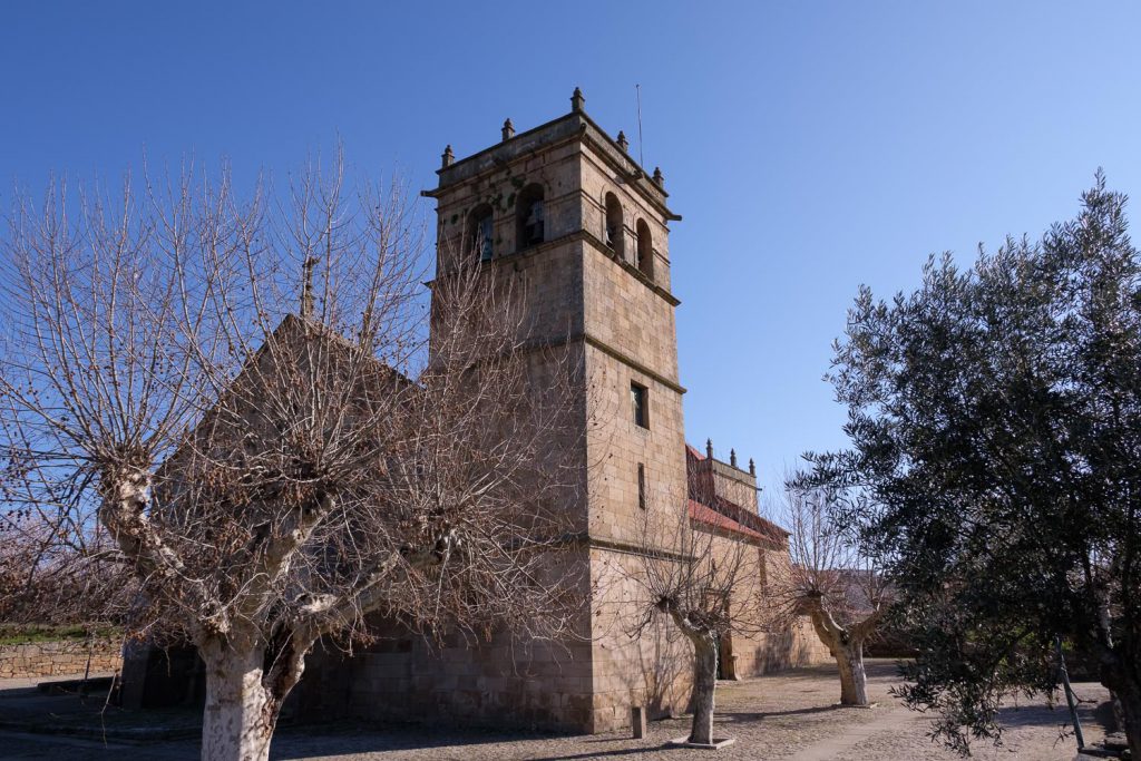
From Belmonte we kept driving North, towards VNFC, enjoying the nice sunny weather and the mountainous landscape. A few km before VNFC, lies another medieval village, Marialva. I remember stopping here when I was a kid, and even today Marialva is an invitation to a child’s imagination about knights and castles. The whole village is enclosed inside the castle walls. Its history goes back to Roman times, after which the Goth tribes occupied the region. In the year 1063 it was conquered by D. Fernando Magno and received its present name. The first king of Portugal, D. Afonso Henriques, granted it village charter and status (“foral”) in 1179.
Location of Marialva.
This entire region near Spain has seen quite a number of
independence wars, and was never very populated. The first kings, attempting to
attract people to the interior and sustain the conquered lands, offered
incentives to the villages – granting permission to hold markets and offering
lands. It is quite telling that today, in the XXI century, the current
government is still granting incentives to attract people to the interior… some
things never change.
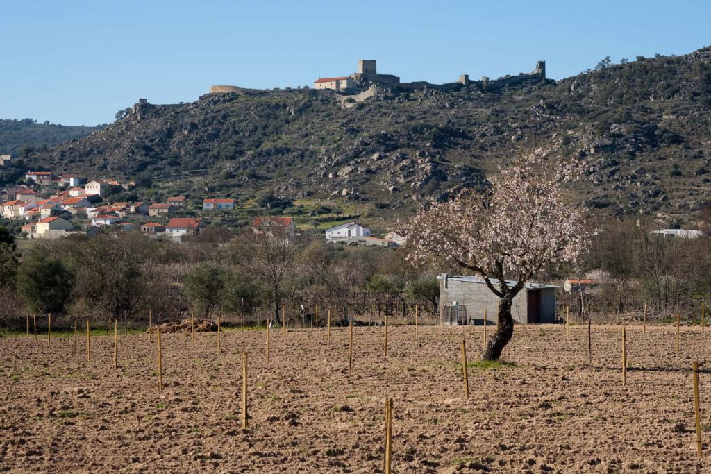
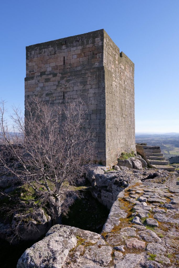
Seeing Marialva’s castle at the top of the hill, surrounded
by farms, is a very nice sight. It is possible to stop the car at the entrance
of the village and visit it. Of course, the mandatory thing to do is to walk
around and inside the ramparts. There are not may inhabitants today, and the
few that we met were old people – this is a common thing in these small
interior villages. The view from the castle over the surround landscape is
beautiful, encompassing many kilometres in all directions, with mountain ranges
and farmlands covered in fruit trees and granitic boulders.
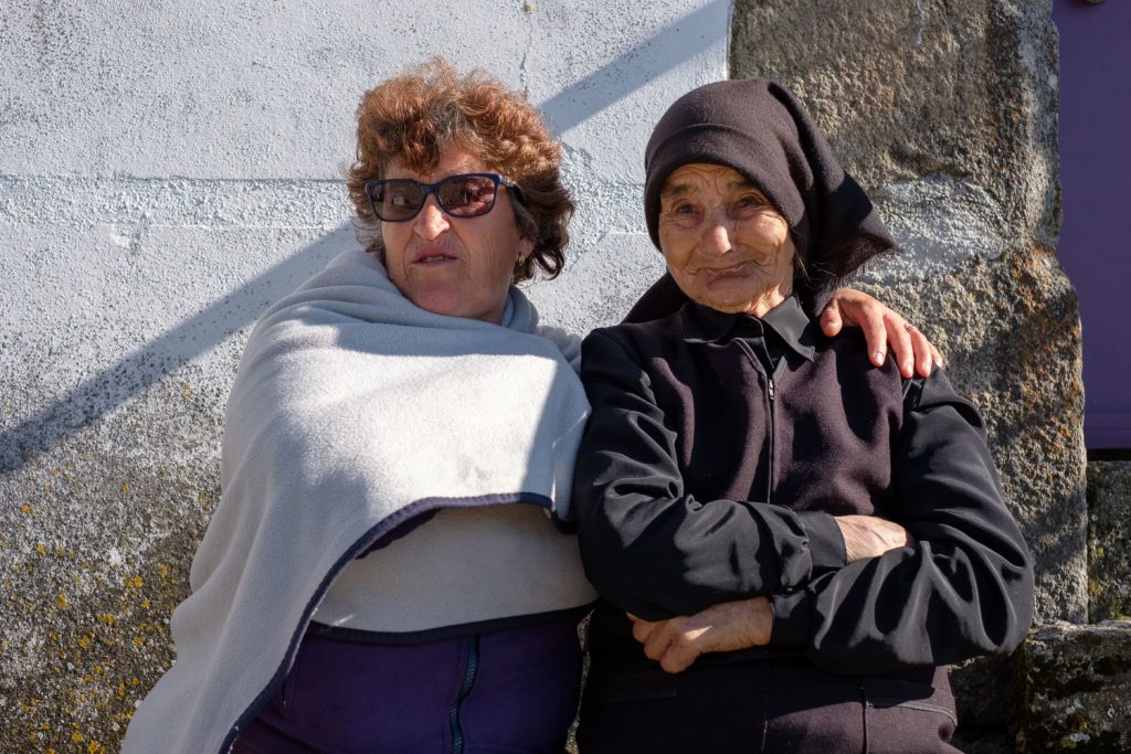
We found a couple of old ladies that were selling some local
products, including almonds and olive oil. I remember being a kid and breaking the
almond shells in my grandparent’s house. I bought a bag of almonds, which are
very good. After visiting Marialva, I left with the feeling that I was exiting
a time machine. The eery silence at the top of the ramparts is a stark witness
to the isolation of the place.
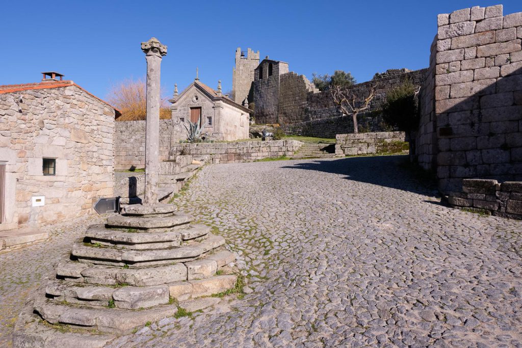
Marialva – view from the road.Marialva – pillory square.Marialva – castle.Marialva – old friends.
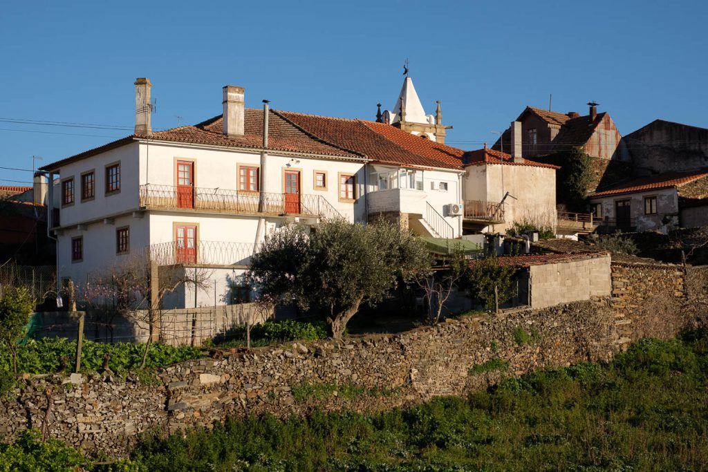
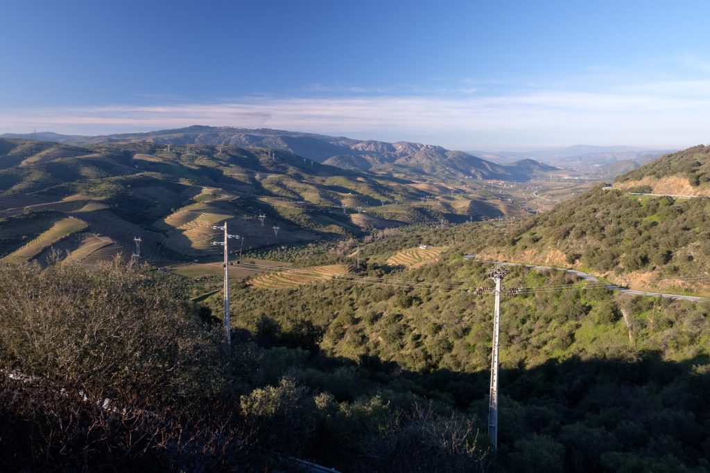
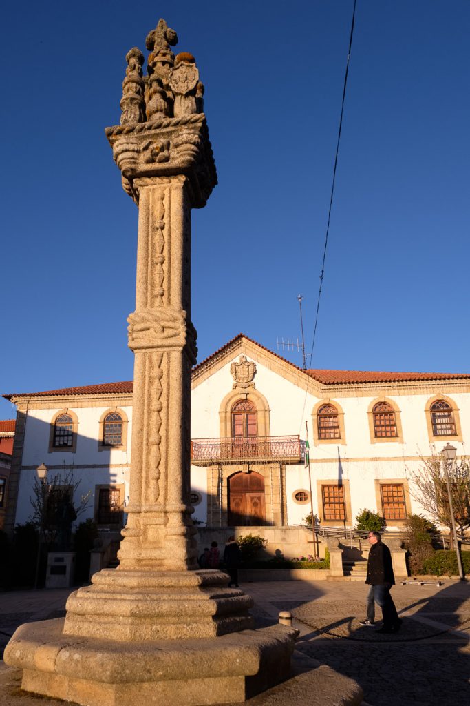
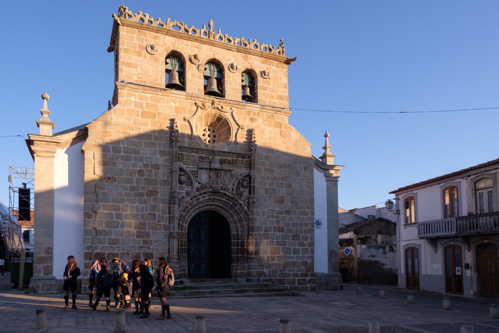
After a few more kilometres, we finally arrived in VNFC, where we settled for the night. Not before doing a bit of walking around, bringing back childhood memories. The historical centre includes the church, pillory, and town hall. The first charter was granted by King D. Dinis in 1299. On the northern exit of the town, by the side of the road, is wrth to stop and admire the view towards the Douro valley. We rested there until sunset, simply admiring the view. The next day was going to be very full, with the visits to some of the pre-historic rock art sites.
VNFC – looking North.VNFC – pillory and town hall.VNFC – church.VNFC – almond blossoms.