The Parque Natural da Peneda-Gerês, Portugal: part 3.

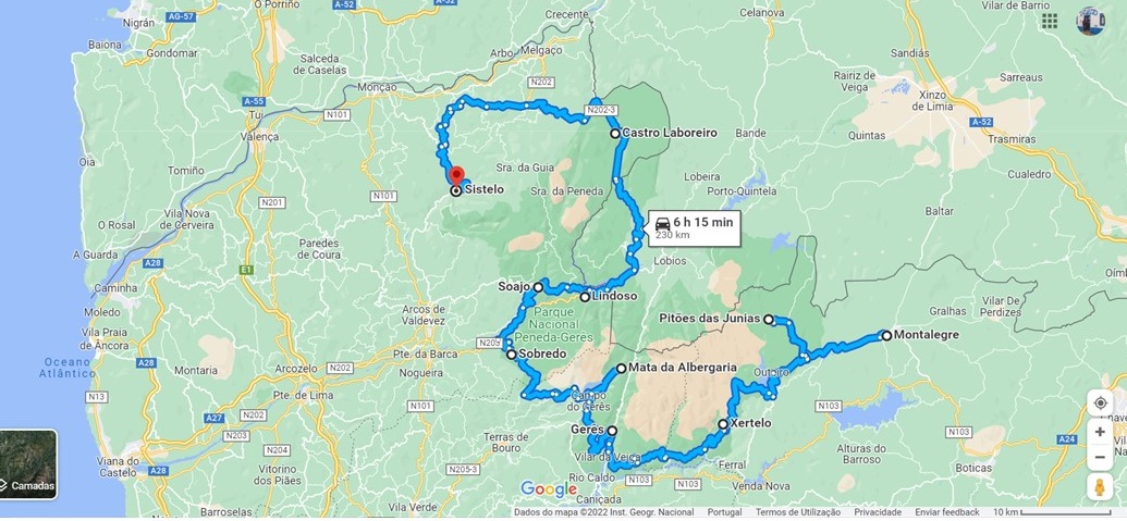
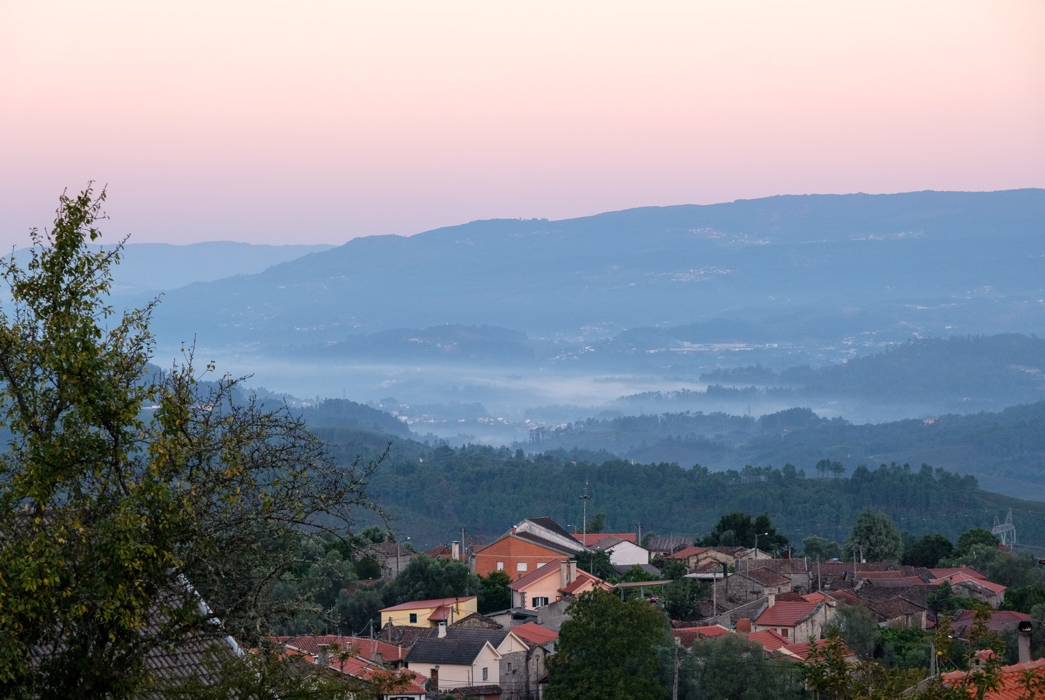
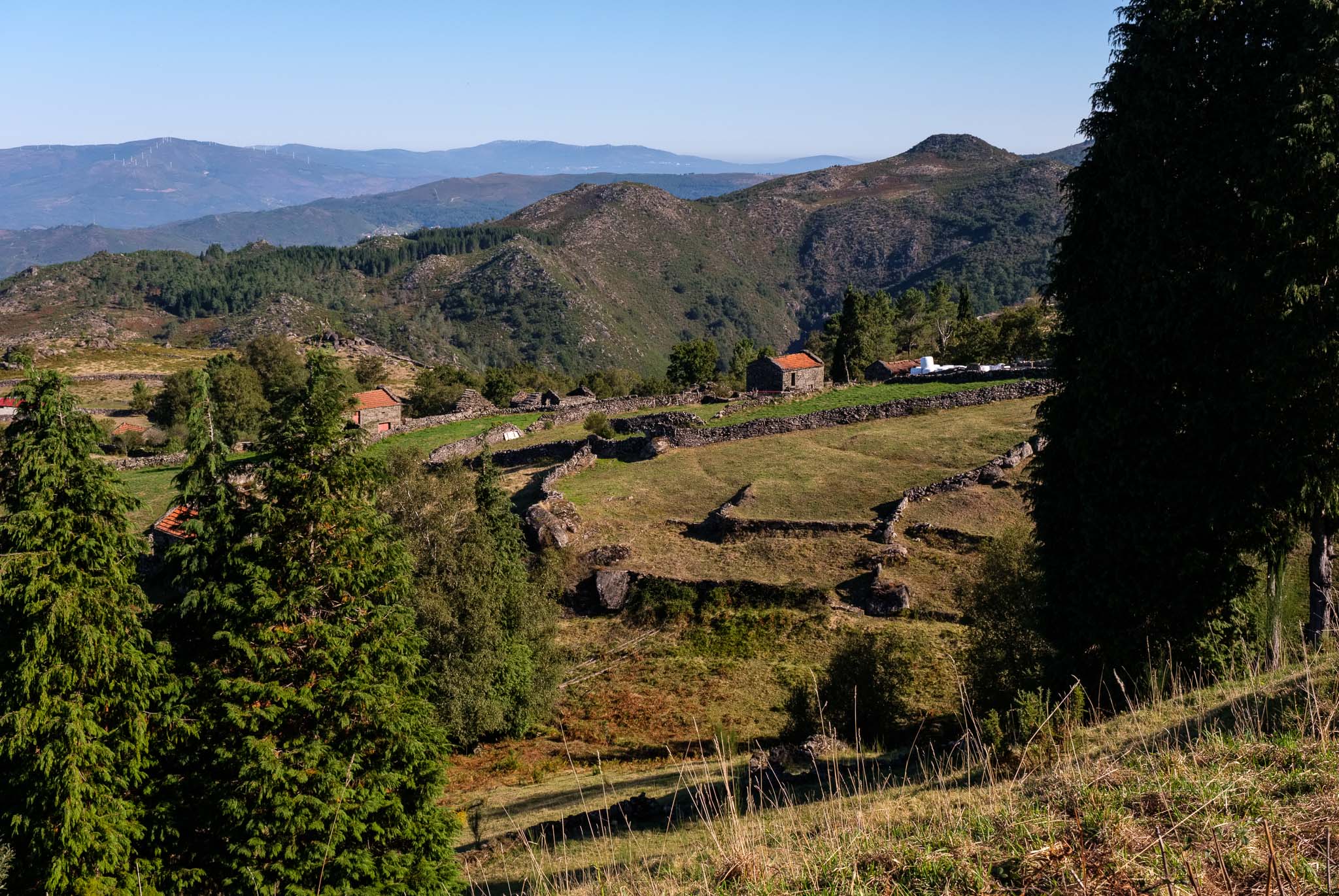
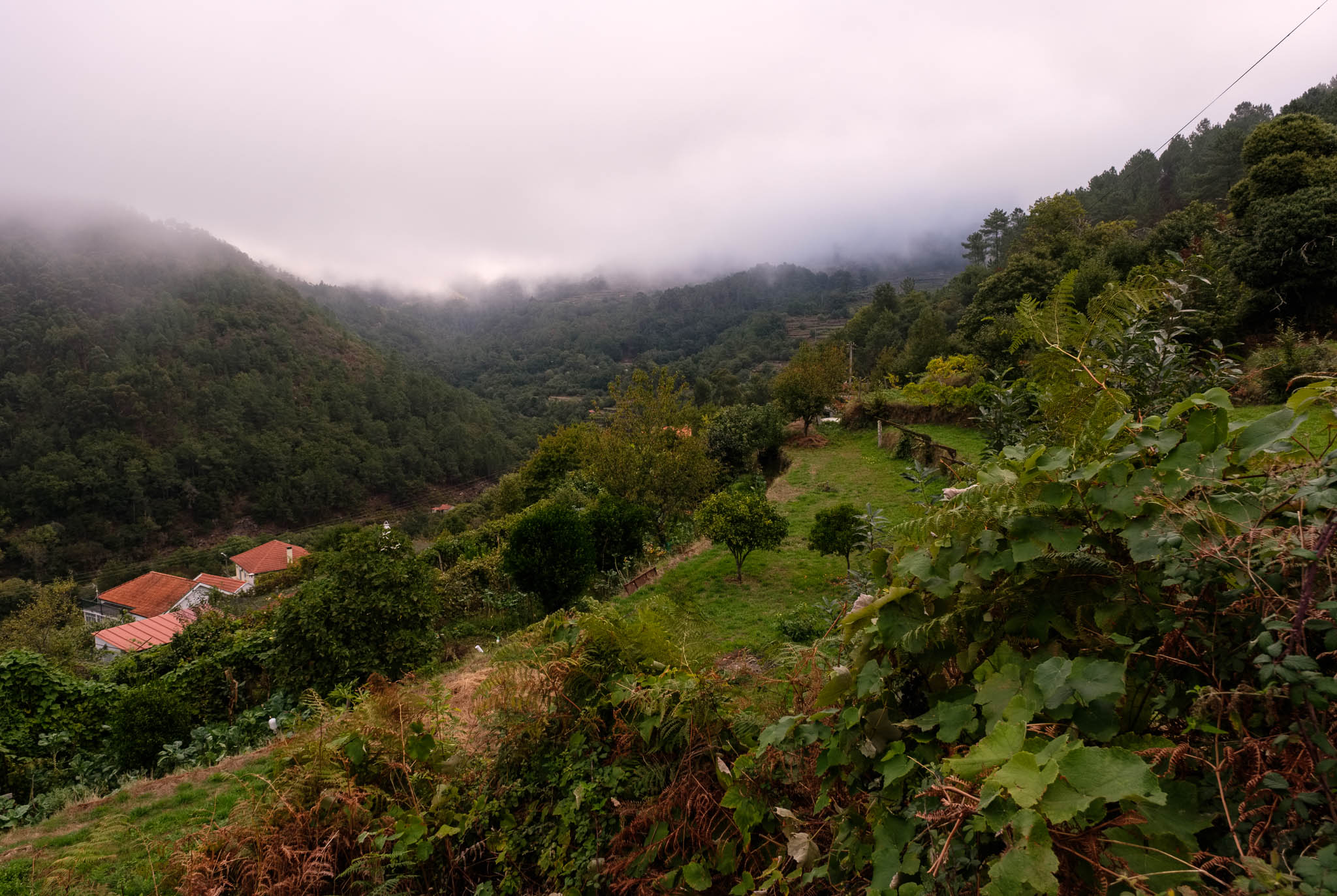
This final instalment will address days 5 and 6 of our trip. The fifth day of the trip turned out to be a very busy one. The plan was to visit some of the iconic villages of the PNPG, such as Soajo, Lindoso, and Castro Laboreiro. With a stop in between at the famous Senhora da Peneda sanctuary. I woke up before sunrise for a walk in Sobredo; I really enjoy grabbing the camera and simply go out into the fresh air and early morning light. Life in the rural countryside starts well before dawn, with the cattle being led to pastures, and the farmers tending to their crops. I walked up to the main road to enjoy the views over the surrounding landscape, with fog in the valleys and the first light illuminating the flanks of the mountains.

Sobredo.
Dawn in Sobredo.
Cute.

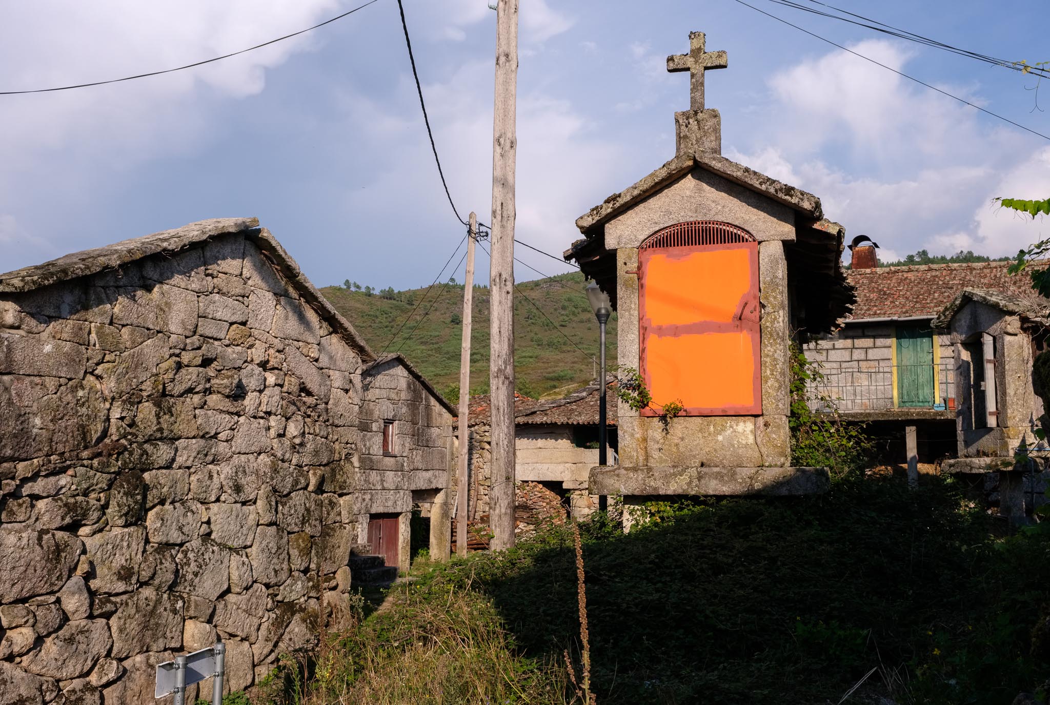
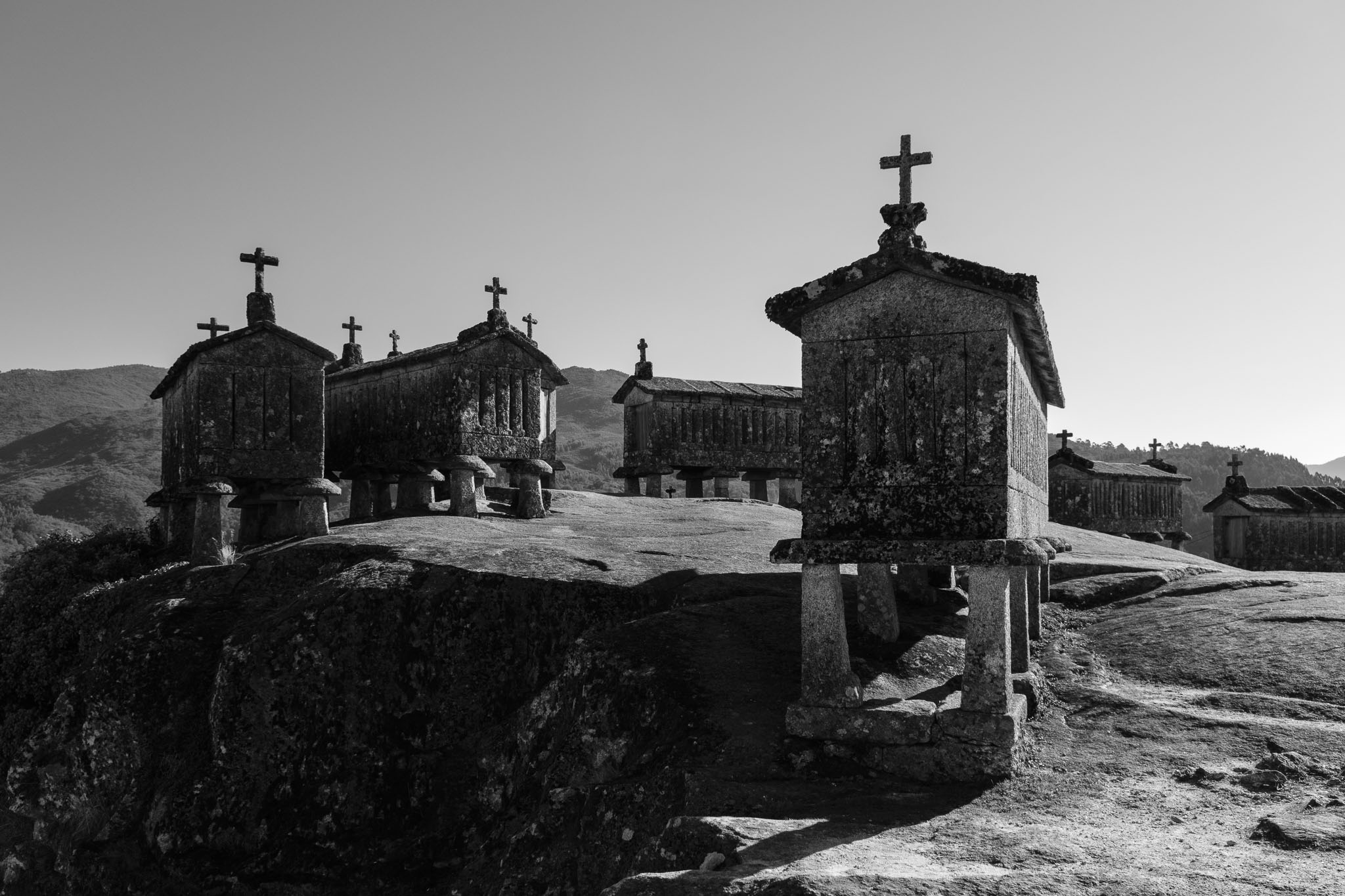
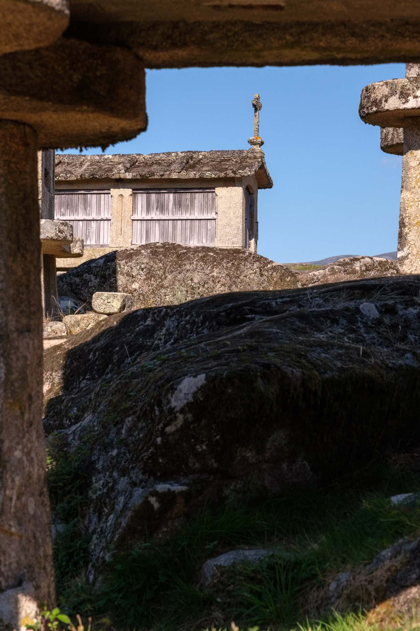
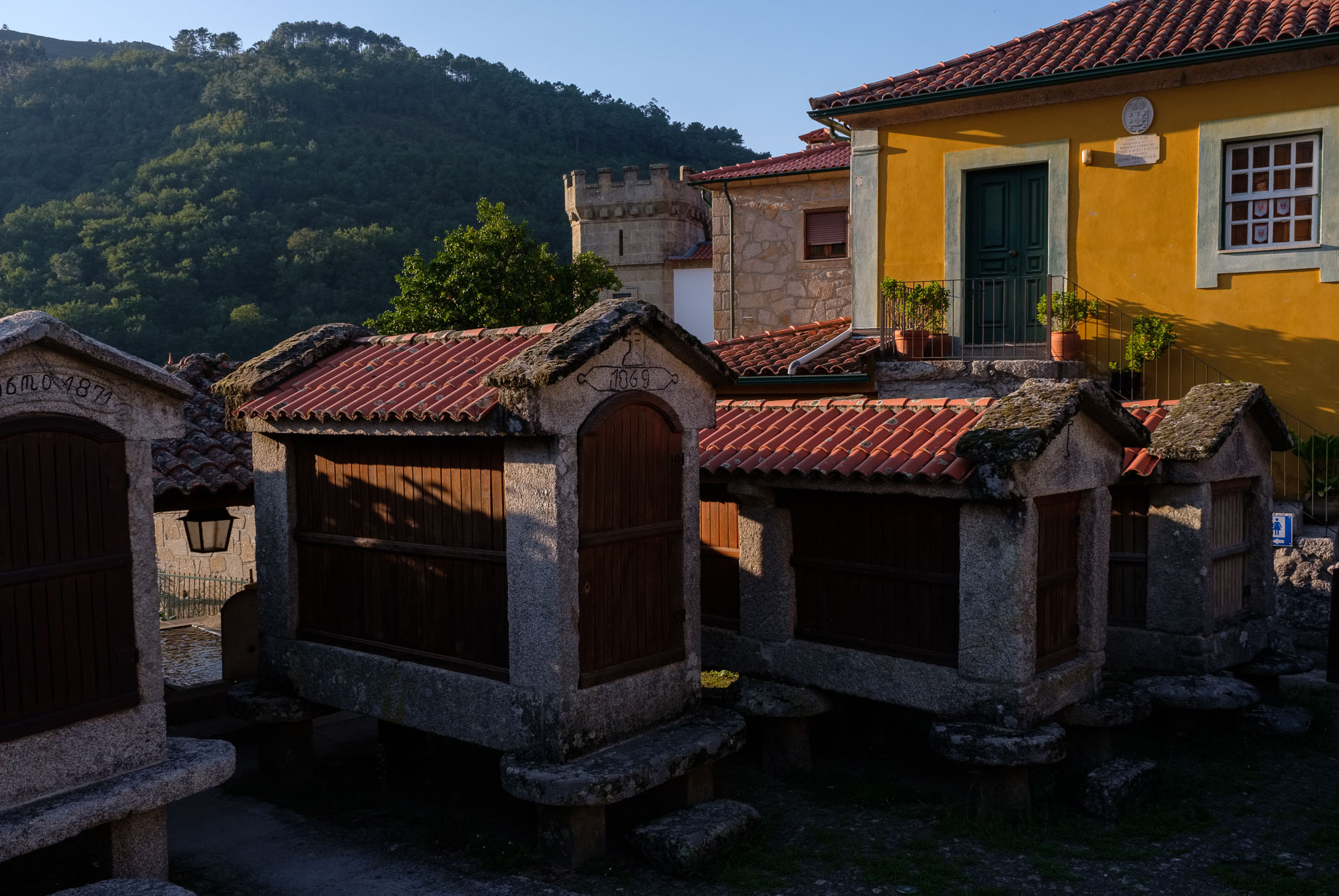
After breakfast, it was time to leave and head to Soajo, a small town rich in heritage and culture. Soajo is known for its “espigueiros”, small granite “houses” on top of stacks, where traditionally the corn cobbs were stored, away from the reach of animals. The group of espigueiros lies at the top of a granite slab at the entrance of the village. But Soajo has more interesting things to see, so do walk around for a while in the maze of narrow streets.

Espigueiros in Soajo.

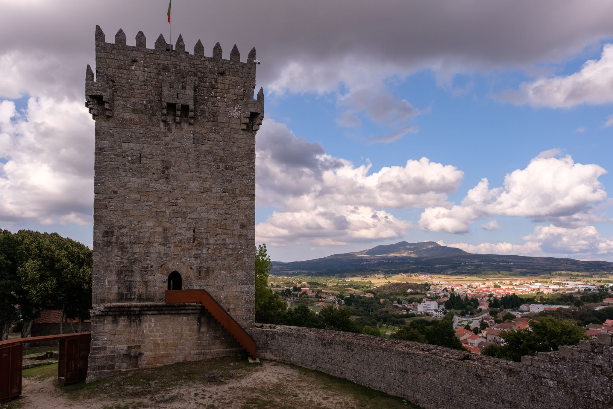
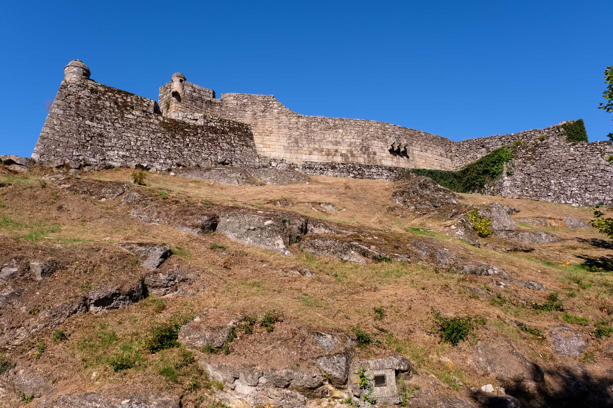
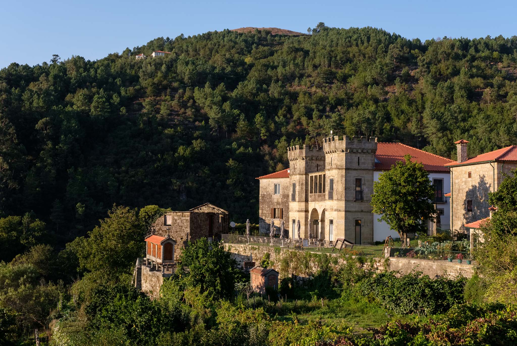
From here it is a short drive to another very interesting town, Lindoso, close to the border. Here, do not miss the castle and the group of espigueiros next to it. There is a rich history of disputes along the border, and for sure this castle played an important role, with its prominent location at the top of the hill.

The castle of Lindoso.
Espigueiros in Lindoso.

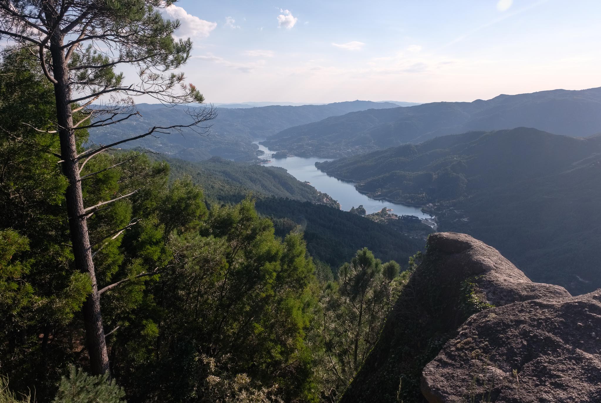
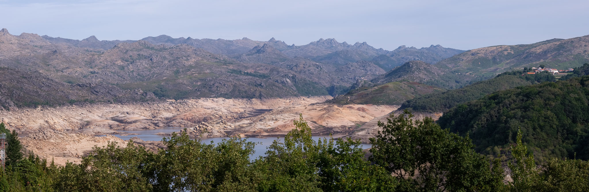
Leaving Lindoso, we drove to Castro Laboreiro, located to the north. The shortest road took us through Spain, and close to the ghost village of Aceredo. Due to the scarcity of rain, the water level in Lindoso dam is so low that this town, once under water, is now emerged.

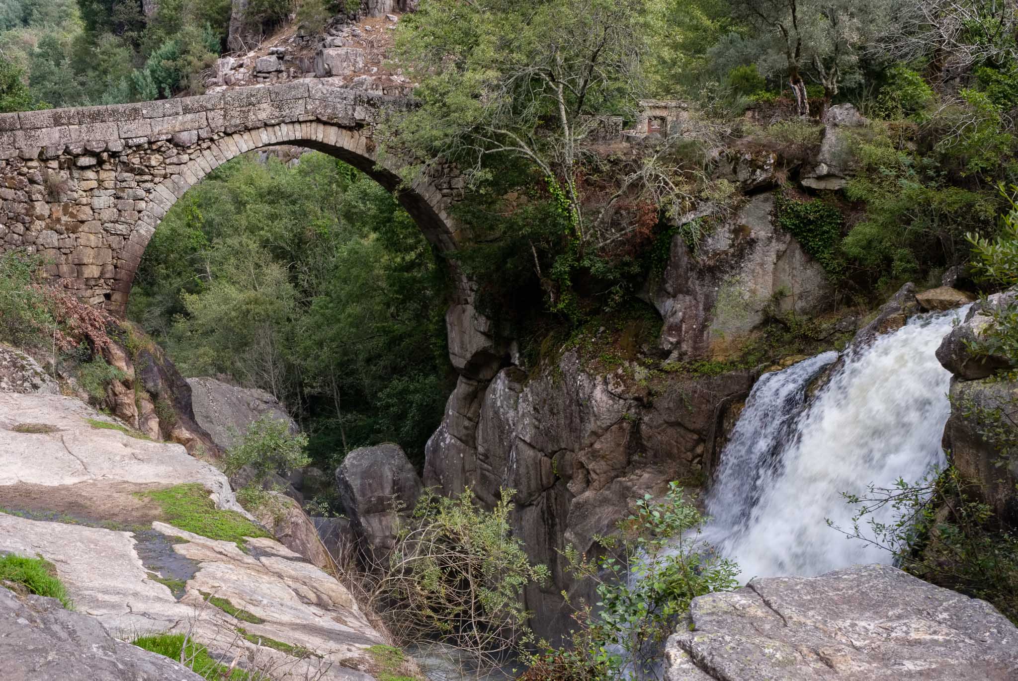
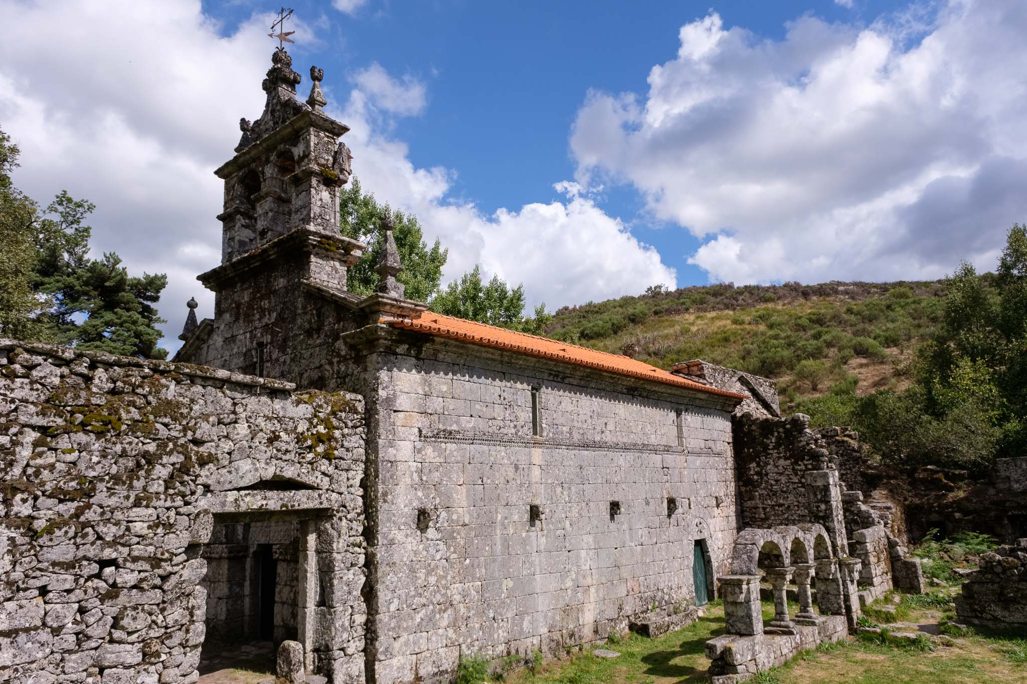
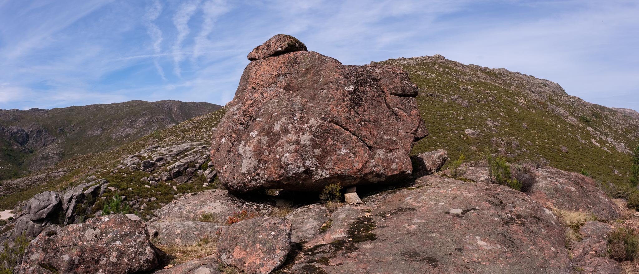
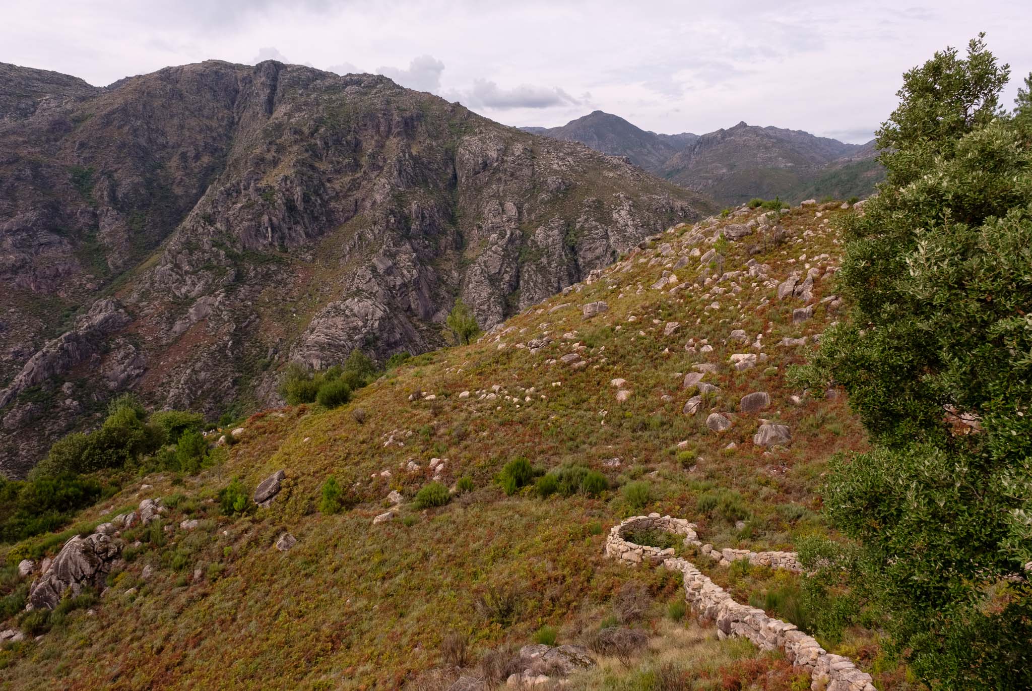
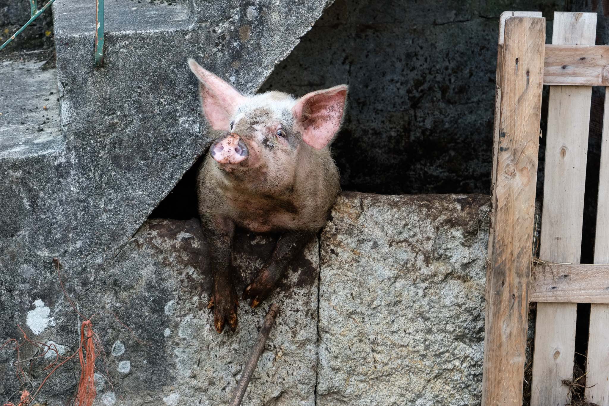
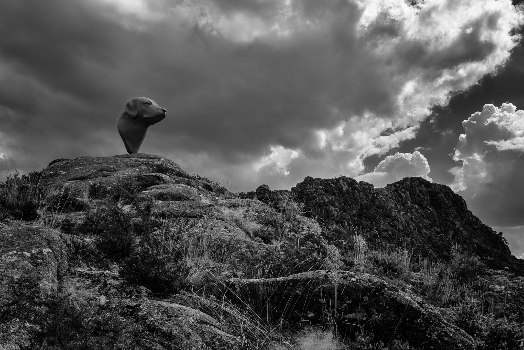
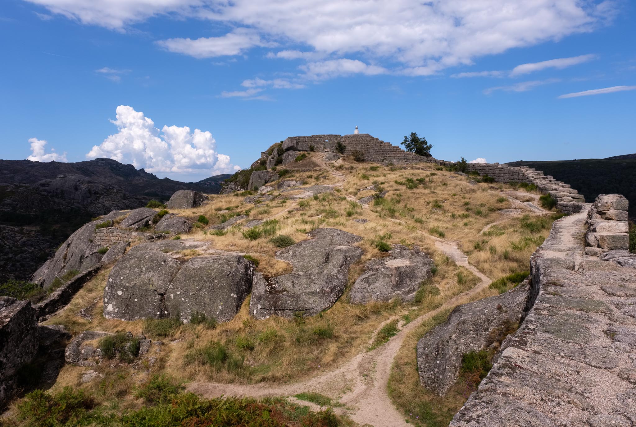
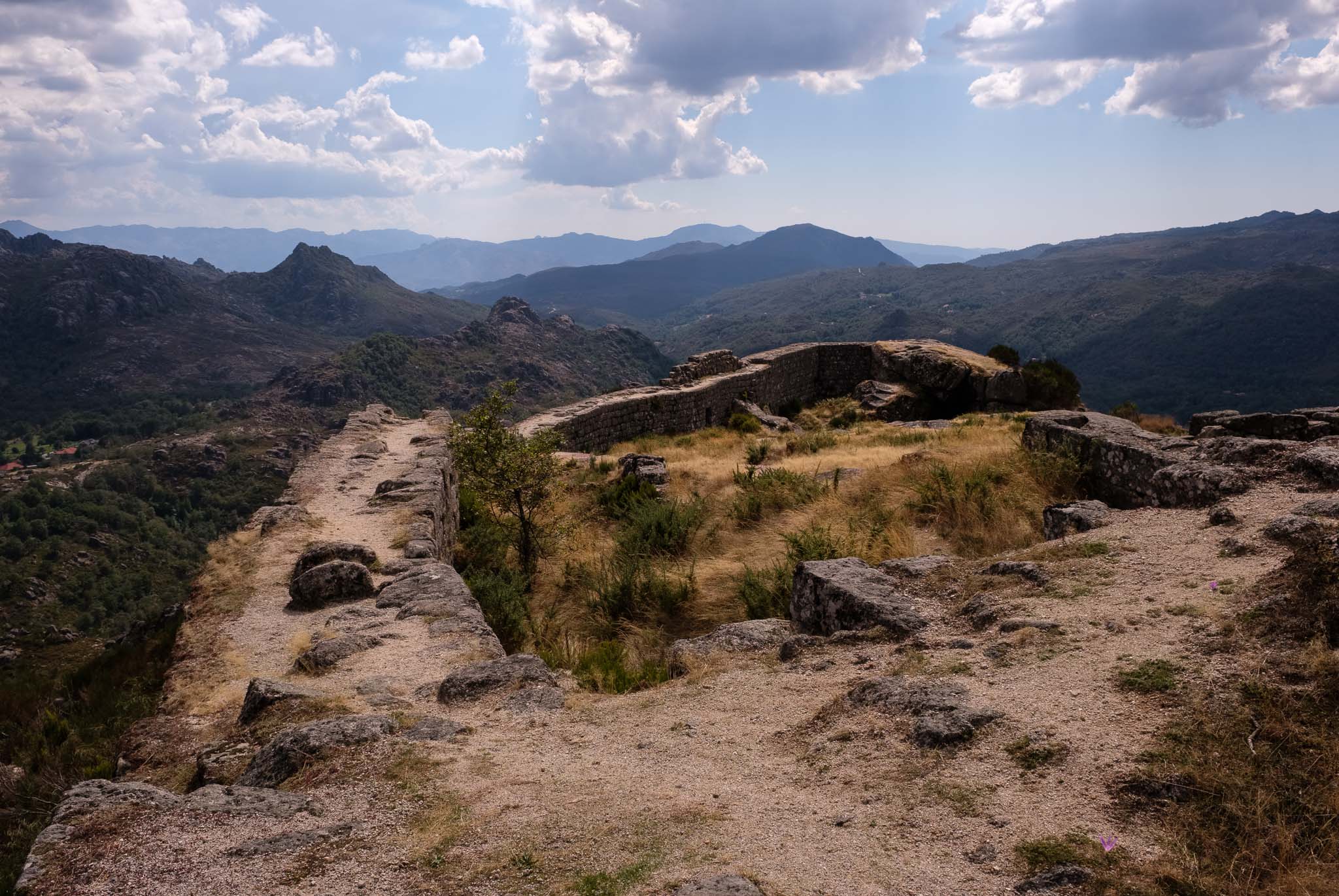
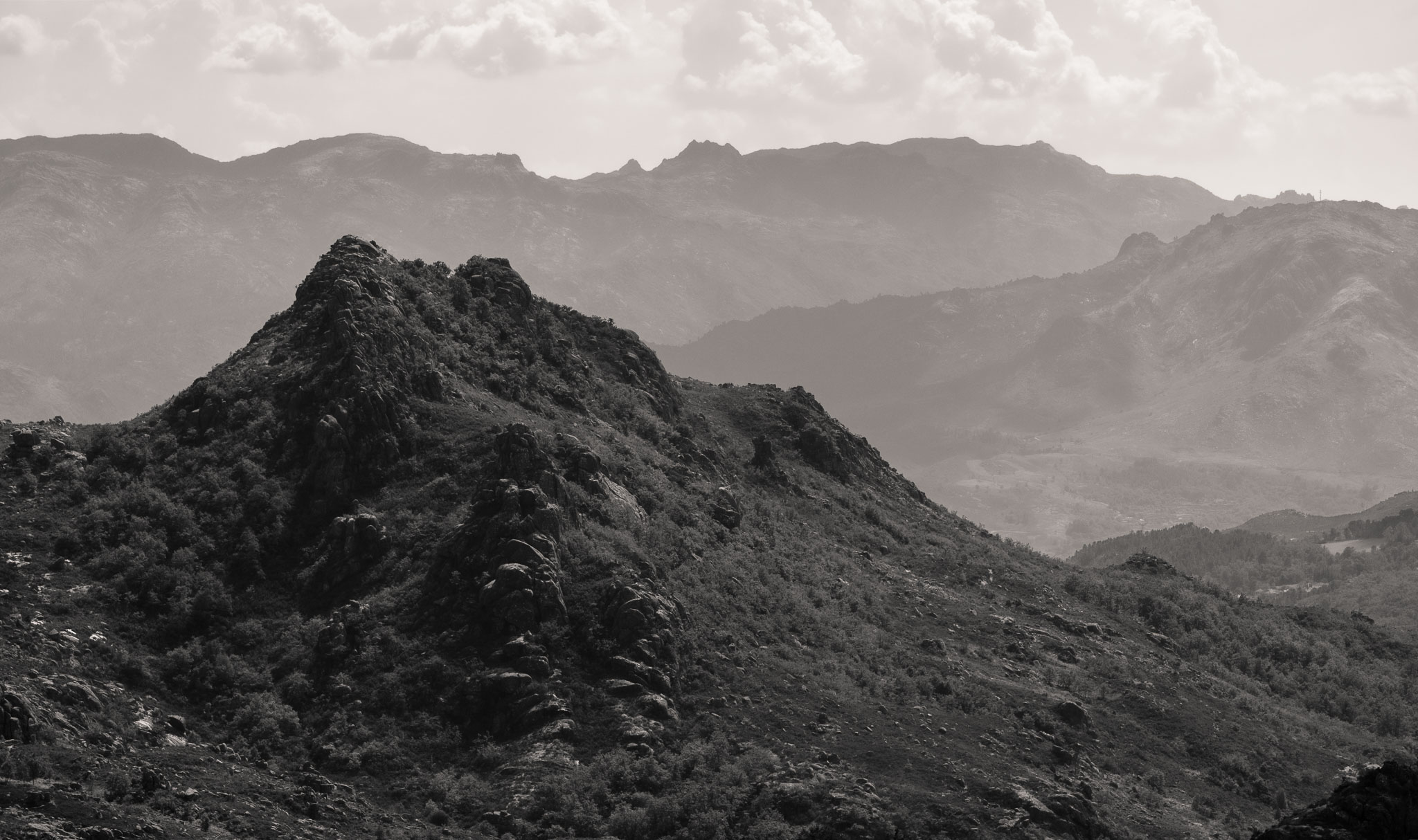
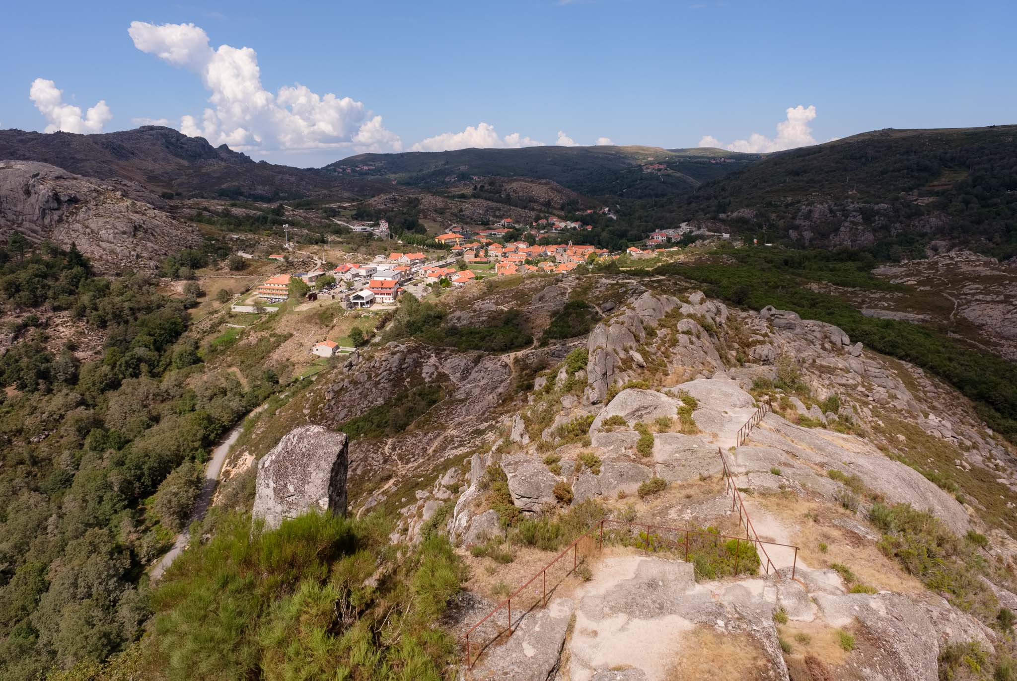
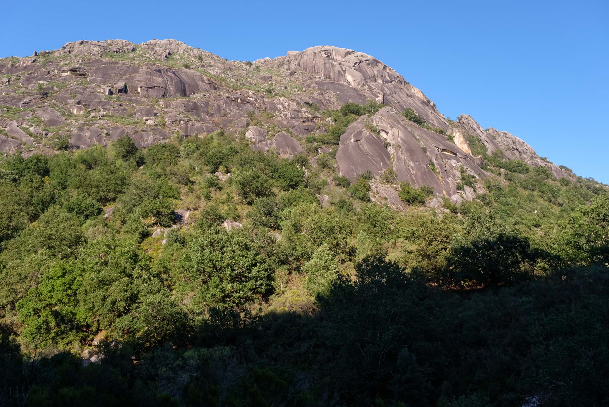
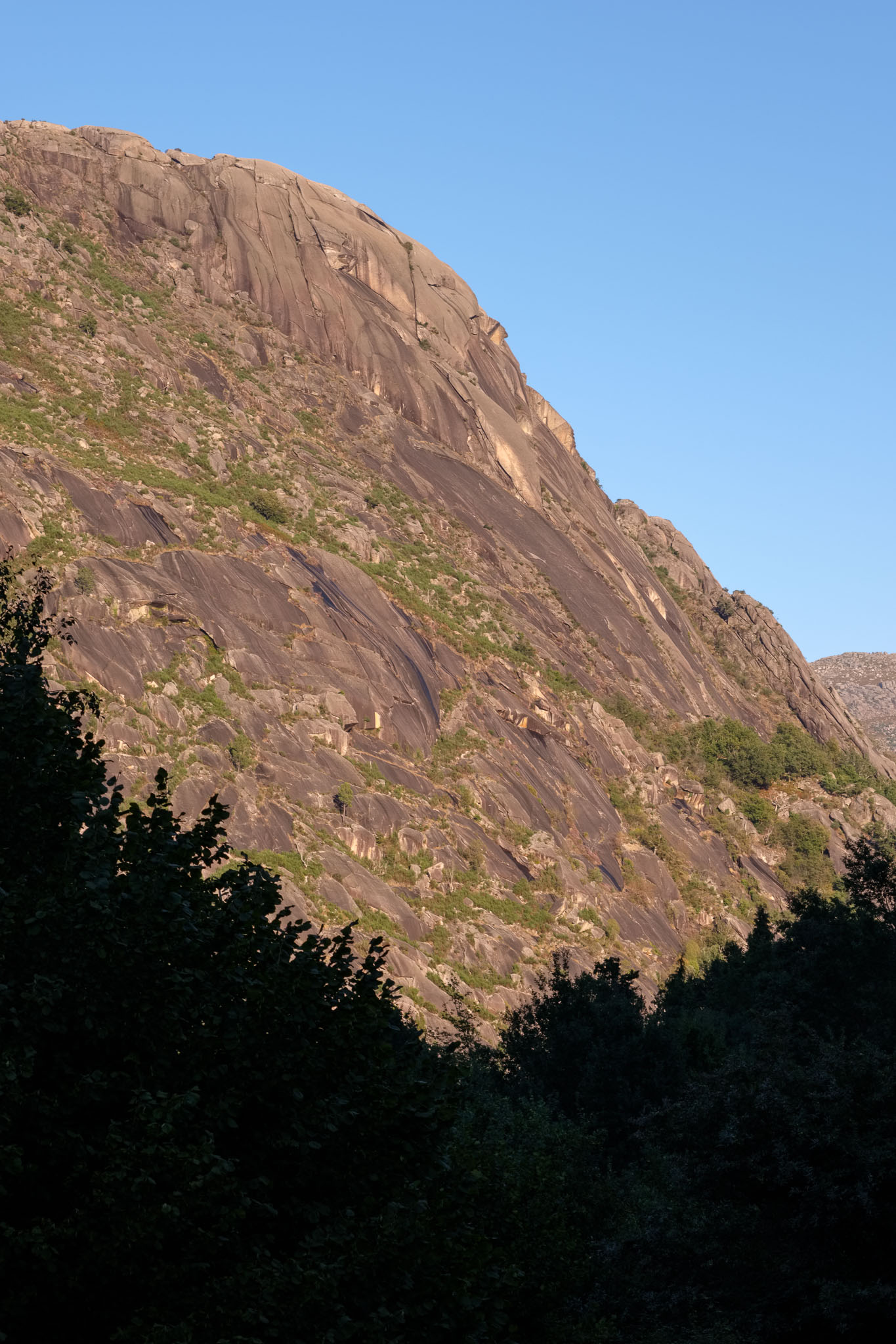
Castro Laboreiro is another place that has its roots in prehistoric times. Located in a high altitude plateau in the serra da Peneda, above 1,100m, the village is well known for its castle (dated from the XII century) at the top of a granite mountain, several waterfalls, and the Castro Laboreiro autochthonous dog race. This is an old race of dogs from this region, specifically bred for the task of herding cattle in the mountains. There are many interesting places to visit, but do not miss the short trail to the castle; at a first glance, the castle is hard to notice, because it can be easily mistaken for another group of granite formations. From its top, the surrounding view is amazing, and the only companions are the wind and the song of the birds.

Statue of the famous Castro Laboreiro dog, with the castle in the distance.
The castle of Castro Laboreiro.
Inside the castle in Castro Laboreiro.
Panoramic view of the mountains near Castro Laboreiro.
The village of Castro Laboreiro, seen from the castle.

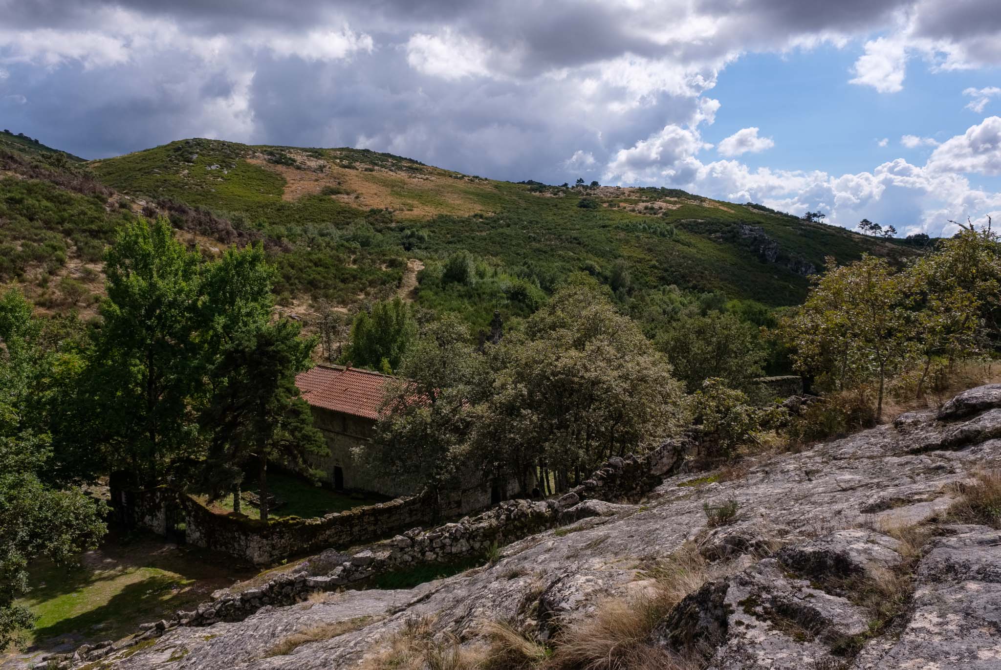
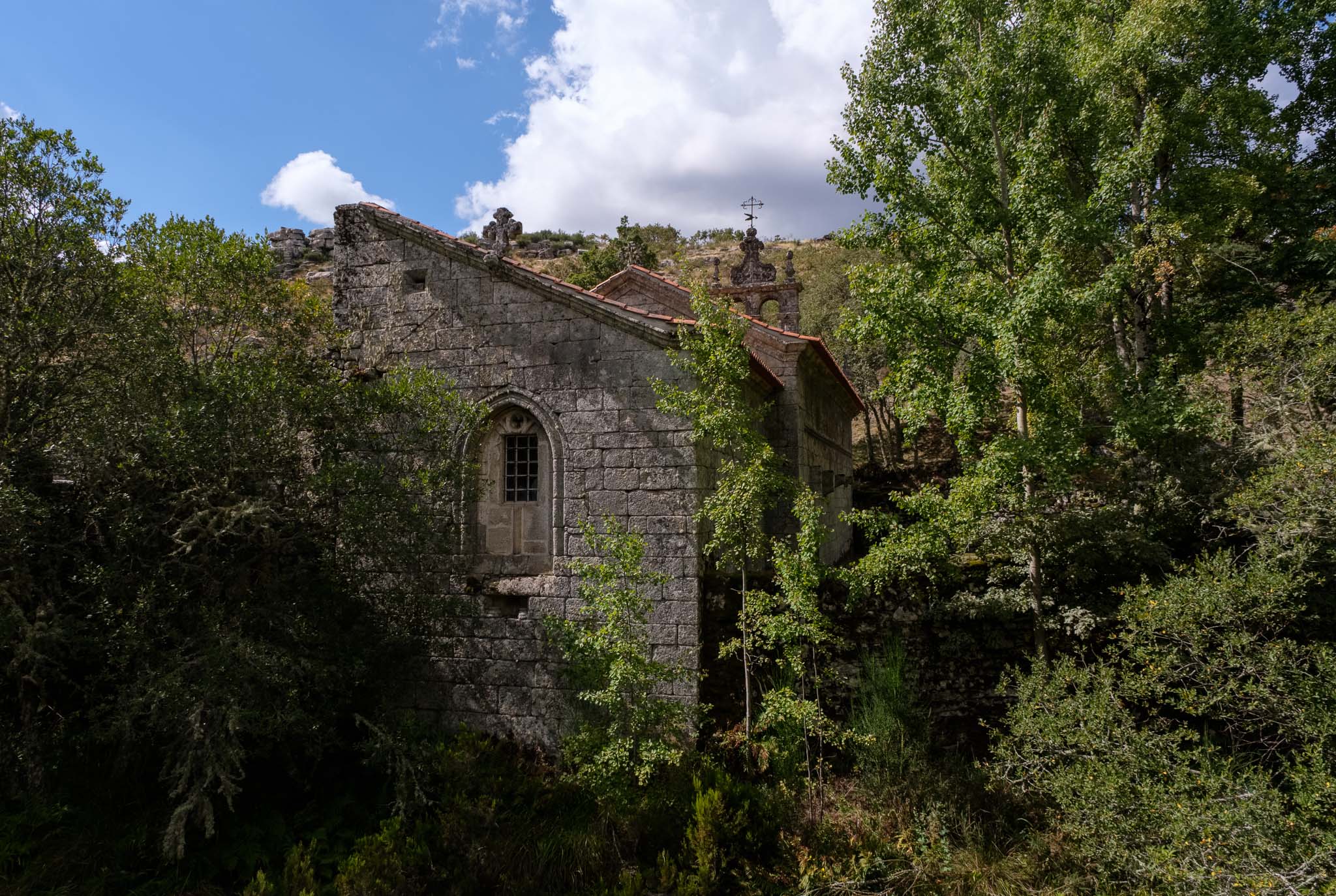
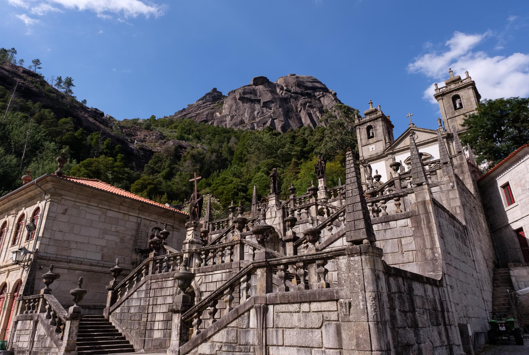
There are several nice places for a picnic lunch and a rest, after which we head to the sanctuary of Senhora da Peneda, hidden amongst the flanks of the mountain. As always, the distance is not great, but the road is quite twisty. I remember visiting 30 years ago, when several of these roads were not yet black top. The sanctuary is located below a large granite block and a waterfall.

Scenic road to Senhora da Peneda.
Senhora da Peneda sanctuary.

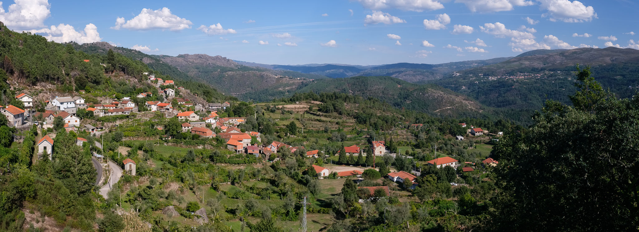
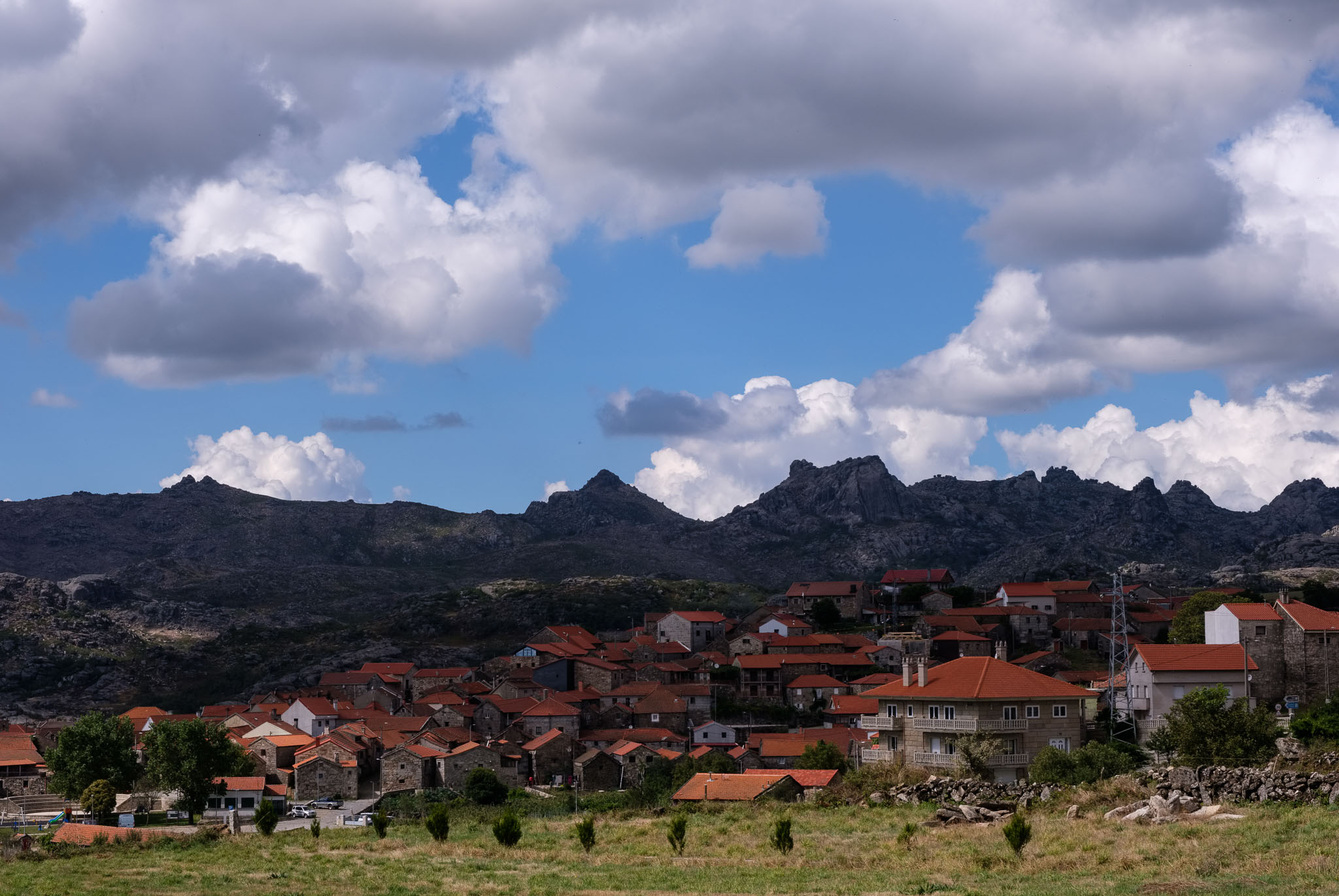
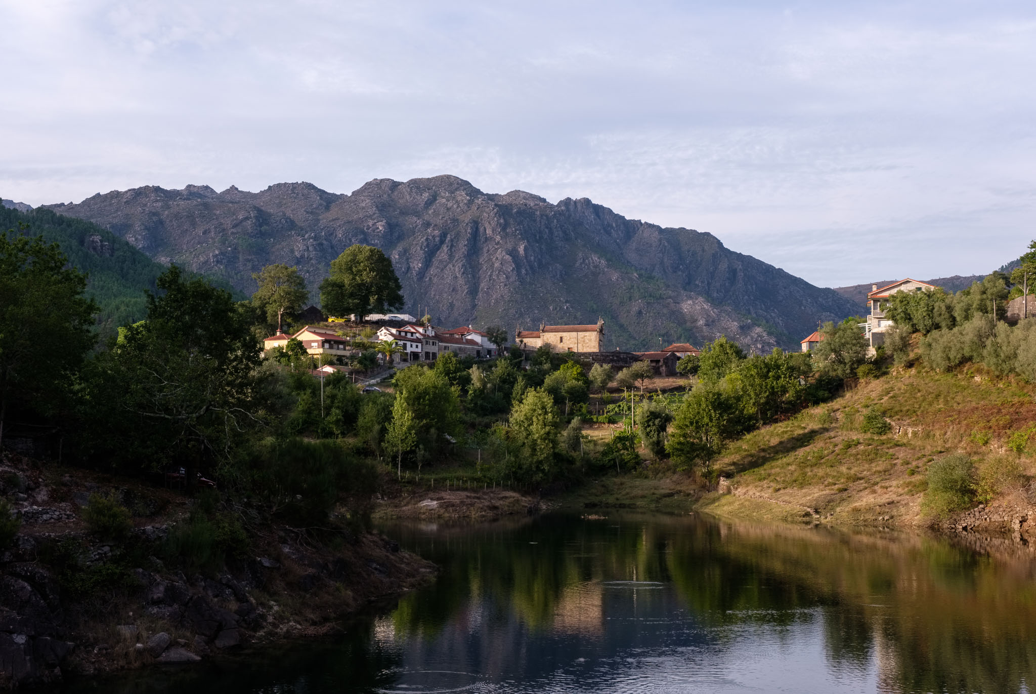
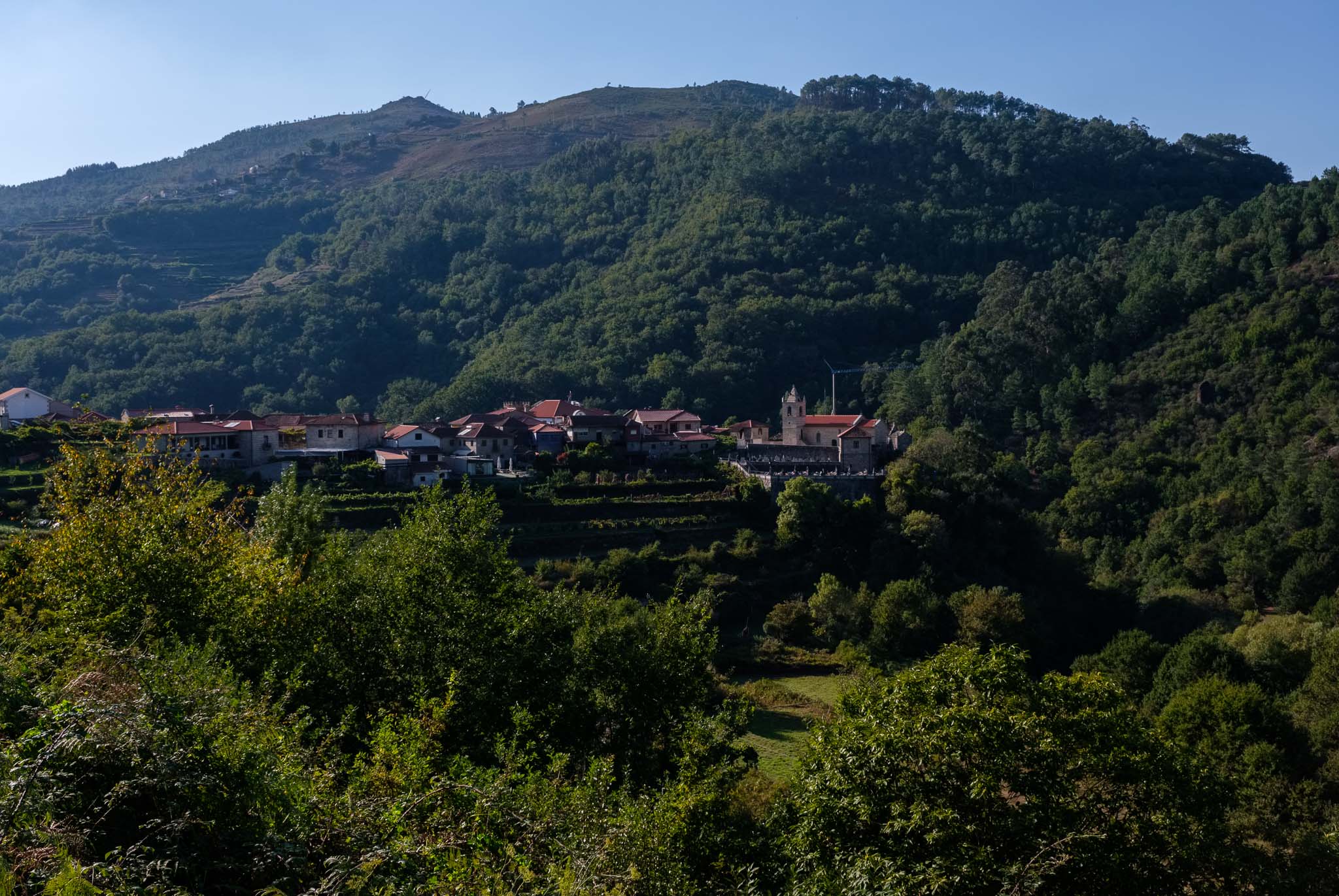
The day was already long, and we still had to go to Sistelo to spend the next couple of nights. Visiting these iconic places was a wonderful experience. The day ended in Sistelo, a village that became quite popular in the last few years, after winning a national contest of rural villages. Located in the lush green valley of the river Vez, Sistelo can be a center point for some great trekking, which we would try the following day.

Sistelo.
Espigueiros in Sistelo.
Sistelo.

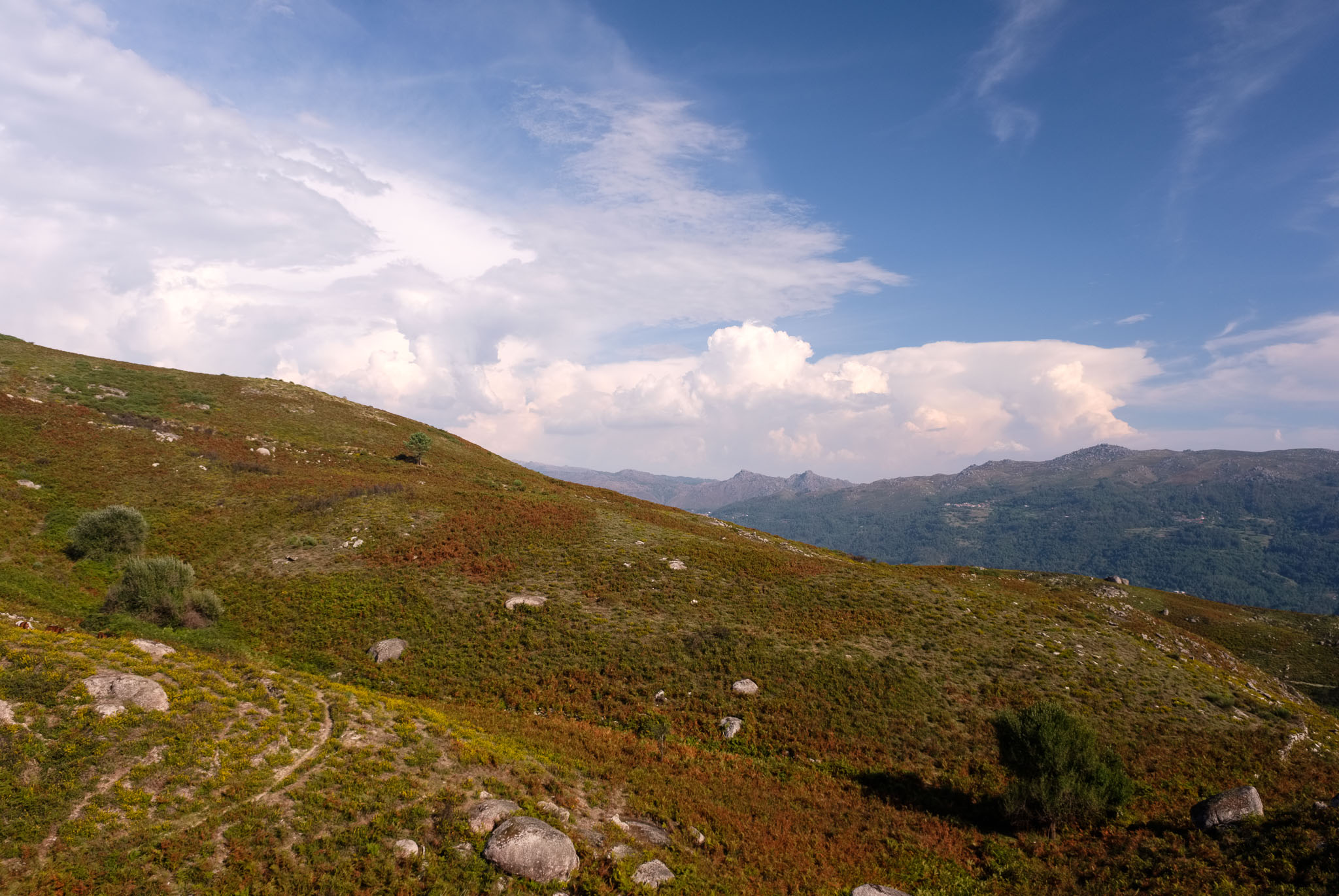
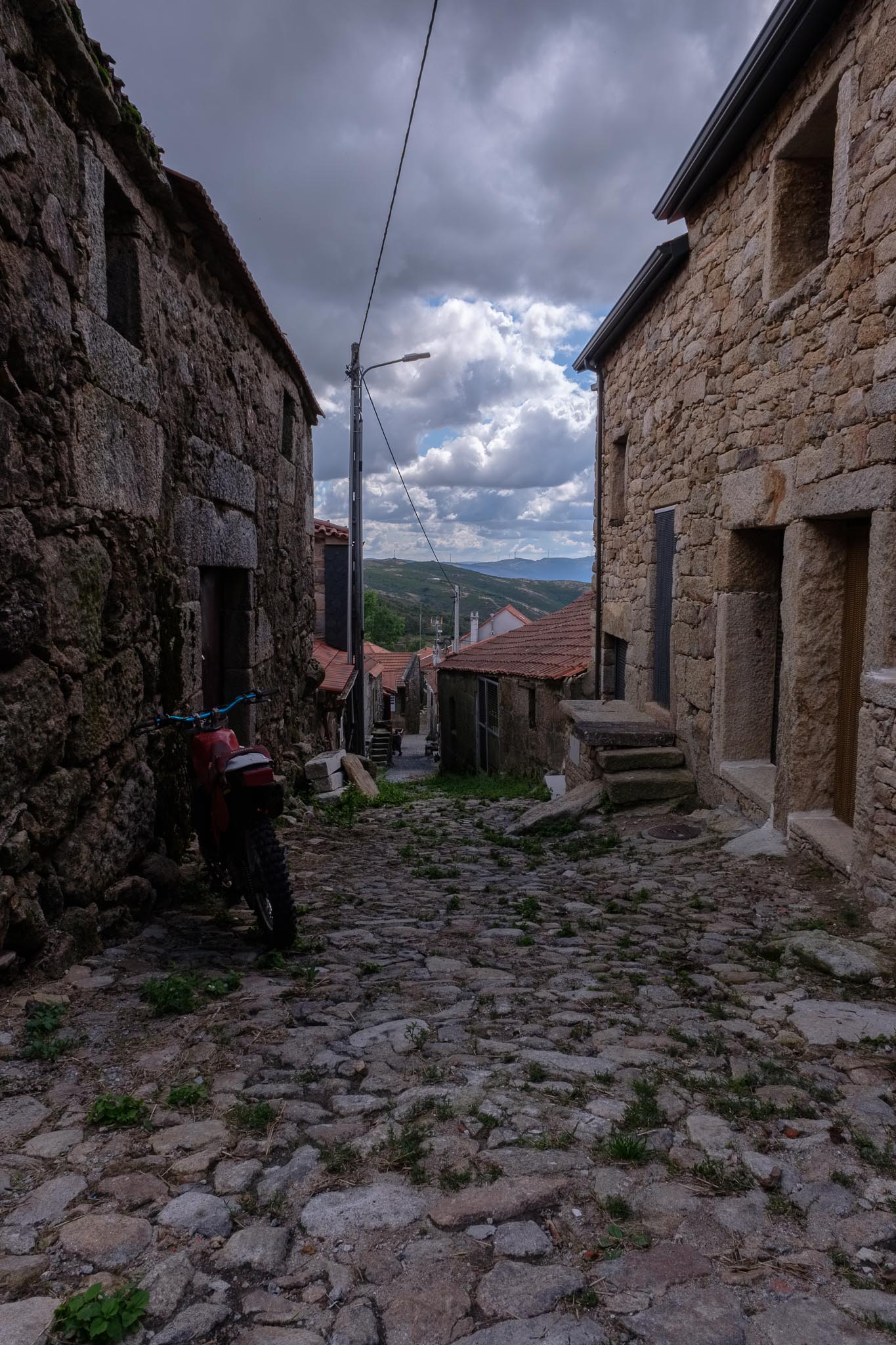
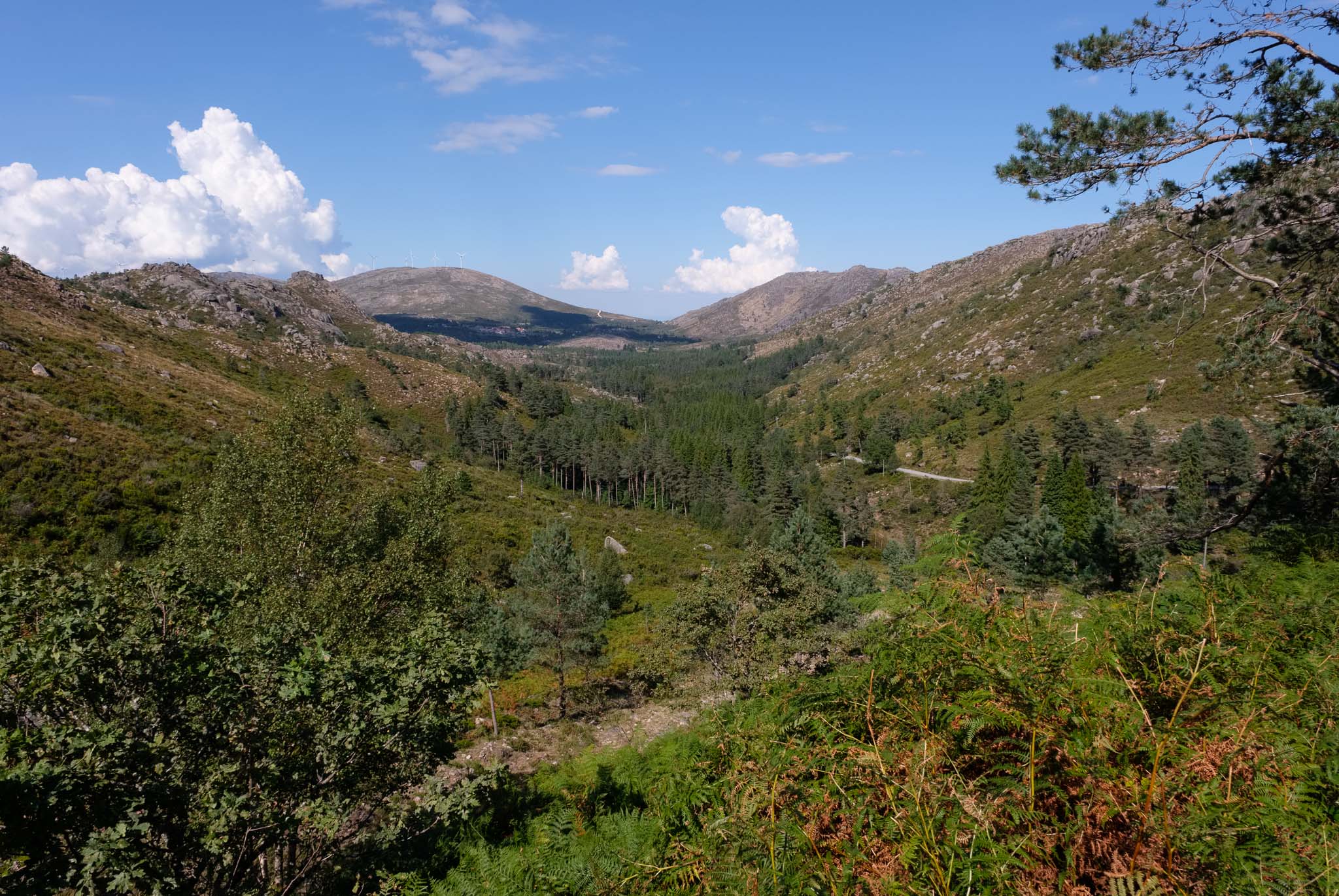
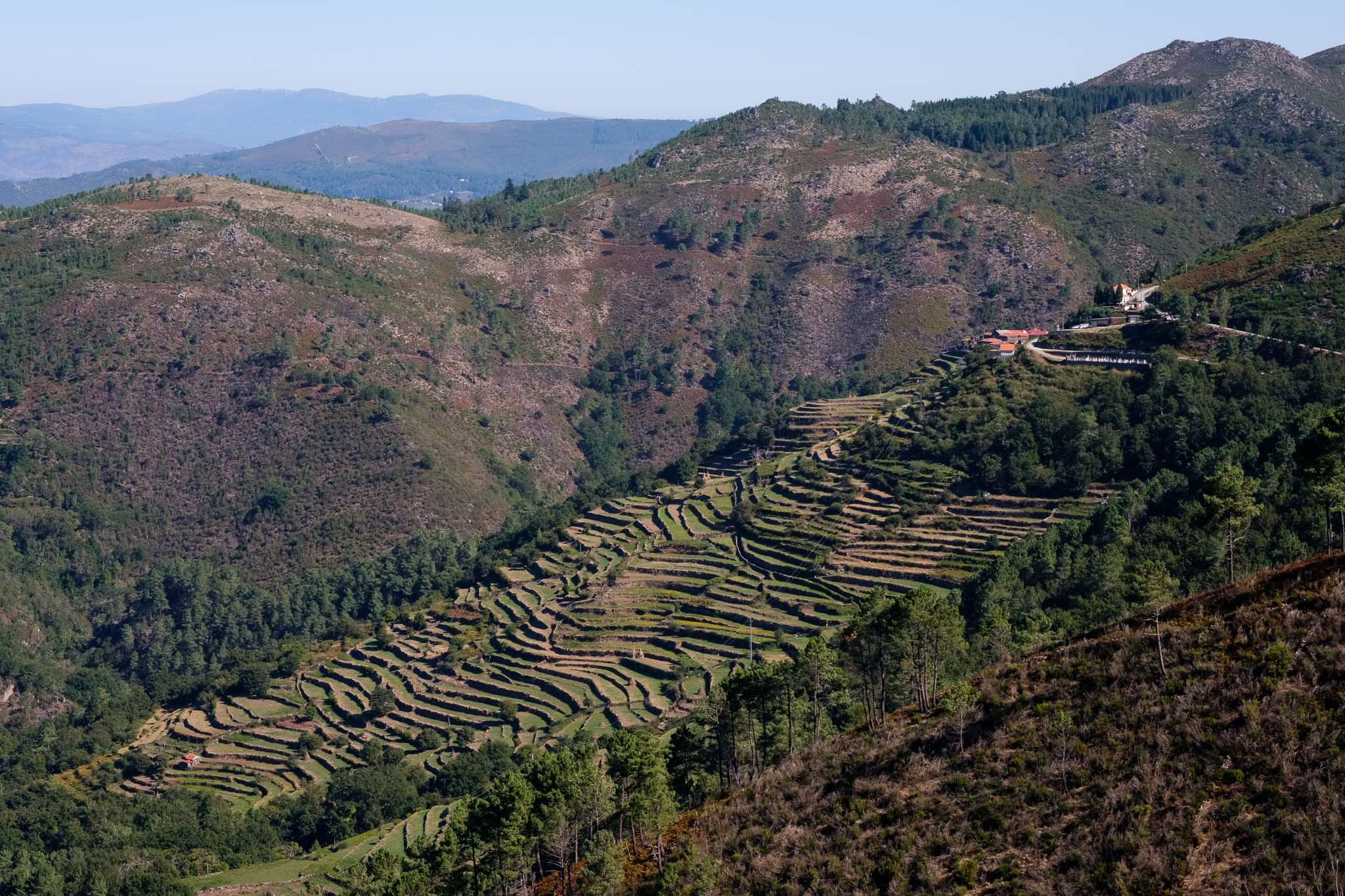
We wanted to walk along one of the trail paths that connected the village to the high altitude “brandas”, or settlements where people take the cattle during the summer, to avoid the higher temperatures down in the valleys. Sistelo is also well known for the terraces built into the flanks of the mountains, where corn is planted. The trail starts in the main square, and initially follows the river Vez in a shaded forest. After a while, it starts to rise in altitude, with great views over the surrounding landscape.

In the trail near Sistelo.
Terraces near Sistelo.

Once at the top, the path crosses the Branda do Alhal, where some of the houses are still in use today. The day is hot, so we benefit ourselves from the lower temperatures up here.

Branda do Alhal, near Sistelo.

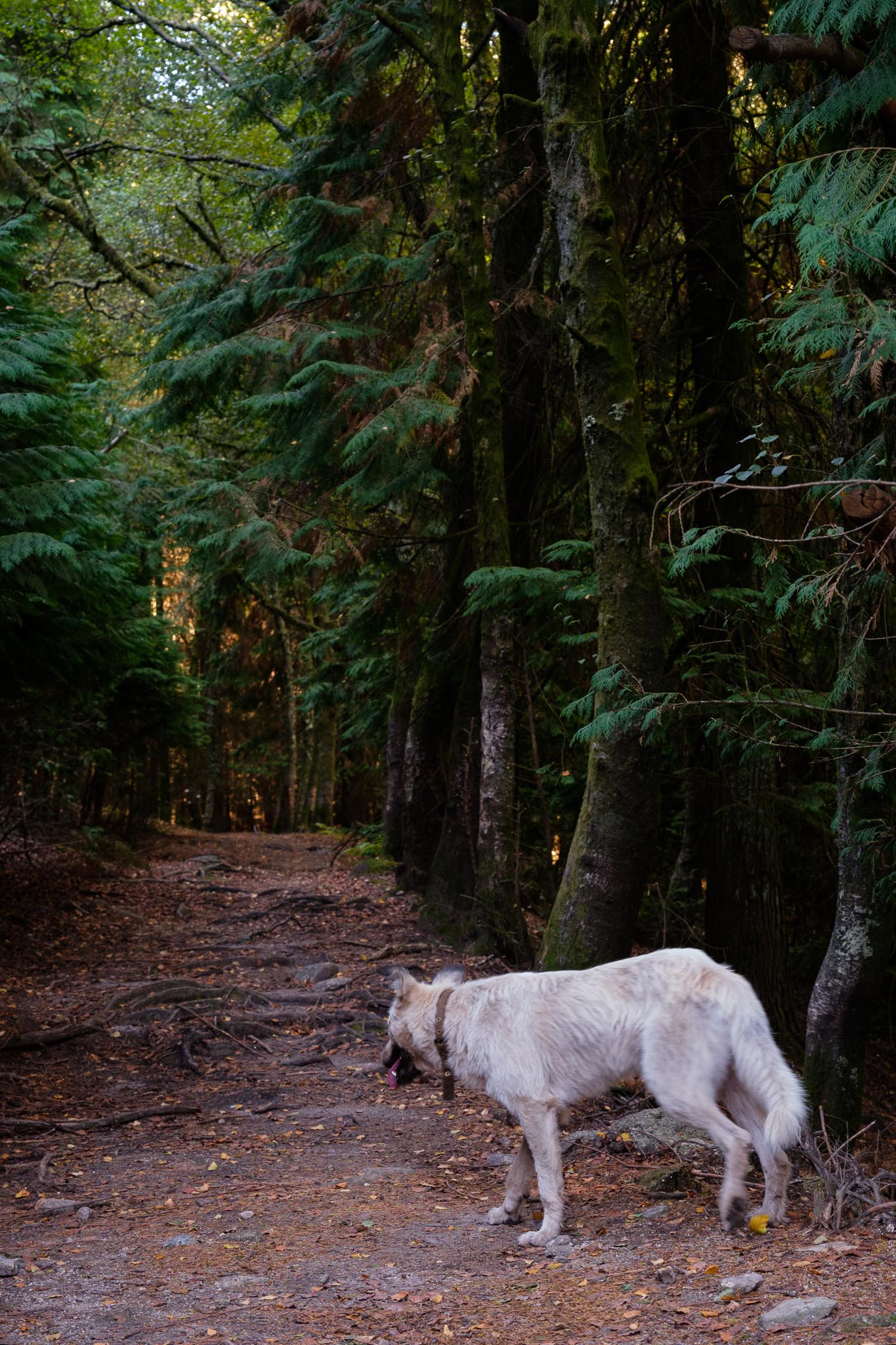
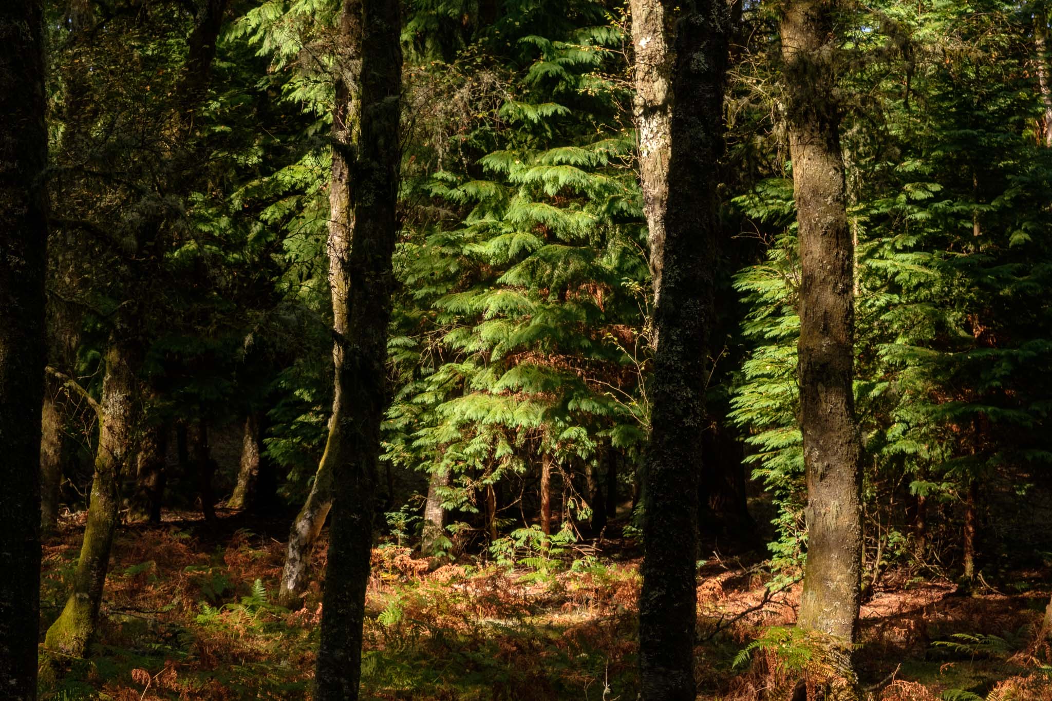
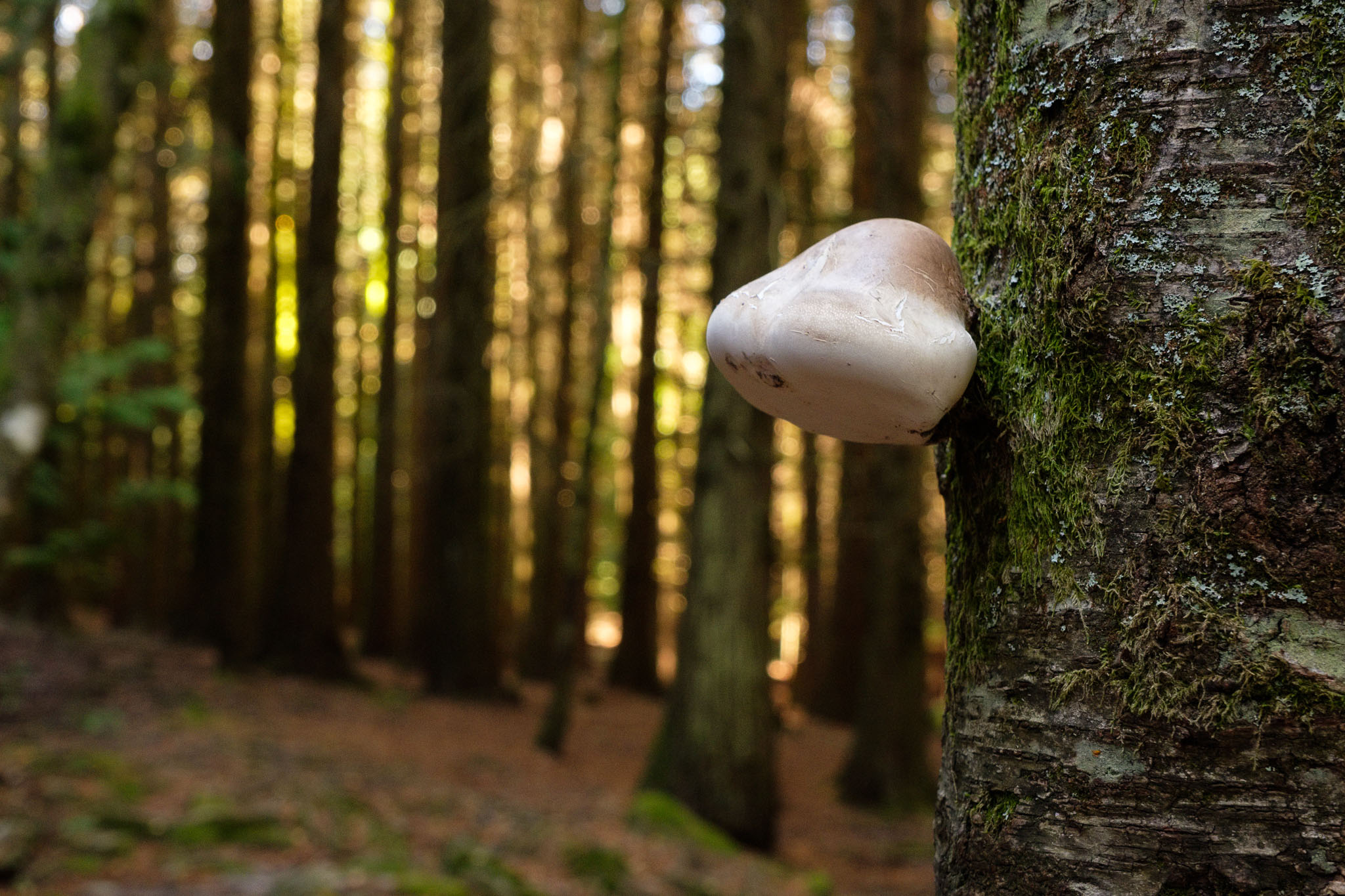
A few kilometres more and we enter a completely different world, a forest so dense that the light barely reaches the ground. It feels like a magical place, straight out of a brother’s Grimm story. Even a white dog appears to enhance the feeling. There is a sense of mystery while crossing this wonderland.

Fairytale?
Patch of sunshine.
Mushroom in the forest.

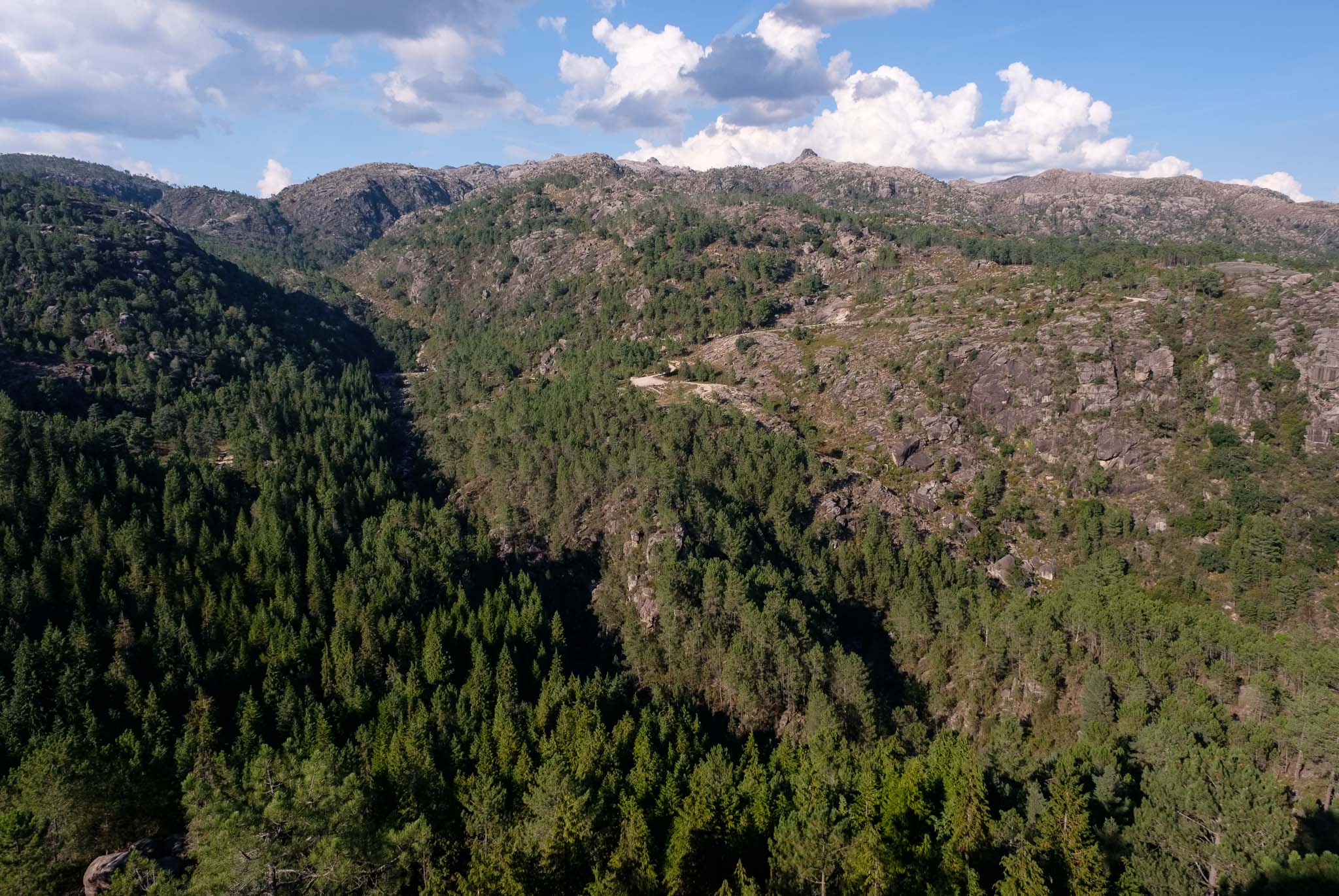
After leaving the forest behind, the trail descends the mountain towards Sistelo. Once we are back in the village, we rest during lunchtime, saving energy for the afternoon, where the plan was to visit another iconic area of the PNPG, namely the heart of the serra da Peneda and a few of its waterfalls and lakes.

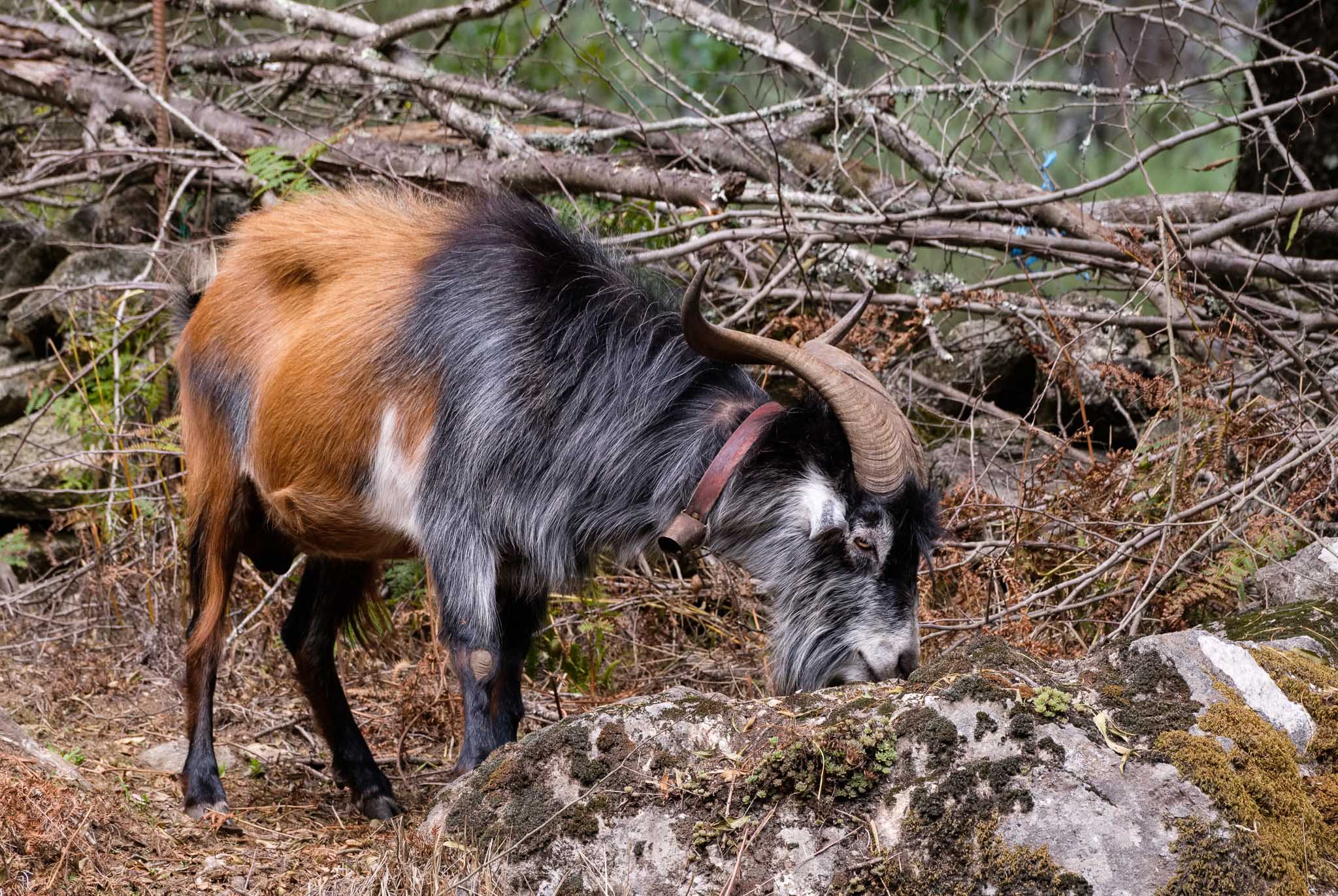
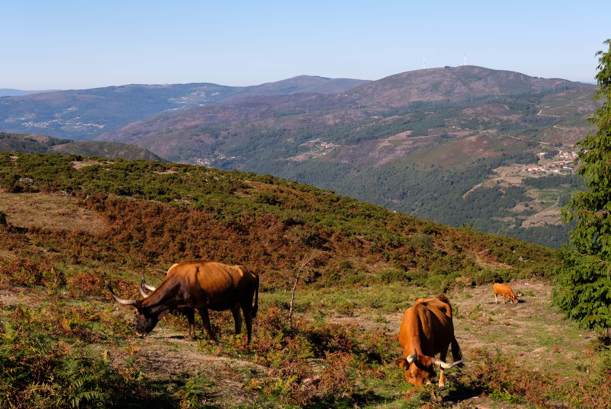
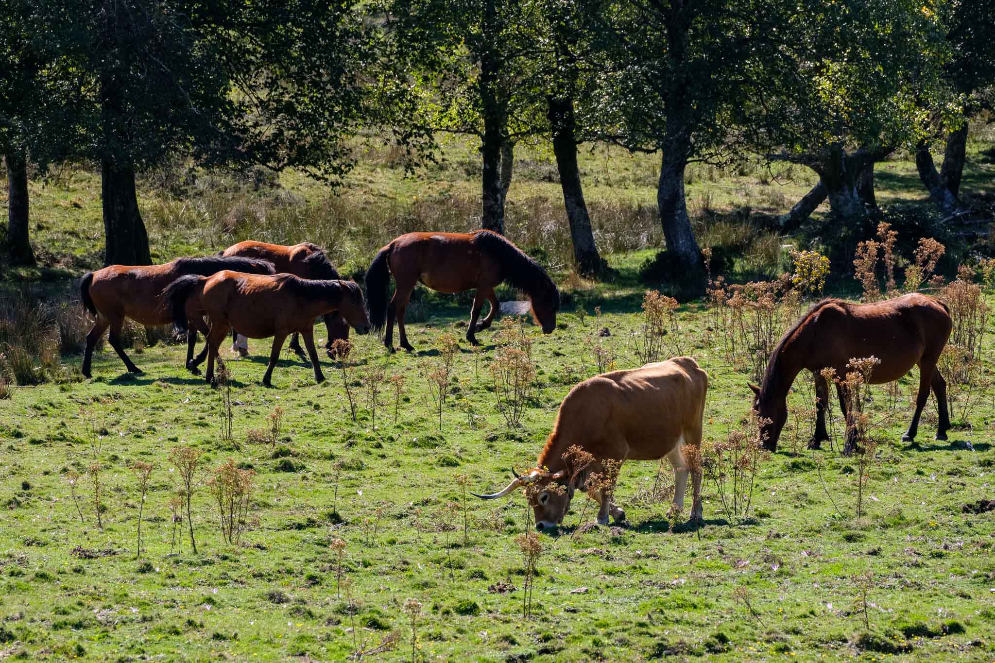
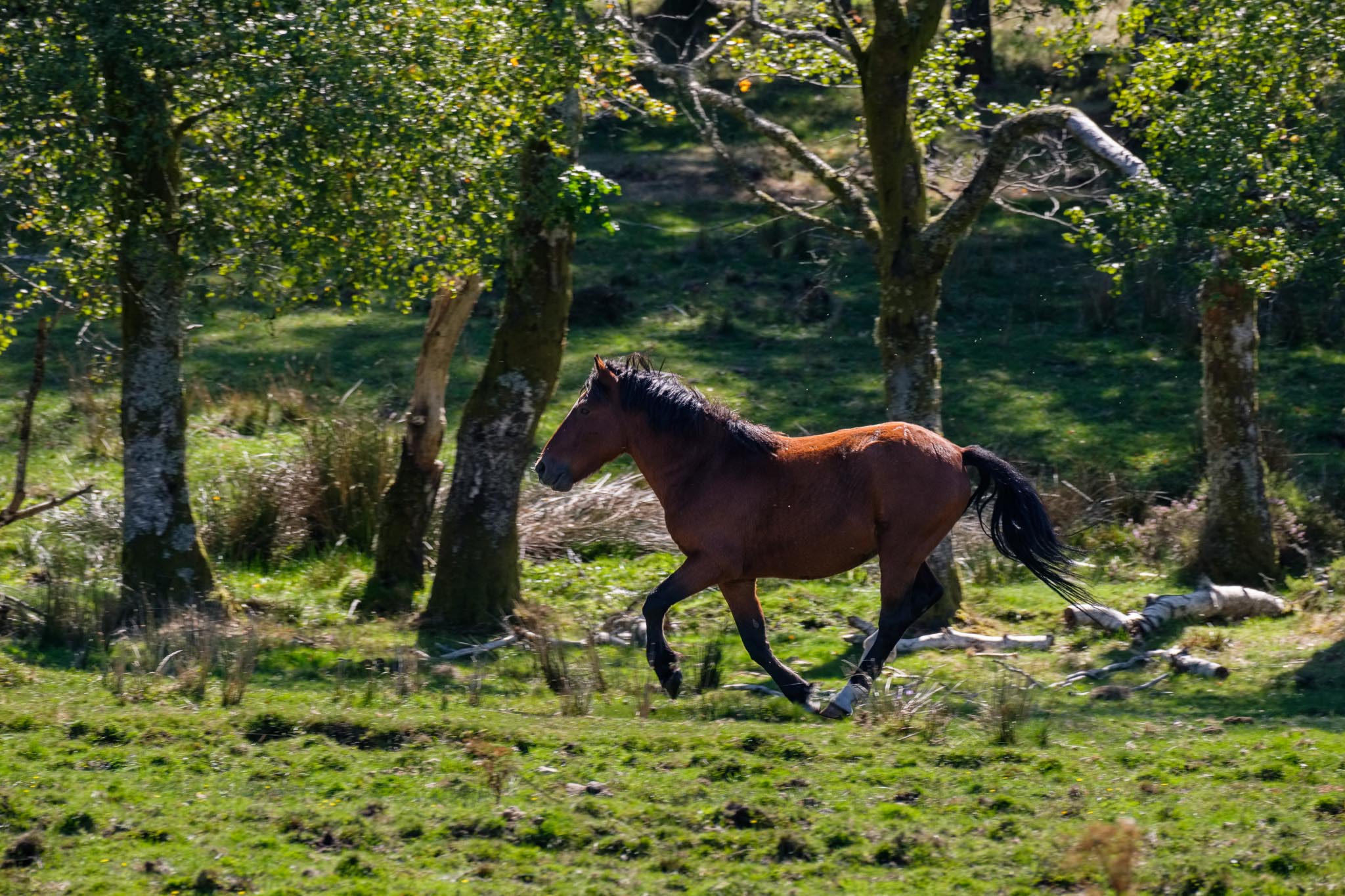
One of the best things in Gerês is the opportunity to see the “garranos”, or local horses that are still raised in complete freedom. As we were driving in the Gavieira plateau towards the viewpoint of Tibo, we saw a herd of them near the road. I stopped the car and made a few photos. They were grazing side by side with cattle, with some running in the fields.

The wild horses from Gerês, or garranos.
Freedom.

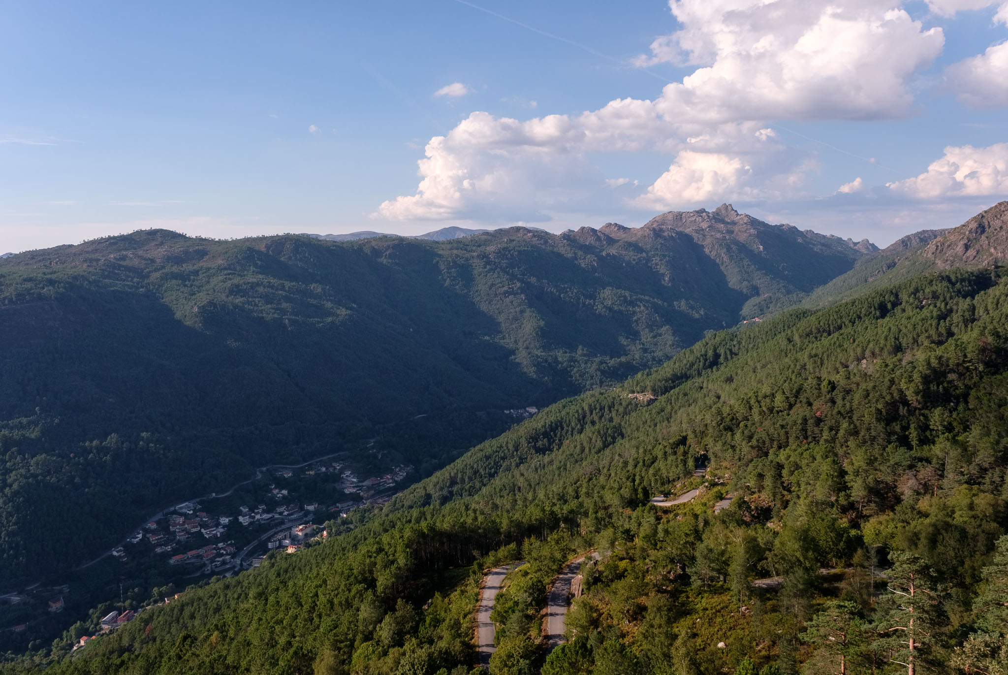
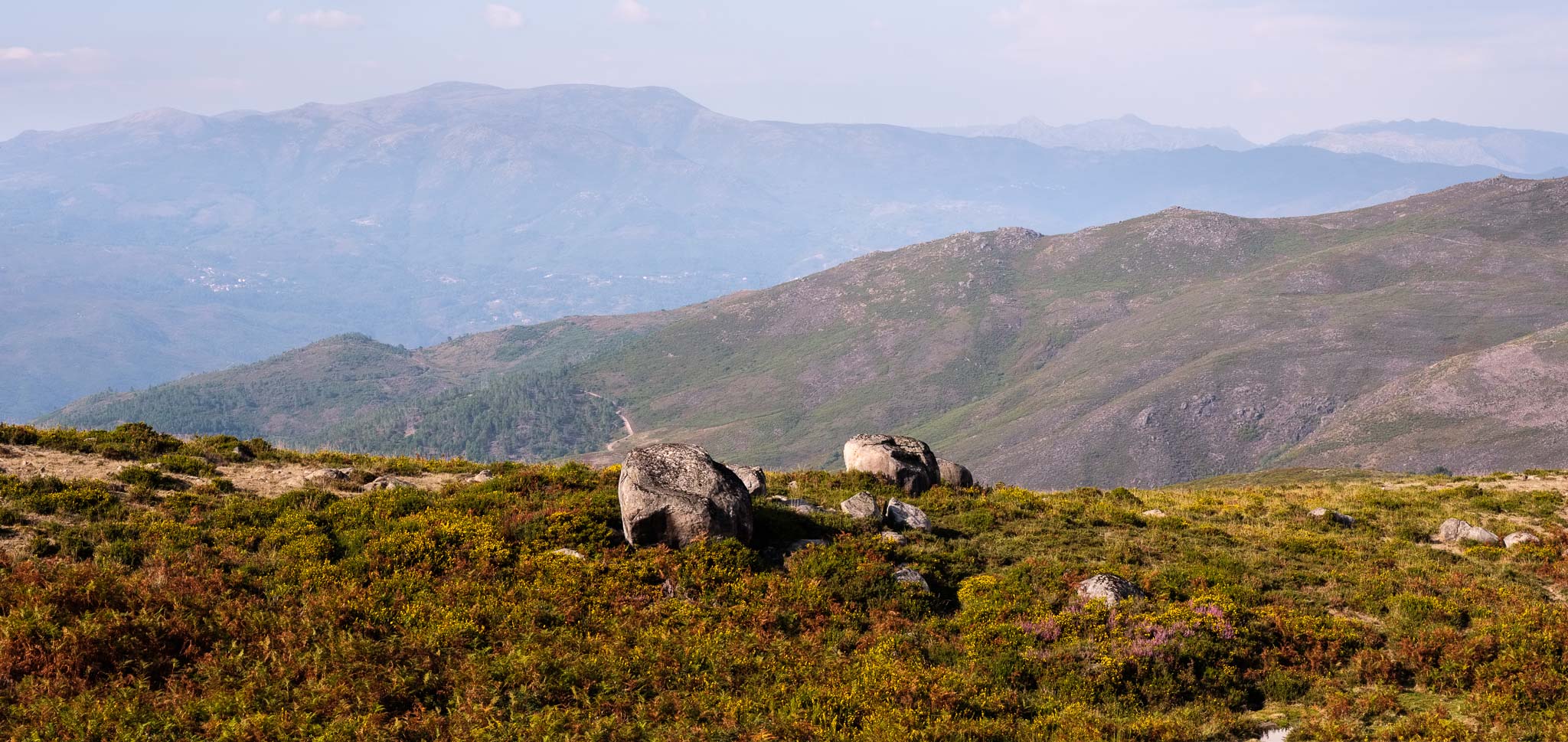
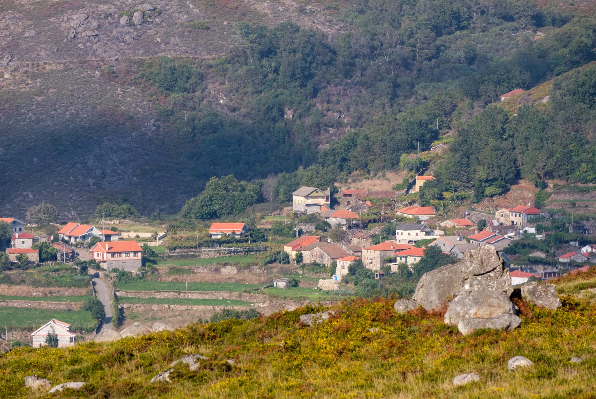
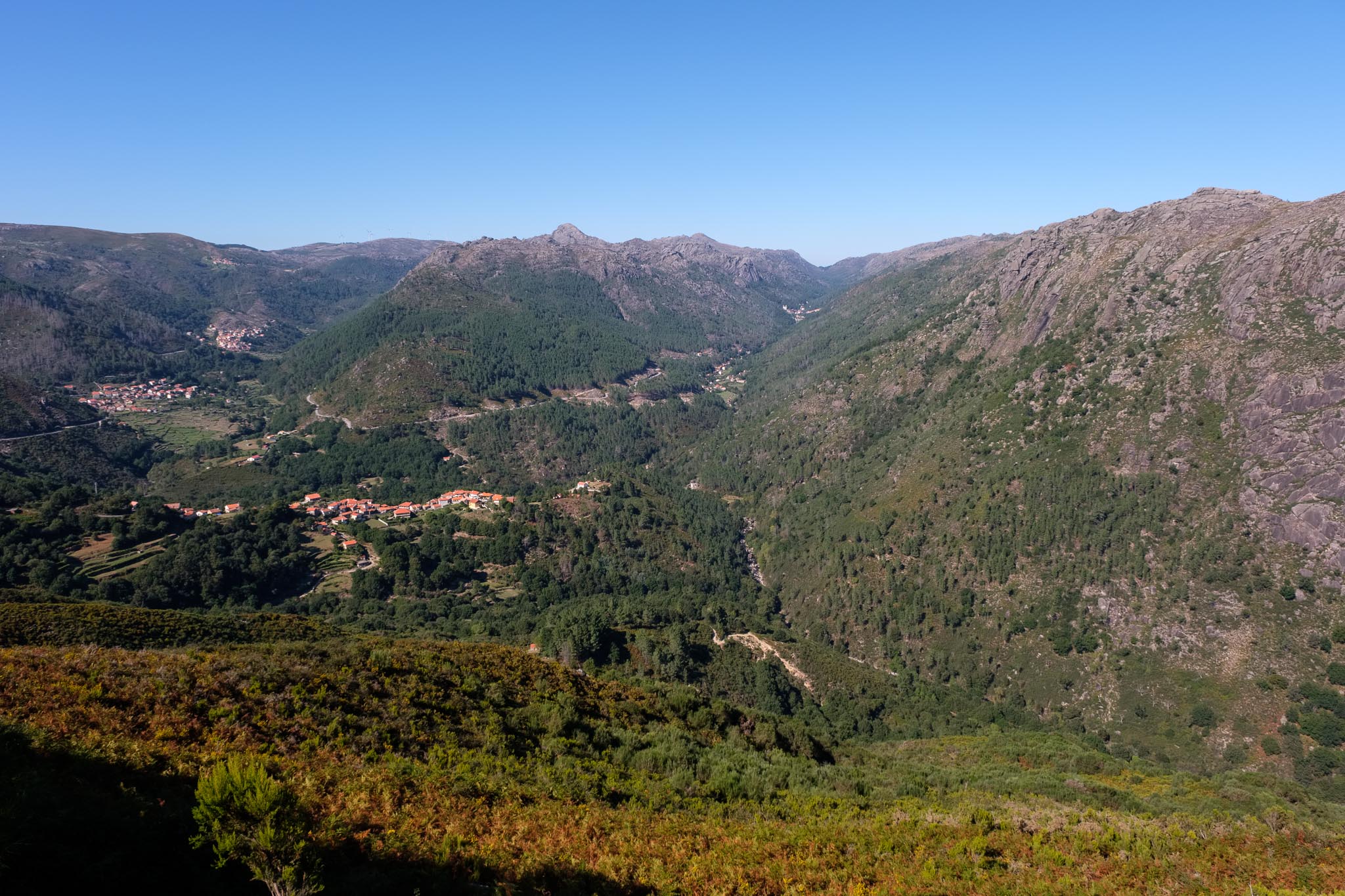
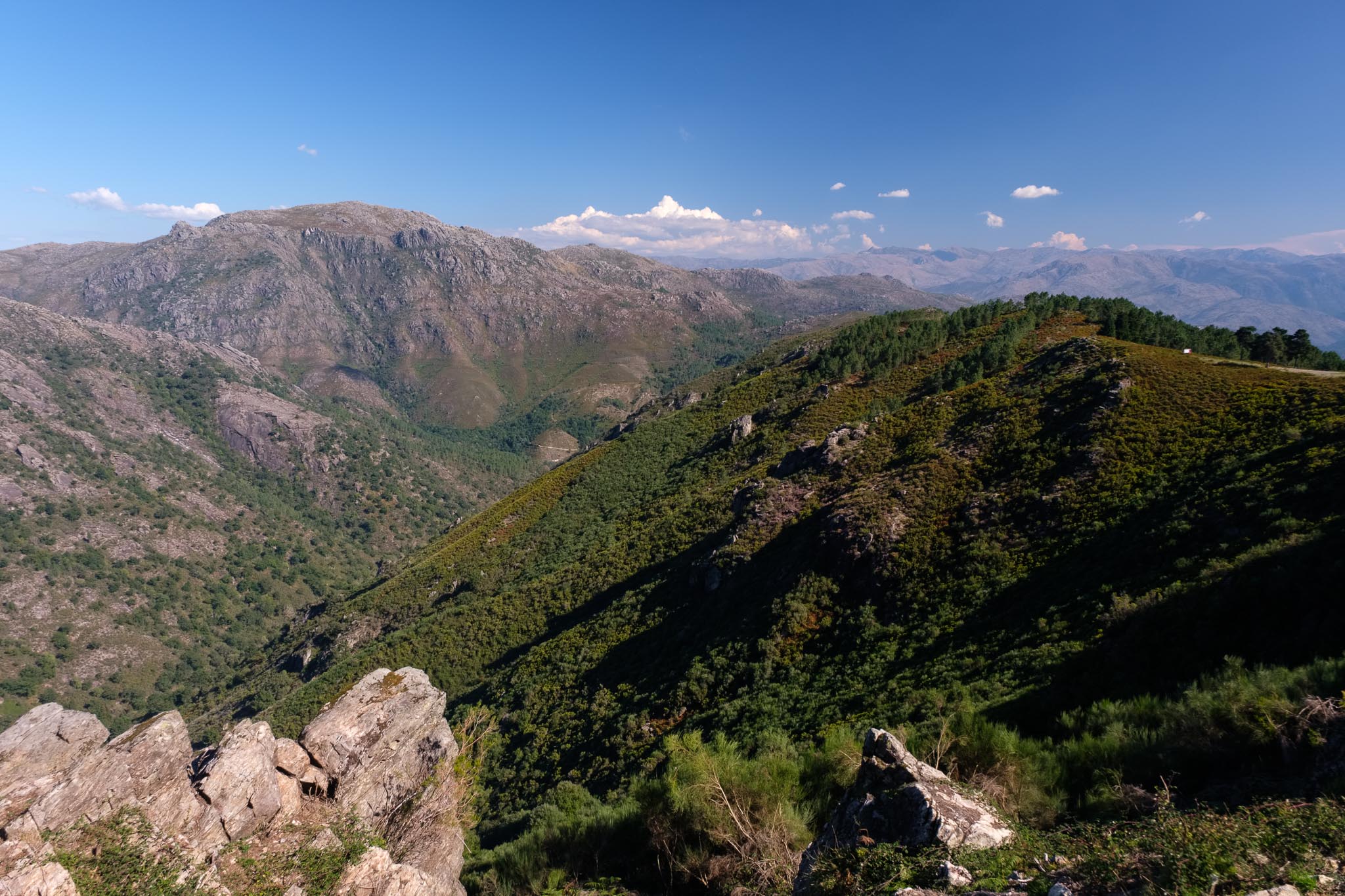
The viewpoint of Tibo is located at the top of the mountain, and affords a panoramic view over the entire serra da Peneda. The Senhora da Peneda sanctuary can be seen in the distance, with the villages of Gavieira, Rouças, and Tibo, a bit closer. The entire landscape is made of impressive granite formations, including the Fraga das Pastorinhas, an impressive granite wall that is also know by rock climbers as the “Portuguese Yosemite”. This is really an incredible view.

View from Tibo viewpoint, with the Senhora da Peneda in the far distance (right-side valley). The glacial nature of the valley is clear, from its U-shape.
Scenery from Tibo viewpoint.

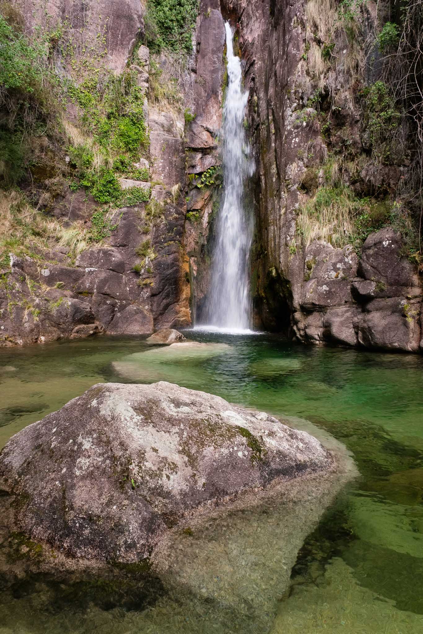
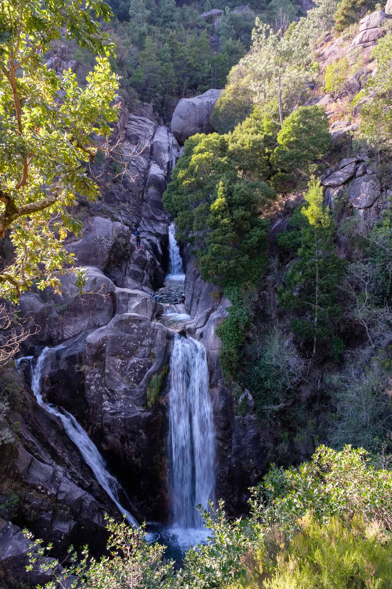
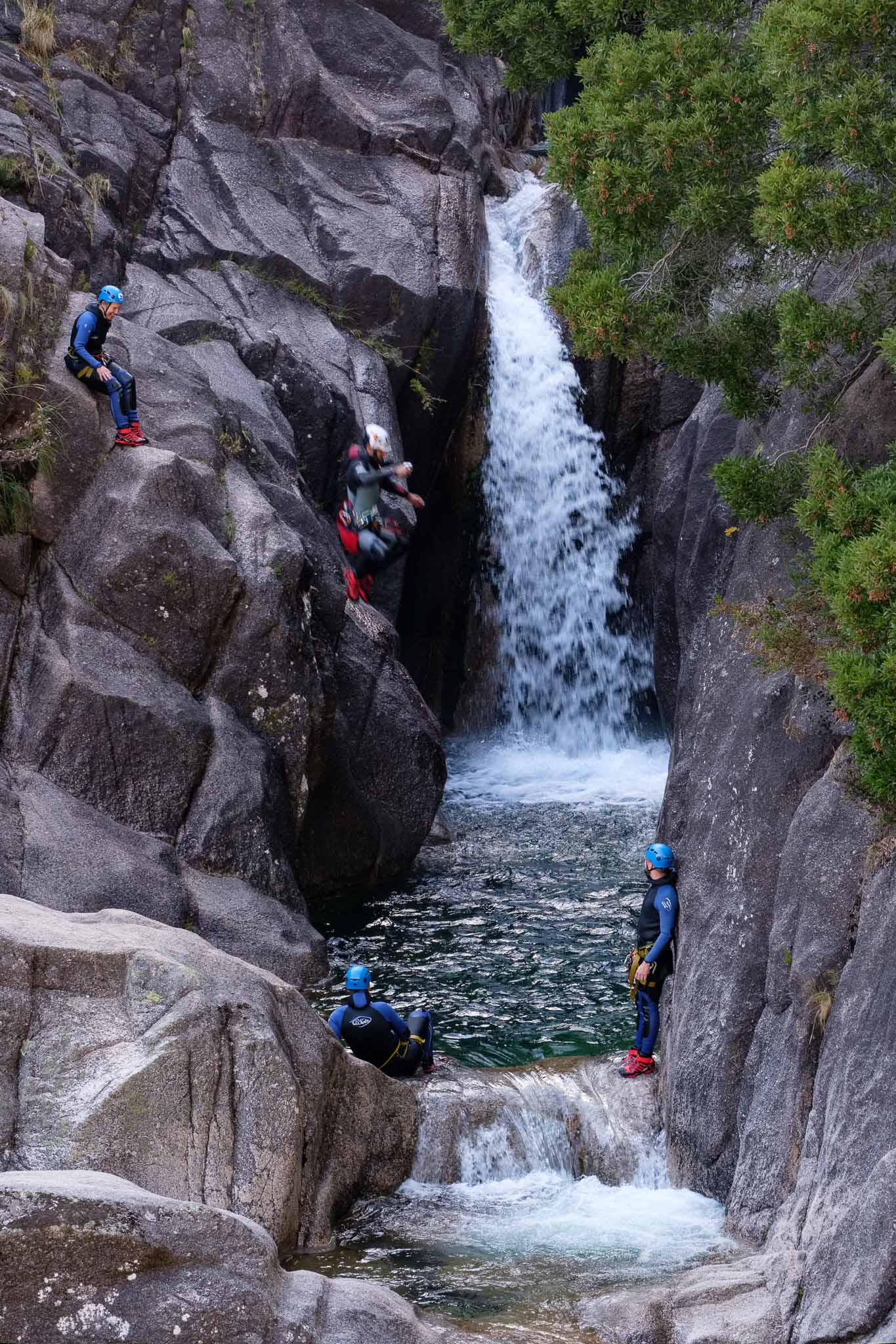
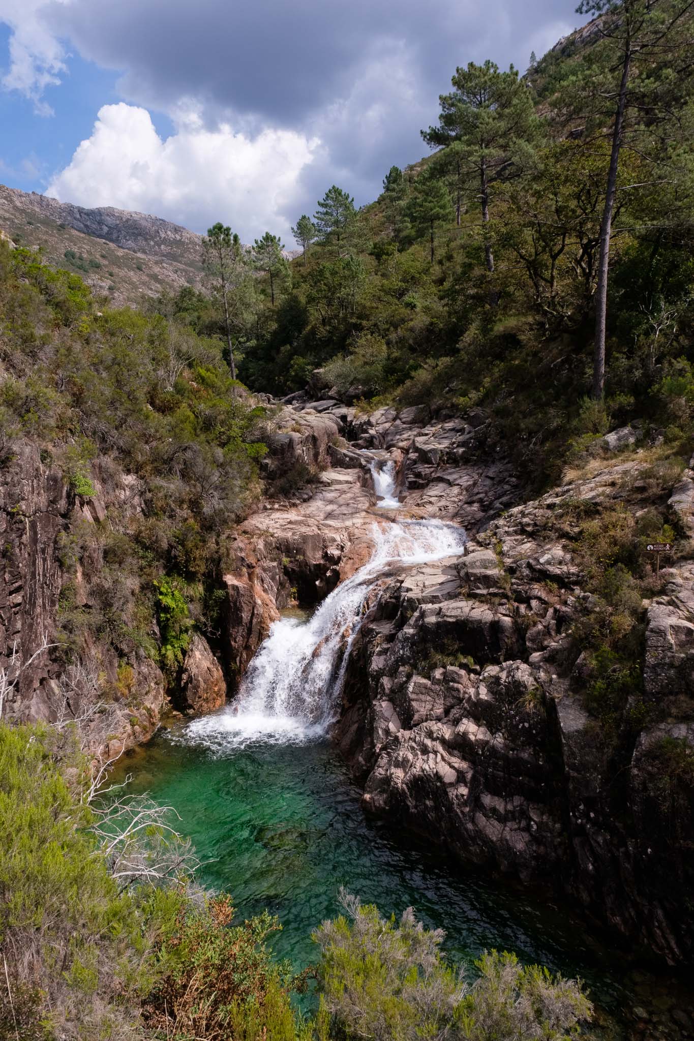
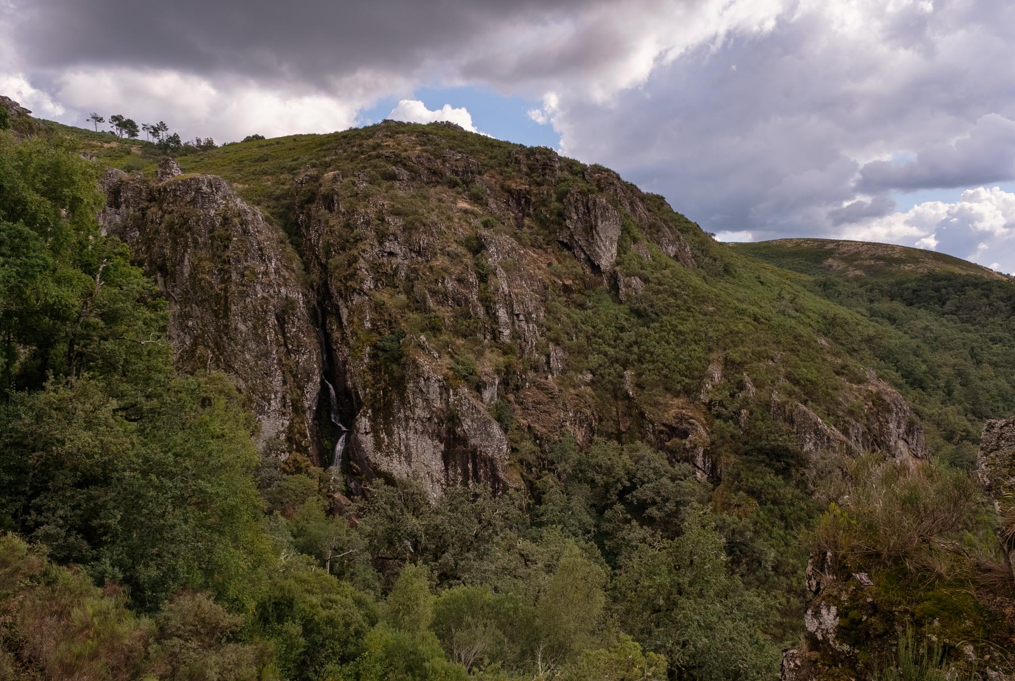
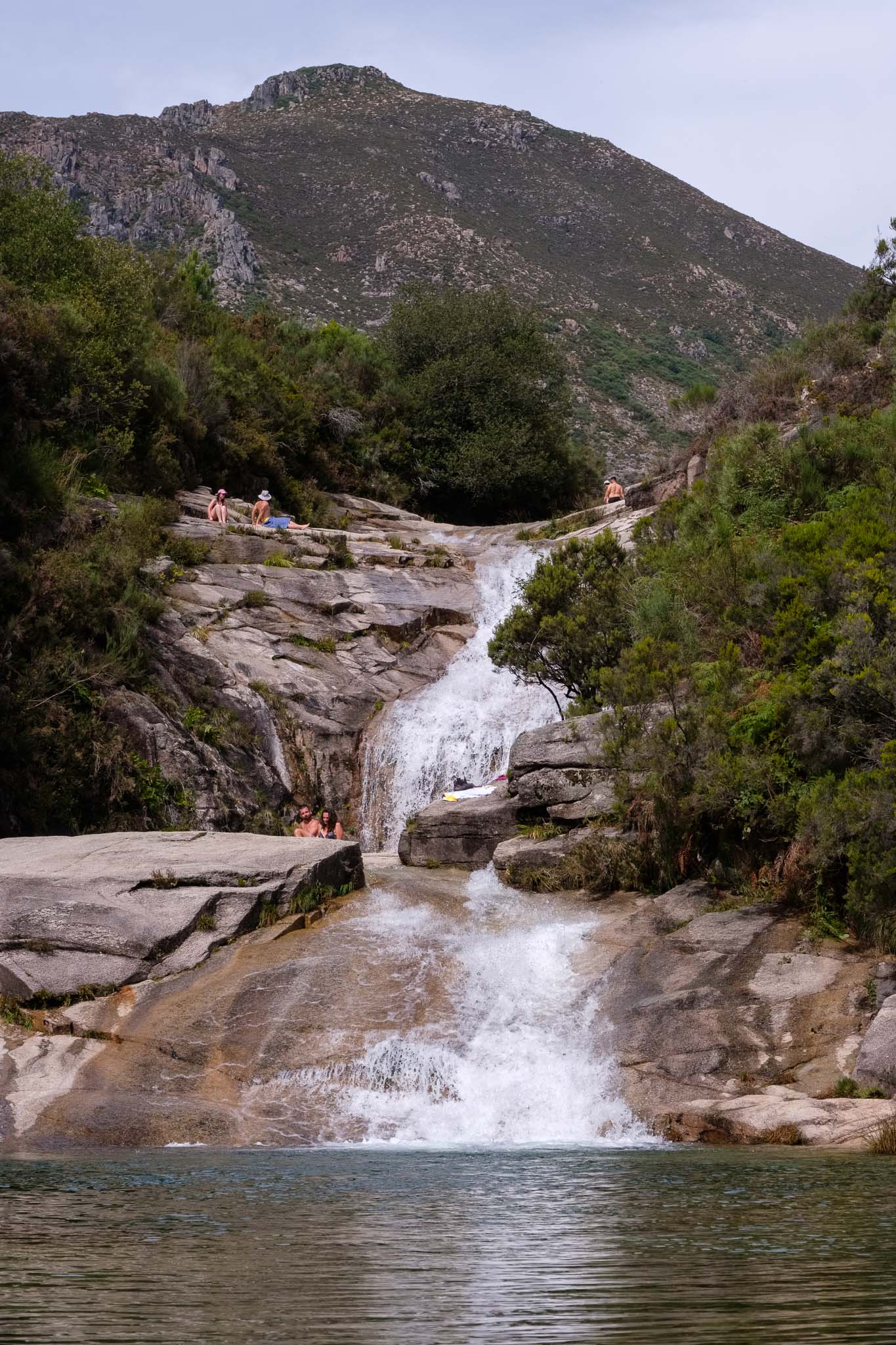
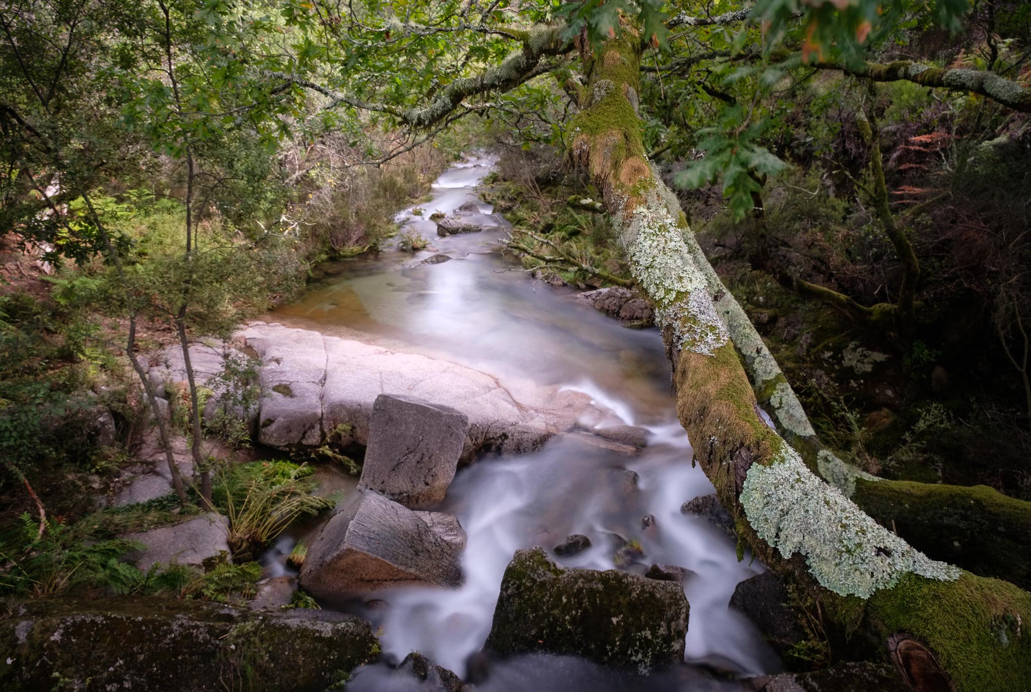
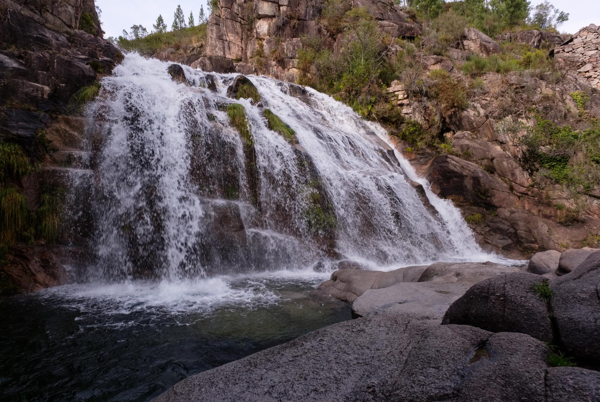
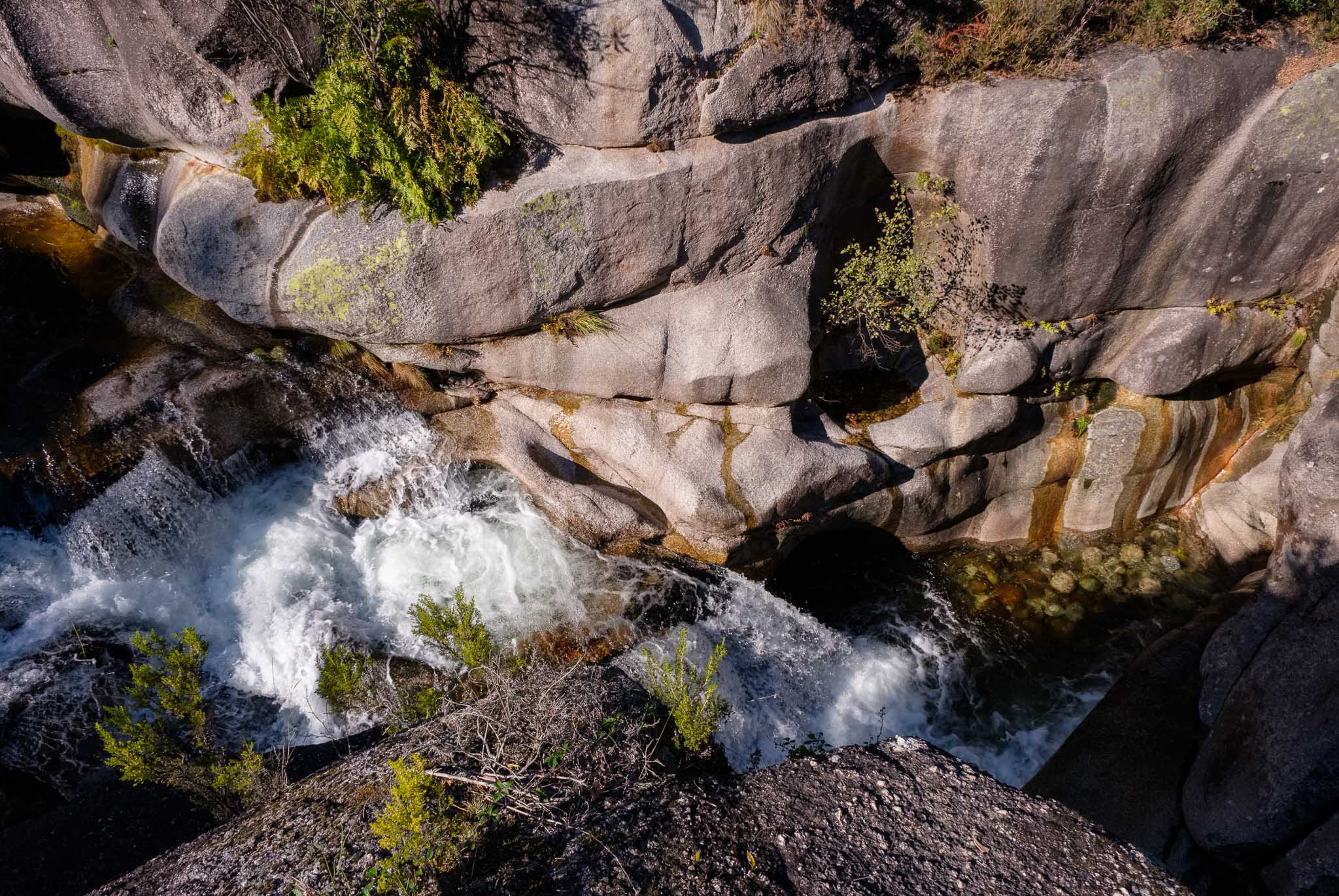
After admiring this view, we drove to Tibo, where we left the car and took the footpath to the valley. We wanted to find one of the (still) hidden lakes of the area, the so-called Druids lake. The trail is not signaled, but follows a few local paths along the woods. The name of the lake is appropriate, as very soon we are crossing some wonderful magical woods, with large chestnut and oak trees. The shaded path is a welcome respite after the days’ heat. Soon we are walking near the Peneda river, that has a few waterfalls here and there. Looking up, we can see the impressive Fraga das Pastorinhas. Even though the valley is already in the shade, and the water is cold, I can not resist to take a swim. What a wonderful place.

Canyon in the Peneda river.
The Fraga das Pastorinhas, a granite escarpment that is known as the “Portuguese Yosemite”.
The Fraga das Pastorinhas.

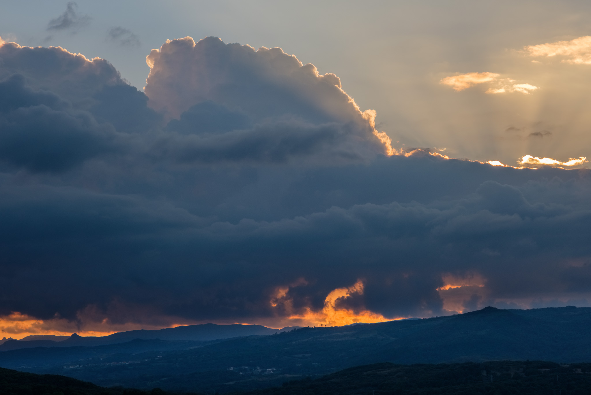
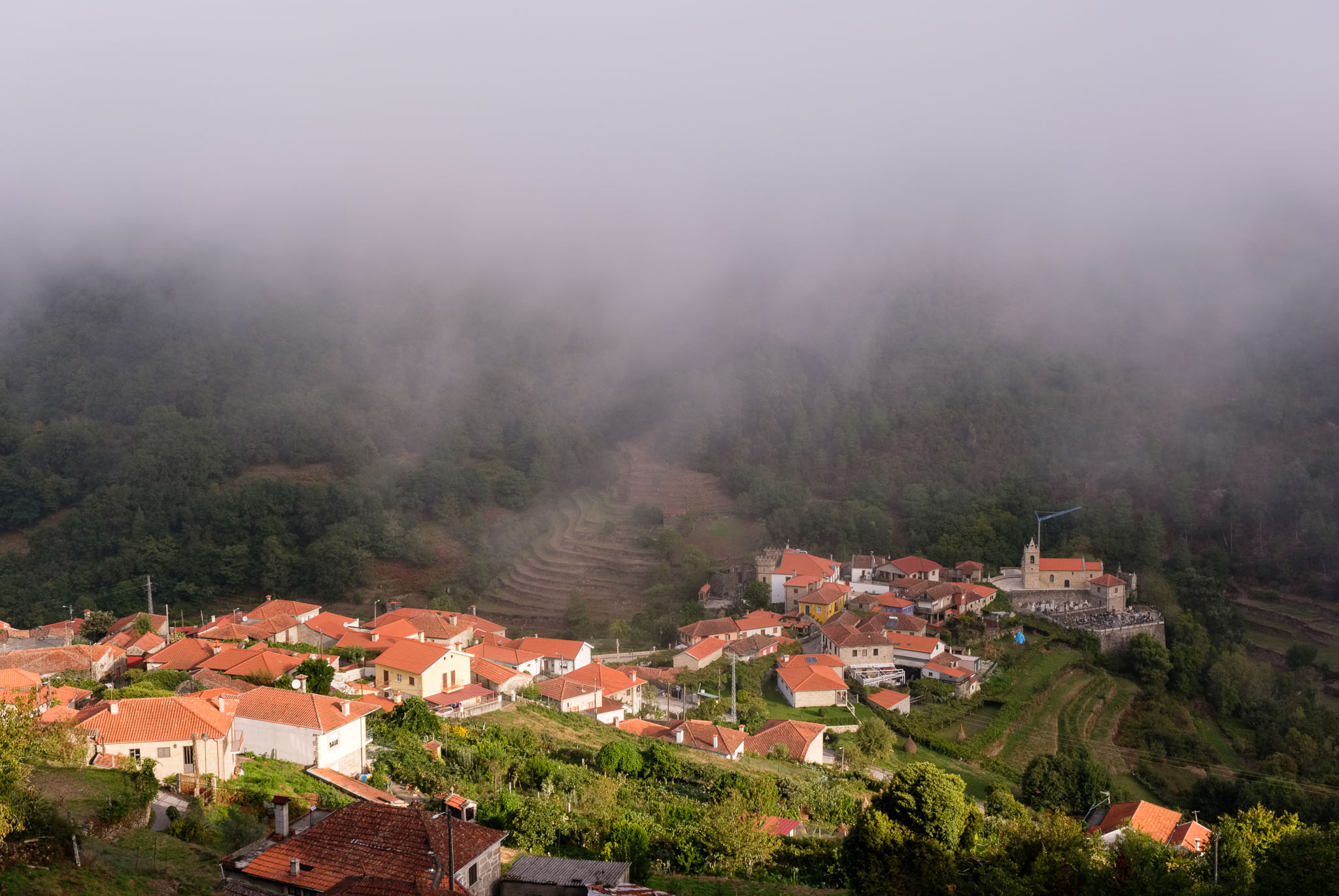
At the end of the day, we are back in Sistelo. Our trip is coming to an end, as the following day we would be driving home. But again, I like to wake up early to check the light, and when I leave the house the next morning, the valley of Sistelo is covered in fog. I grab the camera and make a few photos with this weather. The fog filters the light and enhances the greens of the foliage.

Foggy dawn in Sistelo.
Foggy dawn in Sistelo, with the first rays of sunshine hitting the village.

I hope you have enjoyed tis 3-part instalment that describes a one week trip in the PNPG, a truly wonderful region. A final word about the photographic equipment that I have used during this trip. As I knew flexibility would be very important, I chose to carry 2 cameras, each with its own zoom lens. As you know, these days I use Fujifilm, so the list was: Fuji XT3 with 70-300mm f/4.5-f/5.6 lens, and Fuji XT30 with 16-80mm f/4 lens. Both lenses feature image stabilization, which is very helpful to avoid using a tripod in many instances. But of course I also carried a small tripod to use when the light levels were low, or when I wanted to make some long exposures.

The Parque Nacional da Peneda Gerês, Portugal: part 2.

In this second instalment, I will describe days 3 and 4 of out trip in this Park. As we move towards the west, we will visit some of the iconic areas around the Gerês valley, right at the heart of the Park. It will be a nice mix of waterfalls and great viewpoints, from which it is possible to admire this unique landscape.

Before leaving the region of Montalegre, you have to go to the Misarela bridge. Built over the Rabagão river, it was built in the Middle Ages, but there is a nearby Roman road, so no one knows for certain. It features a single 13m high arch, and shares the scenery with surrounding waterfalls. Legend has it that this bridge was built by the Devil itself, in exchange for the soul of a man who was running away from the authorities; facing the river and with no way to cross it, the man promised the Devil his soul in exchange for safe passage. The Devil built the bridge and took the man’s soul. During one of the Napoleonic invasions of Portugal in the XIX century, the French troops were held back on this bridge. Today, the place has a certain mystique, but only the quaint goats graze nearby.

Misarela bridge.
A typical mountain goat near Misarela.

Leaving this legend-rich place behind us, we drove to the waterfall at Pincães, where the plan was to have a picnic lunch. Parking the car at the entrance of the village, it is a mere 1km to the waterfall through a nice forest trail. There are a few other people on the trail, after all it is the weekend and the day is hot. This waterfall fits the cliché nicely, with a tall column of water falling into a pool of crystalline water. A great occasion for a refreshing swim.

The waterfall at Pincães.

After relaxing in this wonderful place, it was time to continue our journey, this time to the waterfall at Arado. As you have surmised by now, there are numerous waterfalls in the PNPG, and they are all different. In some of them, it is possible to swim, but always exercise great care not to slip on the wet rocks. Even after a year of severe drought, the waterfalls that we visited had plenty of water. Back on the road, before reaching Arado, it is worth to stop in the small town of Ermida, halfway up the mountain. Here, there is a nice viewpoint over the landscape.

Panoramic view over Ermida.

To reach the Arado waterfall, there is a beautiful forest trail, in the shade of tall trees. This waterfall is located at 900m altitude, and the water falls in a couple of steps from up high. It is one of the most beautiful places in the heart of Gerês, and it is popular for canyoning.

The waterfall at Arado.
The waterfall at Arado is popular for canyoning.

Don’t leave the area without climbing up to the Roças viewpoint, where you can admire the Arado river valley cutting through the mountains.

View of Arado valley from the Roças viewpoint.

Speaking of viewpoints, there is no better way to end the day than admiring the scenery from the Pedra Bela viewpoint. From here, you have a complete view of the Gerês valley to the north, and the Caniçada lake to the south. Mountains, trees, and water. Pay attention, and you will also see the birds of prey flying in the distance.

View of Gerês valley from the Pedra Bela viewpoint.
View of Gerês mountains and Caniçada lake from the Pedra Bela viewpoint.

After a really full day with waterfalls, forest trails, and great viewpoints, it was time to return to Gerês for a well deserved night rest. For day 4, the plan included a visit to one of the iconic places of the PNPG, the Mata (Woods) da Albergaria, located north near the border with Spain. There is a trail of about 4km that takes you through the heart of these famous woods, where you can admire, amongst other things, very old oak trees (Quercus robur and Quercus pyrenaica), plus parts of a Roman road and its associated milestones (or marcos miliários) and bridges. These woods are unique in Portugal, and as such the access can be prohibited if the risk of forest fires is considered high. Walking along this ancient forest is truly a magical experience. And of course there are a few waterfalls too!

Roman road milestones in the Mata da Albergaria.
The Portela do Homem waterfall, in the Mata da Albergaria.
Bridge in the Mata da Albergaria.

After visiting Albergaria, why not drive into Spain and enjoy the hot thermal baths in the nearby village of Lobios? You just have to continue to follow the road along the Gerês valley (Xurês in Spanish), where the river Caldo runs its course. And there are nice shaded areas for a picnic.

As we were spending the night in the village of Sobredo, in the western part of the Park, there was some more driving to do. The road crosses some of the most wild and deserted areas of the region, in the Germil plateau. At high altitude, vegetation is short and constantly buffeted by strong winds; granite is everywhere, and seems to cascade down the mountainsides. Here and there, groups of houses form small rural settlements.

Roadside view in the Germil plateau.
Panorama of the Germil plateau.
The village of Germil.

It is difficult to resist the temptation of stopping to admire and photograph the landscape. But we keep going until we reach Sobredo, where we were spending the night. This is a typical rural village, quite small, with houses made of granite. In many of these places, houses have been recovered for the tourism industry, supplementing the income of the owners. The streets are narrow, and the ubiquitous espigueiros are present. I sit down in some stairs and strike a conversation with Dona Ermelinda, an old lady that has many stories to tell. She talks of difficulties of making a living from agriculture, where only the month of August sees some animation brought to these parts by emigrants returning to spend their vacation.

Sobredo.
Dona Ermelinda and her cat, in Sobredo.

The Parque Nacional da Peneda-Gerês, Portugal: part 1.

Given the uniqueness of its geography, geology, fauna, flora, and cultural heritage, the Parque Nacional da Peneda-Gerês (PNPG), located in northern Portugal, was created in 1971. It is the only National Park in the country, and occupies an area of 69,595 ha bordering Spain and extending through the provinces of Minho and Trás-os-Montes. It is a mountainous region, reaching an altitude of 1,600 m, where the landscape is dominated by rugged granite formations, and where the effects of the latest glaciation can be seen. Deeply cut valleys in the mountains of Peneda, Soajo, Amarela and Gerês support a dense hydrographic network, .

The Park has a remarkable botanical diversity – woods, forests, riparian vegetation and peatlands in addition to wet meadows – with rare and endemic species. It is home to some of the most important oak forests in Portugal, a diversity of animal species including endemic (gold-striped salamander) and endangered (Iberian wolf, Iberian wild goat). In the agricultural areas the prairies and “prados de lima” (semi natural humid meadows) are worth mentioning. The region has been inhabited since pre-historic times, so there is a rich historical and cultural heritage. Attesting to this, there are important to megalithic monuments, Roman constructions, medieval castles, and the famous espigueiros (traditional granaries to store corn).

I had been planning to visit this area for a long time, and finally, in the end of September, we organized a 7 day trip. It is not easy to select what to visit in such a vast region, but after a few hours, a draft plan started to emerge. Roughly, we travelled from the east (Montalegre) to the west (Sistelo), as indicated in the map below. We decided to spend the night in different places, as the trip evolved.

The PNPG (in darker green) with the broad travel route taken during the trip.

In this first part I will cover some of the most interesting locations in the regions of Montalegre and Gerês, but of course this is only my view. We visited many waterfalls (some in hard-to-reach places), historical monuments, isolated villages, but mostly, it is the mountainous landscape and the constant presence of green vegetation that impresses travelers.

Montalegre was the start of the journey, with its important castle near the serra do Larouco. It was given a “foral” in 1273 – that is, elevated to village status, with permission to hold its own fair – by King Afonso III. Walking along the ramparts and the medieval part of the town feels like going back in time.

The castle in Montalegre, with the serra do Larouco in the background.
Copy of the “foral” document granting Montalegre the status of village by king Afonso III in the 13th century.
Sunset in the distance over the serra do Gerês.

One can not be in the region without visiting the famous monastery of Santa Maria das Júnias, close to the village of Pitões das Júnias. The monastery is located in a narrow valley, surrounded by lush vegetation and a nearby creek. Its origin dates back to the middle of the XIII century, when a pre-existing occupation was taken over by monks. What impressed me the most was the complete sense of isolation and the tranquility of the place.

Monastery of Santa Maria das Júnias.
Waterfall in Pitões das Júnias.
Pitões das Júnias.
Pitões das Júnias, where the granite dominates.
Prehistoric monument in Pitões das Júnias.

We ended our first day in a nice tourist house in the small village of Gralhas, a few km outside Montalegre. The building itself, an old seminary, was quite interesting.

At the entrance of Casa do Seminário, a tourist accommodation.

For the second day of the trip, the plan was to visit a couple of famous waterfalls, not far from Xertelo, still in Montalegre municipality. While driving around, its better to take your time and not hurry; the roads are often narrow and twisty, so averages of about 30km/hour are not uncommon. The advice is to go slow and admire the majestic landscape. The first waterfall, Sete Lagoas (or seven lakes) lies at the end of a 10km trail that takes you from Xertelo along the flanks of the mountain. The landscape is dominated by large granite boulder formations and at around 1,000m altitude, there are only a few trees and the heather dominates. You hear the water rushing before seeing the lakes, which encourages you to keep going. The day is hot, so the view of the emerald-green water from above is a revelation.

Panorama of showing the Paradela damn, south of Pitões das Júnias. It is clear that the rain has been scarce.
Panorama near Xertelo.
Honey production near Xertelo.
One of the waterfalls in the Sete Lagoas.
Sun bathing.

Don’t forget to visit the unique “fojo do lobo” near Xertelo, a typical and old construction of stones that served to entrap wolves. In the older days, the wolf was considered as a threat, as it could decimate a flock of animals, thus risking the livelihood of a family.

The mountains and the the tip of the “fojo do lobo” near Xertelo.

During the afternoon, we trekked to the Cela Cavalos waterfall, which is very different from the previous one. Again, it lies in a deeply cut valley, and it can be heard before being seen. Amidst a dense patch of vegetation, the water falls with tremendous force from higher up, smoothing the nearby granite blocks. It was a perfect place to relax and have an afternoon snack. The way back up the hill was the price to pay for this visit, but it was well worth it. Once back in the car, we drove to the village of Gerês, where we spend the night. The waterfalls of the PNPG are really wonderful, wild, and refreshing.

In the waterfall of Cela Cavalos.
The waterfall of Cela Cavalos.
The quiet village of Cabril, on the road to Gerês.