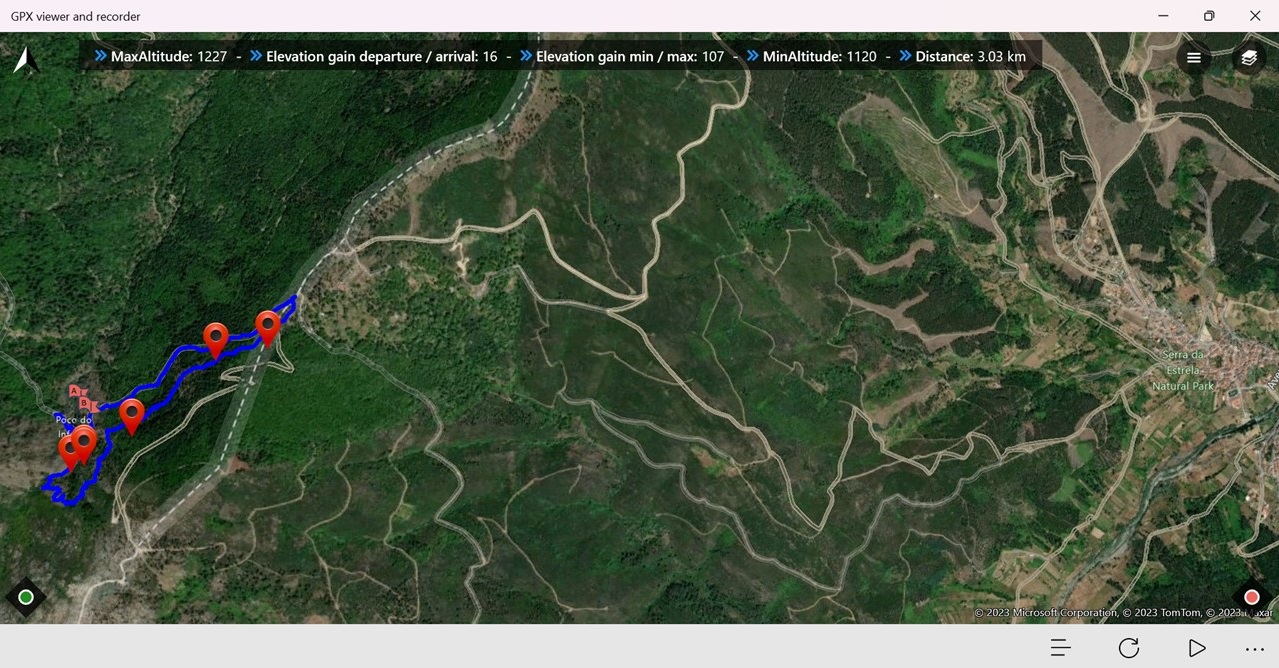
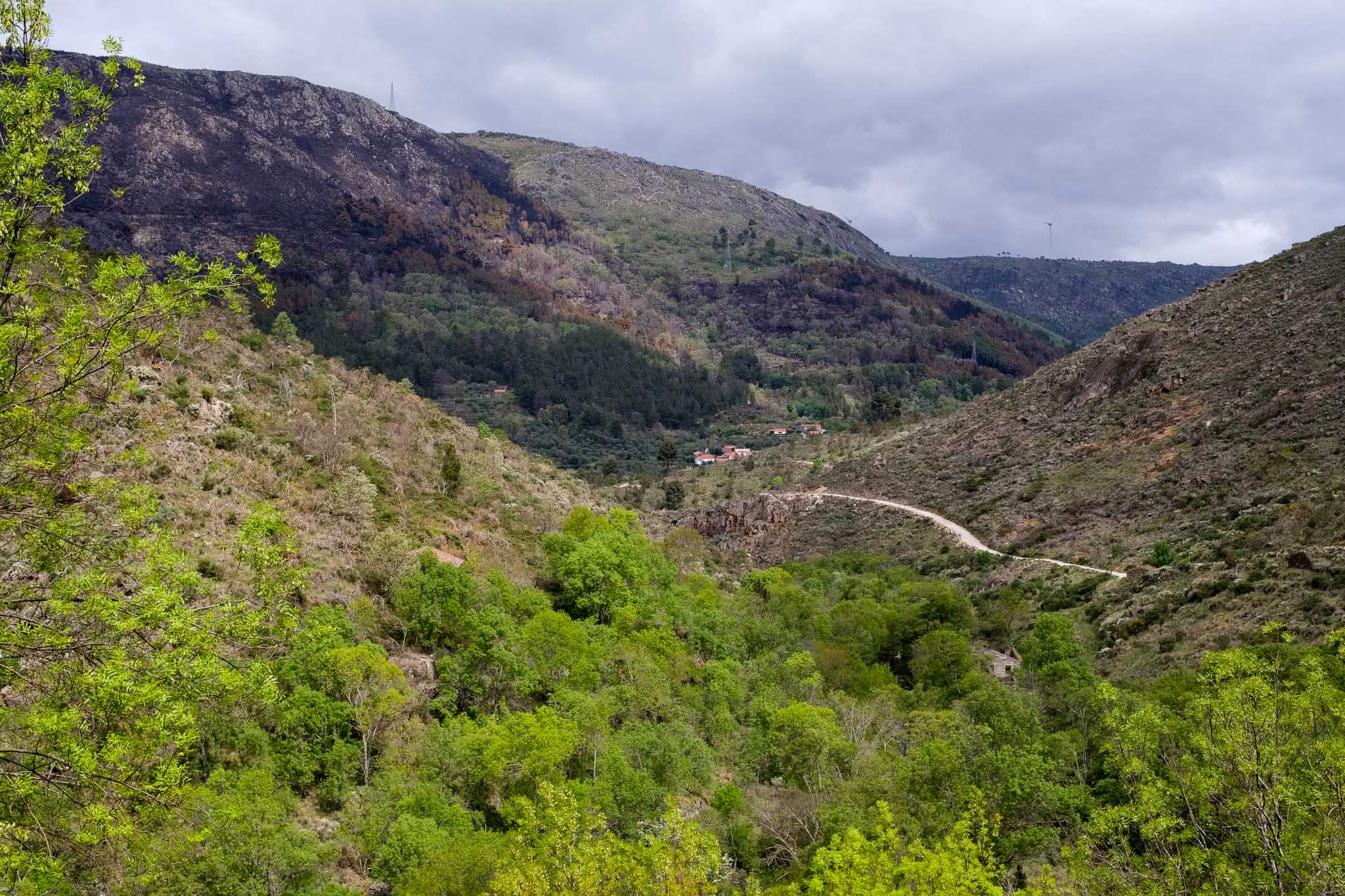
For our final day in Serra da Estrela, the plan was to do trek PR1 near the city of Manteigas. This route is circular and short, around 3 km, but crosses wonderful areas, such as the Poço do Inferno waterfall (in the Leandres creek), and some dense forests. The map below shows the general location.
Location of route PR1, which is close to the city of Manteigas.
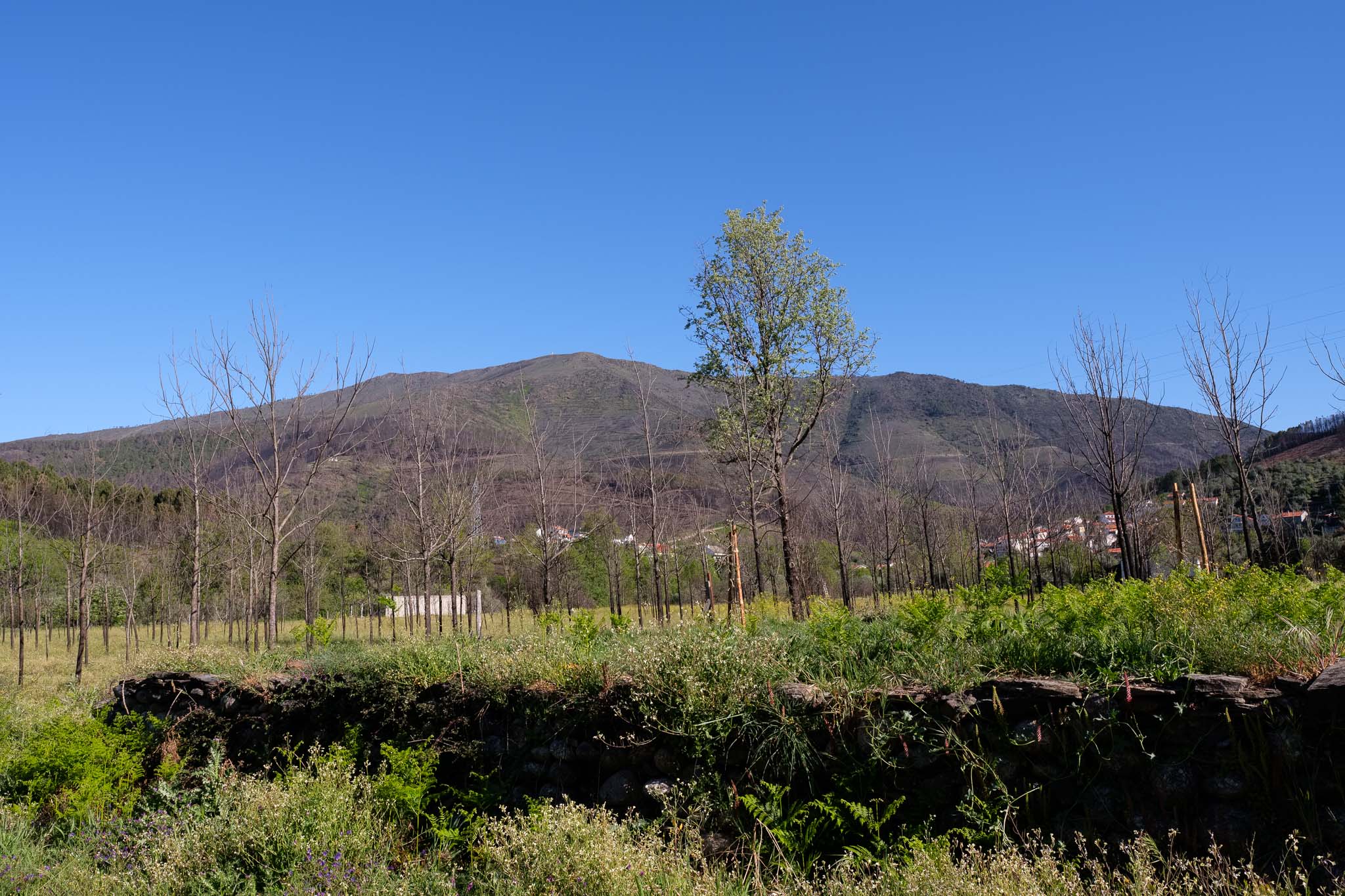
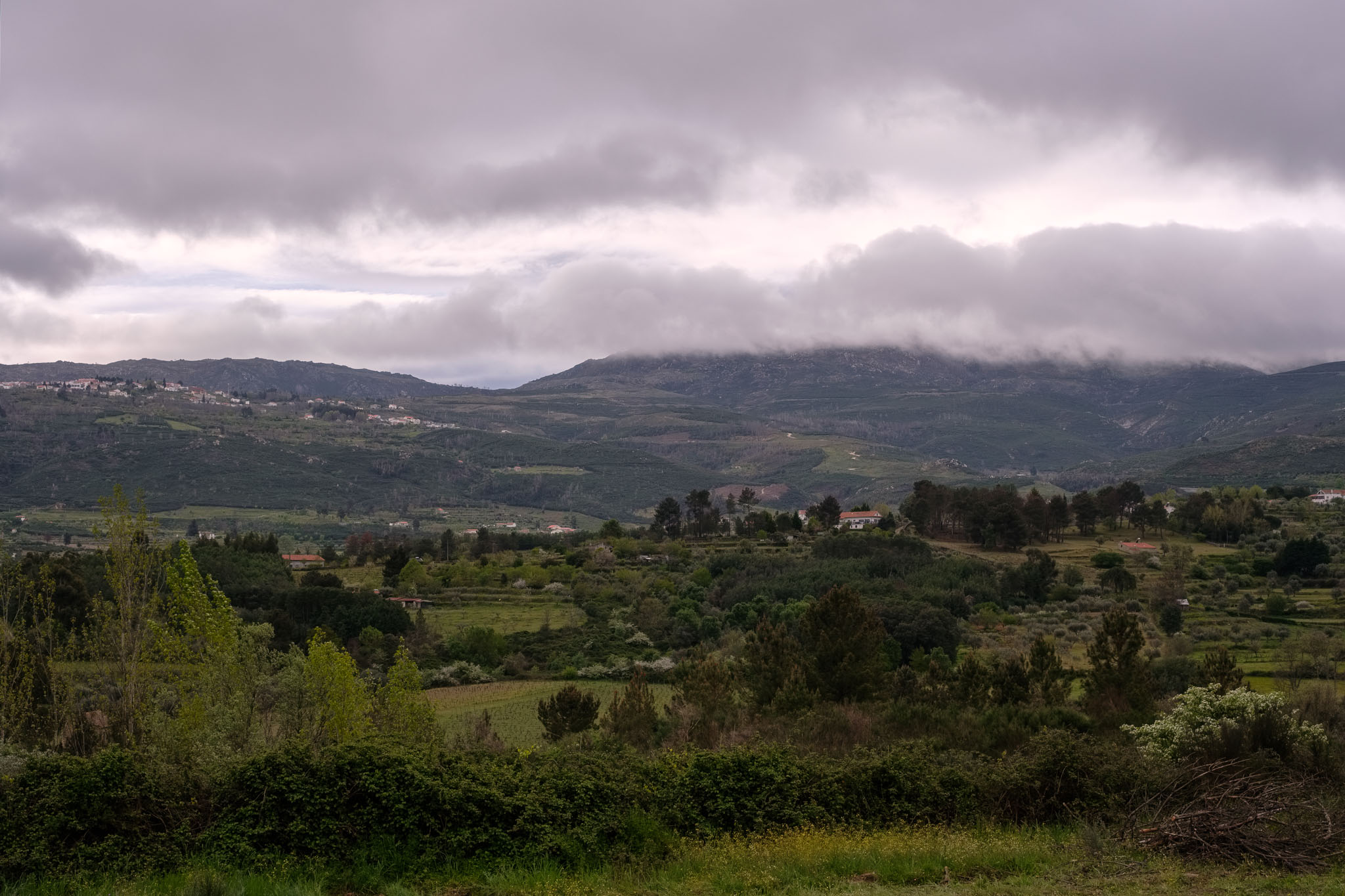
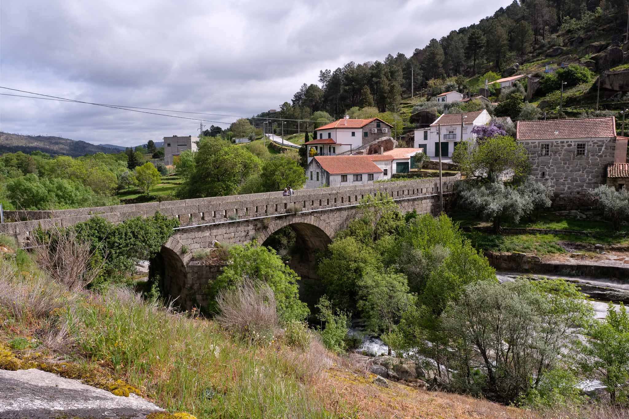
Manteigas is a city located in the valley of the Zêzere river valley, which starts its journey in the Serra da Estrela. The road to Manteigas generally follows this river, and crosses agricultural lands and forests, surrounded by the steep mountains. In marked contrast with the previous day, the weather was clear, with a balmy temperature and a deep blue sky.
Along the road to Manteigas.
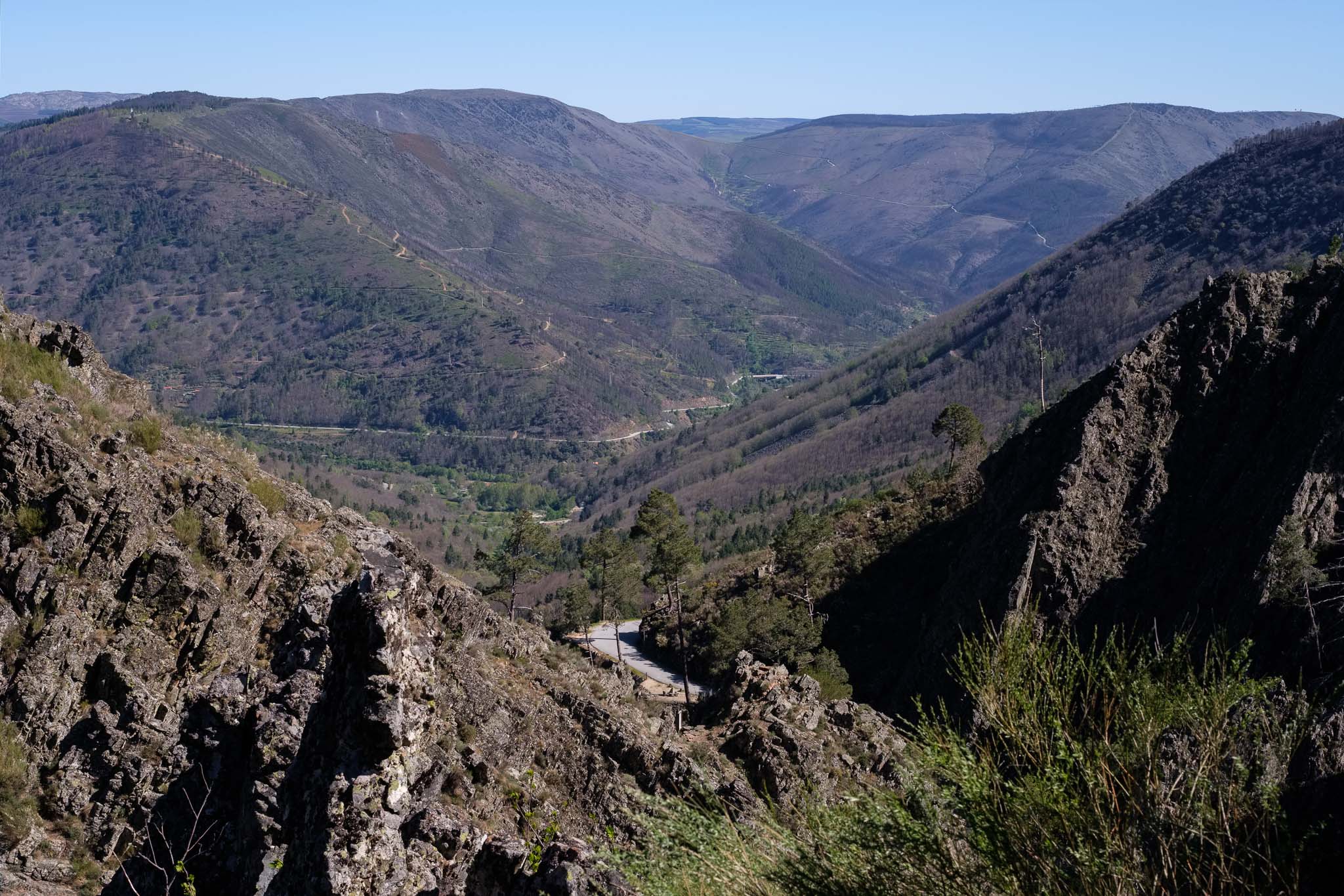
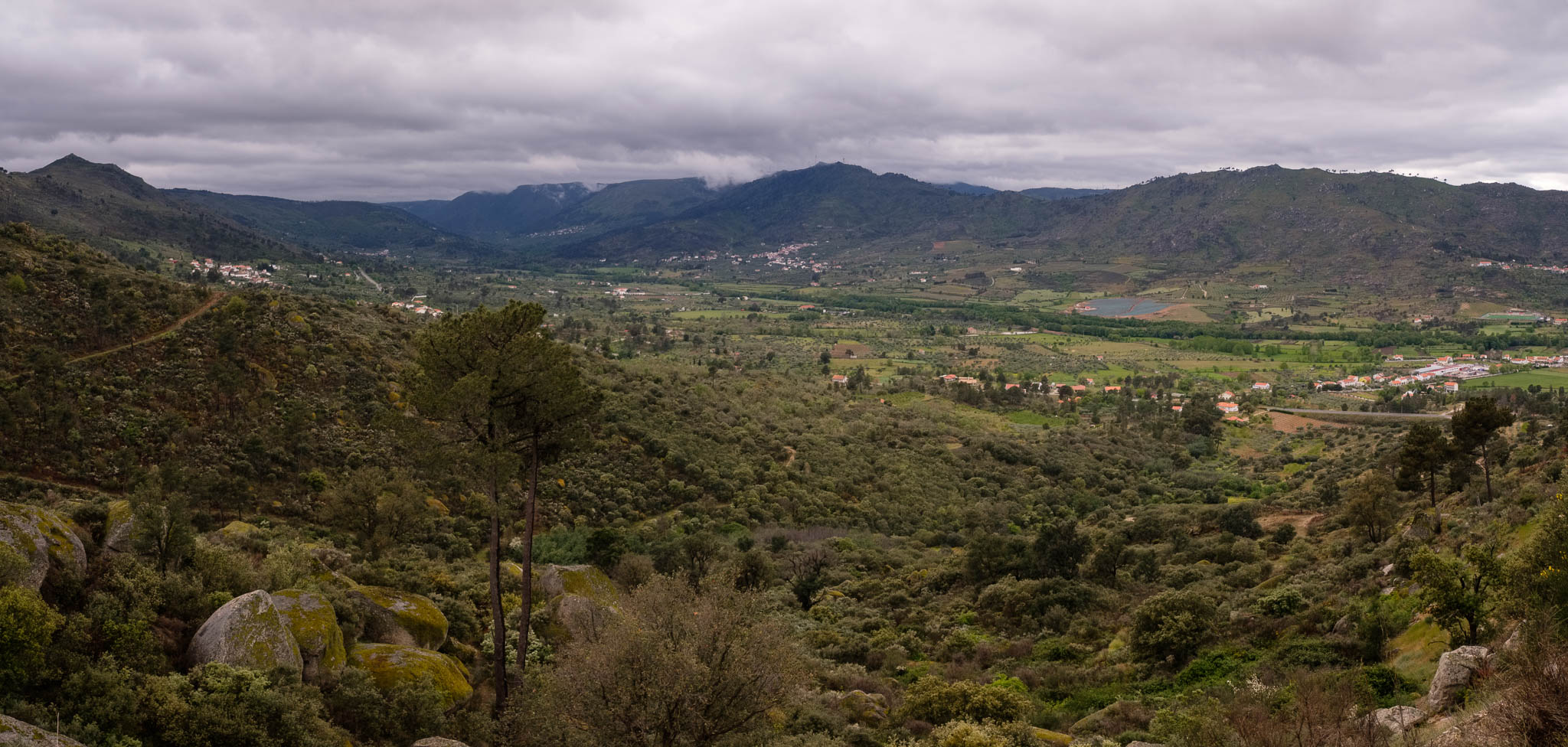
From Manteigas, it is a short drive to the starting point of the trail; the road is quite narrow with a few hairpin curves, so be careful. However, there are a couple of places where it is possible to stop and admire the view over the valley below.
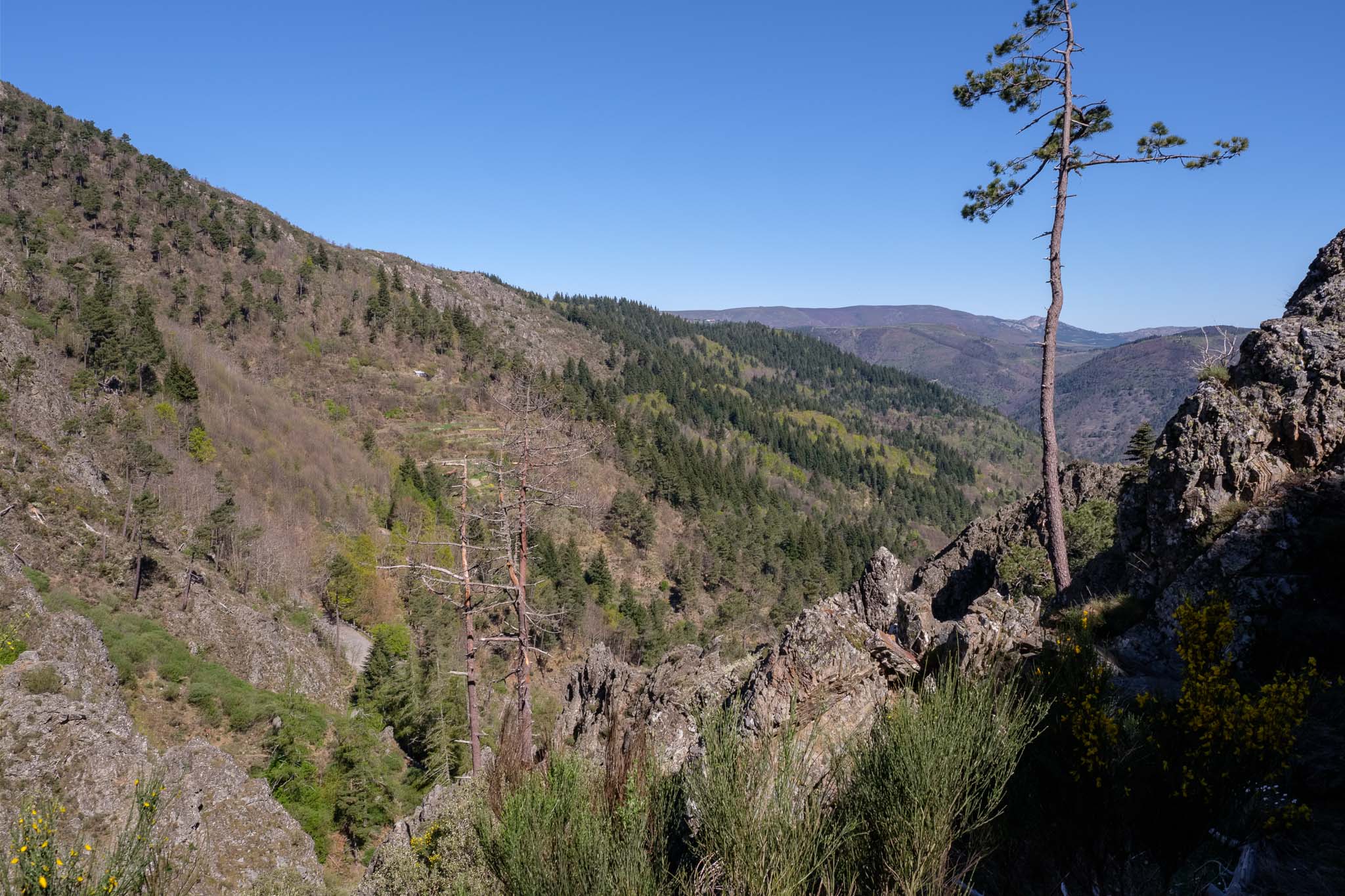
View over the valley.
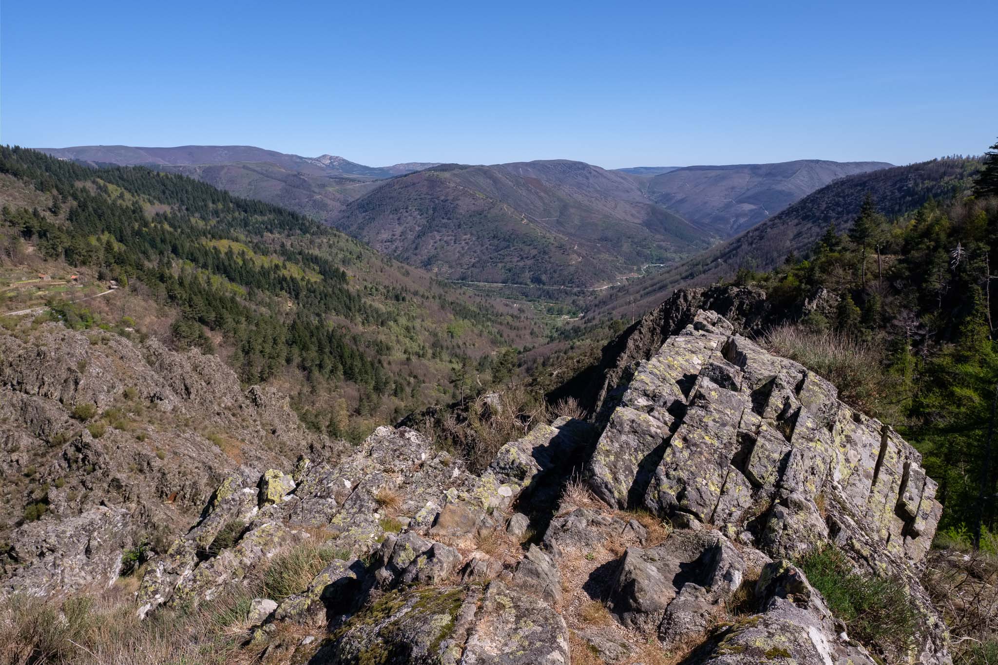
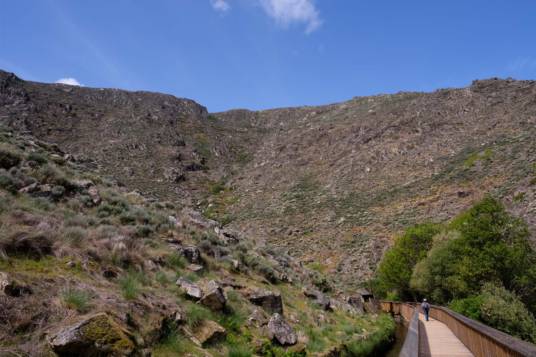
The route starts in the car park and is easy to follow. The first part is challenging, as the path is narrow and rocky, climbing next to the course of the Leandres creek. Over millions of years, the water has cut through the hard outcropping rocks, which are metamorphic quartzites. I stop a few times along the way, to admire the views.
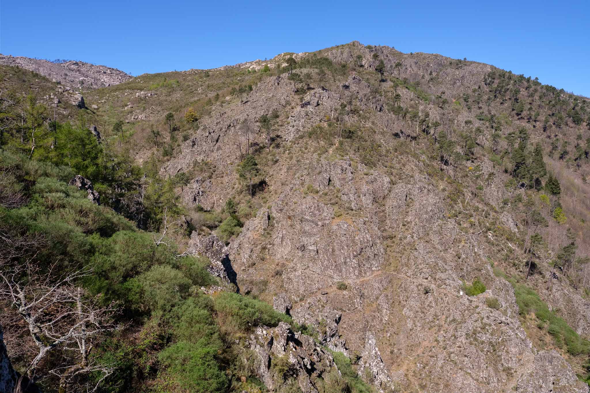
View over the Zêzere valley from the trail path.The hard quartzitic rocks.
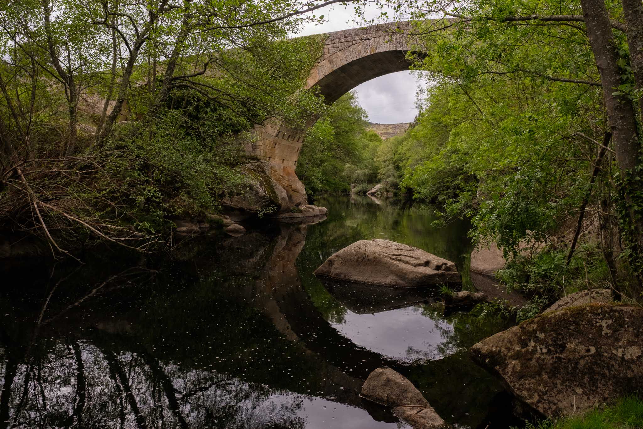
The highest point of the trail is reached at the head of the gorge, after which the path crosses the creek in a small wooden bridge, surrounded by a shaded forest. After the climb, it is a nice place to rest for a while and refresh in the cool water.
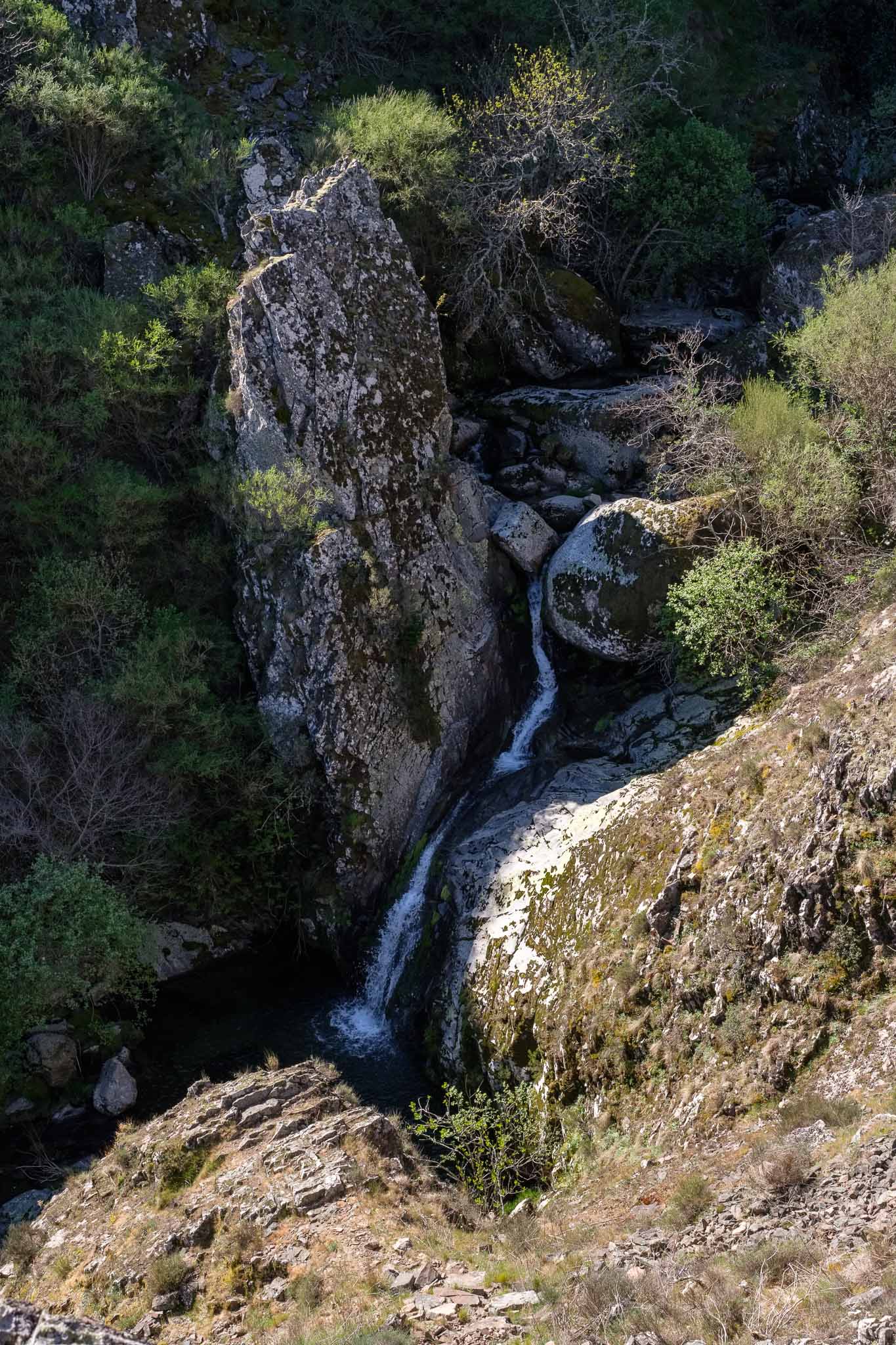
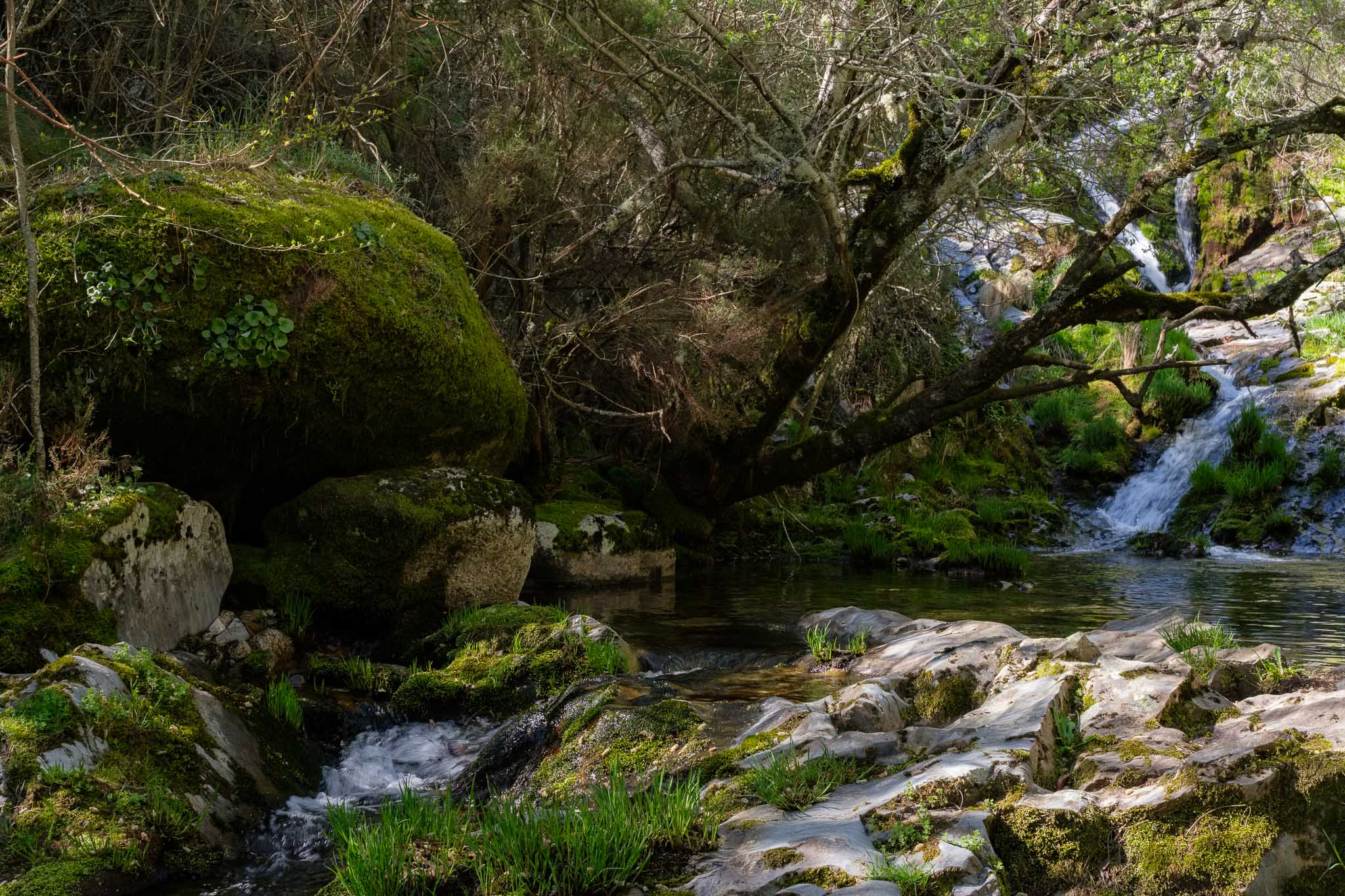
A waterfall in the Leandres brook, close to the trail.Crossing the Leandres creek.
Leaving the steeper terrain behind, the route then enters a beautiful forest, where oaks, chestnuts, beeches and Oregon pines dominate. The silence is only disturbed by the song of numerous birds.
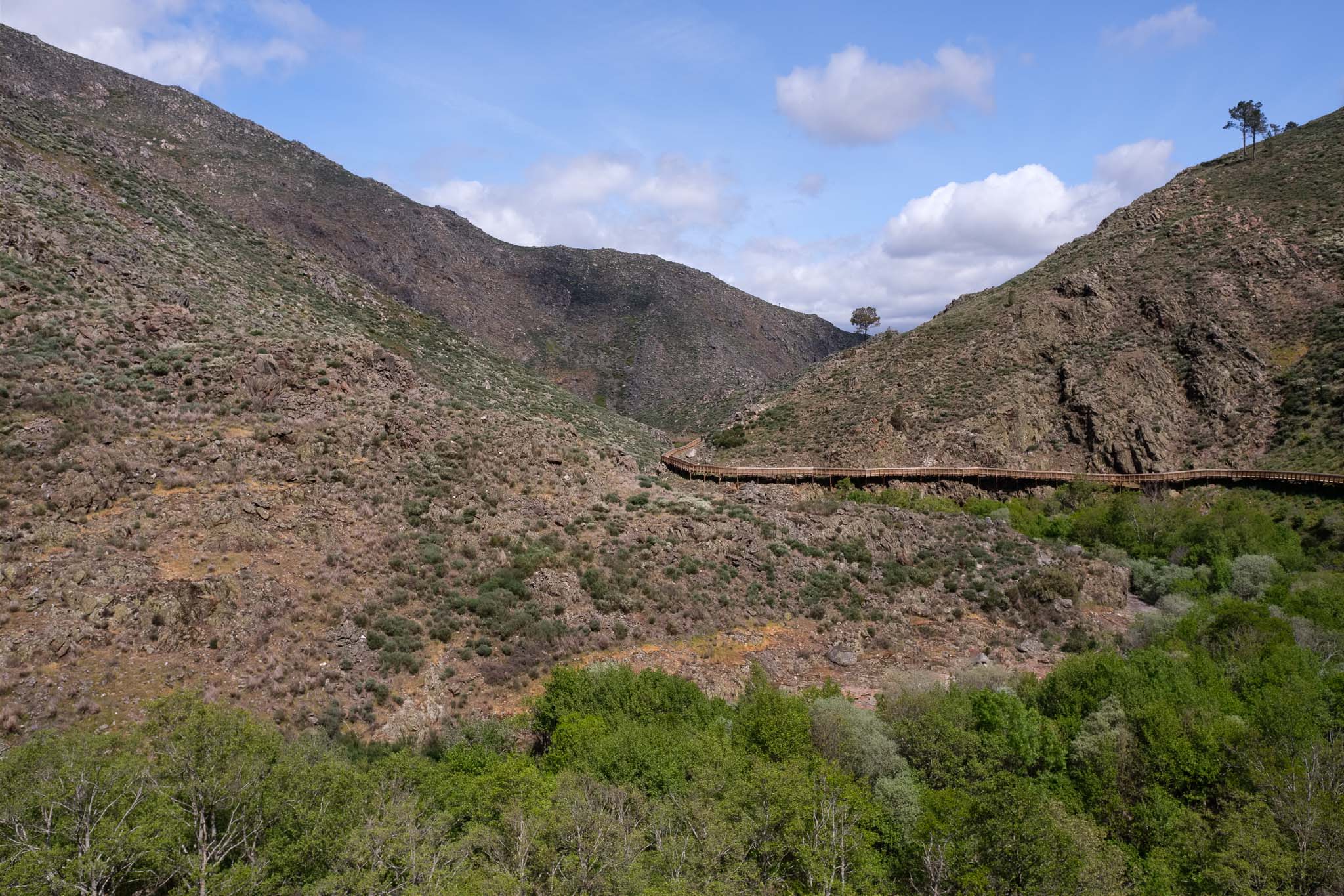
View over the Leandres gorge, cut into the quartzites. Part of the trail path can be seen in the opposite slope.A break in the forest affords a great view over the landscape.
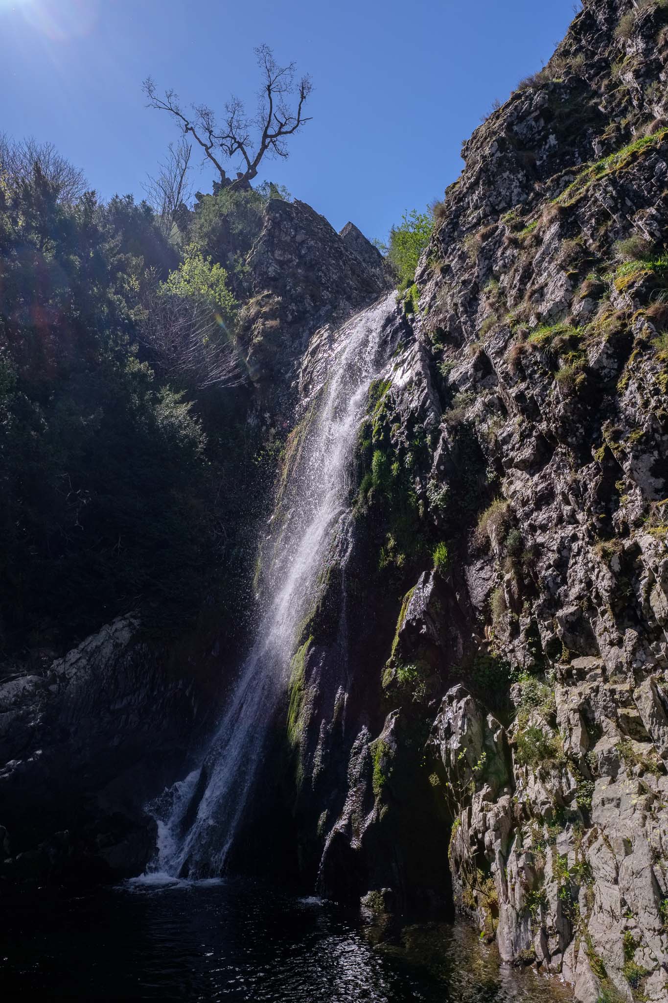
The final part of the trail is made over the blacktop road, until it reaches the Poço do Inferno waterfall viewpoint. A short walkway allows direct access to the waterfall, where one can see the rushing water and the pools below. Even though it is almost noon, most of the falls remain in the shade; in really cold winters, this waterfall freezes.
The Poço do Inferno waterfall.
After lunch in Manteigas, we start the long drive back home. During the last 4 days, we had the opportunity of visiting and experiencing some of the wildest areas of this Natural Park, together with old historical villages. Much more remains to be seen, and for sure we will return to this magical land.
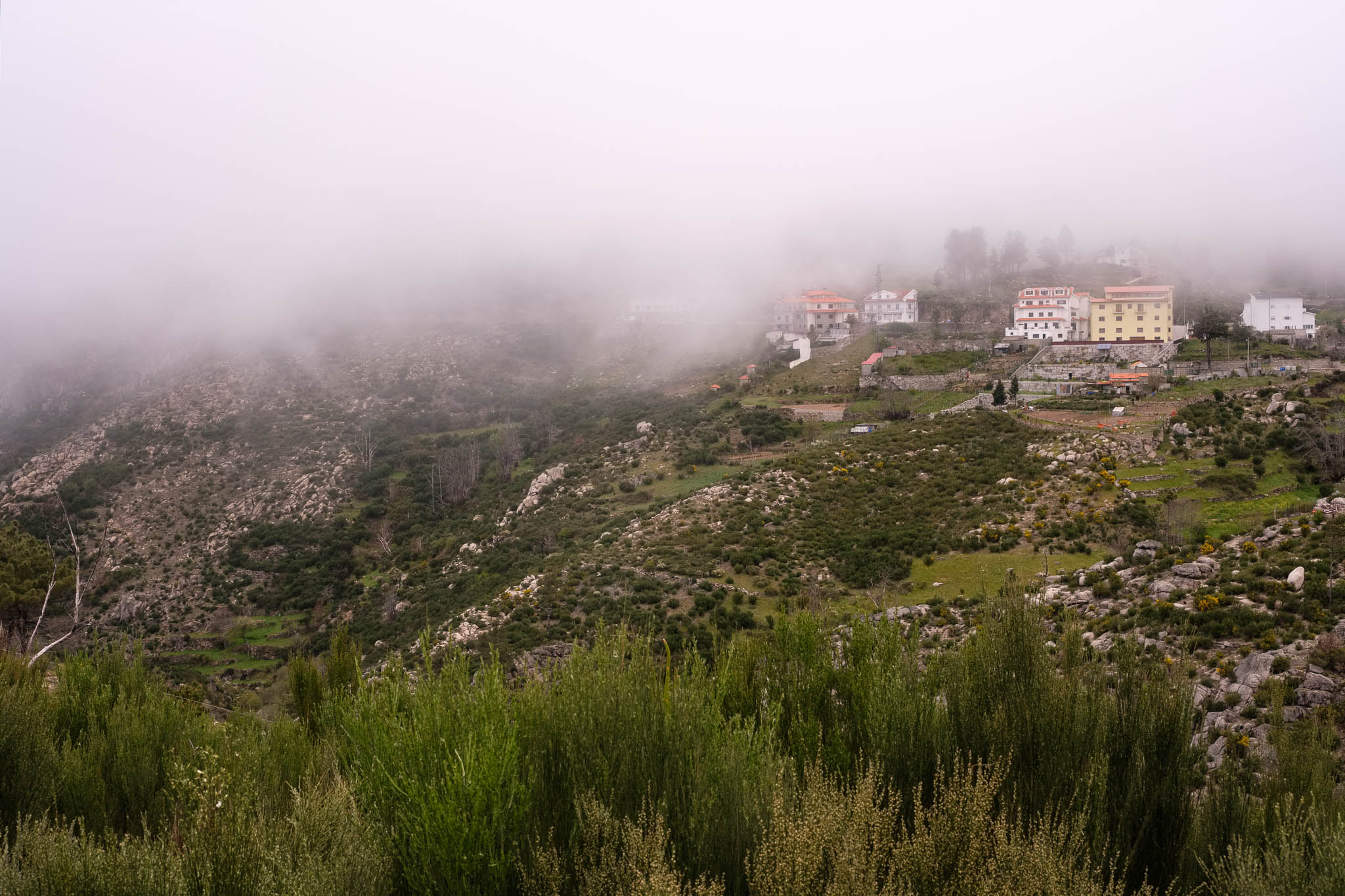
The plan for the third day of our trip was to walk the trail between Lagoa Comprida and Covão dos Conchos, in the heart of the mountain. After breakfast, we drove to the town of Seia, from where it is easy to reach the starting point, via the village of Sabugueiro. The weather was overcast, with a heavy cloud cover. Our concerns were confirmed once we reached Sabugueiro, which was enveloped in fog. Given that the trail route is at an altitude in excess of 1500 m , the presence of fog was bad news.
Serra da Estrela covered in clouds.View of Sabugueiro, the highest village in Portugal.
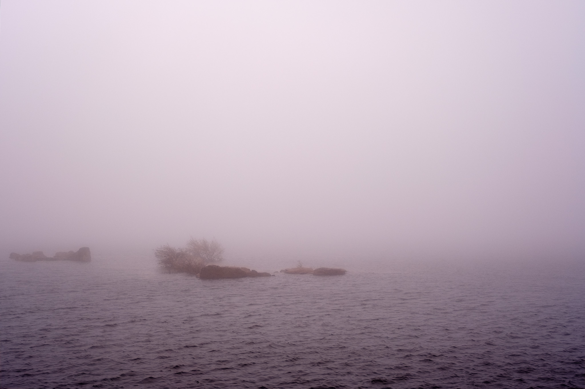
Still we persisted and continued driving up the road. When we arrived at the Lagoa Comprida, a lake created by a dam, the visibility was near zero. The wind was strong and freezing, and in such conditions, we decided not to walk this trail. Even though the path was easy and we had the GPS track, there was no point in doing it. I walked around for a while and took a few photos of the landscape in the fog.
Lagoa Comprida lake.Granitic landscape near Lagoa Comprida.
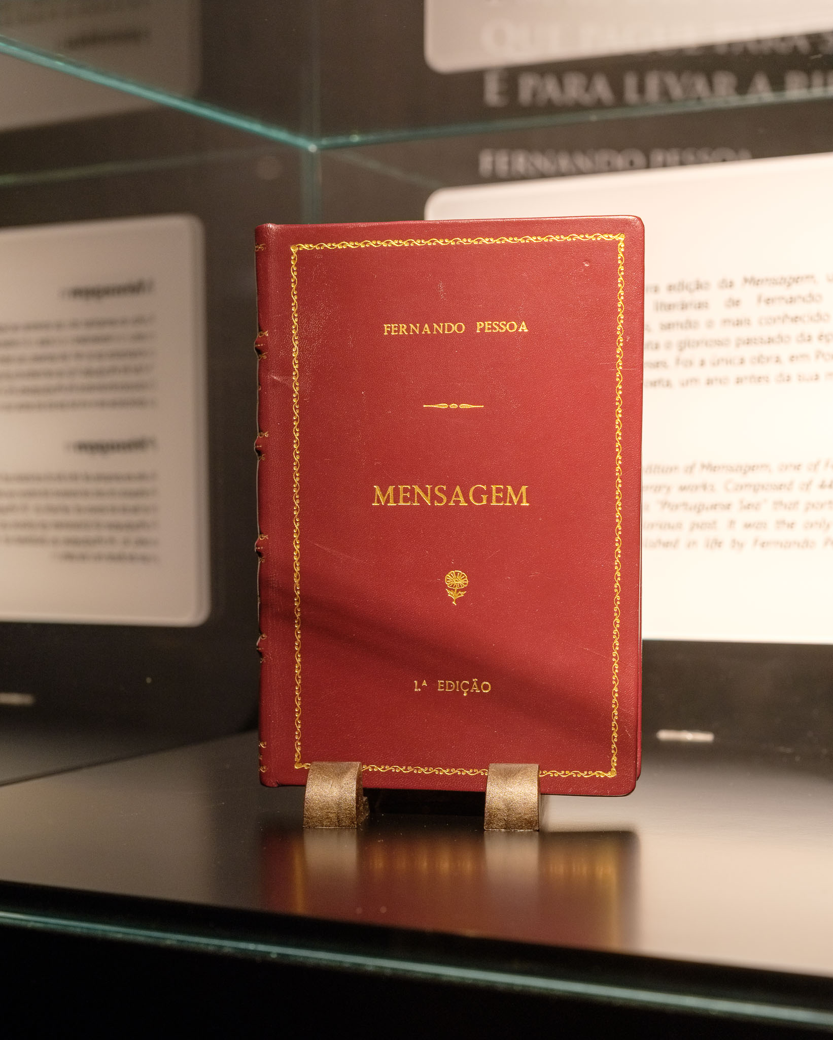
We drove back to Seia and quickly devised an alternative plan for the day. Fortunately there is no lack of interesting places to visit, given the abundance of historical villages in the region. In Seia itself, we visited the Bread Museum, which tells the story of bread and its importance since pre-historic times. In the area assigned to poetry and literature about bread, there is a corner dedicated to Fernando Pessoa, the great Portuguese poet of the 20th century. There is even a rare first edition of his book “Mensagem”, the only one that was published while he was still alive. The book is displayed on top of his writing desk, together with a coffee cup from Brasileira, his favorite coffee house in Lisbon. It was interesting to find these rare pieces in a museum outside of a large city.
A rare first edition.
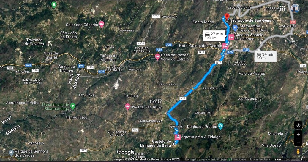
From Seia, we decided to visit a few other historical villages, such as Castelo de Linhares da Beira and Celorico da Beira. Near Celorico, another interesting place is the pre-historic necropolis of São Gens.
Road map between Castelo de Linhares da Beira and Celorico da Beira.
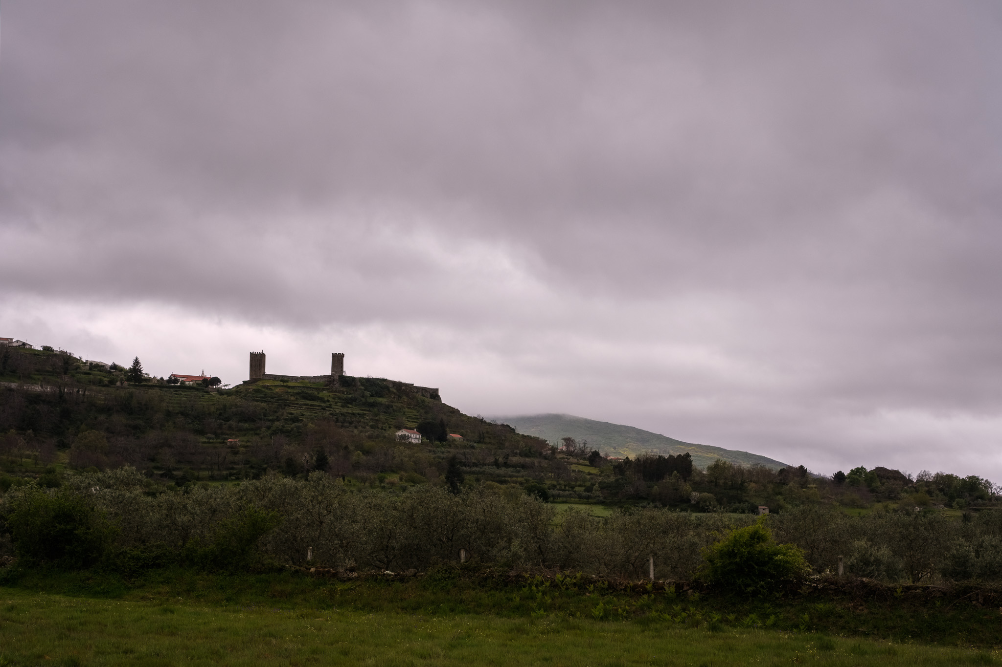
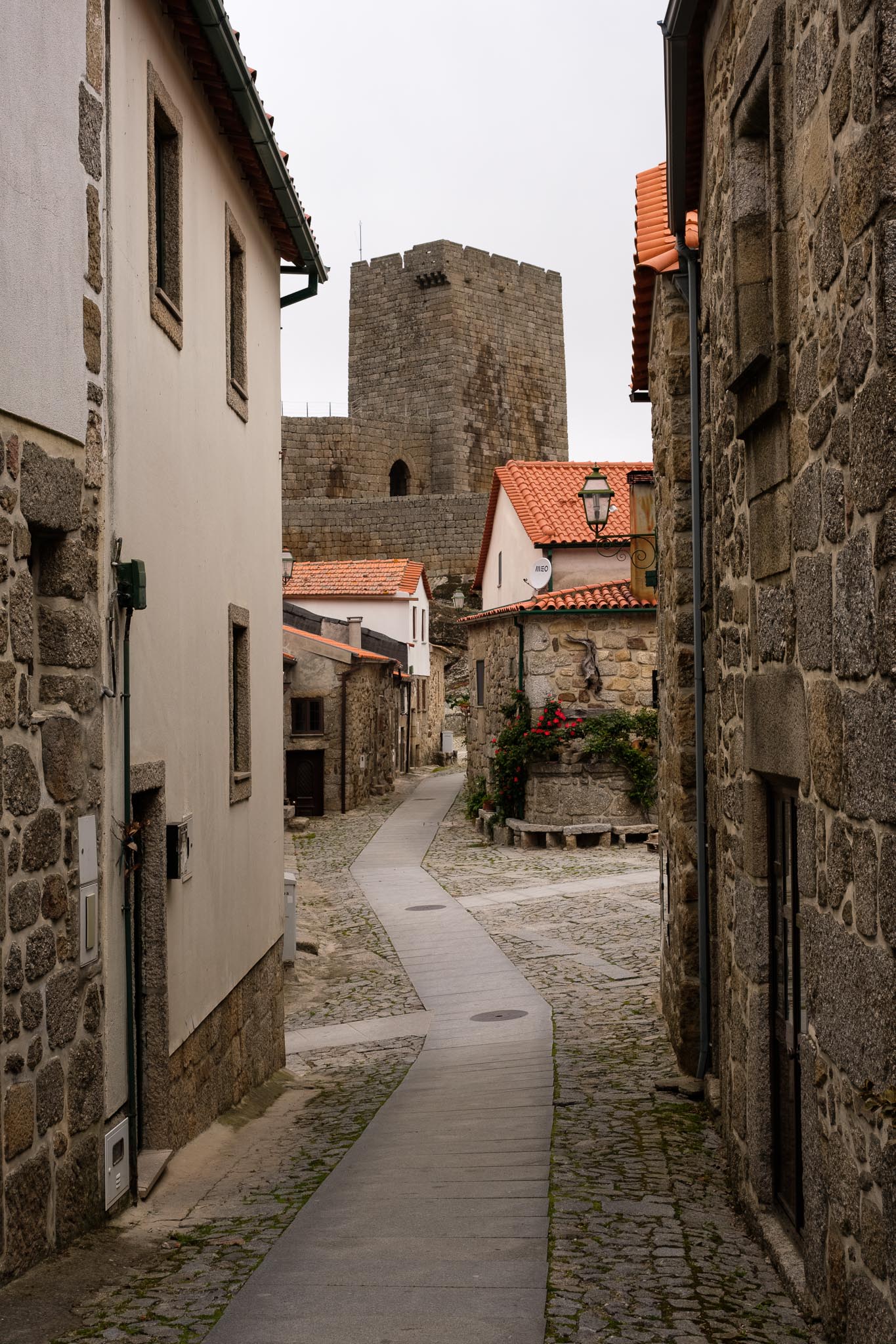
The weather continued to be cold and dark, which actually suited the character of the landscape and the constant presence of granite. Arriving in Castelo de Linhares da Beira, the silhouette of its castle dominated the surroundings.
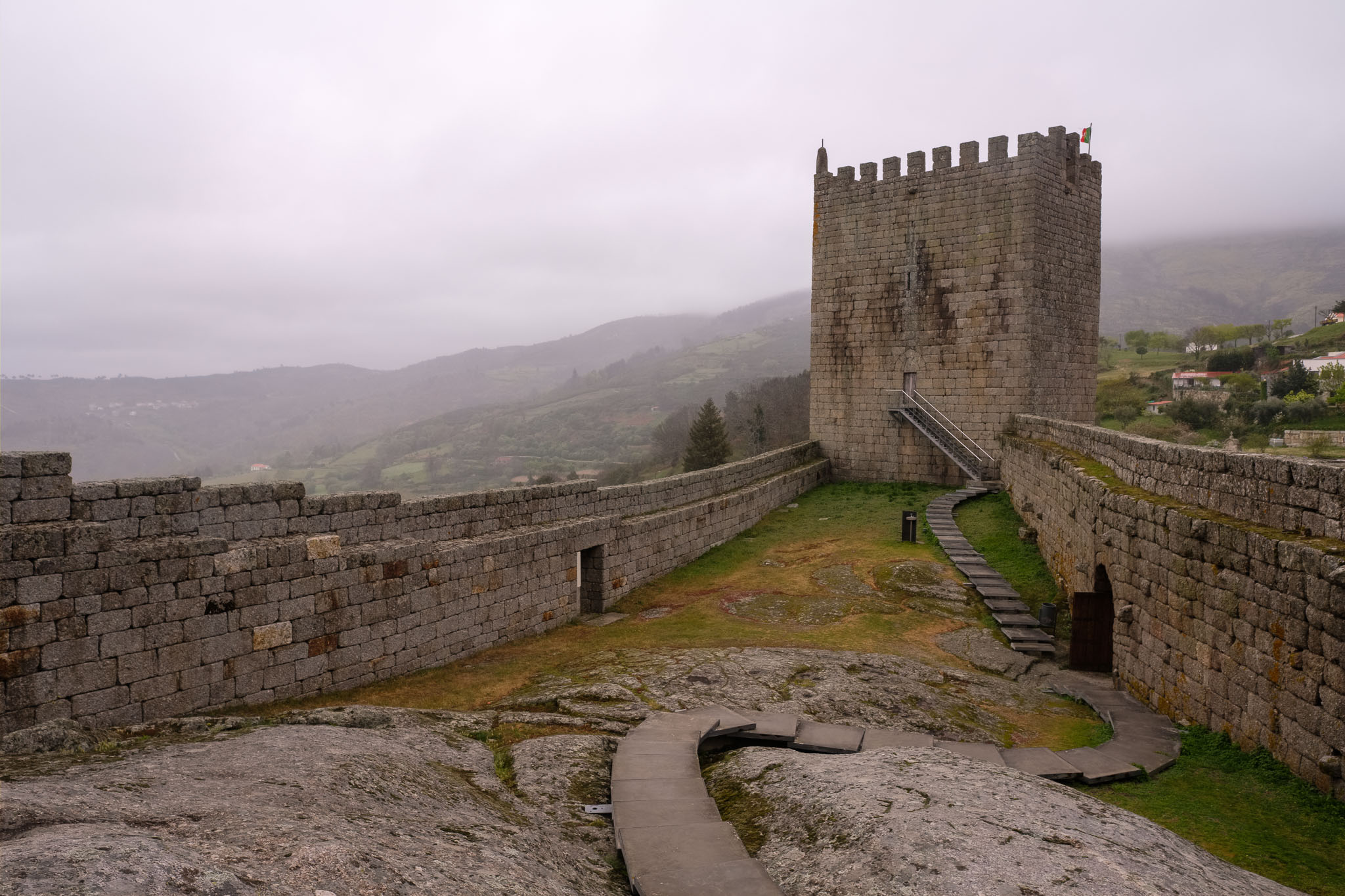
Castelo de Linhares da Beira.
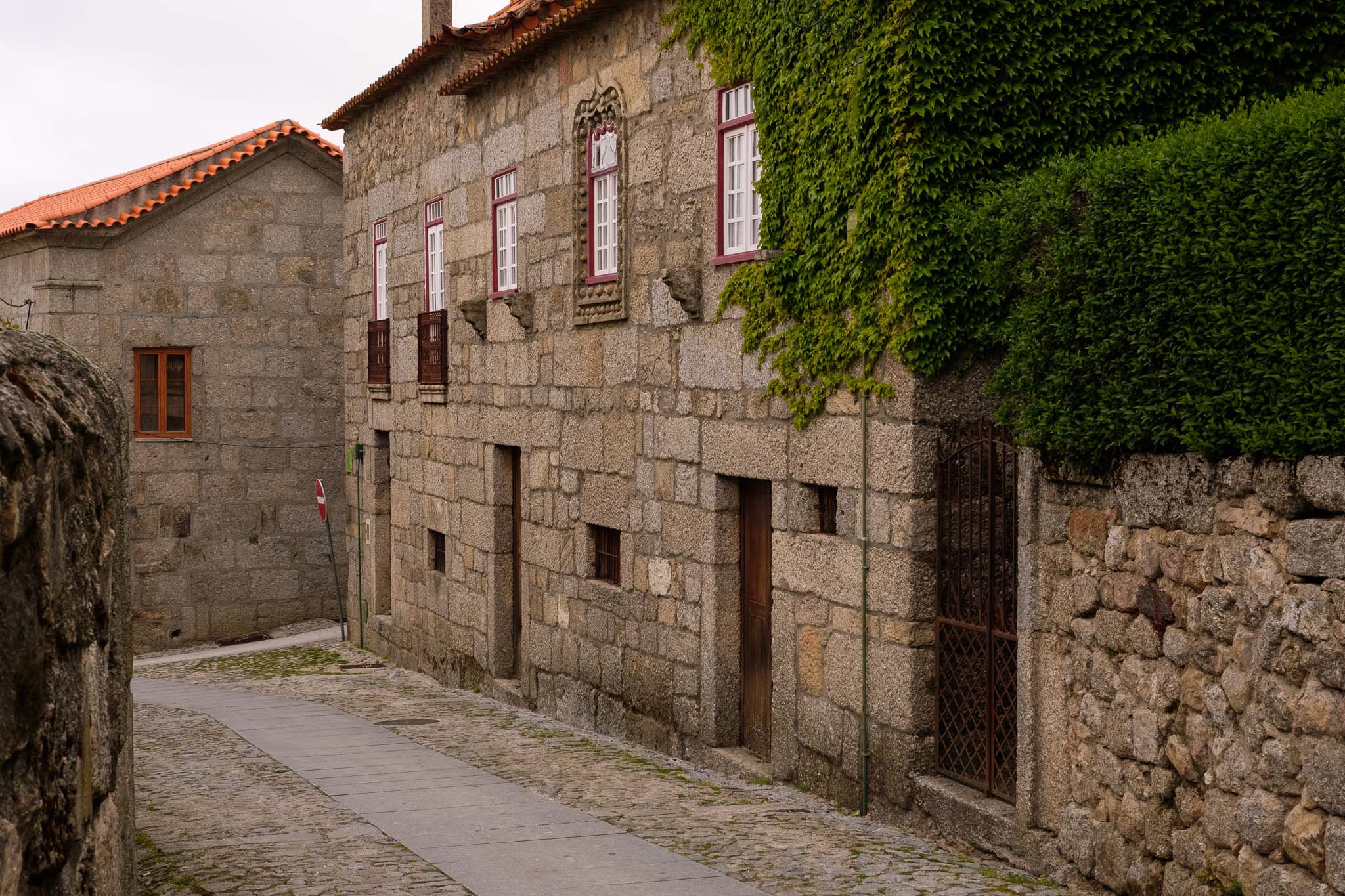
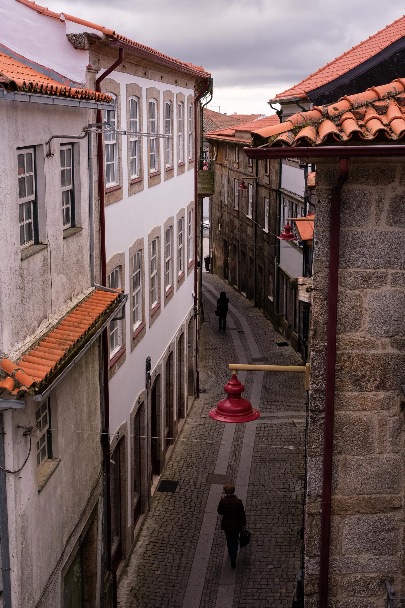
As with all villages in the region, the history of Linhares is lost in the mists of time. The first settlement in the top of the hill is dated from around 850 b.C., before the Roman occupation of the territory. Then came periods of occupation by the Visigoths and Arabs, before the Christian reconquer. In 1169 a.C. King Afonso Henriques grants the village its first charter. We have a quick picnic lunch in the nearby woods, and then proceed to walk along the narrow streets, where the wind blows and the rain starts to fall.
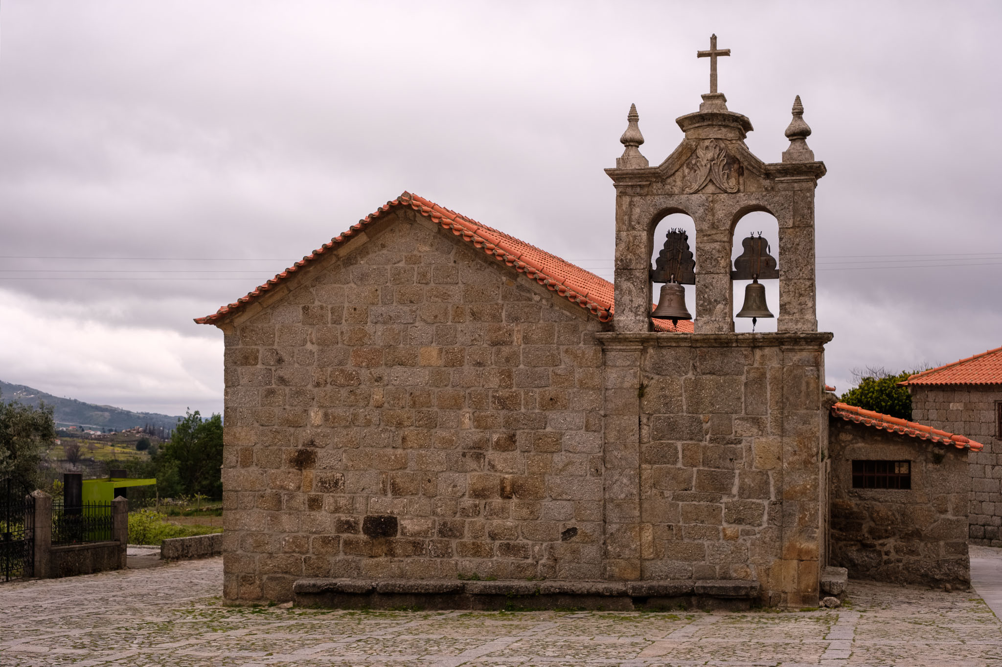
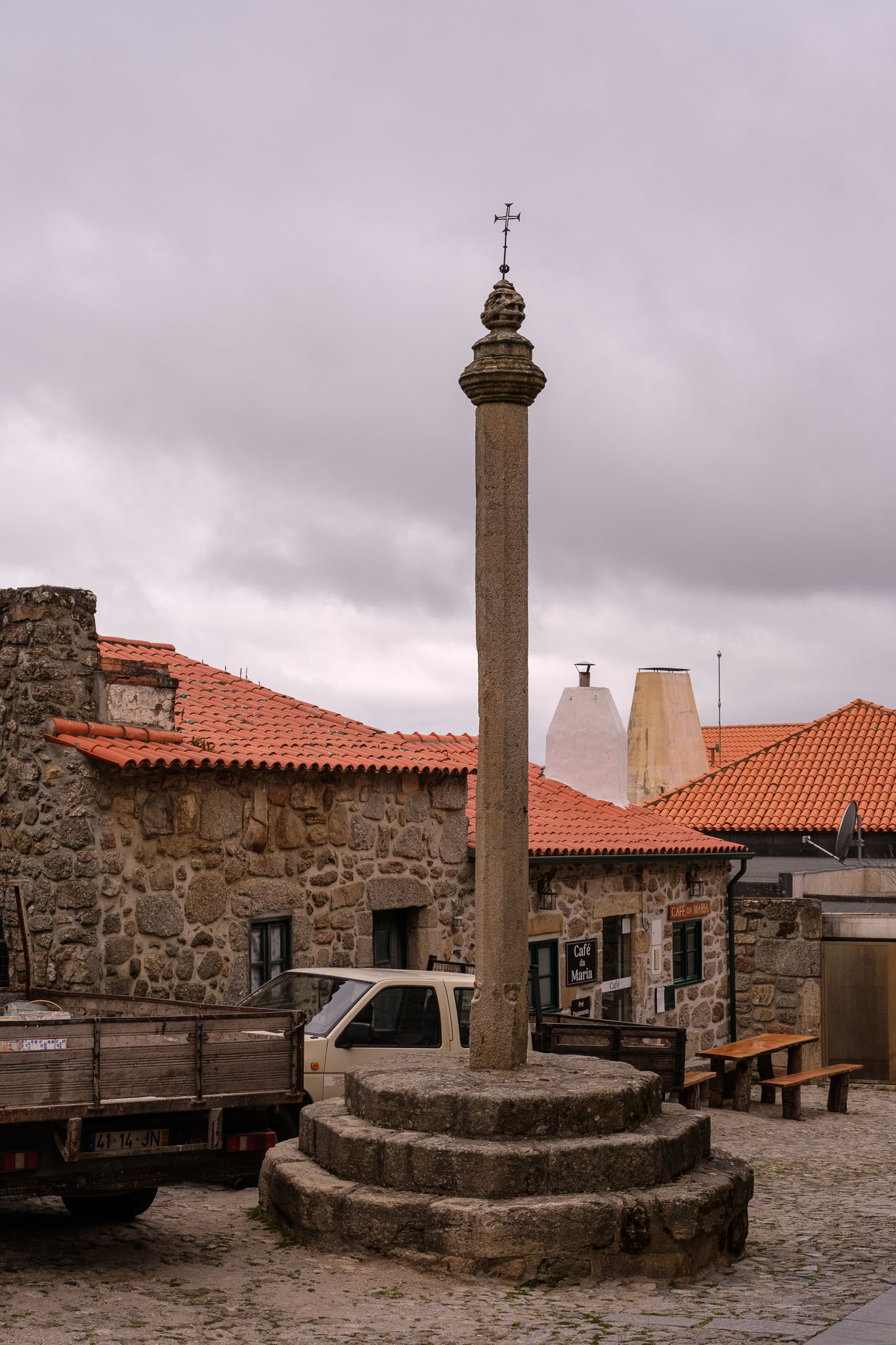
Church in Linhares.Pillory in Linhares. This was the sign that the town had been given its charter, or “foral”.Typical granite houses in Linhares.The castle.Inside the castle walls.View of Linhares from the castle ramparts, with the Serra da Estrela in the distance.
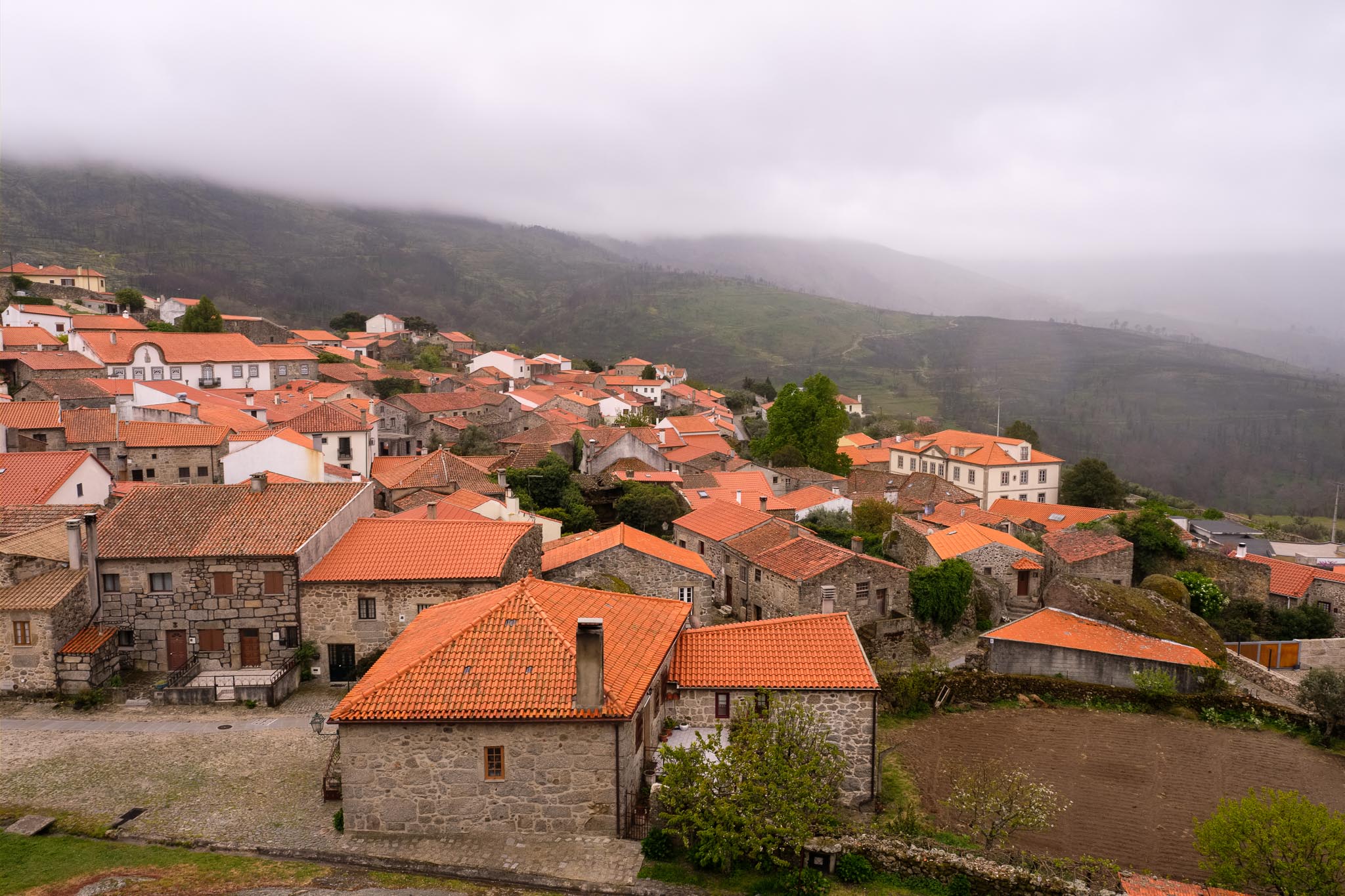
This village, as many others, only comes to life during the summer, when the emigrants return to spend their vacations. For now, it seems like a ghost town, but the weather is also not inviting to go out. Linhares is also famous for hosting paragliding events, which makes sense, given its location in altitude and favorable wind conditions.
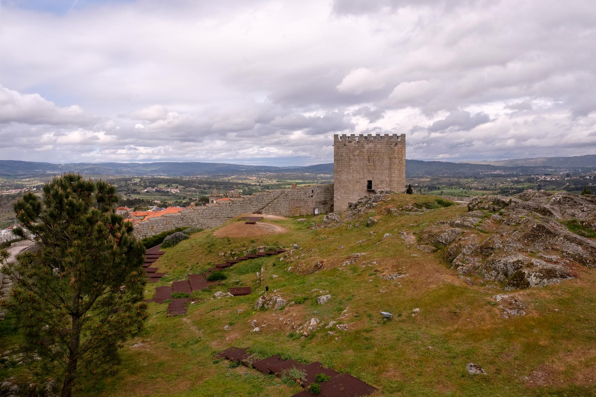
From Linhares to Celorico da Beira is a short drive. Celorico is considered the capital of the Serra cheese, a regional product that is quite famous. Therefore, a visit to the “Solar do Queijo”, in the main square near the castle, is mandatory. There, you can learn about how this delicacy is made, and of course buy it in the local shop. As with Linhares, the history of Celorico also starts in pre-historic times, with successive occupations by Romans, Visigoths, Arabs, and Christians. It is worth visiting the castle and admire the views over the Mondego river valley and the succession of mountain ranges towards Spain. With the advance of the afternoon, finally a little bit of sunshine starts to come through.
The castle in Celorico.View of Celorico from the castle, with the Serra da Estrela in the horizon.
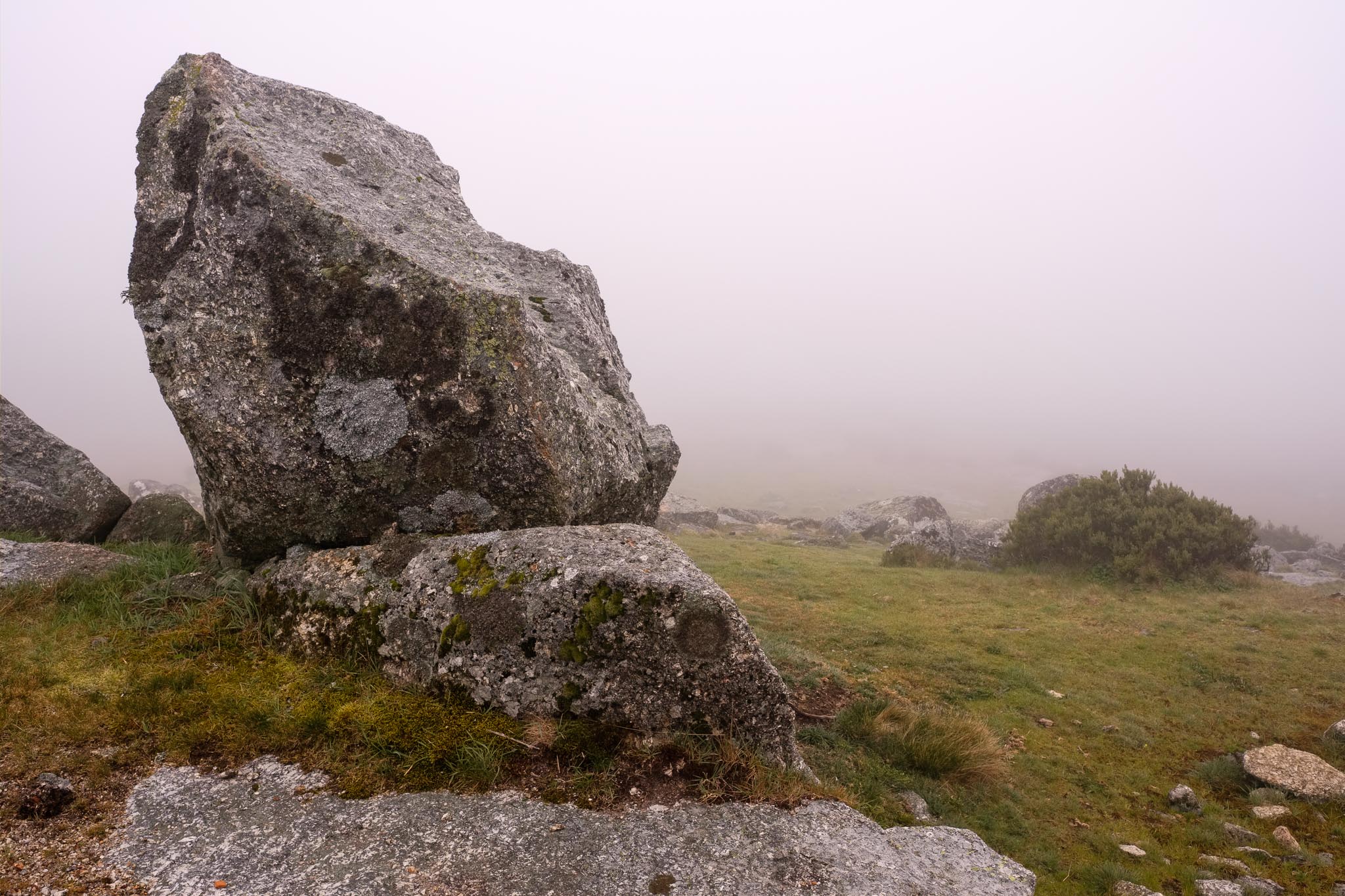
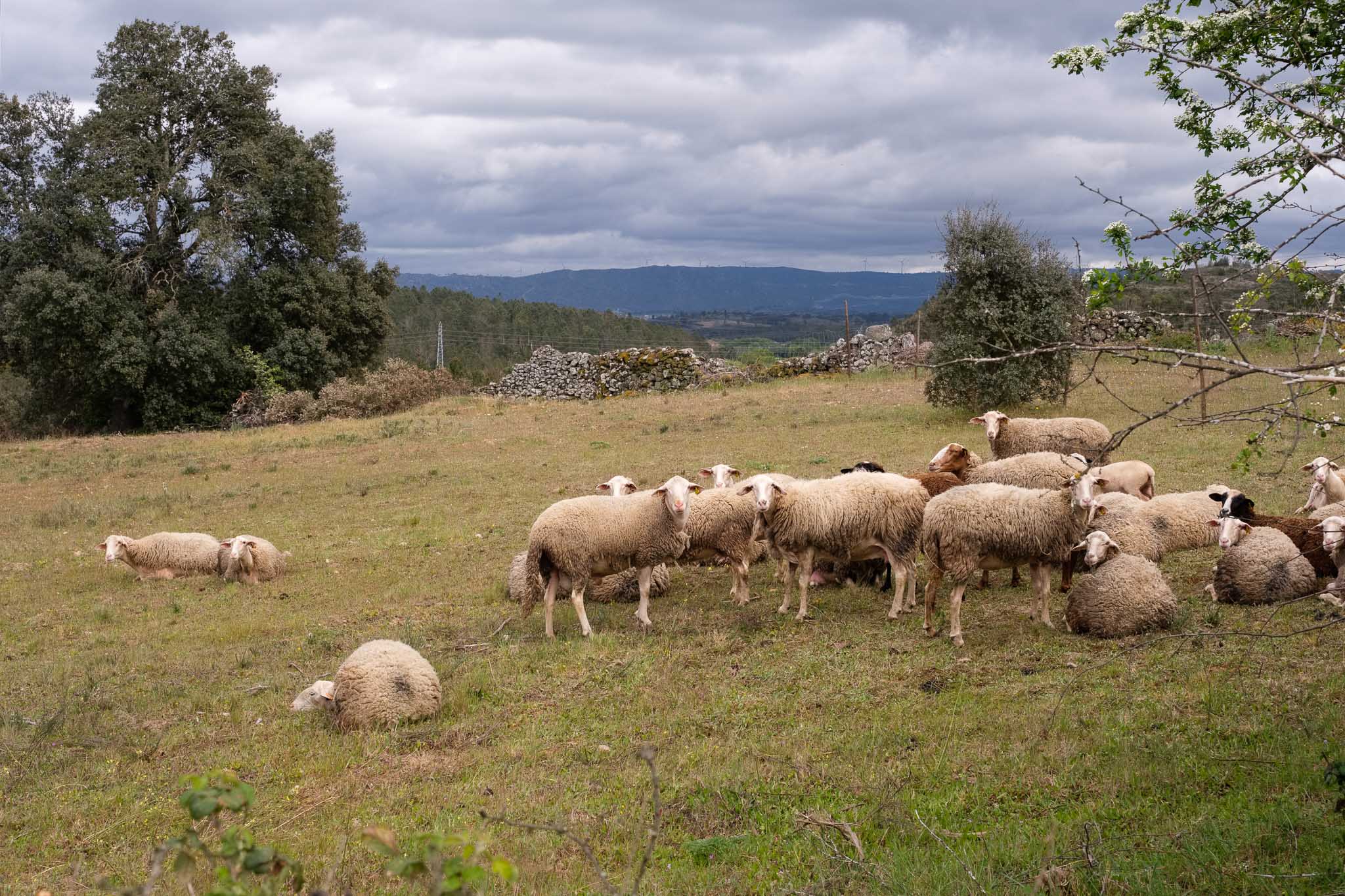
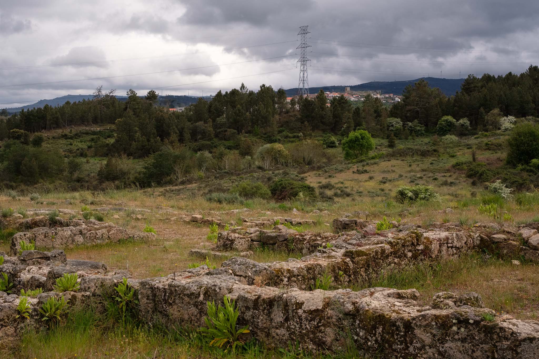
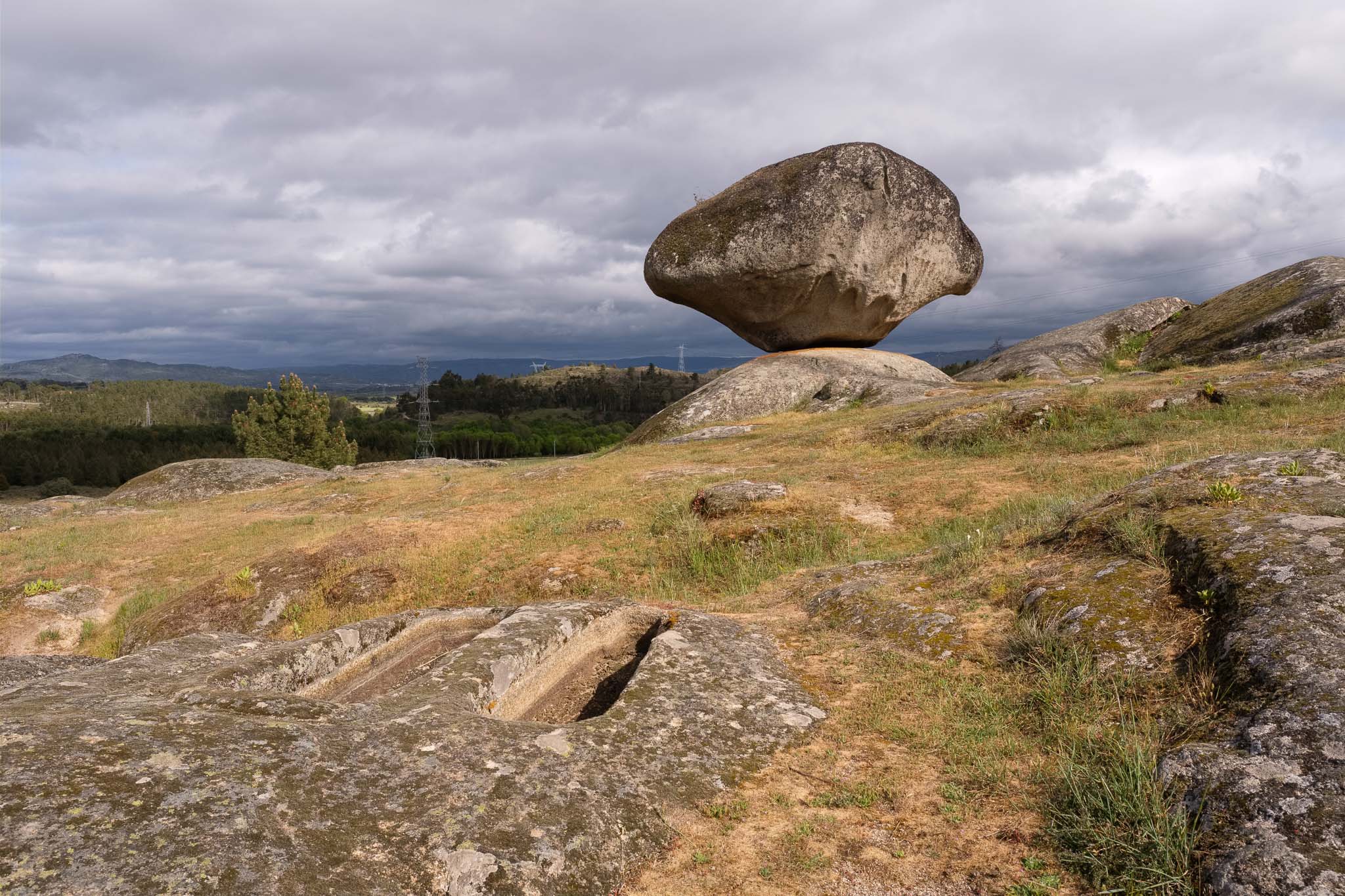
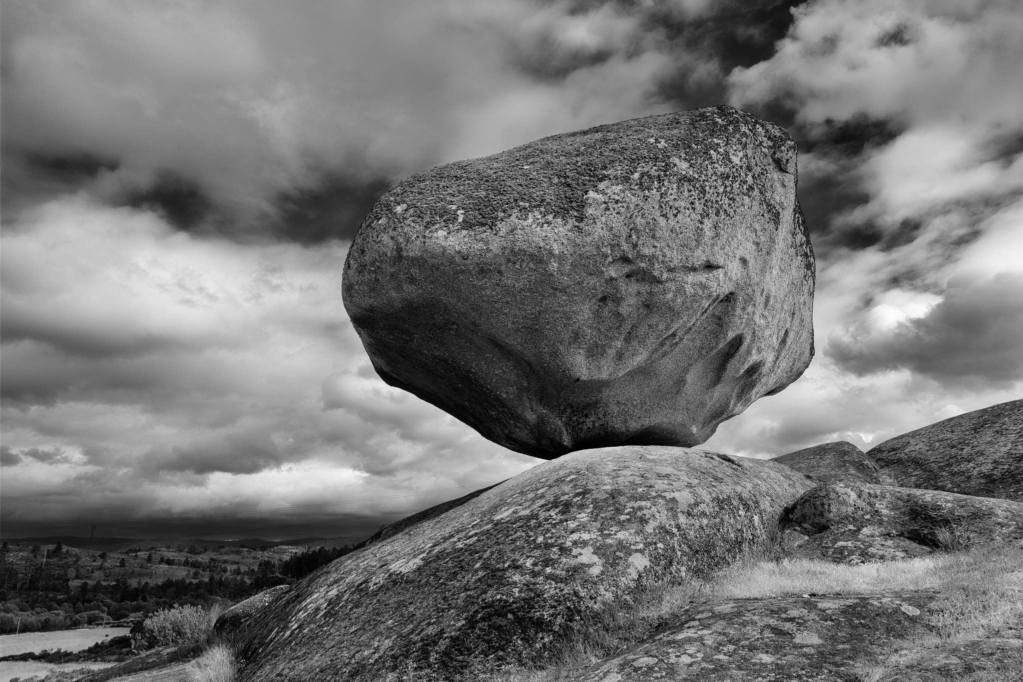
Near Celorico there is a very interesting place to visit, which is the necropolis of São Gens. Located in the granitic plain, this is a location where evidences of human settlements have remained until the present day. These include 7000 years neolithic tombs, and remnants of Roman and medieval houses. These are close to a geological monument that consists of a granite block in precarious equilibrium on top of another one. The combined effect of meteoric agents has resulted in the erosion of the bottom of the granite block, creating this particular peduncular shape. I walk around taking some photos, having to wait here and there for the sun to break through the clouds. When that happens, the light acquires a dramatic character, illuminating my subjects against a dark menacing sky. It is easy to imagine our ancestors living in this area, perhaps also admiring and wondering about how this granite shape was originated.
Medieval bridge over the Mondego river, near Celorico.Flock of sheep near São Gens.Walls of medieval houses.Granite block geosite watching over neolithic tombs.Geosite in São Gens.
With the end of the day approaching, we had no regrets about cancelling the trail from our original plan; with a region so rich with cultural and historical routes, it is easy to find interesting places to visit and experience.
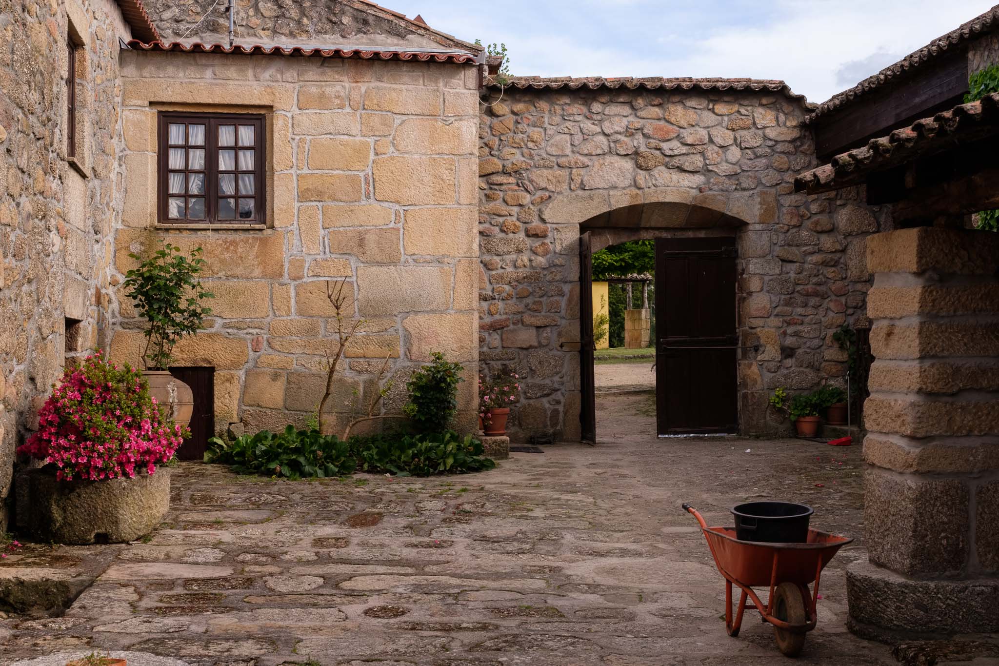
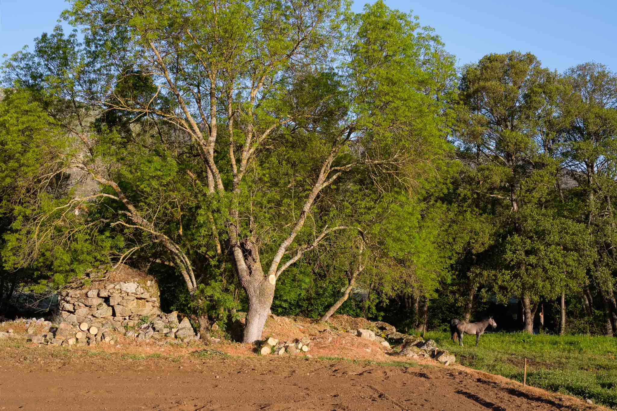
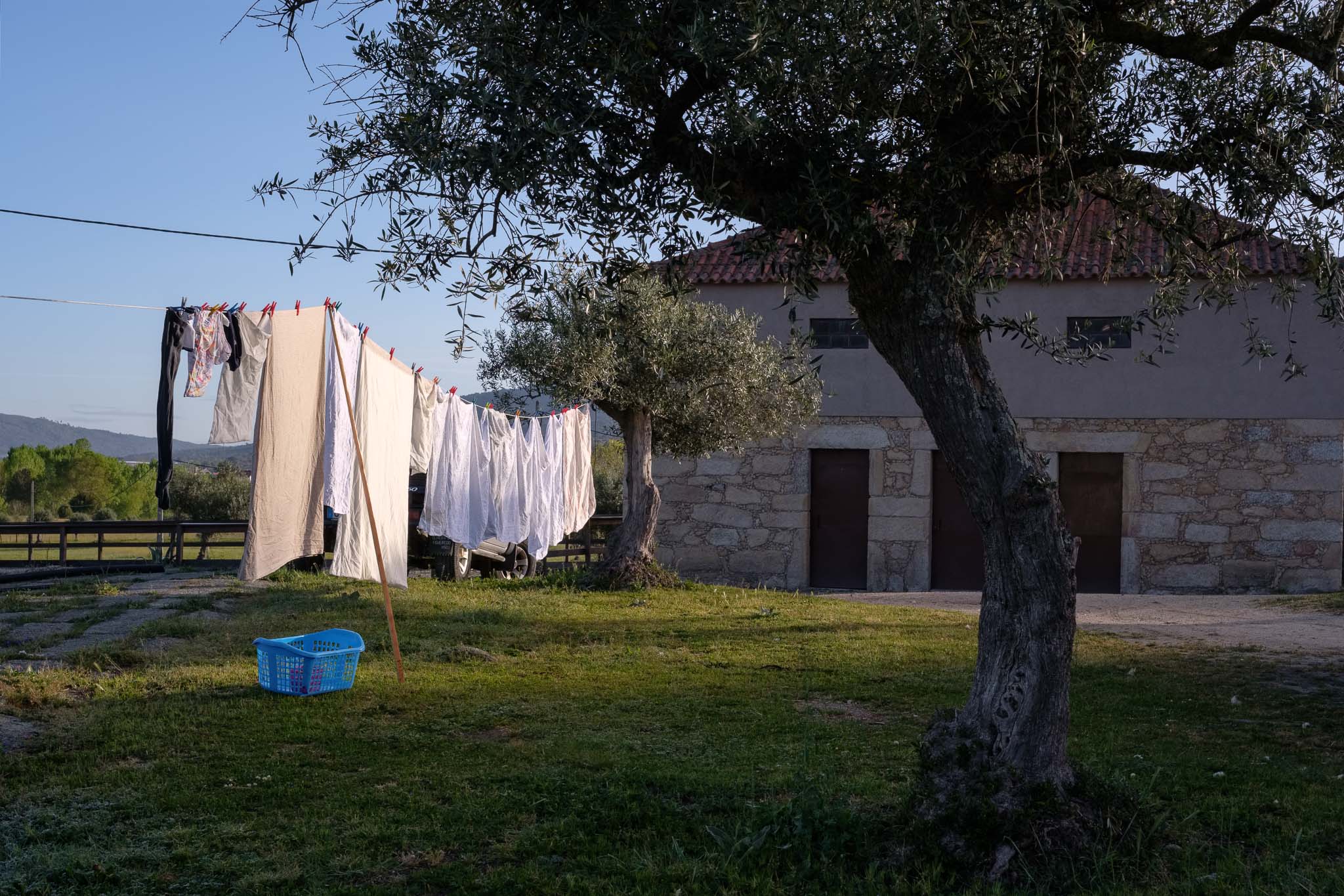
The second day of this trip to Serra da Estrela was dedicated to do the walk in the Mondego river walkways (Passadiços do Mondego). I woke up before sunrise to explore a little bit around the place where we were staying, a local farm in the village of Cavadoude, near Guarda. The morning was cold and breezy, with the ground covered in frost.
Farm where we stayed in Cavadoude. These old granite houses are full of character.The owner of the farm raises Lusitanian horses.Clothes drying.The unique Serra da Estrela, a race of shepherd dogs.
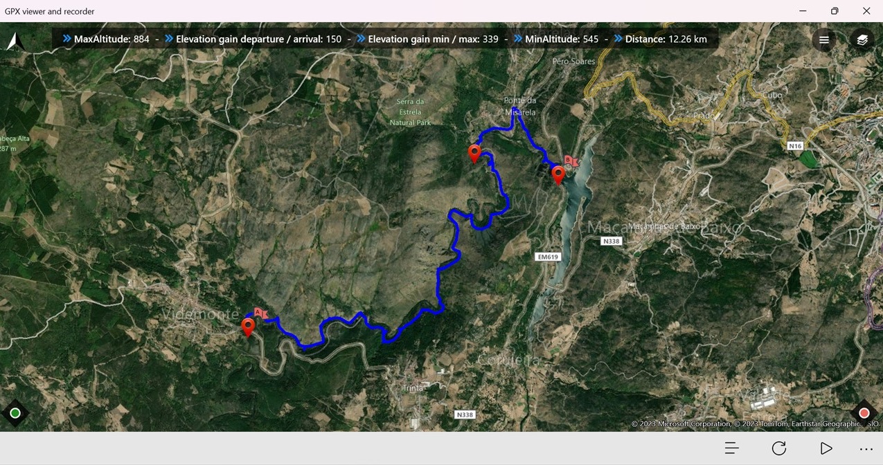
The Mondego river starts its journey in the heart of Serra da Estrela and reaches the Atlantic in the city of Figueira da Foz. This walkway is a 12 km trail that was inaugurated in November 2022; around half of its length is made of wood walkways (the so-called passadiços), thus making it possible to reach thus far completely isolated and wild areas of the upper Mondego. The map below shows the route.
Map showing the route of the Mondego Walkways.
The path always follows the river, which in this area runs along a narrow and steep valley. The topography is rugged, with a marked contrast between the lush vegetation near the water and the barren and rocky granitic slopes. We decided to start the walk in the northern entrance, at the Caldeirão dam. You can also start at the southern entrance near the village of Videmonte; however, if you do so you will face a very steep and strenuous climb in the end at Caldeirão.
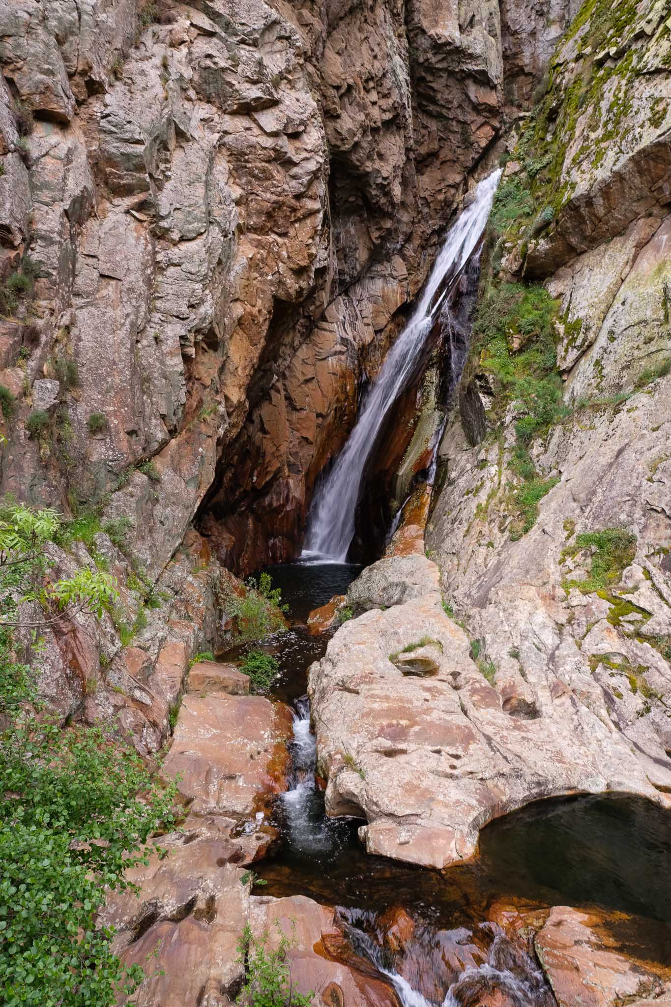
The weather was a bit like in the previous day, overcast with clouds and a strong wind in the more exposed parts of the mountain. In the afternoon the sky cleared up somewhat. As usual, I had my photo kit (2 cameras and 2 lenses plus tripod) in my daily backpack. I recommend a wide angle lens for the mountain views, plus a normal lens for the other subjects along the way. A pair of binoculars is also a good idea. Near the beginning of the route, there are a few spots where nice vistas of the valley can be seen; there is also a small detour that reaches the Caldeirão waterfall, a wonderful place where the water falls from a height of 50 m, cutting through pink granite.
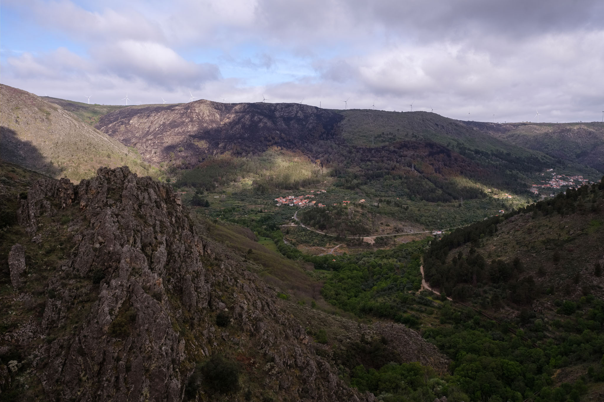
Caldeirão waterfall.View over part of the Mondego valley, with the trail route in the distance. Only a few days before, a fire affected the slopes above one of the villages.In the forest.
After a few km we reach the village of Misarela, famous for its medieval bridge. I think that Spring is a great time to do this walk, because the rivers and brooks have plenty of water, after the Winter rains.
Misarela bridge.
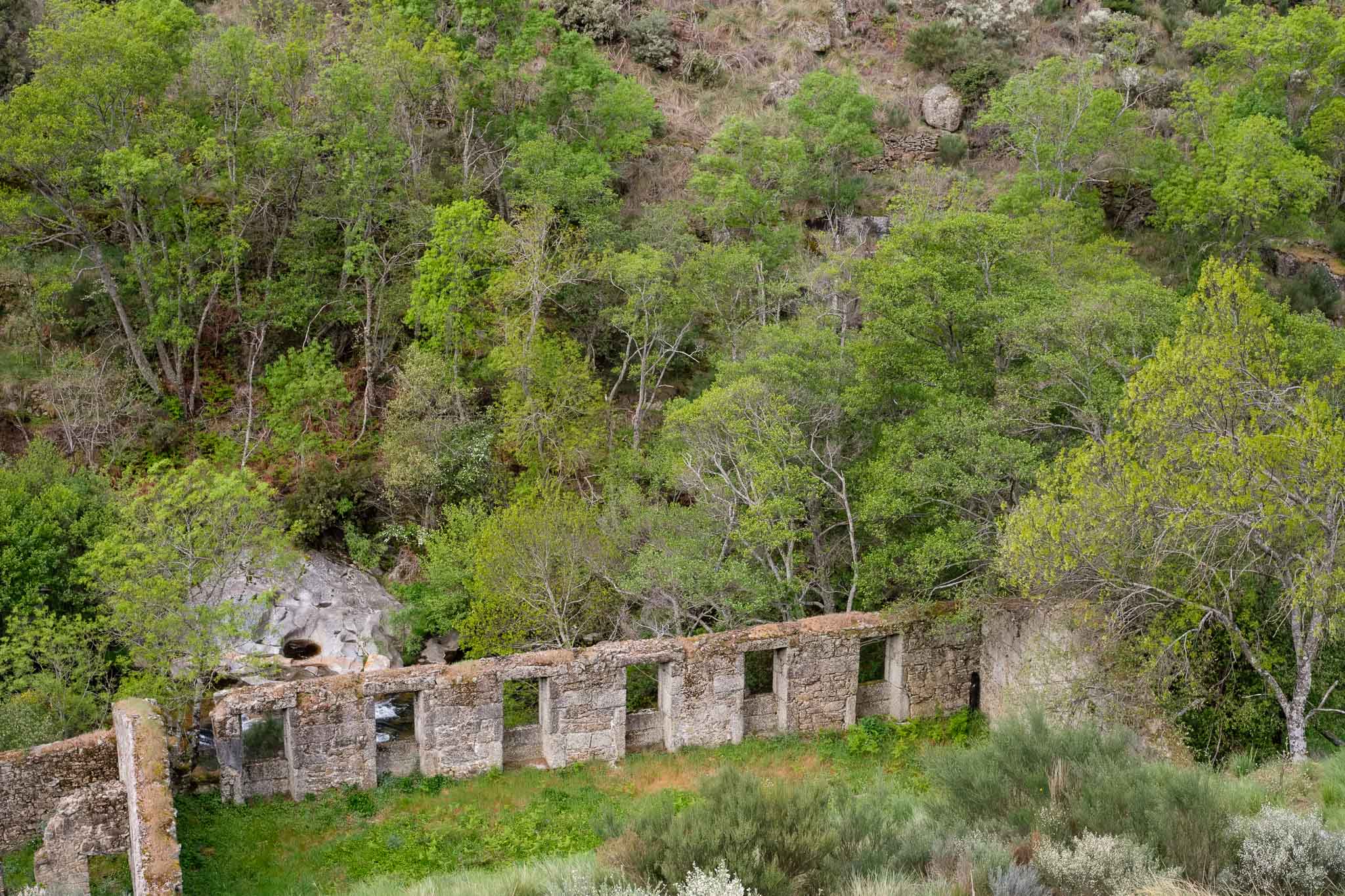
As I have mentioned, the trail follows along the course of the river, so the sound of running water is always present, together with the rich singing of the various birds in the trees. There are plenty of interesting things to see as we walk along the path, including the remains of the once very important wool factories. You will see several signposts indicating them near the river, where the water’s energy was used to sustain the manufacture of wool. They are a testament to human ingenuity and persistence from more than 100 years ago, where living conditions in these isolated mountain reaches must have been tough.
Ruin of old factory, or “engenho“.Another abandoned factory.Old farm along the way.
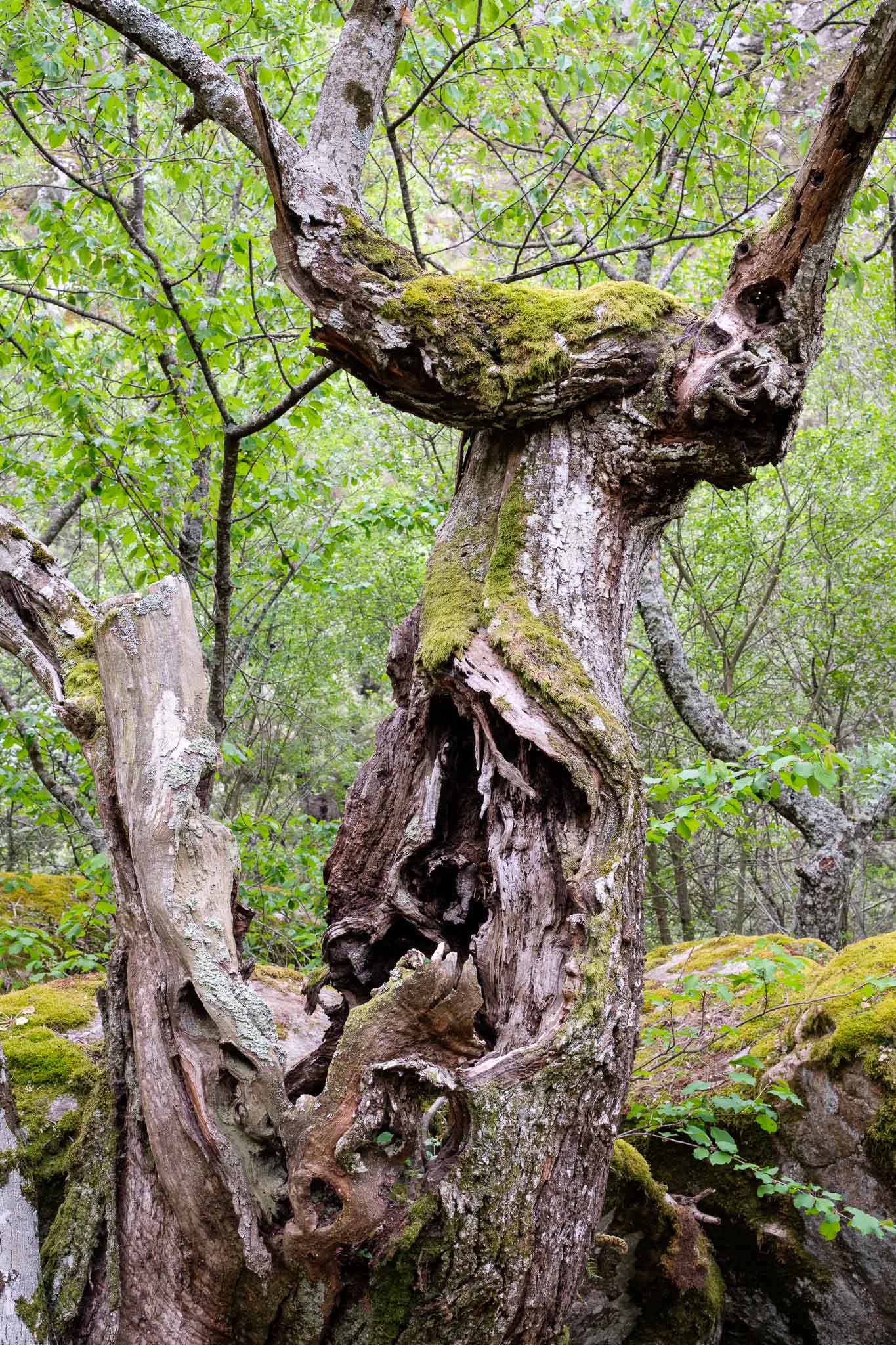
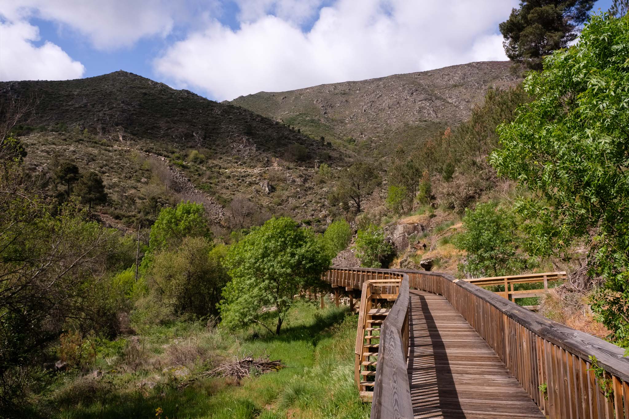
In general, the trail route is a mix of wood walkways and forest paths, and is easy going. There are hardly any other people on the trail, so the tranquility of the mountain prevails. In the more sheltered valley sections the temperature goes up, but sometimes we turn a corner and we can feel the strong and cold wind. It is a good idea to dress in layers and adjust accordingly. In general, when walking in this direction (towards Videmonte), we gain altitude. As the latter increases, the vegetation becomes scarcer, with the trees limited to the vicinity of the river. In the slopes, heather and bush grows among the granite, buffeted by the constant wind. The rocks are often twisted and convoluted, as a result of the action of the tectonic forces that, for millions of years, have shaped these mountains. It is difficult not to stop and take another photo, because the landscape is simply beautiful.
Looking back over the valley.Along the walkway.Scenic route.The walkway reaches places where otherwise the access would be extremely difficult.
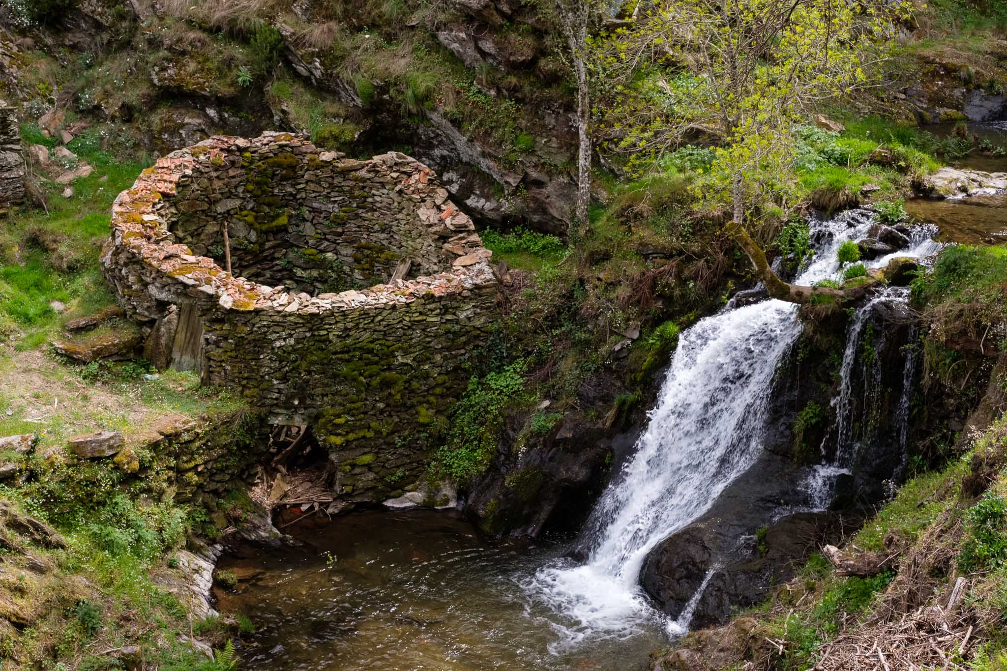
The final stretch of the walk, towards the village of Videmonte, is a long but not too hard climb. For those with a geological inclination, it is well worth spending some time admiring the so-called Videmonte metasediments. These are Paleozoic metamorphic rocks that started their history as sediments in the ocean floor, but were later subjected to extreme pressures and temperatures during a continental collision. Today, we can admire the tightly folded layers of hard rock, that are in places cut by creeks, like in the Moinhos waterfalls.
Twists and turns of the Videmonte metasediments.Moinhos waterfalls. There are a few watermills nearby, that were once part of the wool industry.
The trail ends in the car park, and from there you can catch a taxi to the starting point. Normally, there are a few taxis waiting for customers, if not, it is easy enough to call one. My impression at the end of the day was one of gratitude, for being able to visit such a wonderful region in the Serra, where wild beauty still prevails.
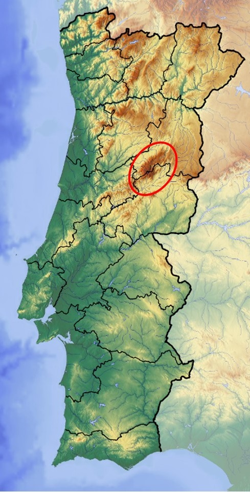
The Serra da Estrela is a mountain range located in the central part of Portugal, where the highest point of the continental mainland can be found, with an altitude of 1993 m. This mountain chain is part of the largest Portuguese Natural Park, created in 1976. This region is characterized by the presence of granitic mountains, which hold a rich fauna and flora; it is also home of some of the oldest villages of Portugal, with a history that goes back to the country’s foundation, almost 1000 years ago.
Map with the location of the Serra da Estrela (red line).
Several days are required to experience this region fully, but I only managed to visit during 4 days. Still, my wife and I had great fun, and Spring is one of the best times to visit. The rivers and brooks carry plenty of water after the Winter, days are longer, and the fields are green. Each day was dedicated to a particular area and/or activity, thus I will assign one article per day, as follows:
Day 1 – driving from home to the accommodation, with a visit to the city of Guarda;
Day 2 – trekking the Mondego River Walkways, a recent route that opened in November 2022;
Day 3 – the original plan was to walk between Lagoa Comprida and Covão dos Conchos, but such was not possible due to weather conditions. Alternatively, we visited several historical villages;
Day 4 – walking route PR1 in Manteigas, around the Poço do Inferno waterfall. Then return home.
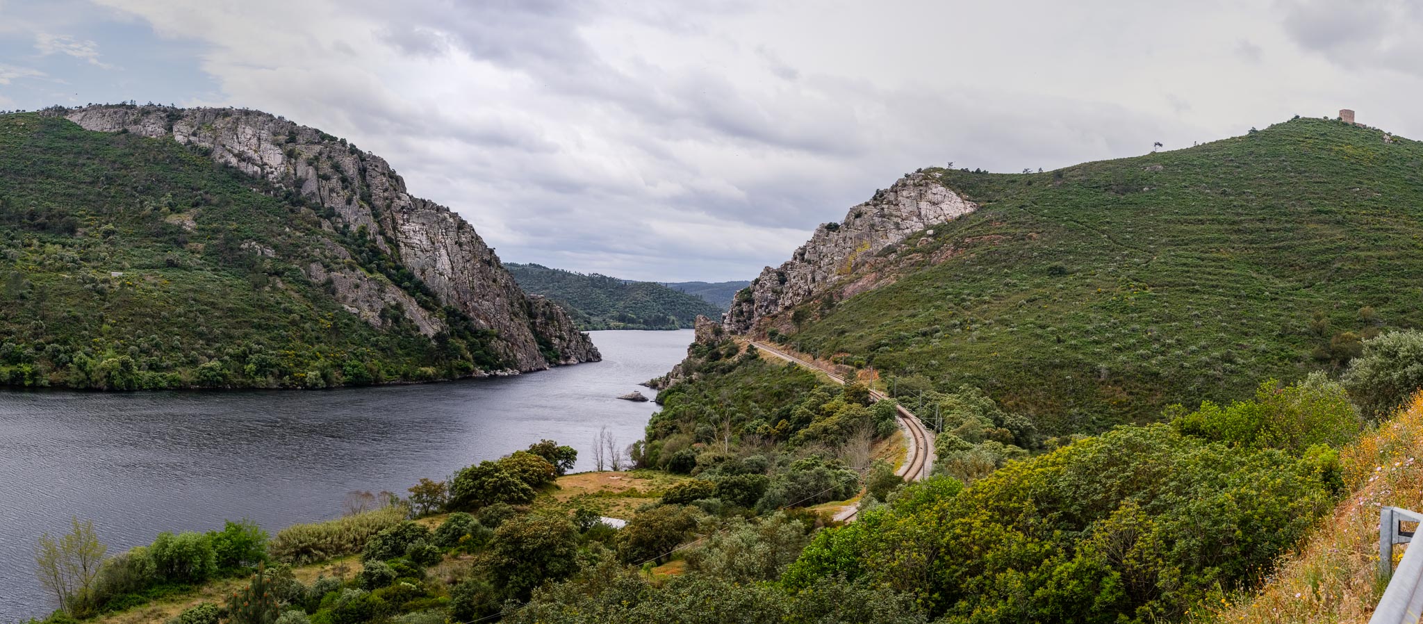
We left our house in the morning, and stopped for lunch in the town of Vila Velha de Rodão, by the side of the river Tejo. There are many interesting places to visit nearby, but time was short. Still, you can find a pre-historic site where Neanderthals lived during the Paleolithic. As a geologist, I could not miss the geomonument of Portas (Gates) do Rodão, where during millions of years the Tejo has eroded and cut through hard quartzitic rocks.
Panorama of Portas do Rodão, a geological heritage site.
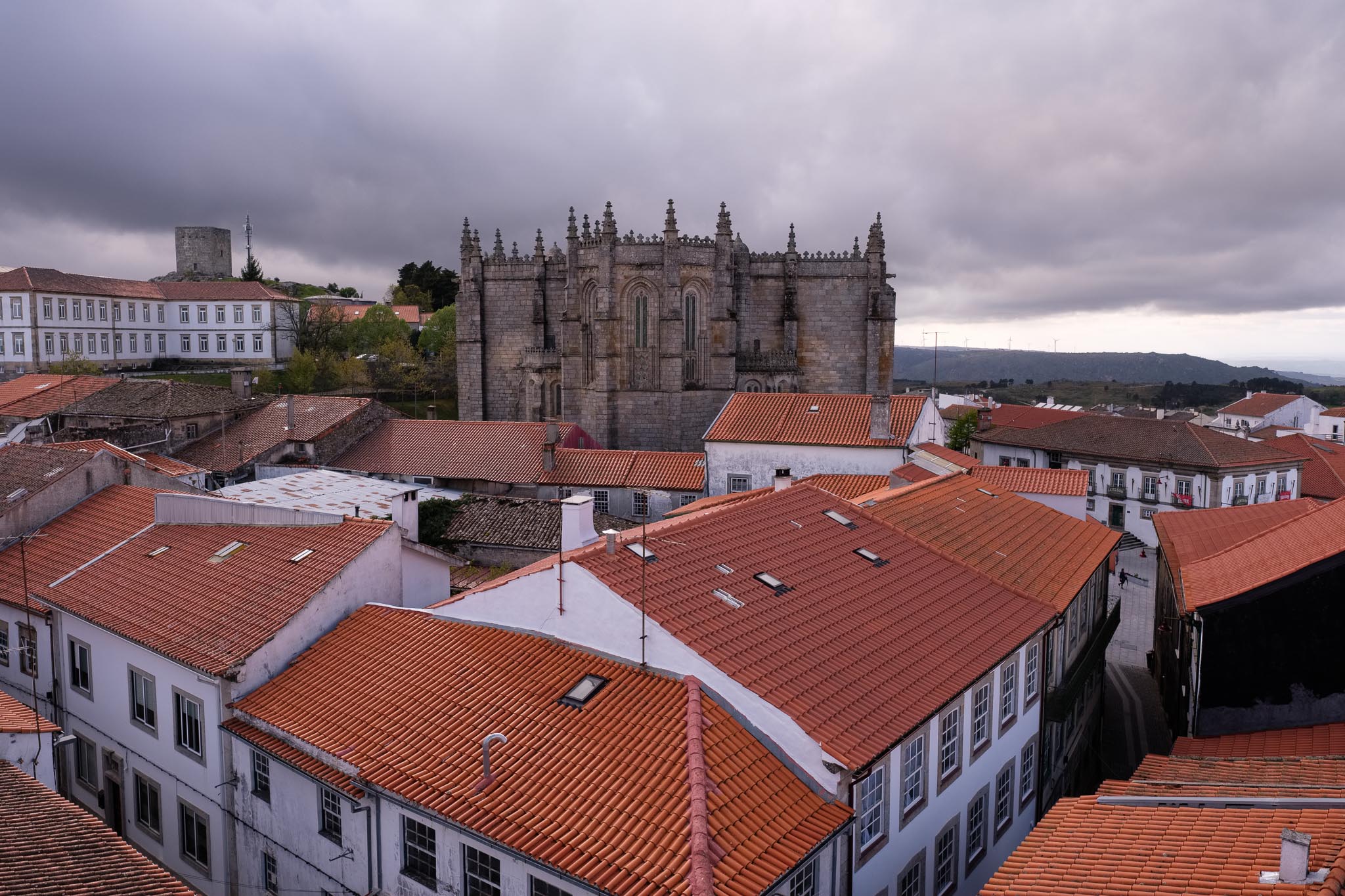
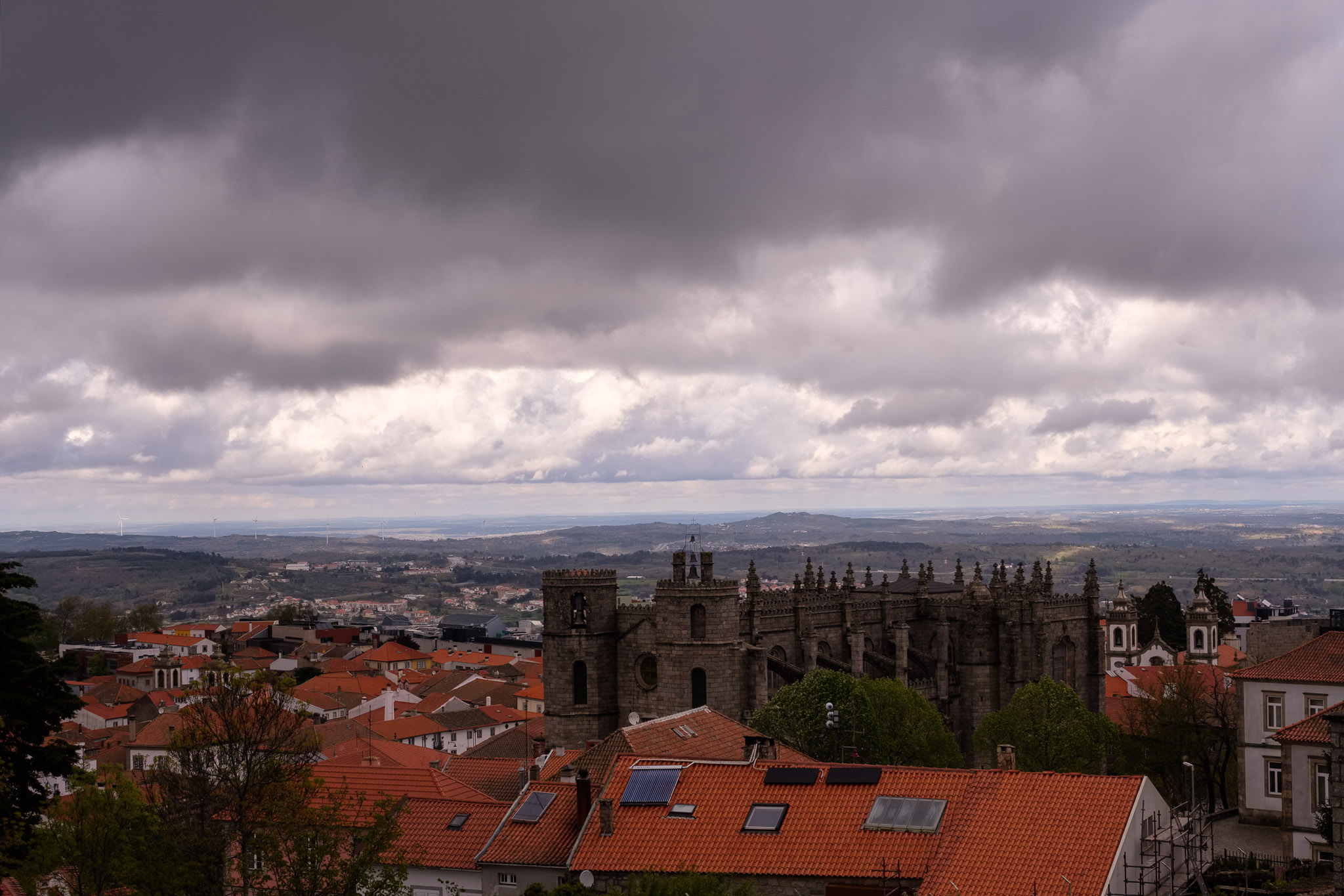
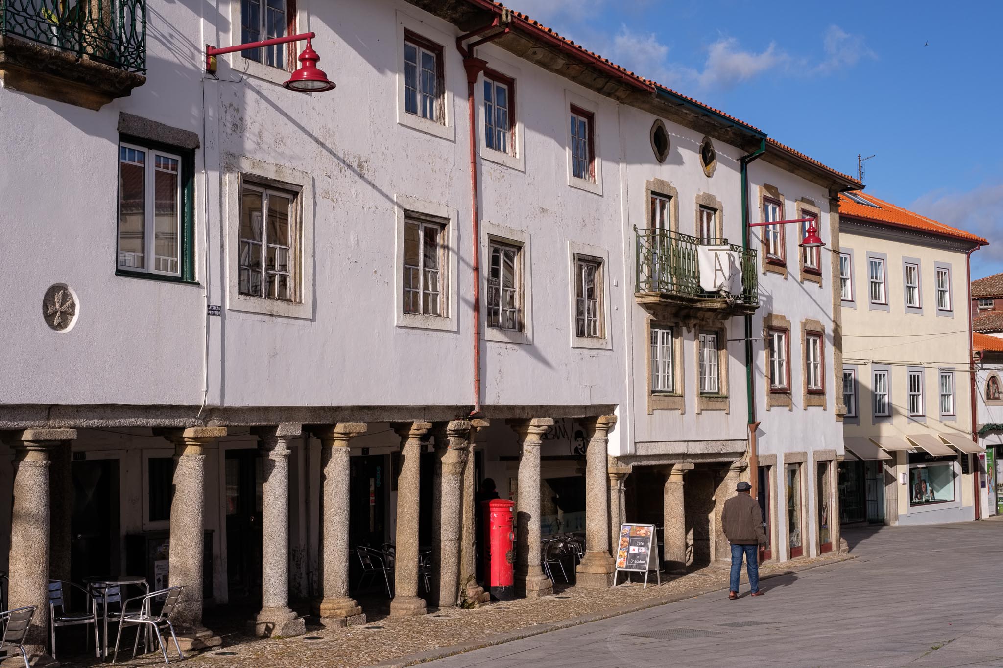
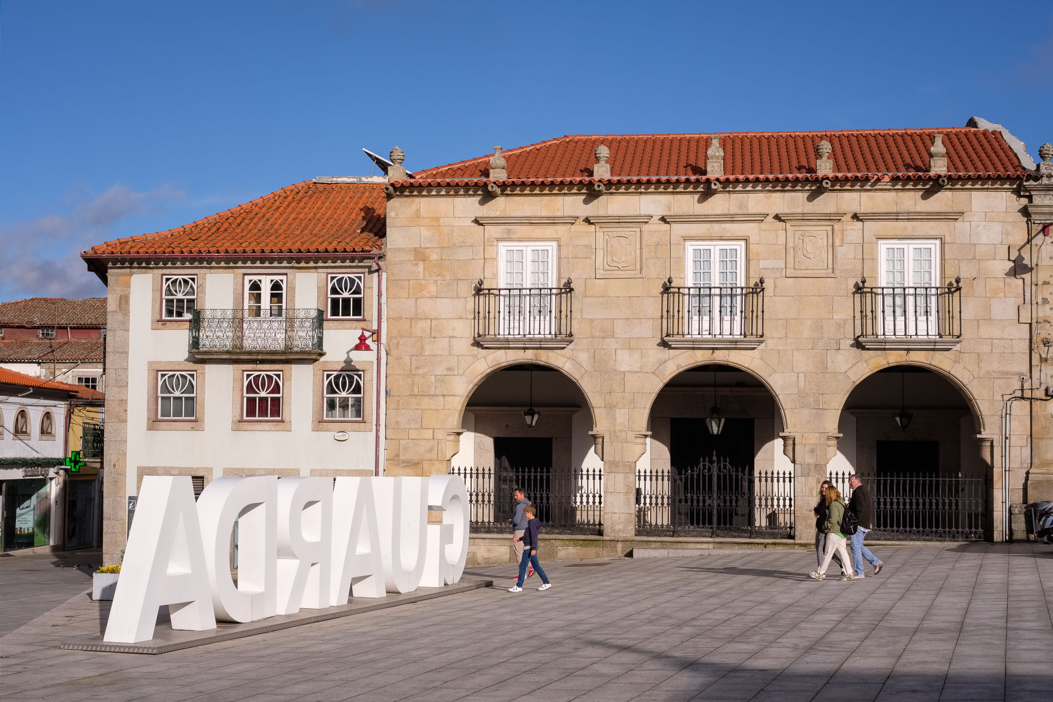
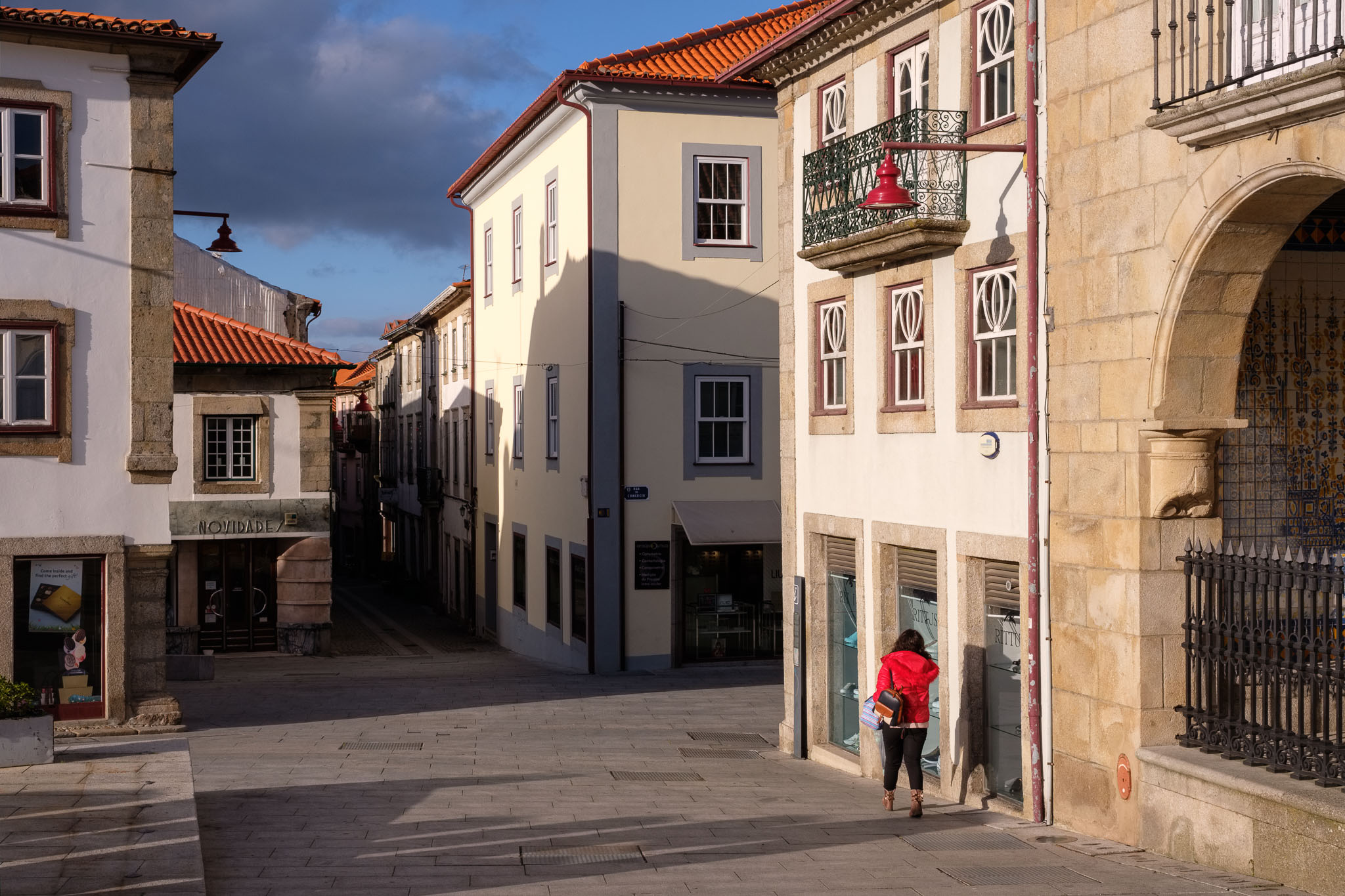
The rest of the drive was uneventful, and in the afternoon we visited Guarda, the highest city in Portugal, located at 1056 m of altitude. The city has a rich historical record, which is a result of human occupation since prehistoric times; Romans, Visigoths, Arabs, Jews, Christians, all have lived in these lands. It was in Guarda that the first literary text in Portuguese was written, in the year of 1189. Walking along its narrow medieval streets, one can feel history coming out of every granite block.
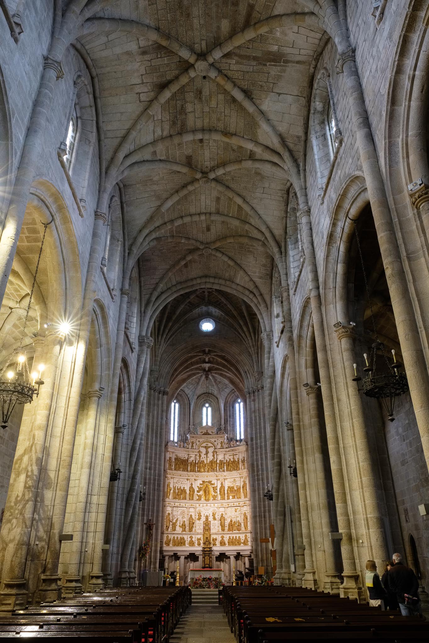
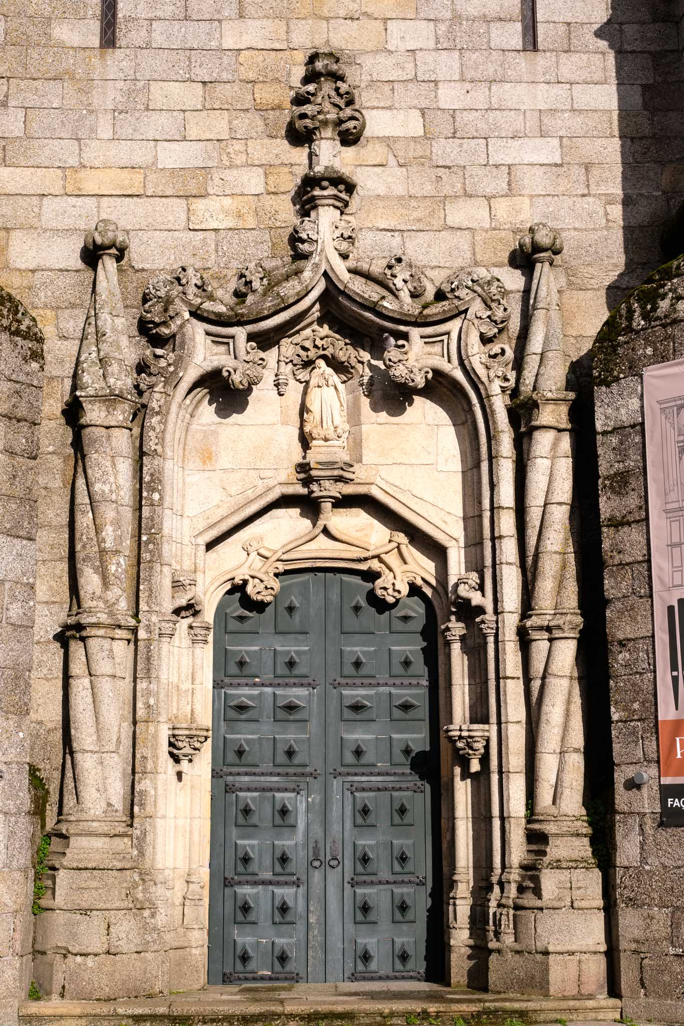
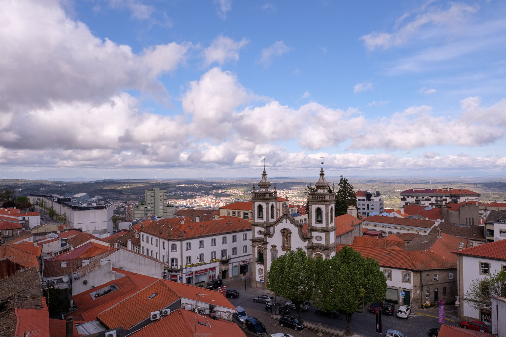
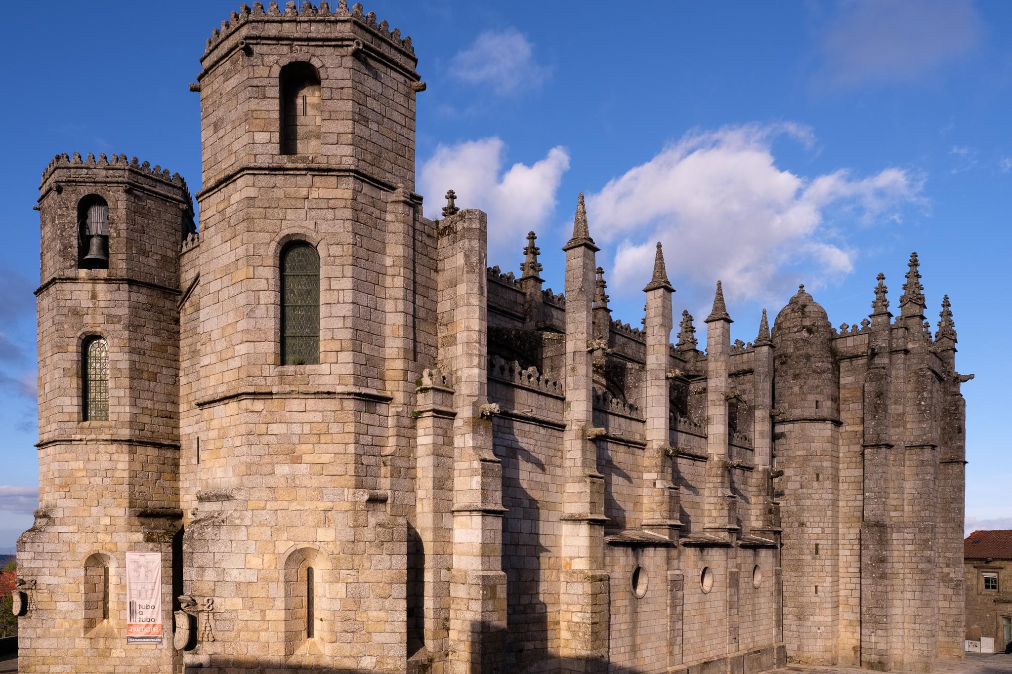
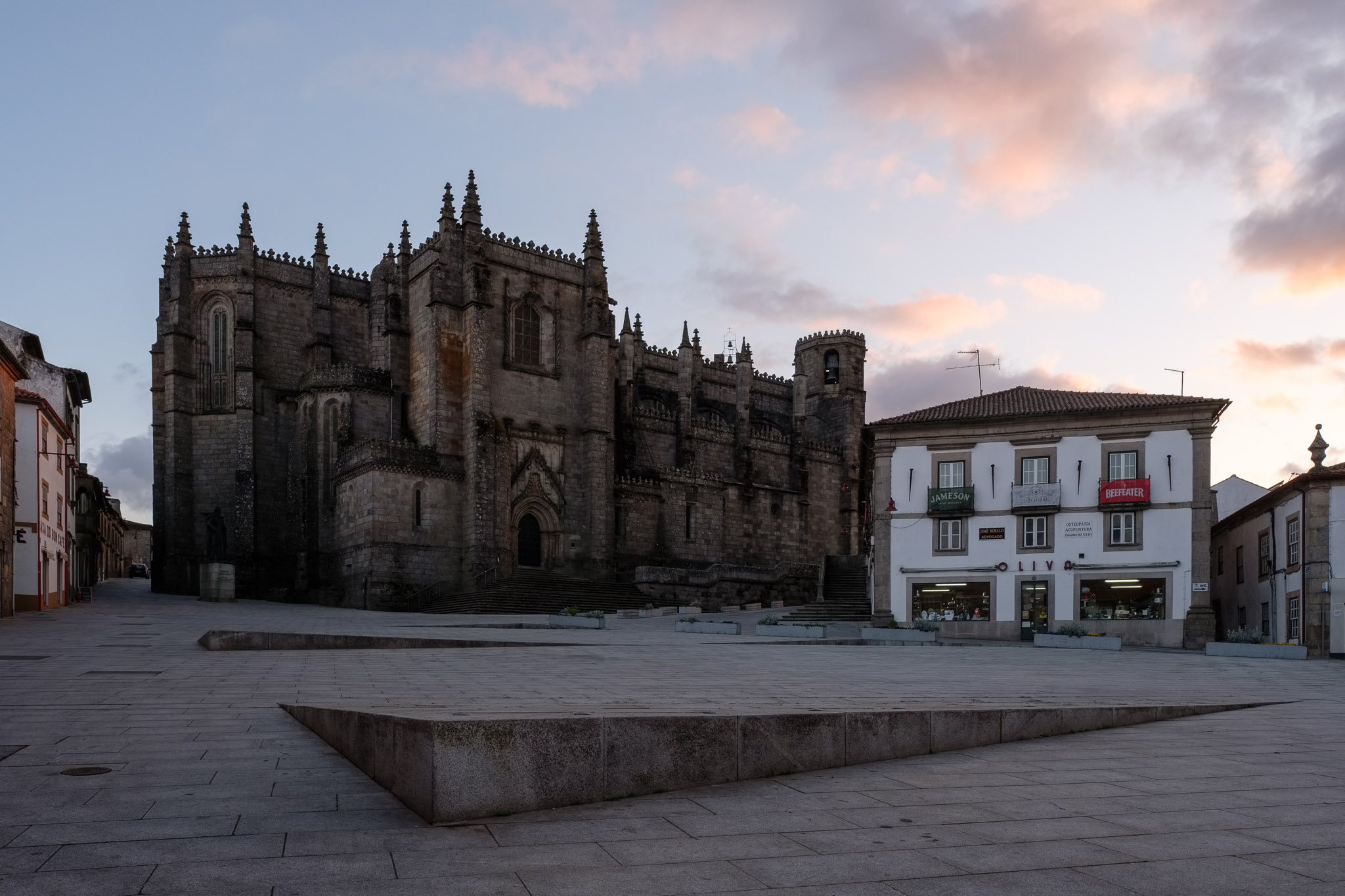
Nowhere else is this feeling stronger than in the imposing cathedral. Built between 1390 and 1540, it has been compared to a ship of granite, thanks to its impressive size and to the panoramic view from its terrace. From there, one feels like being on a ship, admiring the surrounding landscape. The thick granite walls and the size of the cathedral also speak about its protective role for the population. I recommend to visit the cathedral, to admire the magnificent architectural work; as I have mentioned already, you can also climb to the terrace to admire the views. The altarpiece was sculpted in 1553 and represents scenes from the Old and New Testaments.
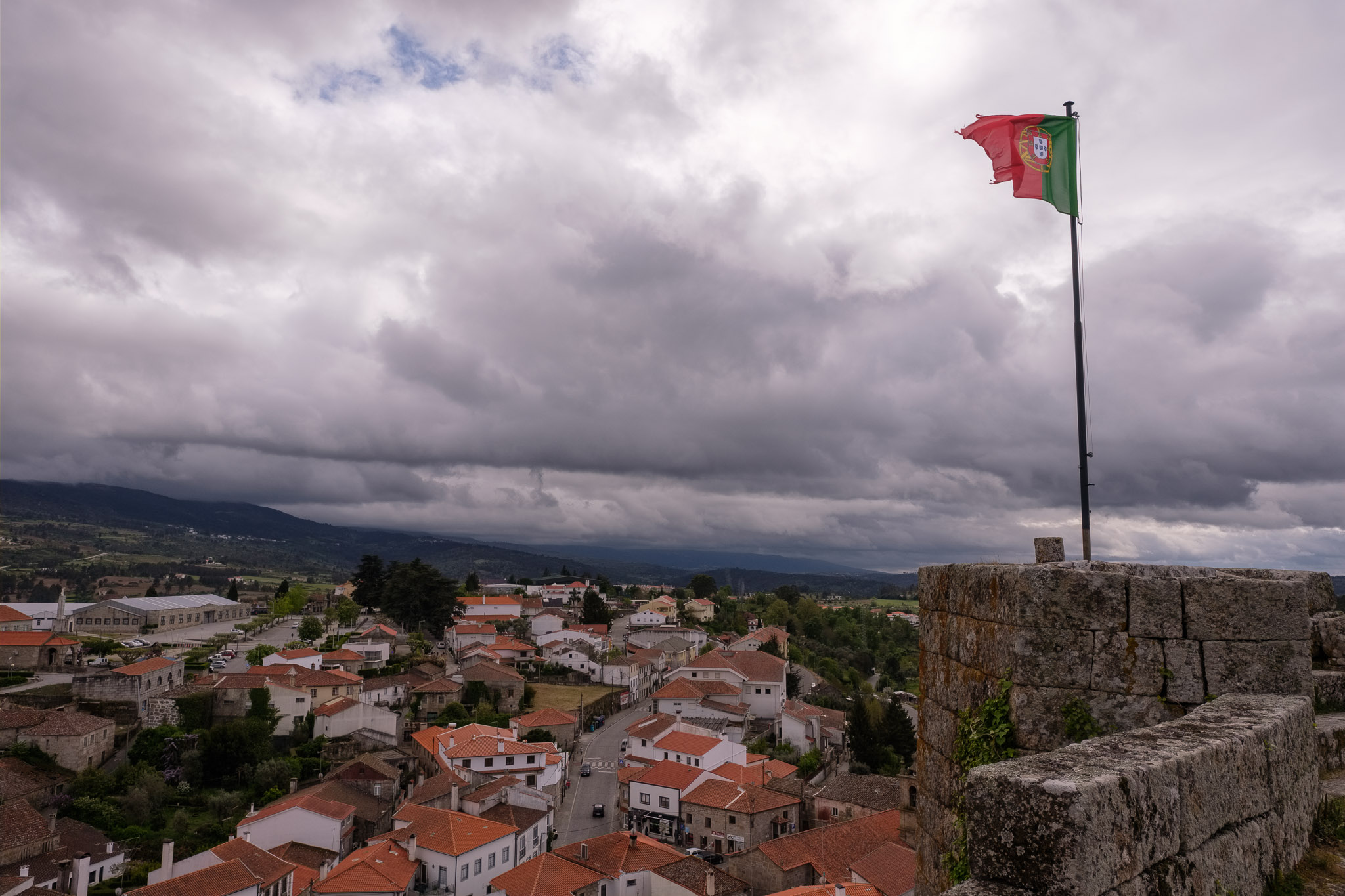
In the main square in front of the cathedral, there is a statue of Dom Sancho I, the second king of Portugal, who in 1199 gave the city its foral (charter). The presence of granite as a source of construction material is everywhere, and even today it is abundantly used. The wind is quite strong, and cold, so we look for a bit of respite in a nearby coffee, before continuing our walk. It is wonderful to simply walk around, experiencing the history that exudes from every corner. What follows is a selection of the many photos that I took in the city. For this trip I carried: Fujifilm X-T3 and X-T4; Fujinon 16mm f/1.4 and 33mm f/1.4 lenses; tripod.
Panorama of the Mondego river valley near Cavadoude, where our accommodation was located.Medieval streets in Guarda.Inside the cathedral. Historical center and surrounding landscape, seen from the cathedral’s terrace.View from the top of the Ferrarias tower, including the cathedral and the keep.View from the keep, with the cathedral in front and Spain in the horizon.A bit of sunshine in the main square.Main square.Detail of one of the cathedral’s doors.Detail in the cathedral’s wall.Main square.Church of Misericórdia.The cathedral, like a granite fortress.Cathedral at sunset. The light was low so I had to use the tripod.
At the end of the day we had dinner in Guarda, tasting some of the famous regional culinary dishes. A great way to finish our first day in the region.