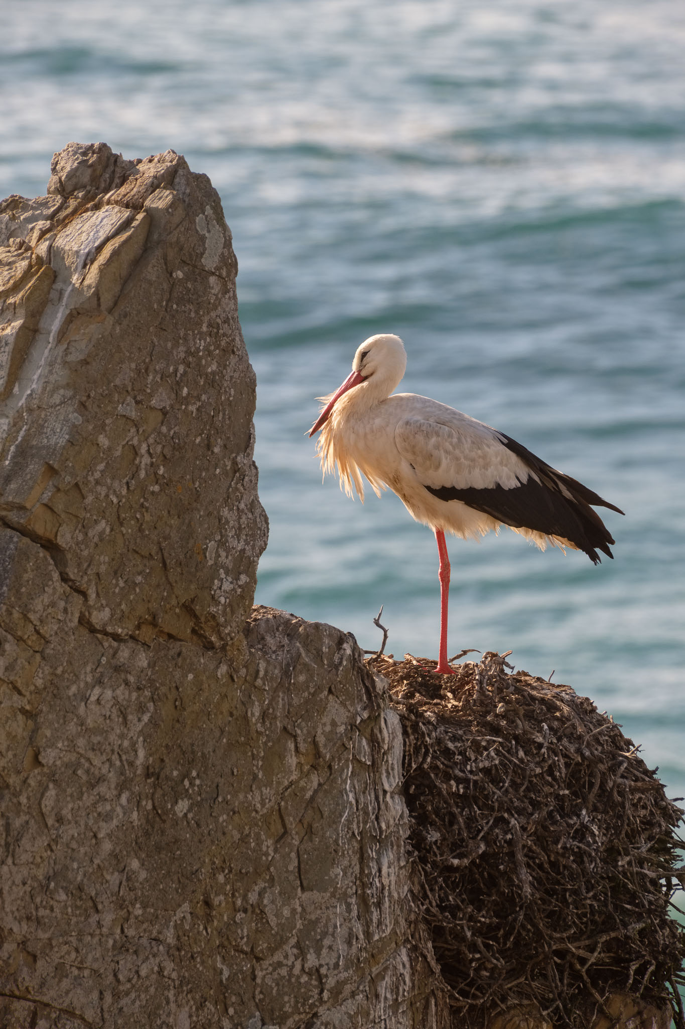
Every year I do my best to photograph this unique species of birds. Like them, I return seasonally to this location in the beginning of Spring. That is when they come back to nest in the coastal cliffs and sea stacks, the only species of white stork in the world that does that. The last time I visited the location in the early morning, in May 2022, and I wrote about the experience here:
This time I went to Cabo Sardão during the late afternoon, and I was happy to see that the nests were occupied. There is a small bay in front of the lighthouse, where several species of birds can be seen; besides the white storks, there are cormorants, and even a couple of peregrine falcons (these are more elusive). Plus, of course, lots of seagulls.
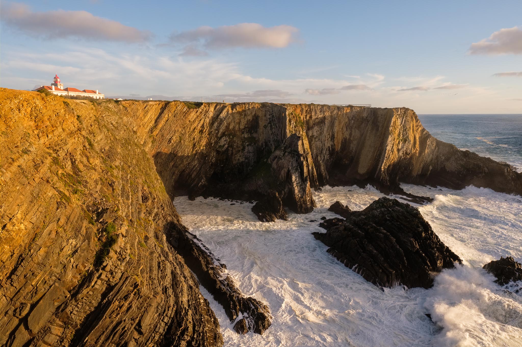
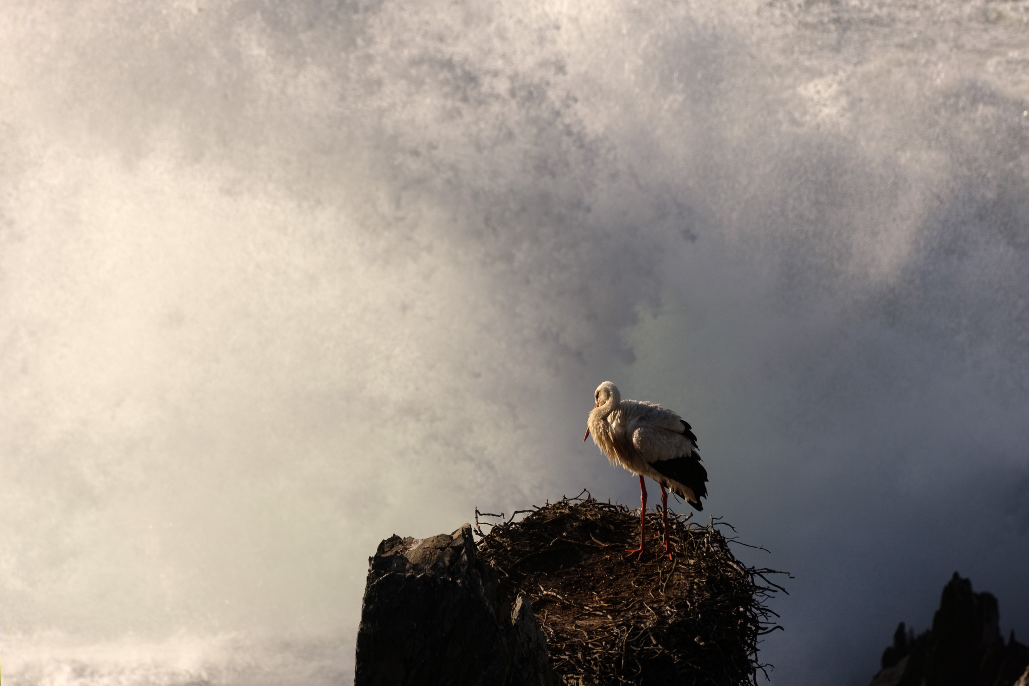
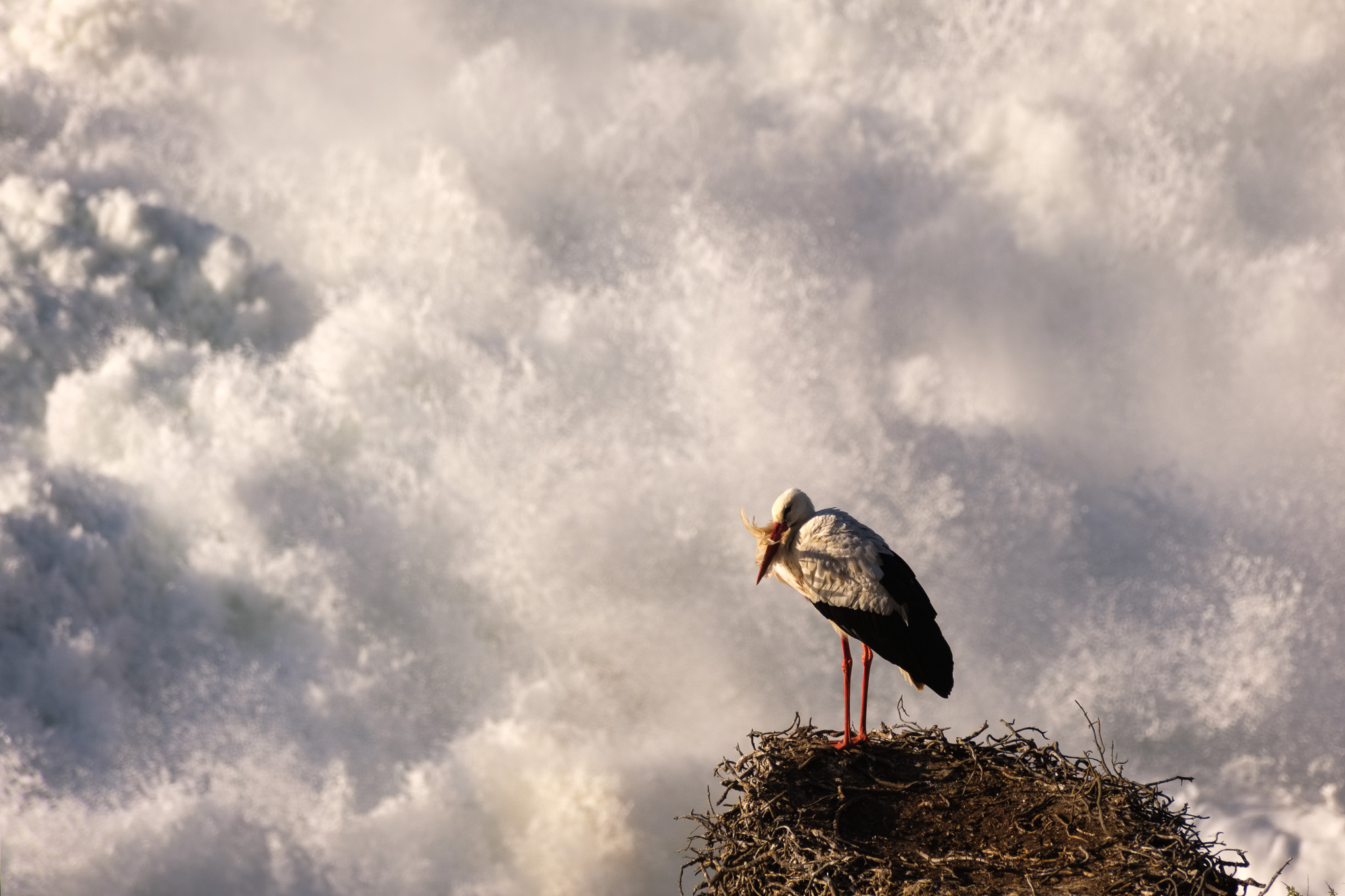
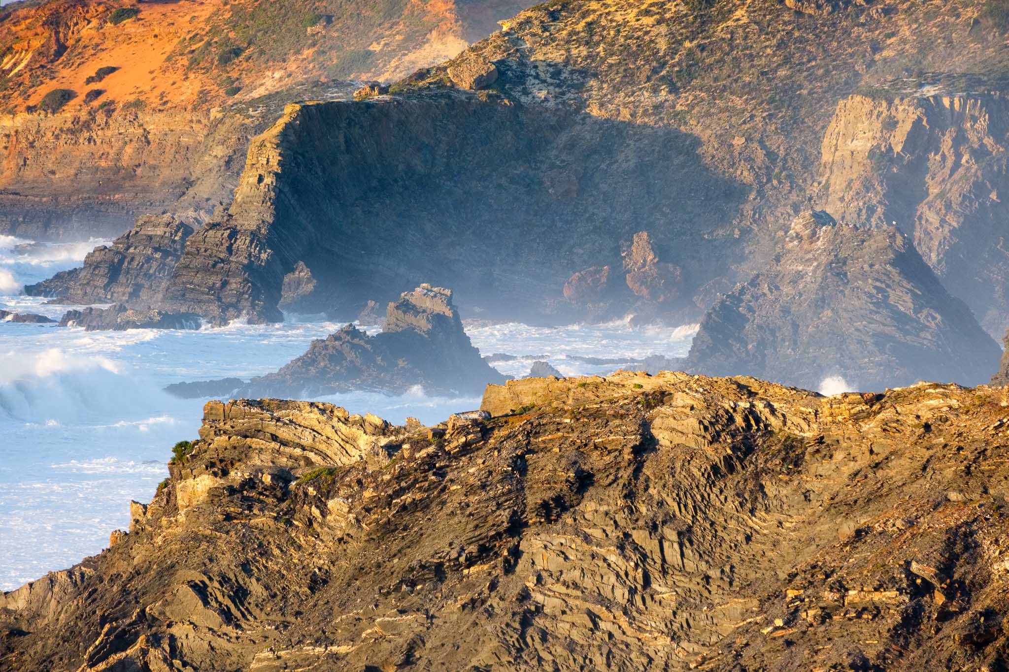
Cabo Sardão at sunset. The sea stack in the middle of the photo is home to three stork nests.
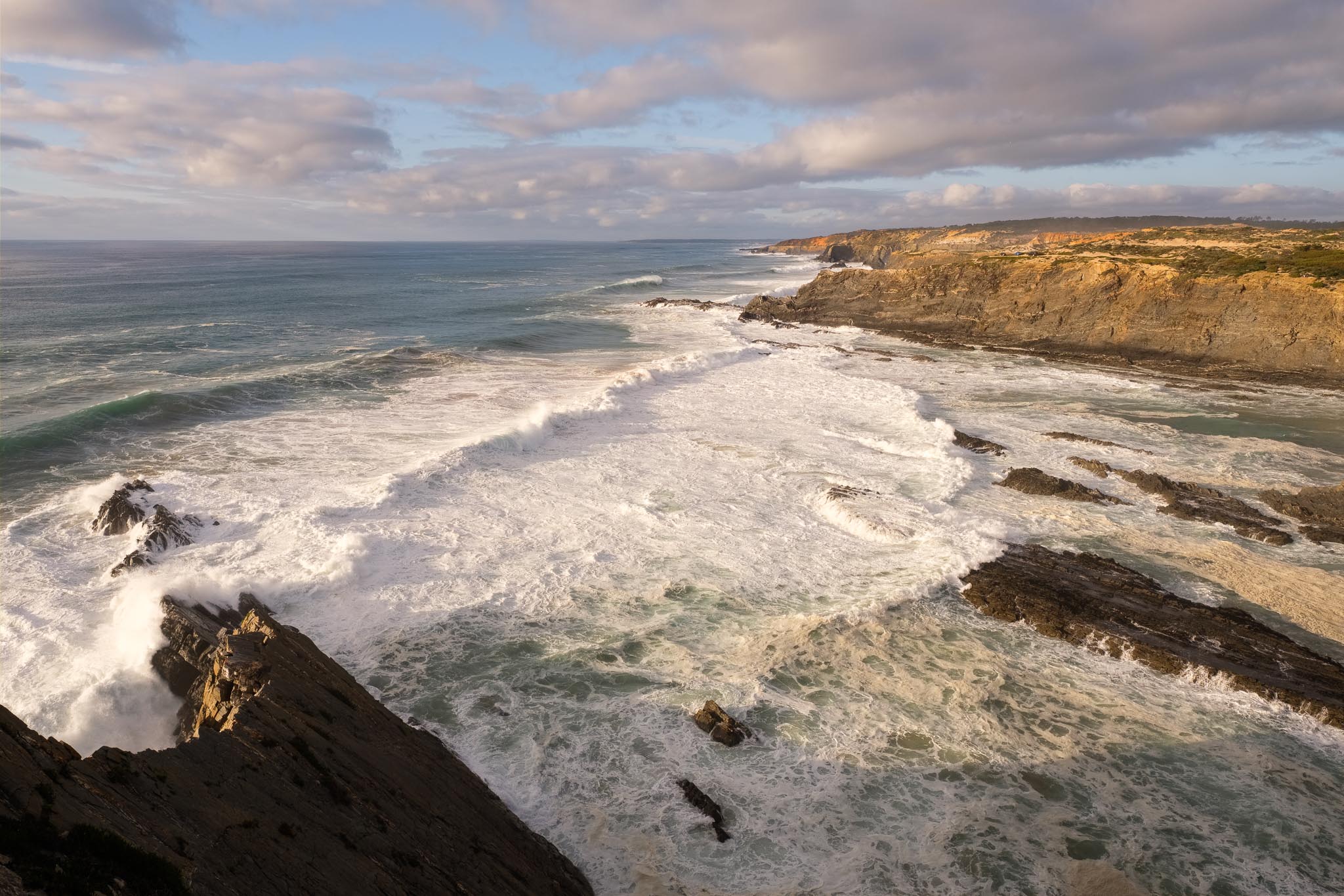
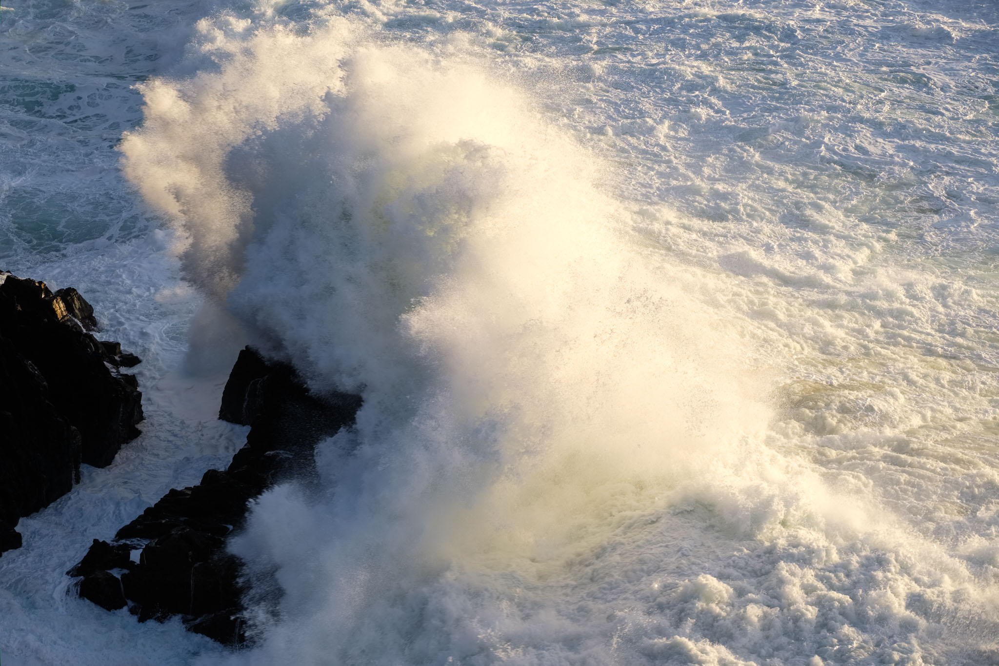
The afternoon was nice, with sunshine and some clouds. The wind was weak, which is unusual for this area, but the sea was very rough, with large waves. It was the first day of Spring, which is the equinox, so the tides were strong.
Rough seas during the Spring equinox.
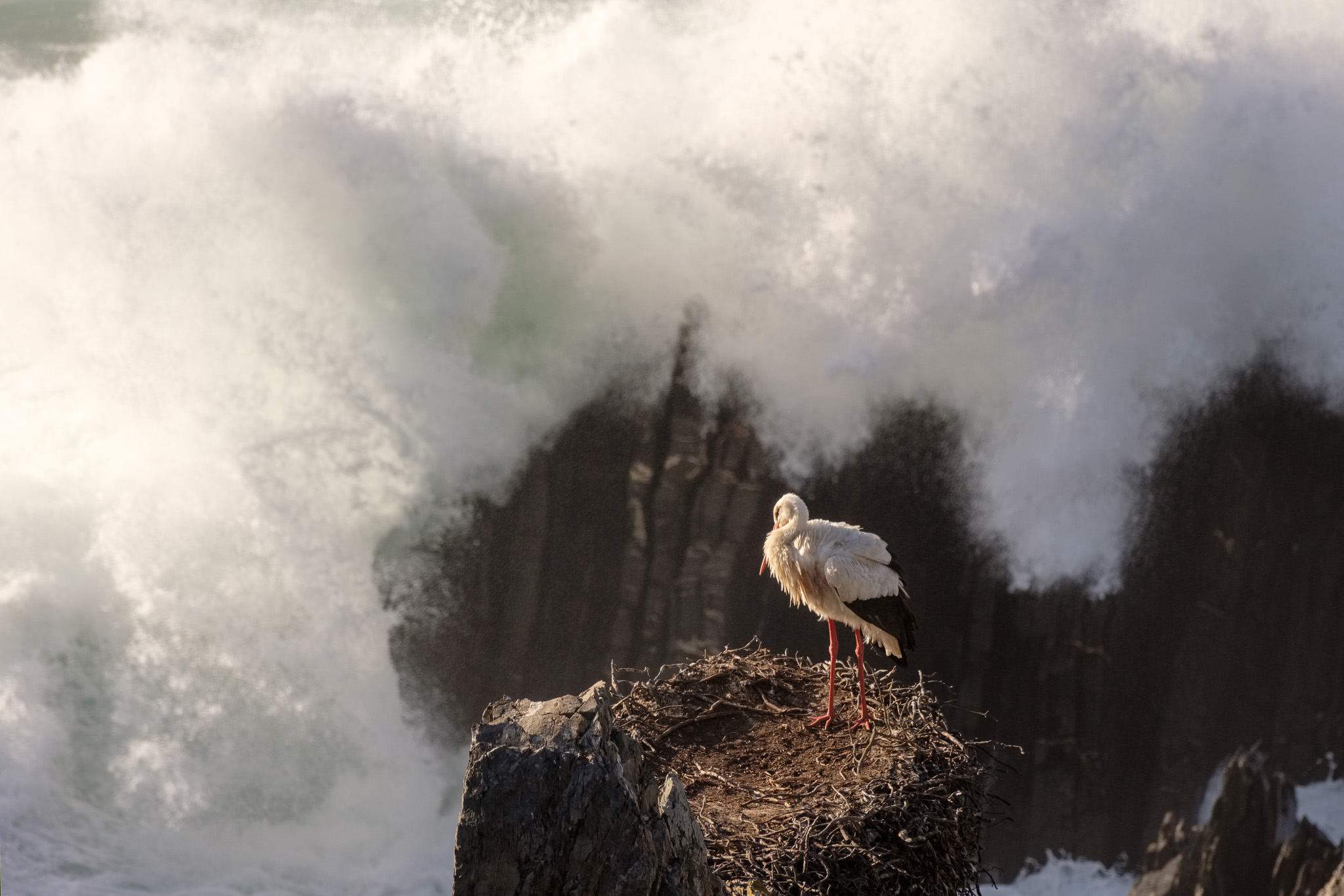
I used my Fujinon 70-300mm zoom lens and the Fujifilm X-T4 camera for the bird photos. Walking around the cliff edge along the bay, it is possible to get some nice vantage points looking down, from where to photograph the nests. The conditions were good, and compared to previous visits, the rough sea and crashing waves provided some different and really interesting backgrounds. These convey the difficult conditions these birds endure, because the nests were being hit by sea spray; I was further up from the sea and I was being hit by sea spray.
One of the couples of storks was busy ensuring the next generation will be born soon. This was an endearing moment and the first time I have witnessed this behavior. Maybe next month the little ones will be in their nests.
Intimacy.Intimacy.Force of nature.Waves.
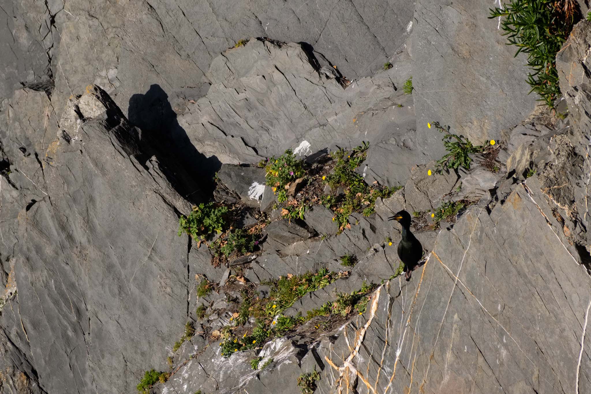
If you have them, take a pair of binoculars to scout the cliffs. That was how I managed to spot a small cormorant on the cliff’s face.
Cormorant.
I spend the rest of the time until sunset watching these wonderful birds, and I hope to go back in April to check on the new babies. It is a great time to visit these shores.
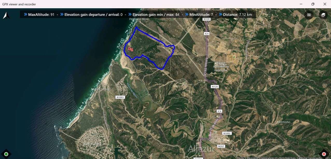
With the end of the trail season approaching (the temperature is increasing with the beginning of Spring), last week I have walked a short circular route near Amoreira beach, Aljezur. The map is shown below.
Map of route 16 of the Rota Vicentina (in blue).
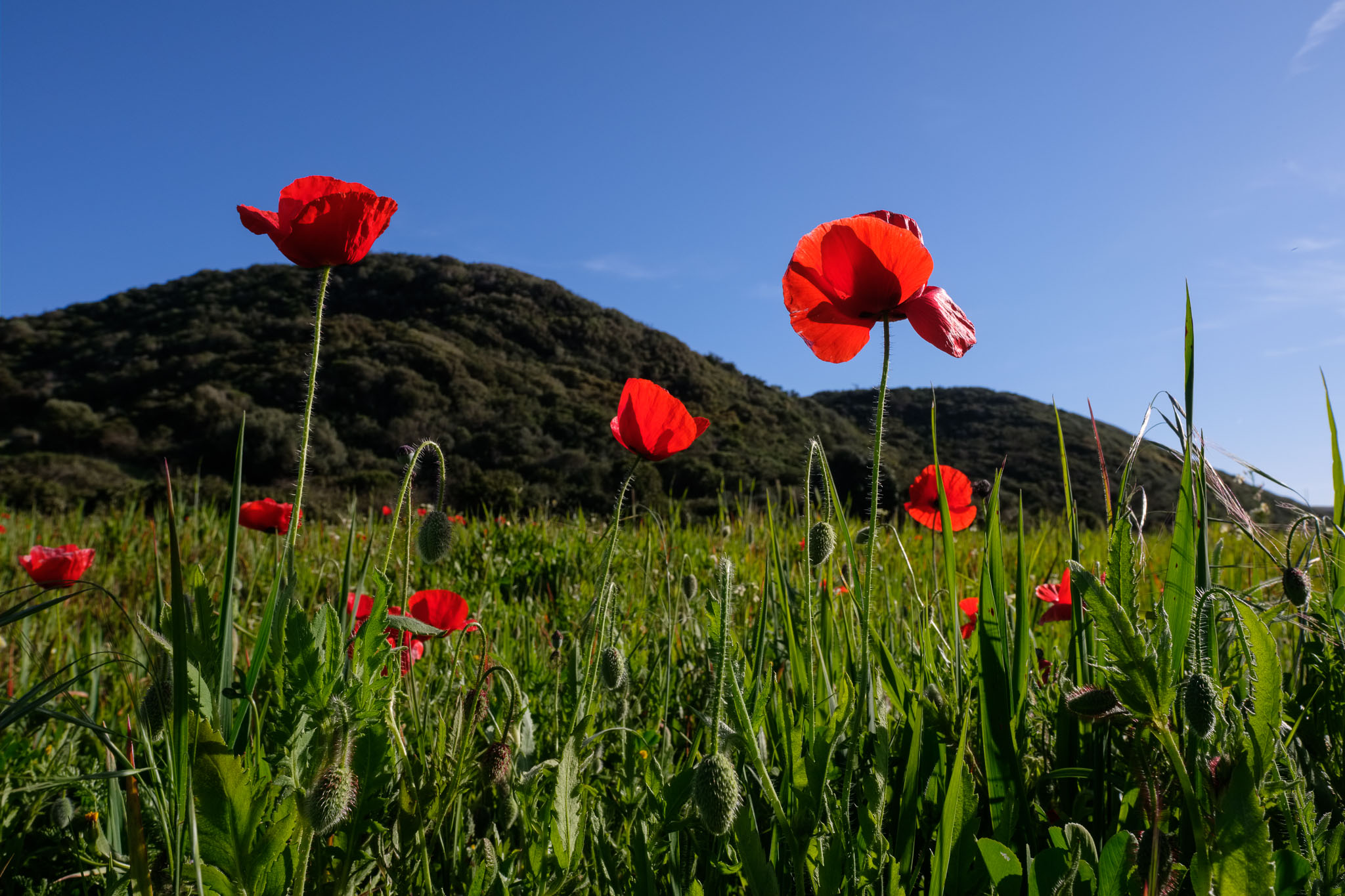
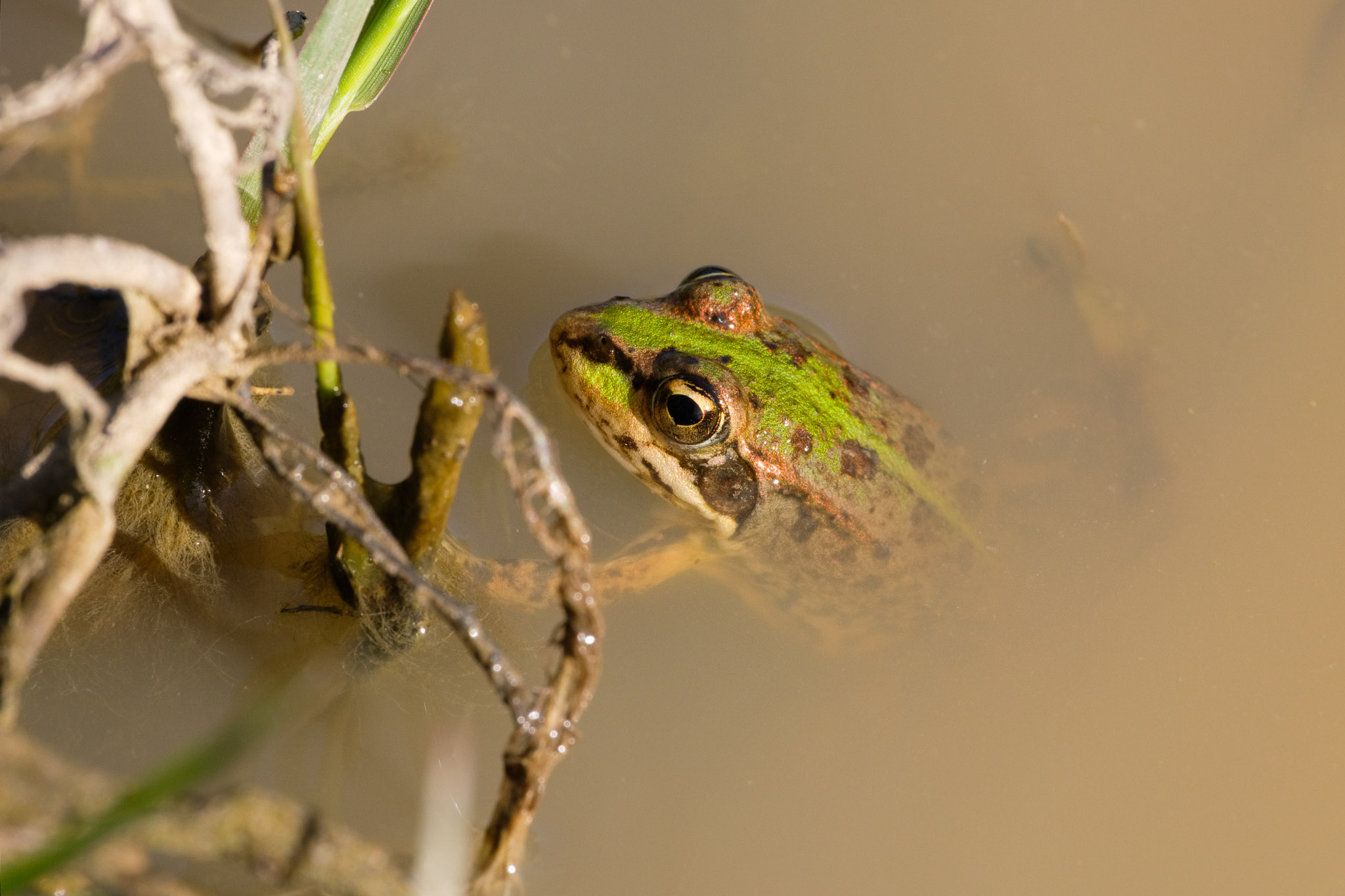
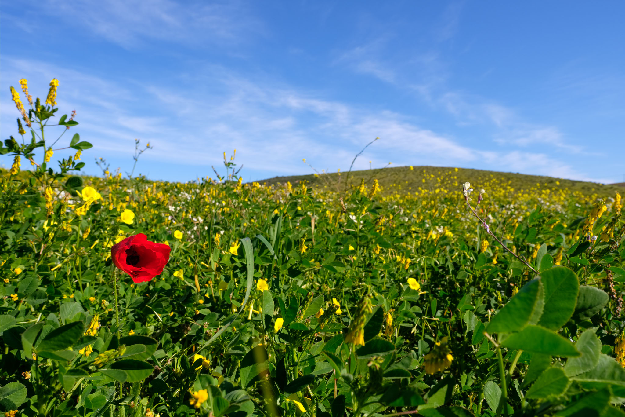
This is a short (7 km) and easy walking path that starts in Amoreira beach, at the mouth of the Aljezur brook. From the beach, the trail heads to the interior, crossing a small valley before climbing to the top of the plateau. I stopped in the valley to photograph the numerous red poppies, which add a colorful touch to the landscape. I also found a small frog in a nearby pond.
Spring landscape.Poppy.Small frog in pond.Green valley.
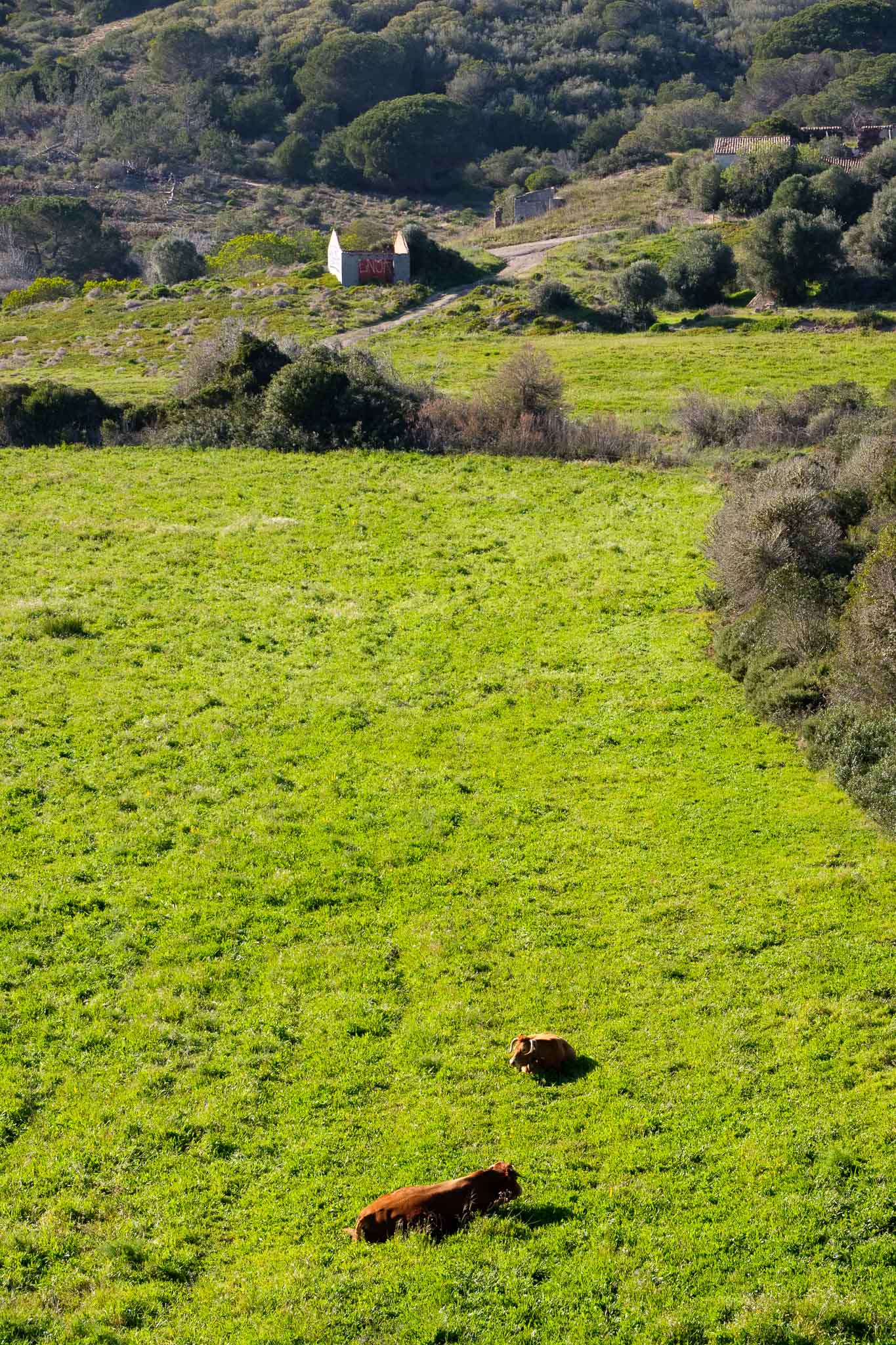
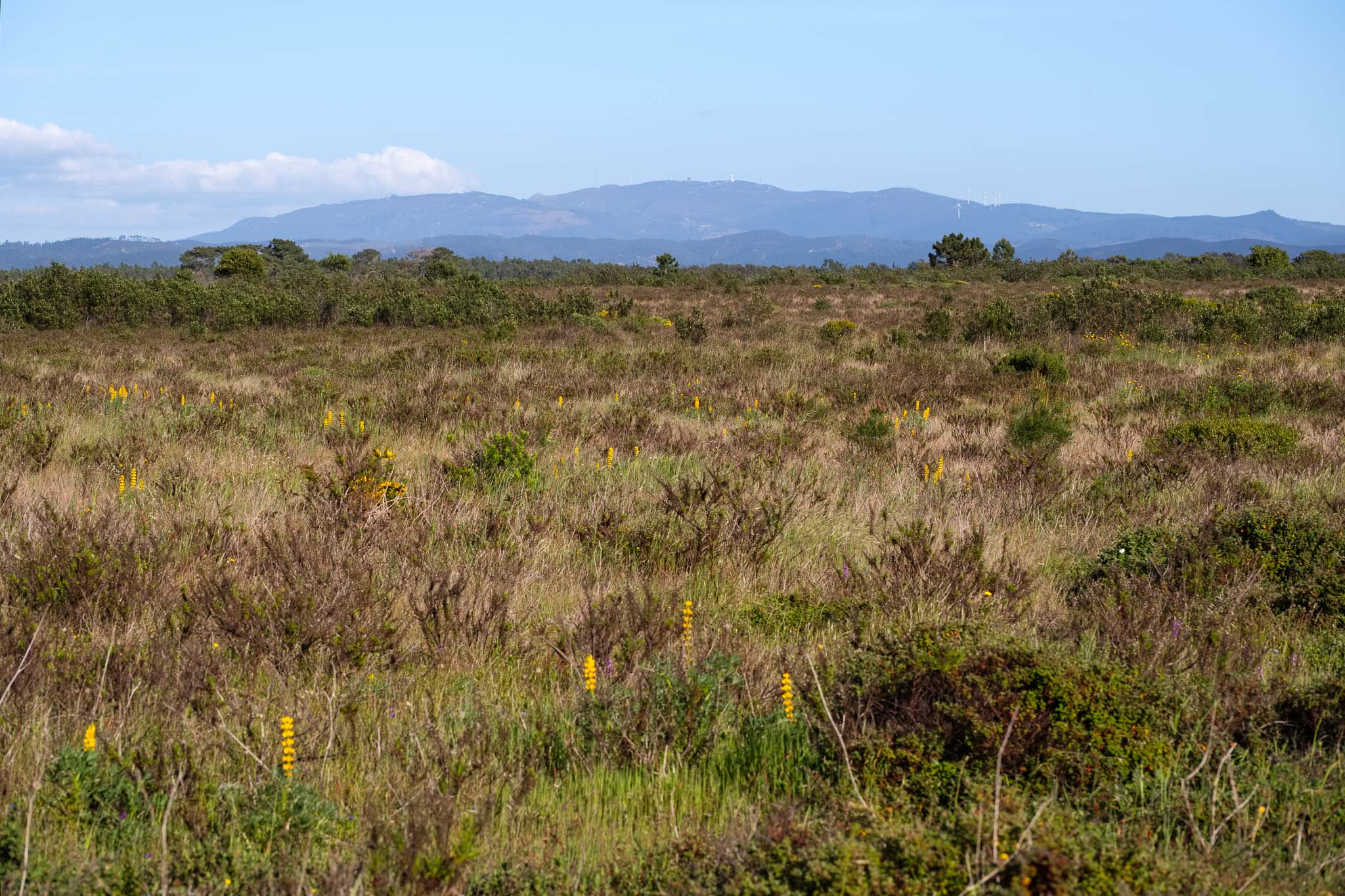
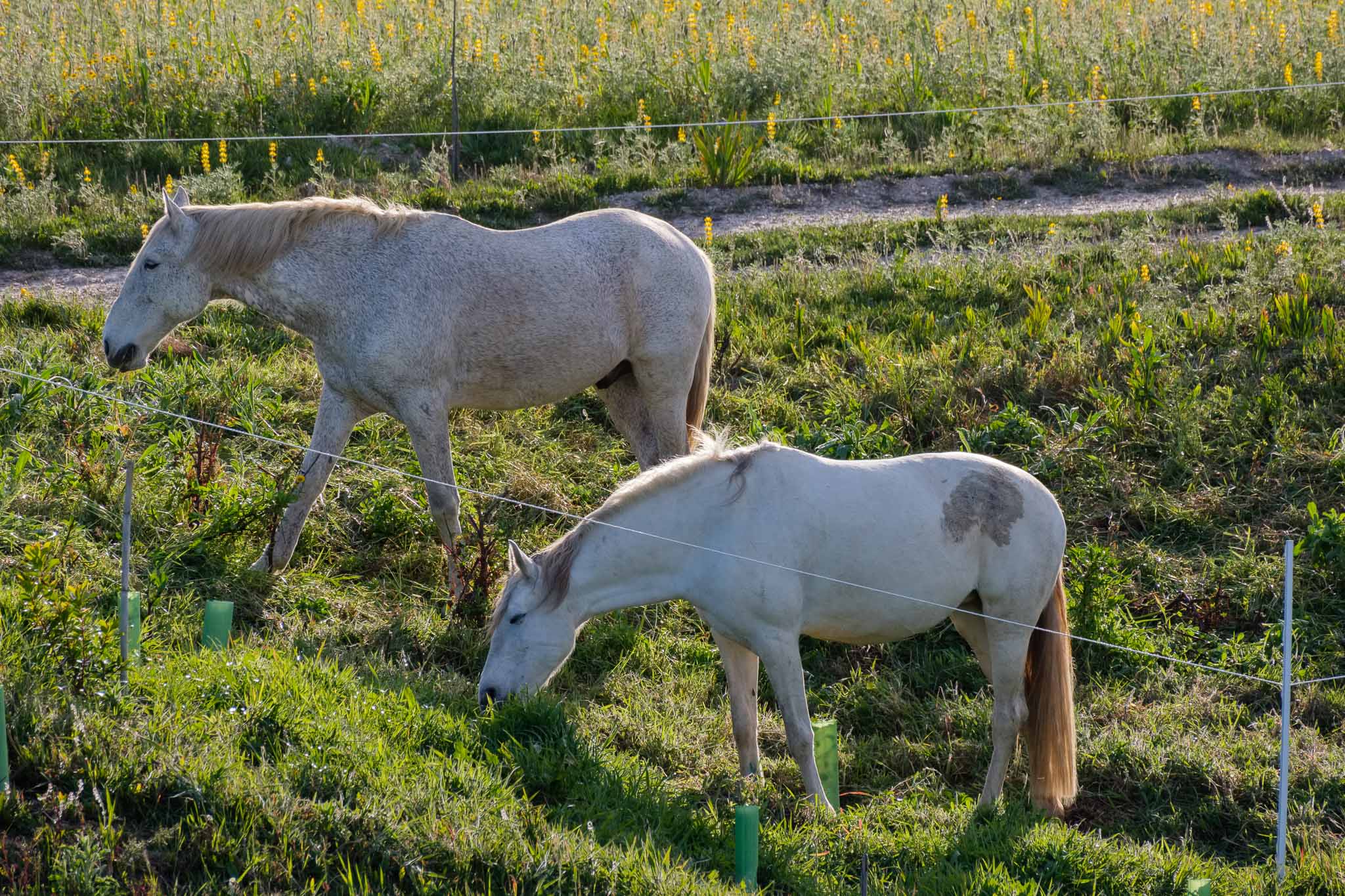
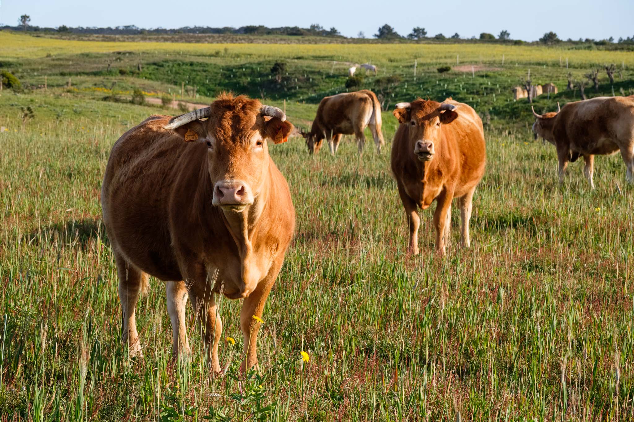
After a couple of kilometers, the trail starts to cross the plateau, which is dominated by small brushes and pine trees. Here and there, a few farms dot the landscape, with cultivated fields and grazing animals.
Plateau and Monchique in the distance.Grazing horses along the way.Some cows.
Roughly mid way in the trail, the path turns and heads back to the coast; now the sand dunes prevail, with pine forests and shrubs. During springtime, several typical flowers are in bloom, and I stop to photograph them, using a close-up diopter filter in the telephoto zoom lens.
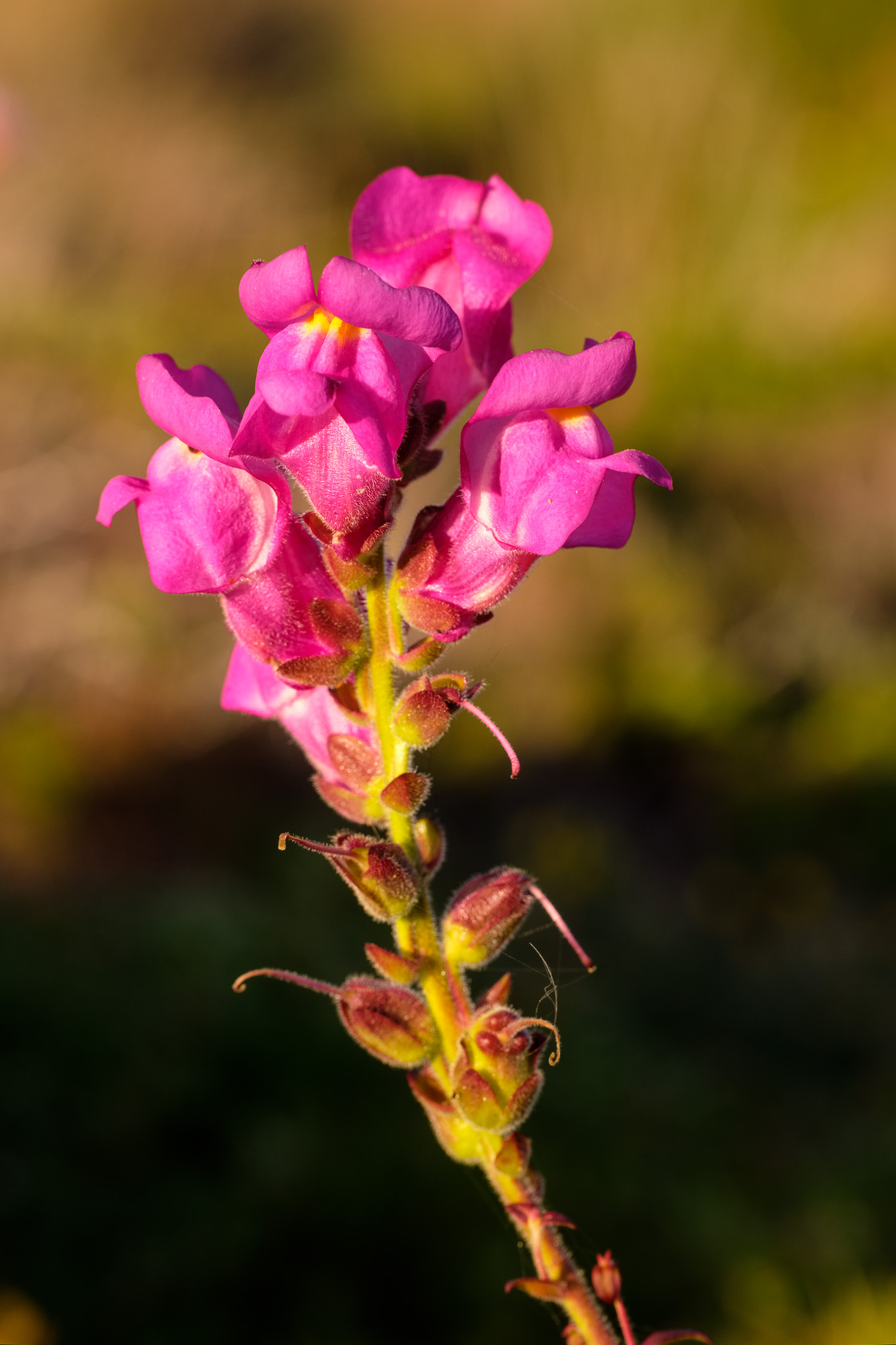
Three-leaved Snowflake.Snapdragon.
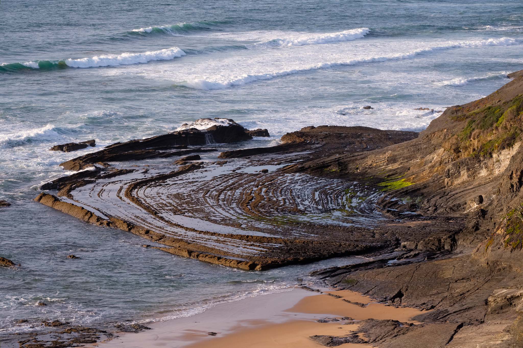
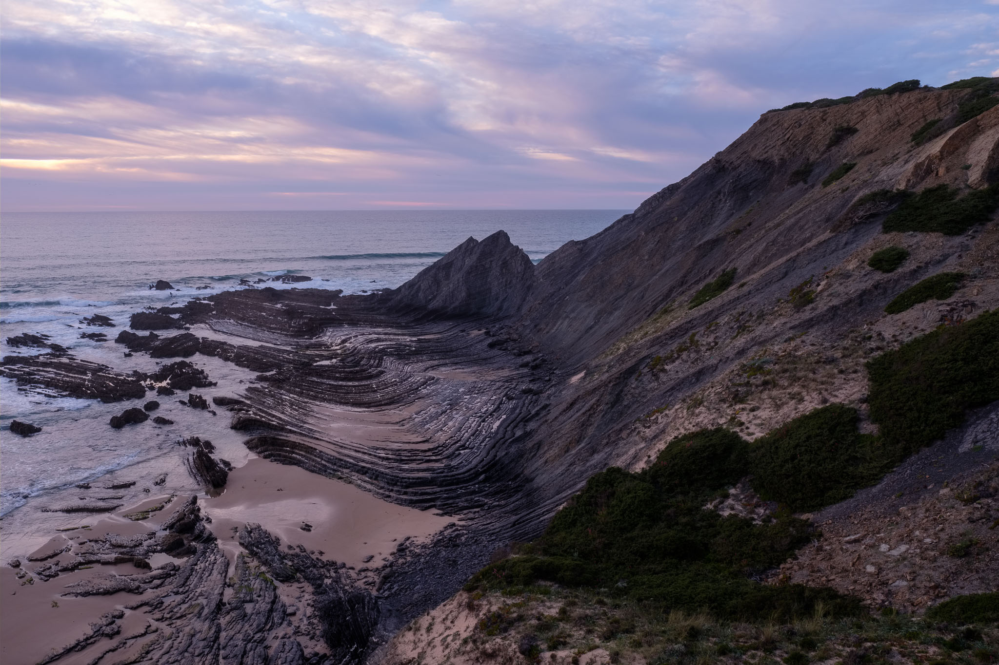
After reaching the coast, I highly recommend to make a small detour to visit the beautiful Carriagem beach. I was short on time, because sunset was approaching fast, but I could not resist making a few photos. During low tide, the erosional patterns on the rock formations resemble plowed furrows. They are the result of the water cutting horizontally through the folded layers of rock, exposing their internal geometric pattern.
Carriagem beach.Carriagem beach, with its famous eroded rock formations.
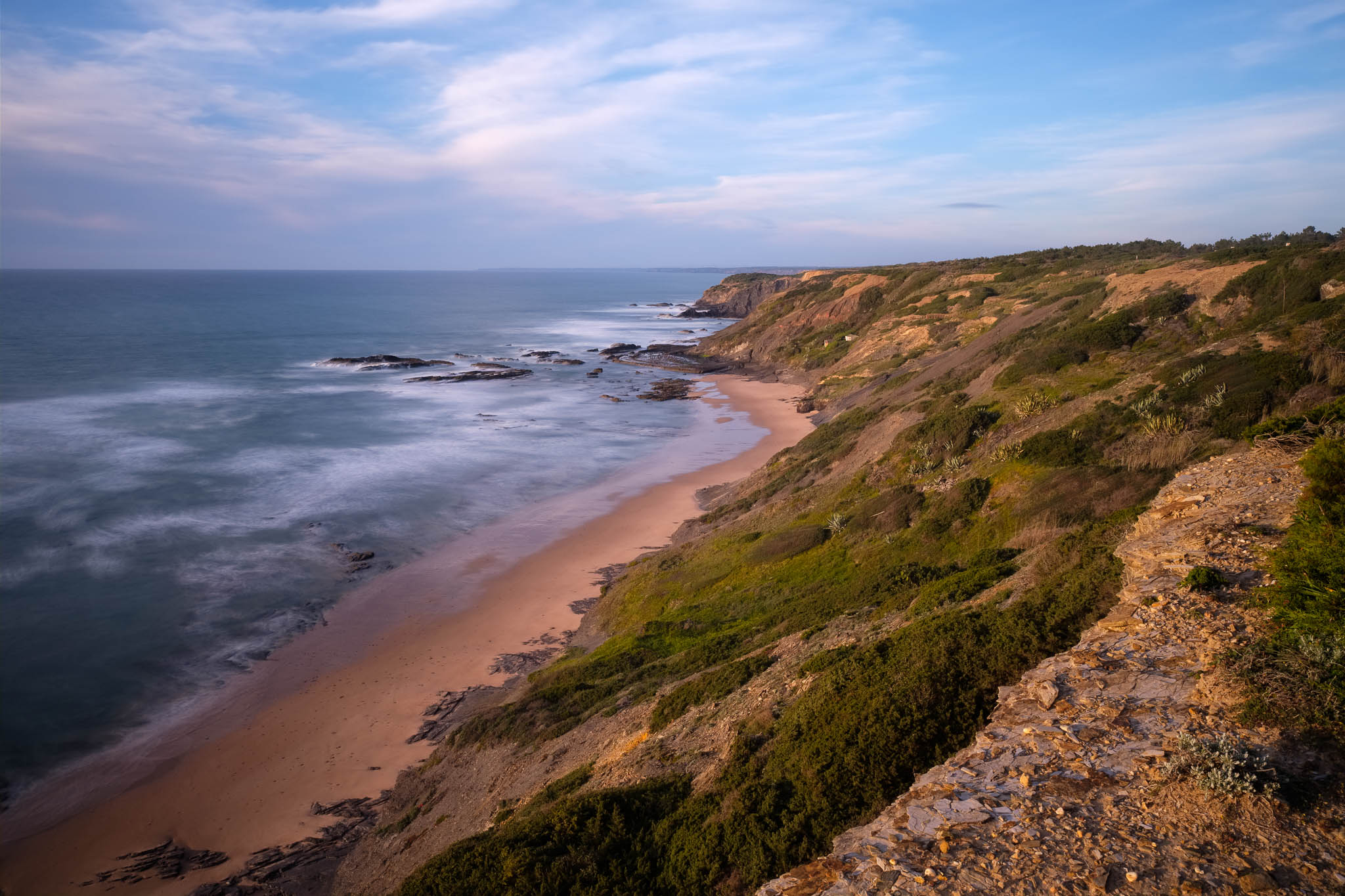
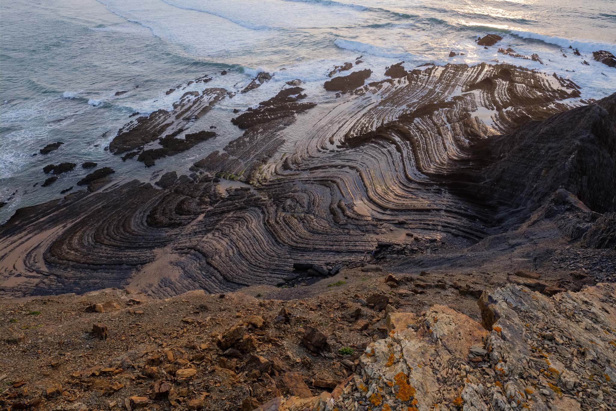
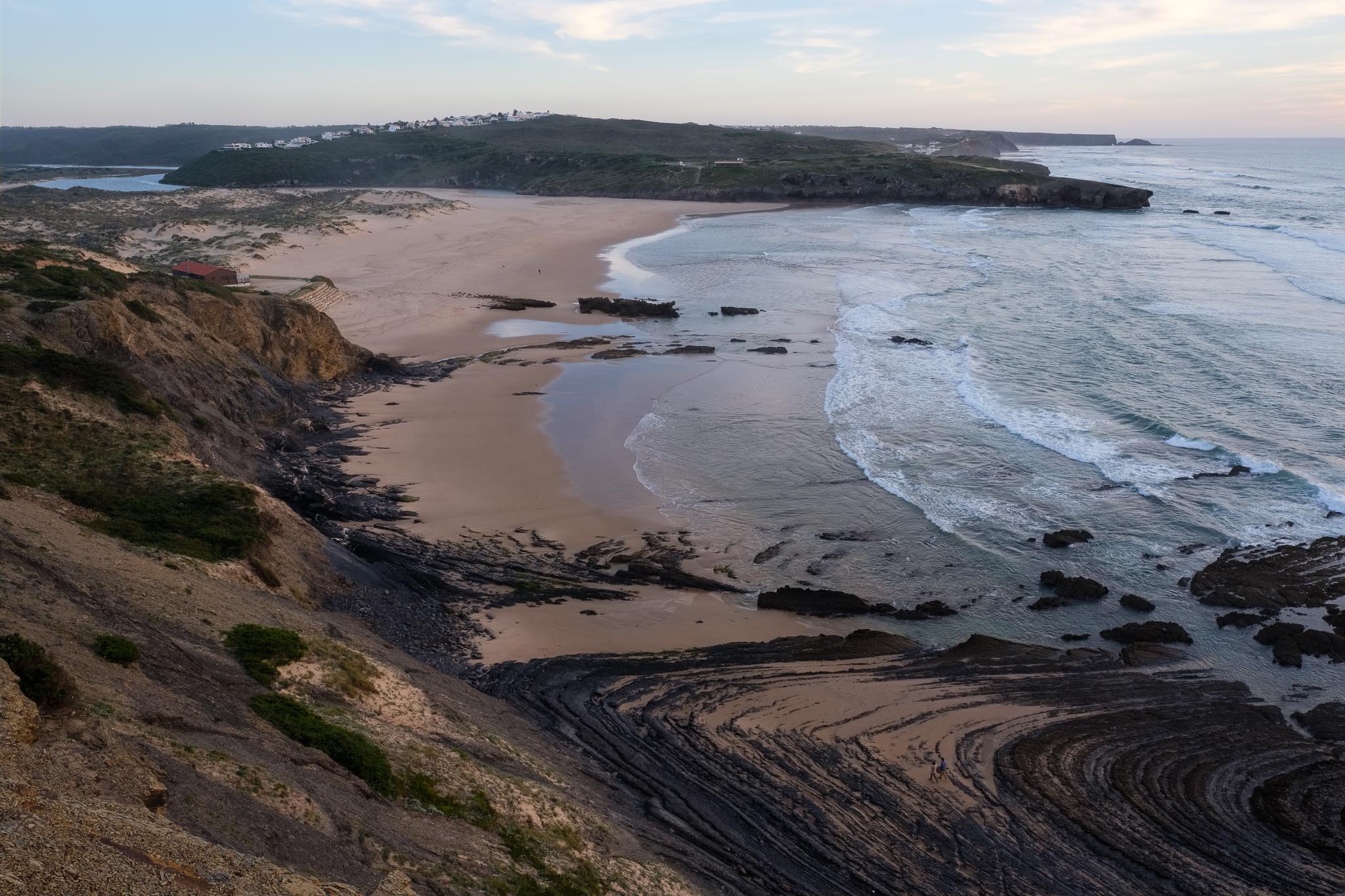
From Carriagem it is only a short walk back to Amoreira, where this particular erosion effect is also present. It really adds a special interest to the landscape. the sun had barely set behind the clouds, resulting in a soft light that was adequate to photograph these dark rock formations.
Erosional pattern seen from above.Amoreira beach, with its wonderful rock outcrops.General view of Amoreira beach.
Even though this is a short route, there are may interesting things to see, as the path crosses different ecosystems and landscapes, including the rural interior and the coastal environments. It was the first time I walked this trail, and I am sure I will go back. In terms of photo gear, as usual I carried two cameras (Fuji’s X-T3 and X-T4) and two lenses (Fujinon’s 16mm f/1.4 and 70-300mm f/4.5-f/5.6), plus the tripod.
During the first quarter of 2023, I have walked several trails of the Rota Vicentina, which is a vast network of walking and cycling paths located in the Southwest Alentejo and Vicentina Coast Natural Park. I normally walk in the circular routes because the logistics are easier. However, there are a few non-circular routes that I wanted to walk, notably the one between the villages of Vila do Bispo and Sagres, in the Algarve region of the park. Throughout the years I have visited this area a few times, in particular some beautiful locations such as the lighthouse in São Vicente, and the beaches of Telheiro and Ponta Ruiva. As such, I wanted to go back this year and walk the complete trail, not only parts of it.
This corresponds to route TP-09, which is stage 9 of the Trilho dos Pescadores, or Fishermen’s Trail. The latter is a long 180 km route that follows along this entire coast, roughly between Sines and Sagres. The map below shows only the path for stage 9.
Map of route TP-09 of the fishermen’s trail of the Rota Vicentina.
I chose to start the walk in Vila do Bispo, where I left my car. There is a regular bus service between Sagres and Vila do Bispo, or taxi services, to return. There are more buses during school days compared to weekends, so I recommend you do a bit of research beforehand. At the end of the day, it works alright.
The weather forecast for the day was sunny and mild, which was perfect for a long walk. Spring has arrived in full force, coloring the landscape with many flowers. In fact, one of my interests in this walk was to spend some time searching and photographing several species of flowers that are typical of this region. For such, I had with me an old high quality close-up filter (or diopter lens) to mount on my Fujinon 70-300mm lens; this combination is very good for near macro photography, and I got nice images.
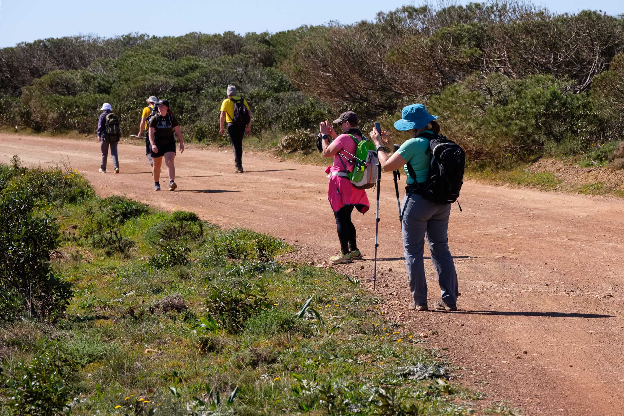
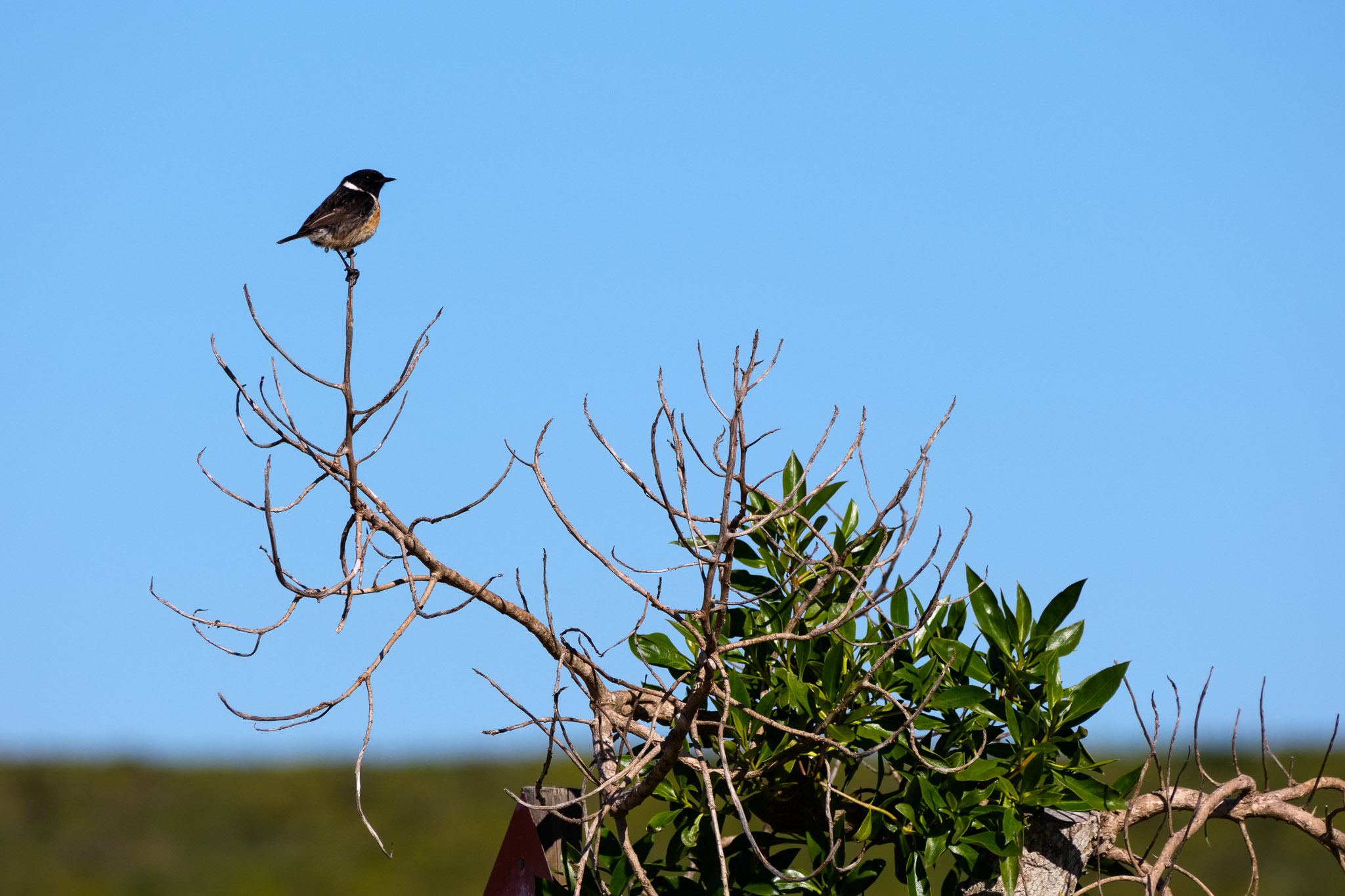
Leaving Vila do Bispo, the path heads directly to the coast, climbing gently until it reaches the coastal plateau. Along the way, some red poppies start to appear in the countryside. It is an easy going and enjoyable walk, and also quite popular, judging by the number of people on the trail. Indeed, when I walk in the interior routes, I normally don’t see anybody, but here that is not the case. Nevertheless, the only sounds I hear are the strong wind and the chirping of small birds.
Countryside near Vila do Bispo.The trail to Sagres.Popular trail.Small bird.
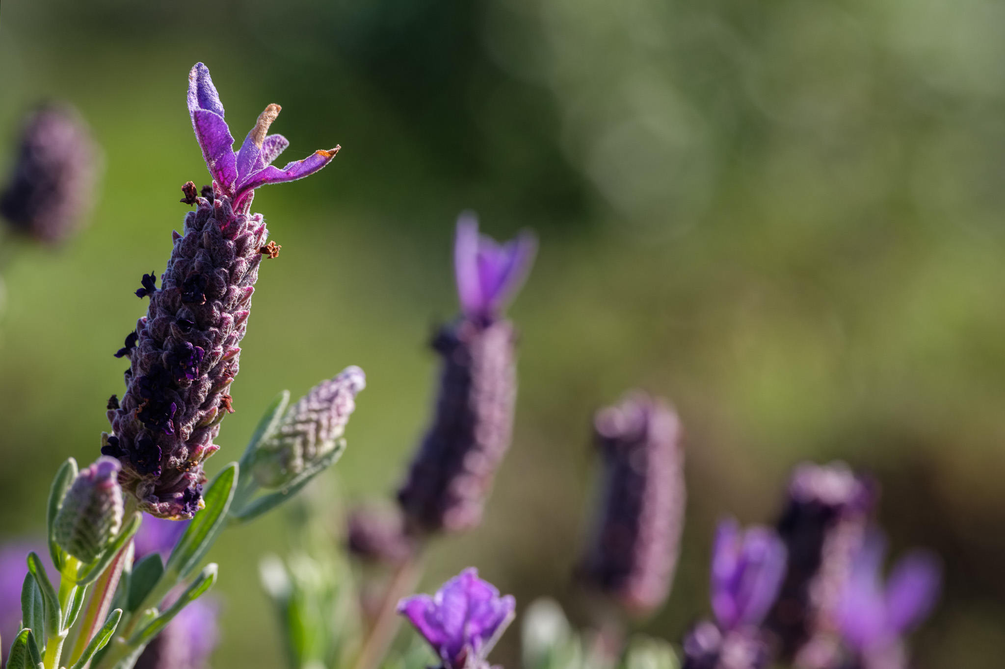
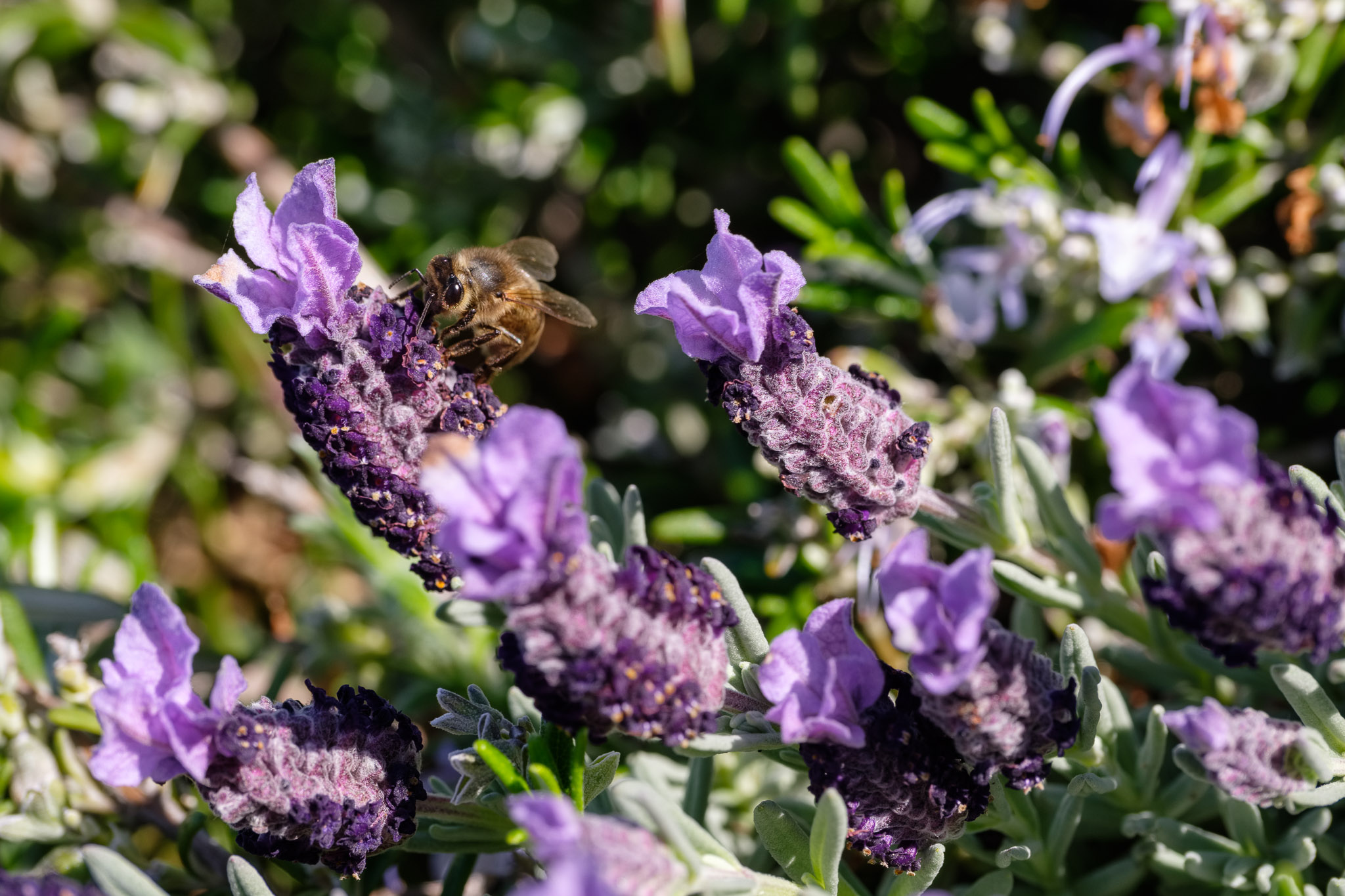
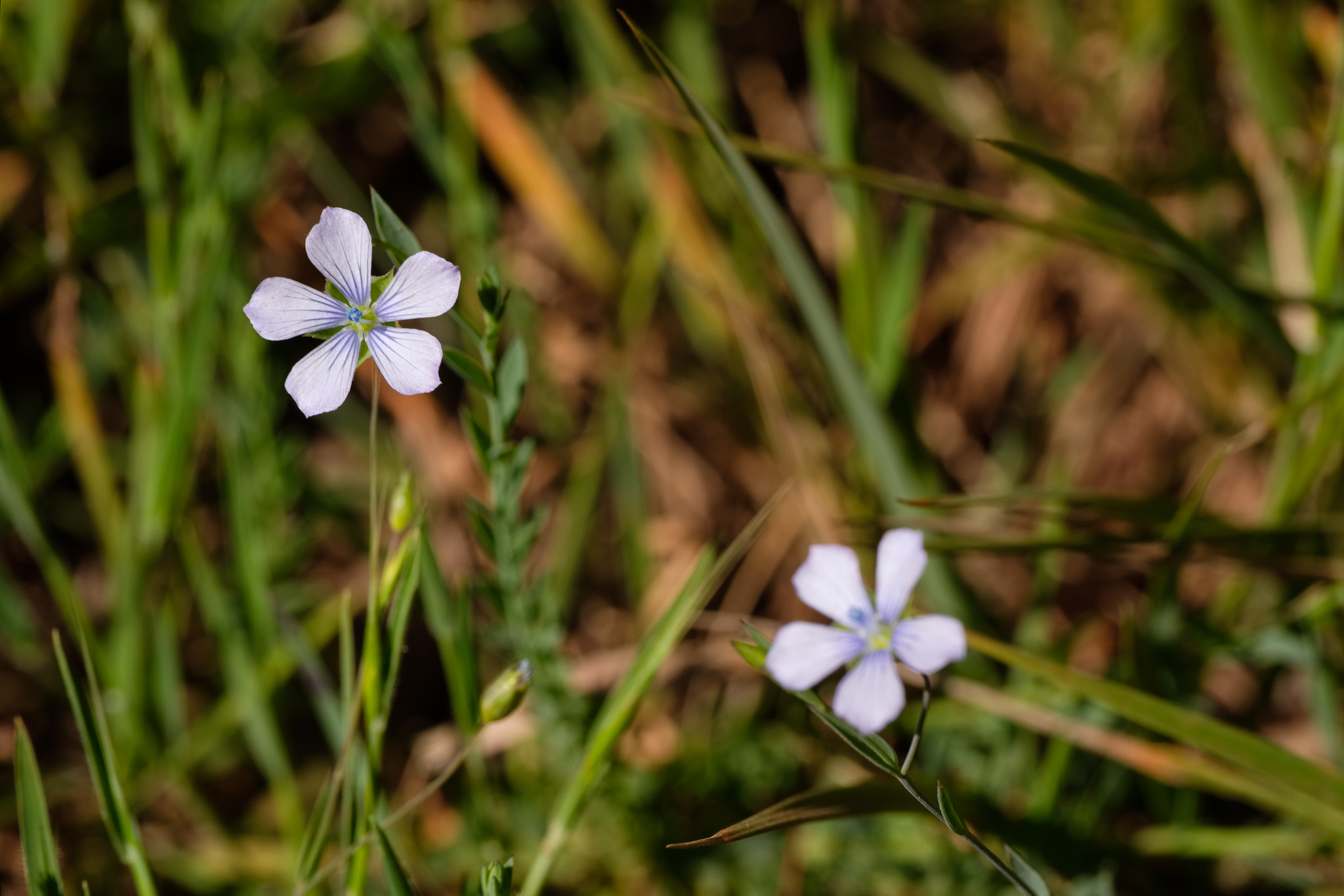
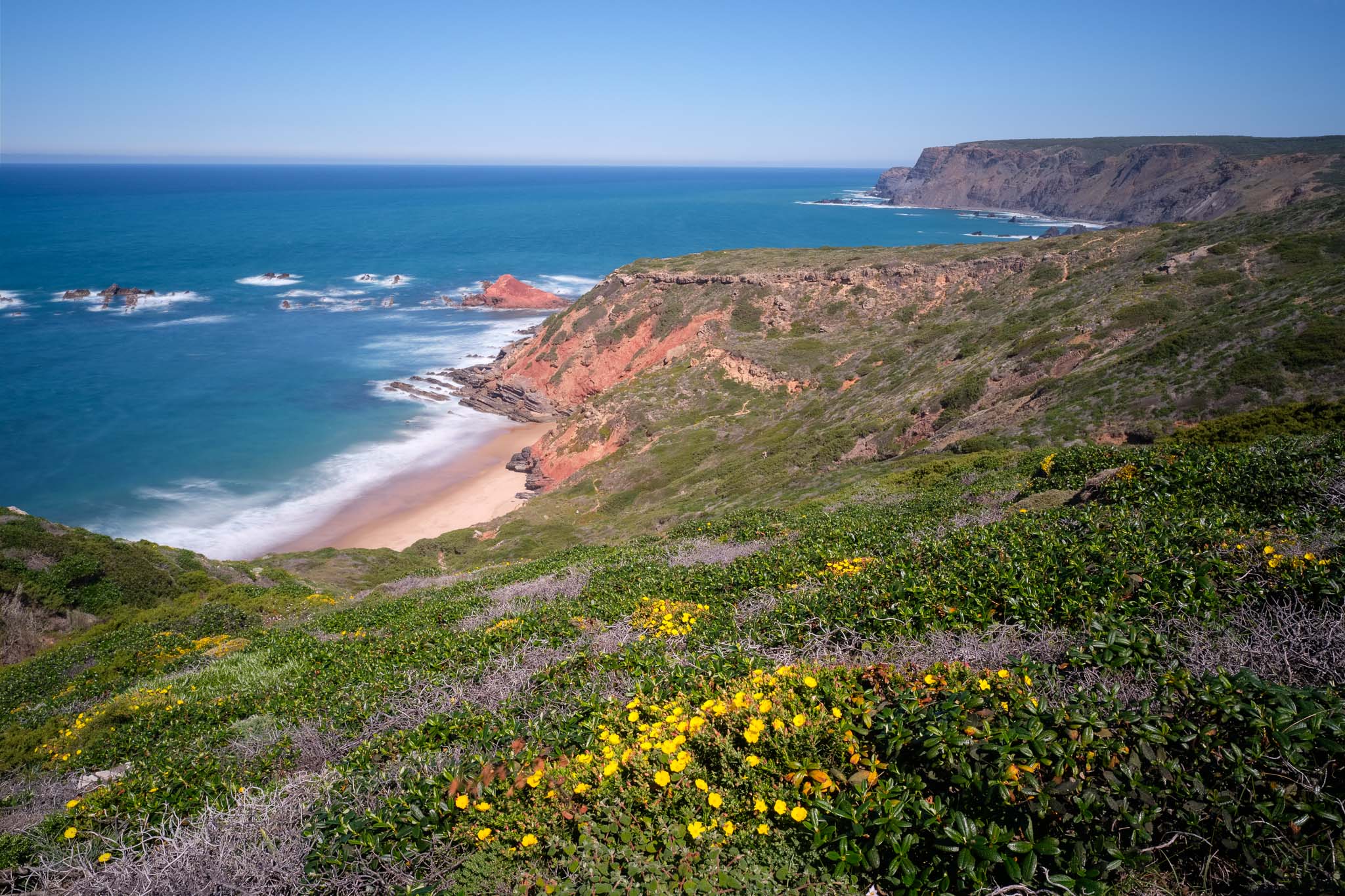
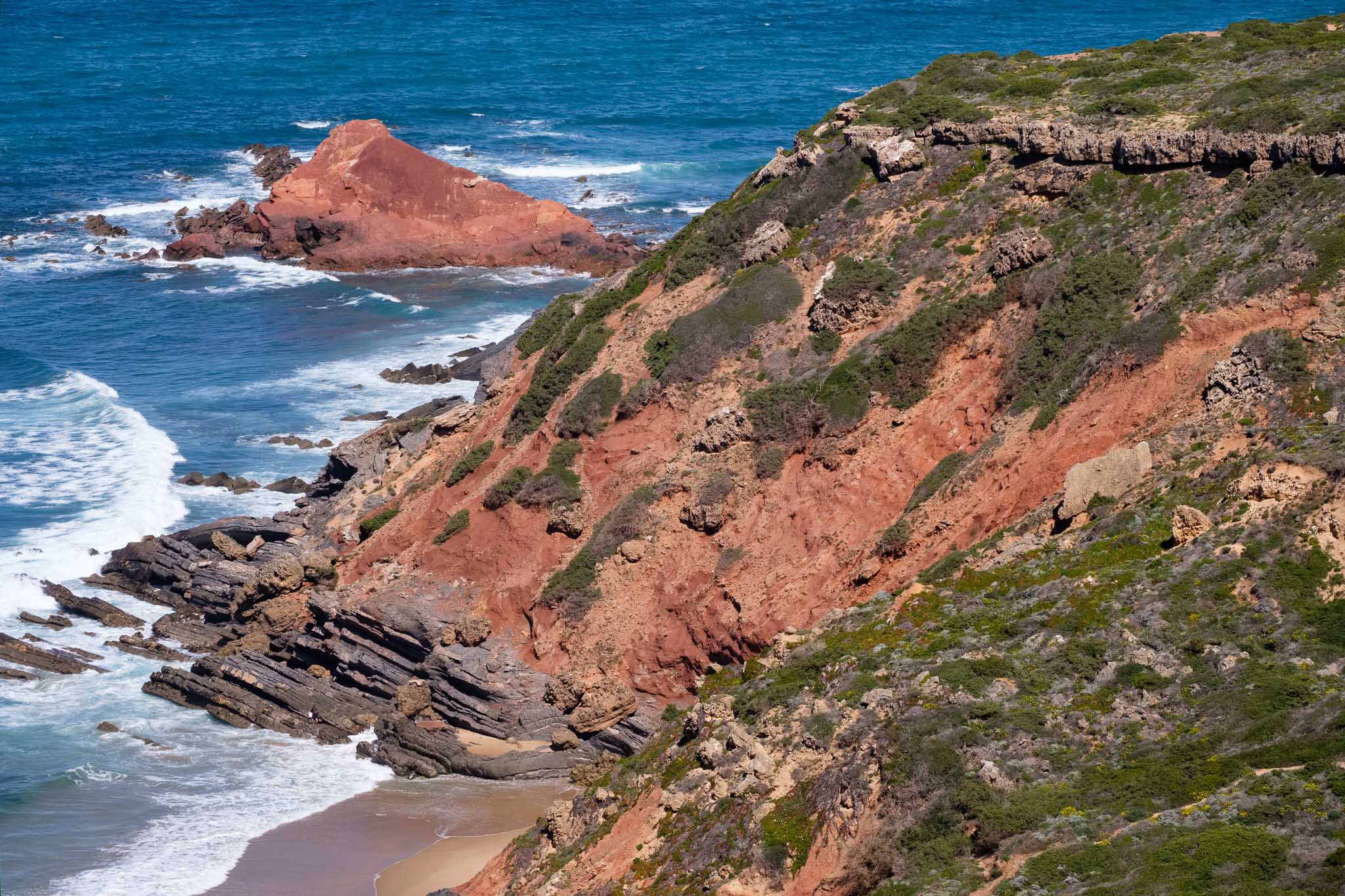
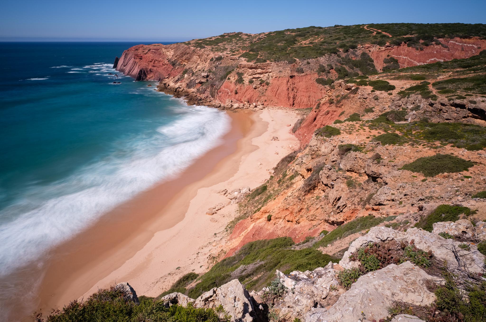
My first planned stop is at Ponta Ruiva (or red rock point), which owes its name to the strong red color of the outcropping rocks. Along the way, I photograph a few more flowers. Some of them are really small, only 1 or 2 cm in diameter; this, plus the constant wind, makes for challenging photographing conditions, but I am patient. There is always a lull in the wind, just 1 or 2 seconds when the wind abates, and that is when I take the photo.
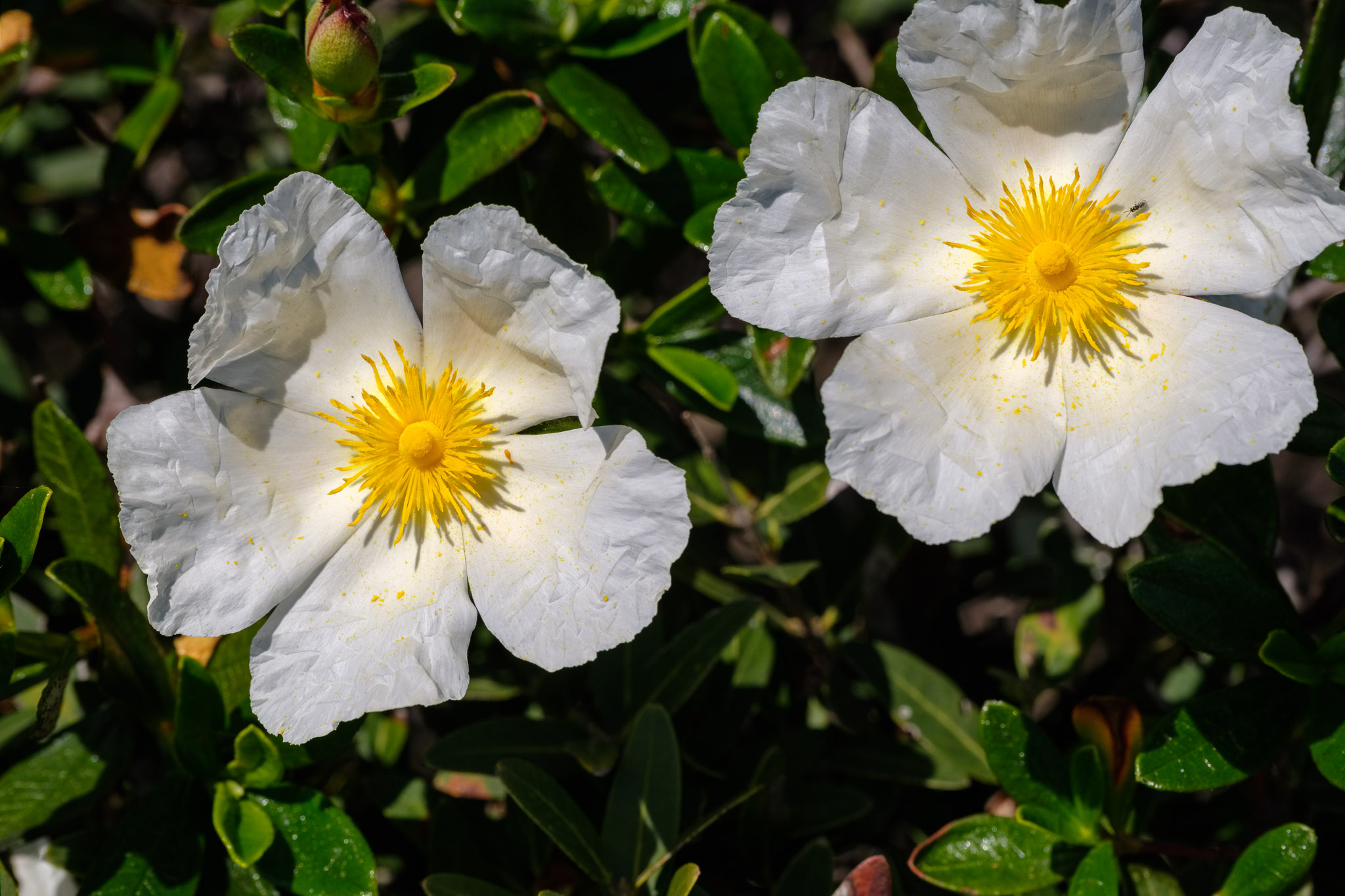
Musk Stork’s-bill.Lavender.Bee in lavender.Scrambling Gromwell. This is a tiny flower with a strong color.Pale Flax.Rock Rose.
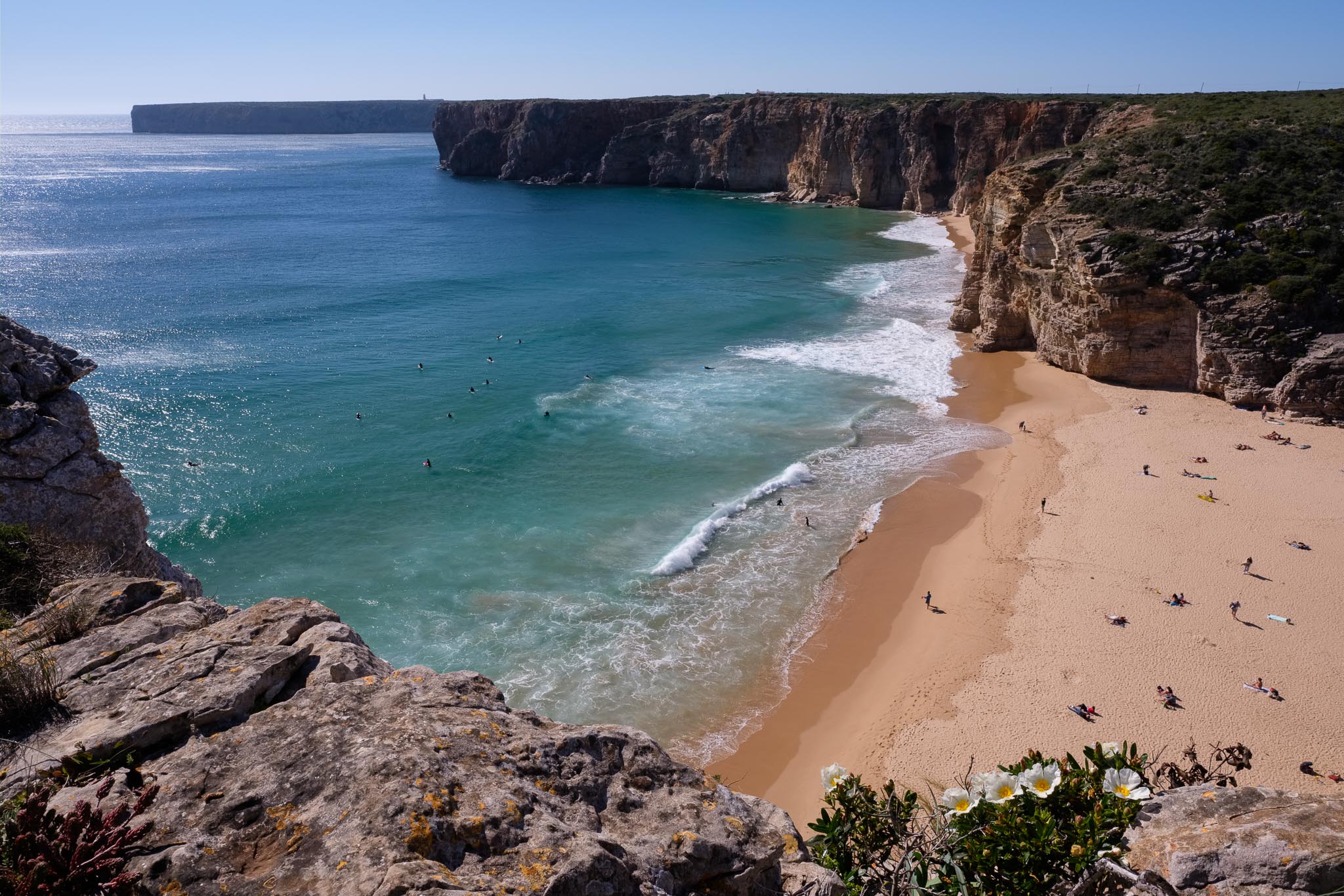
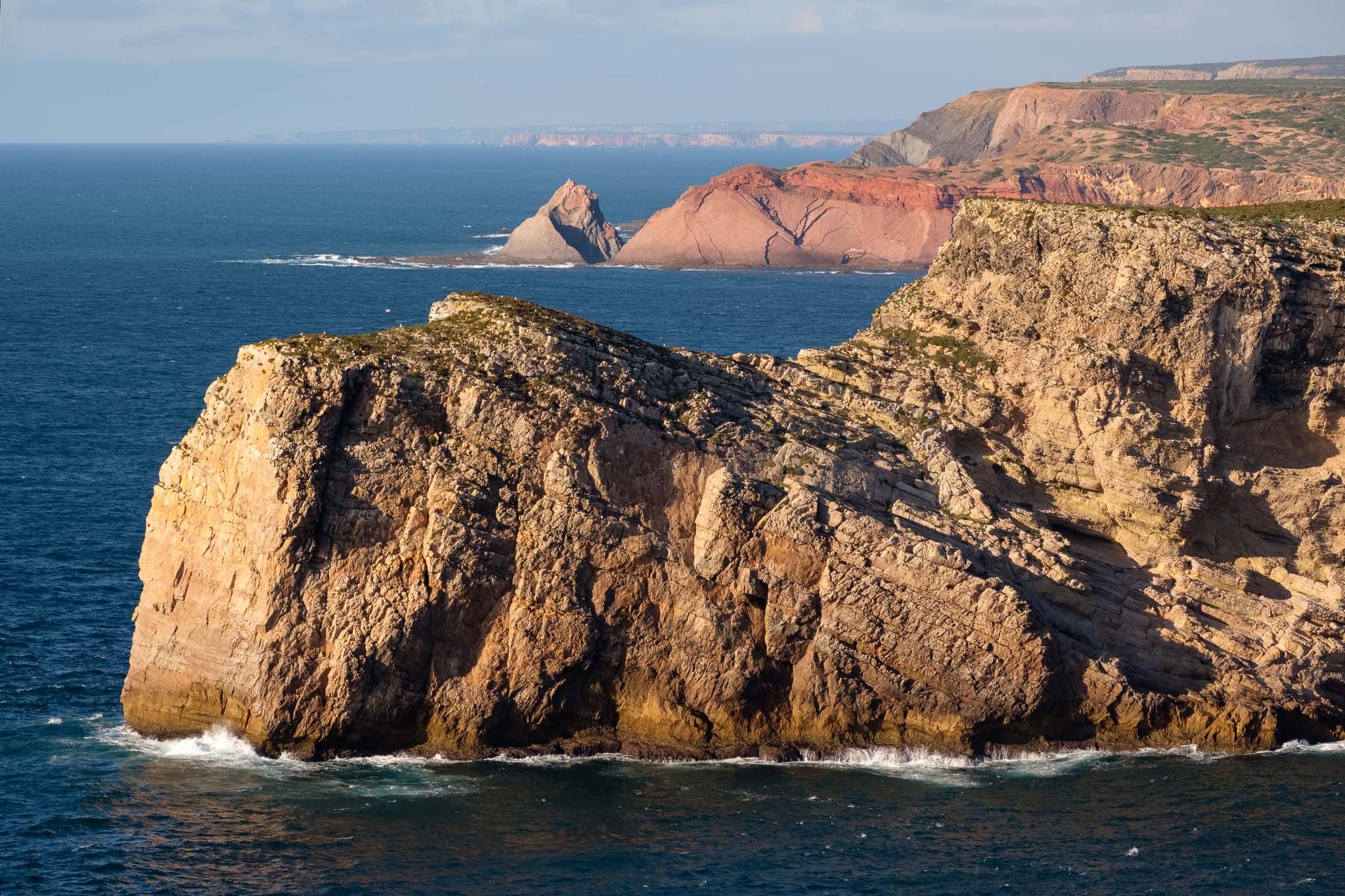
At the middle of the day, the light is not the most interesting one, so I decide to go for long exposures at Ponta Ruiva, using a neutral density filter. The blue of the sea is really vivid, and the coastal cliffs are more than 100 m high; down below, the waves crash incessantly against the rocks. We are close to Torre da Aspa, the highest point in the west coast of the Algarve, and it shows.
Ponta Ruiva.Ponta Ruiva.Coastline near Ponta Ruiva.
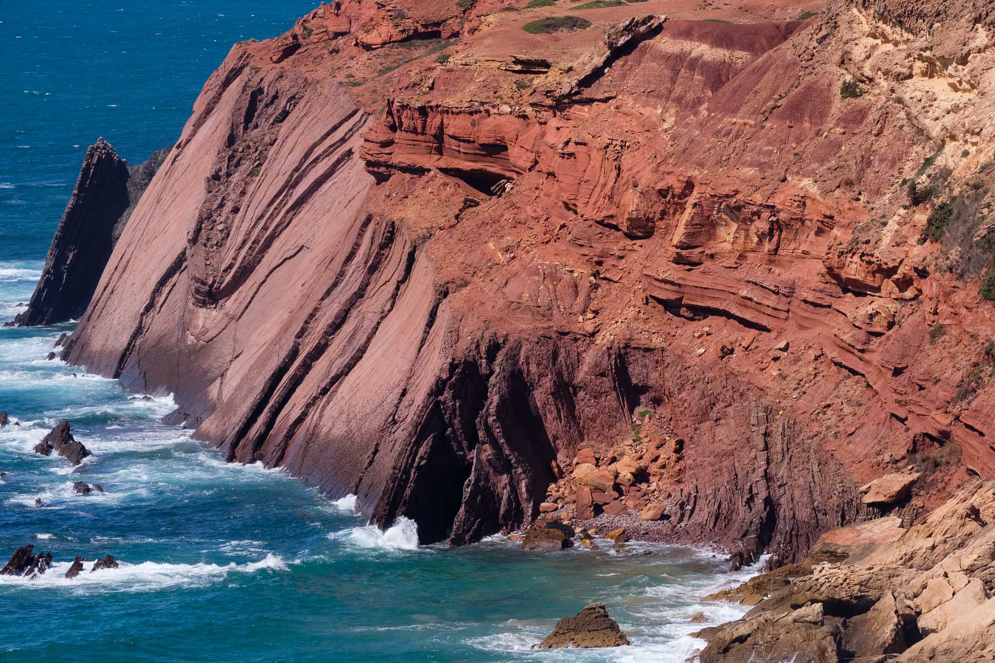
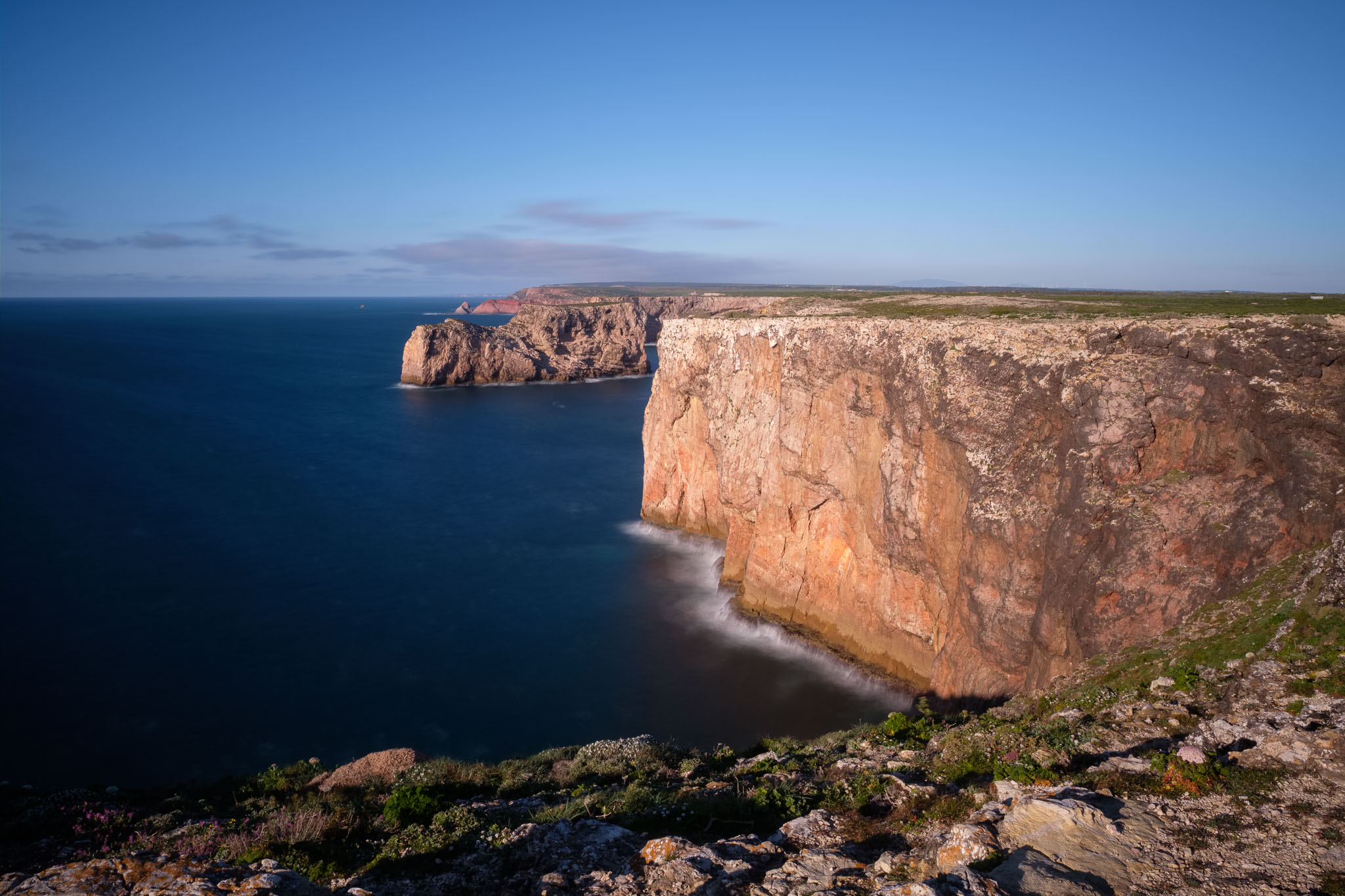
A note of caution, which is actually valid for this entire coastal region: the wind is normally strong here, so take proper care when approaching the edge of the cliffs. I keep walking, already with the Cabo São Vicente and its lighthouse visible in the distance. But before arriving there, it is time for a picnic lunch in the Telheiro beach. This beach is famous for its geology, notably an angular unconformity, where the more recent rock strata overlies the near vertical older rocks below. This means that the older rocks were compressed by huge tectonic forces, uplifted and eroded for millions of years, before the younger ones were deposited over them. The best location to see this is on the northern part of the cliff, which is only accessible during low tide. Unfortunately, this is not the case, so I will have to go back another time. Still, this geometric relationship can be also be seen from above, even though it is not the optimal view. Along the trail near Telheiro, it is possible to see some endemic and rare plants, which grow in the calcareous soil of this area.
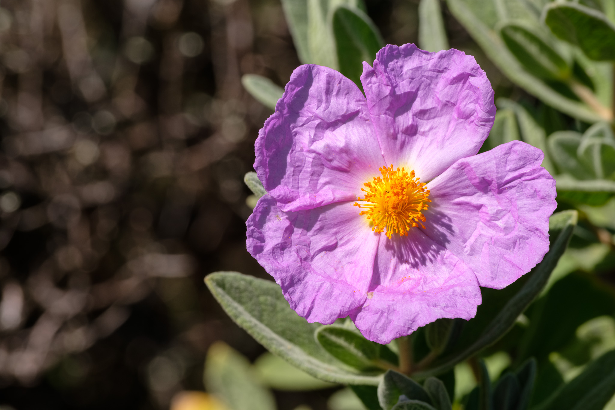
Telheiro beach.Angular unconformity in Telheiro.Gum cistus. It is a rare and endangered plant, endemic to southwest Algarve.Grey-leaved Cistus. The flowers only last 1 day.
After Telheiro, the path enters an area composed of limestone rock, which has been eroded, creating a typical karstic landscape. The terrain is made up of loose rocks and is not level, so be careful not to twist an ankle. Many plants are in bloom, some with tiny flowers sheltered amongst the rocks, where the sand has accumulated.
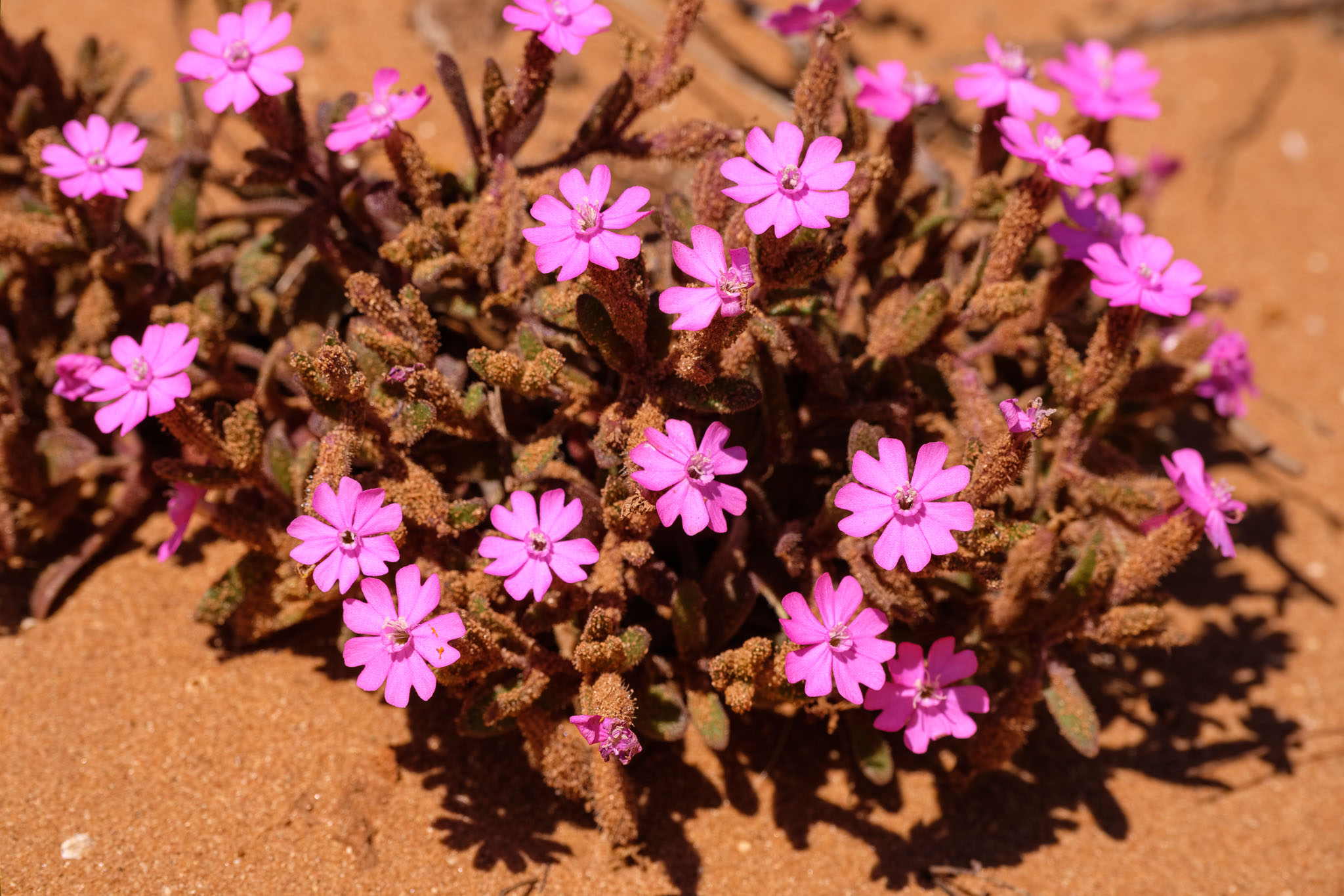
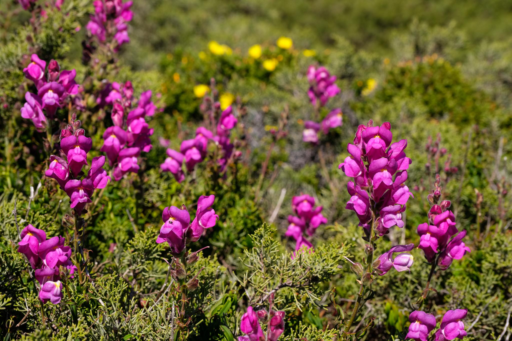
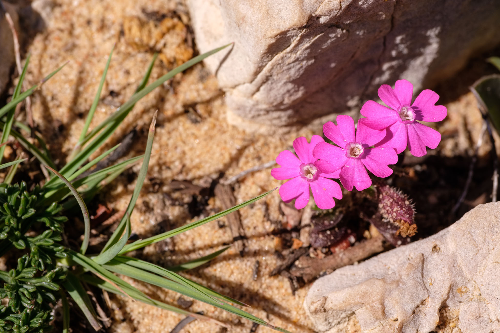
Catchfly. Typical of sand dunes.Snapdragon growing in the sand dunes.Catchfly nested in the rocks.
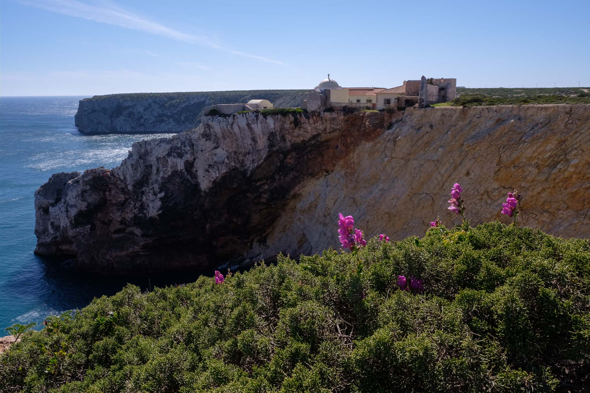
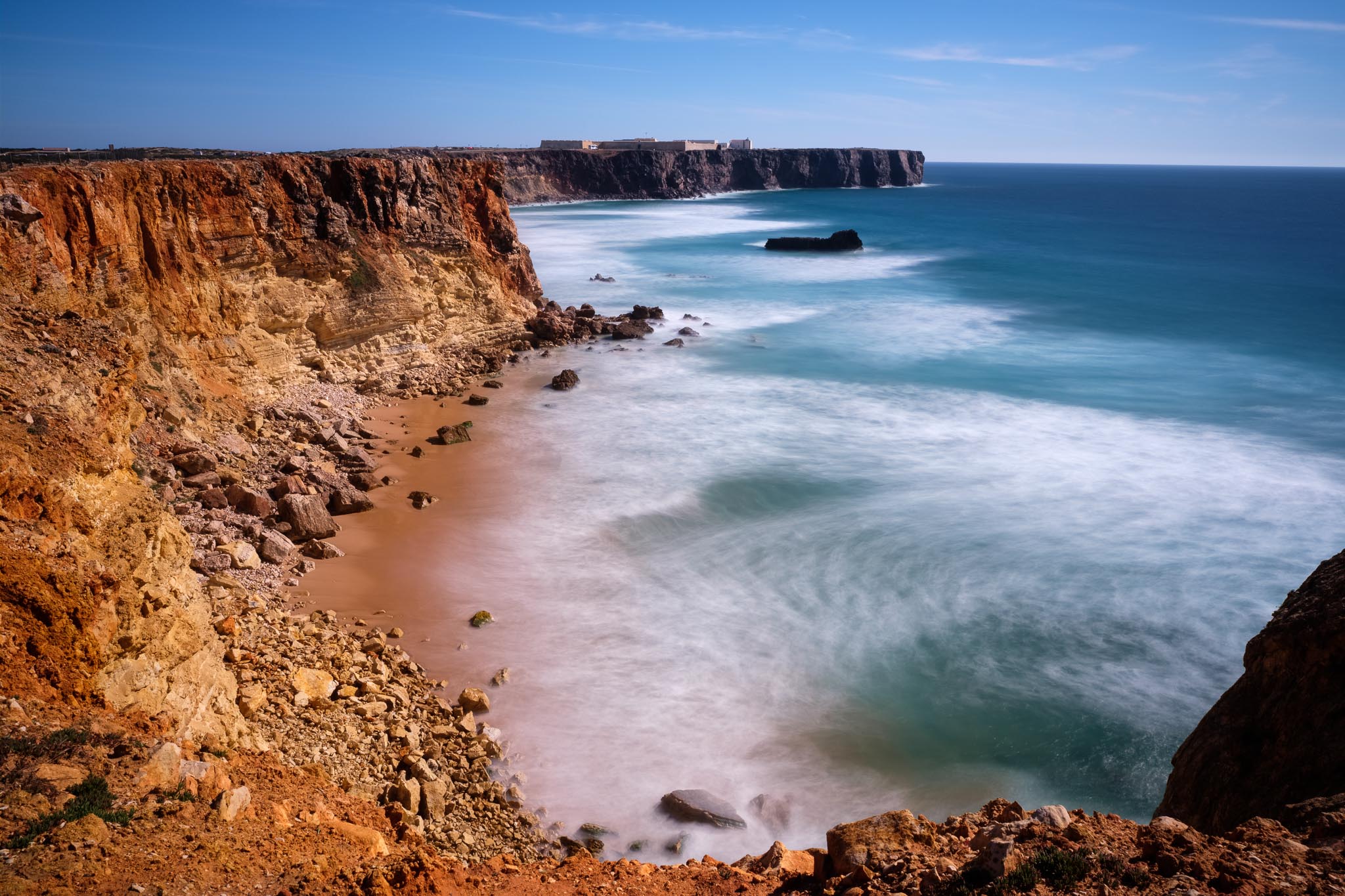
After a while, I arrive at São Vicente, but I do not stop there, since I plan to return at sunset. So I keep walking towards Sagres, leaving the path now and then to see the views from the top of the cliffs. It is worth stopping in Beliche to see the fort with the chapel, and the beach with the same name. The landscape here is amazing, with large promontories jutting into the sea. In the distance, it is possible to see the famous Sagres fort, from where the Portuguese Age of Discoveries was planned. People used to say that the world ended here, and one can appreciate why, when facing this endless sea.
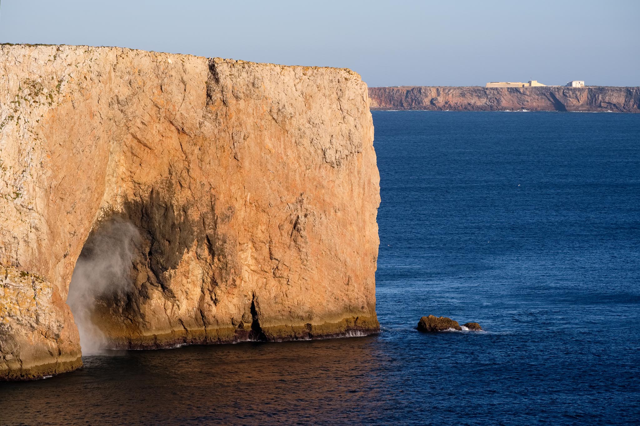
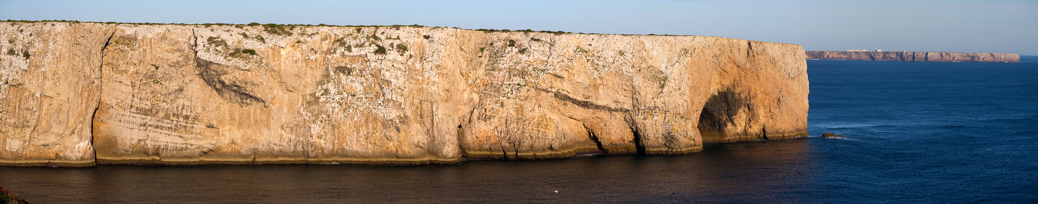
Cave near Sagres. The waves go inside and are pulverized, resulting in foam and mist coming out. Sagres fort is in the distancePanorama of the same location as in previous photo.Beliche chapel and fort.Beliche beach.Sagres promontory in the distance.
I finally arrive in Sagres, and I am lucky because I do not have to wait long for the bus to Vila do Bispo. As a note, the bus stop is right next to the tourism office in the centre of the village. It is only a 10 minute ride back to Vila do Bispo, so pretty soon I am back where I started.
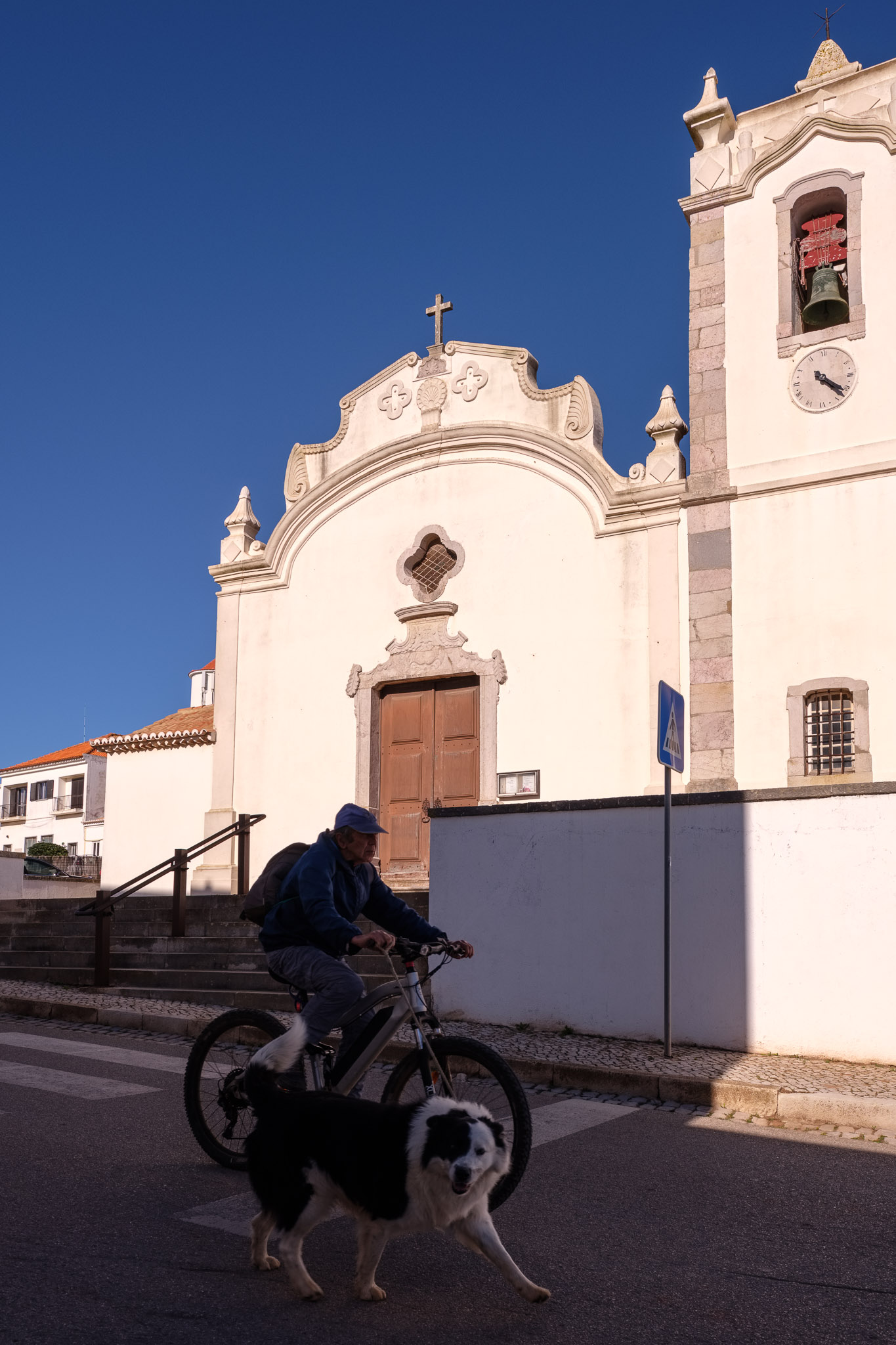
Church in Vila do Bispo.
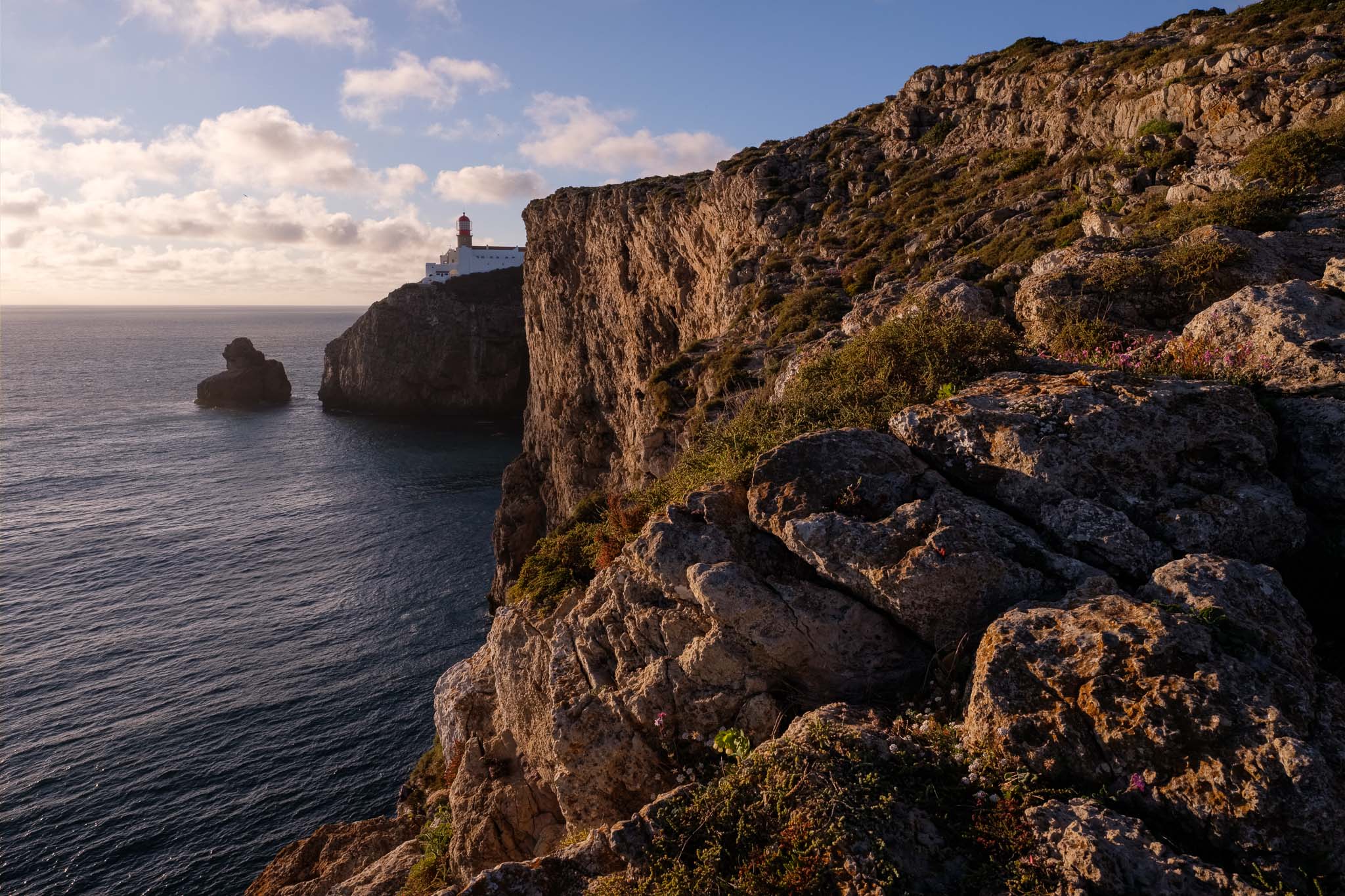
I rest for a little while, before driving to São Vicente for some photography at sunset. The lighthouse is a popular place with tourists, and a great viewpoint from which to admire the surrounding landscape. The sheer vertical cliffs dropping down from the plateau into the deep blue ocean below, with the crashing waves, make for a beautiful scenery. Again, please be careful if you venture into the cliffs, because the wind is really strong; a sudden change of wind direction can be dangerous if you are too close to the edge. I sit down on some rocks and set up the camera in the tripod to make some photos.
Looking north from the Cabo São Vicente.Same as above, this time with a telephoto lens. The colorful rocks in the middle distance are in Telheiro beach.The lighthouse of São Vicente.
Watching the sun going down near the lighthouse was the perfect way to end this memorable day in this beautiful region.
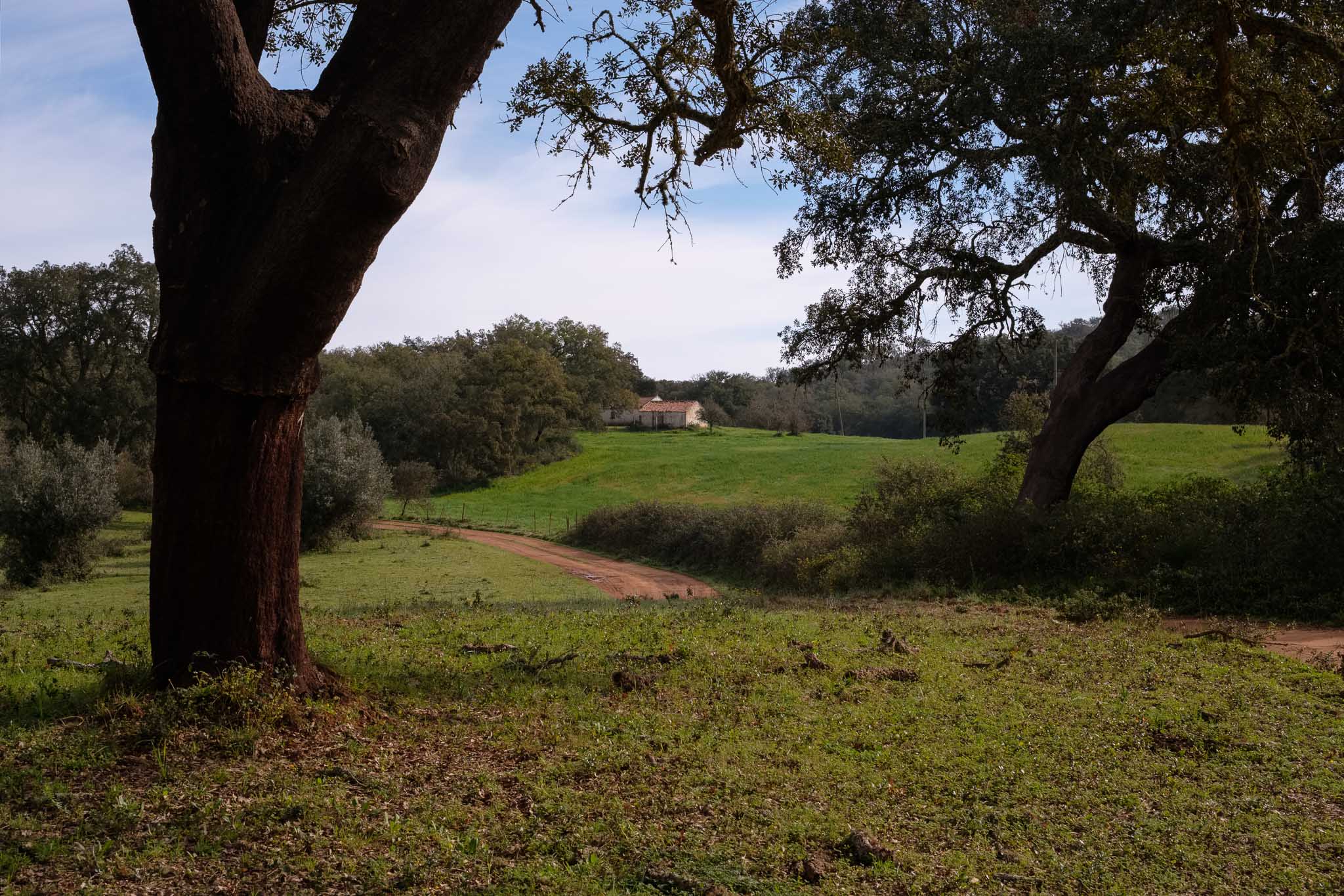
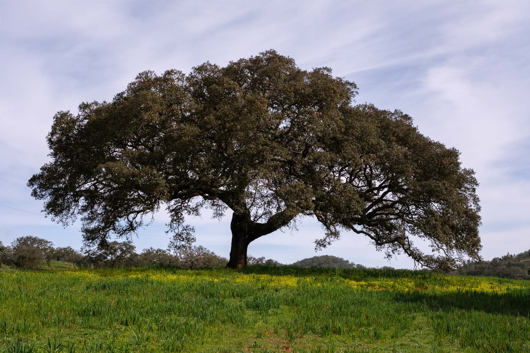
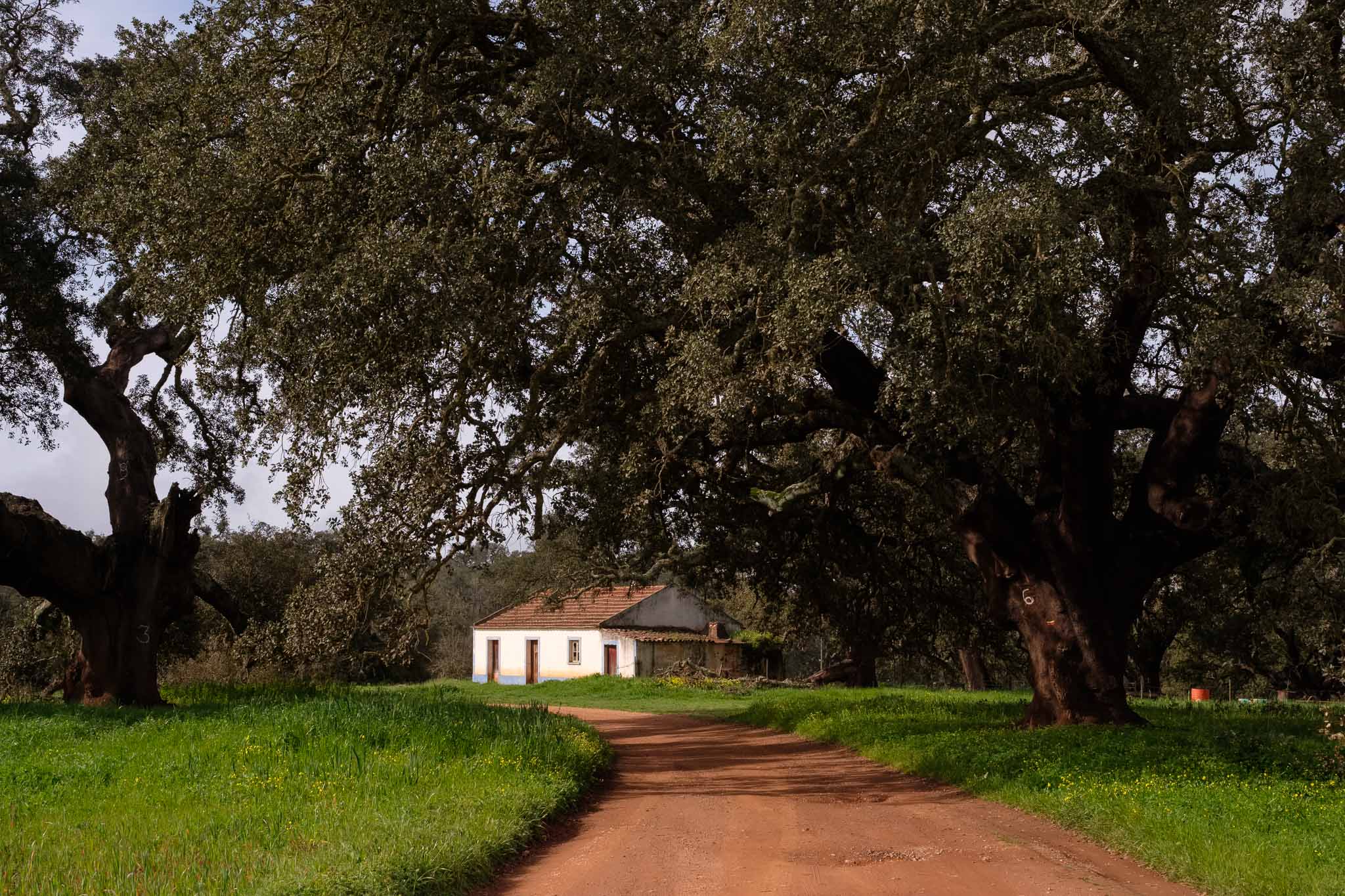
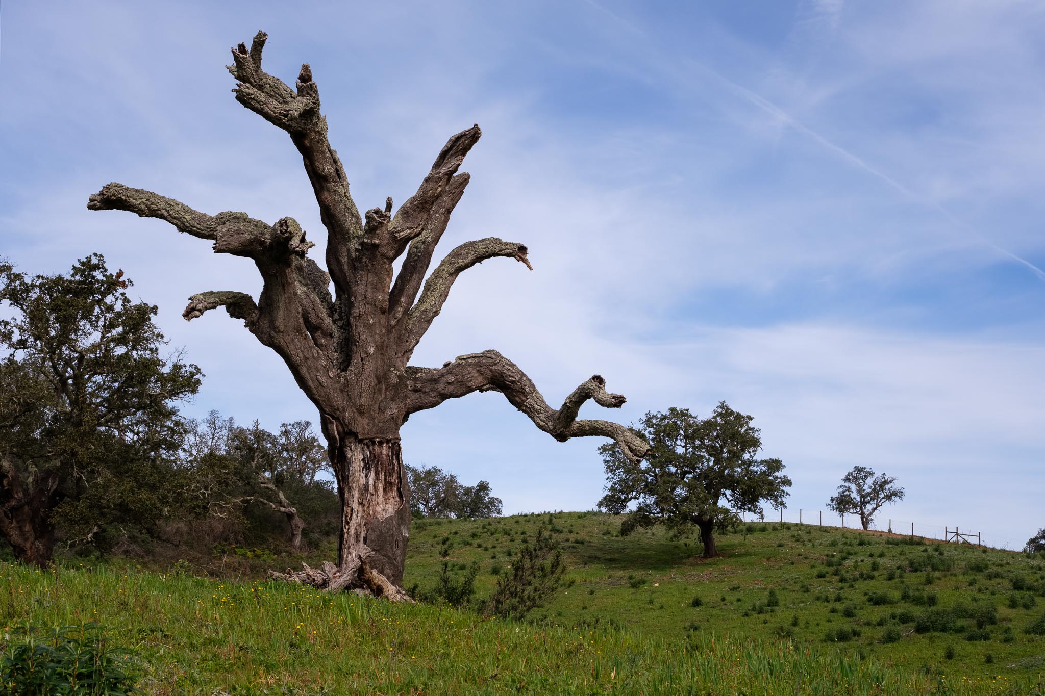
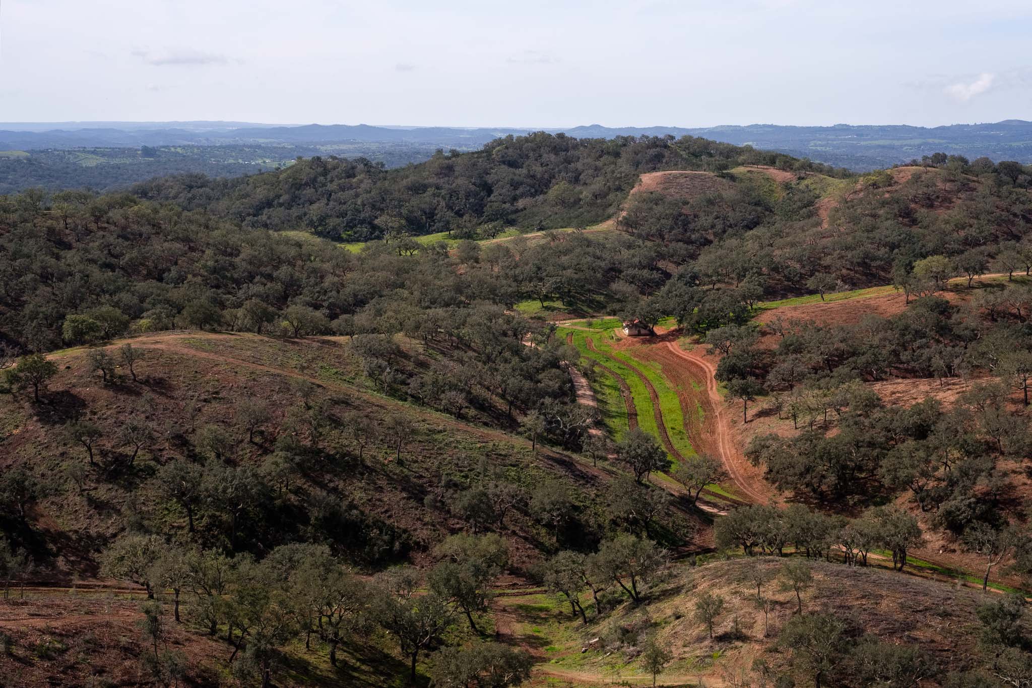
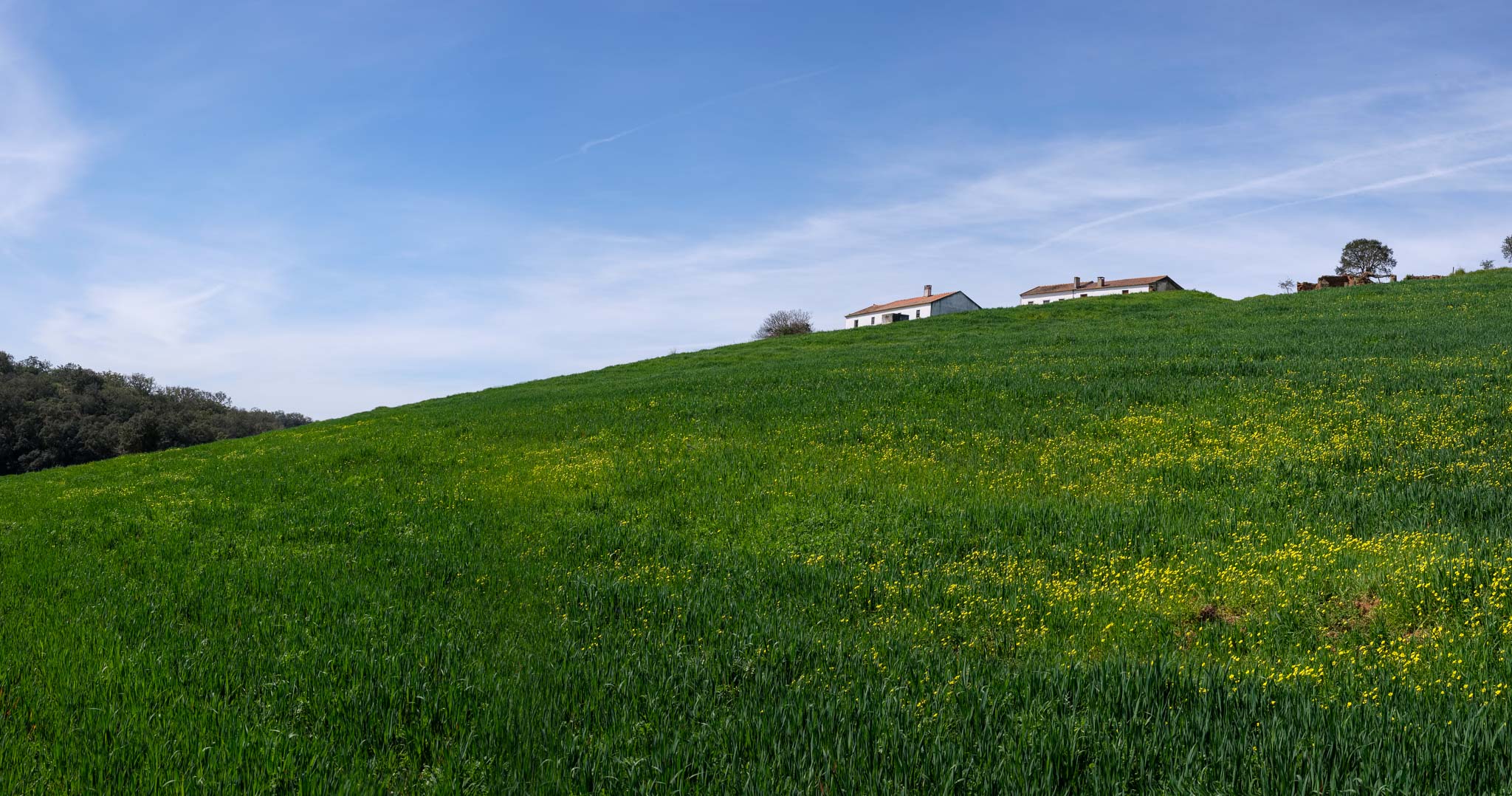
I have walked several trails of the Rota Vicentina since January, with a mix of new and old ones. After a few years of walking in this wonderful SW region, I have a few favorite routes, including this one. Looking at my records, it was the fifth time that I have walked this trail since 2019; in fact, I do this trail every year. So what makes this route so special? In my opinion, if you want to experience the character of the interior region of Odemira, this trail is perfect. It takes you along beautiful rural landscapes, where you can find very old cork oaks, typical farm houses, and panoramic views from the top of the hills.
Spring is a good time to visit, with the fields covered in green grass, and several wildflowers in bloom. Of course I had my camera with me, and of course it was a challenge to try and come away with different photos from the other visits… I have seen this landscape at the end of summer, when it is dry and brown, and at the end of winter, when it is wet and green. What follows is a collection of the photos I made during this latest visit, with my trusty Fujinon 33mm lens, a standard for the APSC format.
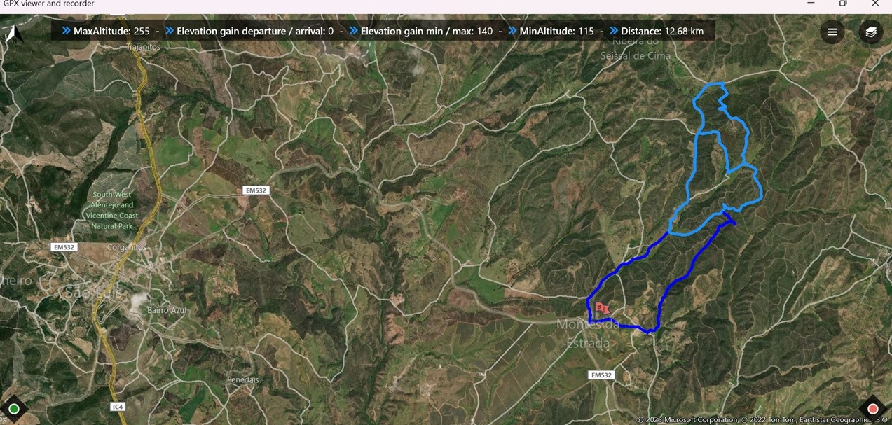
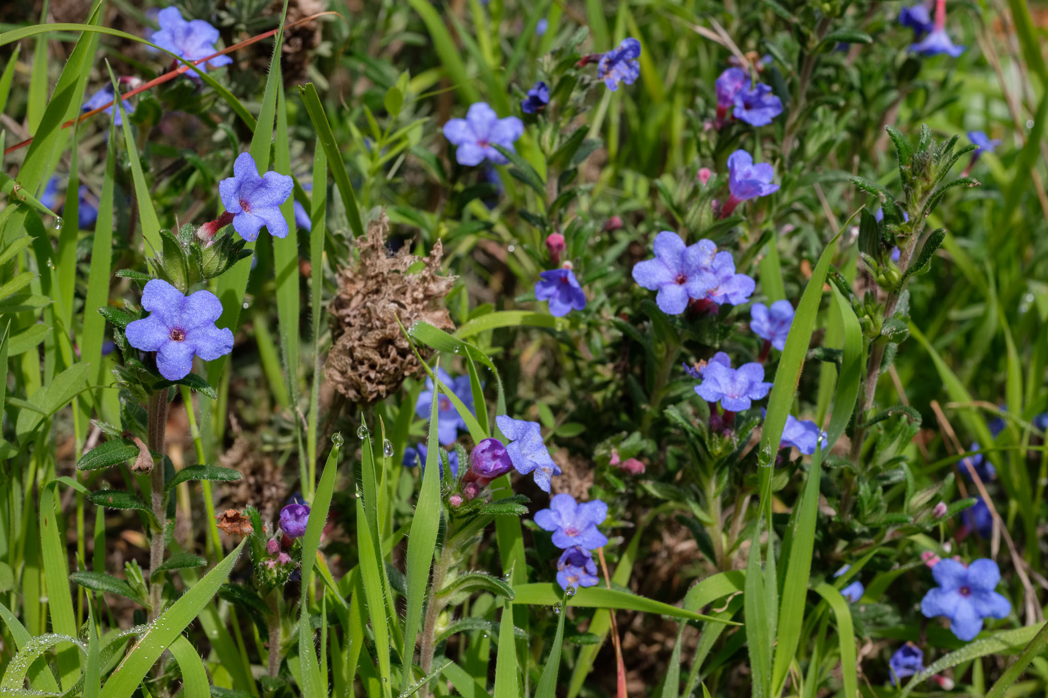
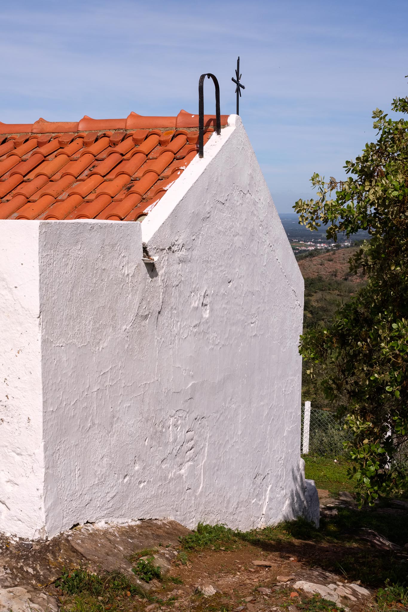
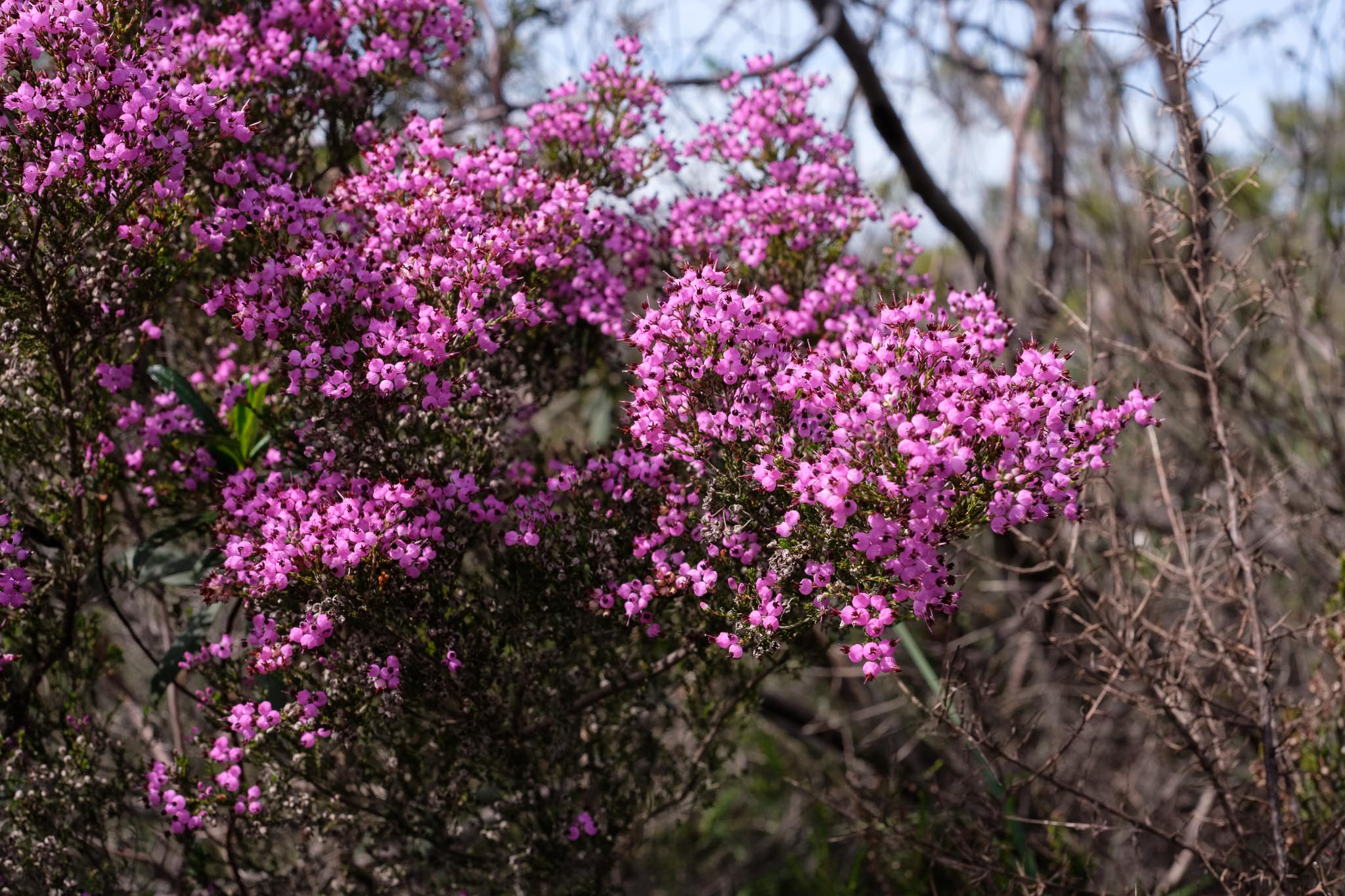
Map of route 7, which is located a few km east of the village of São Luis.Typical landscape along this trail.Large cork oak.Old farm house.Naked tree.Grazing.“Erva das Sete Sangrias”, or Lithodora prostrata. These tiny blue flowers are quite vivid in color.View from the chapel hill. This part of the countryside still has a large area of cork oaks.The small chapel of Nossa Senhora das Neves.The pink heather attracts a lot of bees, which results in very tasty honey.Posing.Spring has arrived. This is a panorama assembled from 8 photos.Weekend bikers near the village of Monte da Estrada, one of the possible starting points for this trail route.