During the first quarter of 2023, I have walked several trails of the Rota Vicentina, which is a vast network of walking and cycling paths located in the Southwest Alentejo and Vicentina Coast Natural Park. I normally walk in the circular routes because the logistics are easier. However, there are a few non-circular routes that I wanted to walk, notably the one between the villages of Vila do Bispo and Sagres, in the Algarve region of the park. Throughout the years I have visited this area a few times, in particular some beautiful locations such as the lighthouse in São Vicente, and the beaches of Telheiro and Ponta Ruiva. As such, I wanted to go back this year and walk the complete trail, not only parts of it.
This corresponds to route TP-09, which is stage 9 of the Trilho dos Pescadores, or Fishermen’s Trail. The latter is a long 180 km route that follows along this entire coast, roughly between Sines and Sagres. The map below shows only the path for stage 9.

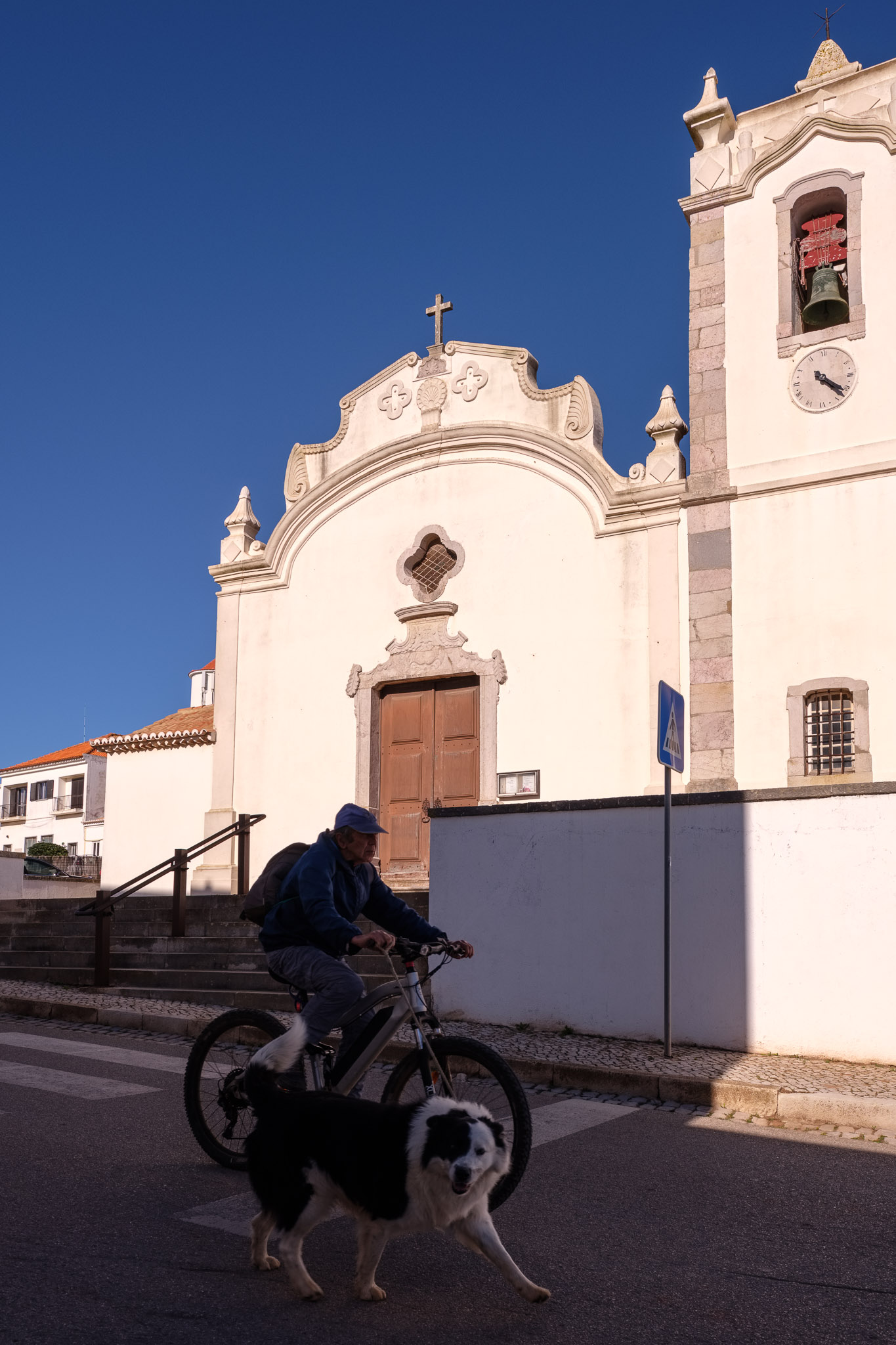
I chose to start the walk in Vila do Bispo, where I left my car. There is a regular bus service between Sagres and Vila do Bispo, or taxi services, to return. There are more buses during school days compared to weekends, so I recommend you do a bit of research beforehand. At the end of the day, it works alright.
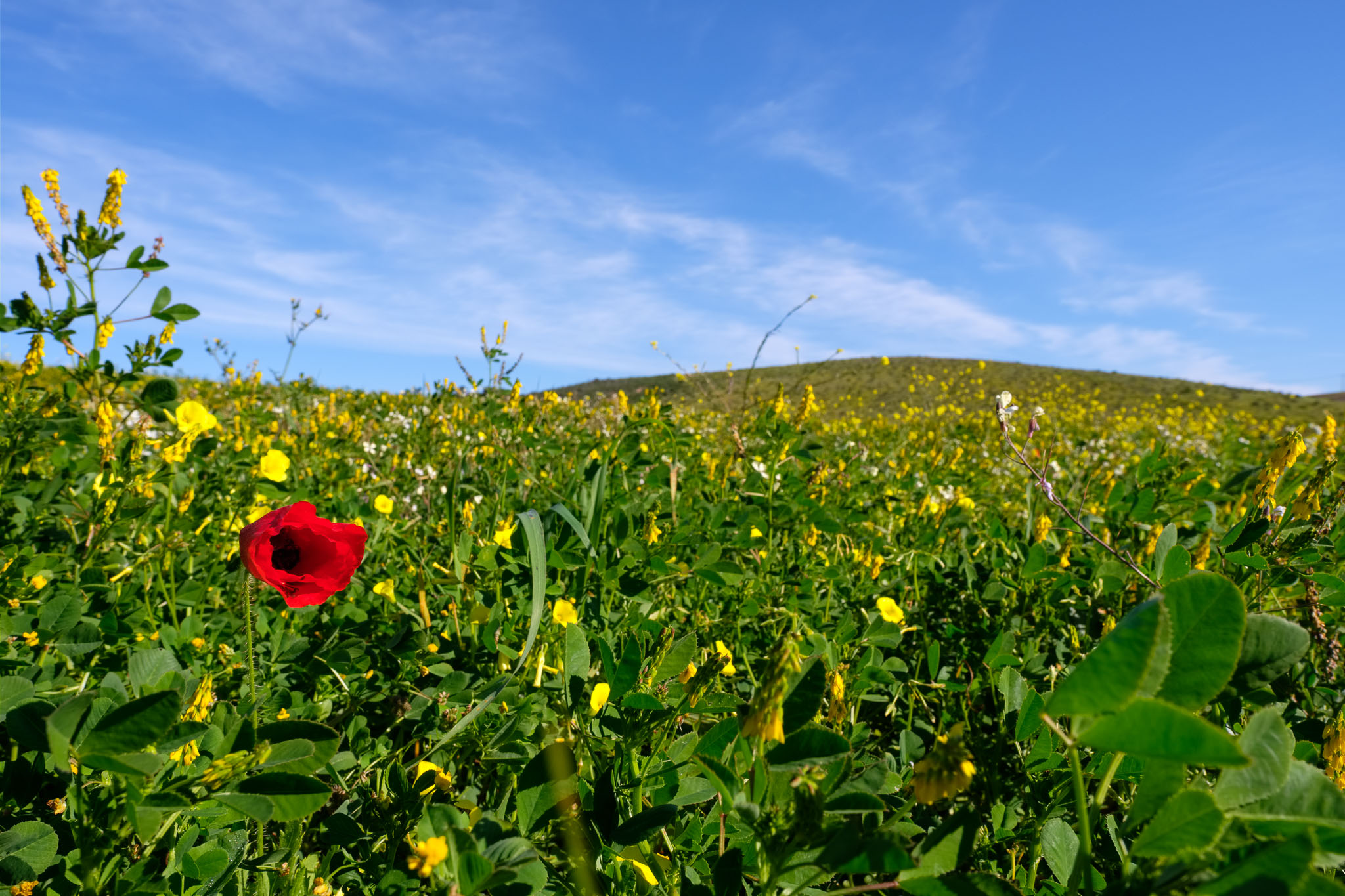
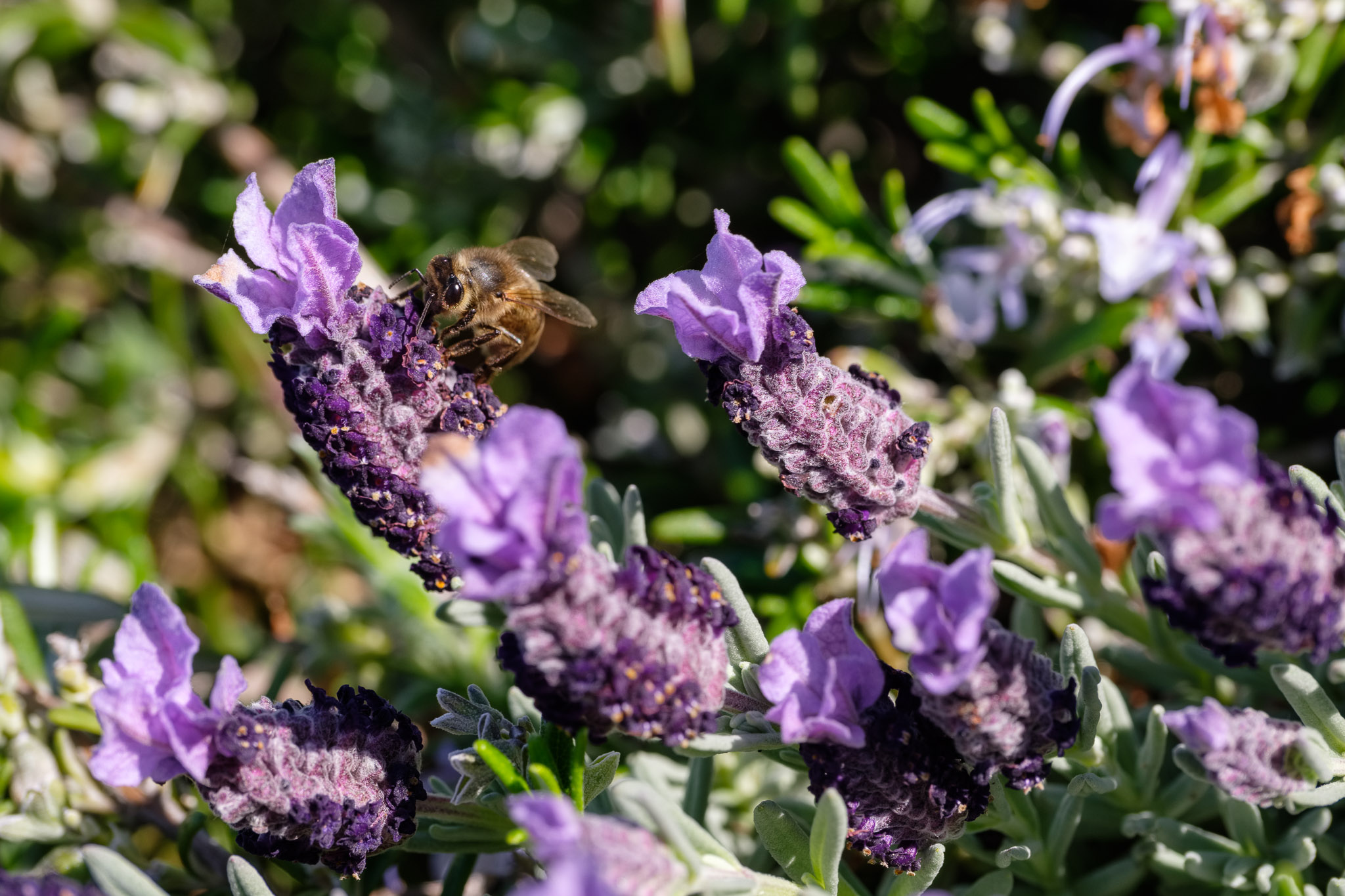
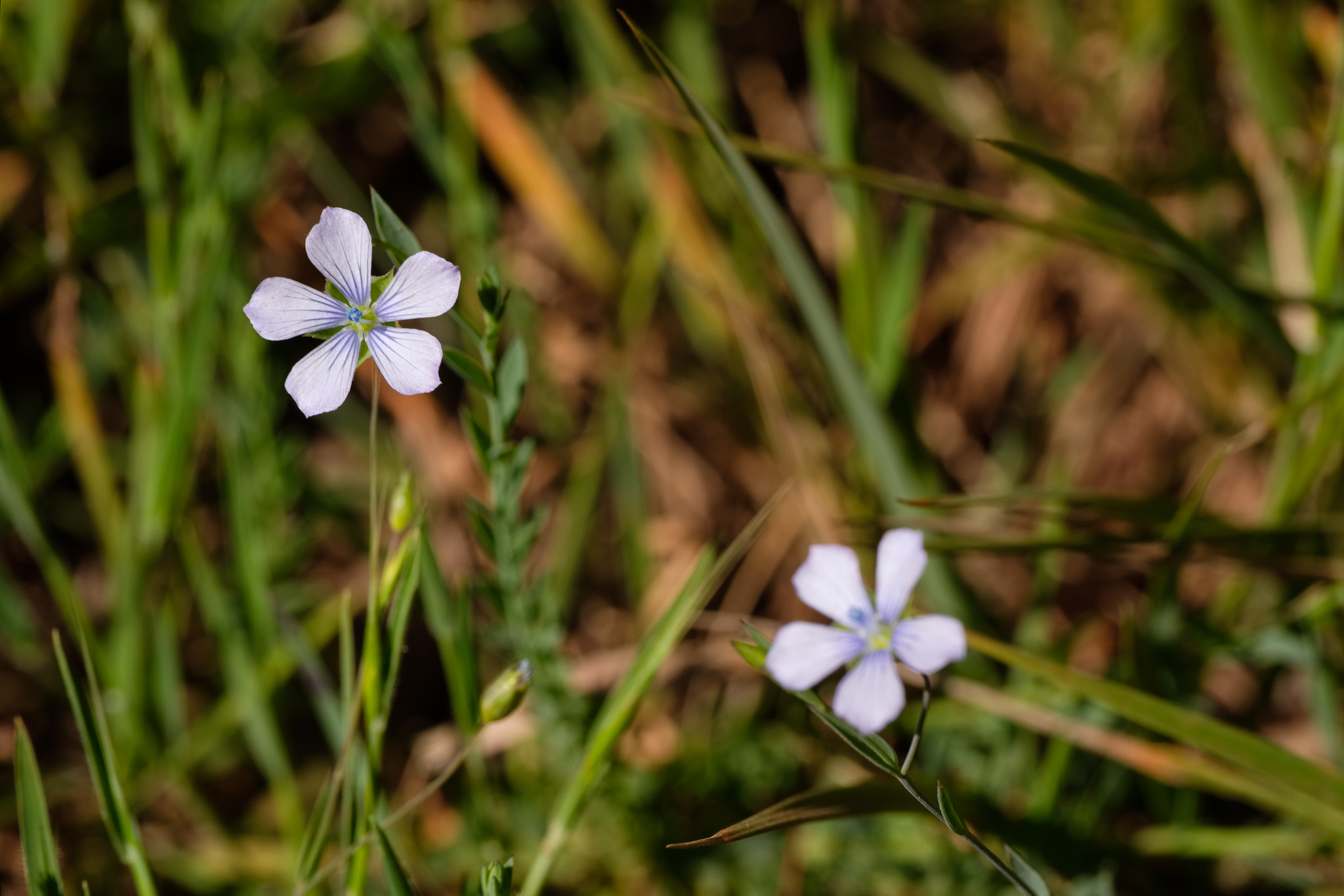
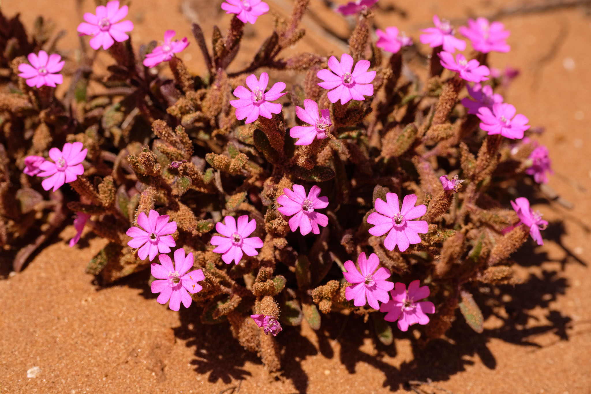
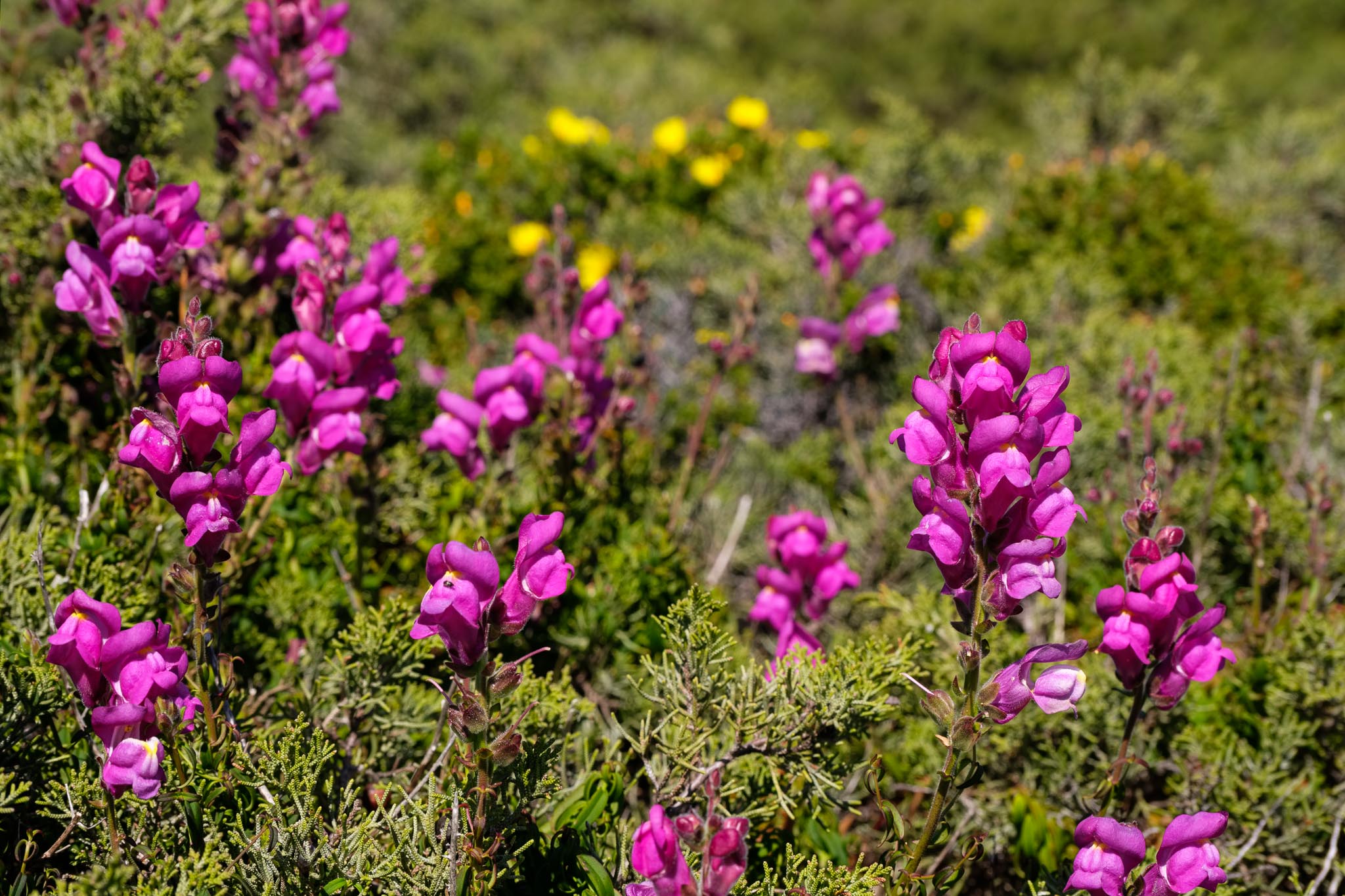
The weather forecast for the day was sunny and mild, which was perfect for a long walk. Spring has arrived in full force, coloring the landscape with many flowers. In fact, one of my interests in this walk was to spend some time searching and photographing several species of flowers that are typical of this region. For such, I had with me an old high quality close-up filter (or diopter lens) to mount on my Fujinon 70-300mm lens; this combination is very good for near macro photography, and I got nice images.
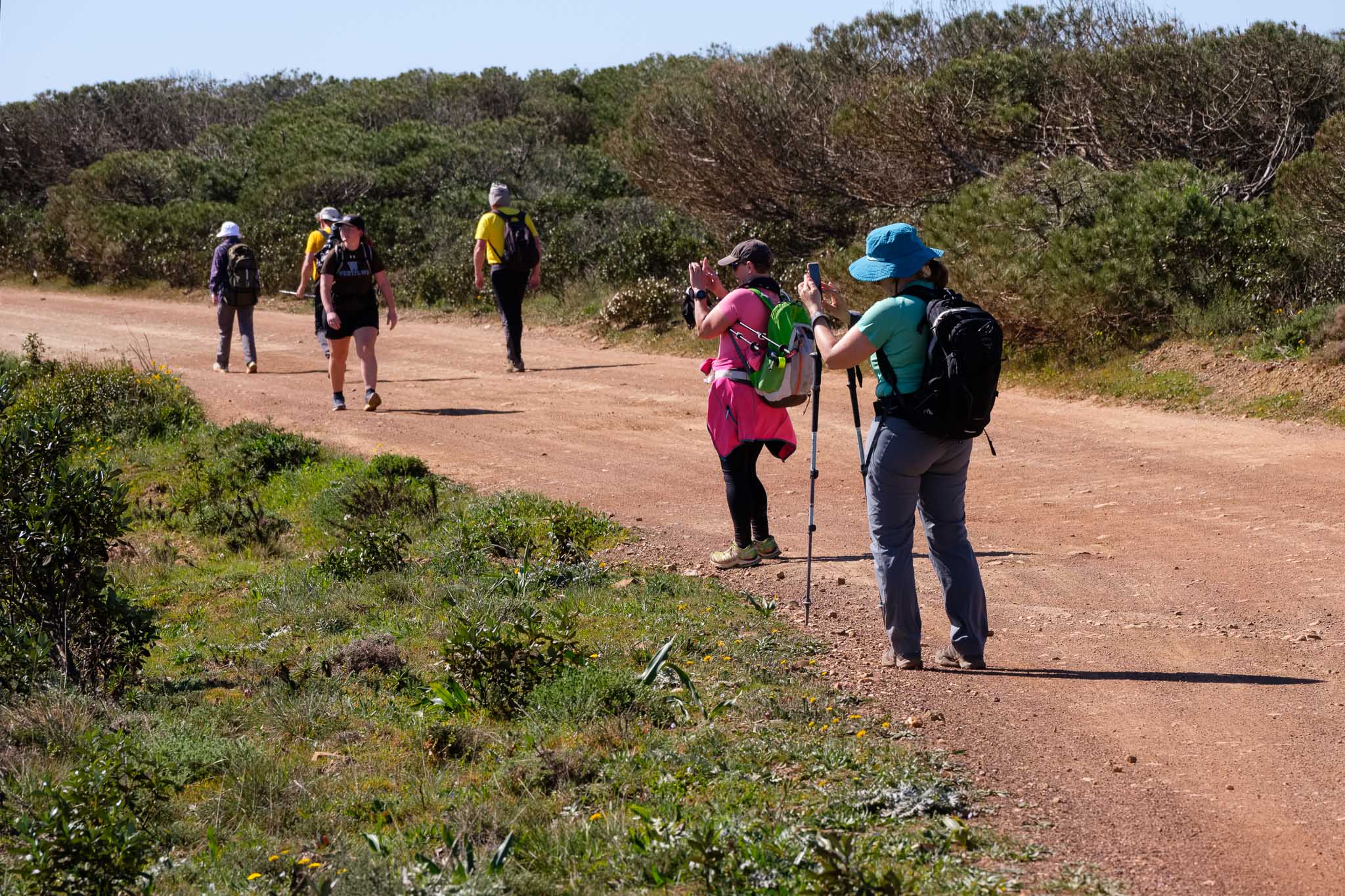
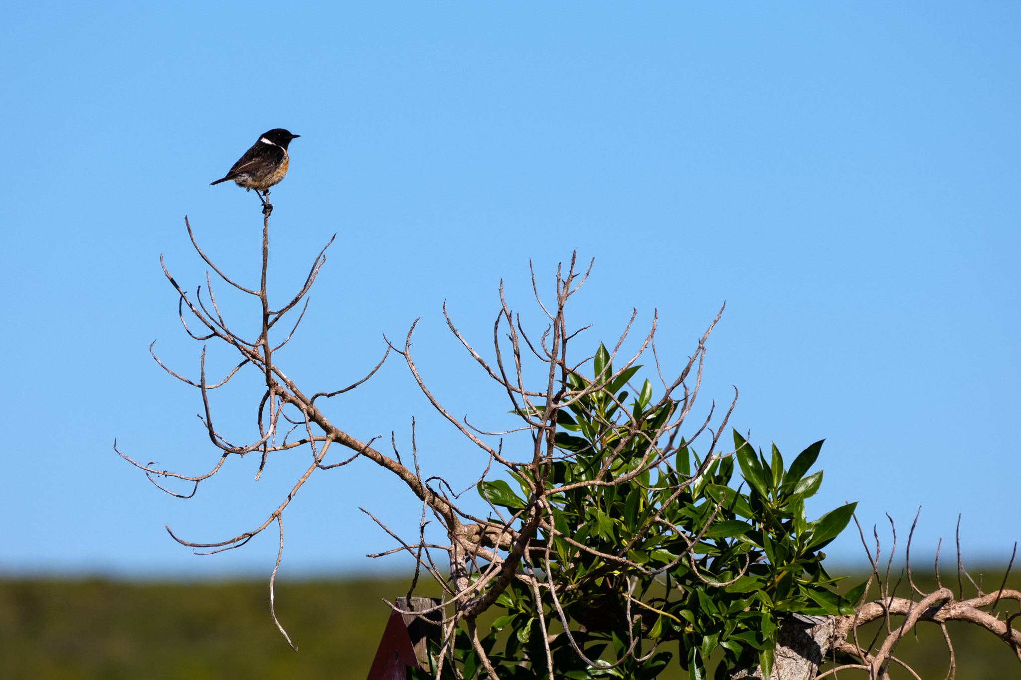
Leaving Vila do Bispo, the path heads directly to the coast, climbing gently until it reaches the coastal plateau. Along the way, some red poppies start to appear in the countryside. It is an easy going and enjoyable walk, and also quite popular, judging by the number of people on the trail. Indeed, when I walk in the interior routes, I normally don’t see anybody, but here that is not the case. Nevertheless, the only sounds I hear are the strong wind and the chirping of small birds.

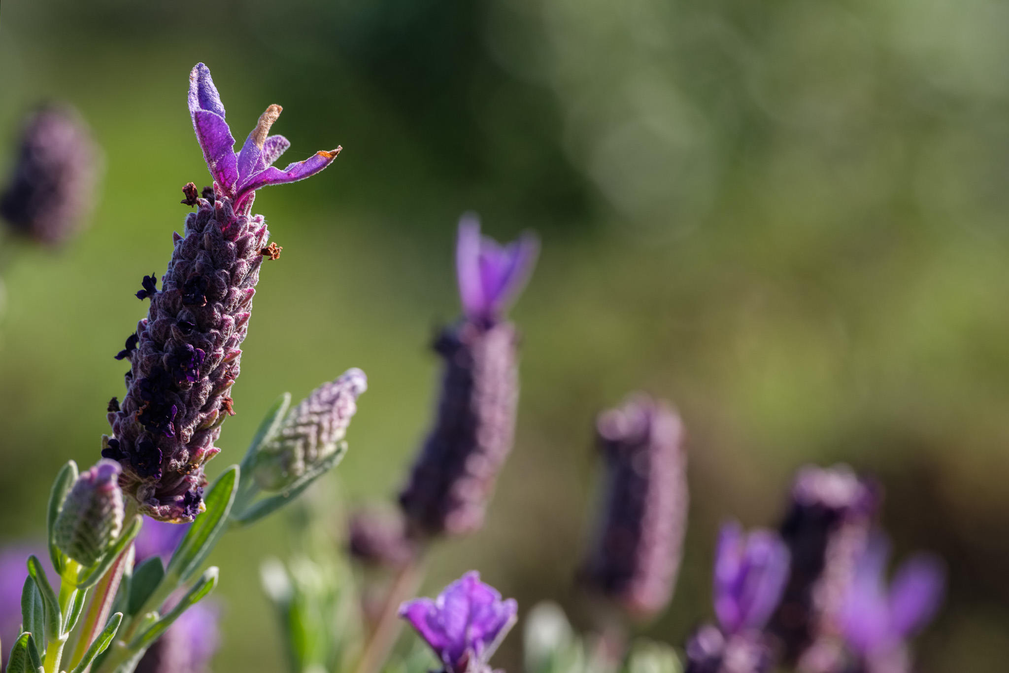
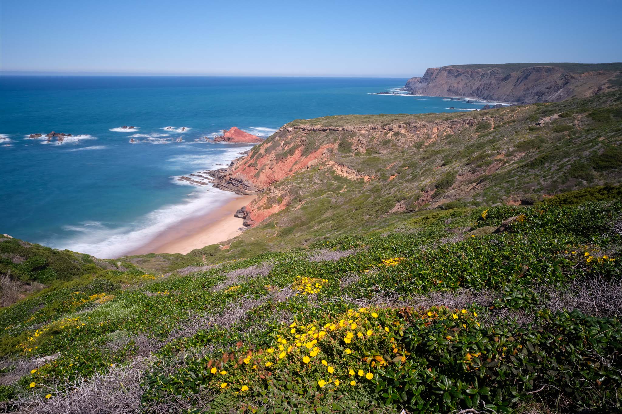
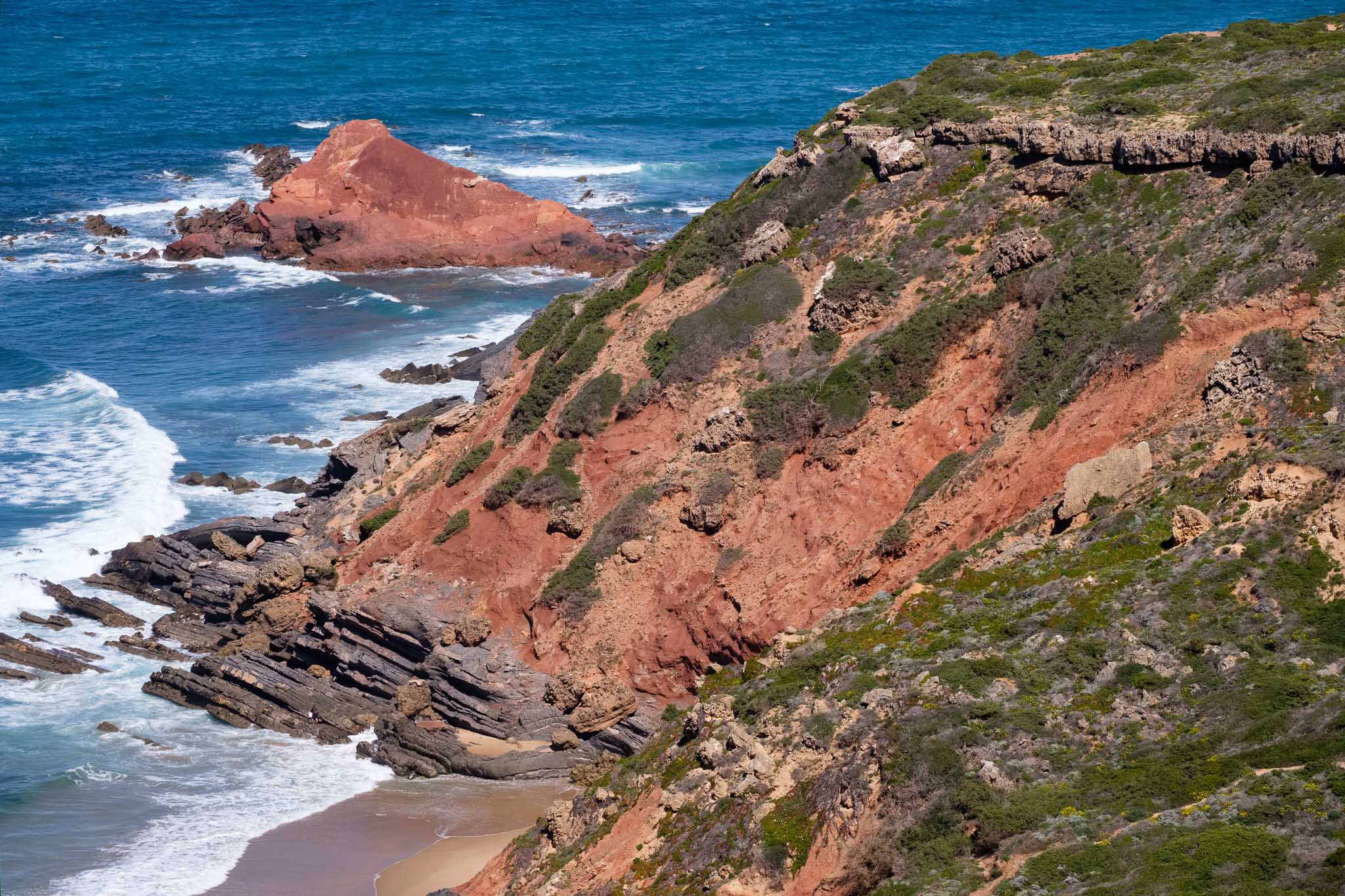
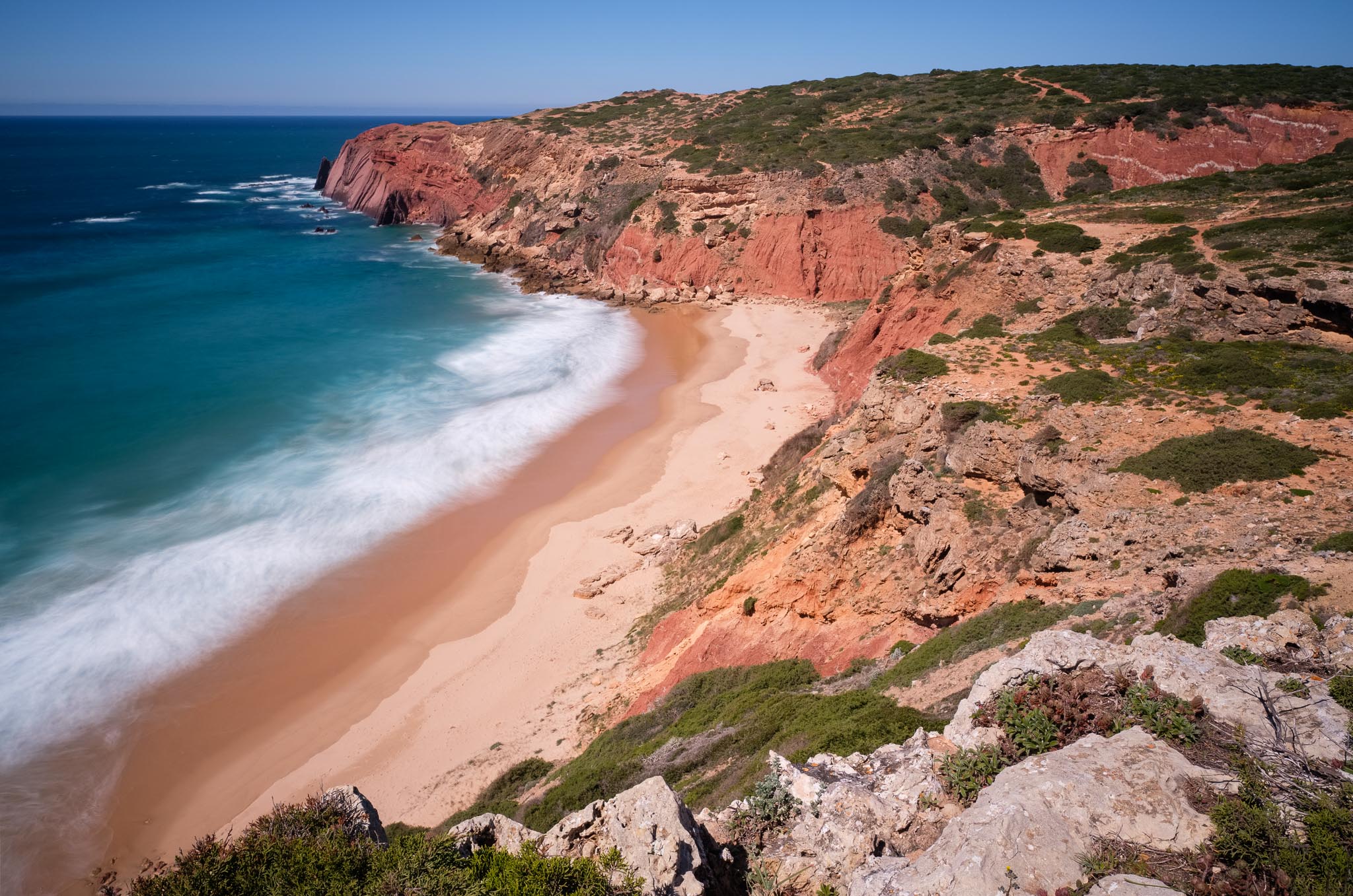
My first planned stop is at Ponta Ruiva (or red rock point), which owes its name to the strong red color of the outcropping rocks. Along the way, I photograph a few more flowers. Some of them are really small, only 1 or 2 cm in diameter; this, plus the constant wind, makes for challenging photographing conditions, but I am patient. There is always a lull in the wind, just 1 or 2 seconds when the wind abates, and that is when I take the photo.


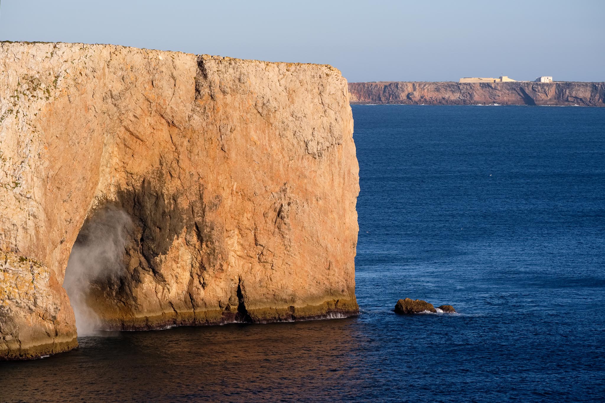
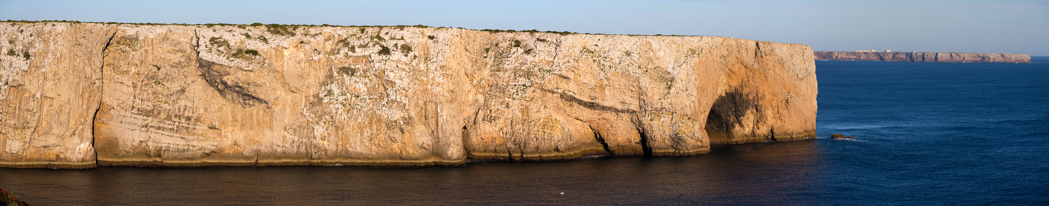
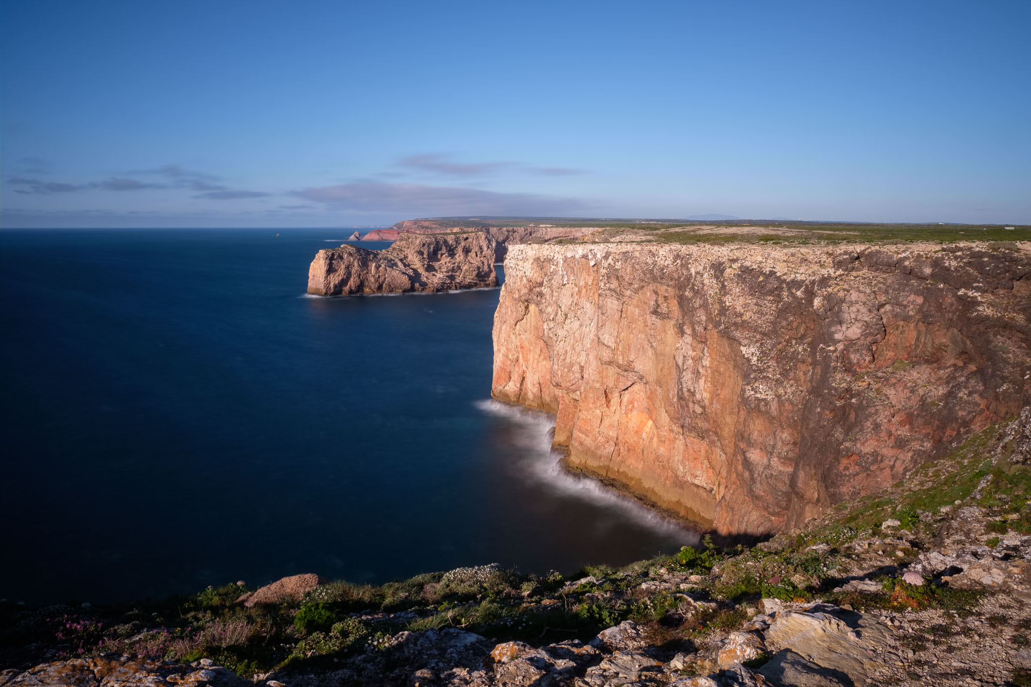
At the middle of the day, the light is not the most interesting one, so I decide to go for long exposures at Ponta Ruiva, using a neutral density filter. The blue of the sea is really vivid, and the coastal cliffs are more than 100 m high; down below, the waves crash incessantly against the rocks. We are close to Torre da Aspa, the highest point in the west coast of the Algarve, and it shows.

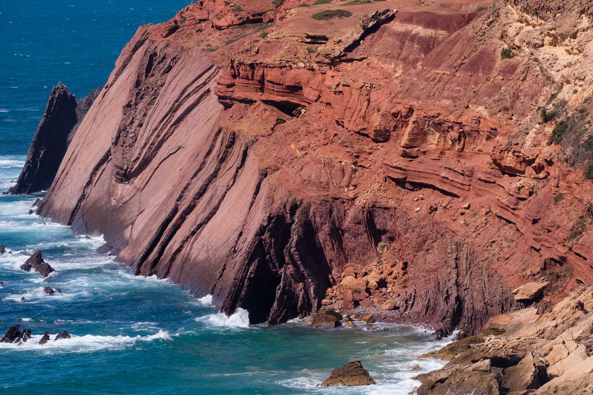
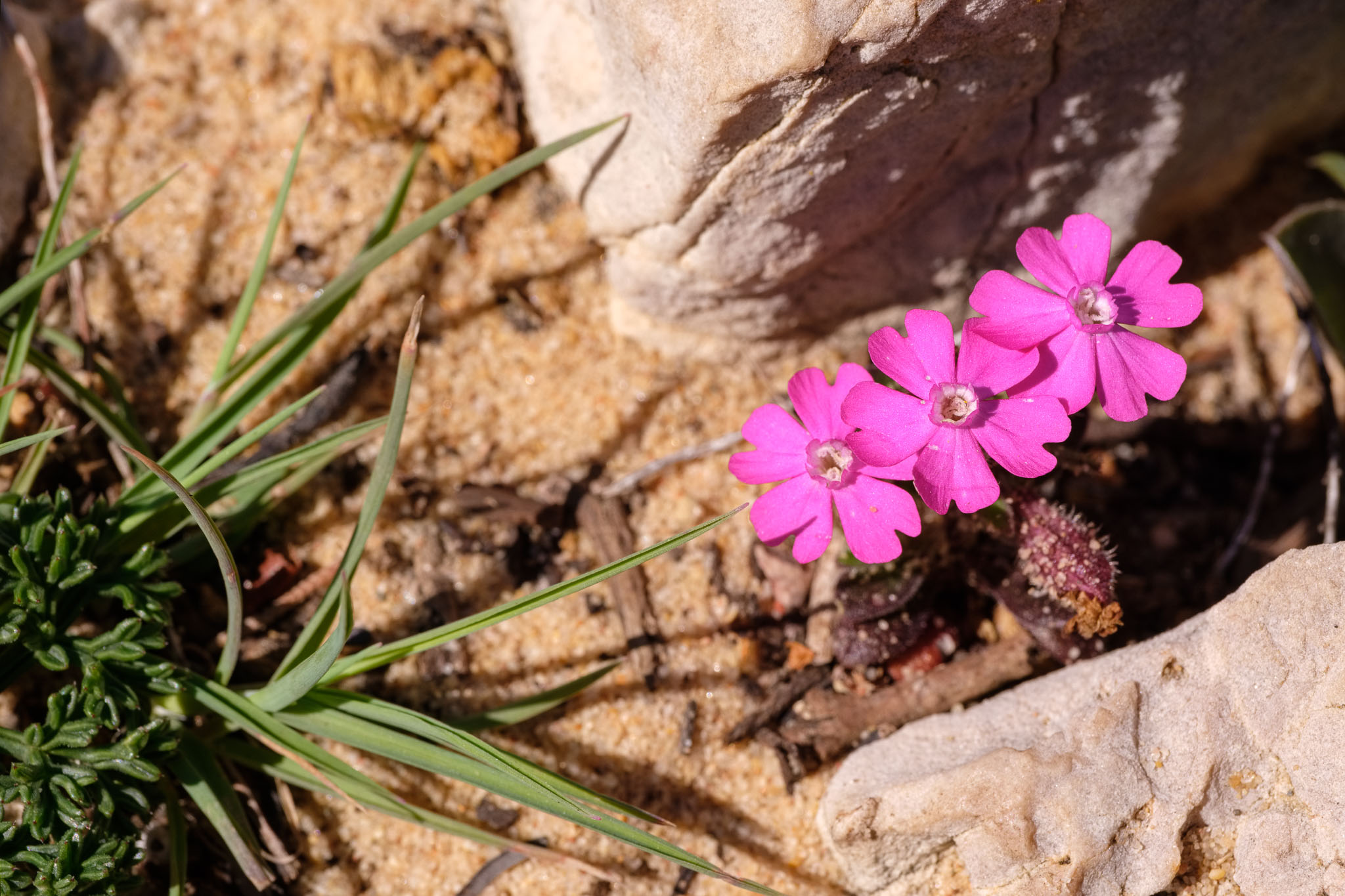
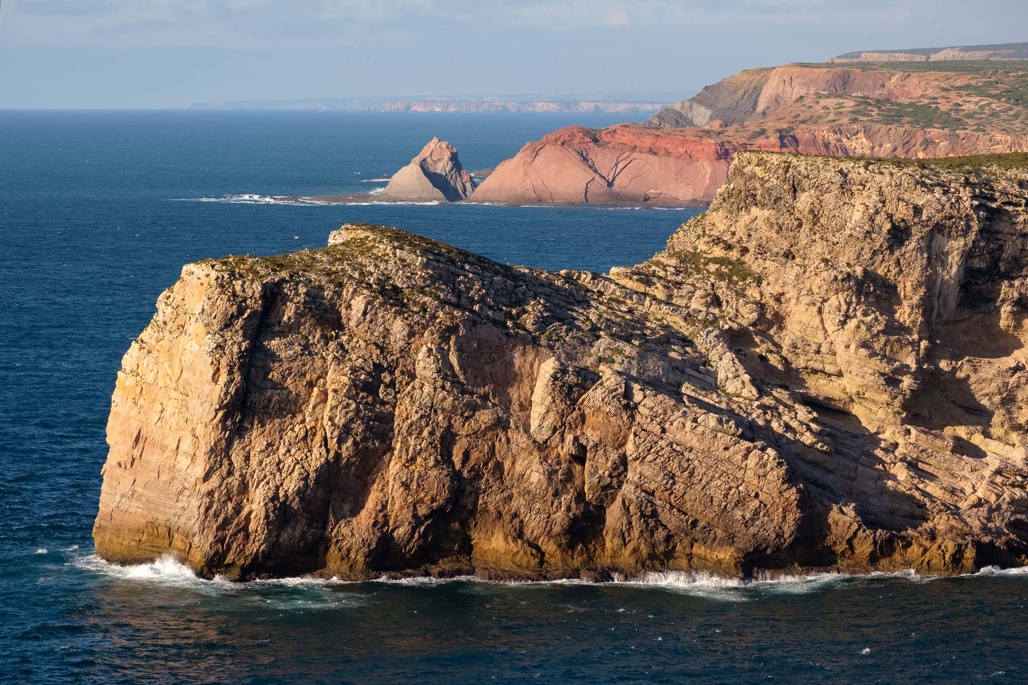
A note of caution, which is actually valid for this entire coastal region: the wind is normally strong here, so take proper care when approaching the edge of the cliffs. I keep walking, already with the Cabo São Vicente and its lighthouse visible in the distance. But before arriving there, it is time for a picnic lunch in the Telheiro beach. This beach is famous for its geology, notably an angular unconformity, where the more recent rock strata overlies the near vertical older rocks below. This means that the older rocks were compressed by huge tectonic forces, uplifted and eroded for millions of years, before the younger ones were deposited over them. The best location to see this is on the northern part of the cliff, which is only accessible during low tide. Unfortunately, this is not the case, so I will have to go back another time. Still, this geometric relationship can be also be seen from above, even though it is not the optimal view. Along the trail near Telheiro, it is possible to see some endemic and rare plants, which grow in the calcareous soil of this area.
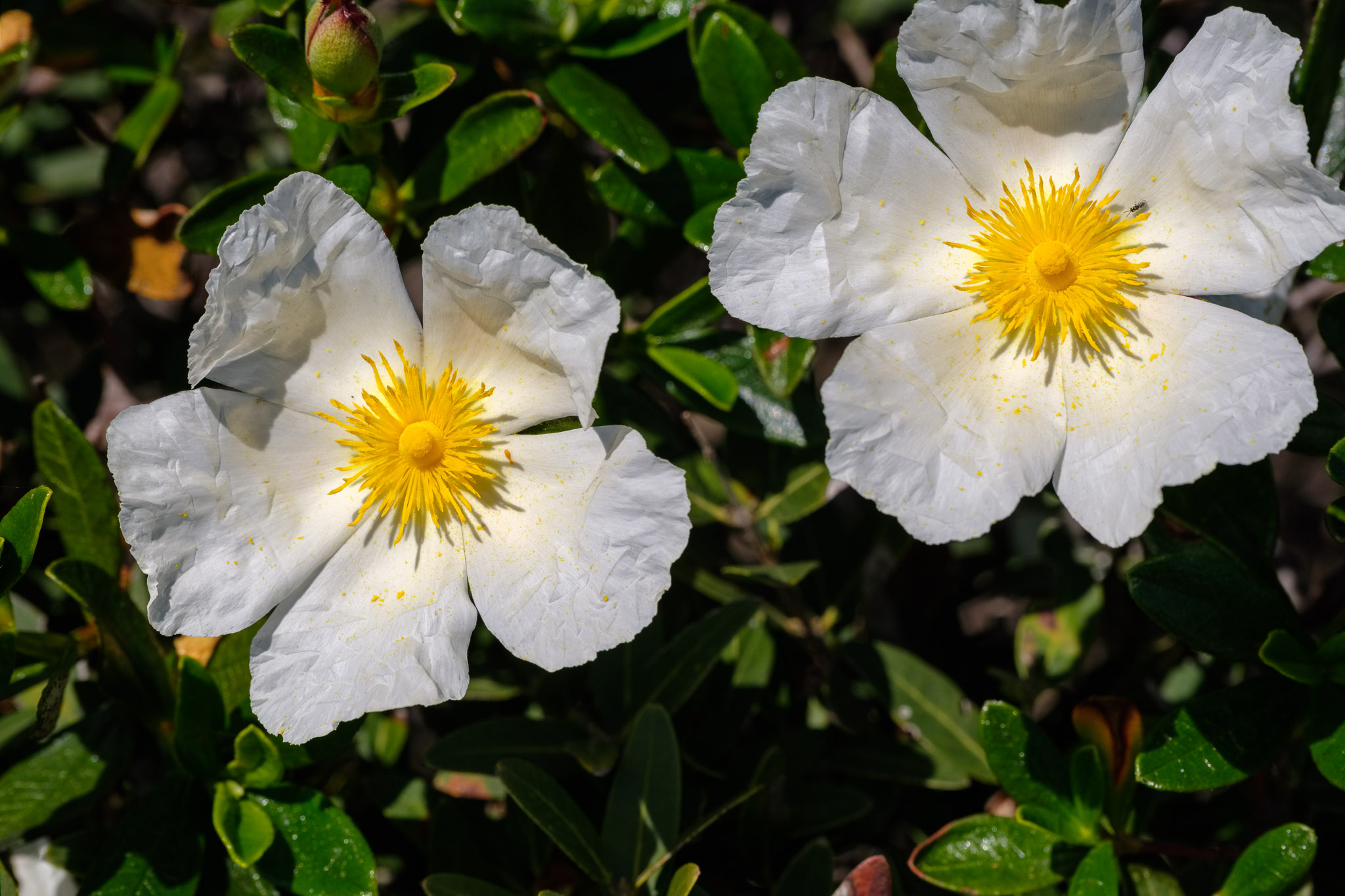
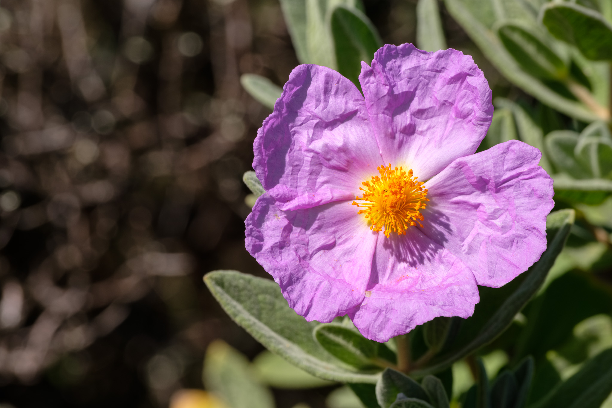
After Telheiro, the path enters an area composed of limestone rock, which has been eroded, creating a typical karstic landscape. The terrain is made up of loose rocks and is not level, so be careful not to twist an ankle. Many plants are in bloom, some with tiny flowers sheltered amongst the rocks, where the sand has accumulated.
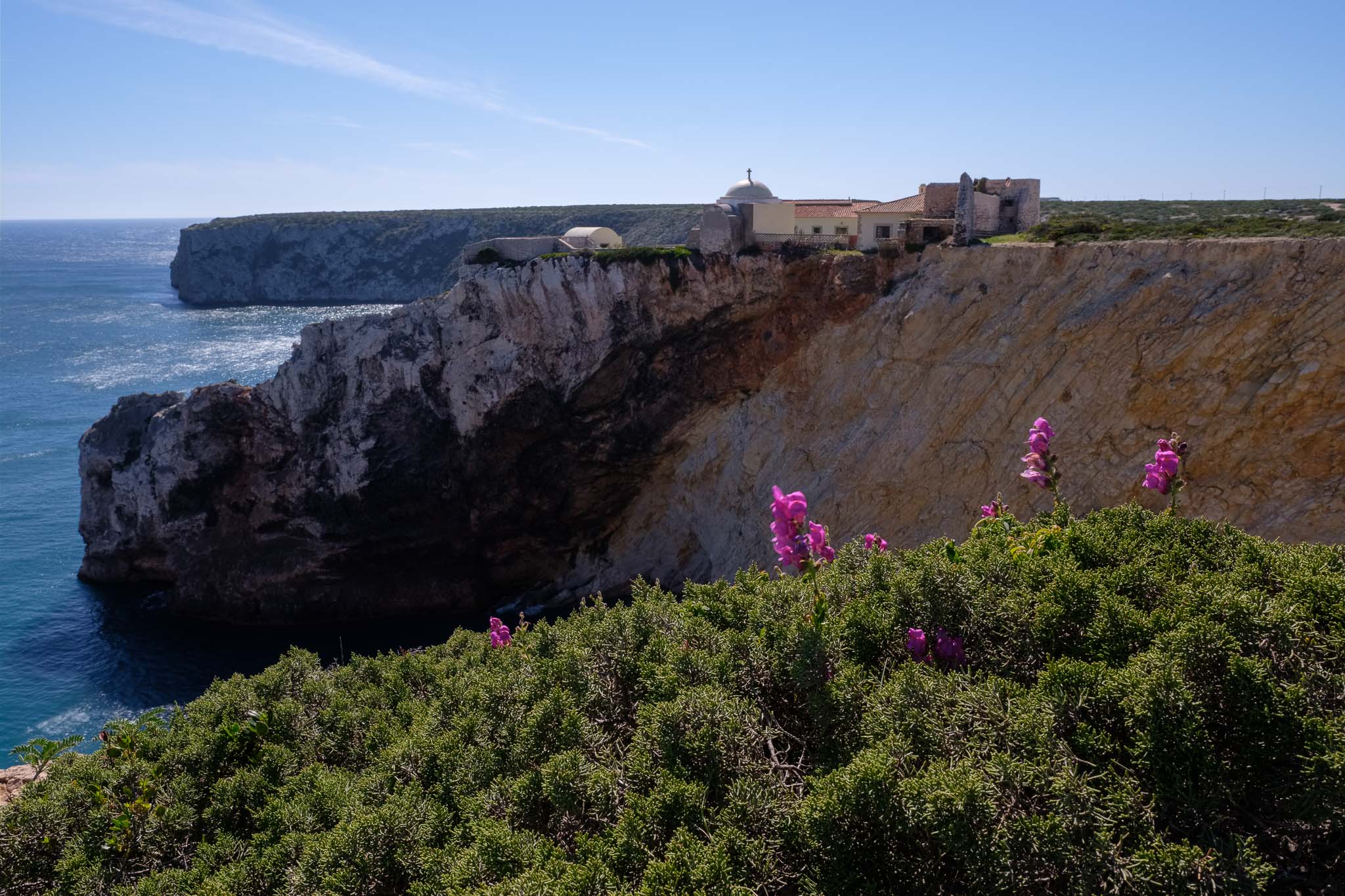
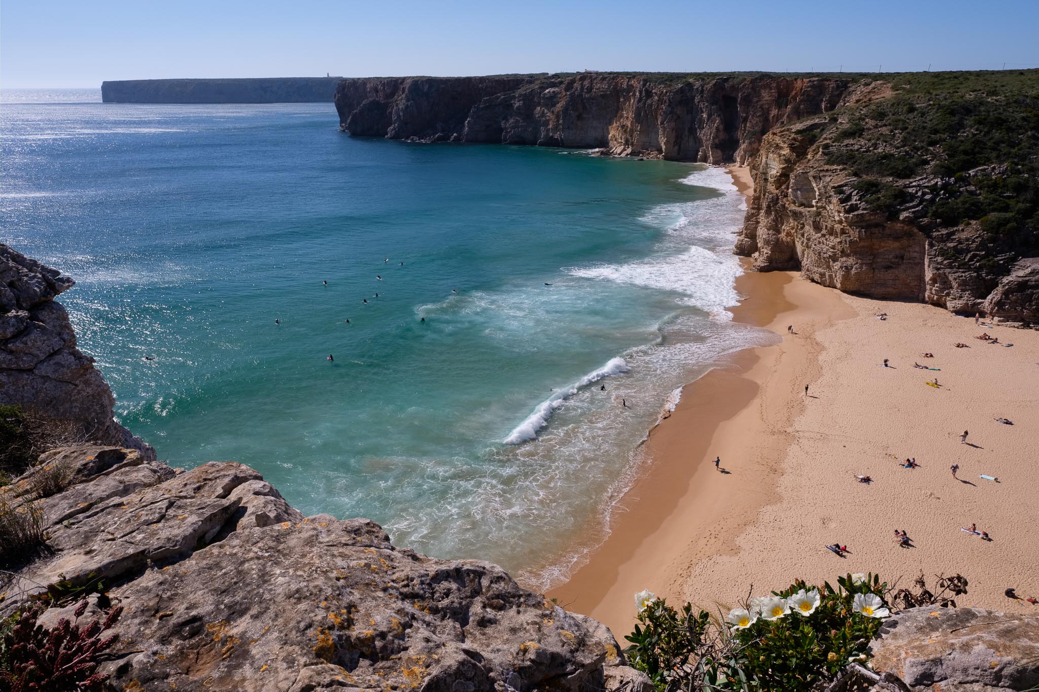
After a while, I arrive at São Vicente, but I do not stop there, since I plan to return at sunset. So I keep walking towards Sagres, leaving the path now and then to see the views from the top of the cliffs. It is worth stopping in Beliche to see the fort with the chapel, and the beach with the same name. The landscape here is amazing, with large promontories jutting into the sea. In the distance, it is possible to see the famous Sagres fort, from where the Portuguese Age of Discoveries was planned. People used to say that the world ended here, and one can appreciate why, when facing this endless sea.
I finally arrive in Sagres, and I am lucky because I do not have to wait long for the bus to Vila do Bispo. As a note, the bus stop is right next to the tourism office in the centre of the village. It is only a 10 minute ride back to Vila do Bispo, so pretty soon I am back where I started.
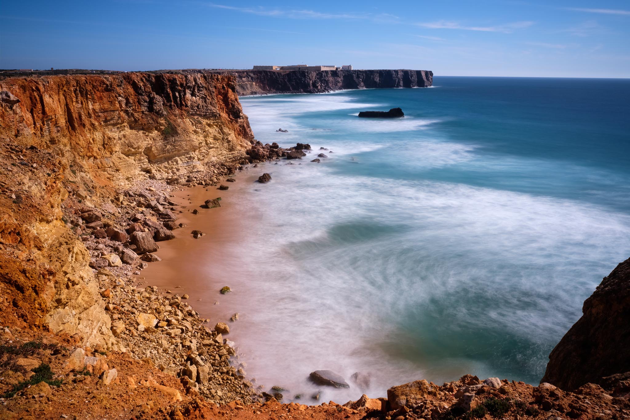
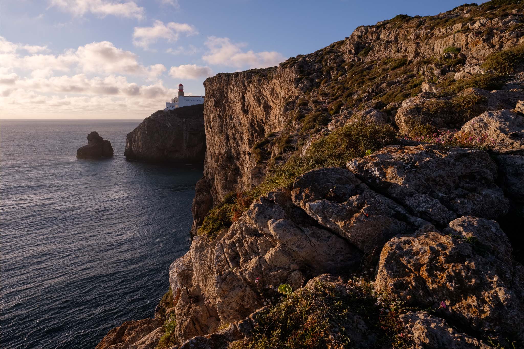
I rest for a little while, before driving to São Vicente for some photography at sunset. The lighthouse is a popular place with tourists, and a great viewpoint from which to admire the surrounding landscape. The sheer vertical cliffs dropping down from the plateau into the deep blue ocean below, with the crashing waves, make for a beautiful scenery. Again, please be careful if you venture into the cliffs, because the wind is really strong; a sudden change of wind direction can be dangerous if you are too close to the edge. I sit down on some rocks and set up the camera in the tripod to make some photos.
Watching the sun going down near the lighthouse was the perfect way to end this memorable day in this beautiful region.