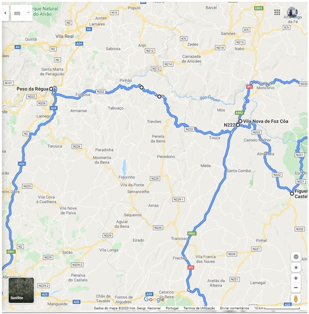
This is the third and final part of a series about my recent visit to the Vila Nova de Foz Côa (VNFC) region. Parts 1 and 2 can be found here:
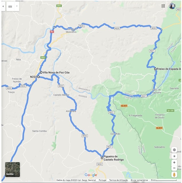
We departed VNFC early in the morning and started the journey to Freixo de Espada a Cinta (FEC), several km to the North. The road passes through a beautiful area of Portugal, limited to the East by the Douro river, which marks the border with Spain. This is a high altitude granitic and schist plateau, part of the geographic feature known as Iberian Meseta. The first village is Castelo Melhor, which I have alluded to before. From there, only a few km away, lies Almendra, considered one of the most beautiful historical villages in Portugal.
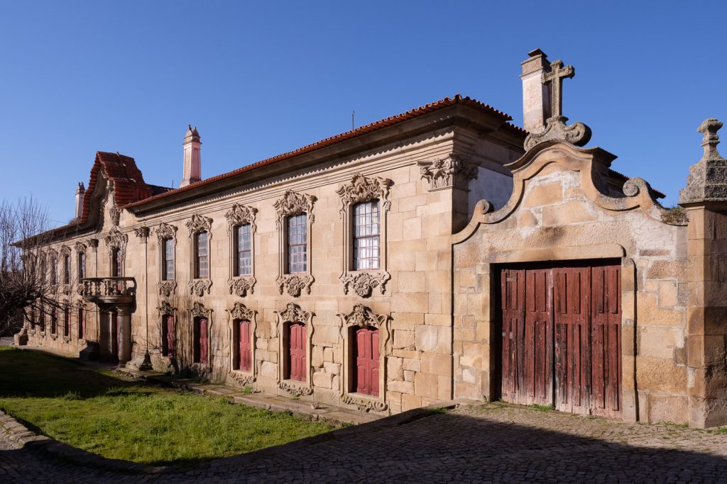
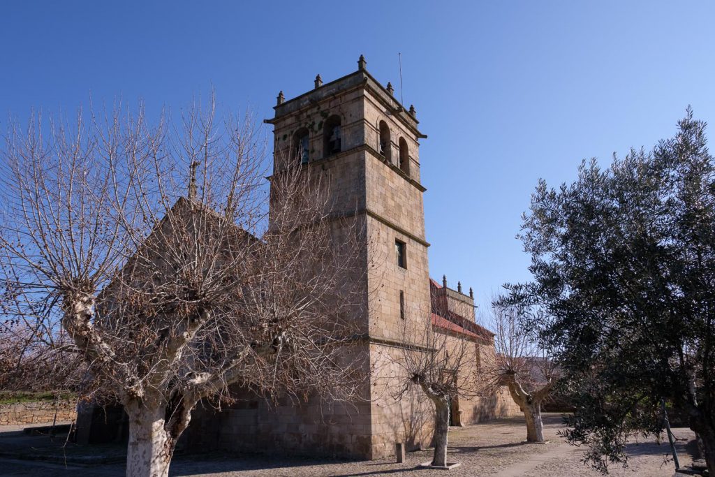
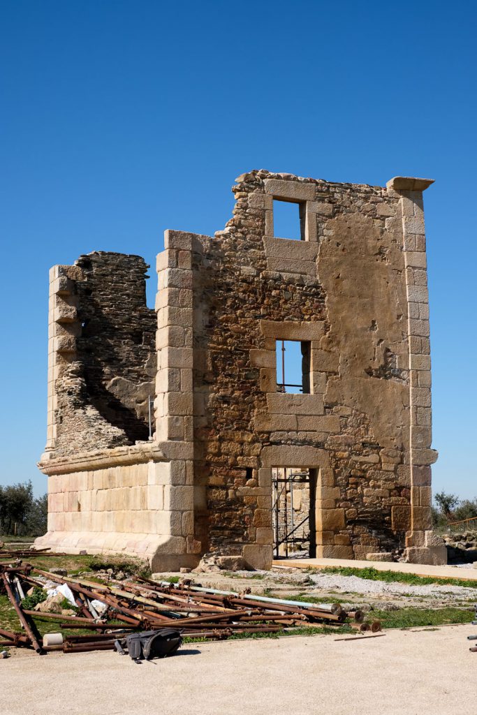
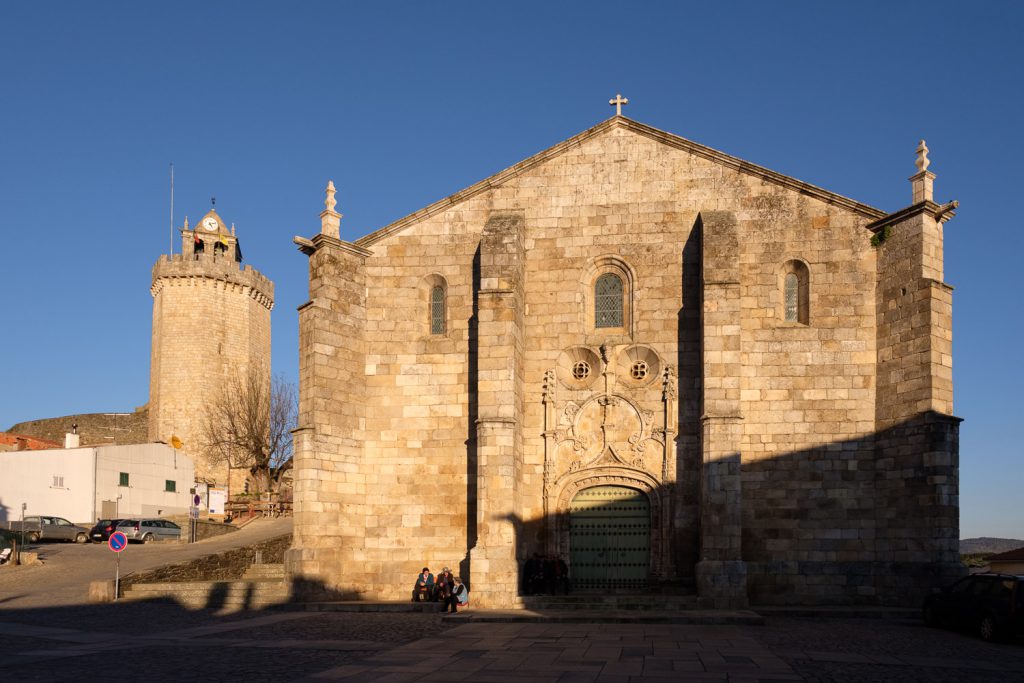
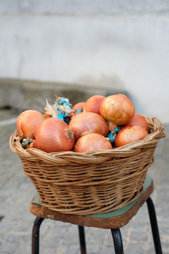
Its name comes from the Arabic word for almond, and it is obvious why; once more, the almond trees are conspicuous in the surrounding fields and farms. The village has several historic buildings, like the Manor (“Solar”) that for generations belonged to the Almendra Viscount. It is a palace from the XVIII century, built in the baroque style. Even though it lies in ruin today, its grandeur is still very apparent, with imposing granite facades. A long time before that, in the year 569 AC, the region was under Visigoth domain. The other important building is the Church of Our Lady of Angels, which was built in the XVI century; it has an imposing profile, and its large size and strongholds attest its relevance in these frontier lands.
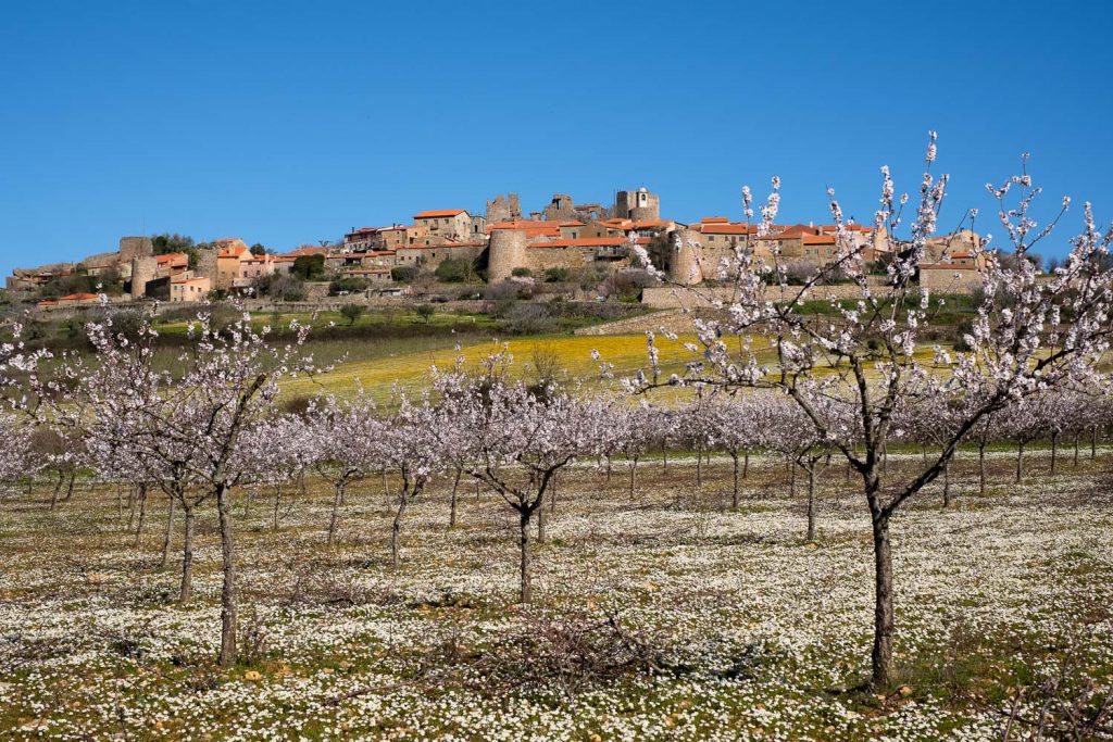
From Almendra, the road leads to Castelo Rodrigo, even closer to Spain. The landscape in between is characterized by granitic plateaus and sparse vegetation, with isolated boulders that have resulted from erosion by wind and water. Today it is quite warm for February, but it is not difficult to imagine the cold winter winds whistling thorough the region. Castelo Rodrigo sits atop a hill, which at this time of the year is surrounded by blooming almond trees; this makes a very picturesque scenery, so I had to stop to make a few photos. The entire medieval town is enclosed inside the castle walls, as a fortification, which was required, given its tribulated history that tells of many frontier wars with Spain.
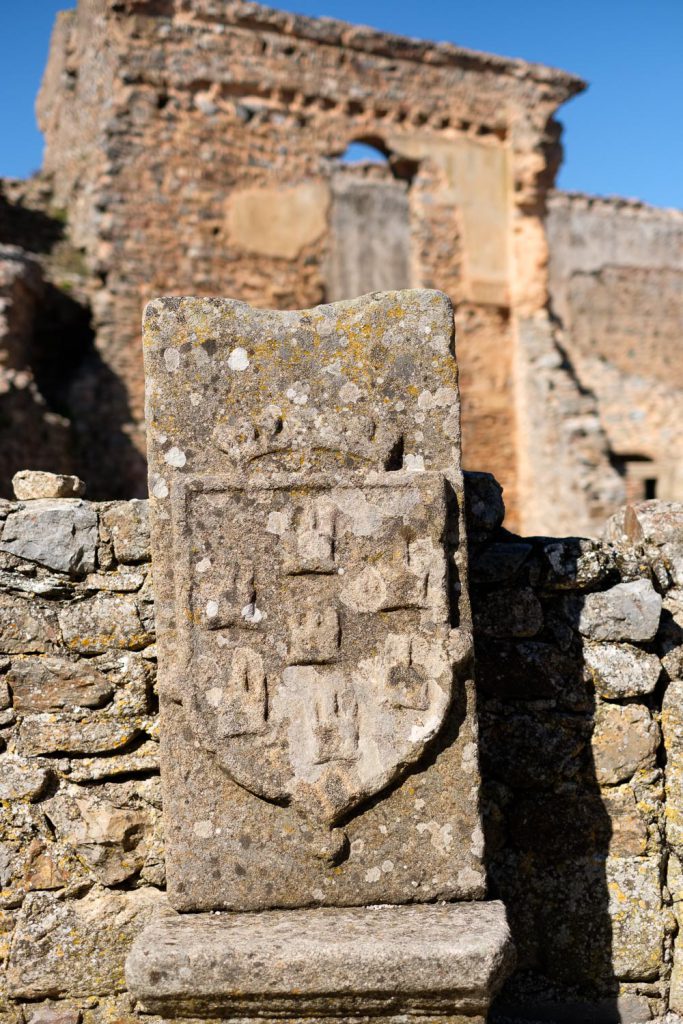
However, the history of the place goes well into the past, from pre-historic times to romans and Arabs; finally, in 1297 it was incorporated in Portugal. It is well worthwhile to spend some time walking along the narrow streets, feeling the history of the place. Also spend some time tasting the delicacies in the shops, particularly the almonds and almond liqueur. Inside the castle, note the “defamed upside down coat of arms”, a punishment by the King of Portugal imposed on the local nobility, who sided at the time with the opposing Spanish party in the war.
The next leg of our trip would take us to Barca de Alva, one of the entry points of the International Douro Natural Park. Before getting there, be sure to stop in the roman villa of Almofala, with its well-preserved tower. Given that it was lunch time, we had a picnic in a small resting area by the side of the road, under the shade of a willow tree, and close to a small creek. I even made a few long exposures of the running water, just for fun.
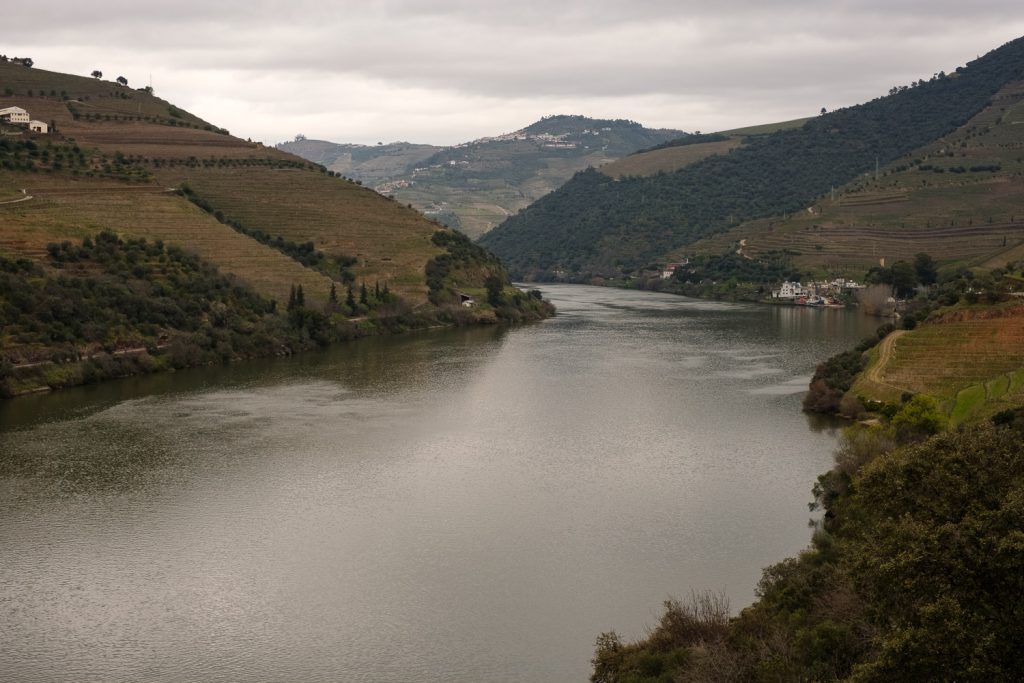
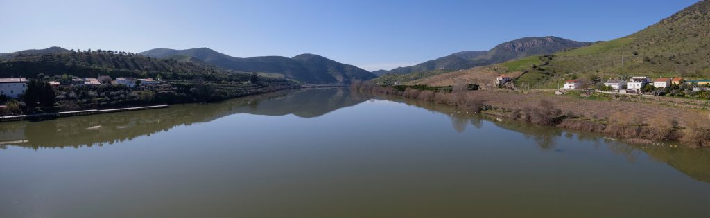
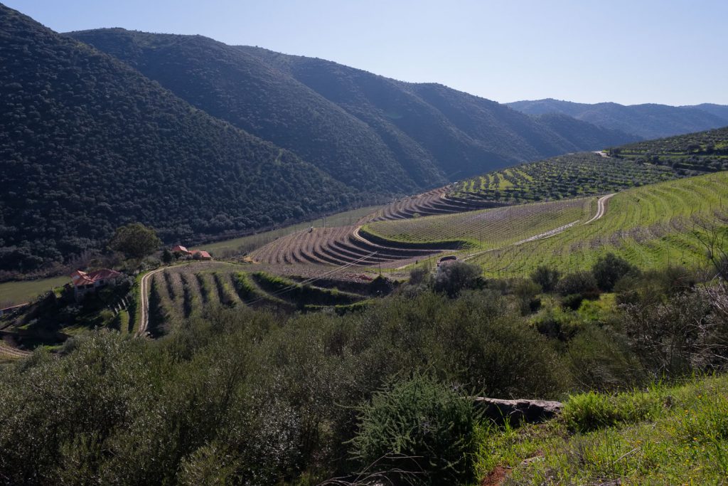
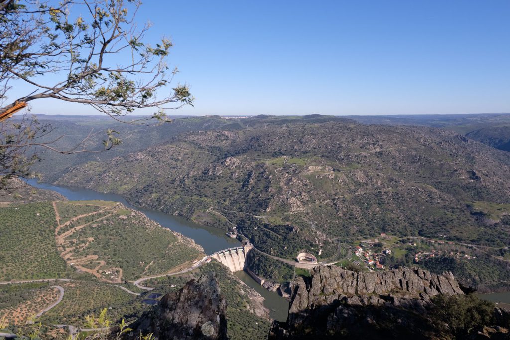
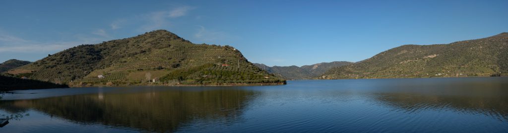
Approaching Barca de Alva, it is interesting to notice that the topography starts to change; in fact, the plateau area we had been crossing since morning, transitions into a rougher terrain, that descends precipitously towards the Douro valley. This is an important location, as it marks the end of the 200 km long train route that starts in Porto in the coast and goes along the Douro river upstream. Unfortunately, part of the route has been deactivated and is in disuse. It also marks the point up to which the Douro is navigable. The Mediterranean microclimate of the region, and how it affects the Douro valley, becomes apparent here: there are many fields cultivated with vineyards, almonds, orange and olive trees. This is where the region of Port wine truly begins.
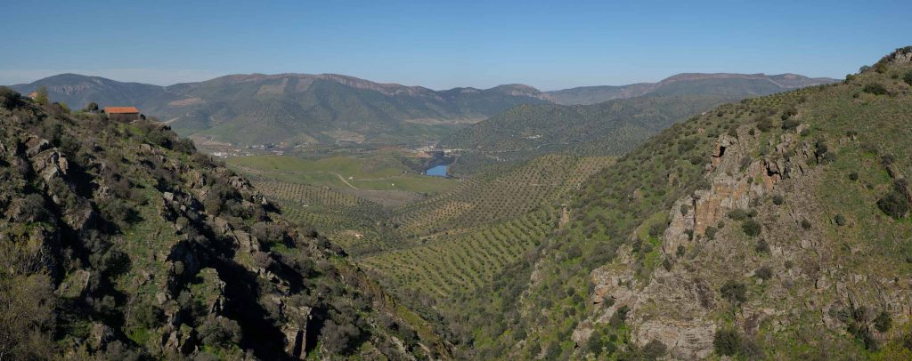
The rest of our trip will follow the road along the border with Spain, and it is impossible not to stop along the way to admire the landscape from several viewpoints. The most famous one is located just before arriving at FEC and is called Penedo Durão. This is a rocky spur that juts out over the Douro valley, at an altitude of around 700m. From this vantage point, and in the right season, many birds that are typical of this Natural Park can be observed: griffin, Egyptian vulture, peregrine falcon, amongst others. It is a great place to stop and appreciate the surrounding nature.
By the time we arrive at FEC, the sun is going down behind the mountains. This is another town rich in history, and whose foundation is lost in the mist of time. The origin of its name “Freixo” (Ash tree) and “Espada Cinta” (sword at waist) is not clear, and there are several legends. One story says that a goth nobleman whose name was “Espadacinta” took a nap under a Freixo after battling the Arabs in the Douro river. Another tells how king D. Dinis, when passing through this land, lied down to rest under the shade of a Freixo tree, but not before placing his mighty sword against it. While sleeping, the tree’s spirit guided the king to establish wise guidelines for the future. Regardless of the story, the town is full of interesting places to visit.
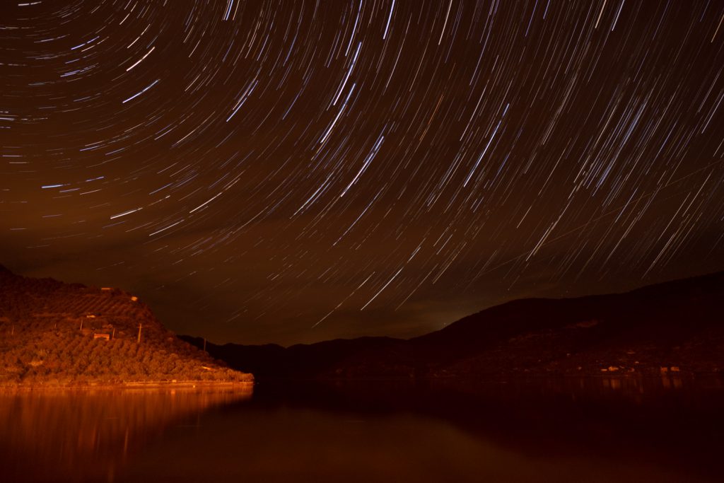
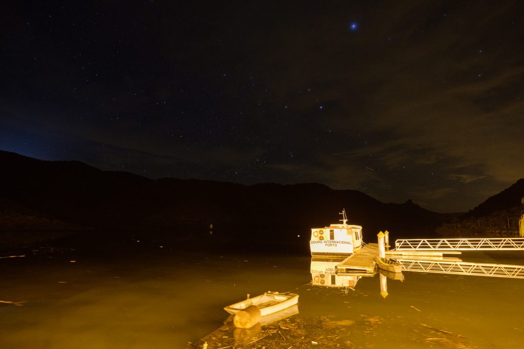
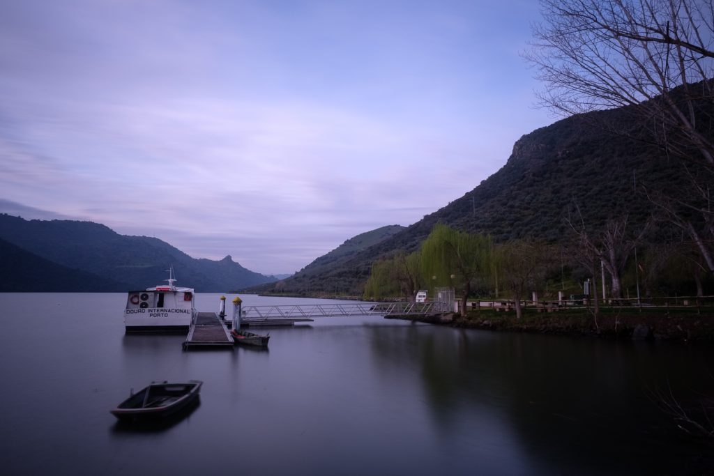
From FEC to the fluvial beach of Congida is a quick and short drive. This is a great place to spend the night, in peaceful tranquillity by the river Douro. The light of the setting sun reaches the banks of the river, bathing them in golden hues. I make haste with my tripod and camera to take a few shots of the surrounding scenery. At night, I went out to make a star trail session. As the river runs North to South, pointing the camera to the North will ensure a nice star trail rotating around Polaris. Fujifilm cameras make this extremely easy to set up, with their built in intervalometer. I programme the camera to shoot 100 frames of 30 seconds each, this will give me a total of 50 minutes of movement.
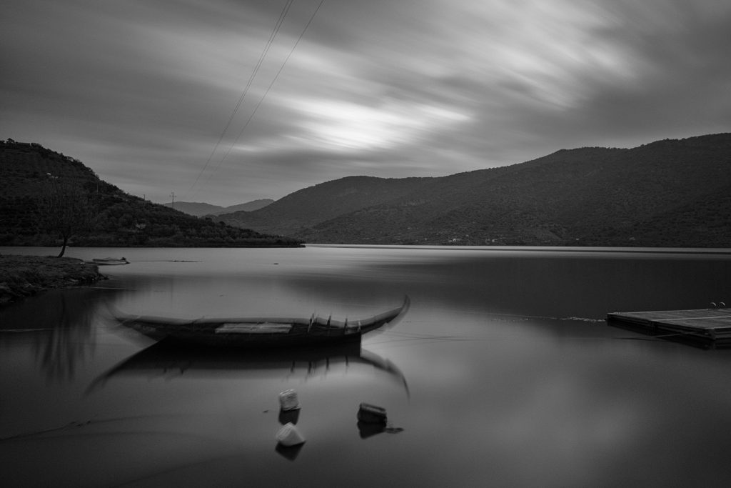
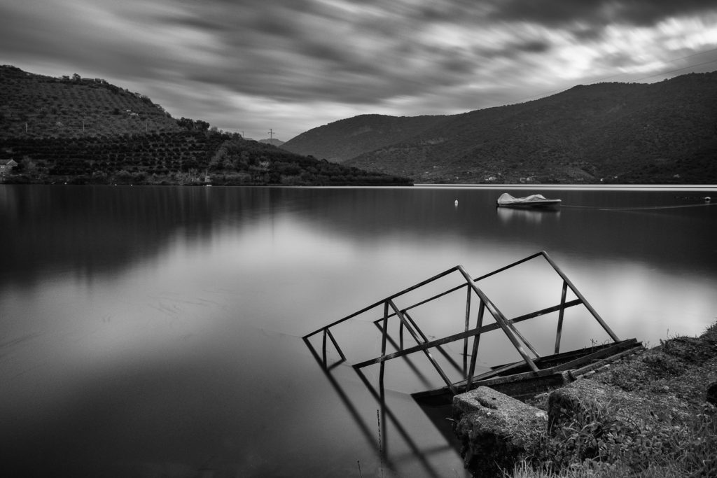
The following morning, I was out of the room before sunrise; the weather had turned cloudy, but that was good, as it added some more interest in the sky area for the photos. I walked around the beach, trying out different foregrounds such as boats and willow trees. I also opted for some long exposures, between a few seconds and 2 minutes; this has resulted in some interesting movement effects in the clouds. In the end, I decided to convert some of the photos to black and white, for added visual drama.
It was with a sad feeling that we left the area and returned home, after a few very fulfilling days in a beautiful part of the country. But we left with our hearts and minds richer, after experiencing all the culture, history, and landscape of the region.