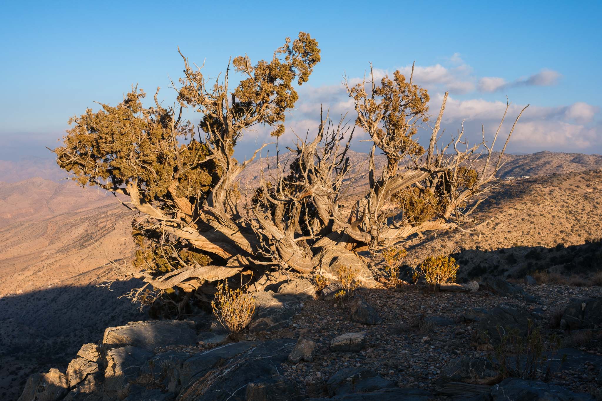
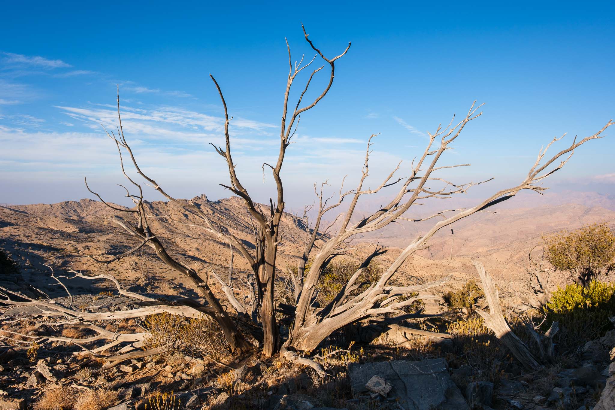
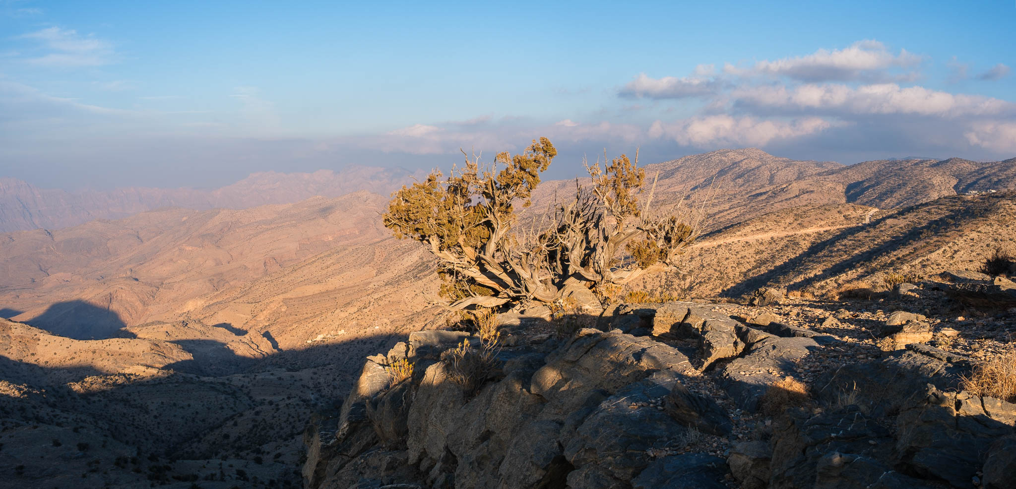
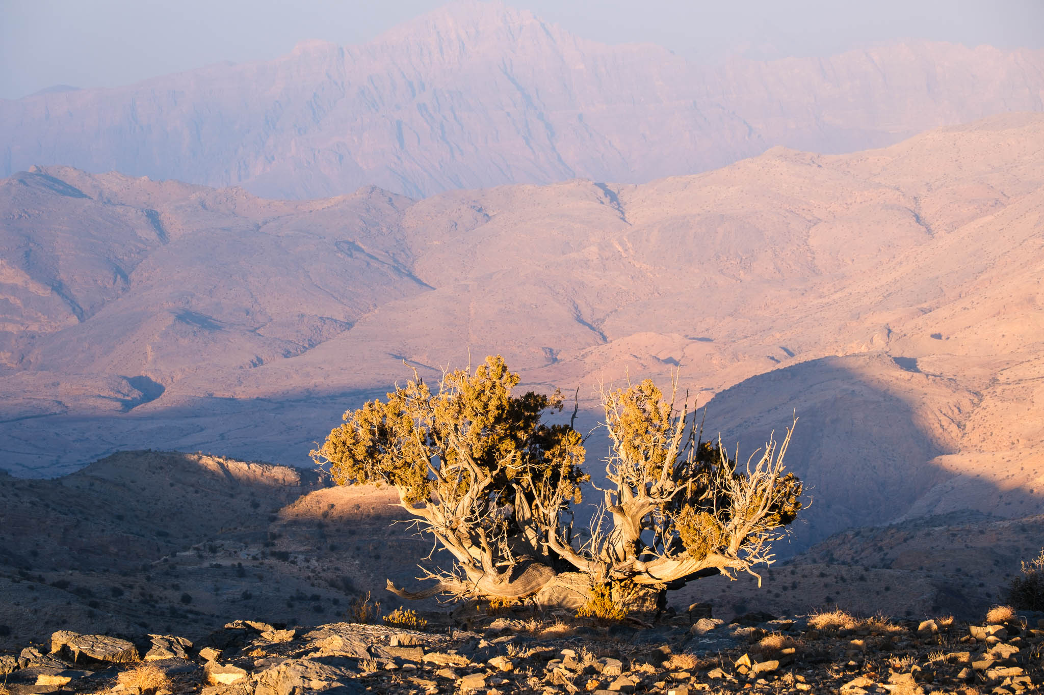
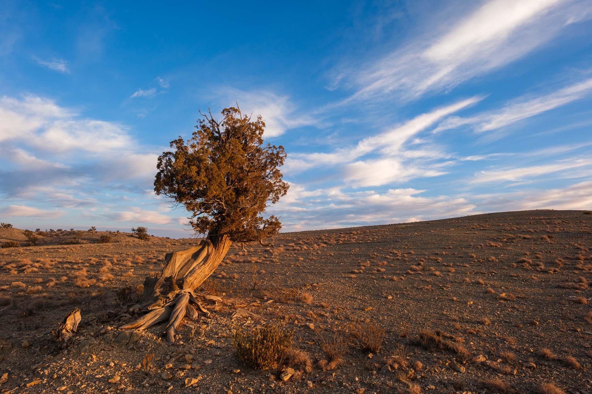
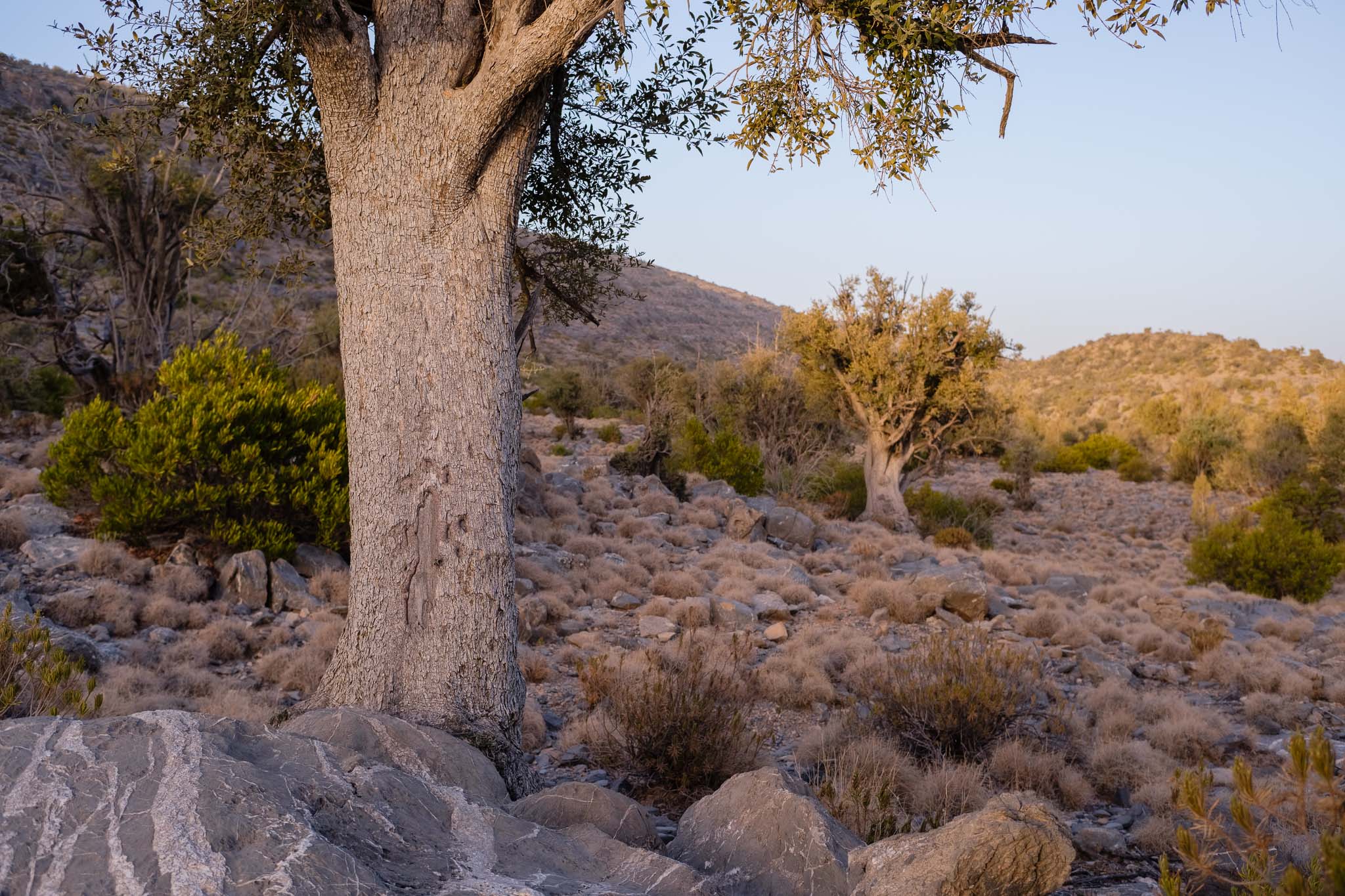
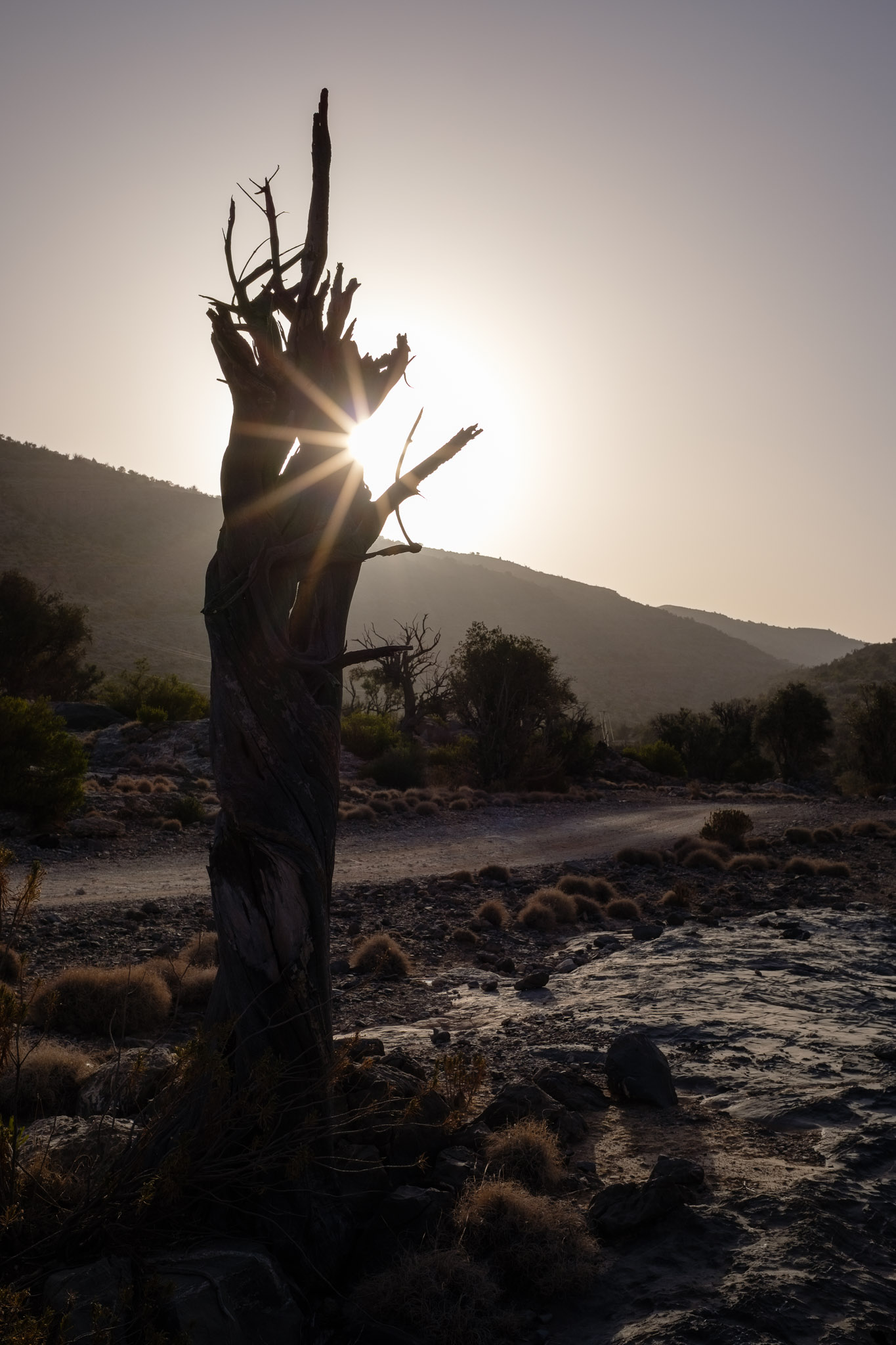
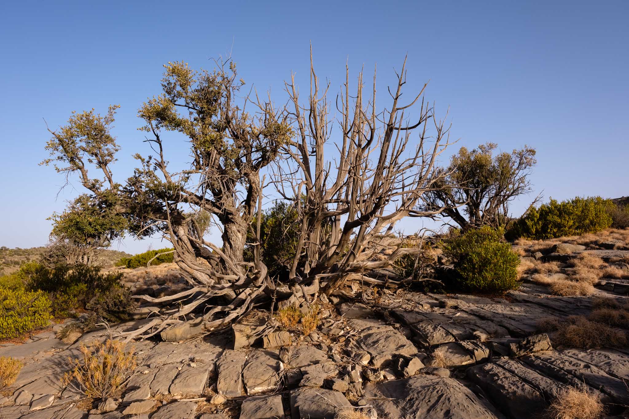
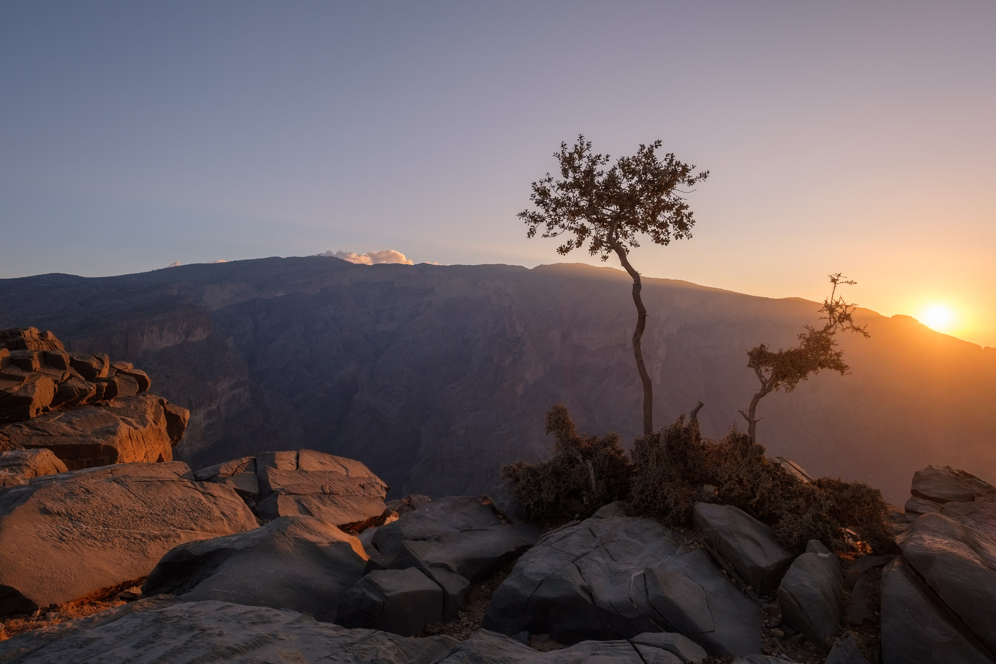
Trees have always been one of my favourite subjects. When I am out photographing landscapes, I am constantly on the lookout for an interesting tree that could provide that extra element. Oman is an arid country, but in the Jebel Akhdar mountains there are several places where trees present; thanks to increased rainfall, there are woods where it is possible to find junipers, bristlecone pines, and olive trees. They survive at high altitude, and often have twisted trunks full of character.
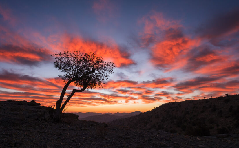
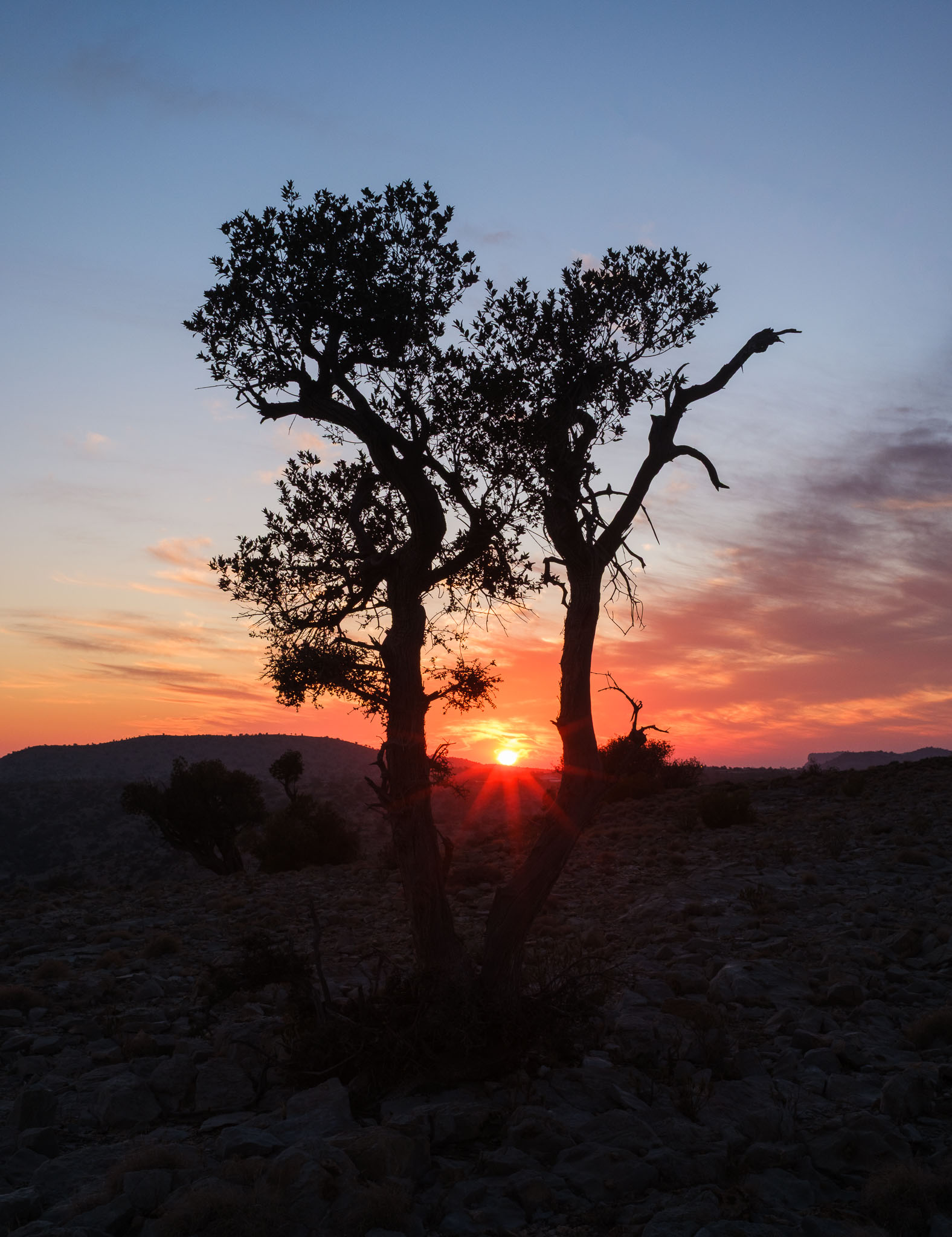
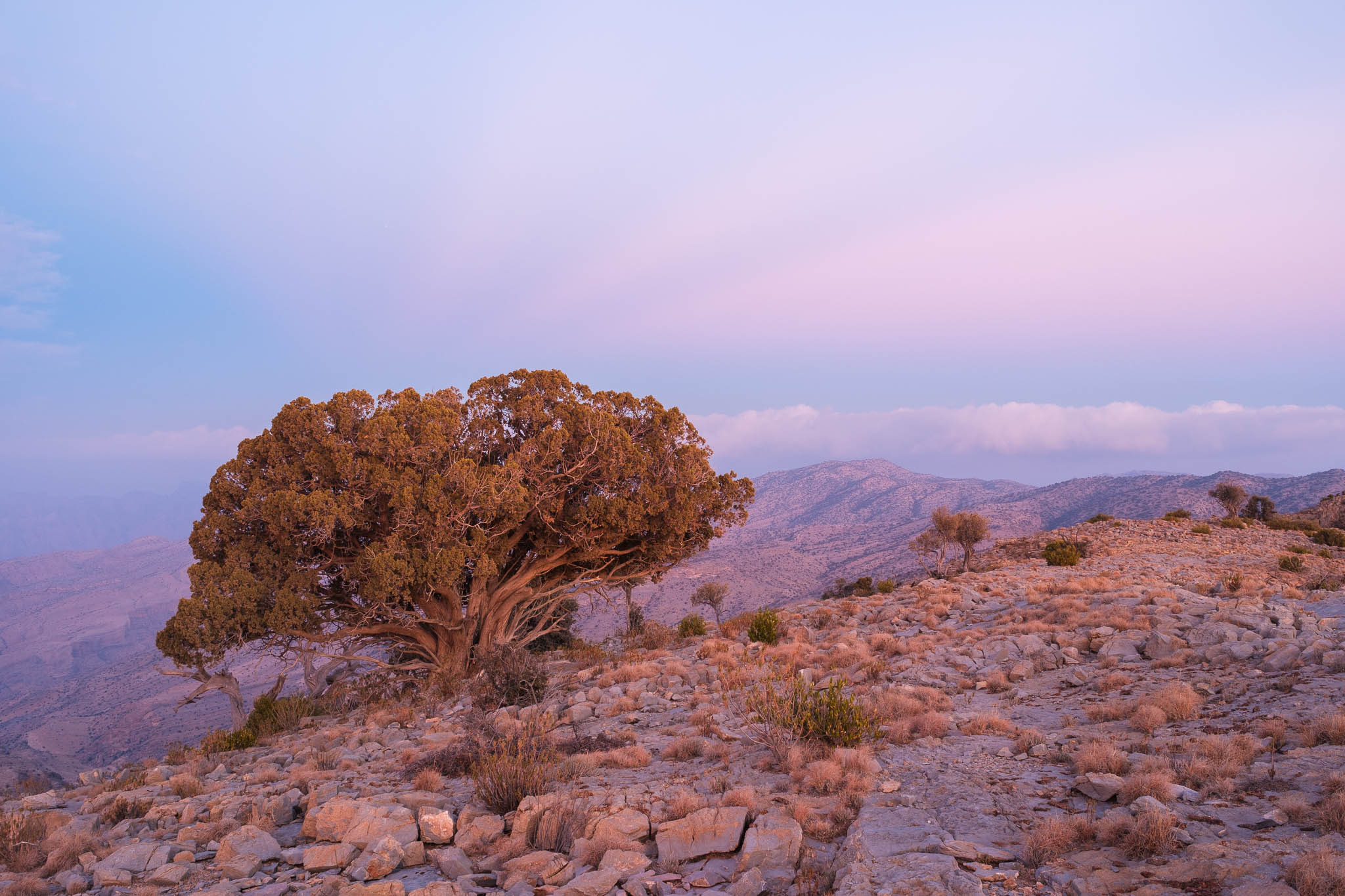
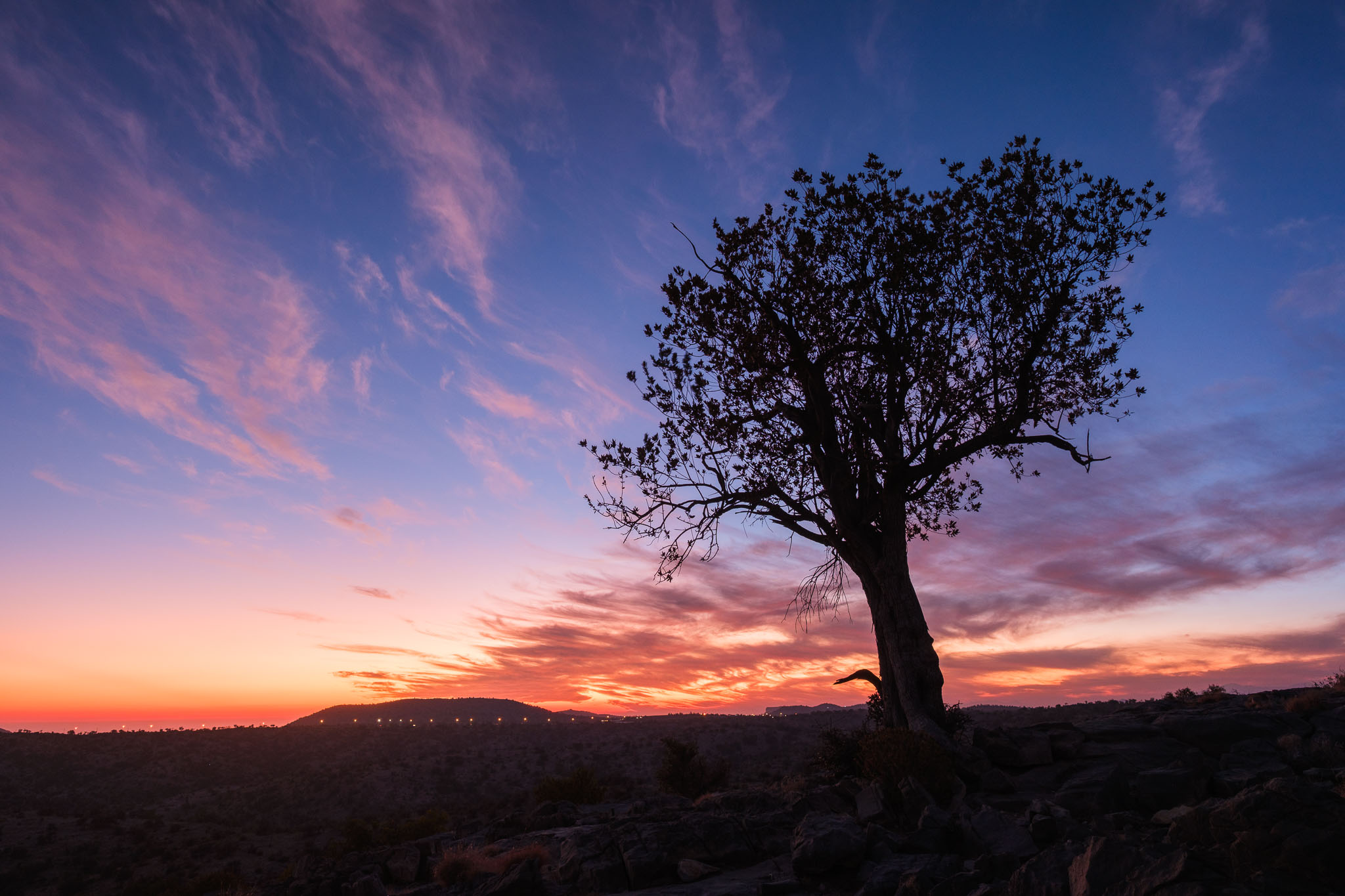
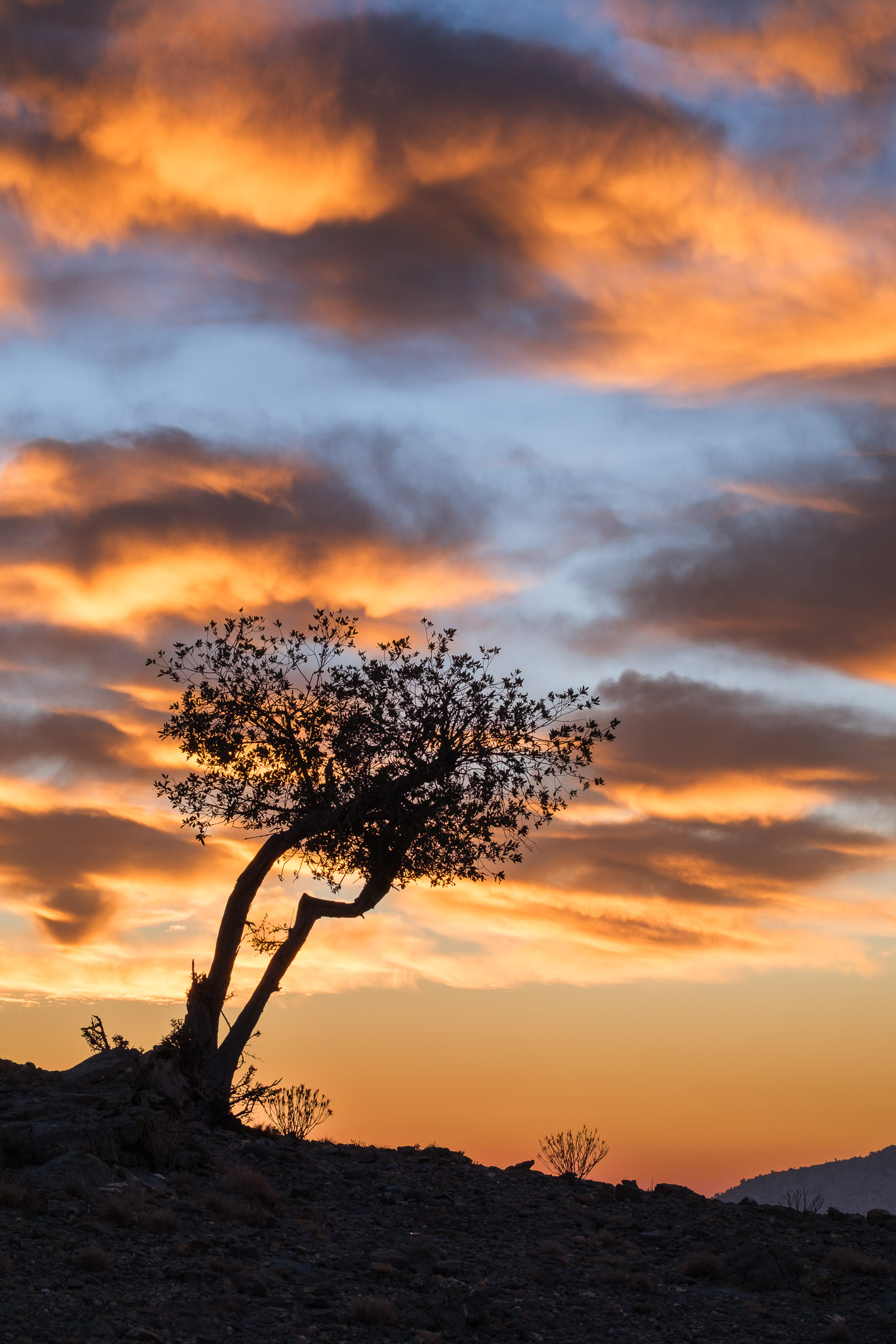
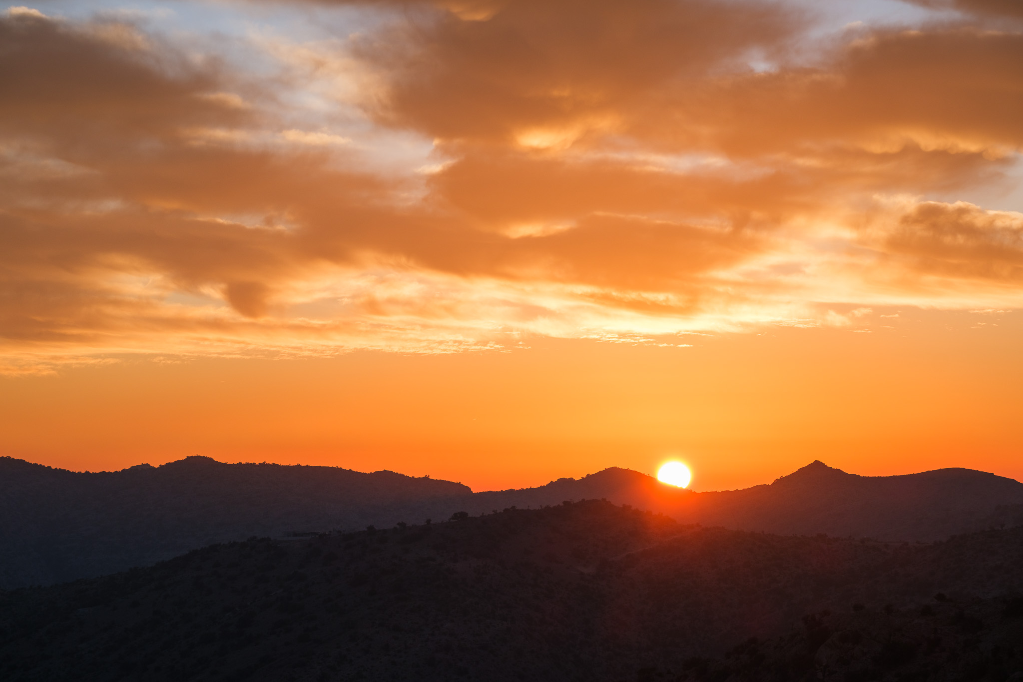
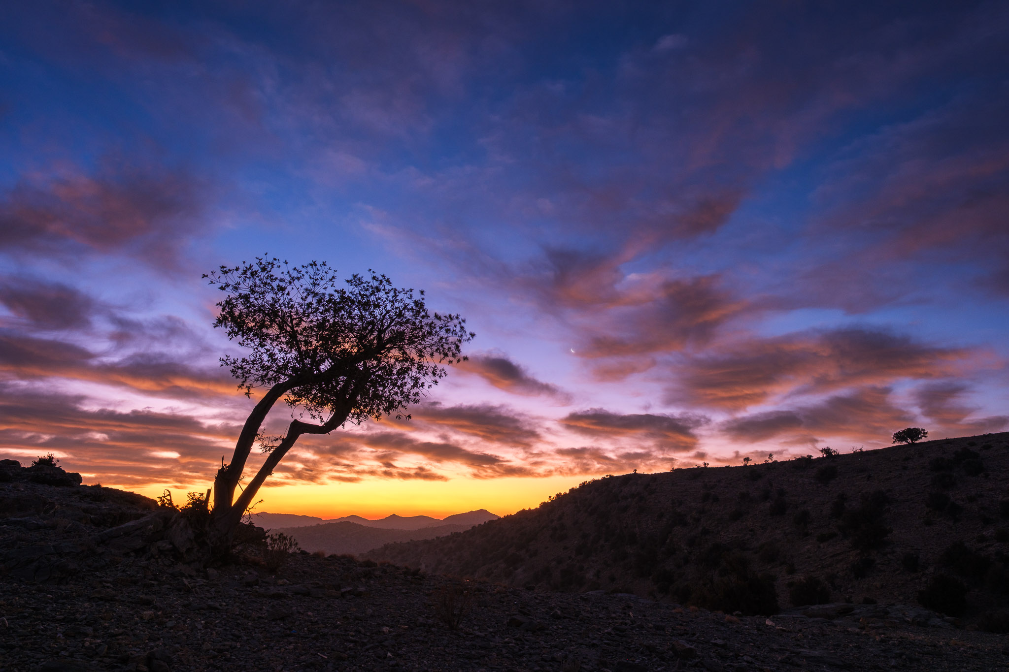
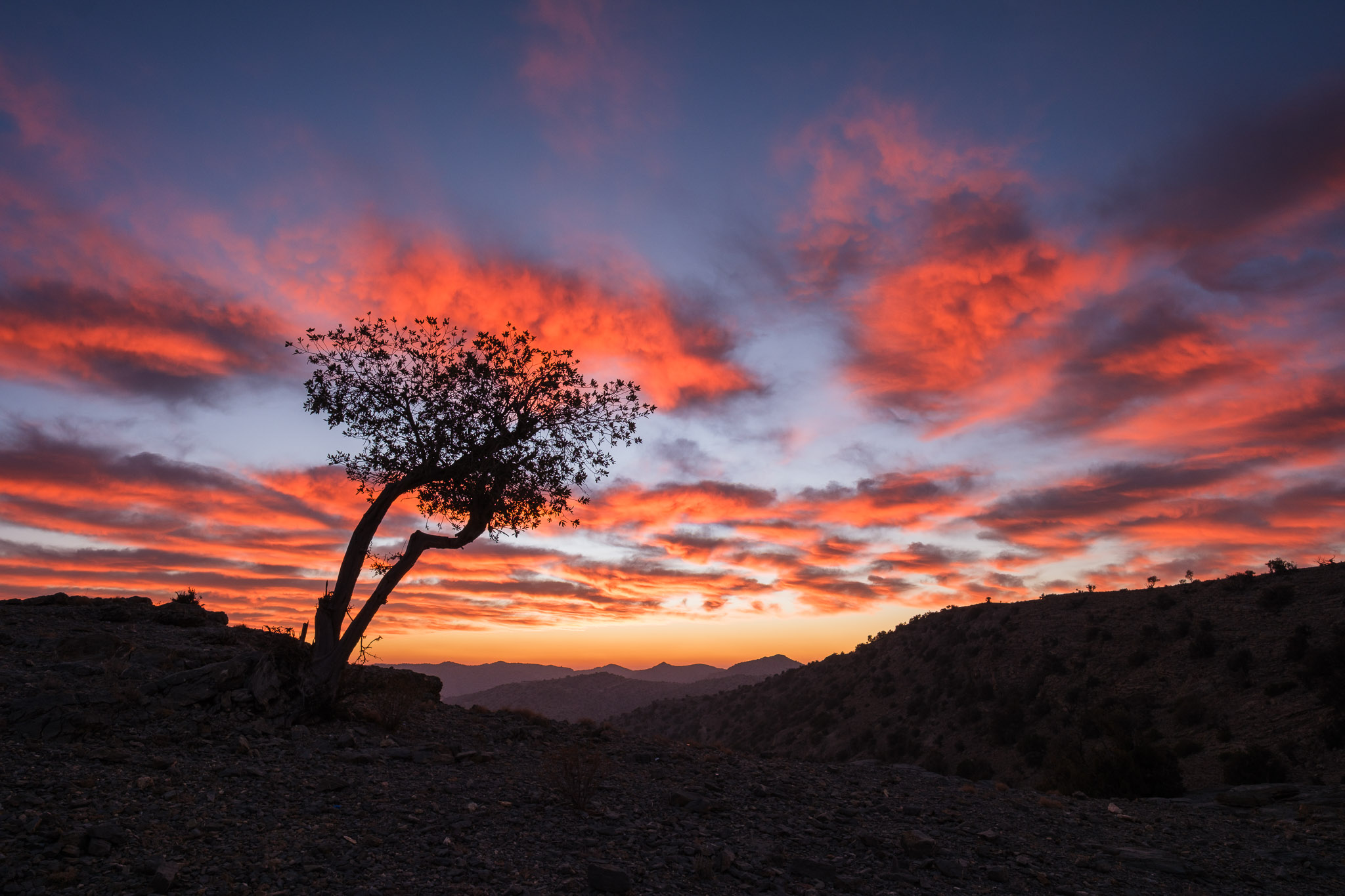
During a recent camping trip to the Sayq Plateau in Jebel Akhdar, I was lucky to find some interesting trees; I photographed them both at sunset and sunrise, and below are some of the resulting photos. Starting with the sunset photo session.
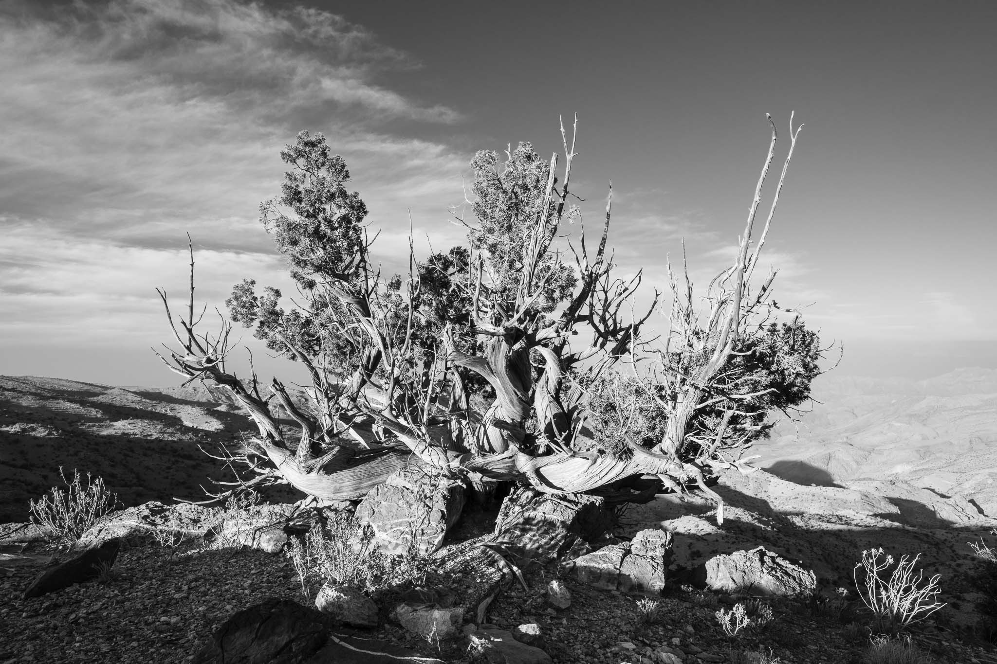
The following morning I woke up to a wonderful sunrise display, with colourful clouds and great light quality. Battling the near freezing cold, I photographed some more trees.
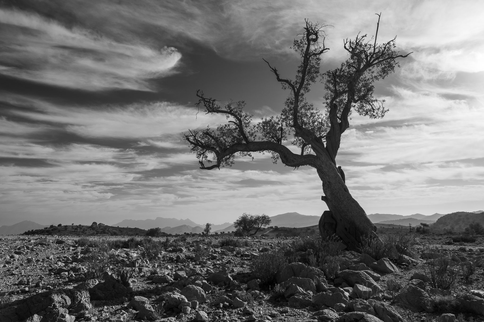
Fujifilm X-E5, Voigtlander 27mm lens.Peeking sun. Fujifilm X-T5, Fujinon 70-300mm lens.Fujifilm X-T5, Fujinon 14mm lens.This photo was taken just a few minutes after the previous one. The light was changing fast. Fujifilm X-T5, Fujinon 14mm lens.A small tree near my campsite, golden hour. Fujifilm X-T5, Fujinon 14mm lens.Black and white often works quite well too. Fujifilm X-T5, Fujinon 14mm lens.
I took a couple of weeks off during Christmas and New Year, spending some time with the family in the Alentejo coast in southwest Portugal. The weather was cold but often sunny, so we walked a couple of the Vicentina Route trails in the region. I particularly enjoy the circular trail (Route 24) in the Vila do Bispo area; you can find more details in the following web page:
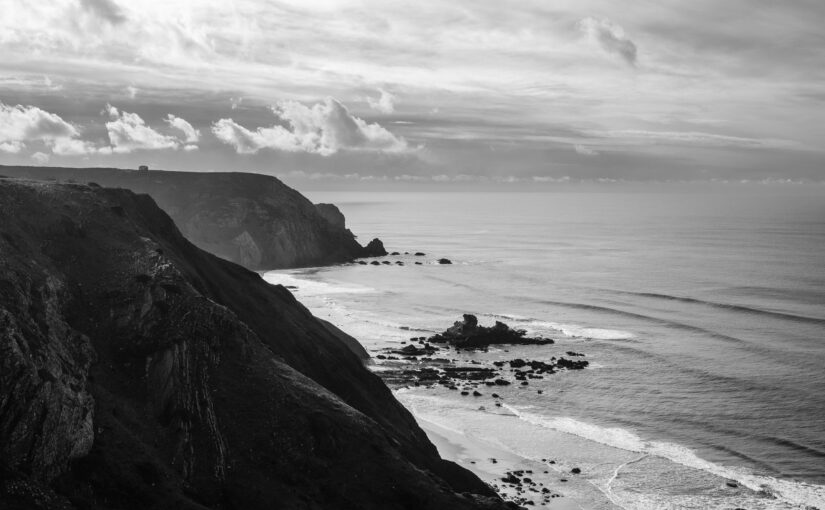
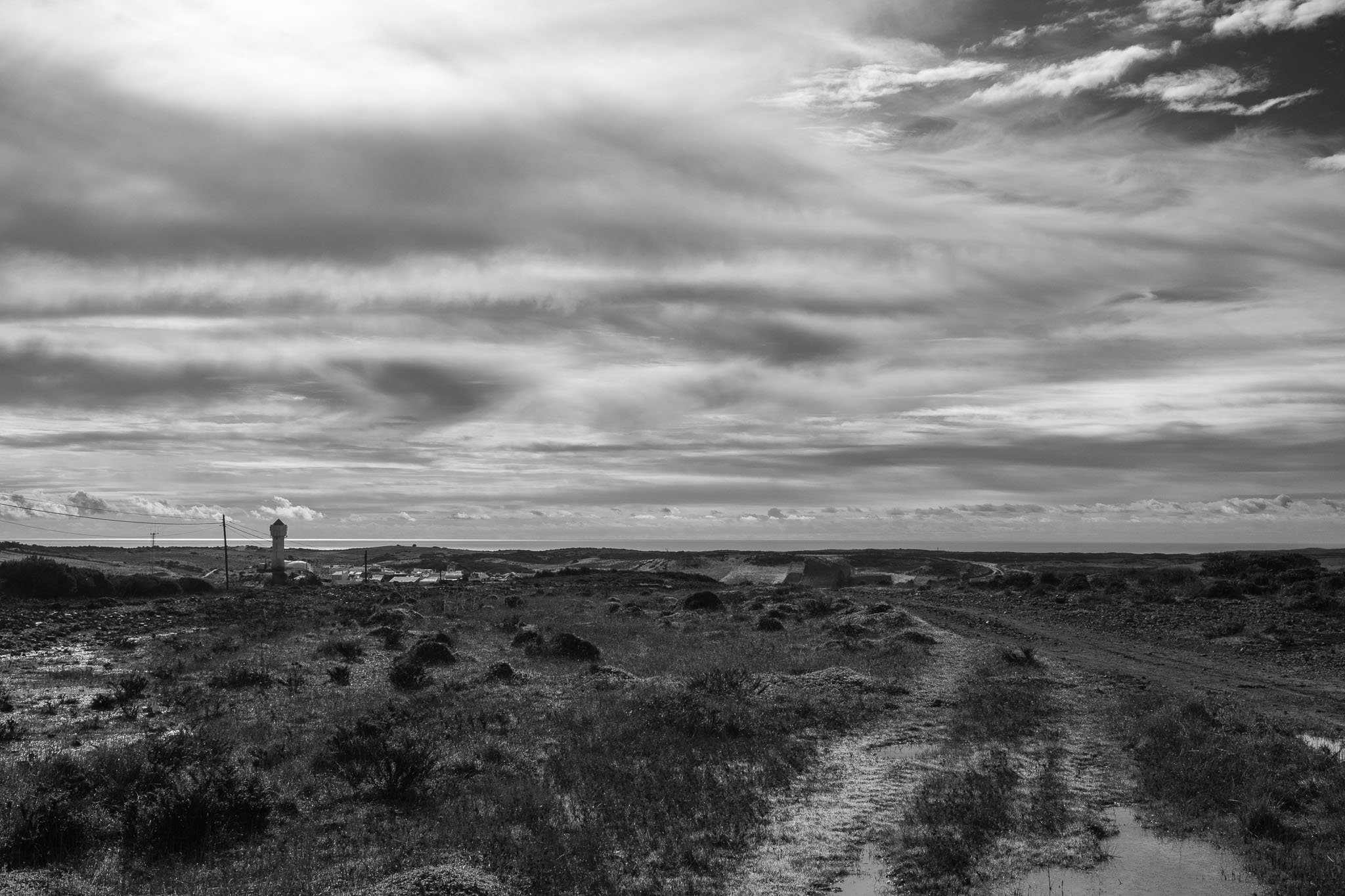
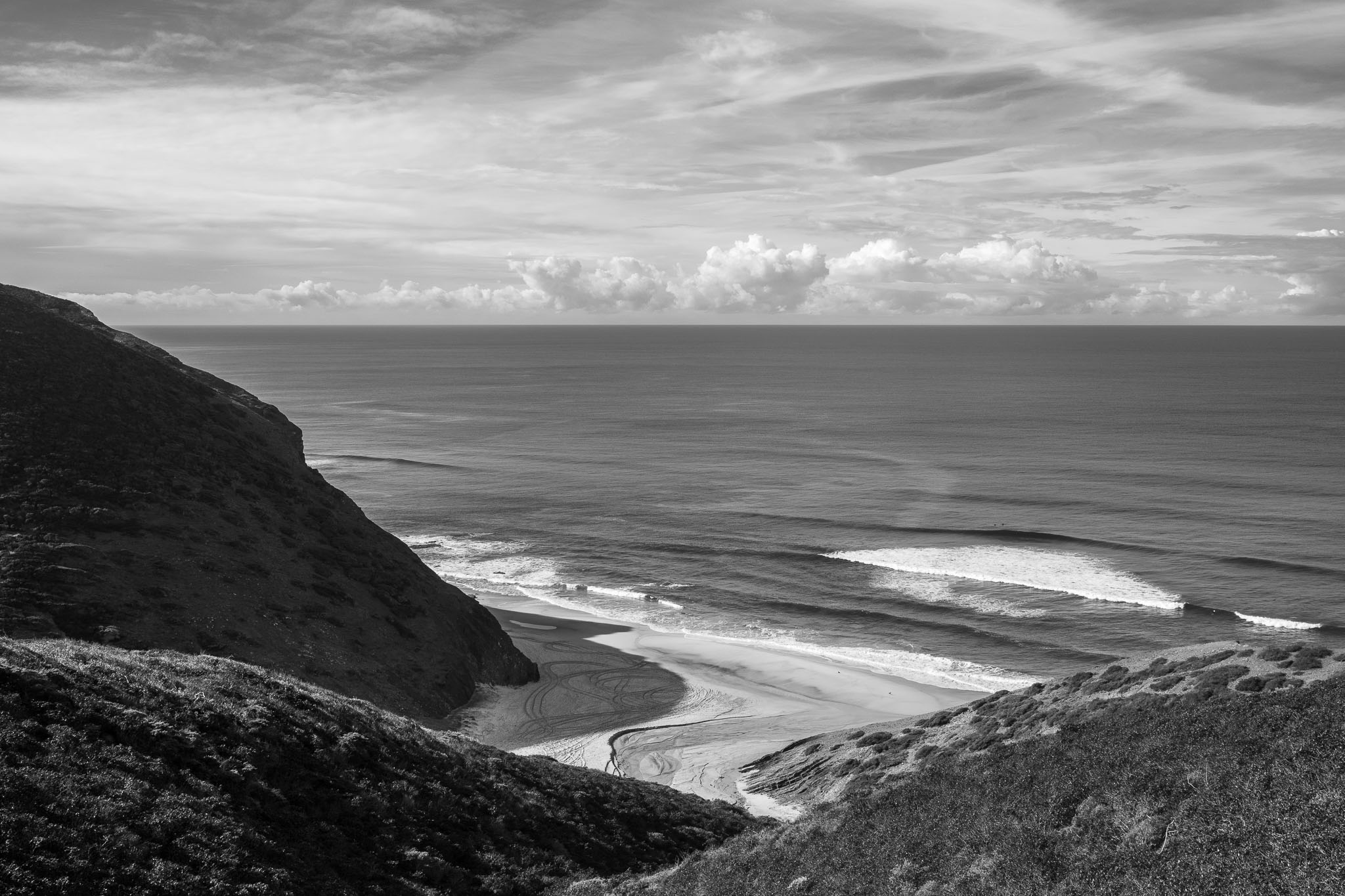
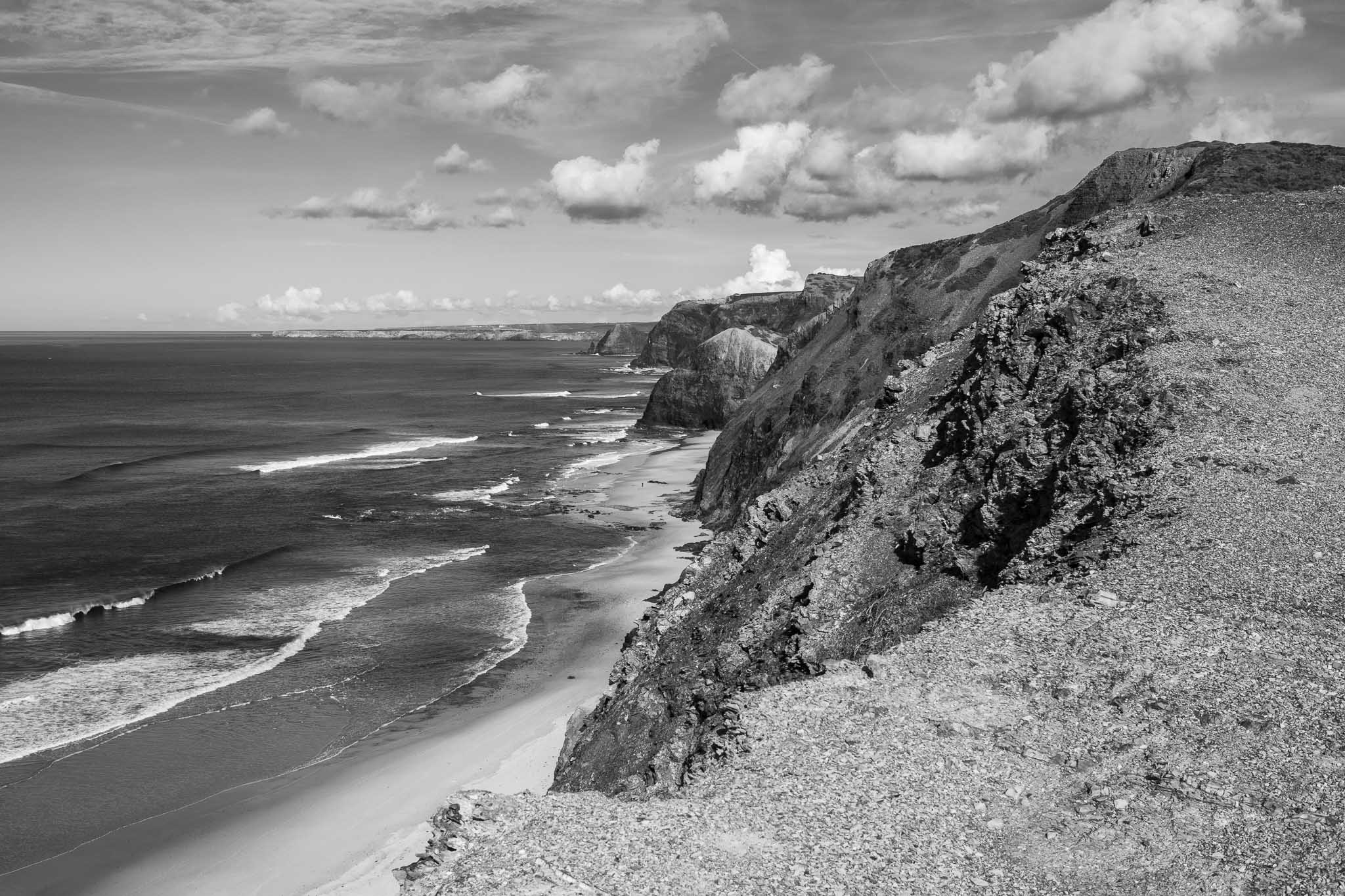
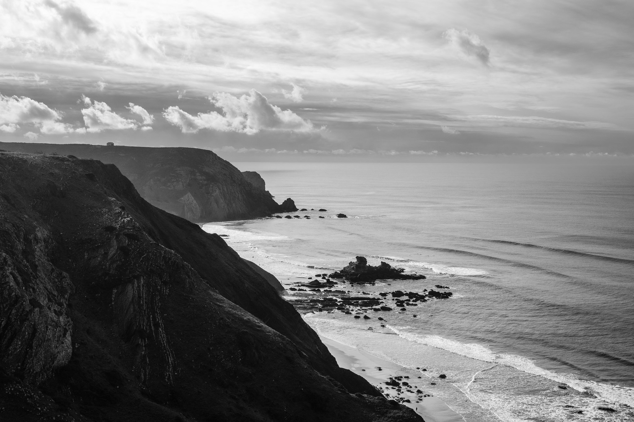
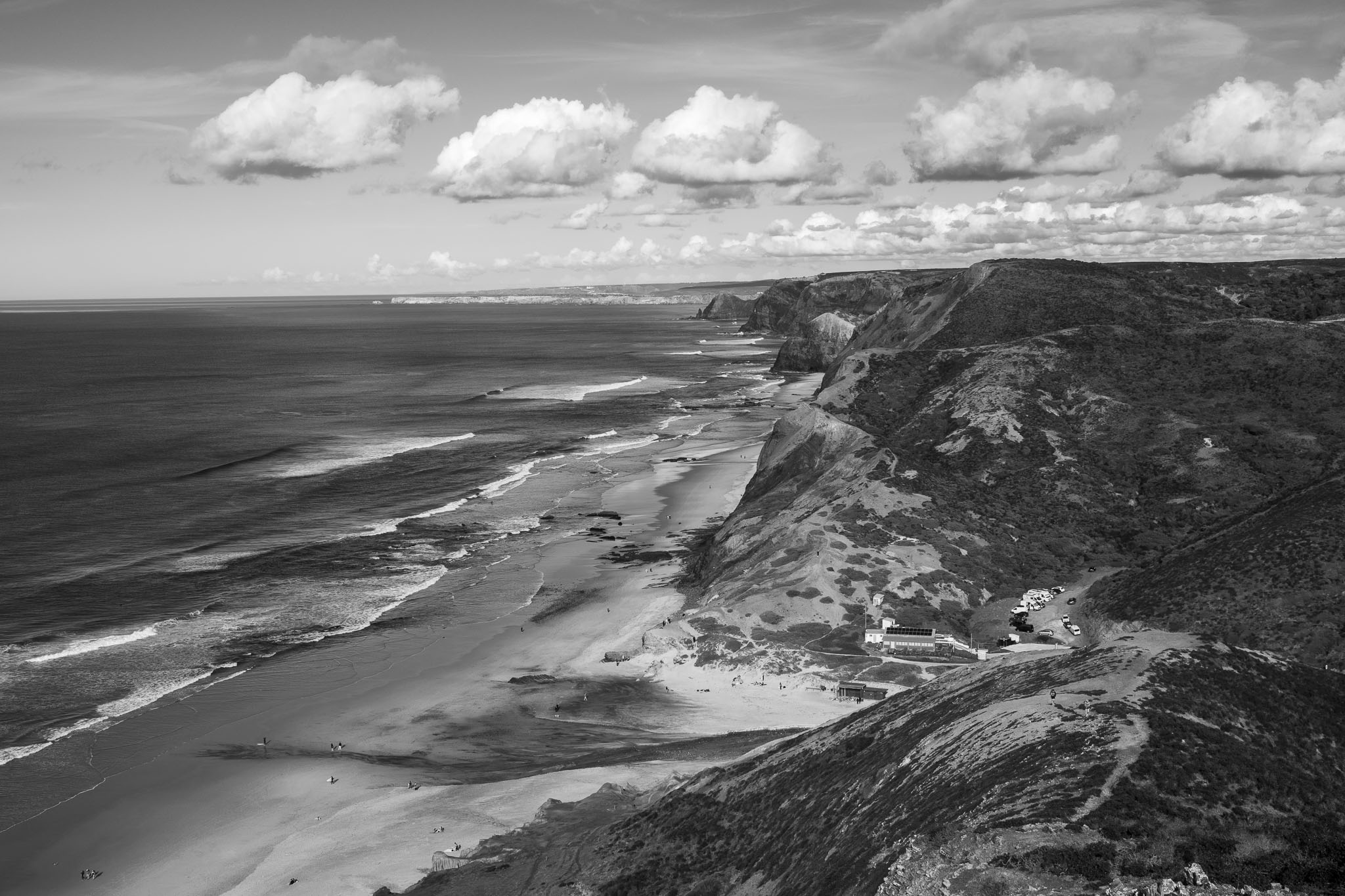
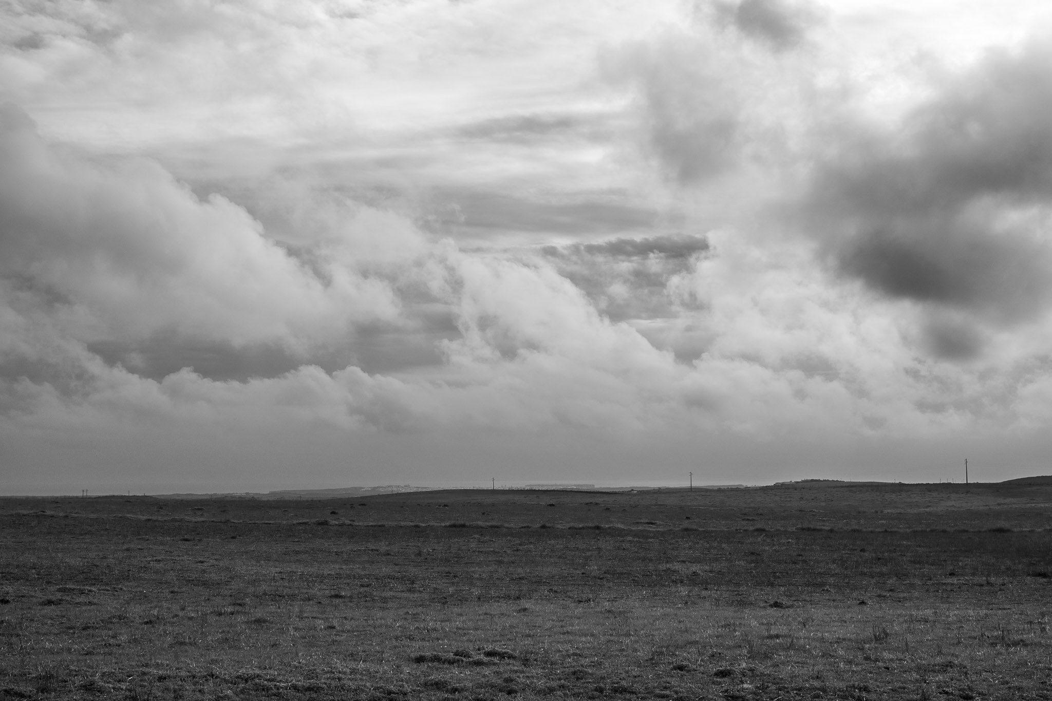
Starting in Vila do Bispo, the trail crosses gentle and rolling green hills that form the coastal plateau, which is always buffeted by strong winds. After a few km, the road starts descending towards the beaches, which are worth spending some time visiting. Names like Barriga, Cordoama and Castelejo are famous for their wild beauty, and quite popular with surfers. There are a couple of steeper climbs, because the coastal cliffs are vertical and tall; the upside is that you can catch your breath admiring the wonderful views. In the winter, with clear visibility, you will be able to spot Carrapateira and Arrifana in the far distance.
All the photos were taken using my by now favourite travel combination, the Fujifilm X-E5 camera and Voigtlander 27mm f/2 Fuji X mount lens. I converted some of the photos to black and white in Lightroom, to convey a different mood. I hope you enjoy the photos and Happy New Year!
Leaving Vila do Bispo.Along the way.View into Barriga beach.Descending into Cordoama beach.The Castelejo beach seen from Cordoama´s viewpoint.Looking north, with Carrapateira in the horizon.Menacing skies on the way back. Sagres can be seen in the distance.
As the title says, some photos from an overnight camping trip to Jebel Shams. In the winter is very cold at such altitudes, but the visibility extends for a long distance. And there is always the attractive and famous Balcony Walk, which I did the following morning.
Vertigo. Fujifilm X-T5 and Fujinon 14mm f/2.8 lens.From the rocks. Fuji film X-T5 and Fujinon 14mm f/2.8 lens.Village. Fujifilm X-T5 and Fujinon 14mm f/2.8 lens.Vigilant. Fujifilm X-T5 and Fujinon 70-300mm f/4 – 5.6 lens.Perched. Fujifilm X-T5 and Fujinon 70-300mm f/4 – 5.6 lens.Light and shade. Fujifilm X-T5 and Fujinon 70-300mm f/4 – 5.6 lens.Jebel Misht sunset. Fujifilm X-T5 and Fujinon 70-300mm f/4 – 5.6 lens.Cannot resist a star burst! Fujifilm X-E5 and Voigtlander 27mm f/2 lens.Massive cliff at sunrise. Fujifilm X-T5 and Fujinon 14mm f/2.8 lens.Along the trail. Fujifilm X-E5 and Voigtlander 27mm f/2 lens.I had to stop for the photo. Fujifilm X-E5 and Voigtlander 27mm f/2 lens.Caught in mid air. Fujifilm X-E5 and Voigtlander 27mm f/2 lens.
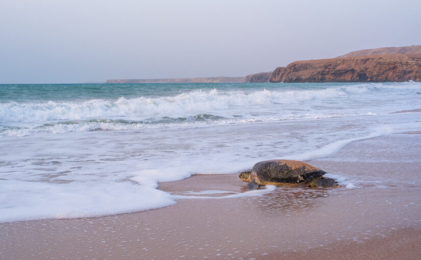
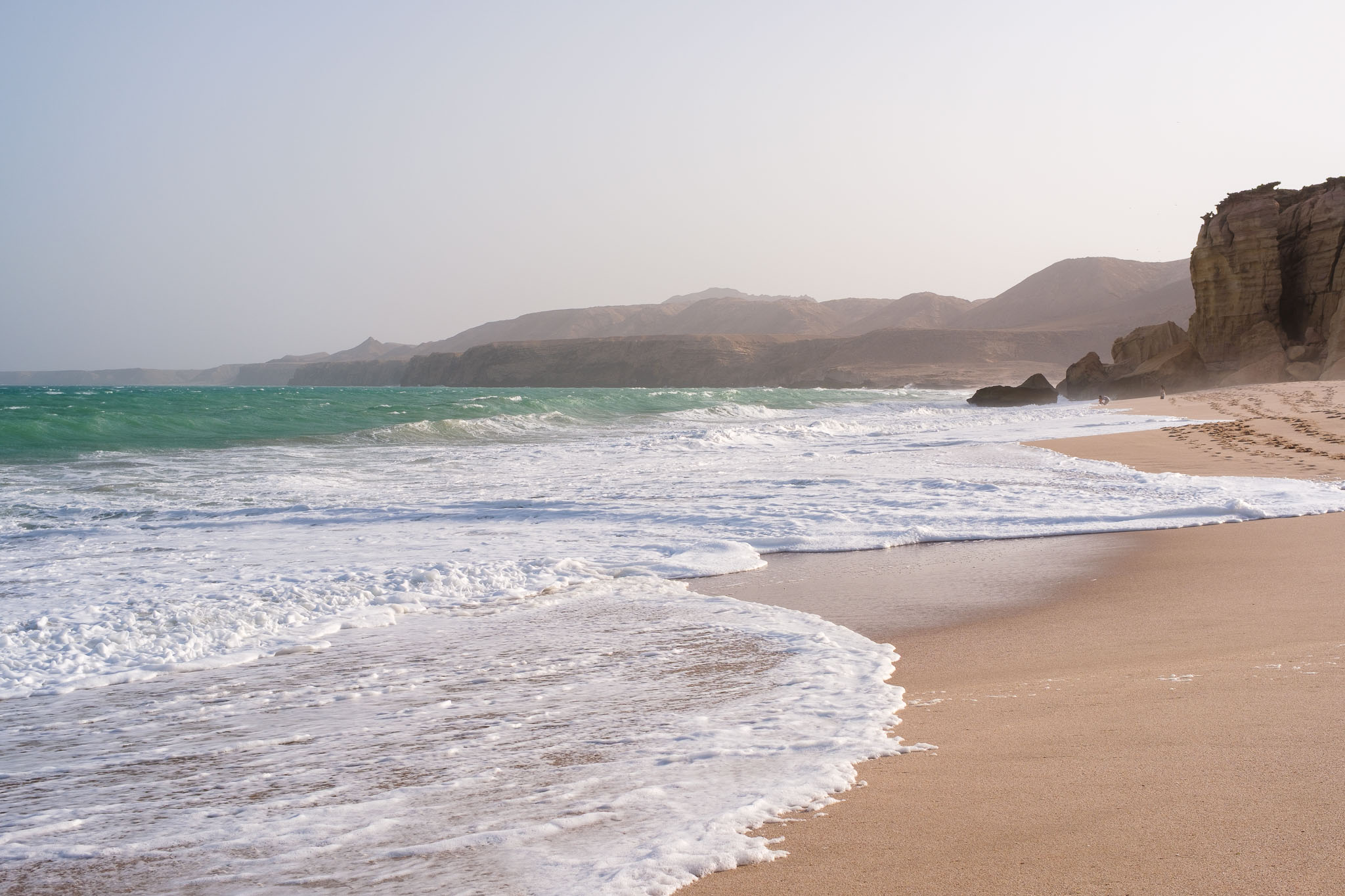
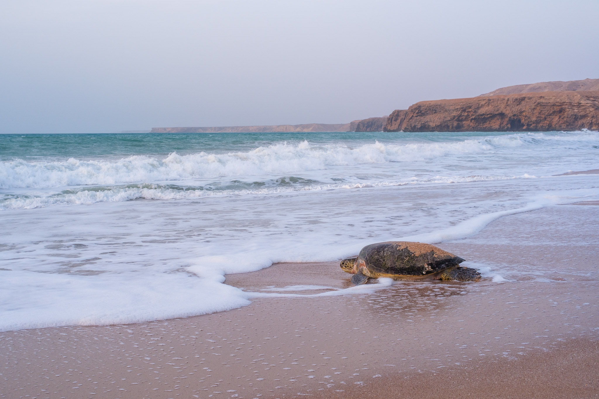
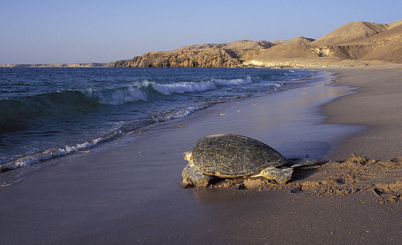
After almost 2 years of being back in Oman, I finally visited the Ras Al Jinz Turtle Reserve. The reserve was established in 1996 to protect 45 km of Oman’s Eastern shore and conserve the nesting ground of sea turtles. The Ras Al Jinz beach is world famous for the nesting of the endangered green turtle (Chelonia mydas) and probably is the most important nesting concentration on the Indian Ocean. It is also the only official place where the public can visit and watch this unique experience.
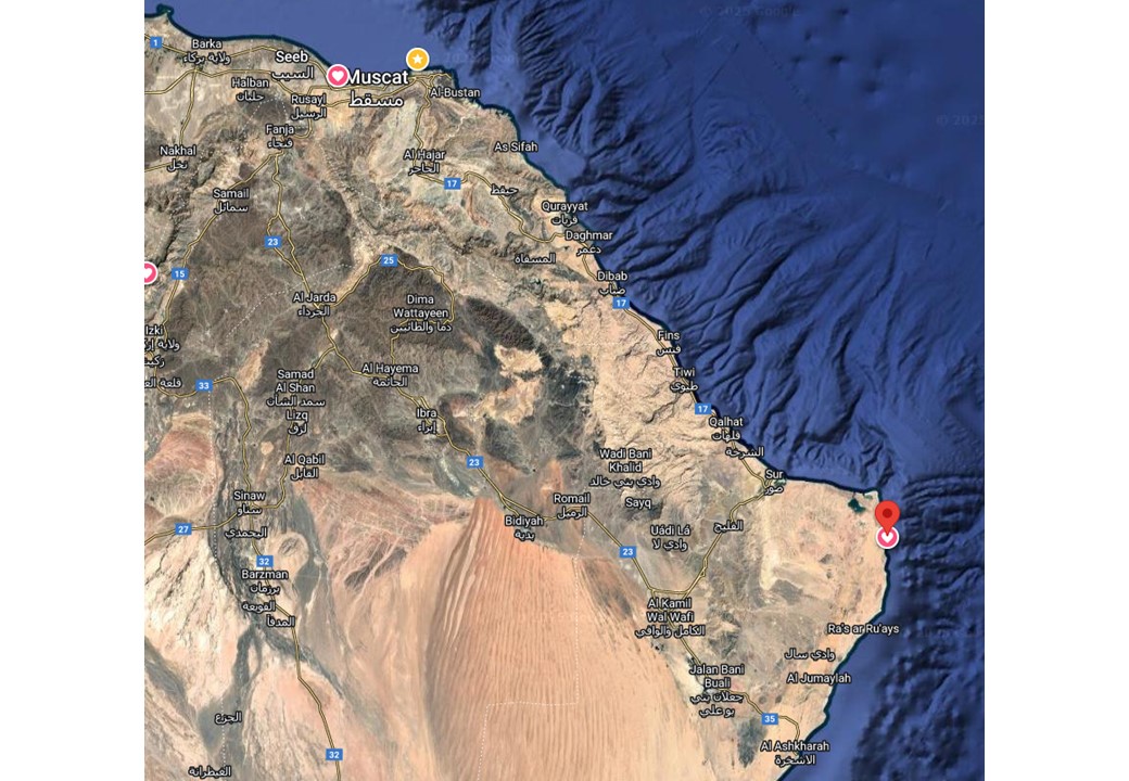
Ras Al Jinz is part of the Ras Al Hadd coastline, an area of rugged beauty, with rocky cliffs overlooking the azure waters of the ocean. As the easternmost point in the Arabian Peninsula, it is the first location to see the rising sun every morning. The last time I visited the reserve was in 2004 when driving from Muscat required a 4WD vehicle to negotiate the gravel road from Quriyat to Ras Al Jinz. Today, a modern 250 km long dual carriage way connects Muscat to Sur (route 17), and from there to Ras Al Jinz is only another 50 km or so along a black top road. Of course, this means that a lot has changed in the intervening years, with more people visiting the reserve.
There are many interesting stops along the way, like the Bimah sinkhole, a collapsed cave that has a beautiful lake; several nice beaches along the coast between Tiwi and Fins, with white sand and warm sea water; Wadi Shab, for a great wadi trekking along several pools; and the archaeological site in Qalhat, just to name a few. Thus, I recommend allowing extra time to check these places. Without stopping, it takes roughly 3 hours from Muscat to Sur.
Location of Ras Al Jinz turtle reserve.A beach in Tiwi.Mountains covered by monsoon fog.Old city of Qalhat.
The best time to see the turtles in during the months of July and August, when hundreds of turtles arrive after sunset to lay their eggs. Even though the summer is hot in Oman, this coastline is buffeted by strong winds during the monsoon season, which reduces the temperature. There are two guided visits daily, one at 9 pm, and one at 5 am.
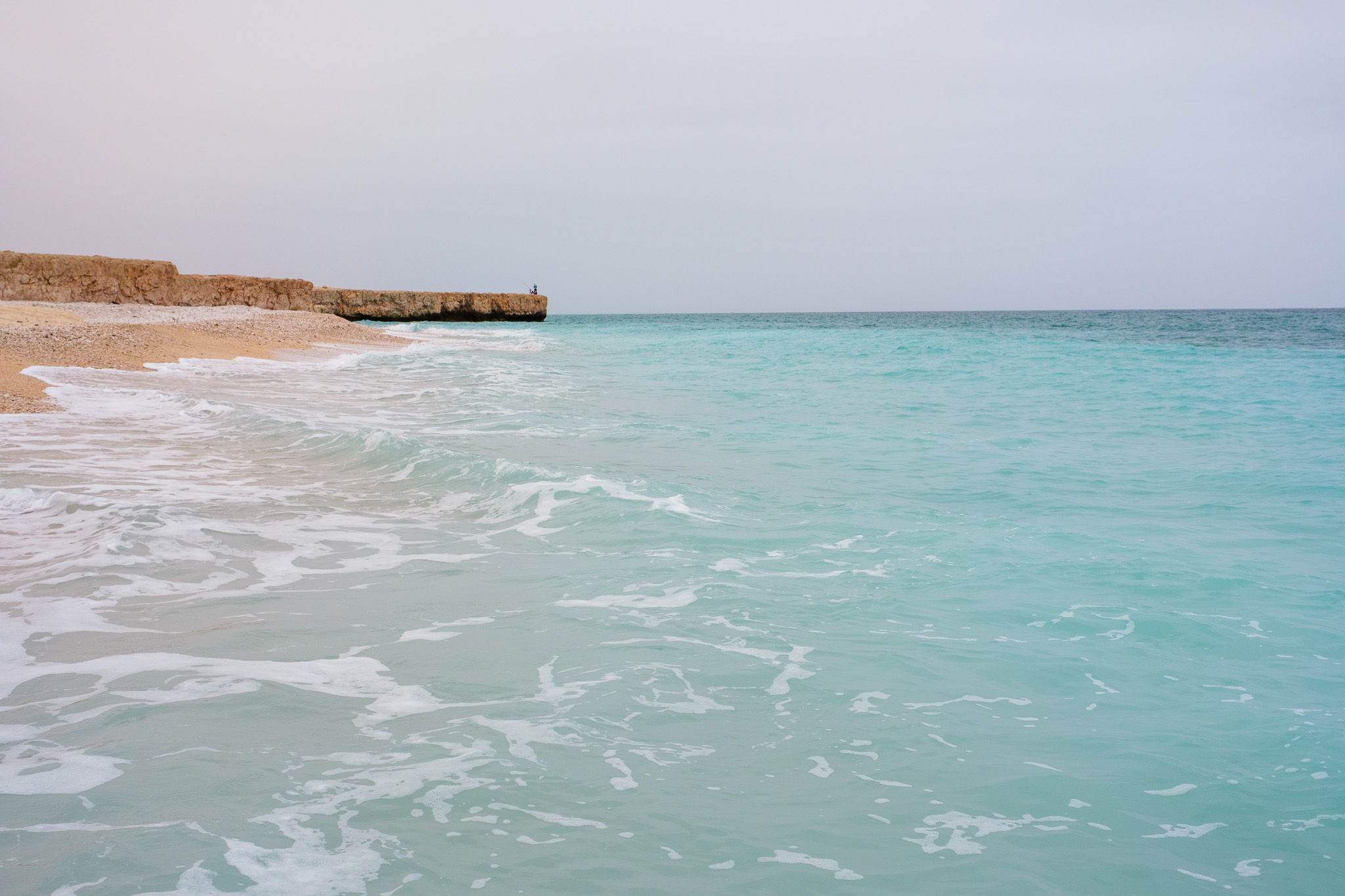
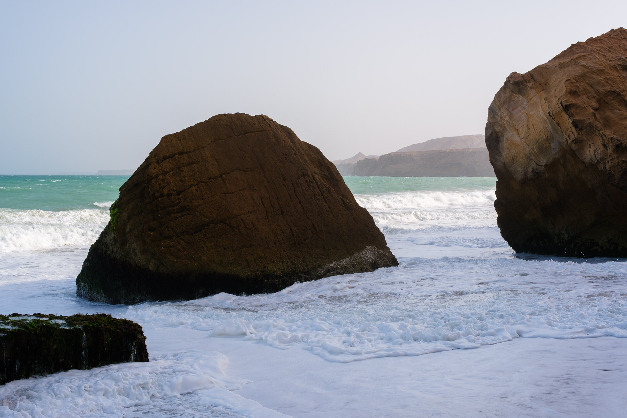
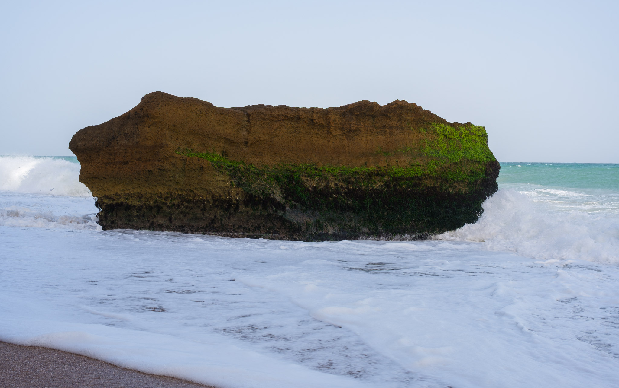
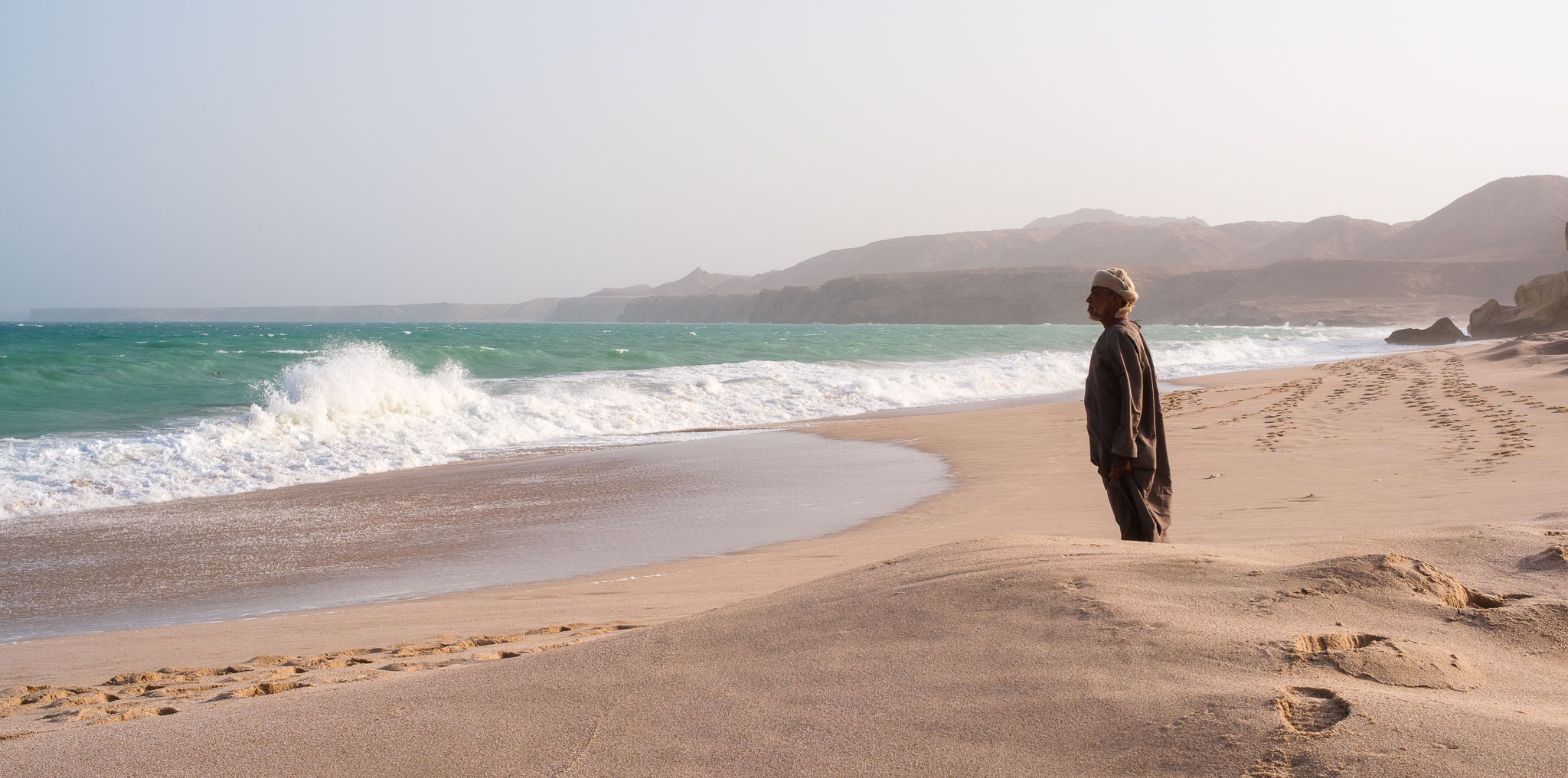
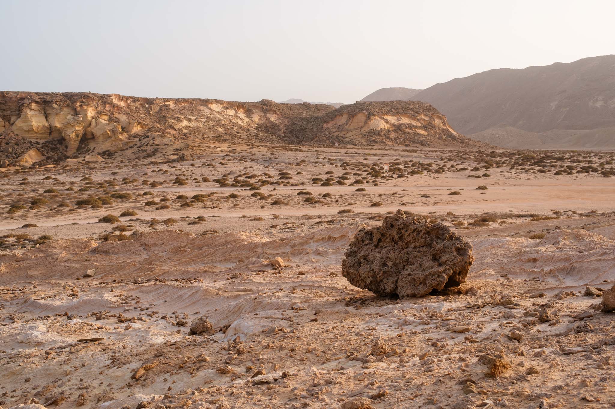
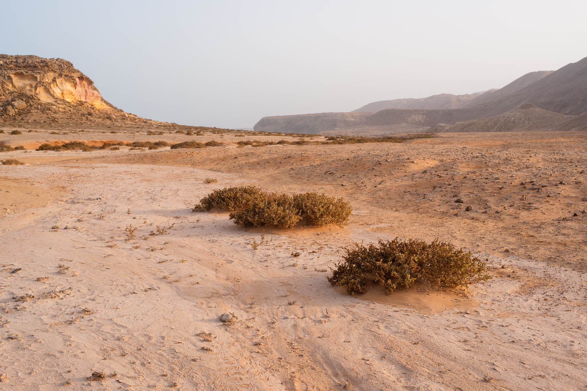
There are several choices for accommodation near the reserve, we decided to stay in the Ras Al Jins Reserve hotel, where the visitor centre is located. This was more convenient, as it makes logistics easier. After arriving at the hotel, we rested for a while and then walked the 1 km or so to the beach. The area is characterized by dry and rocky coastal plain, where eroded limestone and sandstone cliffs rise above the landscape. The wind was really blowing strong, picking up dust and sand; the sea was quite rough as well.
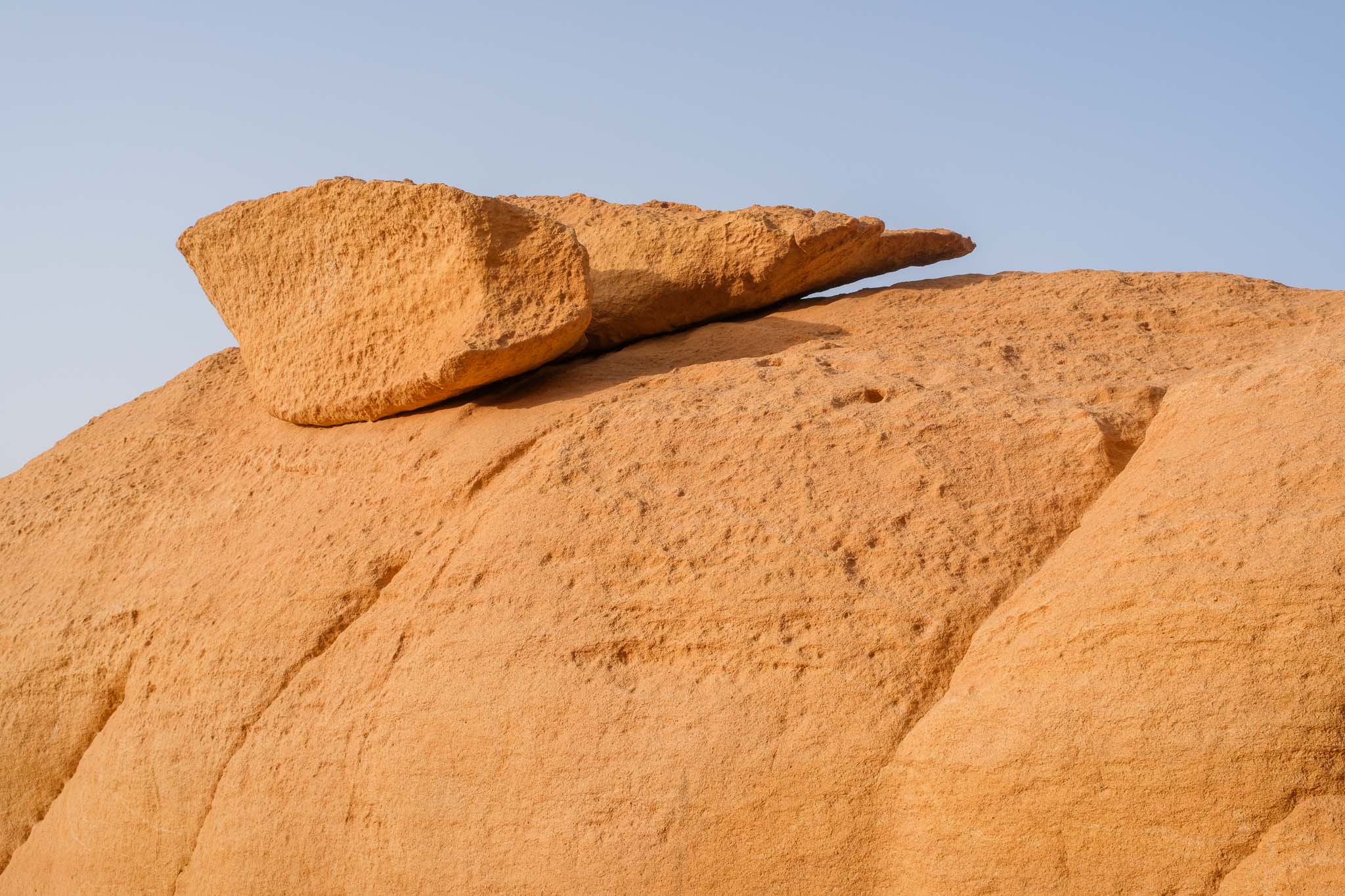
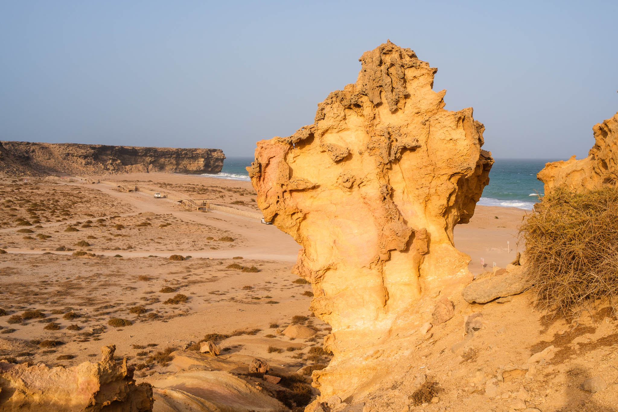
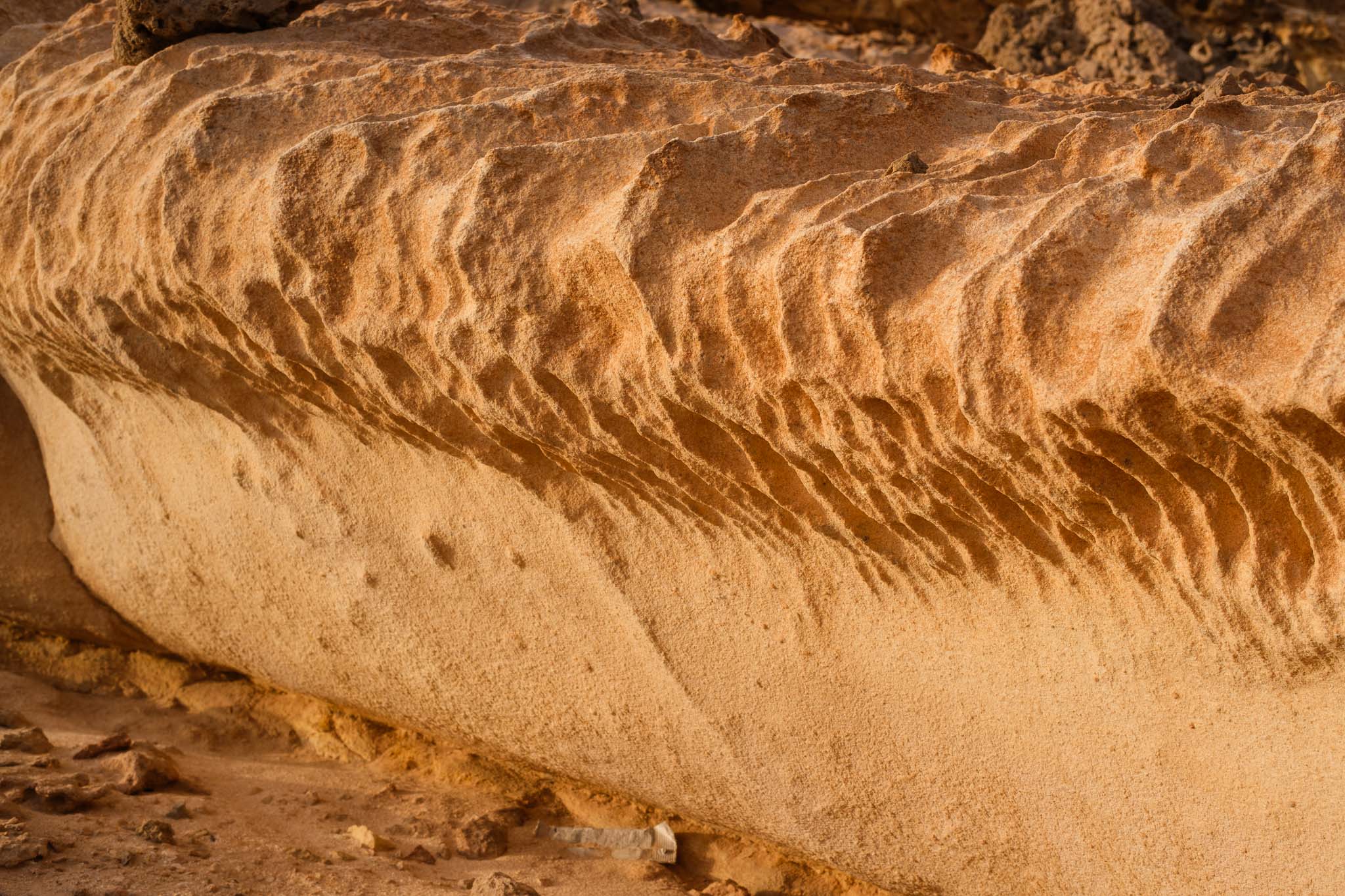
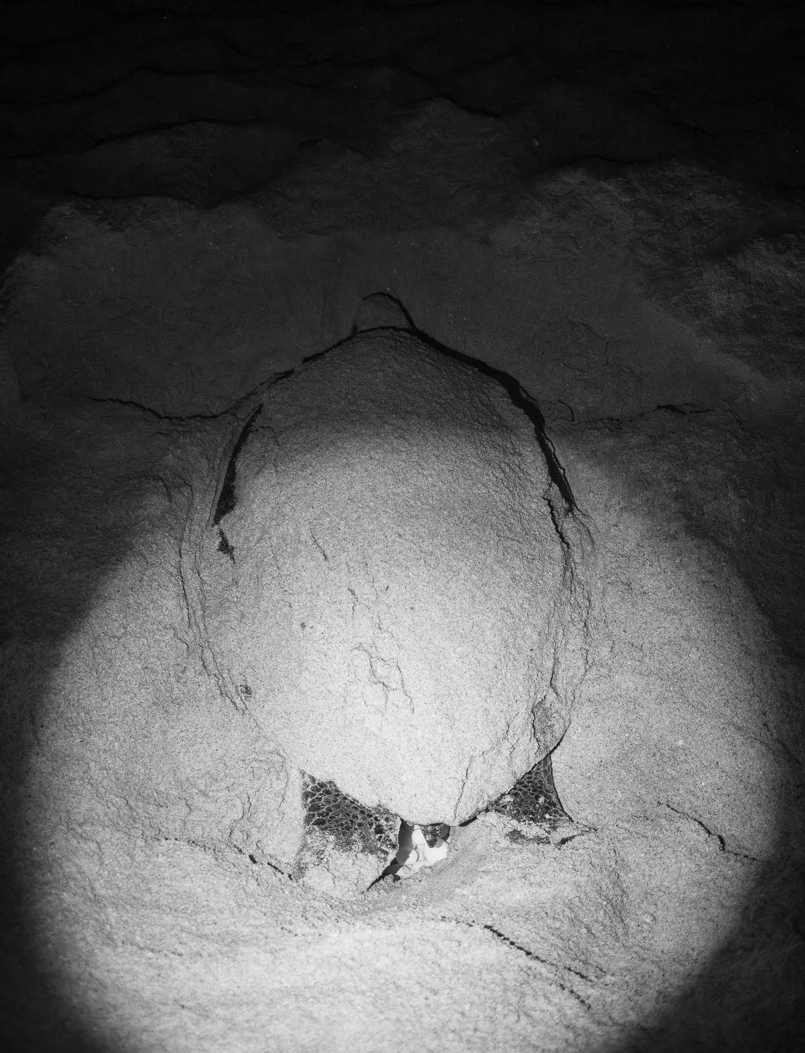
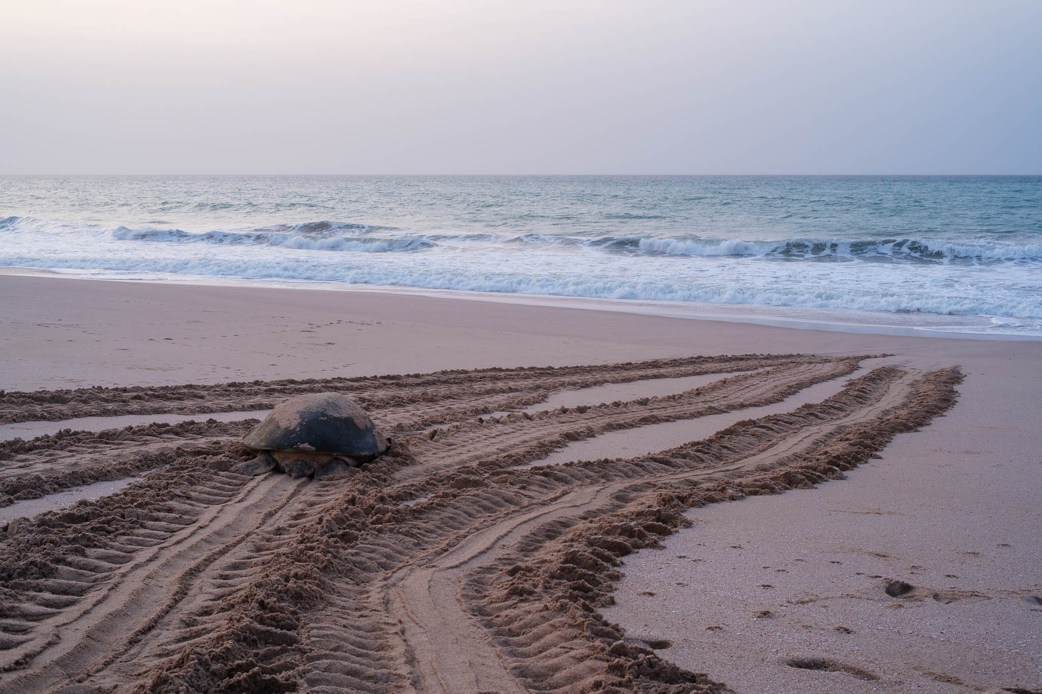
It is possible to stay in the beach until 5.30 pm, when it closes to the public, so I walked around taking some photos and remembering the previous visit from 20 years ago. It was impossible not to notice the large number of “craters” in the sand, where the turtles had excavated their nests. Egg shells were also conspicuous. I made several photos of the beach and its surrounding rocky outcrops, which have been sculpted by wind and water for millennia. The whole Ras Al Hadd peninsula was also home to pre-historic human settlements dating to 5,000 – 3,000 years ago, when the climate was less dry. Several signs describe these archaeological sites, dispersed along the region.
In the shade.Resisting.Wolf rock.Rough monsoon ocean.Watching.On the back.Pinnacle.Erosion.Left behind.Near the coast.
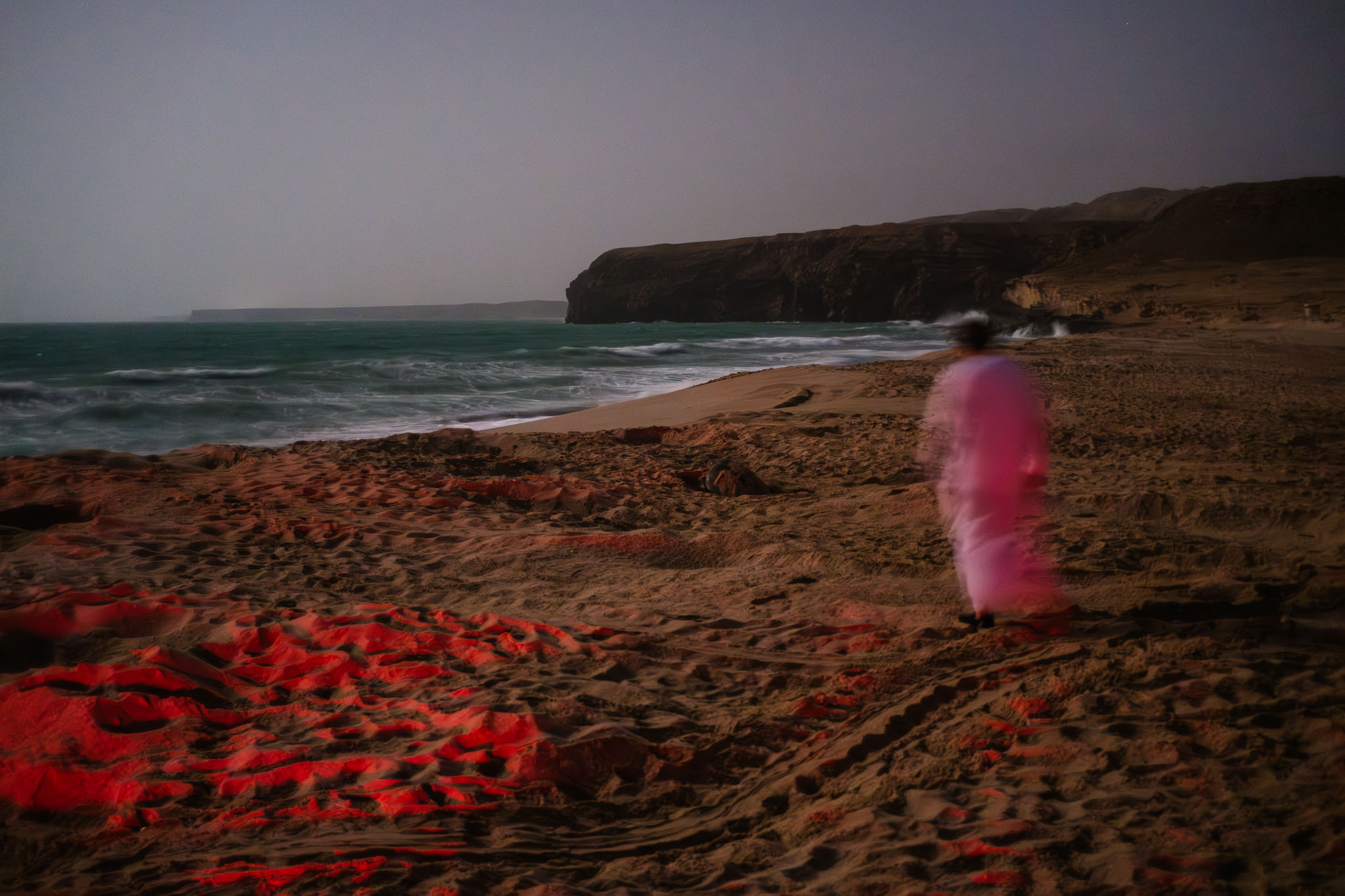
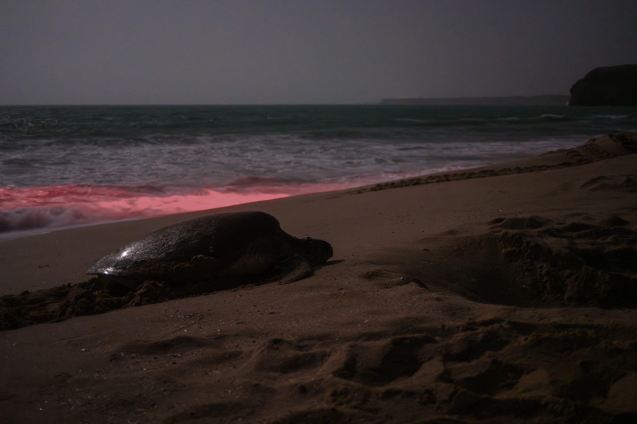
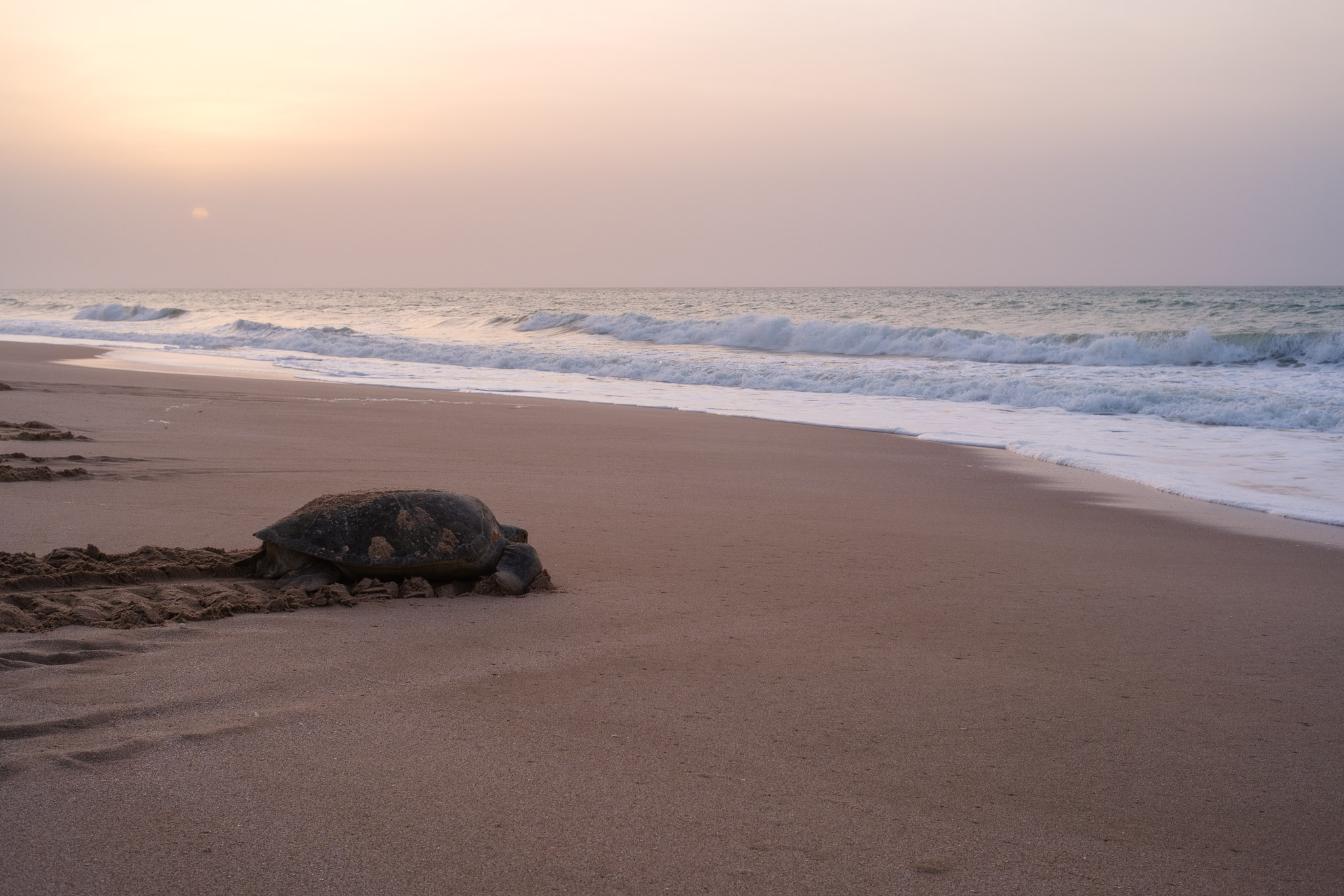
As the sunset was approaching, I returned to the hotel for an early dinner, and to be ready for the night visit. The visitor centre was busy, with maybe 50 to 60 people waiting; the guides separated us into groups, and off we went on a minibus to the beach. The night was beautiful and clear under the light of full moon. We were given a series of instructions to avoid disturbing the turtles and waited until our guide would waive us to see one of them in the nest. These turtles reach maturity at 25 years of age and can live up to 80 years old; they return to the beach where they were born to lay their eggs, hence starting the next cycle. It is truly a magical and humble experience to watch them arriving from the sea after swimming thousands of km and start climbing up the sand to dig up their nest. They arrive exhausted and still take around 3 hours to lay their eggs, in an impressive effort. Then they exit the nest and return to the ocean.
Photographically speaking, of course no flash is permitted. The guide has a flashlight with a red colored bulb to help observation, and in general people are well behaved and follow instructions. I had a 27mm f/2 lens on my Fuji camera and with the full moon I was able to use apertures between f/2 and f/4 with ISO around 3200. Later at home, I decided to convert the Raw files to black and white to get rid of the intense red color cast.
Guide going to check the turtle leaving the nest.Arriving under the full moon.Baby.Mother.Laying the eggs.
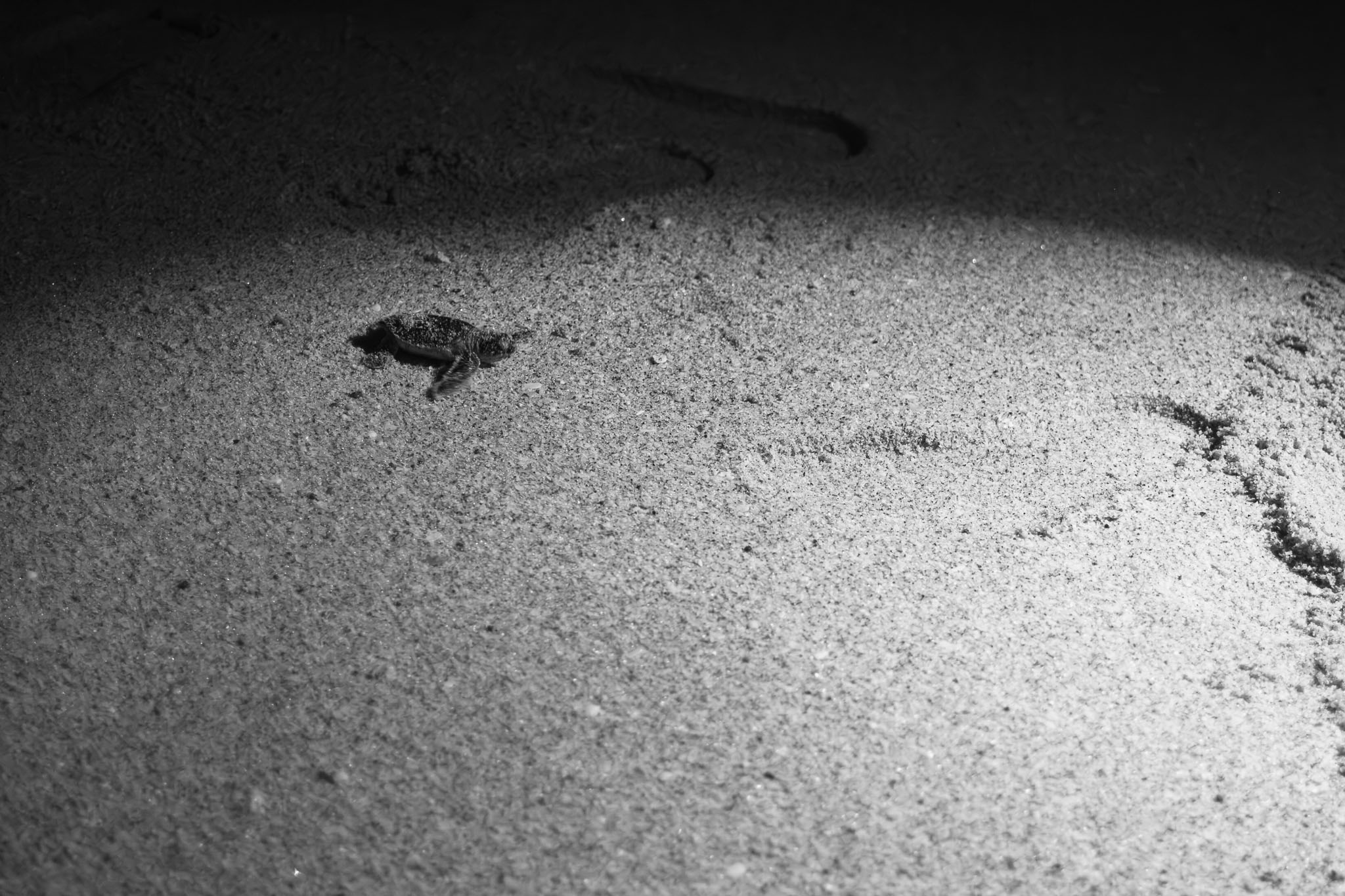
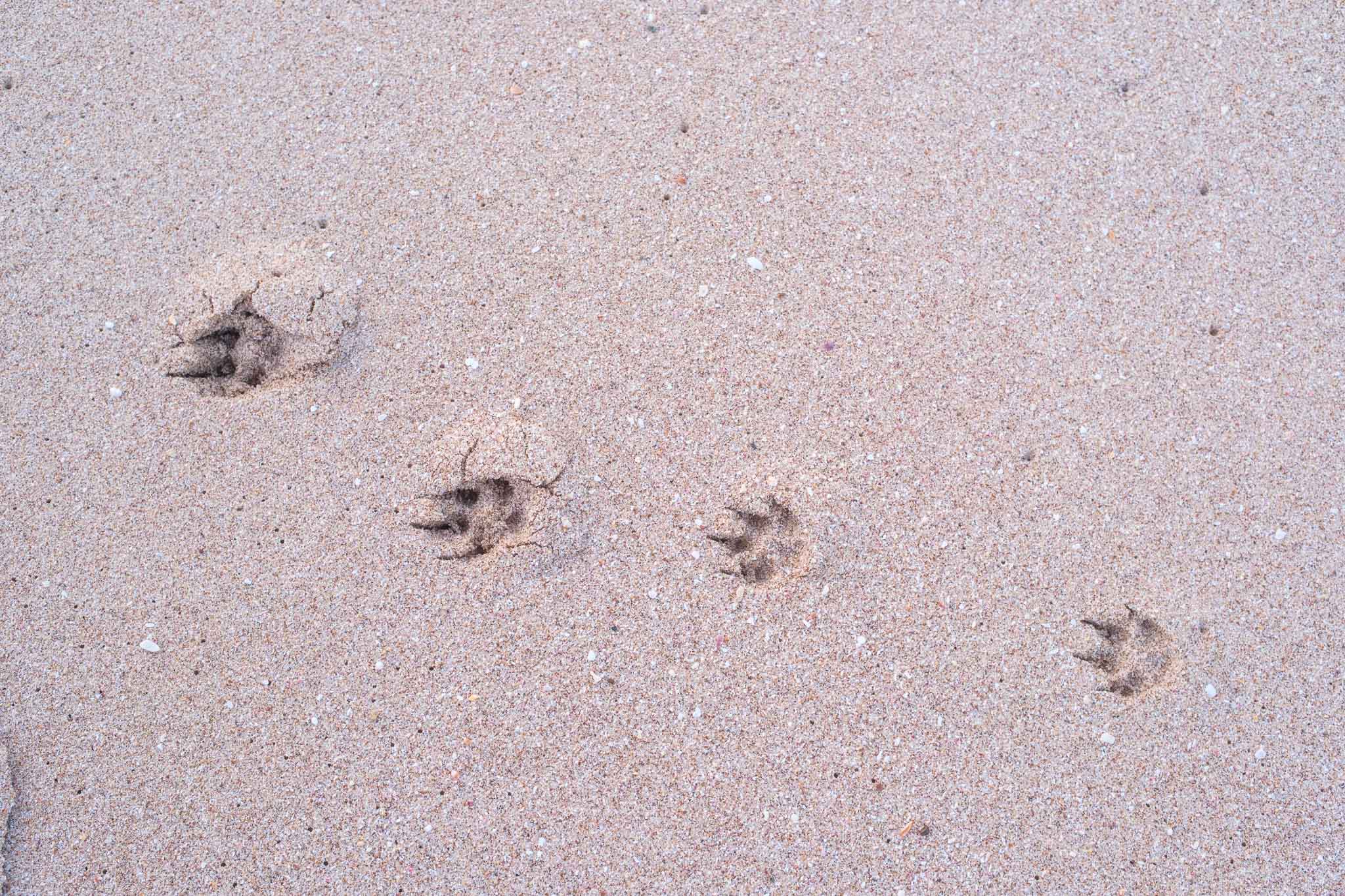
Upon arriving at the beach for the morning visit, the sand was full of tracks, many from the turtles climbing the up the sand; but also, numerous ones from foxes, who prey on the eggs buried in the sand. Abundant eggshells provide testimony of the baby turtles hatching; their journey is a daunting one because as soon as they hatch, they must climb out of the crater and negotiate their way to the water. The distance is small for us, but it is big for them, and they also must survive the sea birds and crabs. About 1 in 500 baby turtles make it to safety, which is a clear indication of the risks these animals face since the day they are born.
Even with more visitors, the Ras Al Jinz Turtle Reserve still provides a unique experience, one to be enjoyed with respect for these wonderful animals.
Dawn at the beach.Exiting from the nest.Busy route.Fox.The return journey begins.Returning to the sea.First light in the Arabian Peninsula.Tracks at sunrise.Erosion (panorama of 2 photos).Morning walk.
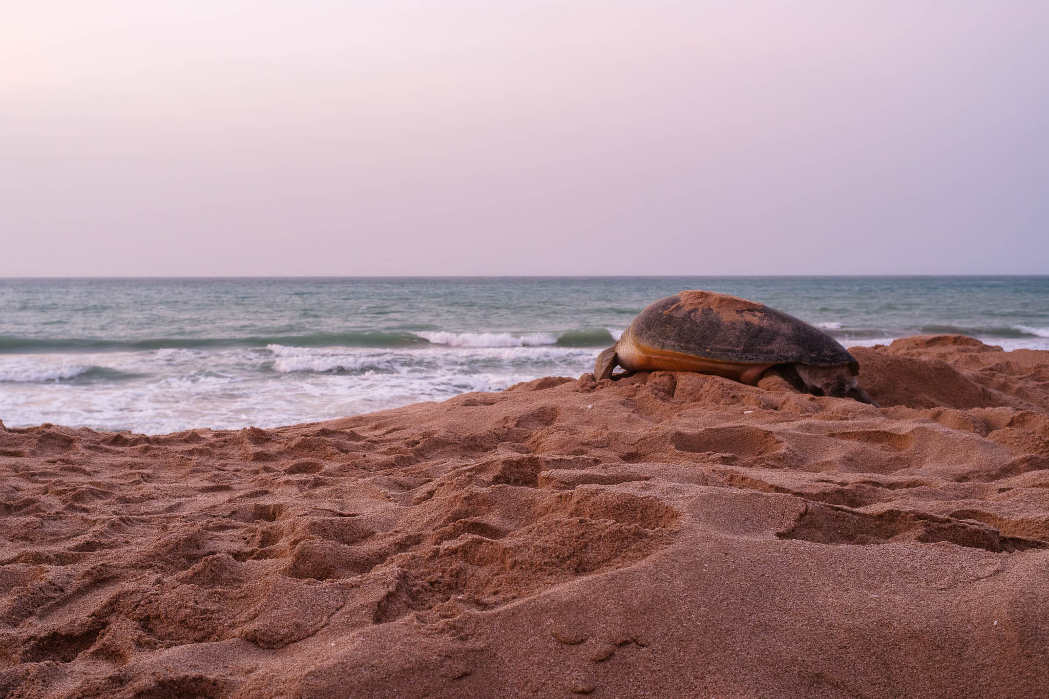
I would like to end this piece with a photo from 21 years ago. Same place, same magic.
April 2004 (Canon EOS with EF 35mm f/1.4 lens, slide film).
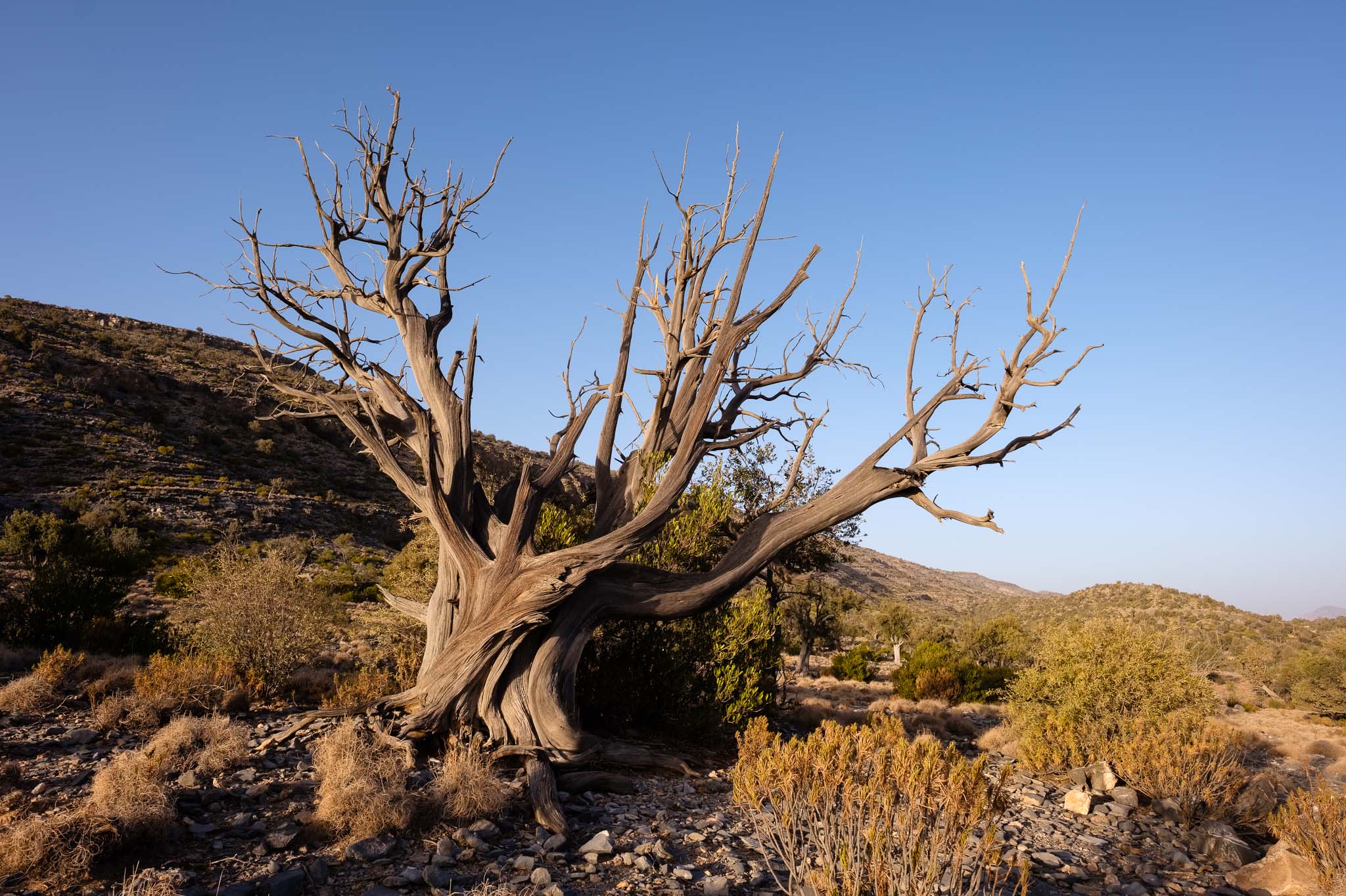
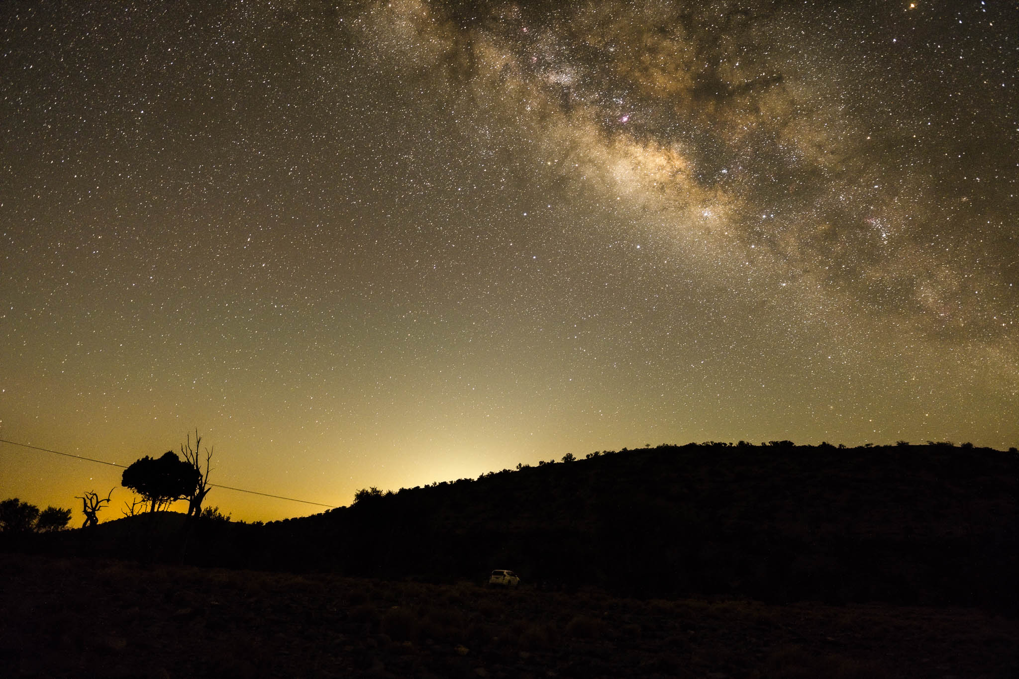
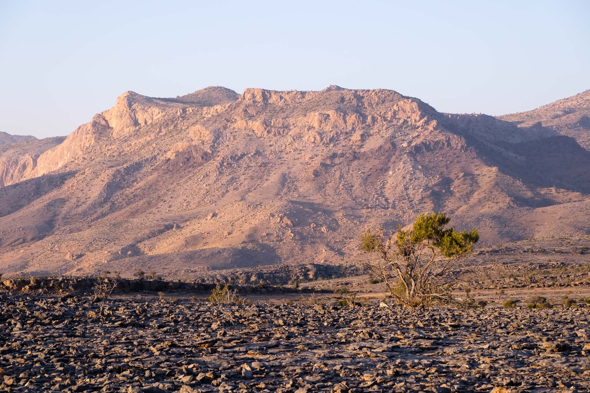
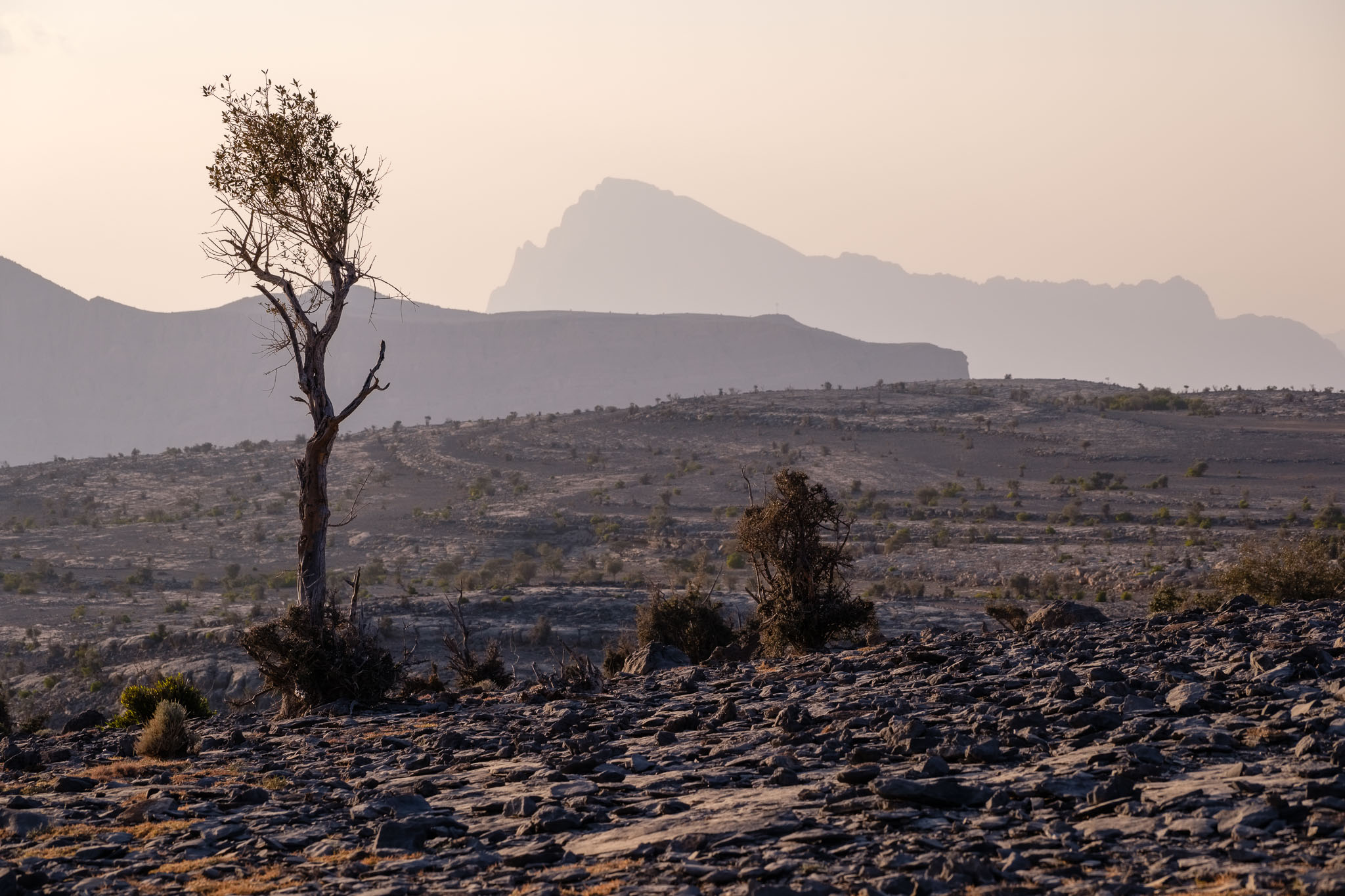
I recently went with the astronomy group here in Oman to the periodic weekend trip during new moon. We normally try to go to a dark place; during the summer, this means heading to the mountains to escape the high temperatures that prevail elsewhere. The chosen location this time was Jebel Sara, a mountain area close to Jebel Shams. At 2,300m above sea-level, the temperature is significantly lower, around 24 centigrade. The drive from Muscat took about 4 hours and was uneventful. A 4WD is required, to negotiate the gravel mountain roads. After setting up camp, I walked around making some photos of the interesting trees in these Juniper woods.
General view of the Jebel Sara mountain landscape. Twisted.Near and far.
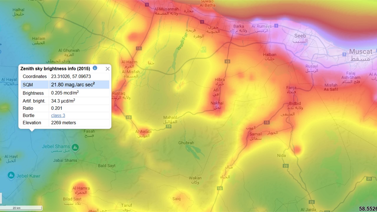
Our camping spot is in a Bortle class 3 location, which corresponds to “rural sky”; this means good dark sky observation properties, with some light pollution in the horizon (see map below).
Map with Jebel Sara location.
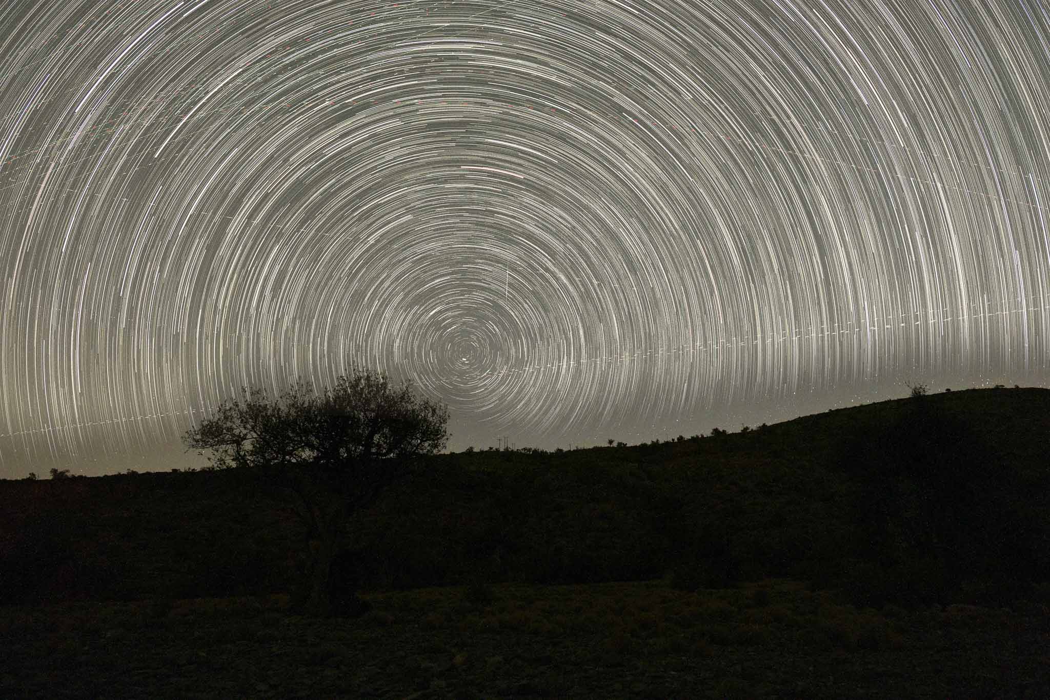
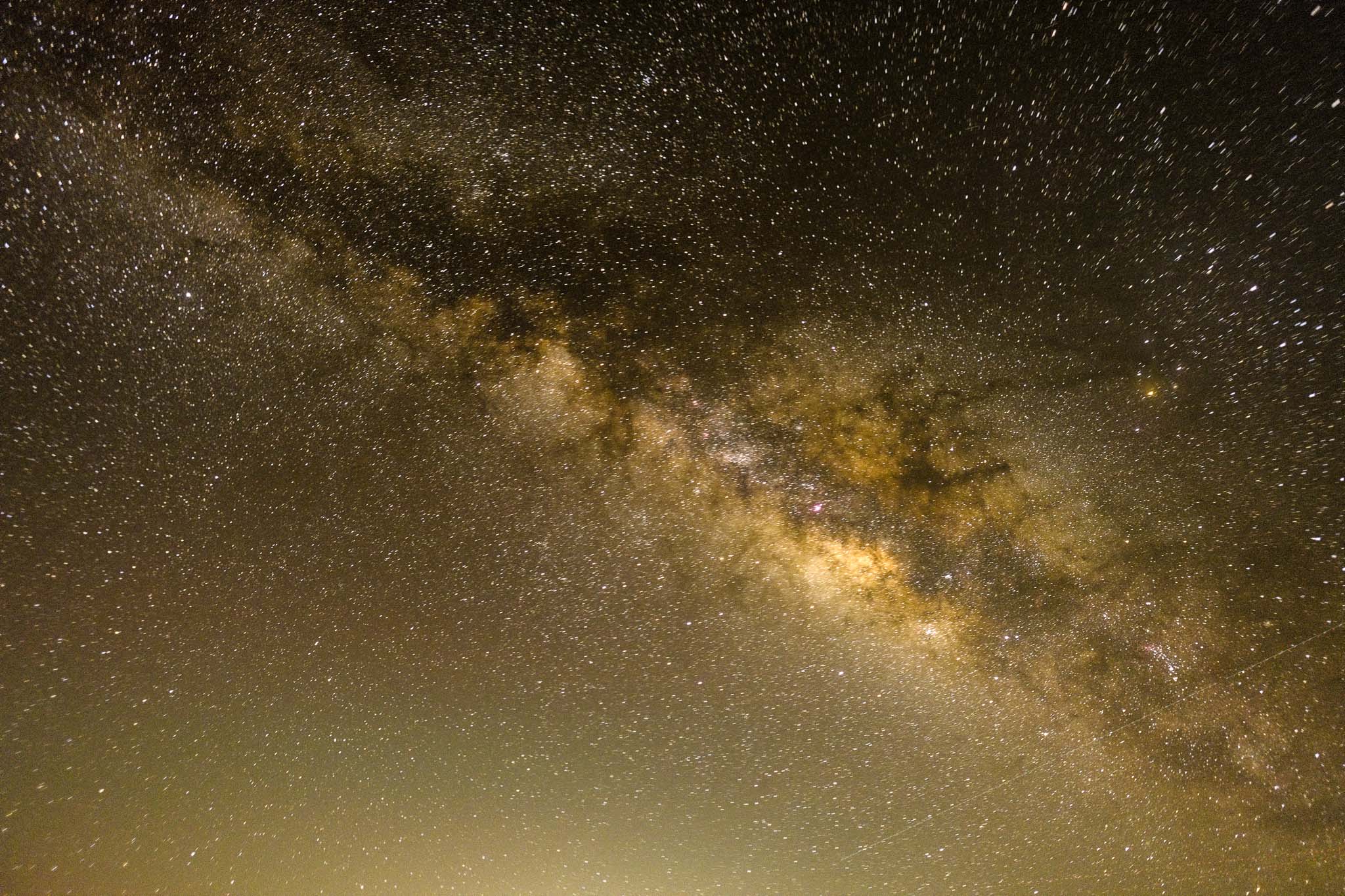
For this trip my plan was to shoot enough images for a good star trail, plus some good photos of the Milky Way. For that, I had with me my Fujinon 14mm f/2.8 wide angle lens, plus the Fujifilm X-T5 camera and tripod. My approach is to set up the camera and lens for star trail shooting and then go and get some sleep. For example, this time I selected 150 exposures in the camera’s intervalometer, 30 seconds each; this gives a total time of 75 minutes.
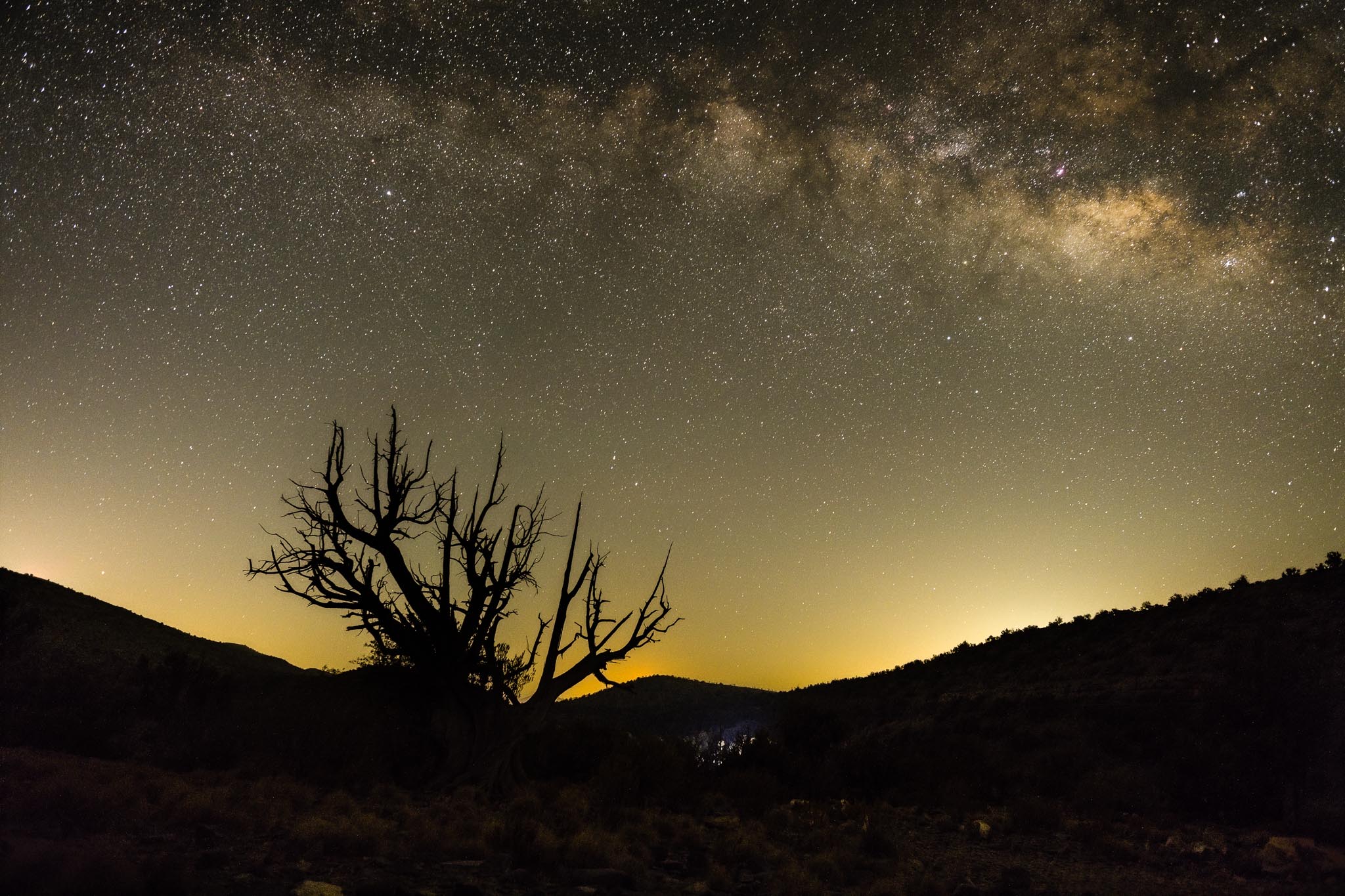
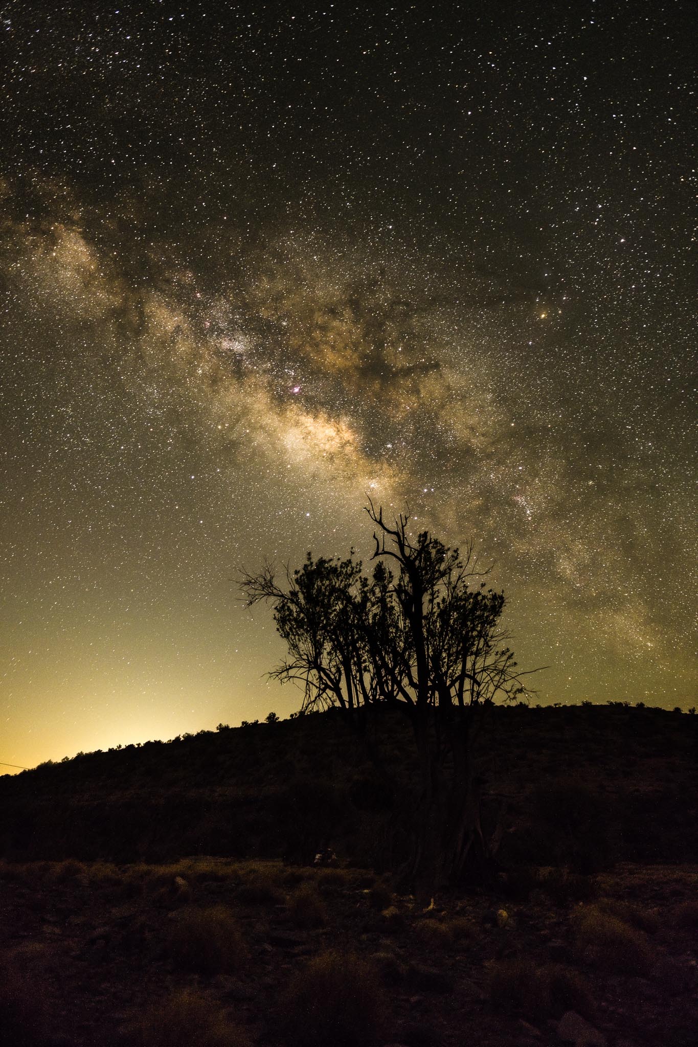
Waking up around 12am, I checked the status of the star trail shots, which was fine. I then proceeded to set up the camera and lens to frame the Milky Way, which in the meantime had risen in the sky. I had previously scouted the area for interesting foregrounds, thus saving some time. You don’t want to stumble in the dark looking for compositions. Again, I shot using the intervalometer, but this time 10 images only; later I would stack them in Sequator.
Star trail.Milky Wai #1.Milky Wai #2.Milky Way #3.Milky Way #4.
Happy with the results, I went back to sleep for a while, knowing that sunrise was only 3 or 4 hours away. Not sleeping much is a compromise of night sky photography, but it is worth it. Besides getting images of star trails or the Milky Way, it is fascinating to observe deep sky objects like globular clusters or galaxies through the telescopes.
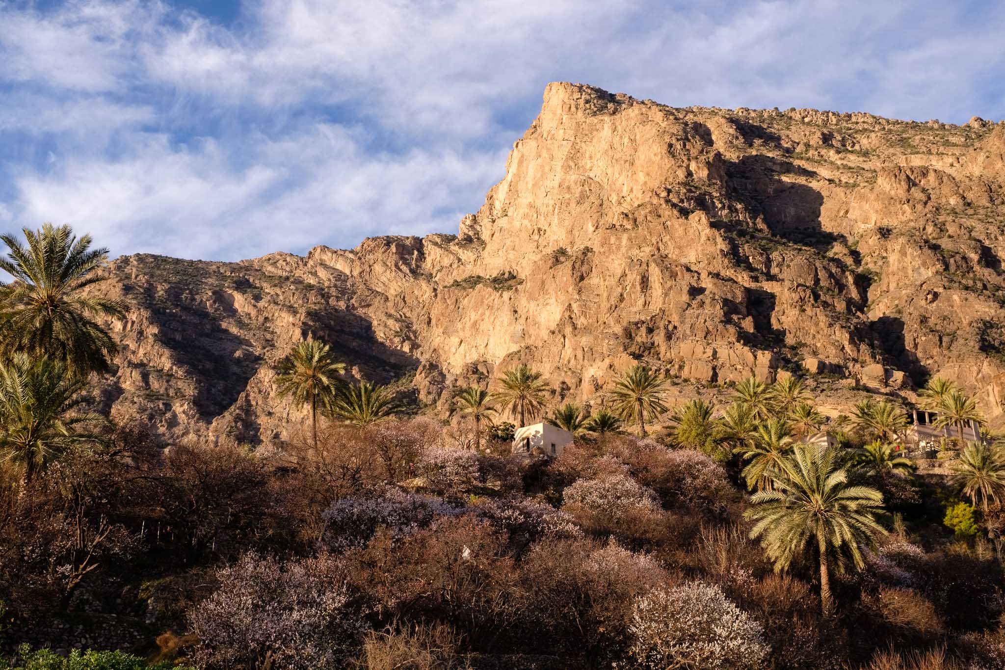
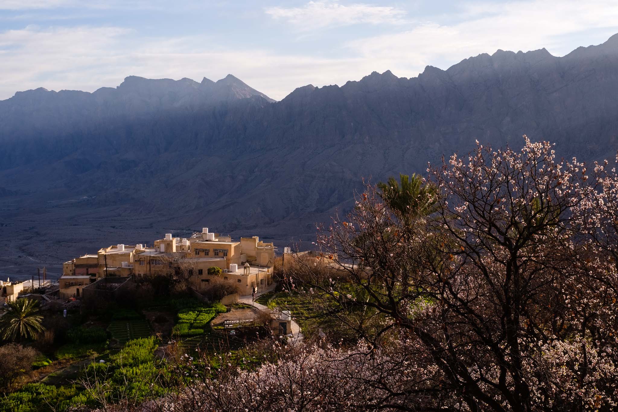
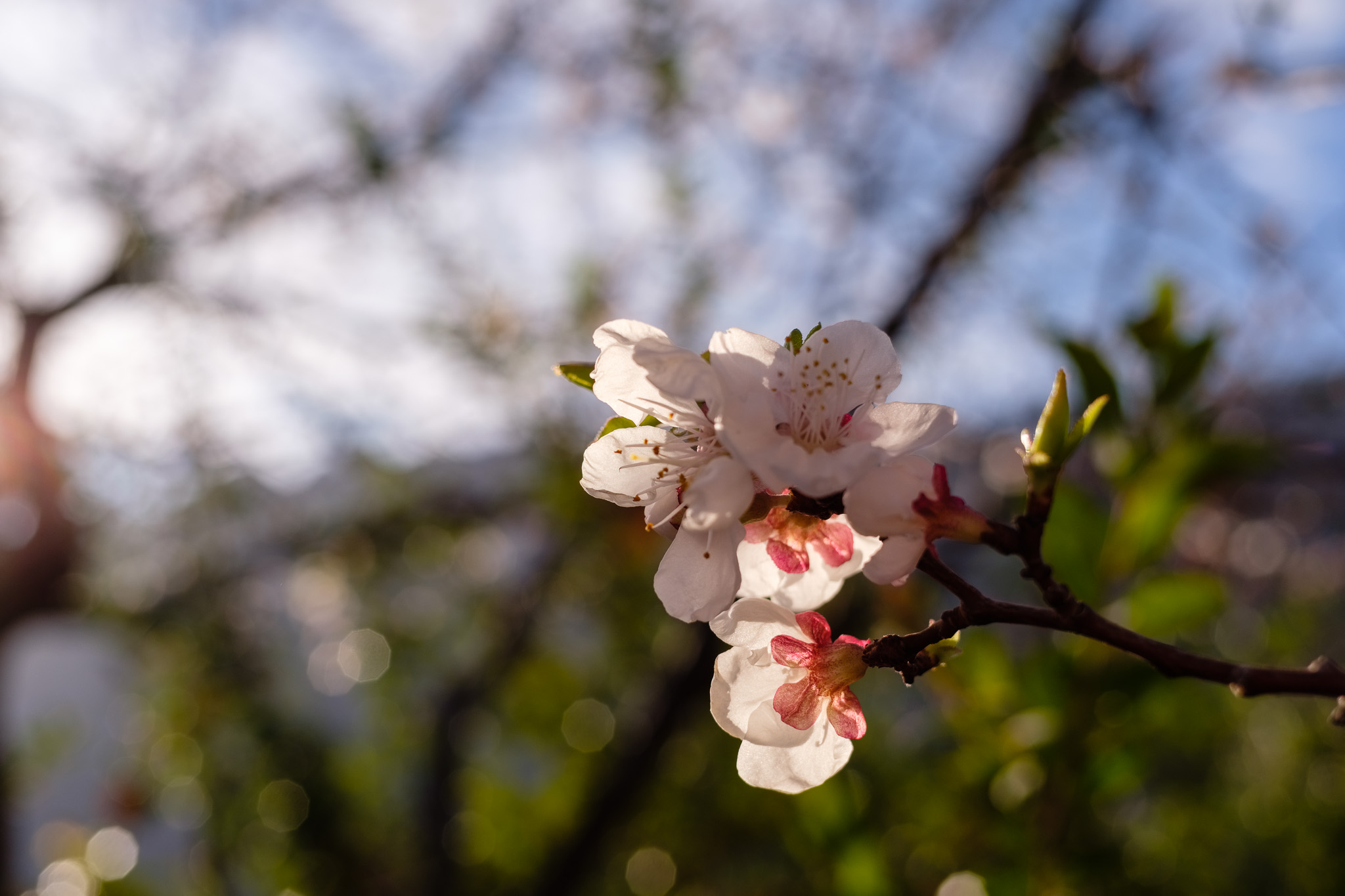
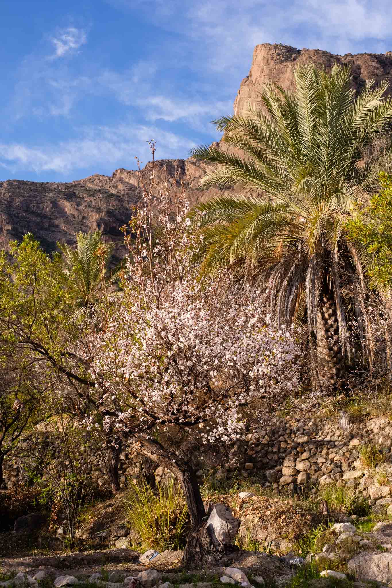
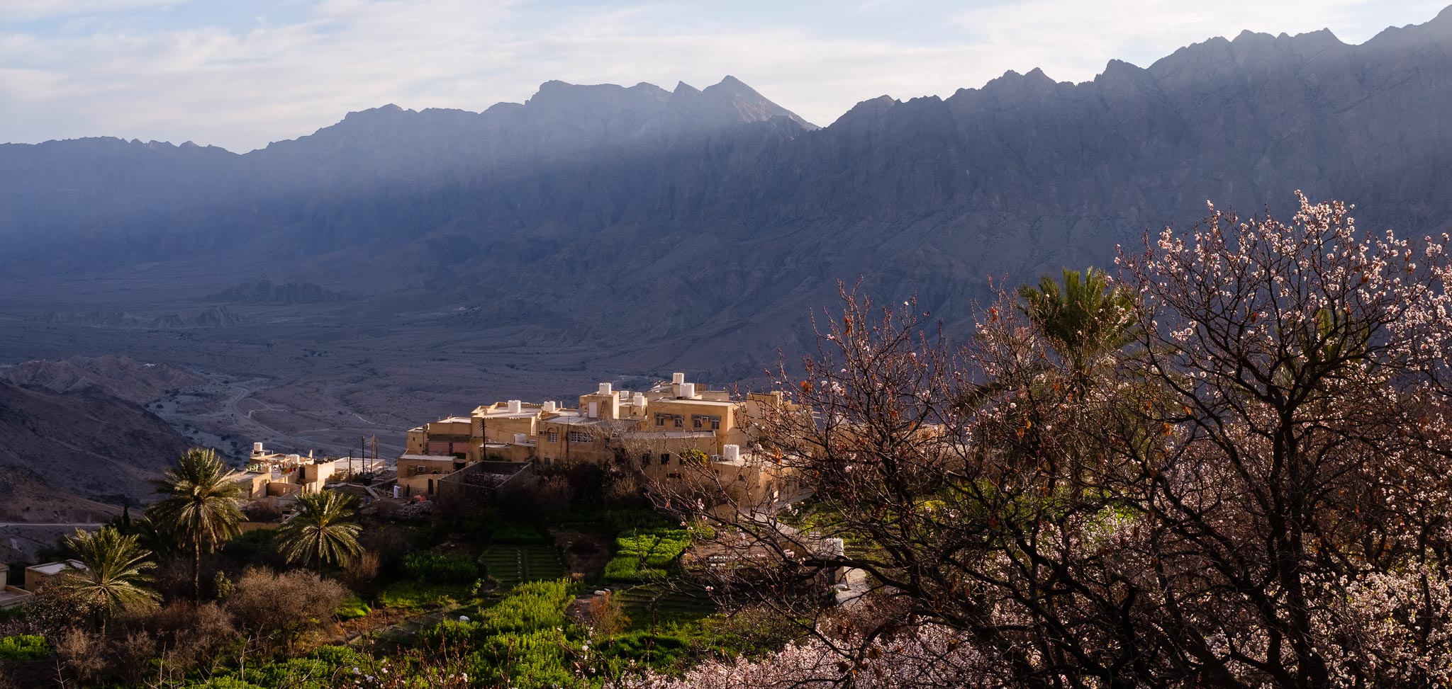
It is mid-February, and springtime is arriving fast in Oman. This means that in many mountain villages, the fruit trees are already in blossom, creating a very special natural tableau. Whenever possible, I like to visit such places; in my home country of Portugal, the almond trees in bloom cover large areas of the Algarve and Tras-os-Montes provinces, blanketing the hills in white and pinkish hues. In Oman, the small village of Wakan, in the Jebel Akhdar mountains, has become quite popular with tourists all year round, but particularly so in the spring. I went there in the spring of 2024 and wrote about it in the following article.
This time I arrived earlier, to avoid the predictable weekend crowds, and to benefit photographically from the higher quality early morning light. I carried with me my trusty Fujifilm X-T5 and a single lens, the Voigtlander X 27mm f/2. This small pancake lens is manual focus only but is perfect for these trips. In case I required something wider, I simply took more images to assemble later as panoramas.
Dawn approaching near the entrance to Wadi Mistal.
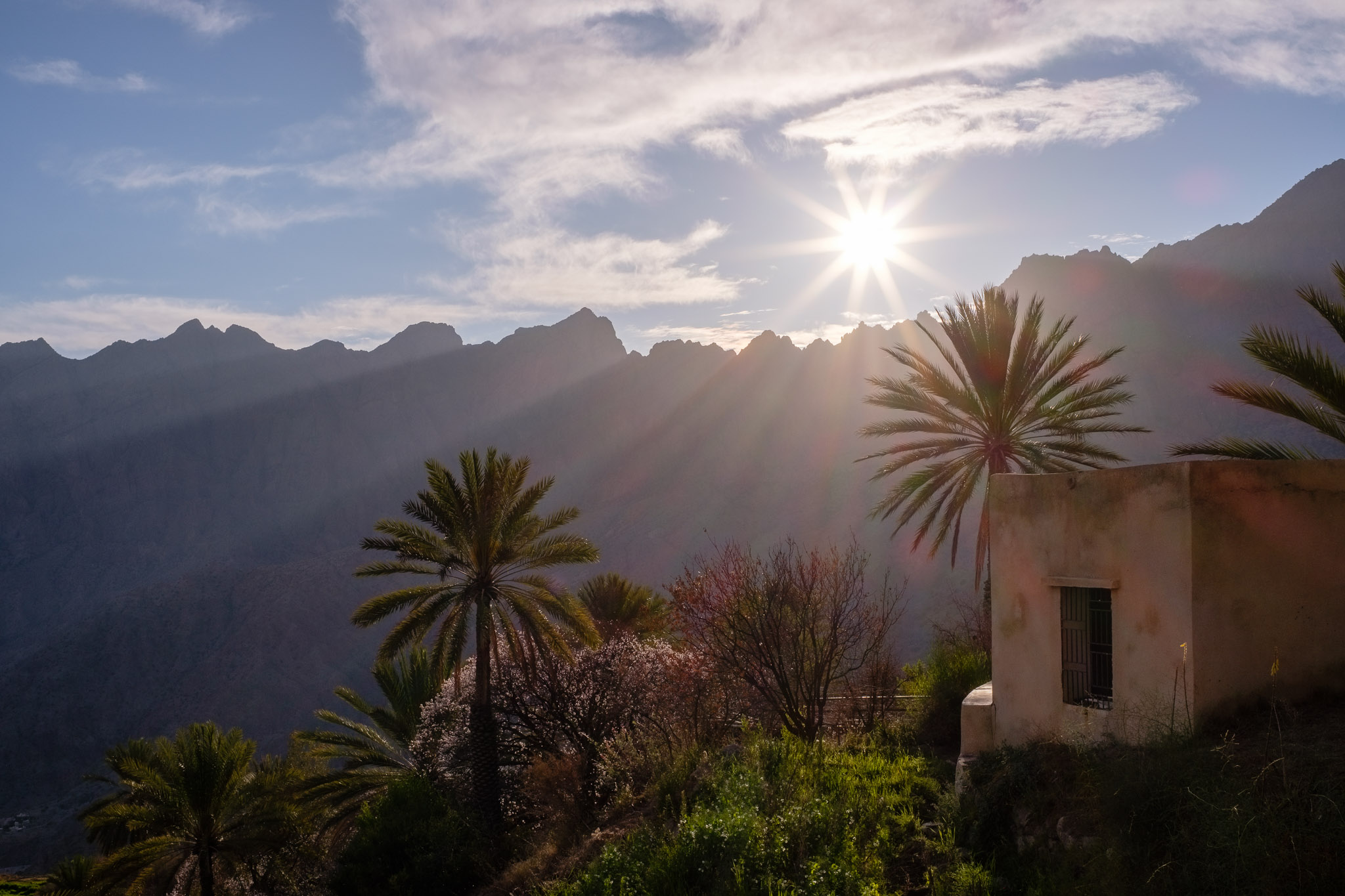
Leaving Muscat at 5 am, I had the first glimpse of Wakan, perched on a hill at 1,400 m altitude, at around 7 am. I parked the car and took a few photos as the first light of the day started to illuminate the surrounding mountain range. I am always impressed by the beauty of this scenery, with the tiny village dwarfed against the jagged mountain peaks that reach up to 2,300 m above sea-level. I drove the final stretch of the (gravel) road and had no problem in finding a parking space in the small local car park. I strolled in the cultivated terraces and fields for a while, in the middle of the peach trees in bloom; daylight first hit the peaks above, slowly moving down along the mountain face. I waited a few more minutes until the sunlight bathed the orchards, and then started walking along the trail that connects Wakan to the Sayq Plateau to the south, and to the village of Hadash to the east.
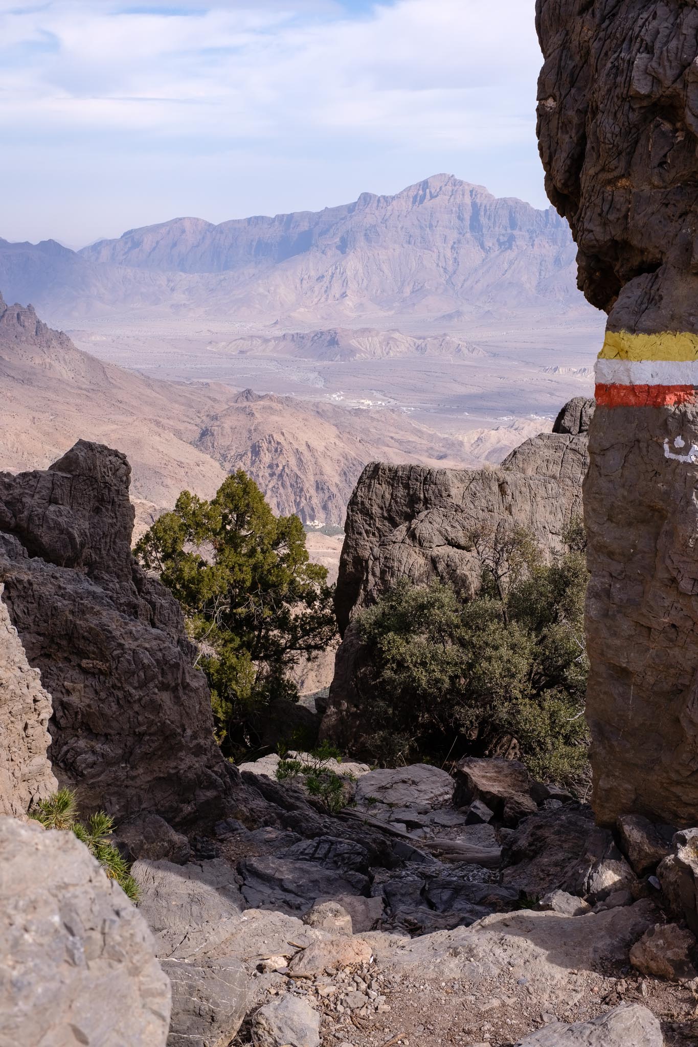
I walked along this trail several times in the past, and it is one I always enjoy, due to the peacefulness and the amazing views over Wadi Mistal. This time my plan was to go all the way up to the Sayq Plateau via the Wakan Pass, a gap in the mountain at 2,300 m altitude. In total, I walked around 14 km, going first to the top, and then coming back. This is not an easy walk, because in places the trail crosses several steep rocky parts and patches of loose rock, but it is well signaled with conspicuous colored markers. One can only imagine how in the past people would travel along these narrow trails on foot or in donkeys. You can see that in some parts, the rocks are well polished from people walking on them.
It took me about 3 hours to reach the top, including lots of stops for photo opportunities of the incredible landscape. The weather was sunny but cold, with fresh winds in the exposed plateau, so it is a good idea to bring extra layers of clothing. I leave you with a selection of images of this wonderful day spent visiting this magical mountain village. Even if you do not walk the entire trail, you can adjust the distance to your requirements; by walking only a few hundred metres, you will get a nice view of the village and the magnificent landscape that surrounds it.
Wakan and first light over the mountains.Trees in blossom.Filtered light.Over the eastern ridge.Delicate.In the terraces.Running water in the falaj.Tricky trail.Quick pause and overview over the landscape.Wakan pass at 2,300 m of altitude.Sayq Plateau.Panorama #1 (27 vertical photos).Panorama #2 (21 vertical photos).Panorama #3 (14 vertical photos).
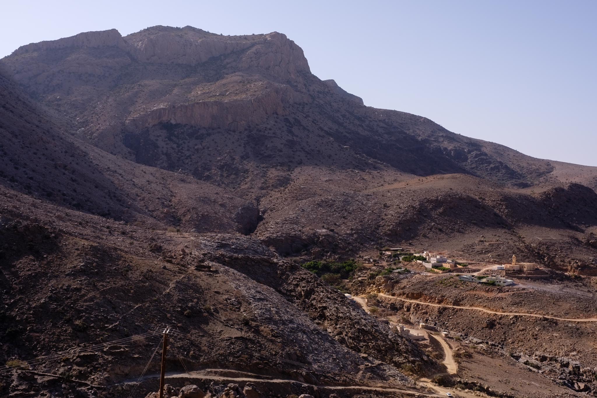
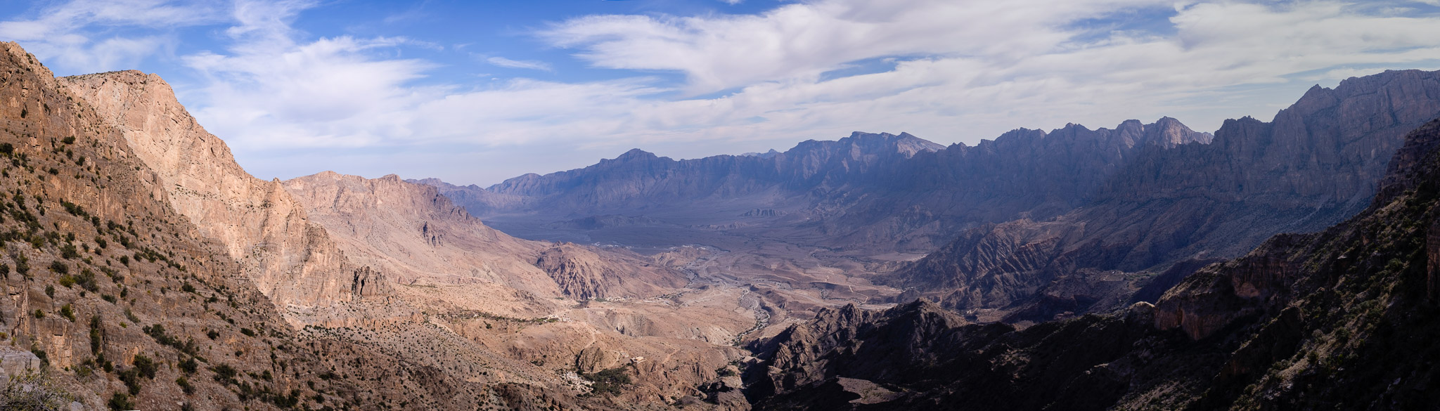
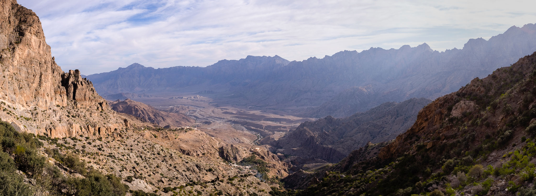
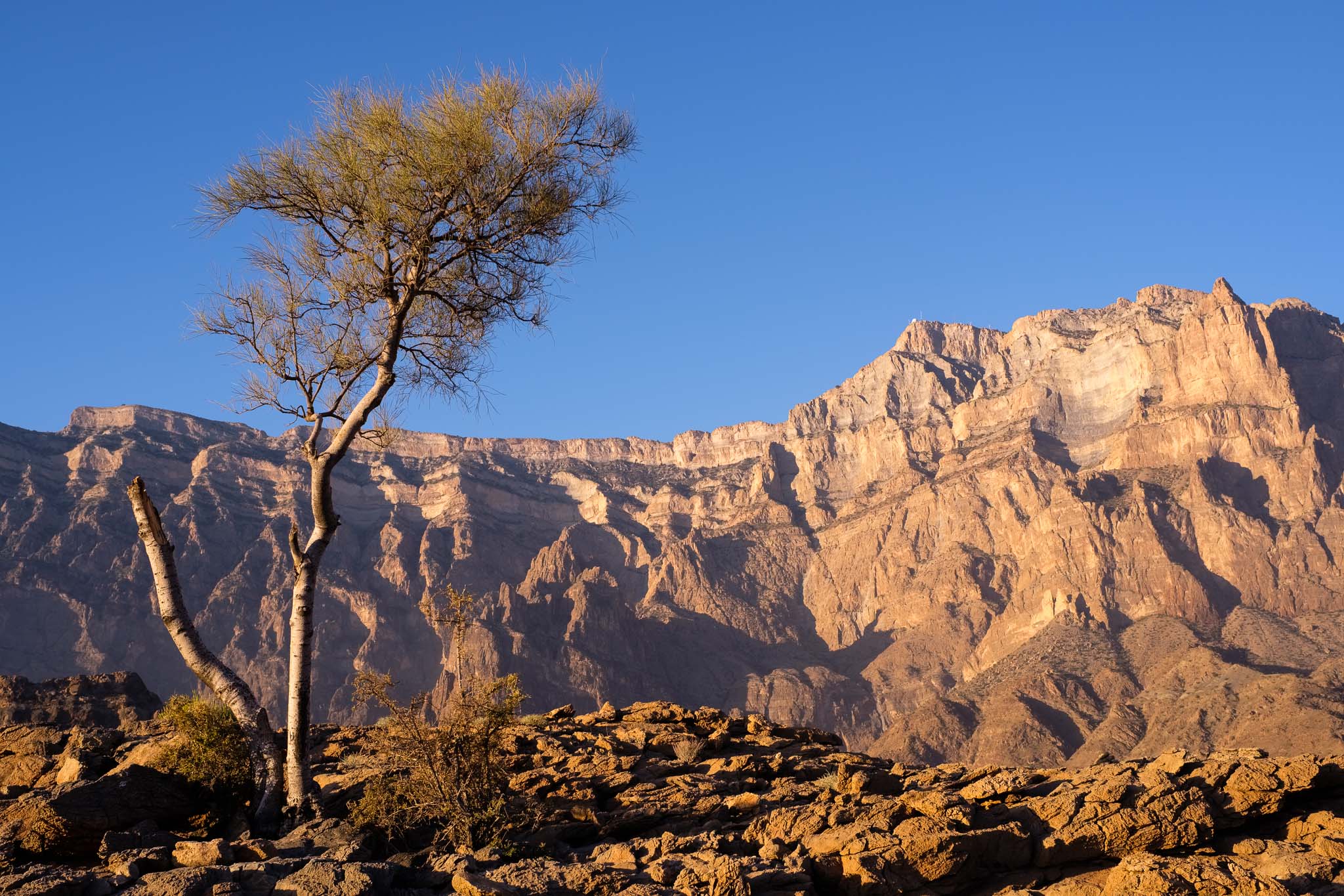
The Jebel Shams Mountain is home to some of the most beautiful landscapes you can find in Oman. It takes several trips to fully explore the region, which can be done via a handful of trails. You can walk along Wadi Nakhr, an easy going walk that takes you through the middle of the mountain, that I have described before:
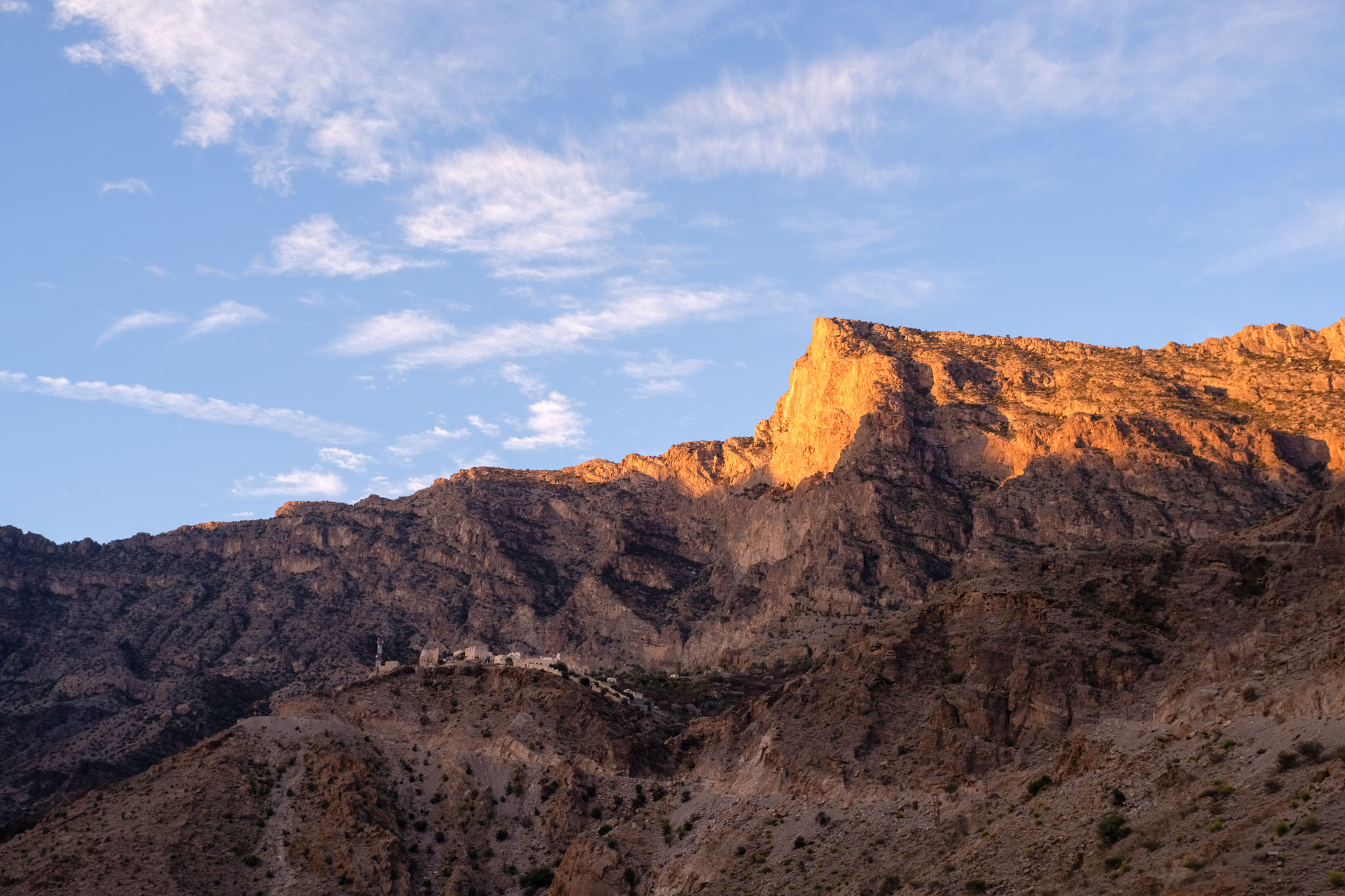
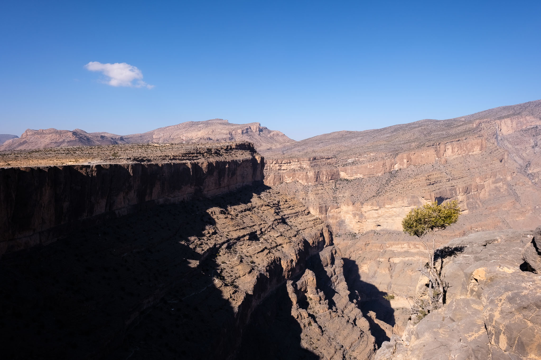
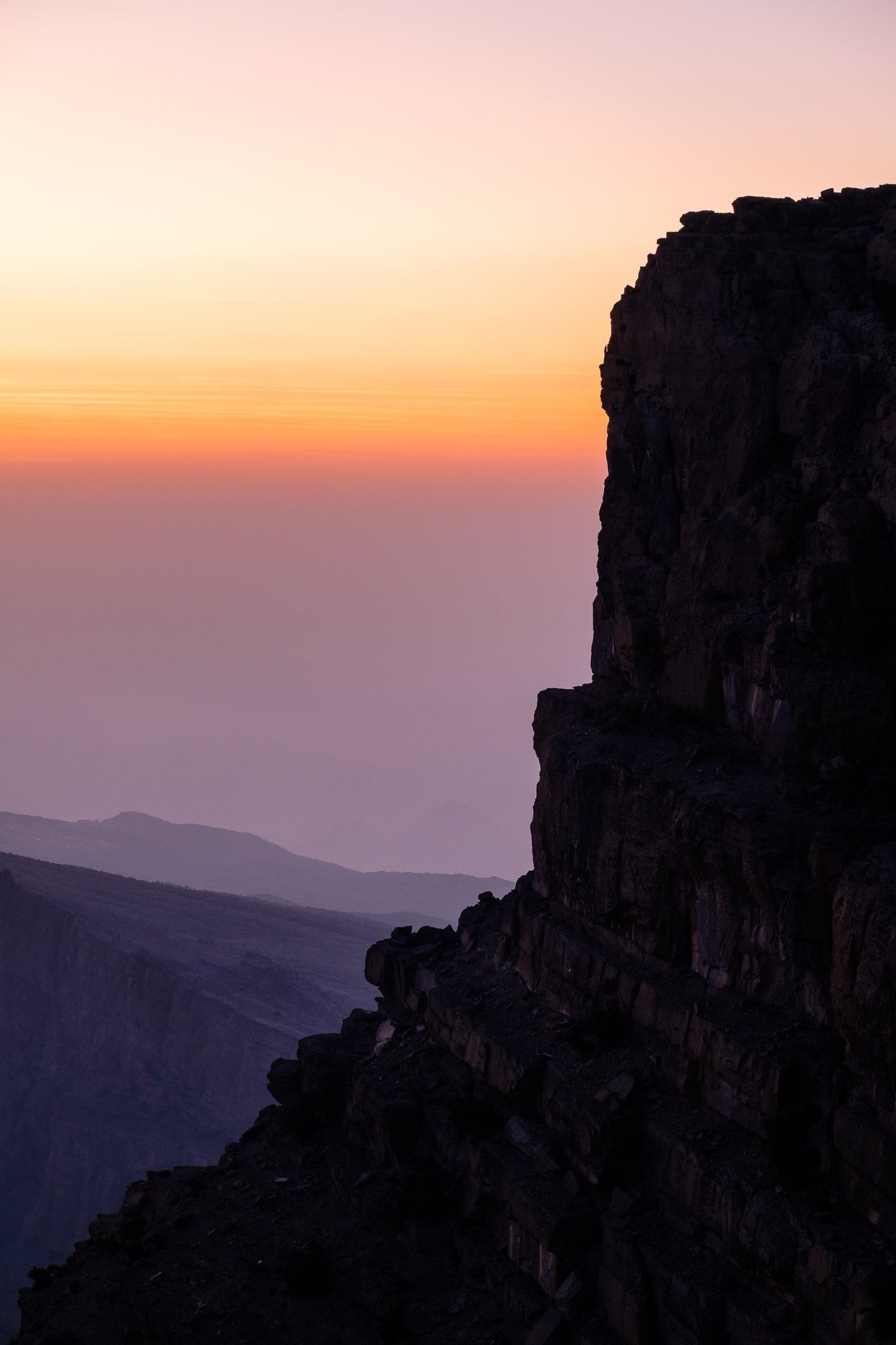
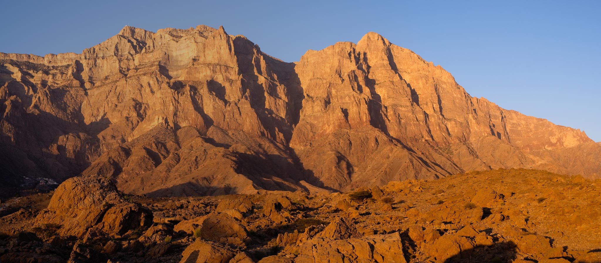
And you can drive all the way up to experience one of the most famous trails in Oman, the so-called “Balcony Walk”. I have recently spent one weekend in Jebel Shams to walk along this old donkey trail, which follows the western rim of the mountain, with fantastic views over Oman’s Grand Canyon. I walked this trail before, in 2006, so I was keen to go back nearly 20 years later. I carried with me the Fujifilm X-T5, with the Fujinon 14mm f/2.8 and 70-300mm f/4.5 – 5.6 lenses. Plus my trusty tripod.
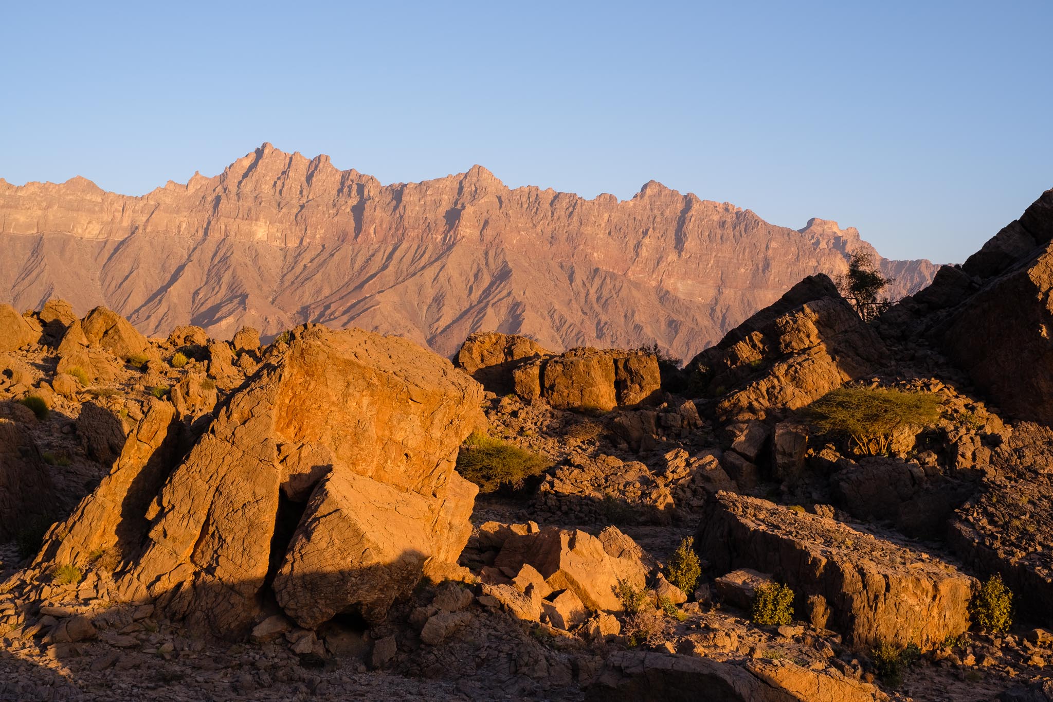
The drive between Muscat and Jebel Shams is an easy one, passing through Nizwa, Tanuf, and Hamra. From Hamra, it will take about 1 hour to reach the top, mostly through a graded road that is perfectly safe, as there are no steep inclines or hairpin turns. You will be climbing the southern flank of the mountain, which is much gentler compared to the northern one. As it is end of January, the weather is cold, with maximum temperatures usually a good 15 degrees centigrade lower than in the plains below. I was camping for one night, so I came well prepared with warm clothing. At 2,000 m above sea-level, freezing temperatures are common in the winter months.
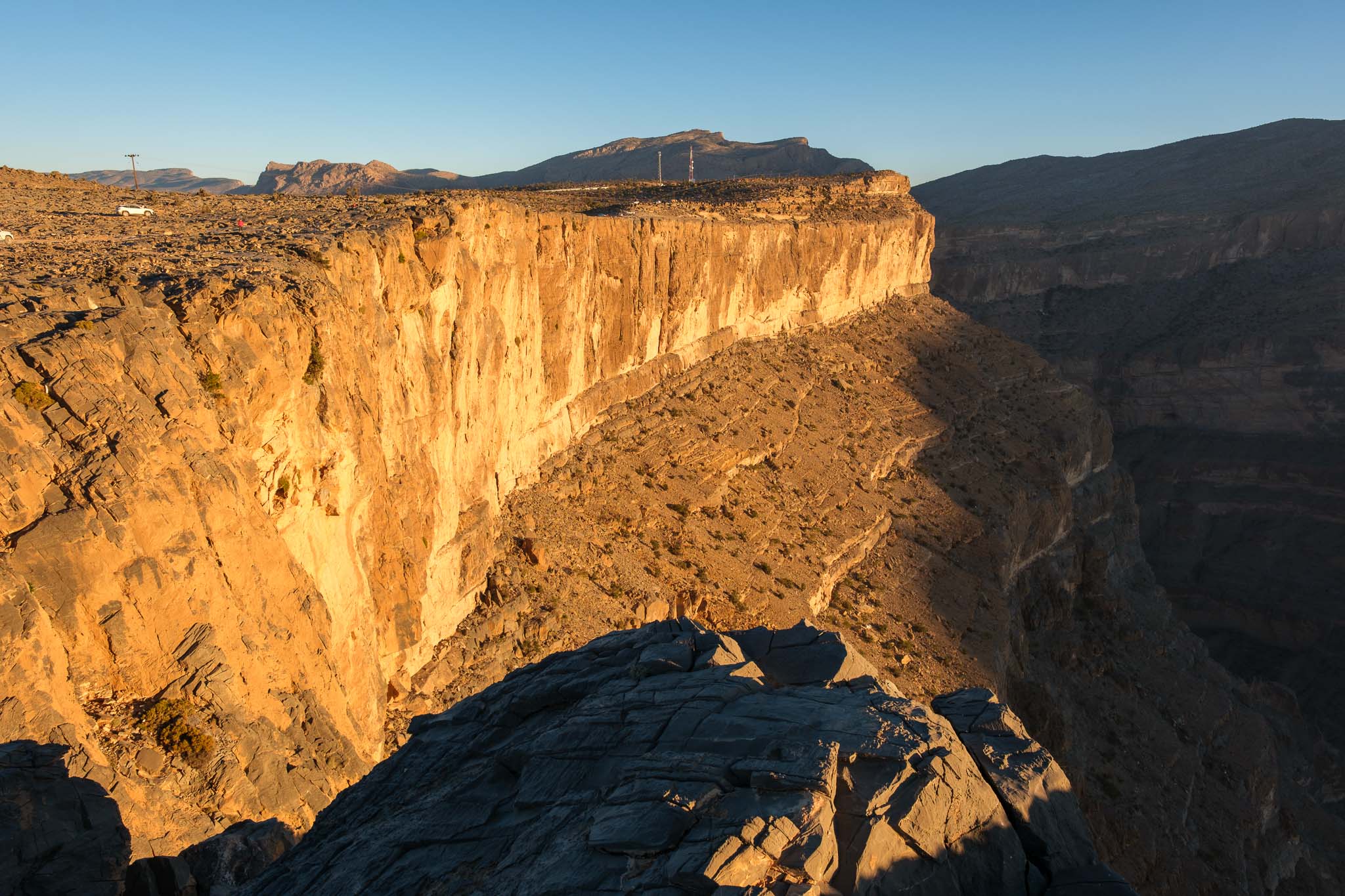
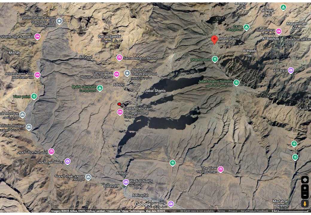
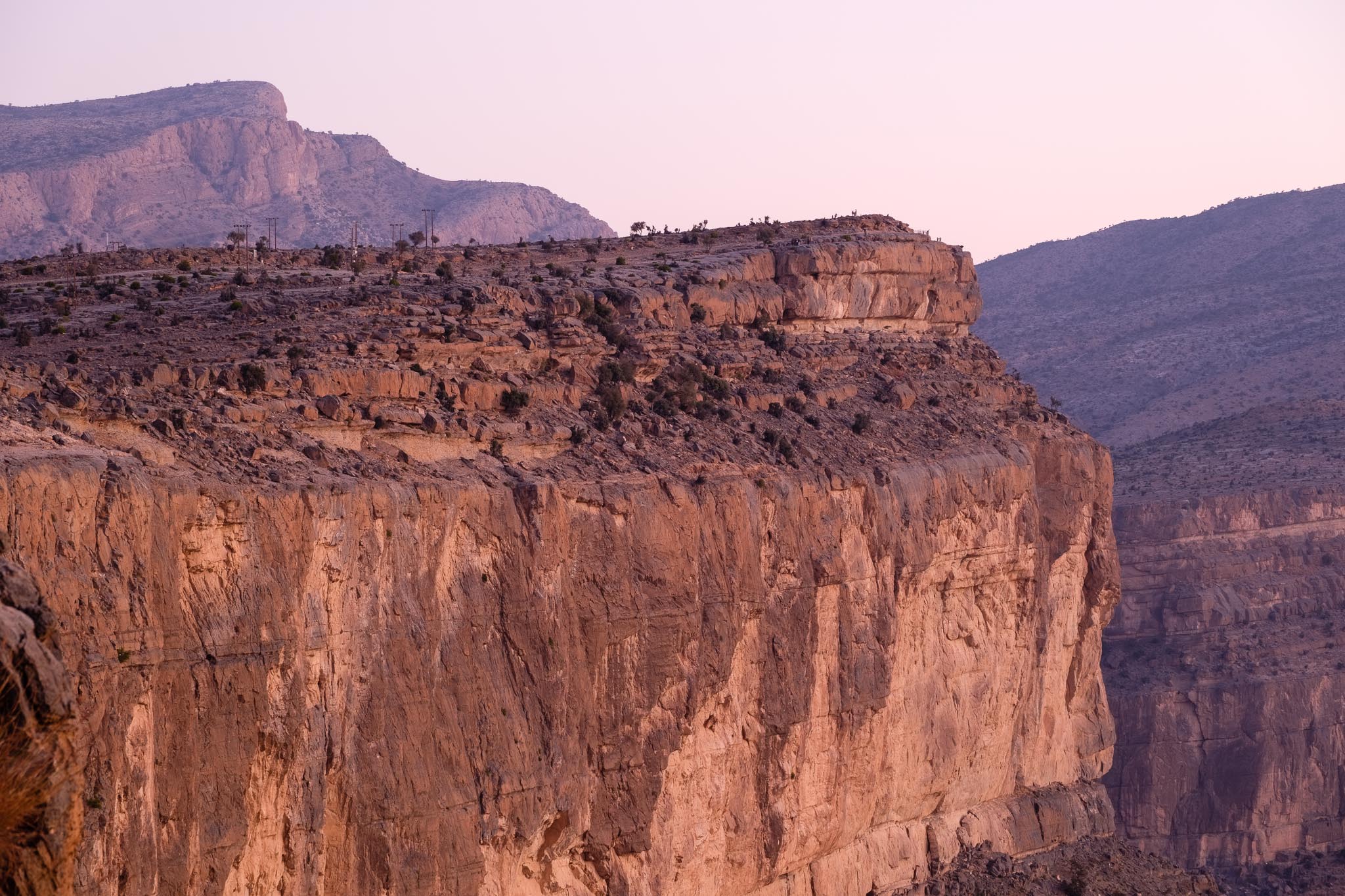
Overview of Jebel Shams area. The red circle on the left indicates my camping spot.
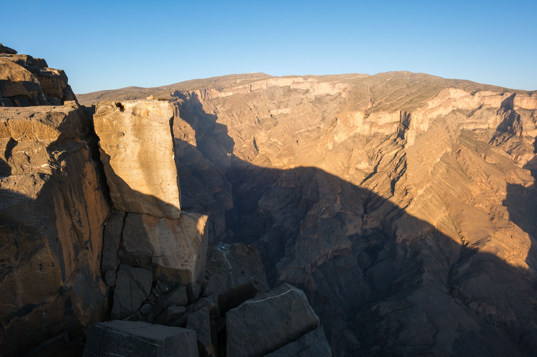
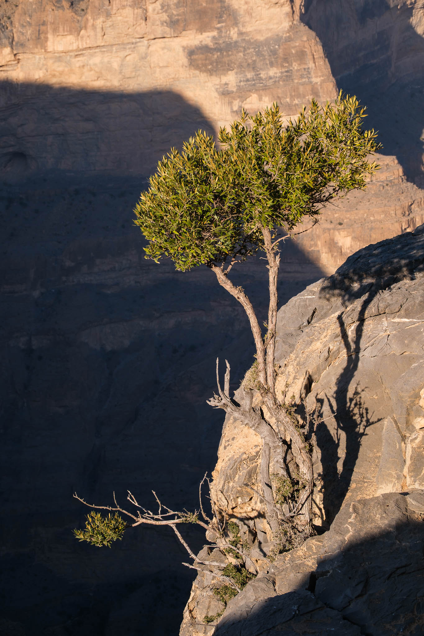
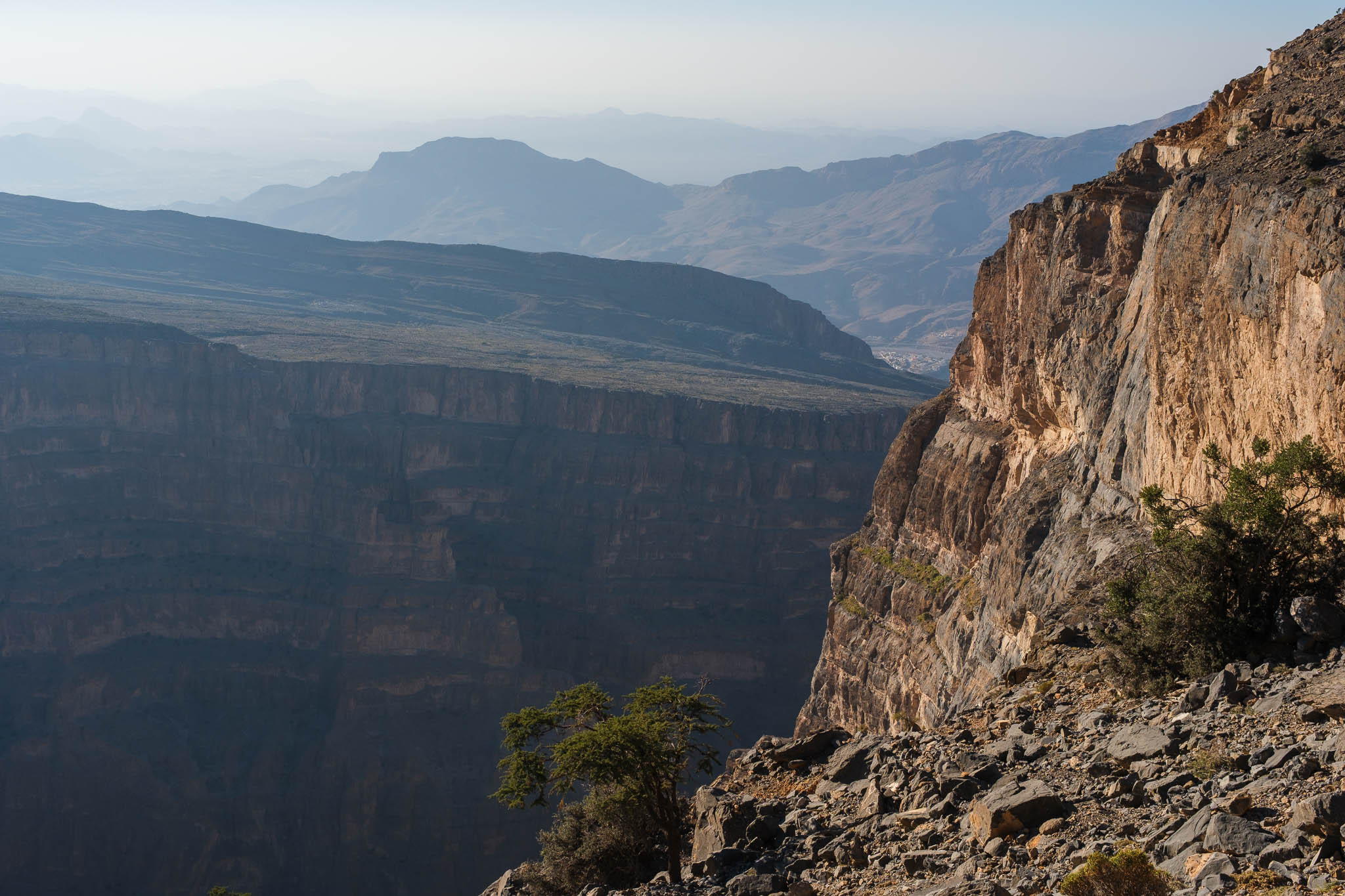
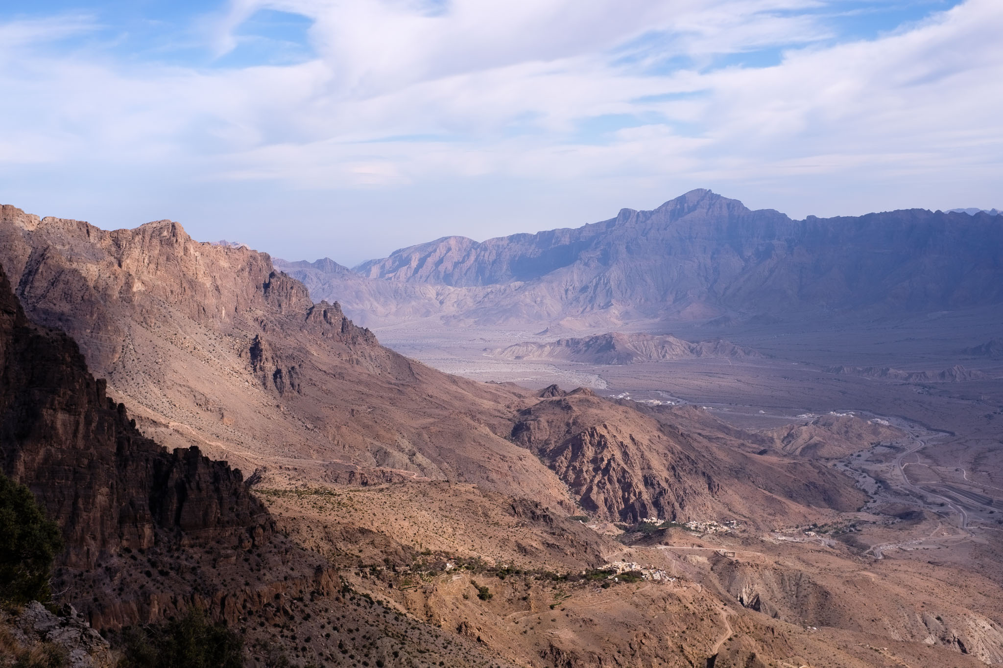
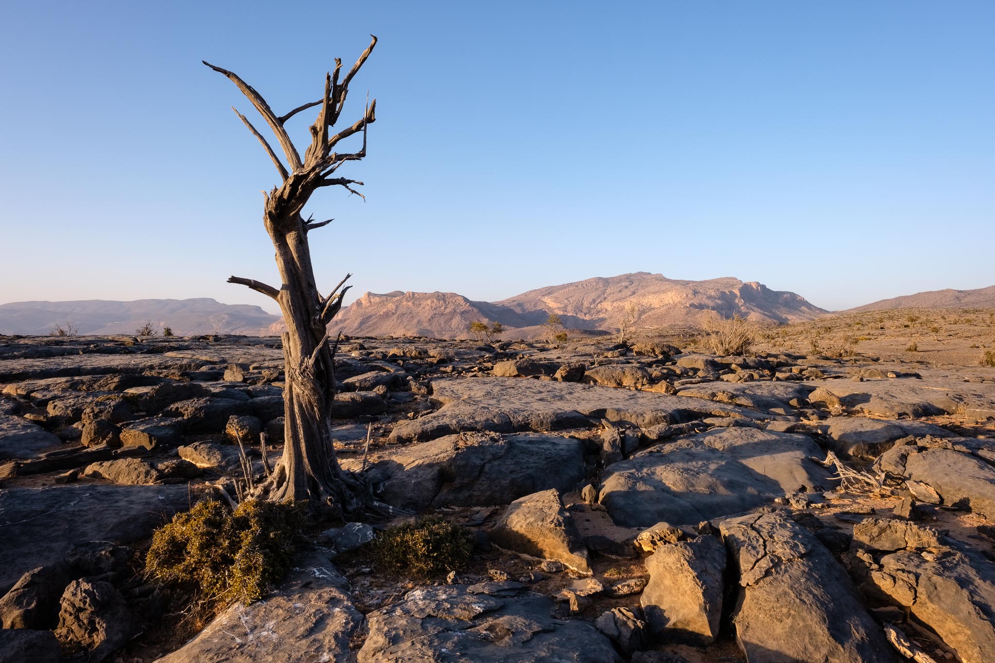
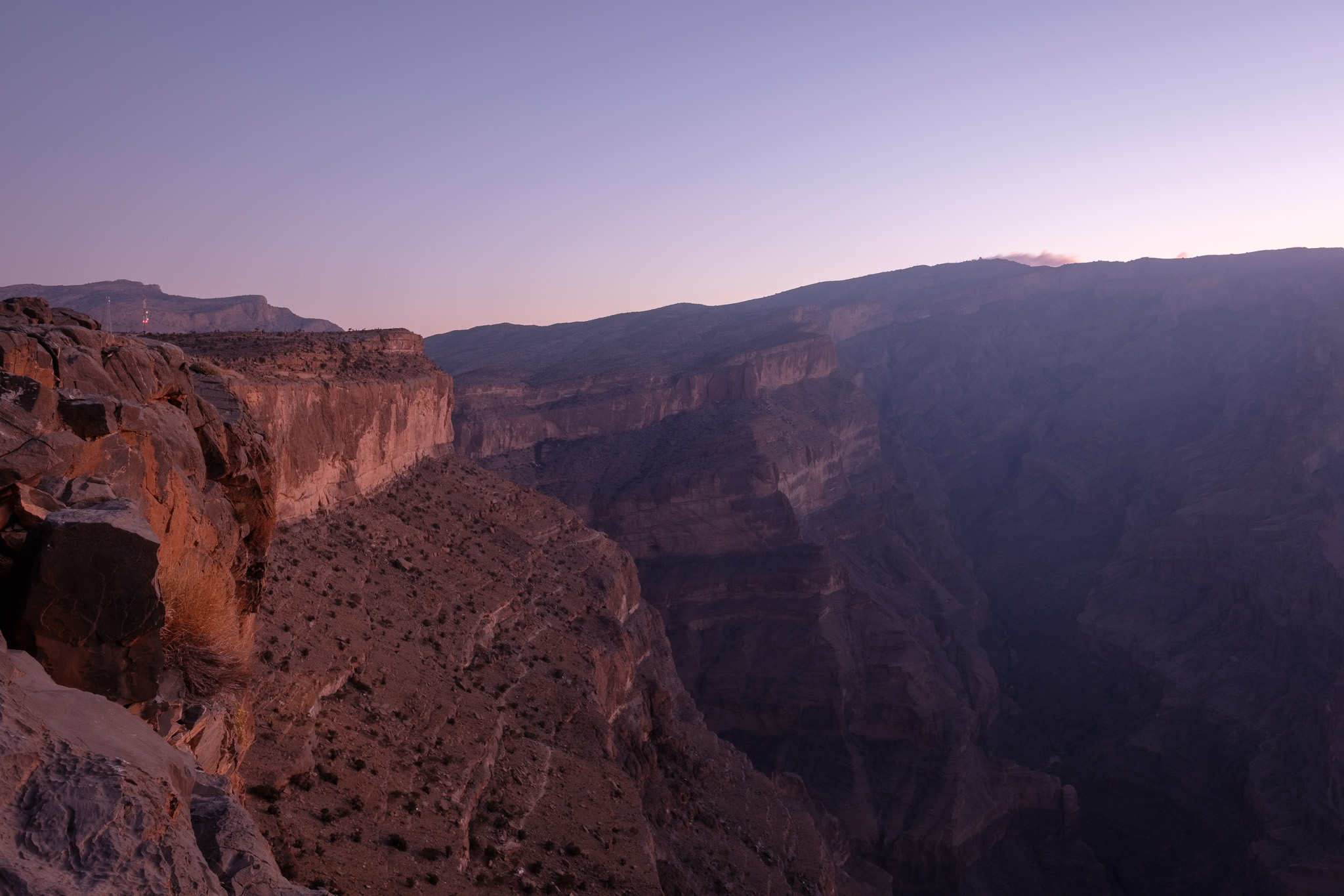
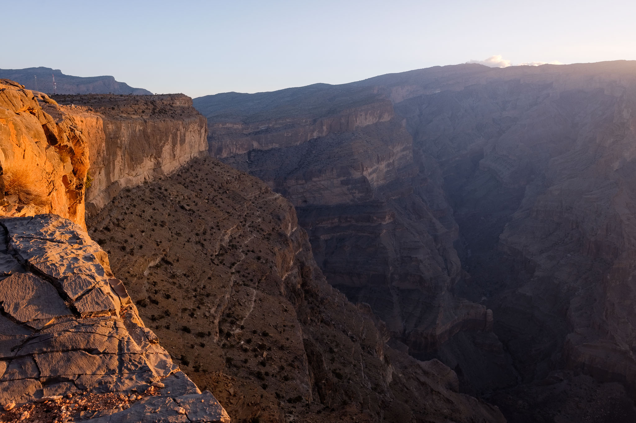
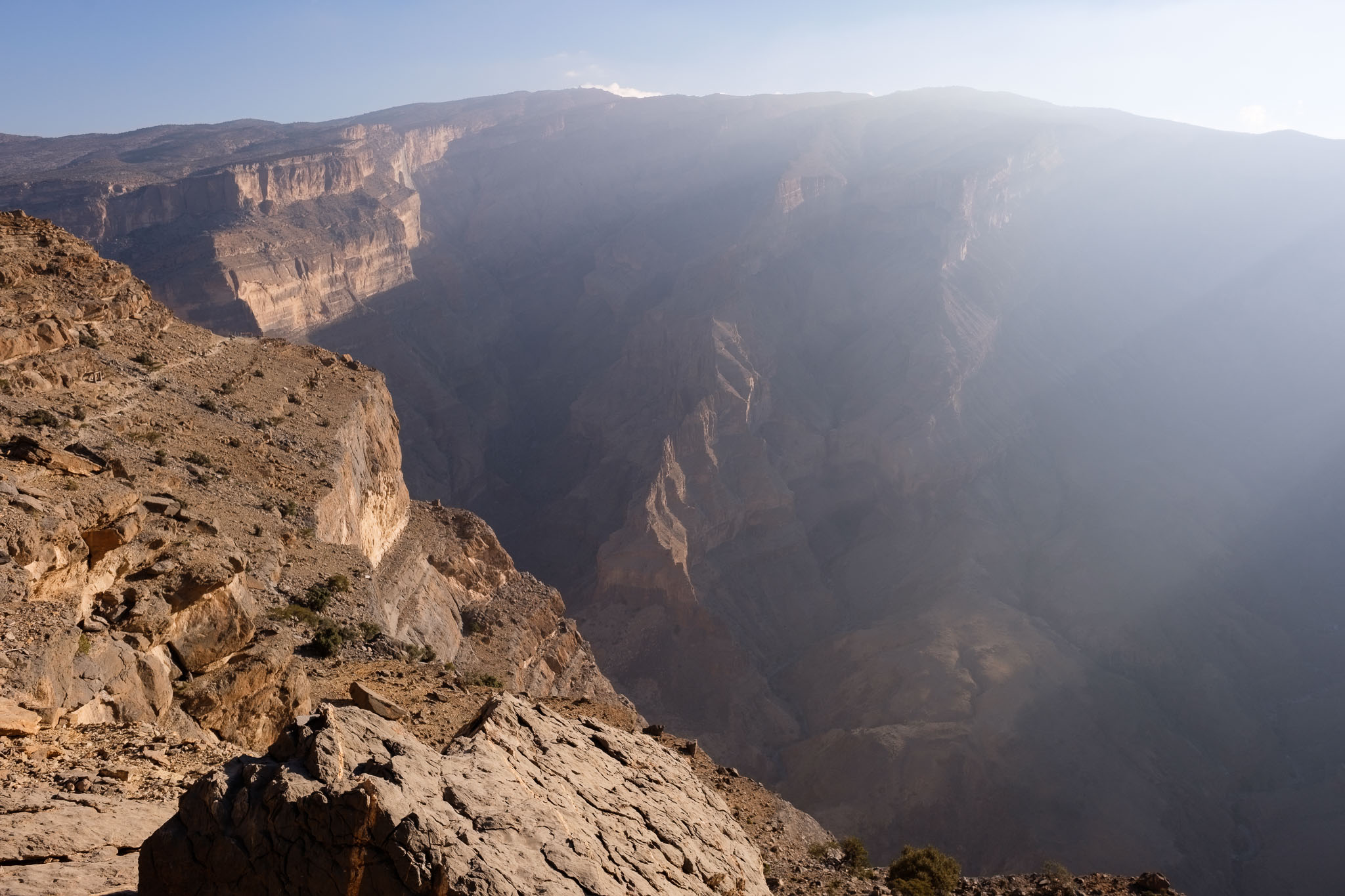
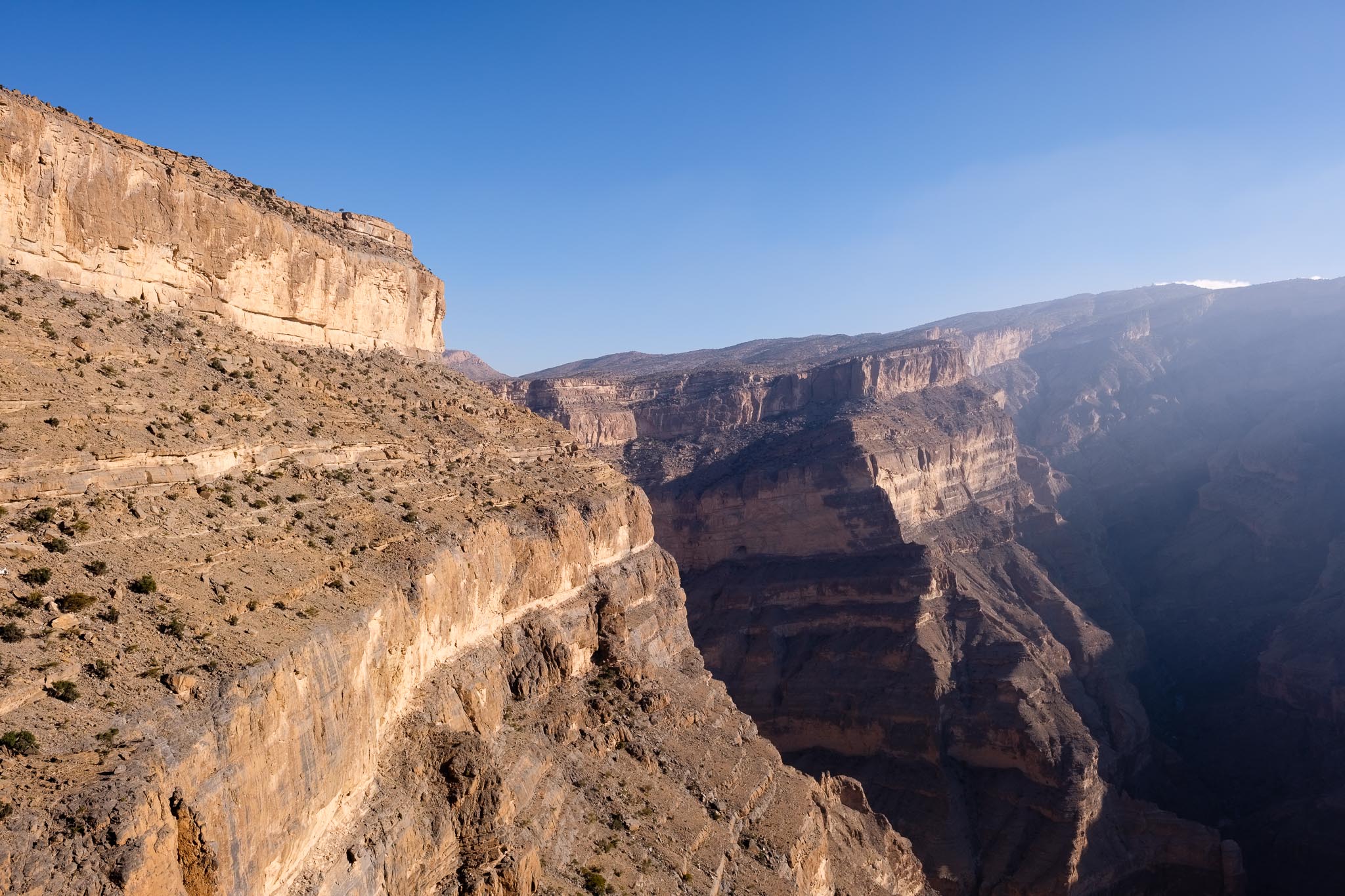
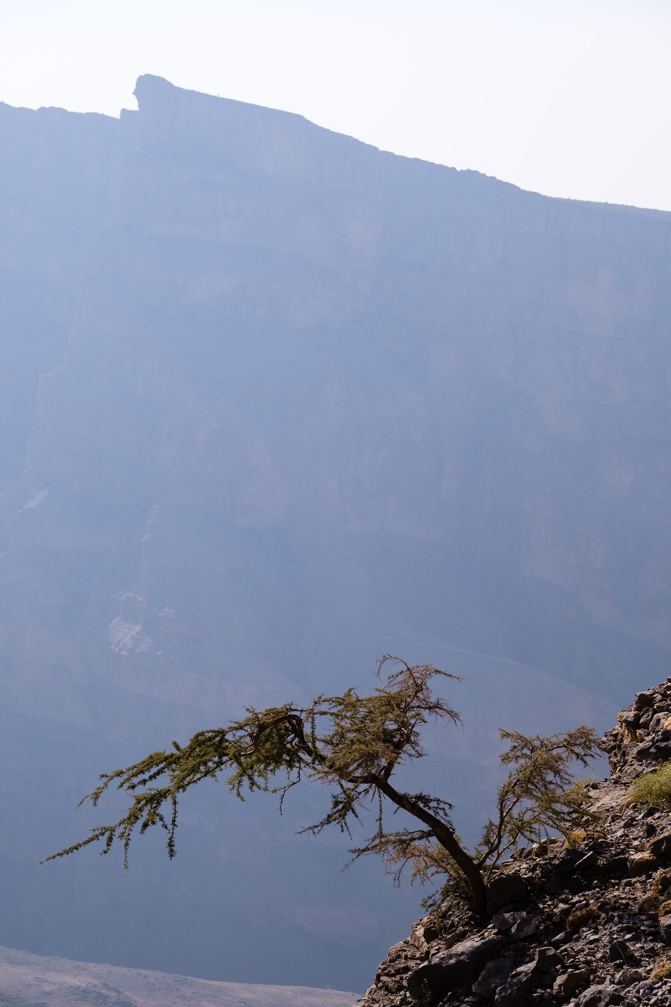
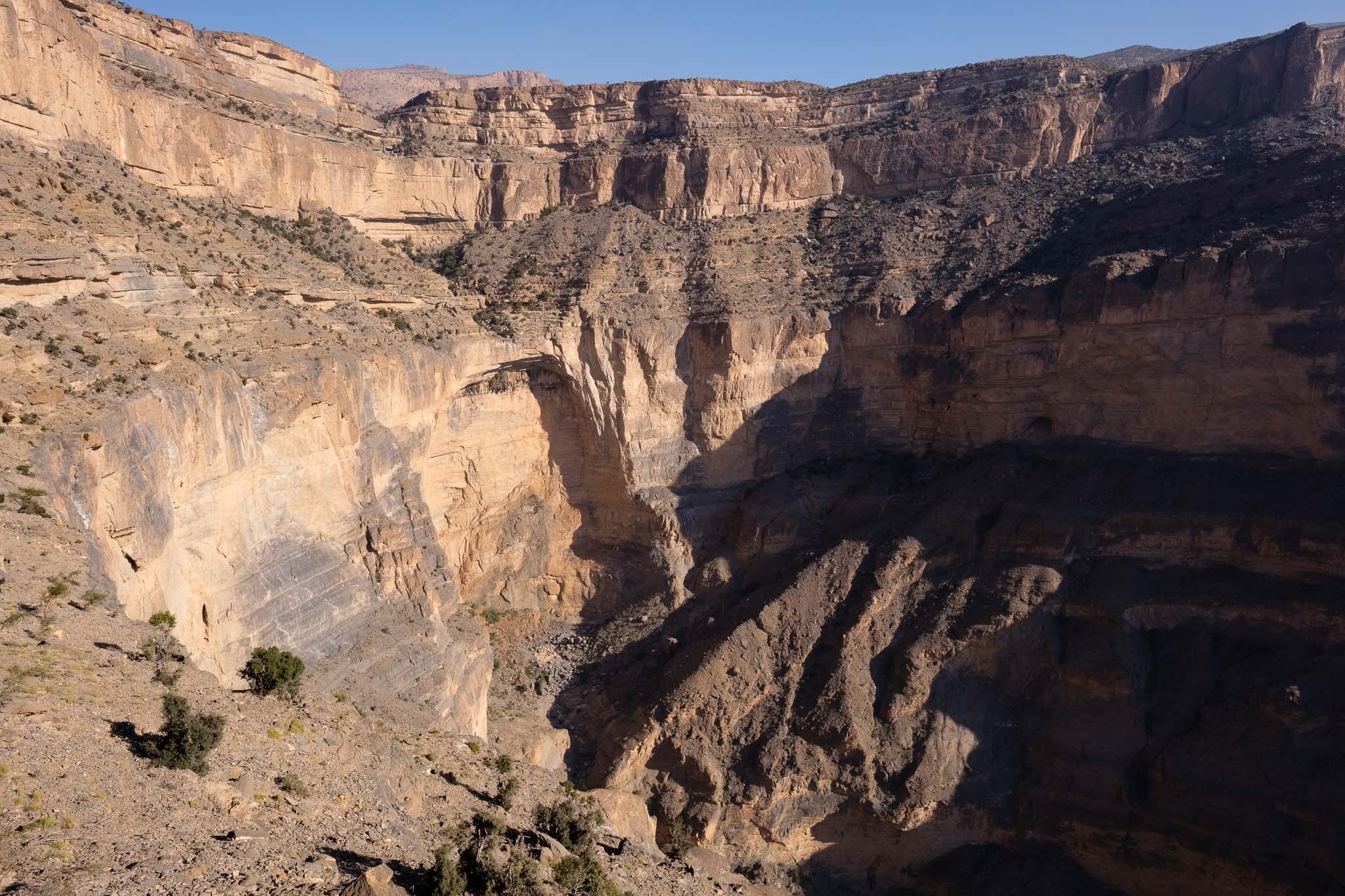
Compared to 20 years ago, things have changed a bit, there are now a couple of resorts, so camping is not required anymore. Still, that is my preference, as I want to fully enjoy the quiet isolation and the mountain environment. I chose my campsite location to be close to the edge of the canyon, with a fantastic view over the entire Jebel Shams. I recognized the radar installation and antennas on the other side of the canyon, built at the highest point. After setting up my tent, I walked around the area until sunset, taking photos of the Grand Canyon, which is impressive. I was looking down into Wadi Nakhr 1,000 m below, and I was able to recognize a couple of villages from my previous walk in the wadi. I could also see the narrow trail that I would be taking the next day, seemingly a thin trace on the side of the mountain. The visibility was great, thanks to the absence of haze.
Looking into the Grand Canyon of Oman.Lone tree.Clinging.1,000 m down.
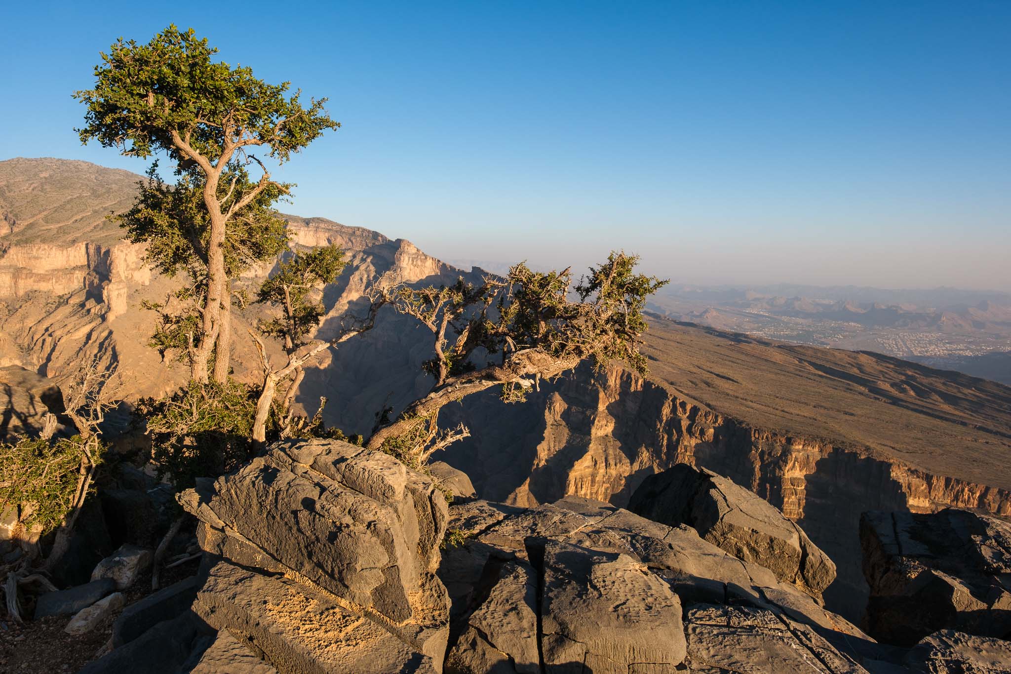
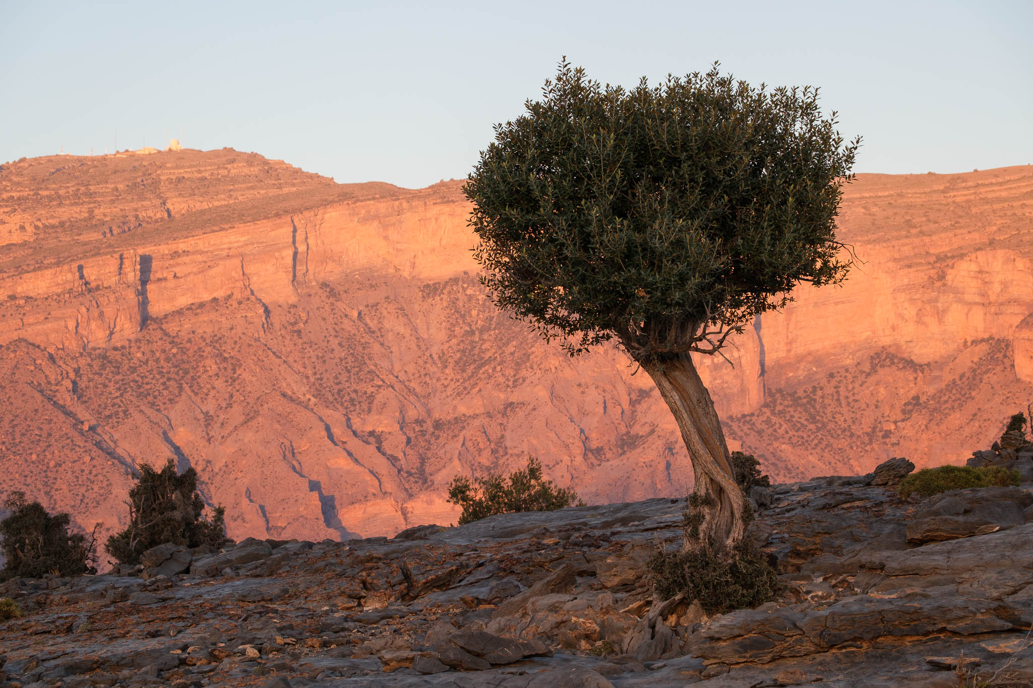
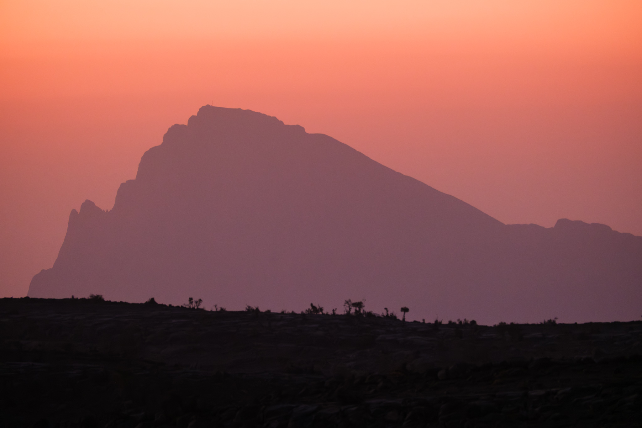
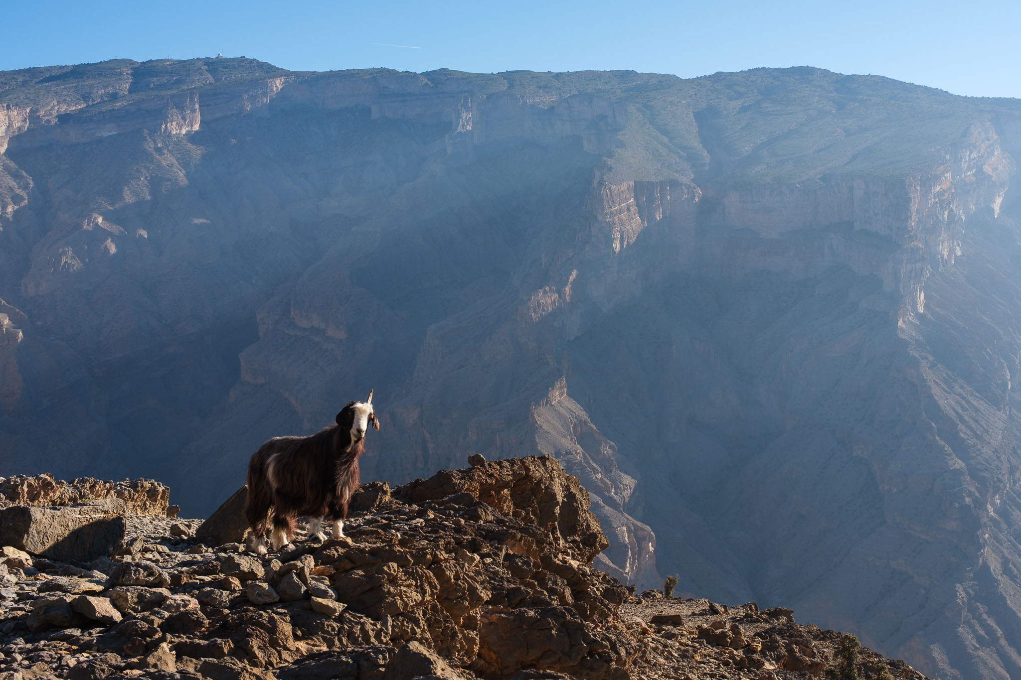
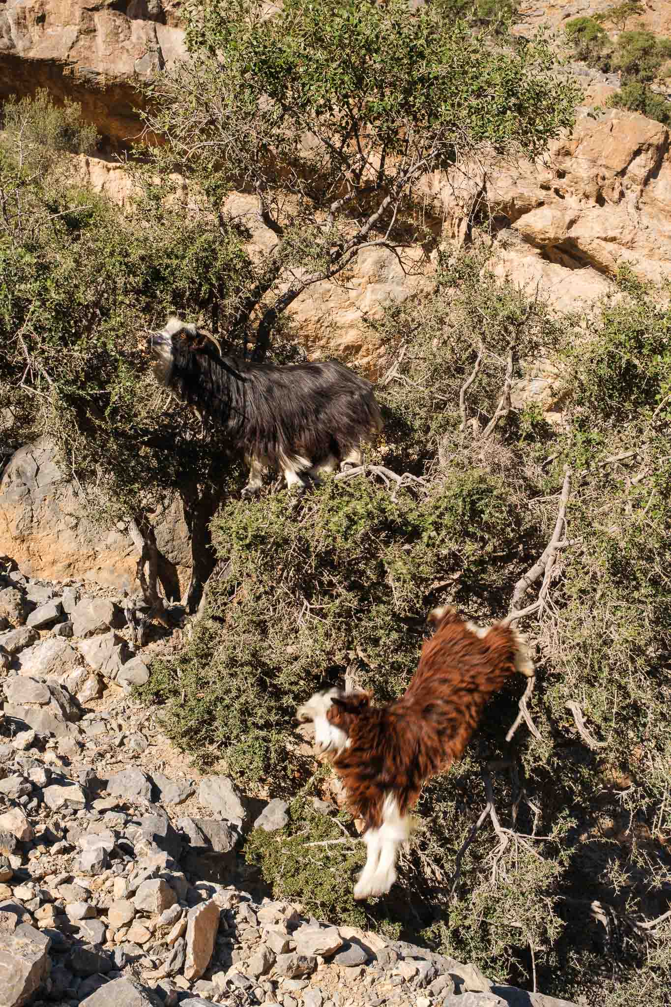
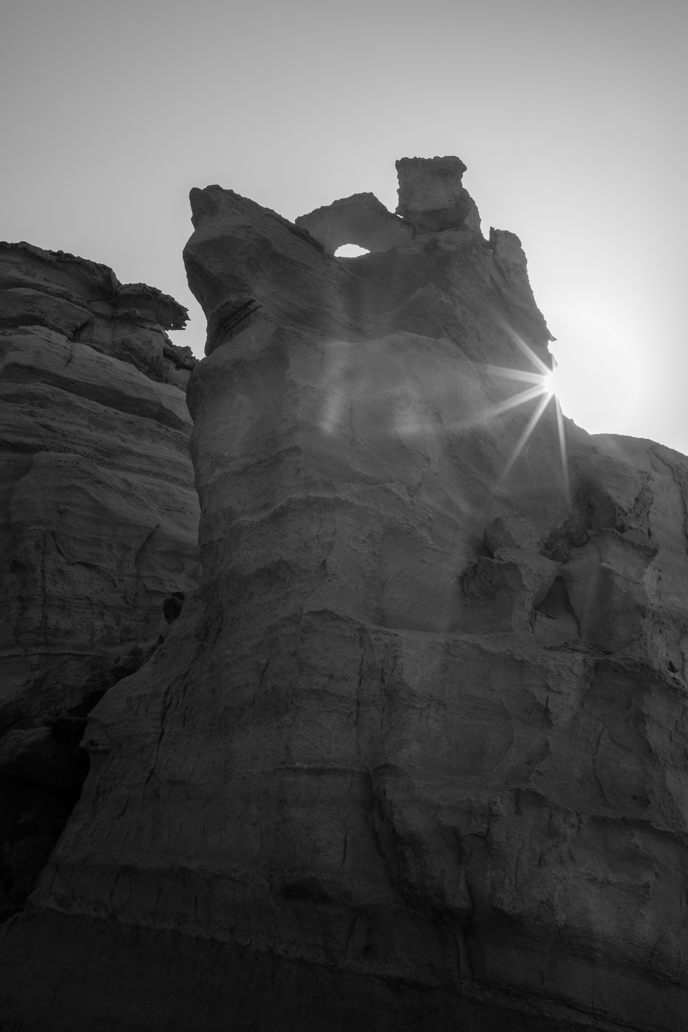
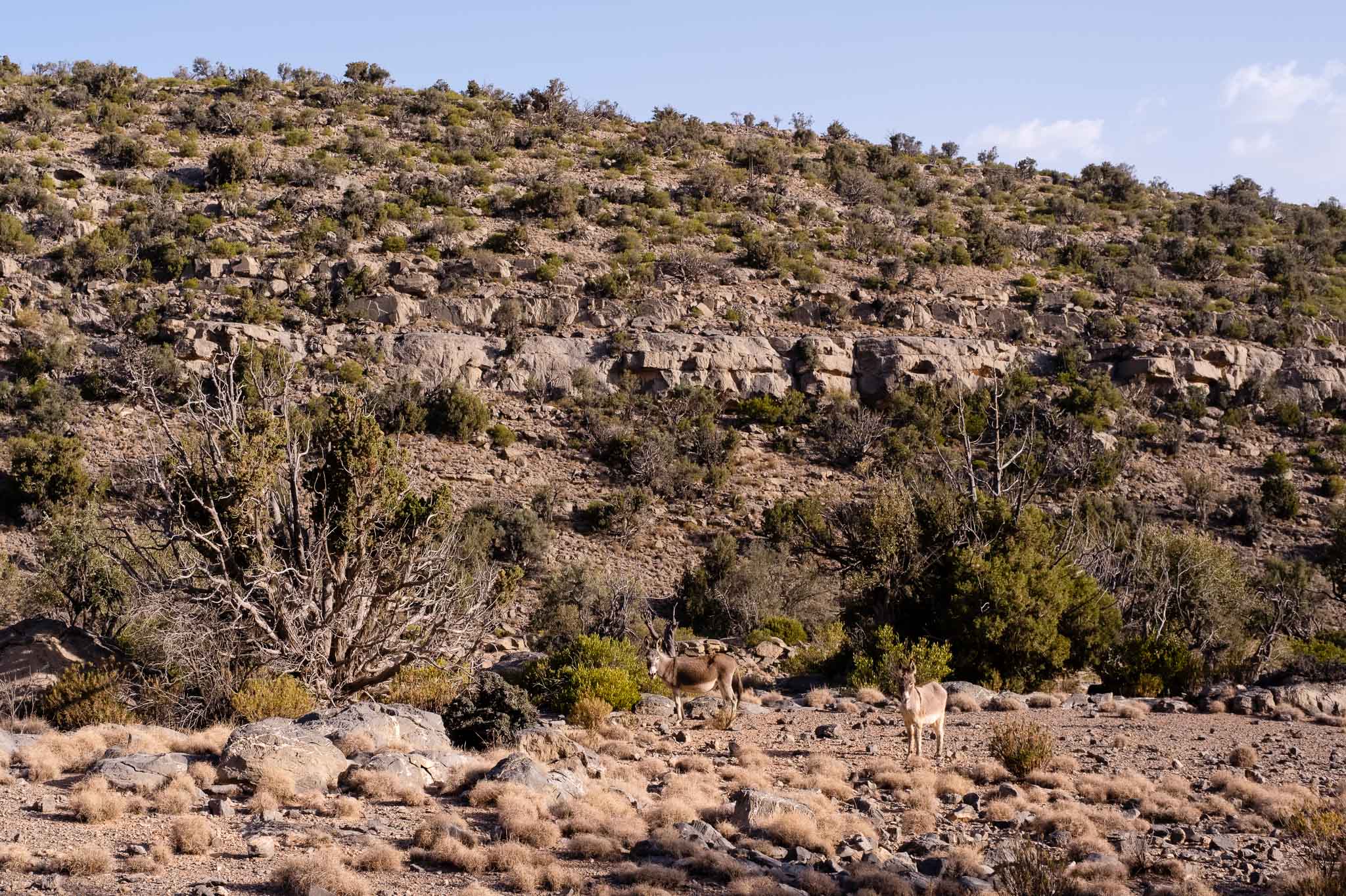
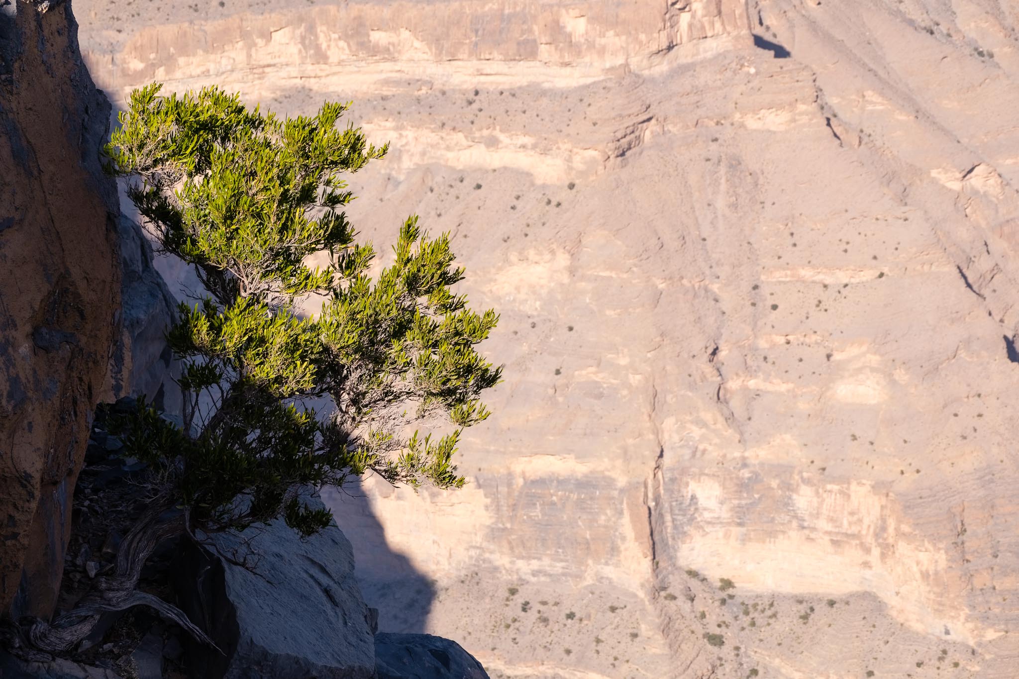
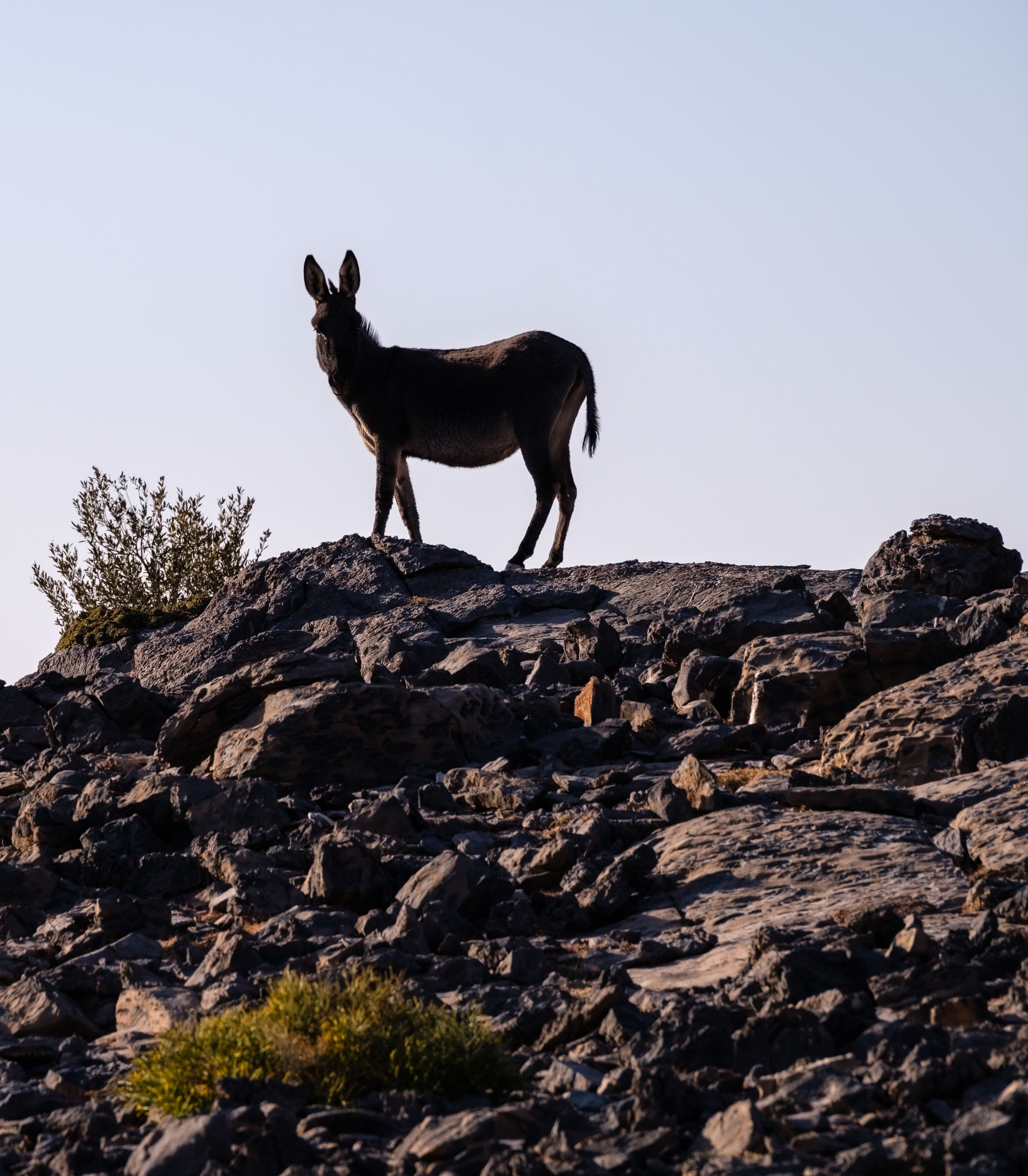
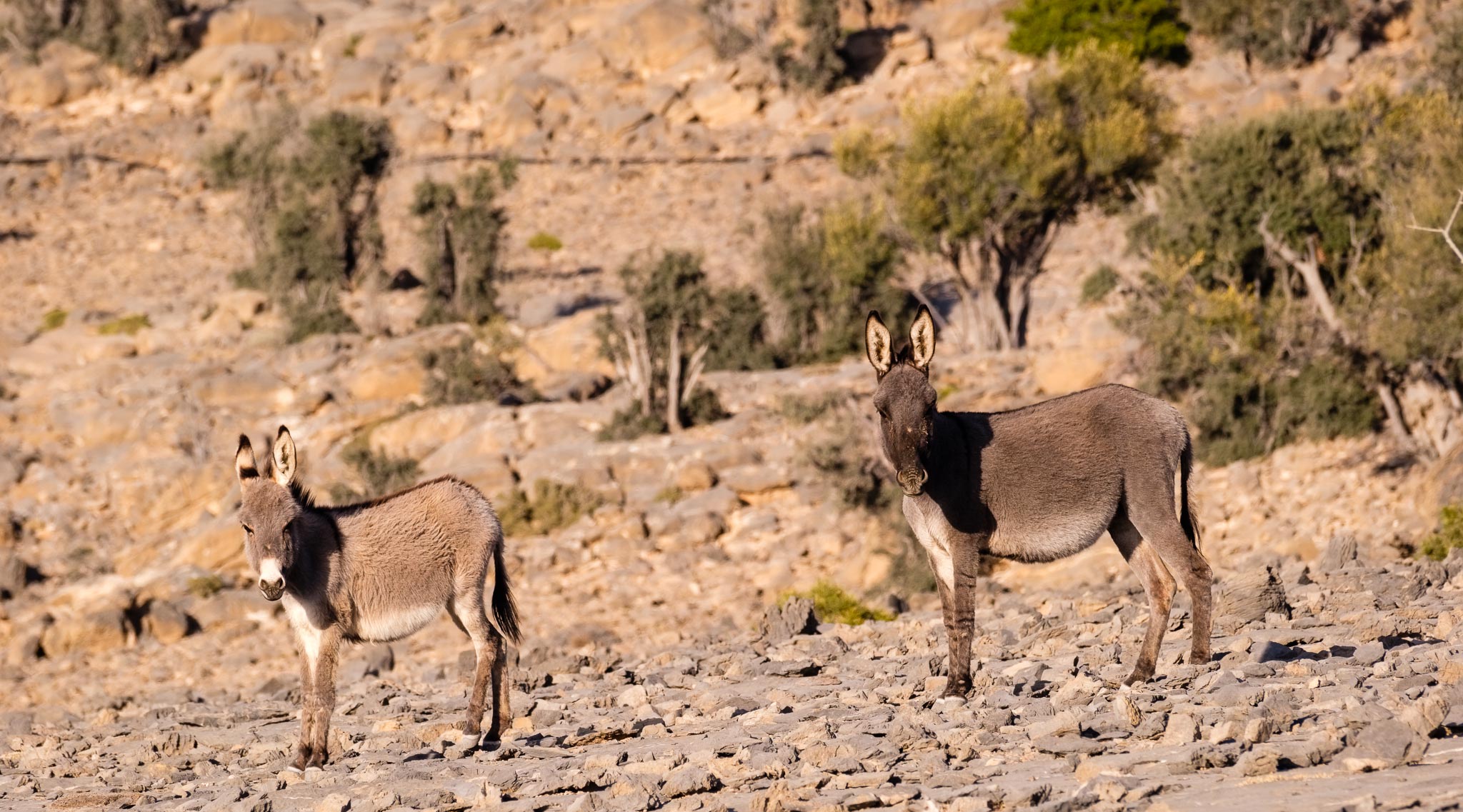
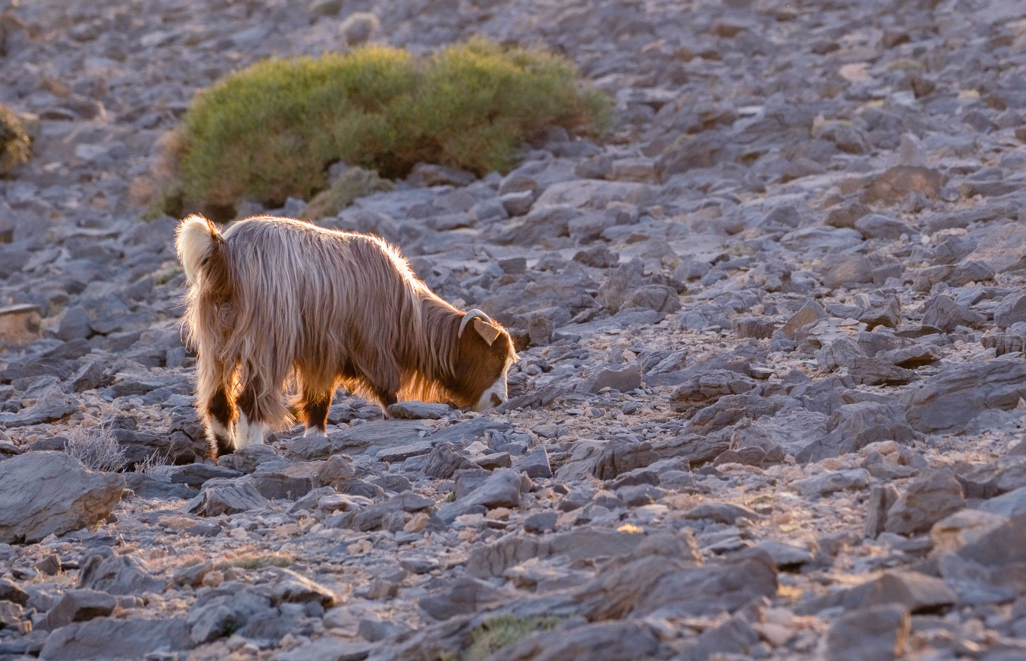
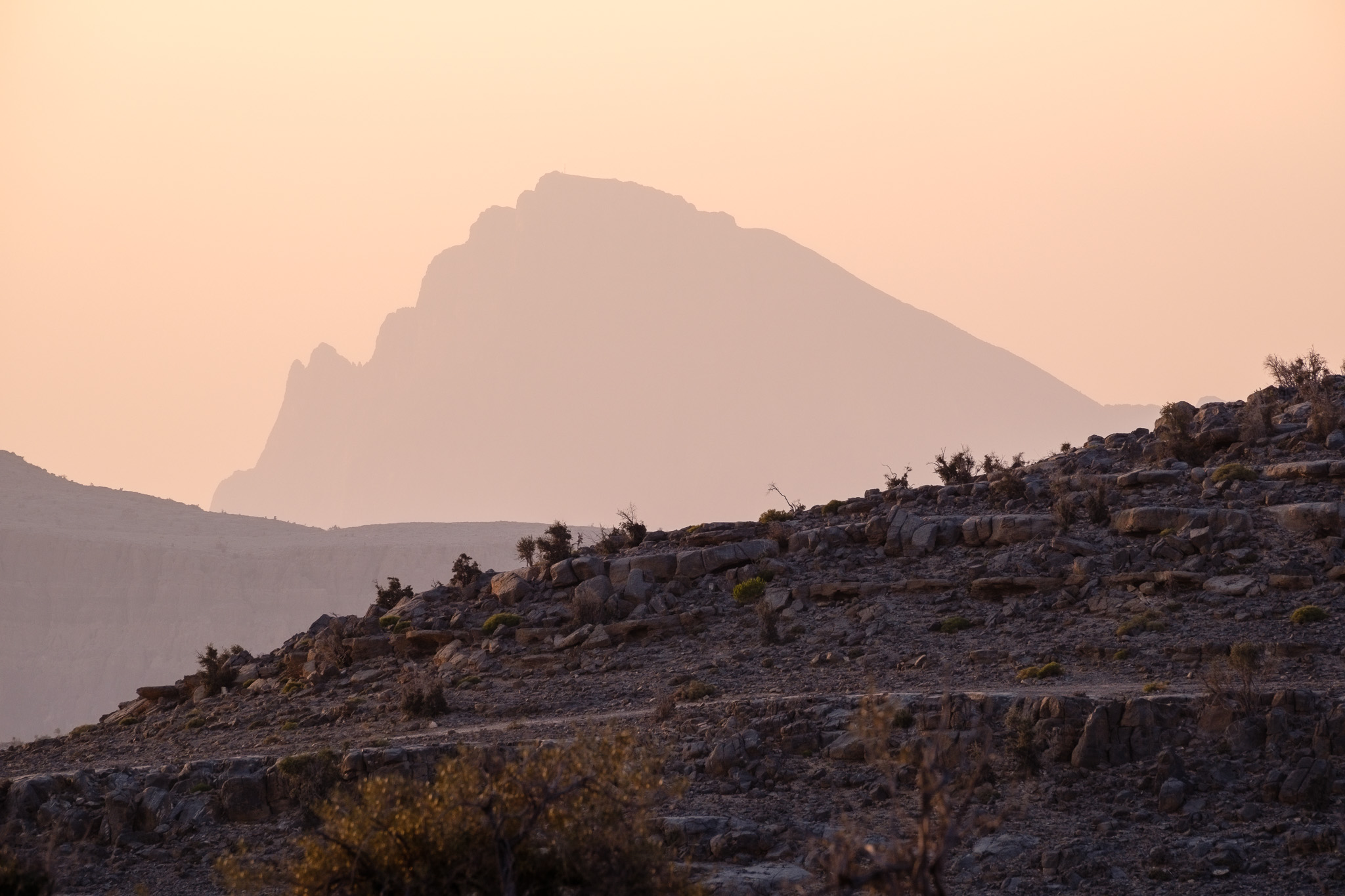
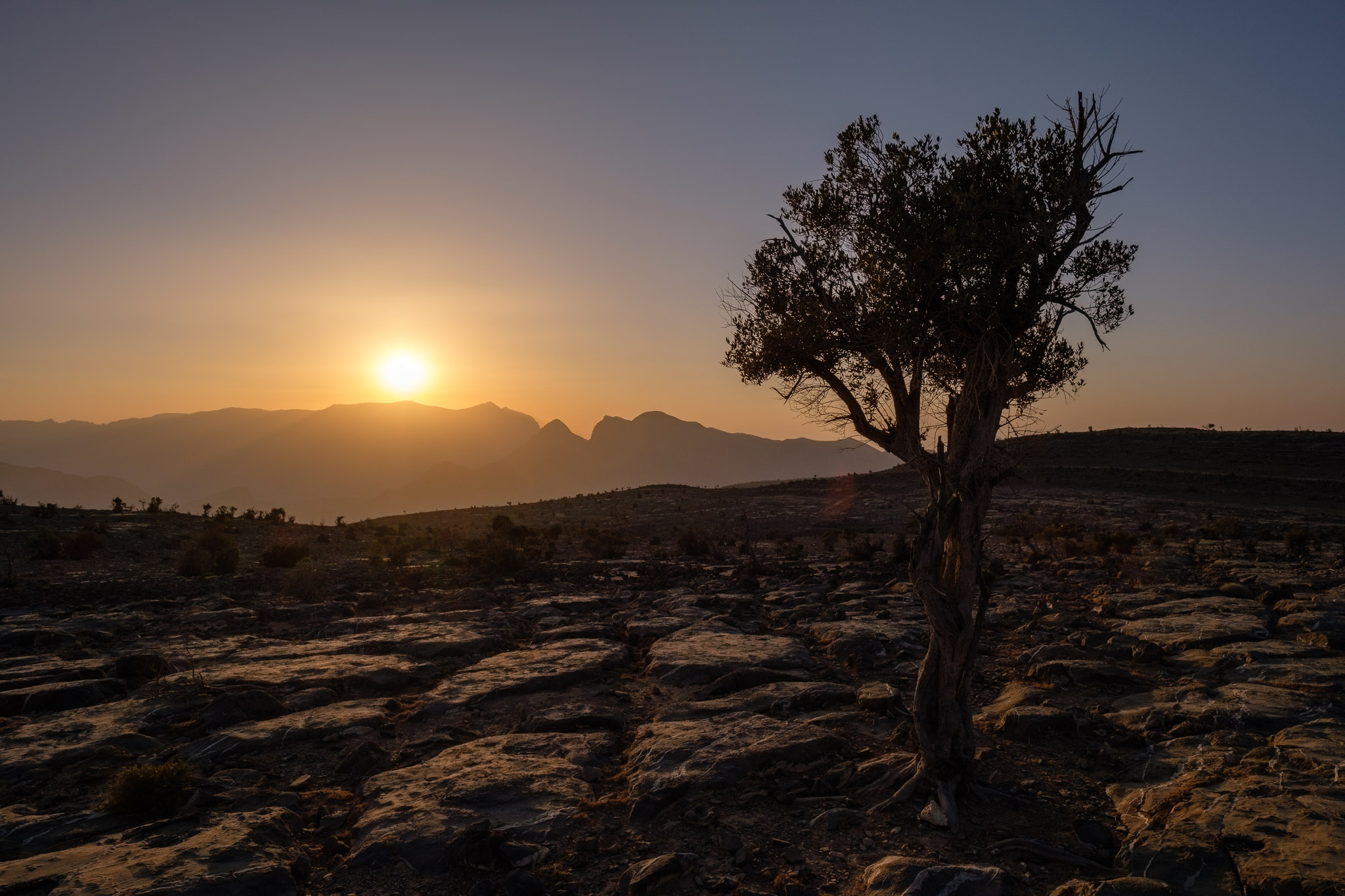
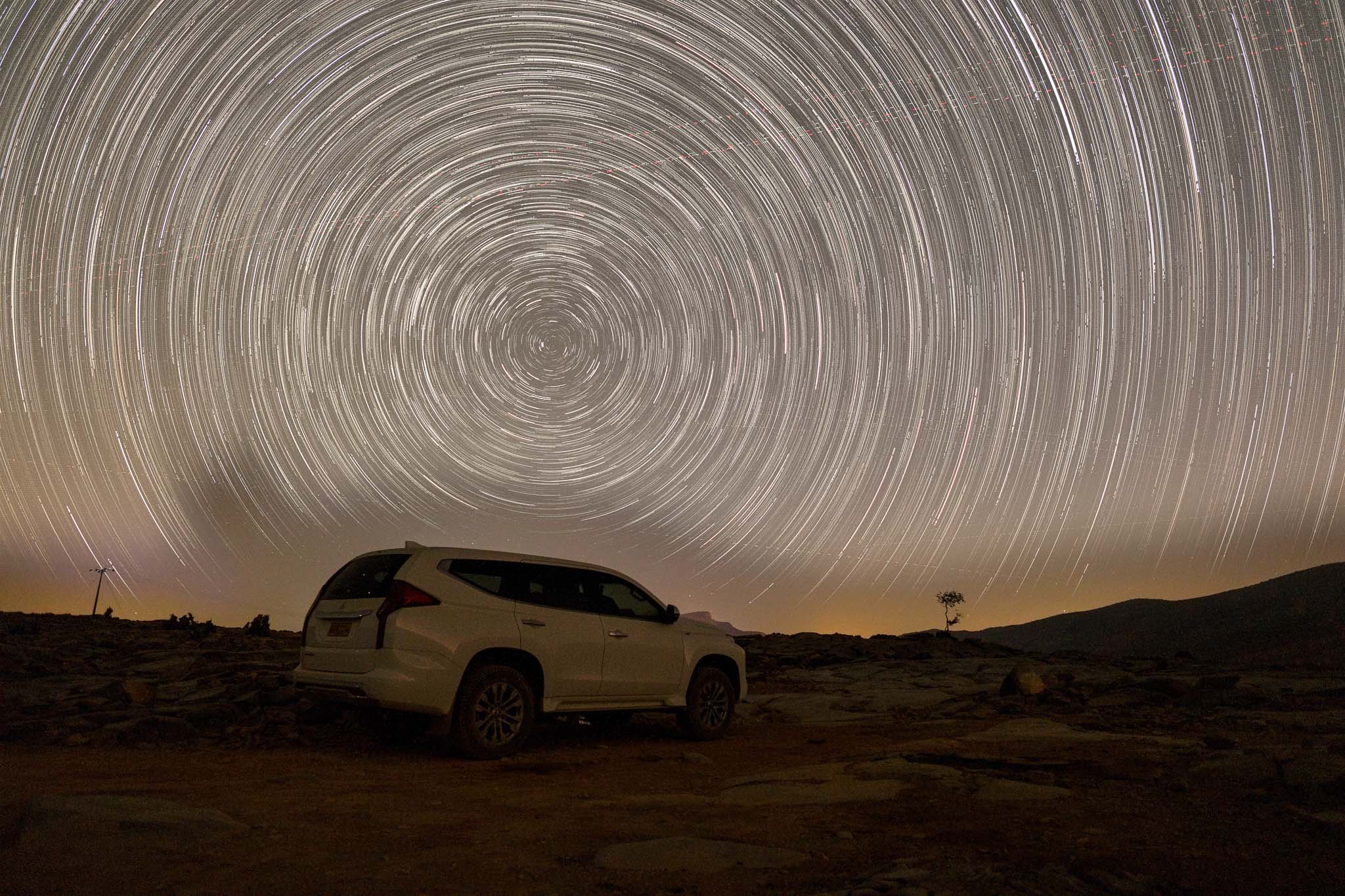
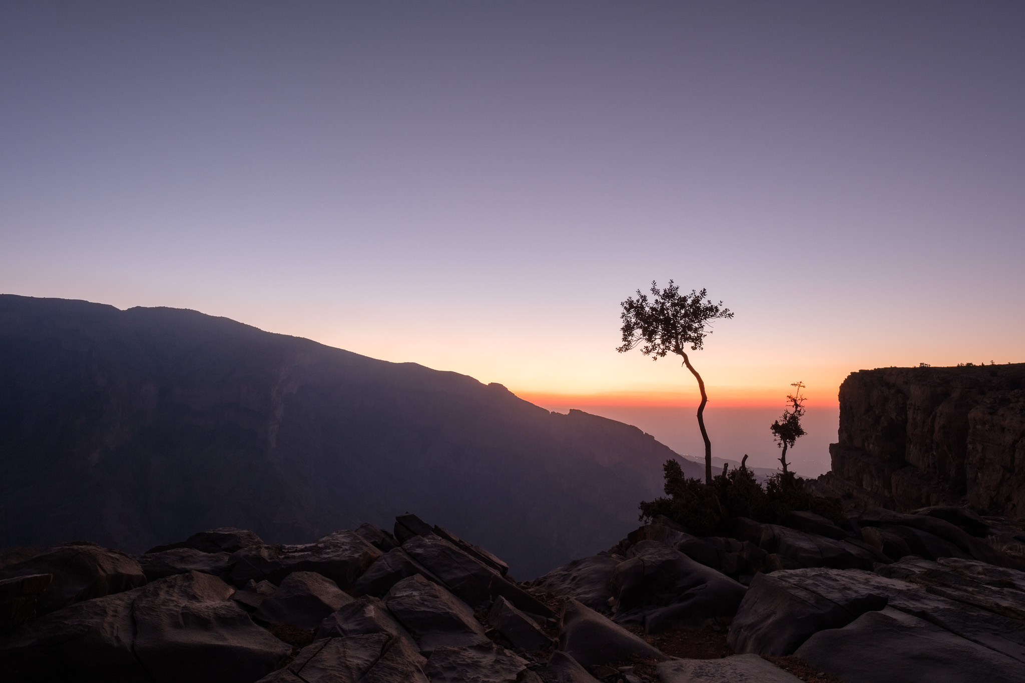
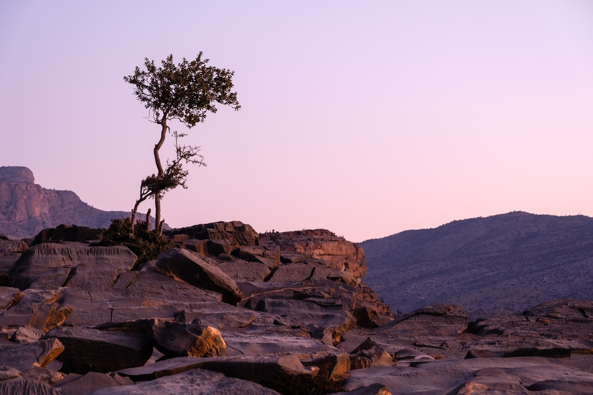
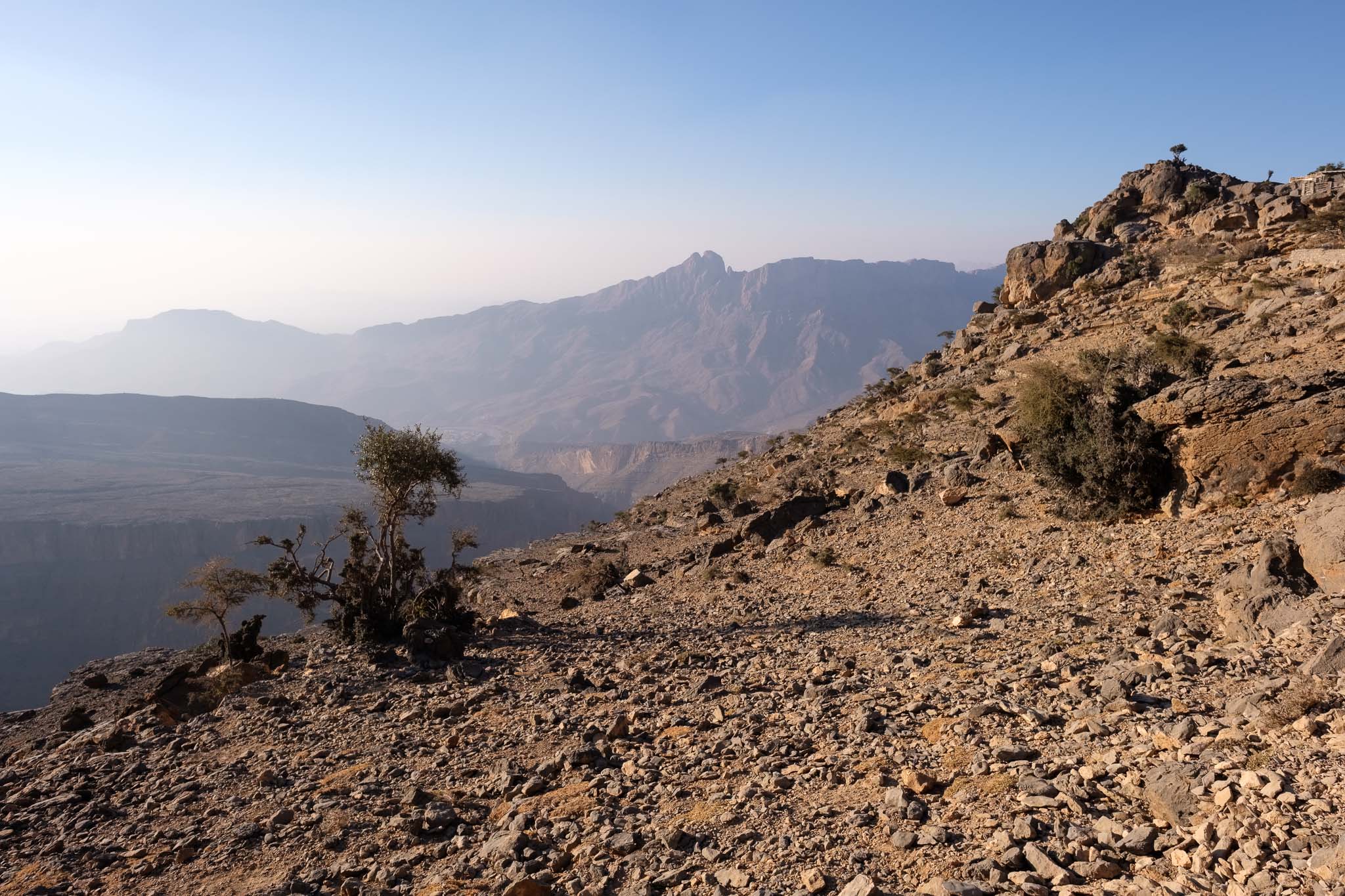
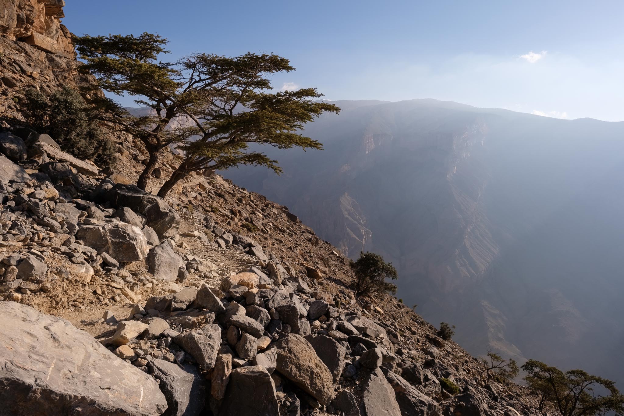
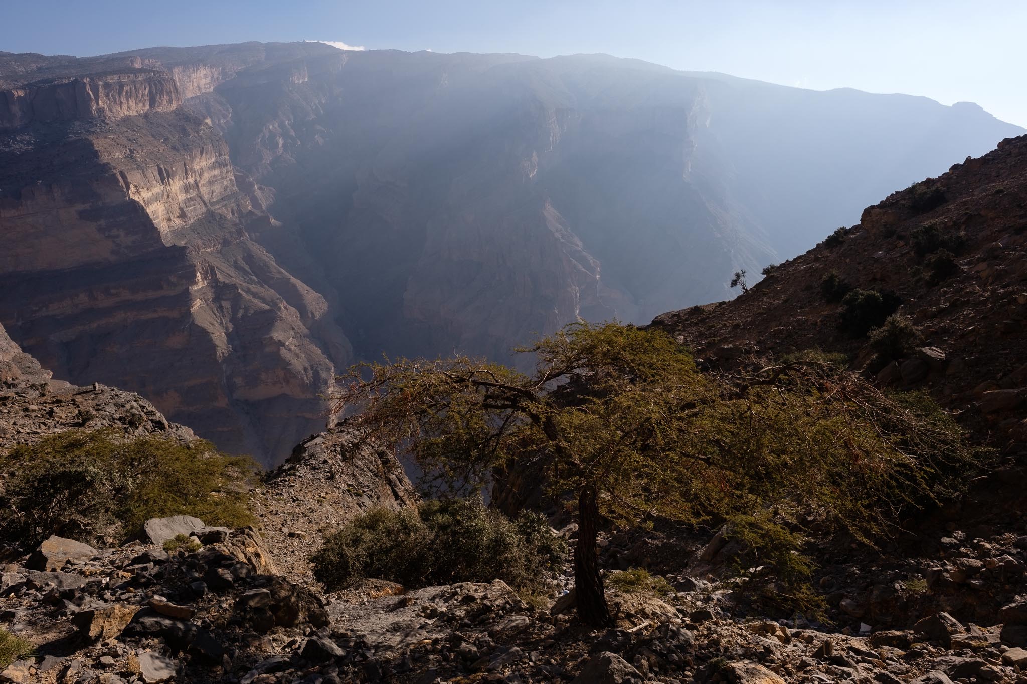
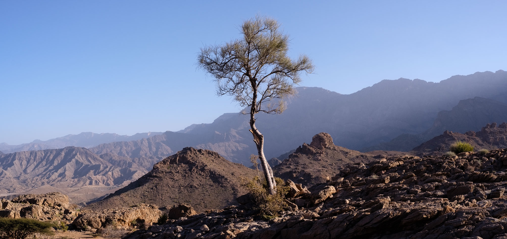
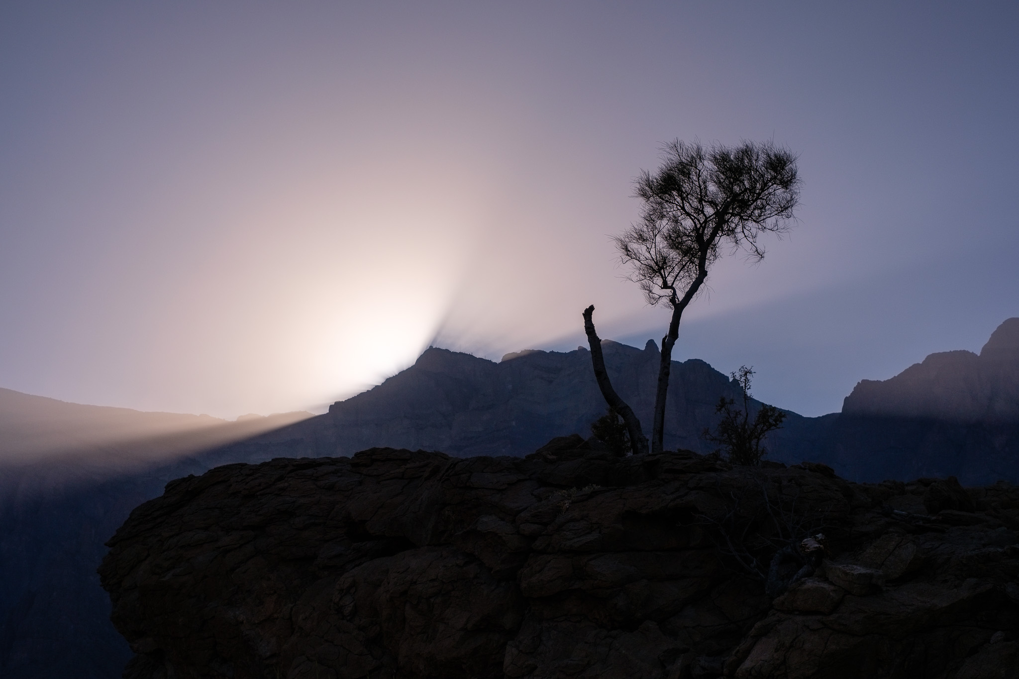
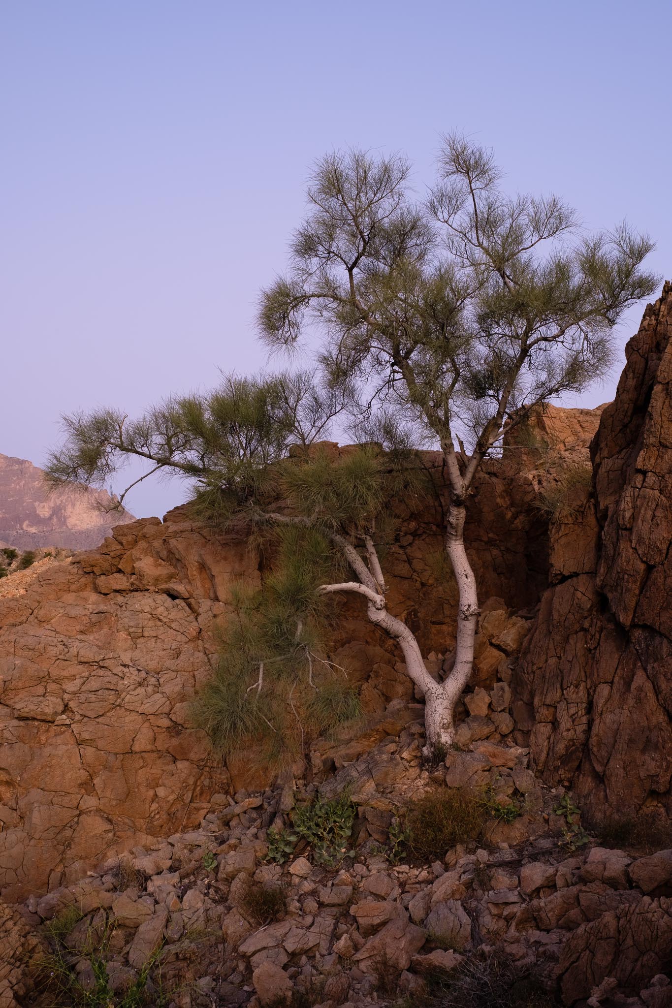
Walking around the plateau there are many other interesting subjects to photograph; the landscape is barren, dominated by rocky outcrops, isolated olive trees and bushes, and with the surrounding tall peaks in the background. One of those peaks is the famous Jebel Misht, with its peculiar raised triangular profile. I had a brief encounter with some wild donkeys, goats, and spotted some birds of prey hovering in the sky. After sunset, I returned to my camping spot to have a meal and prepare for the night photography session; it was new moon, so I wanted to benefit from the darkness. As expected, the temperature dropped quickly, so I put on an extra layer of warm clothes and gloves. I set my camera and lens on the tripod, programmed the interval timer to do its job, and then went to sleep.
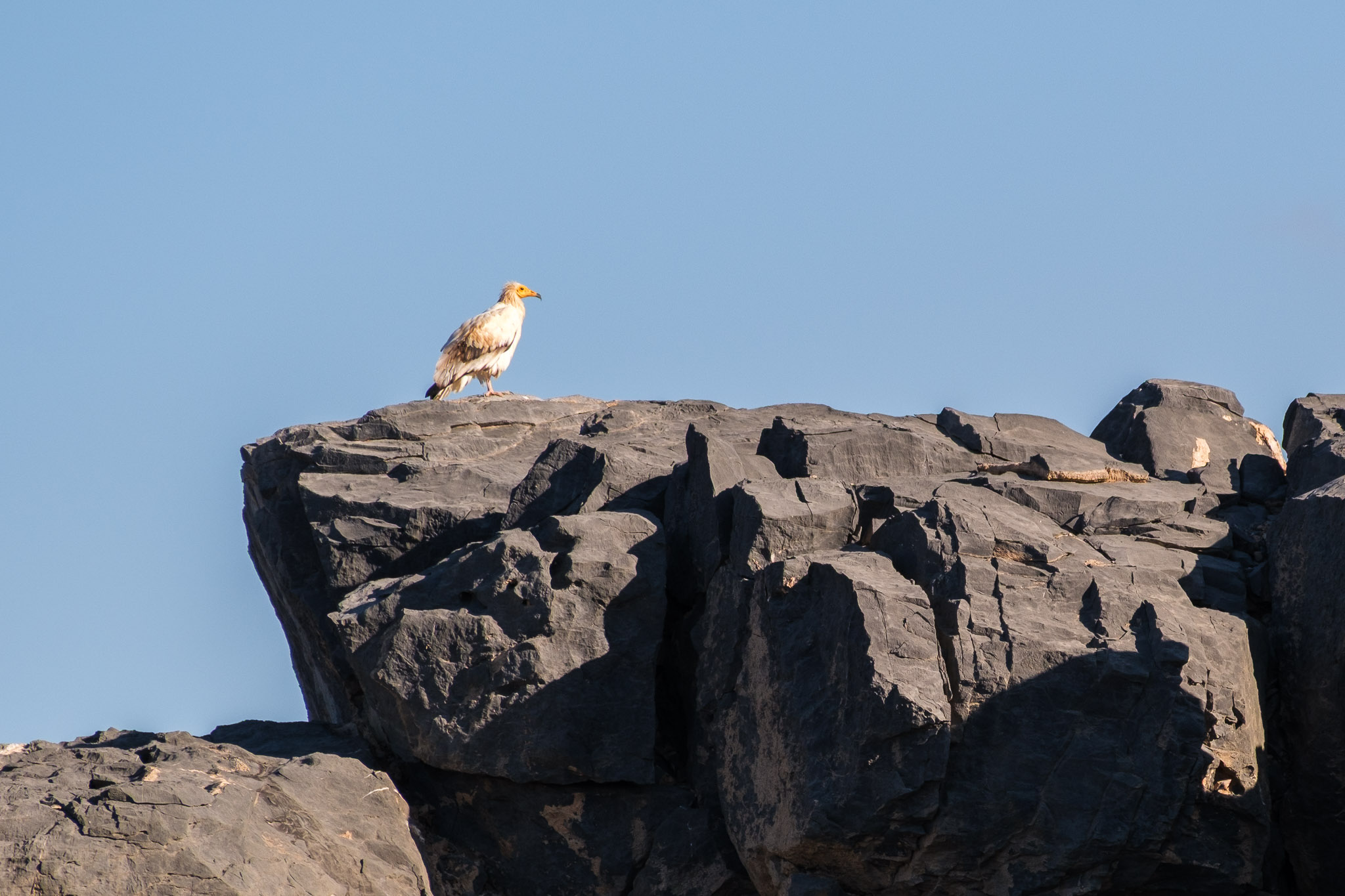
Donkey.Looking at an intruder.Rocky plateau.Foraging for food.Distant Jebel Misht.Barren landscape.Jebel Misht.Sunset colors on Jebel Shams.Color pallete.Sunset.Venus setting.Star trail #1.Star trail #2.
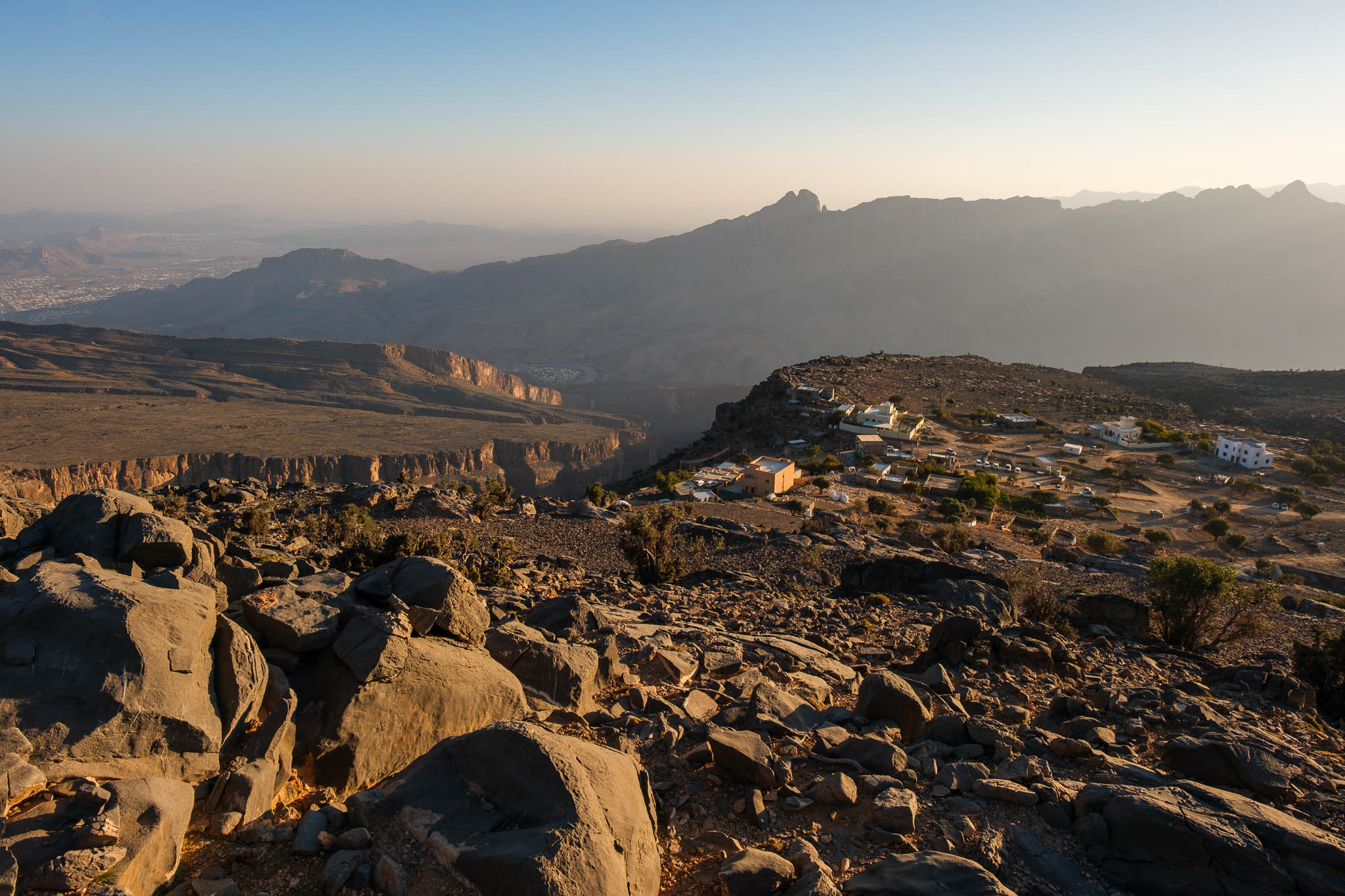
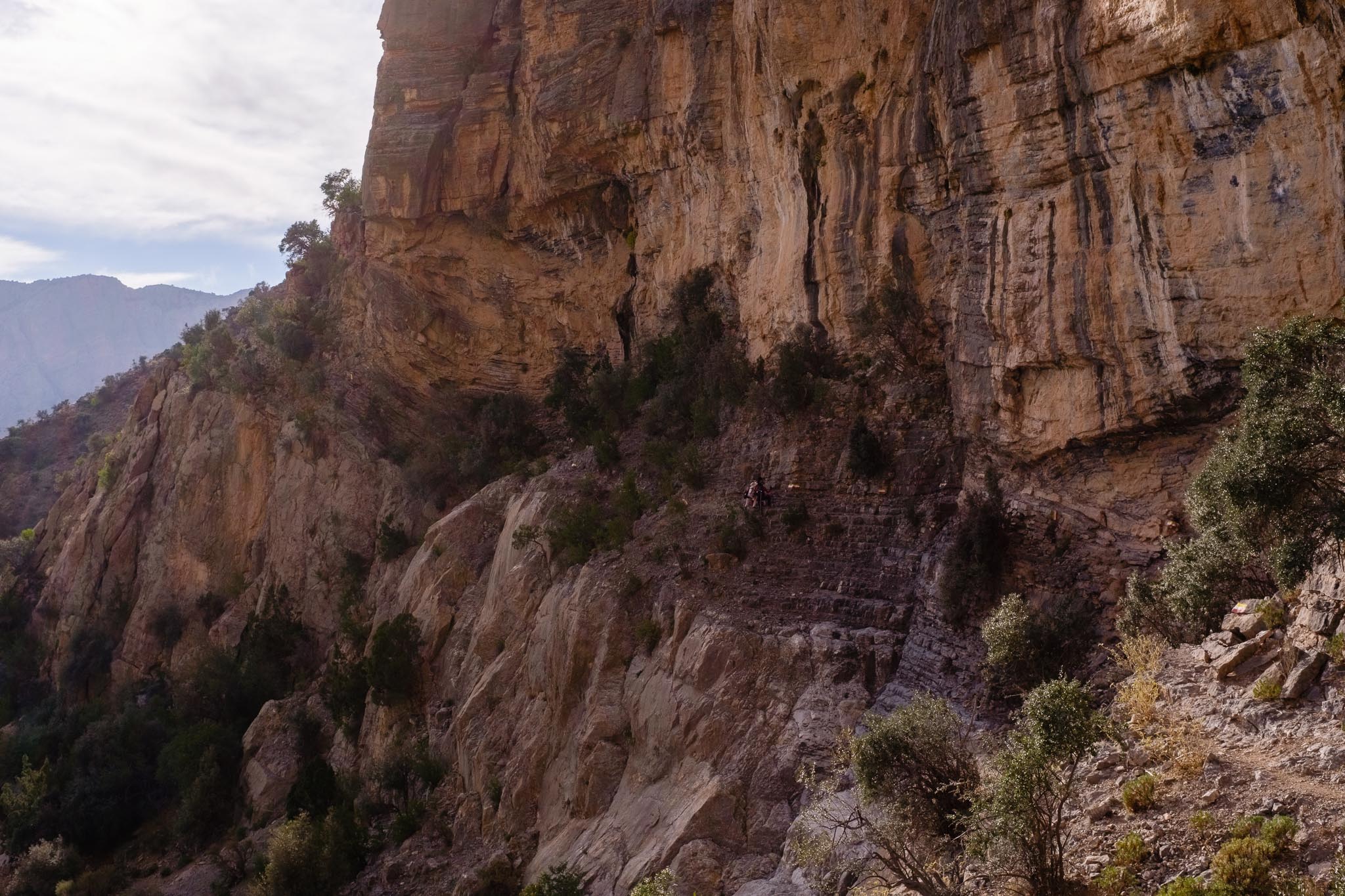
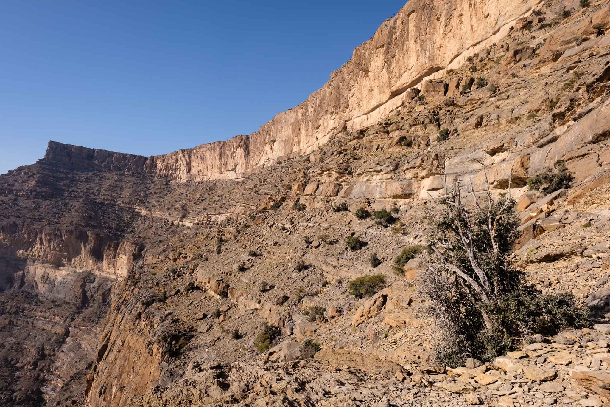
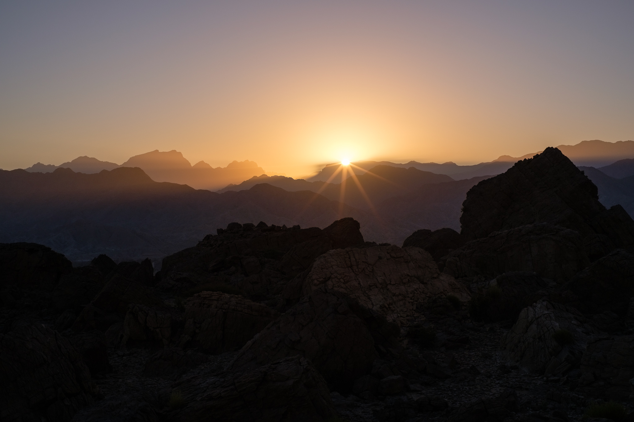
I woke up before sunrise as the first light of the day illuminated the mountain range, in an unforgettable display. After having breakfast and packing up the camping gear, I drove the short distance to the beginning of the Balcony Walk trail, in the village of Al Khitaym. As I said before, this is not a difficult or technical walk, with a total round-trip distance of about 8 km and approximately 350 m of elevation gain. Even though it is a safe walk, it is an old and narrow donkey trail that connected Al Khitaym and As Sab villages, below the rim of the mountain. If you are afraid of heights, make sure you are comfortable with it. I chose to do this walk in the early morning because this side of the canyon would be sunny, with better light for photography. In the afternoon the trail will be under shade, which might be preferable if you visit during the warmer months.
Dawn.First light.Grand Canyon at dawn.Against the sky.Massive.Peaking.Along the ridge.
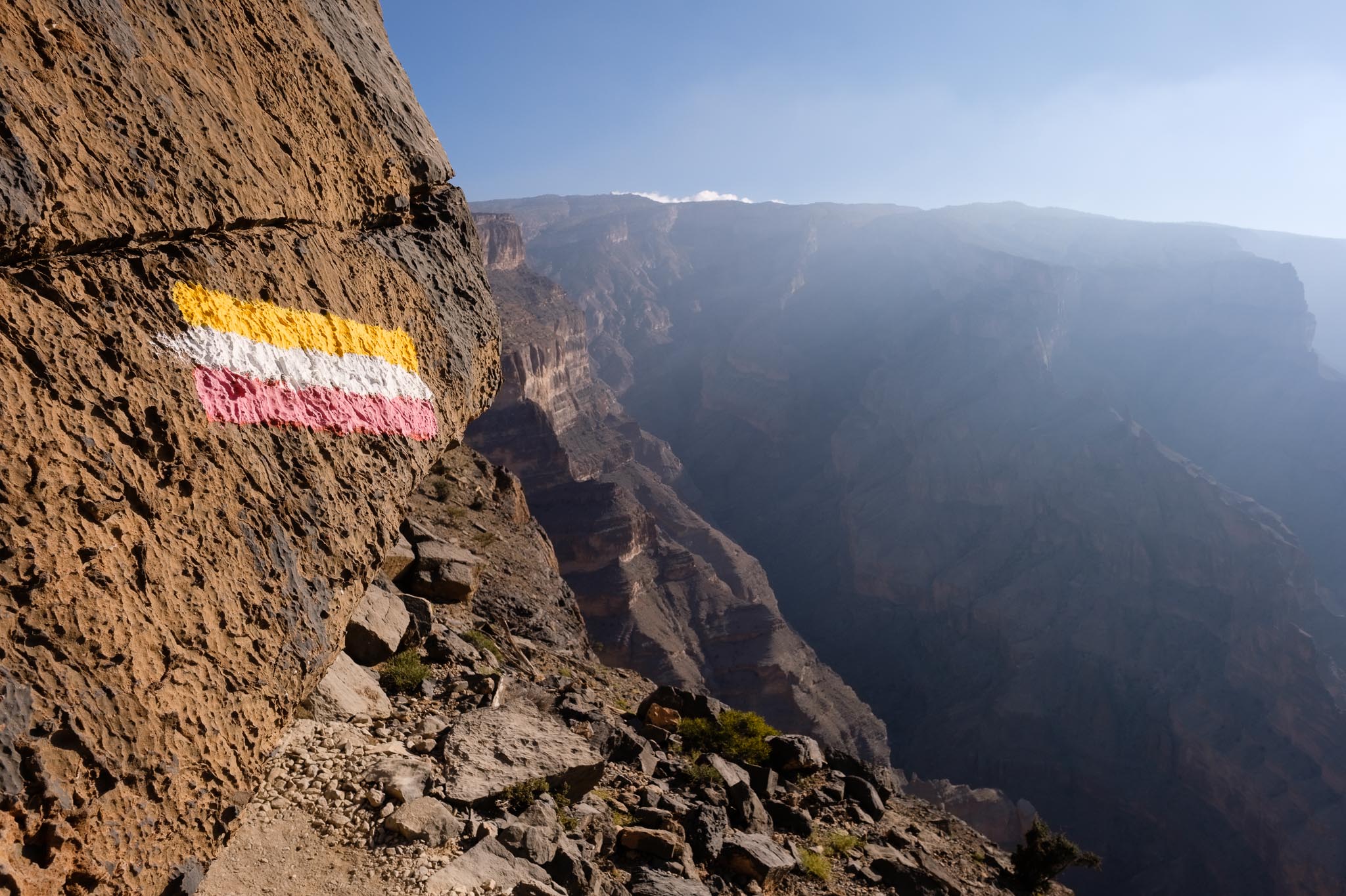
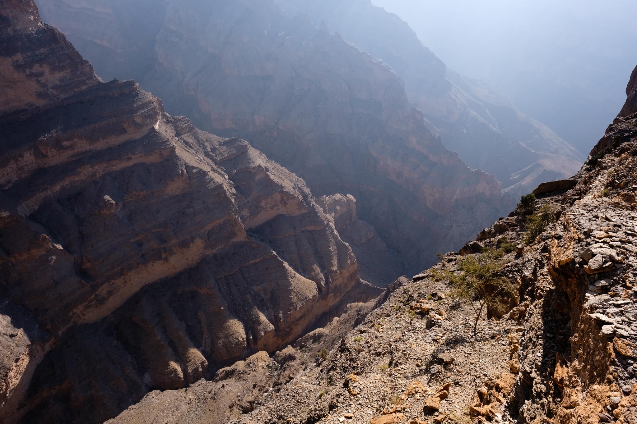
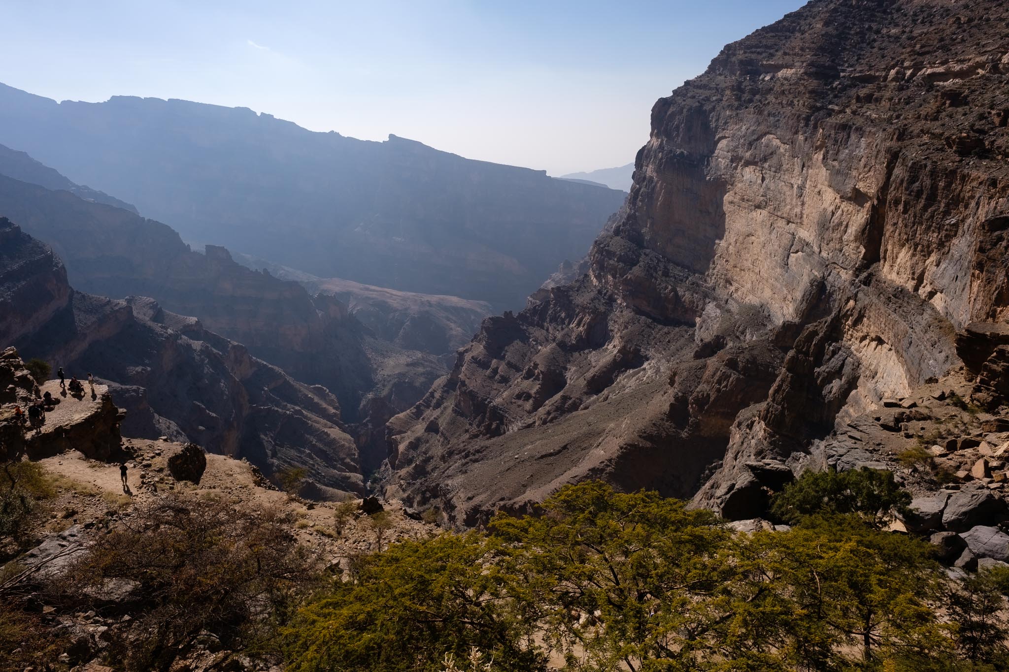
The path follows the gentle slope of the rock layers downhill, and I stopped many times for photos, as the vistas are incredible. Looking up, I recognized the spot where I had been taking photos the previous day, at the top of a massive rock formation. Admiring the canyon from the rim is a great experience, but walking this trail, below the rim, makes you feel like you are really part of the landscape. This is a popular walk, so soon I was meeting other fellow trekkers, even this early in the day. The path is narrow, but there is enough space to accommodate other people, so you can walk at your own pace and stop when and where you wish without any problems.
Near the beginning of the trail.The mountain.Along the trail.Close to the edge.Filtered light.Hanging.Wadi Nakhr from above.Group of runners on the trail.Marker.The trail follows the rock bedding.The head of the Grand Canyon.Out of this world.
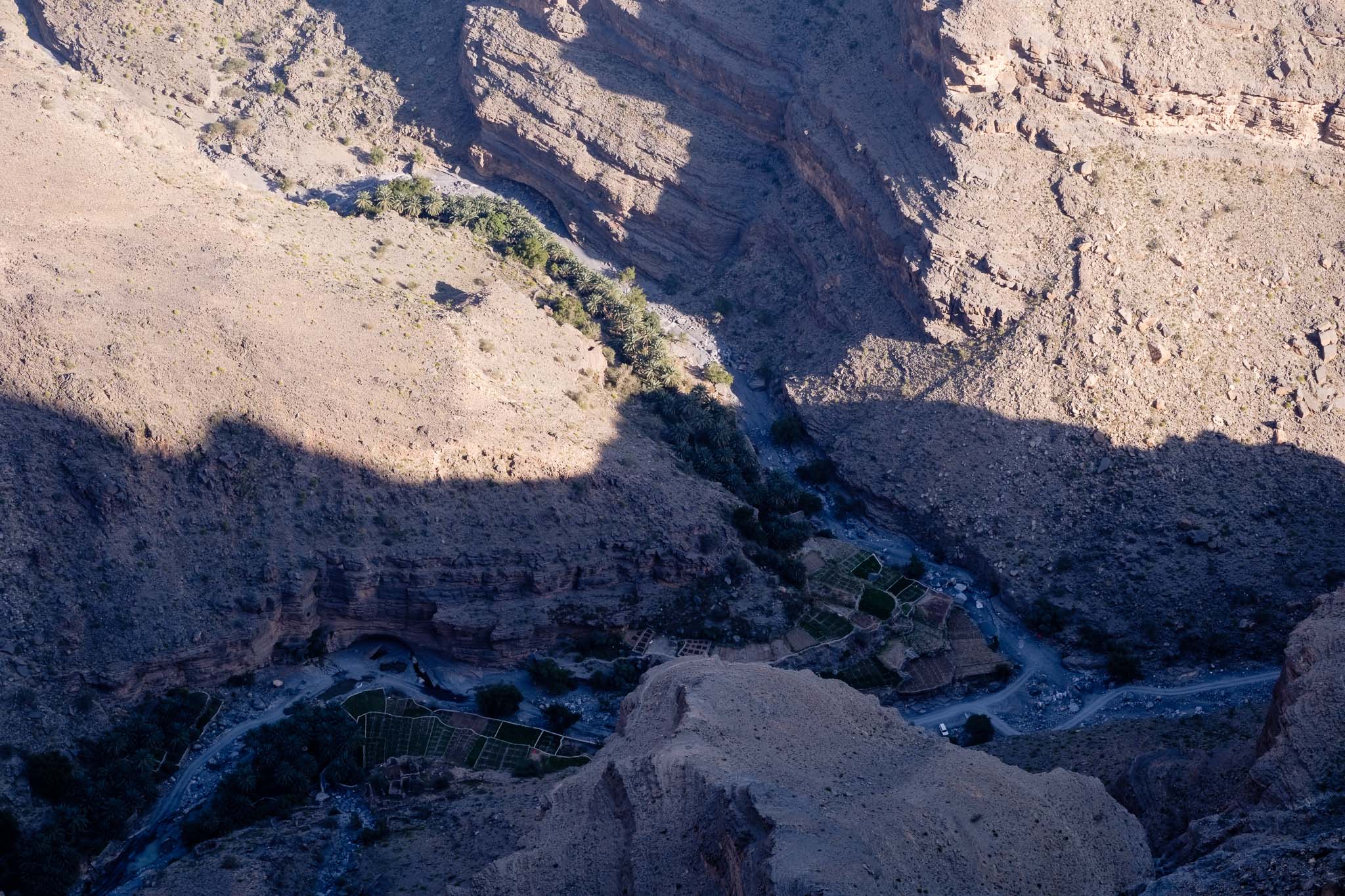
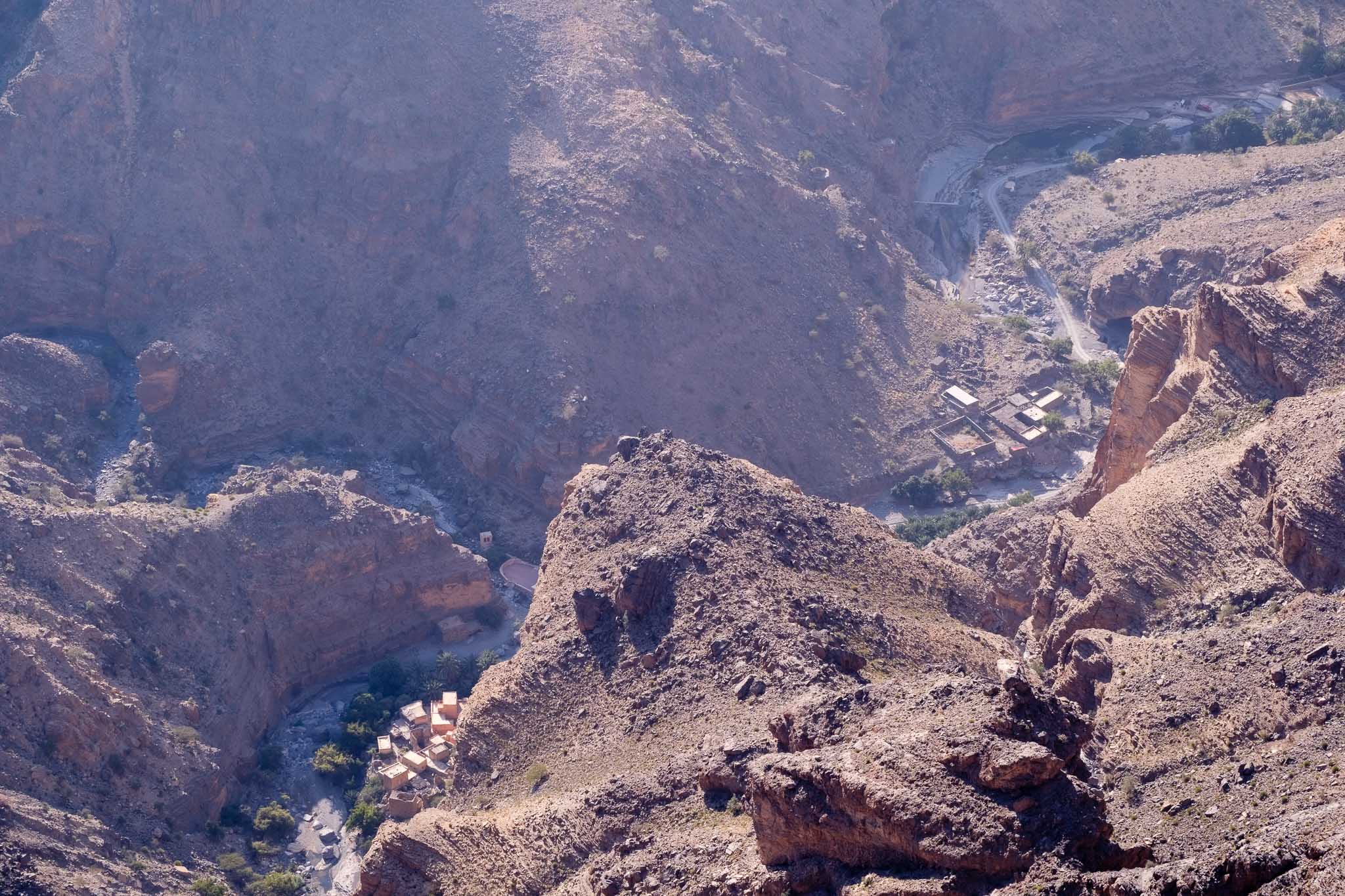
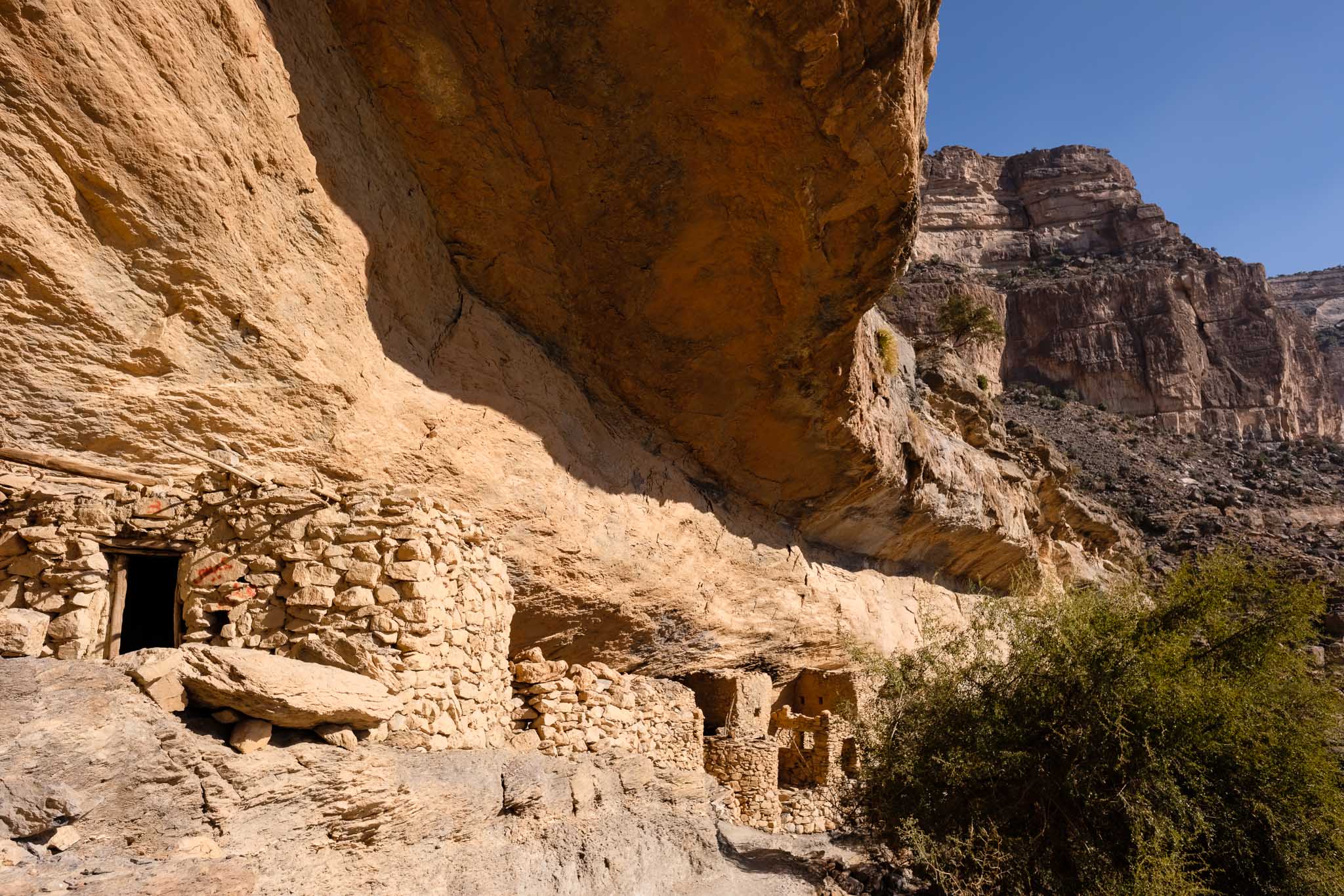
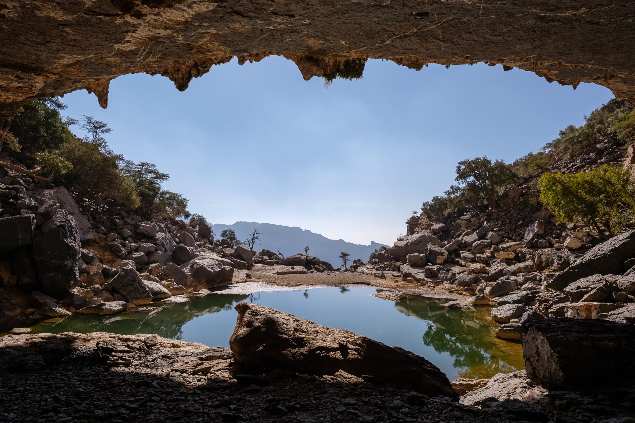
Continuing my walk, after a while I reached the abandoned houses of As Sab. These were built under a rock overhang, and one can only wonder at the skills of its inhabitants, who also built the nearby farming terraces. The sense of isolation is impressive. The terraces were built where the two sides of the canyon come together and seem to be literally hanging from the steep mountain face. Below them, an enormous erosion feature has carved what looks like a scar on the rock face. After reaching the terraces, I stopped for a rest under welcomed shade; even with the cold temperature, walking under the sunshine will make you warm. Normally, for most people, the trail will end here but is possible to walk a bit further to reach a secluded cave and lake. To get there, it is necessary to follow a path that climbs around a few boulders, and which is signaled only with some white paint markers. I reached the cave and the lake after about 10 minutes and rested under the shade for a while.
The abandoned village of As Sab.The terraces.On the way to the hidden lake, overlooking the platform where the trail ends.Hidden lake with cave.
A group of Omanis from Hamra was already there, and they asked me to join them; this is typical Omani hospitality, and soon we were sharing our stories and food, including coffee, dates, and fruit. A welcomed and healthy snack after a 2-hour walk. It was nice to sit under the shade of the cave, looking outside into the lake and the mountain. There are even a few stalactites and stalagmites to admire. When it rains, a waterfall runs over the entrance, in what must be a wonderful sight.
It was time to return, so I made my way back to the trail. Now it was uphill all the way, but still with a gentle slope. I noticed the trail was busier at this mid-morning time, which is normal. After an uneventful trek, I was back at the village and my car. This had been a wonderful weekend in Jebel Shams. The magic of the mountain has not changed one bit in 20 years.
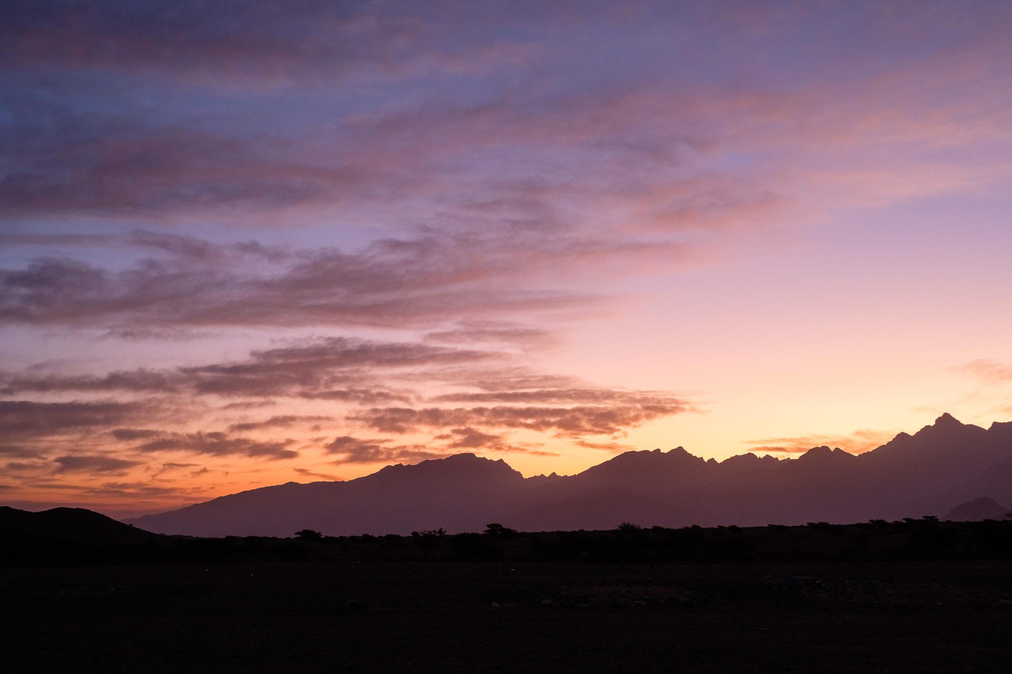
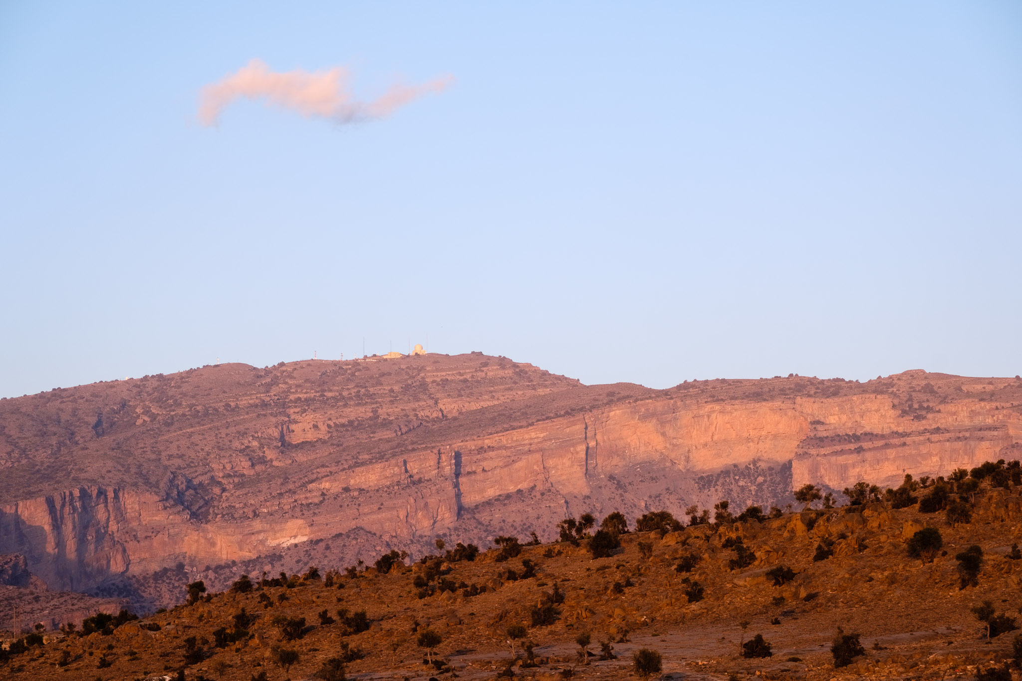
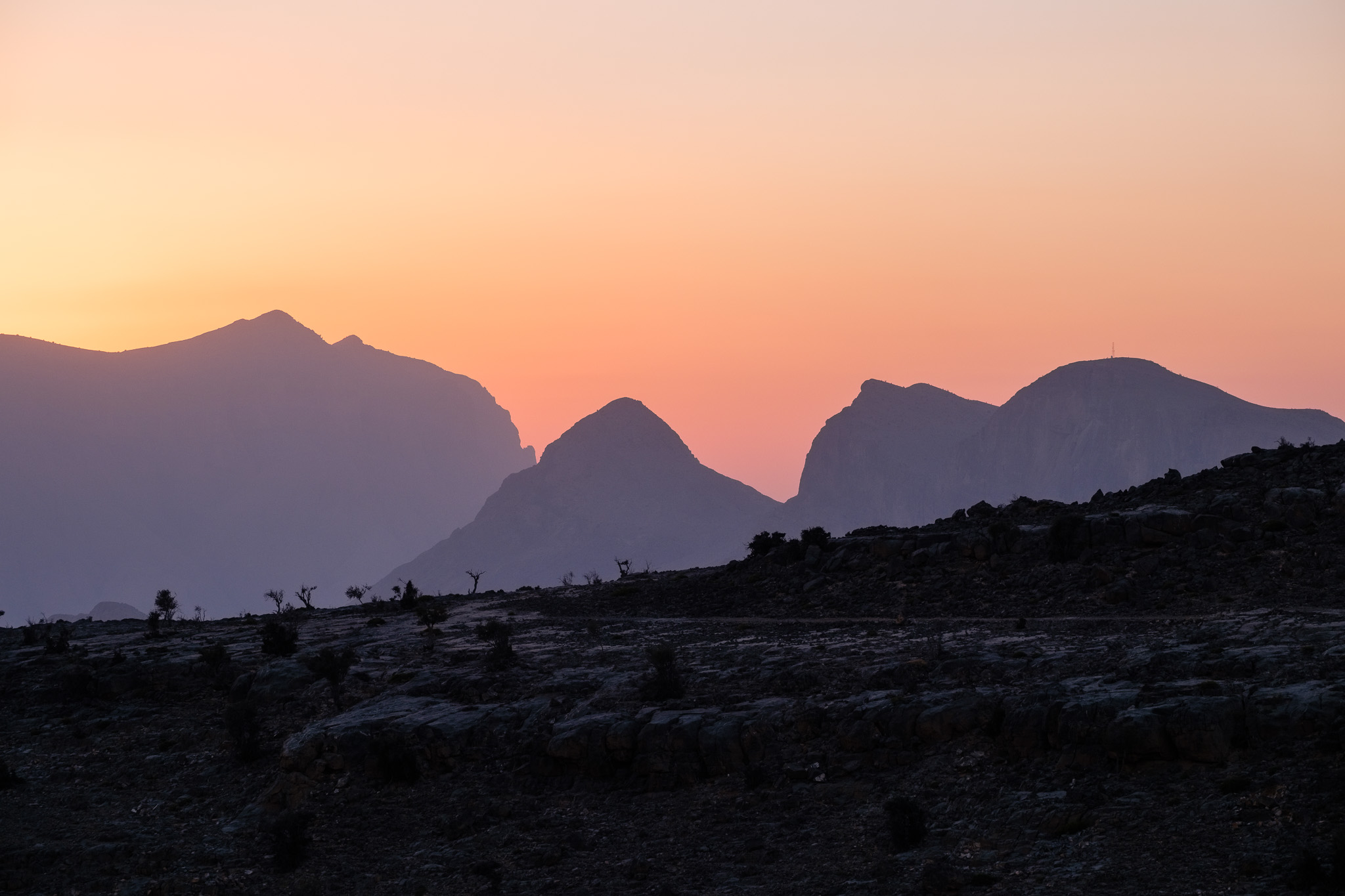
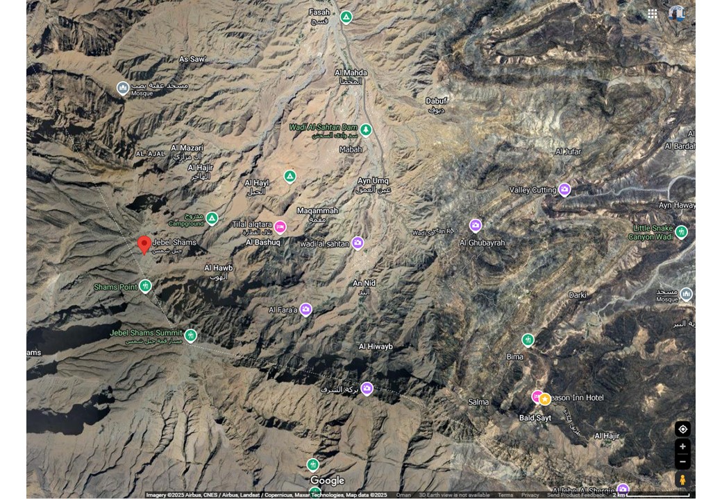
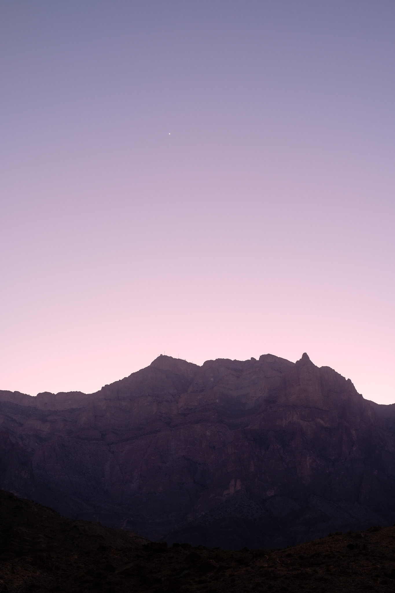
At the end of January, I went on a weekend camping trip with the astronomy group to a site inside Wadi Sahtan (see map below for location). This group normally goes out near new moon time, to benefit from darker skies. The camping site is at 900 m altitude and provides a fantastic view of the northern face of Jebel Shams, the highest mountain in Oman (3,000 m above sea level). This northern face is an impressive 2,000 m sheer vertical wall that will leave you speechless. It is impossible not to feel the presence of this mountain.
Wadi Sahtan location map.
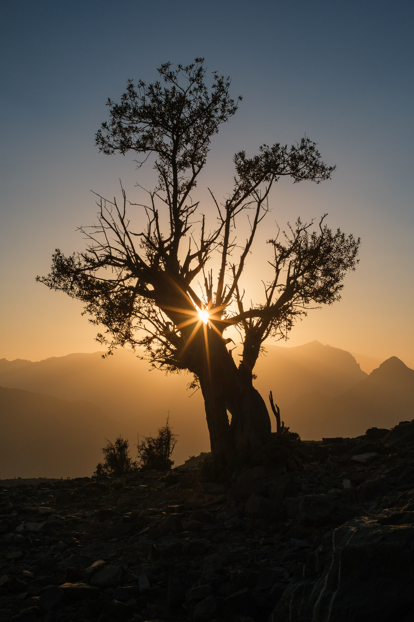
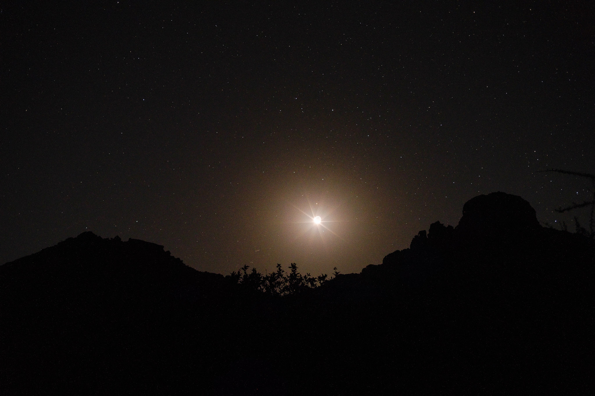
I arrived at the campsite around 3 pm, and after setting up my tent and other camping gear, I went for a walk for some initial exploration. The landscape is made up of rocky outcrops, with some narrow gulches and scattered bushes. Even though the sunset would be around 5.30 pm, it would happen behind the mountain, meaning that the place would be in the shade sooner rather than later. As the sun disappeared behind Jebel Shams, there was a display of light beams that lasted for a few minutes, and I made several photos of this beautiful phenomenon. For this trip, I only carried the Voigtlander X 27 mm f/2 lens, which provides an angle of view equivalent to a 40 mm lens on full frame sensors. This is a small manual focus lens, perfect for travel.
Under the sunlight.Lone tree.Light show.Venus.
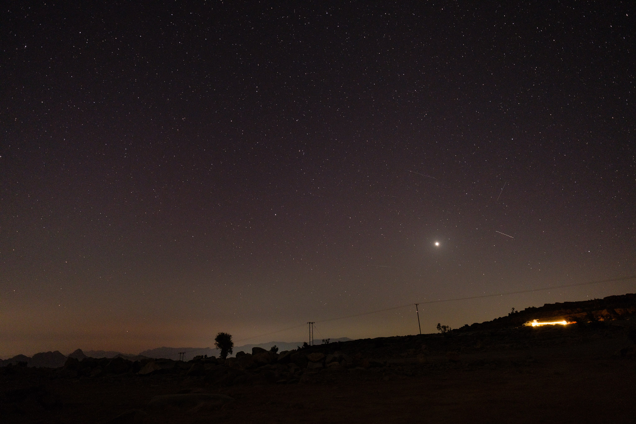
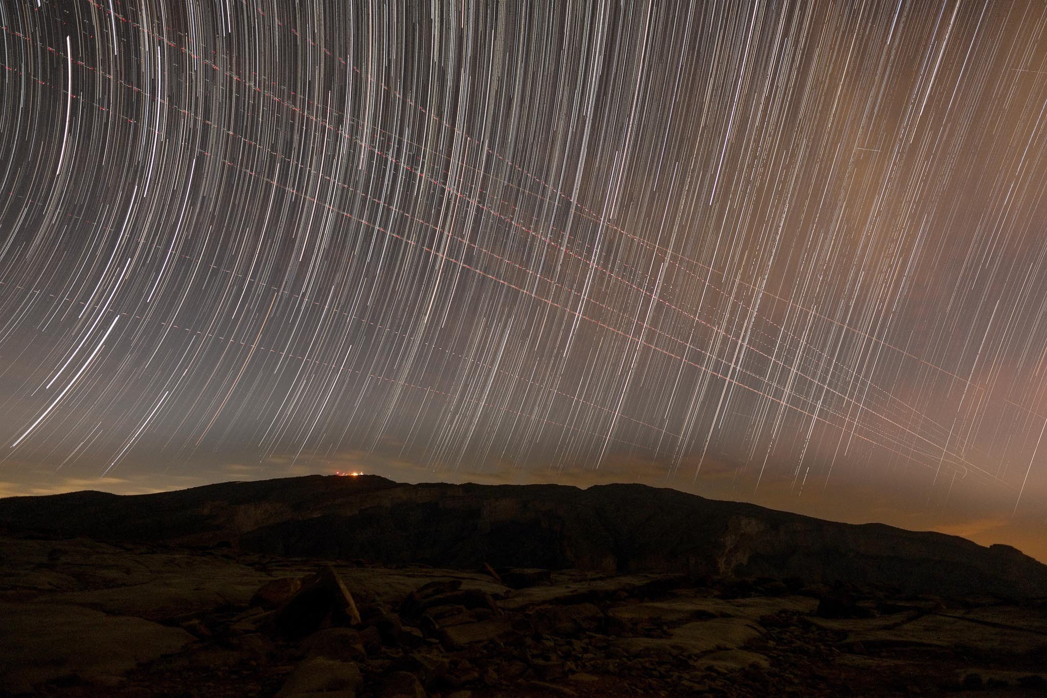
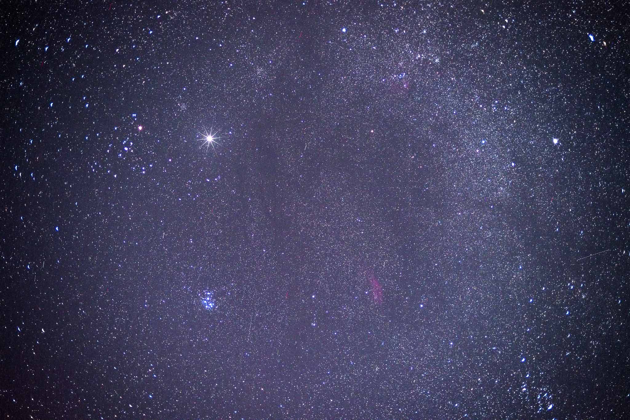
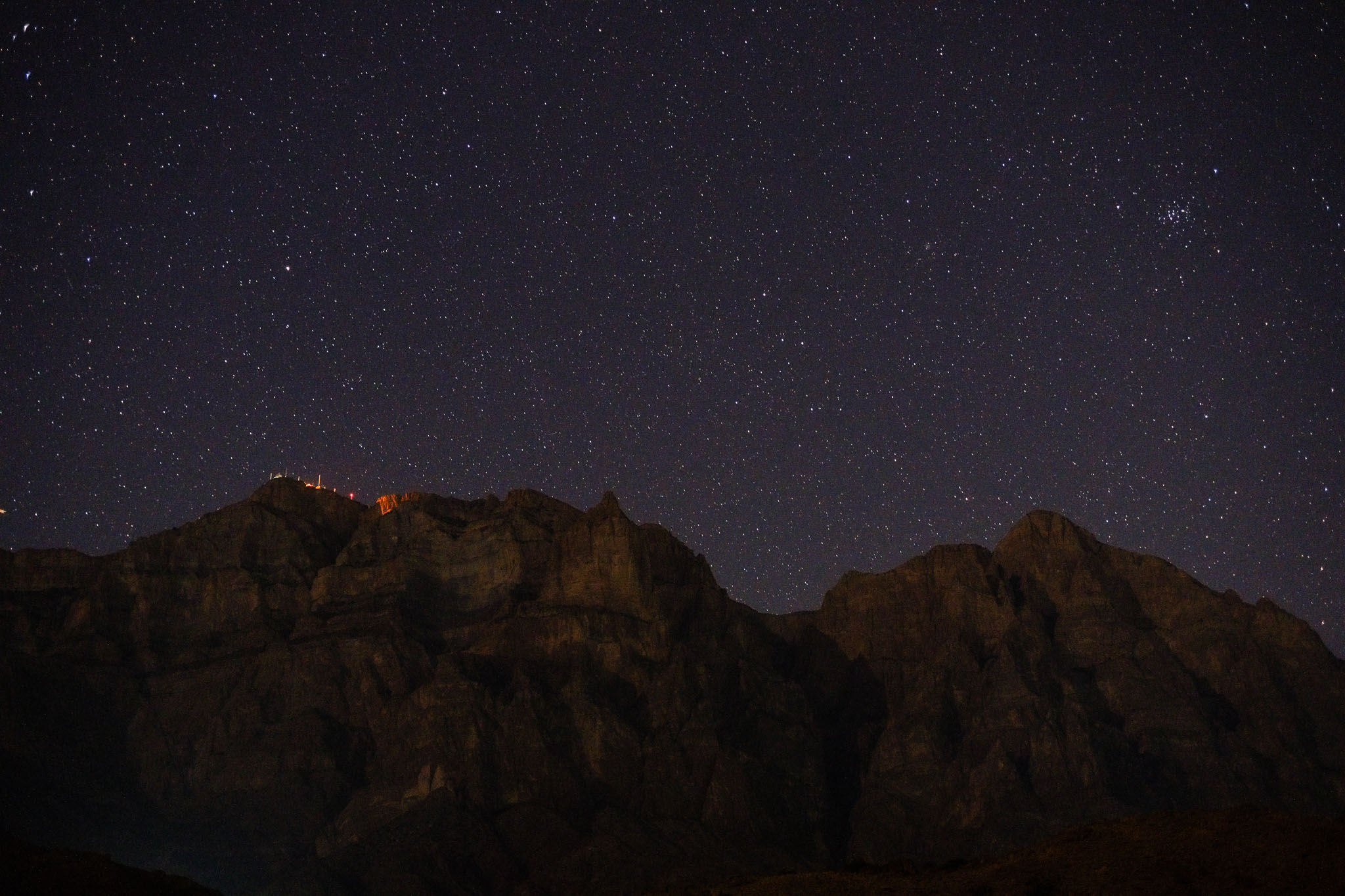
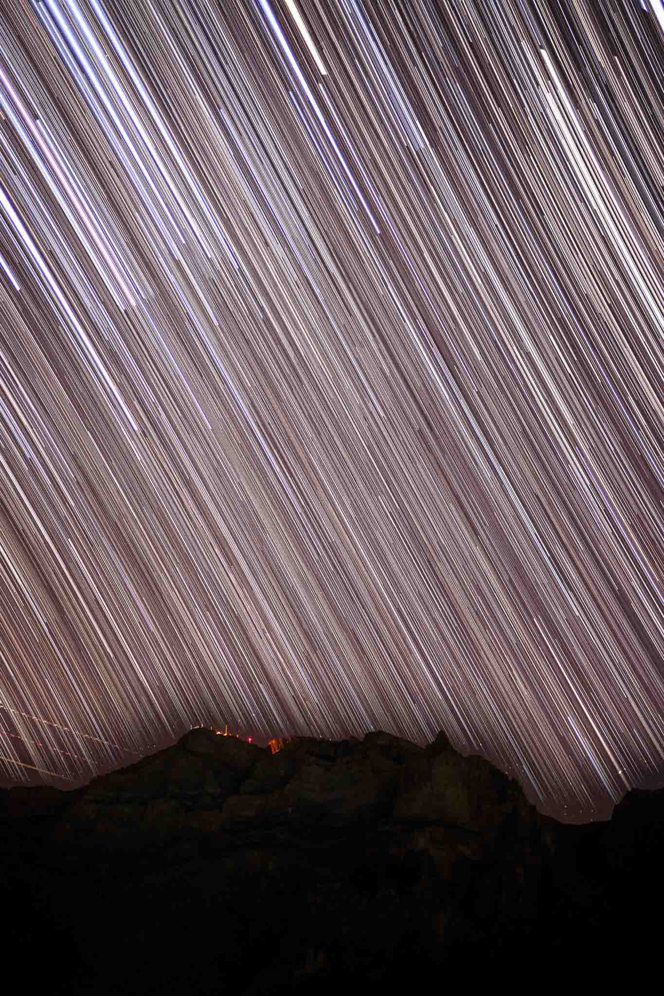
During twilight, it was possible to see Venus and Saturn setting in the West, while Mars was climbing in the Eastern sky. Jupiter was straight above us. These planets were nice to see on the telescopes, plus Neptune. It was great to be able to see so many planets on one occasion. In terms of photos, I set up my camera on the tripod and used the timer to make hundreds of exposures, to be later assembled in star trails. I framed the top of Jebel Shams against the sky, including its radar and observatory installations. Leaving the camera to do its job, I went to sleep. I wanted to be up before sunrise, to see the magnificent mountain wall being lit by the first daylight. The sky had been clear the whole day, and thanks to the low temperatures and crisp air, the visibility was high.
Jupiter and Pleiades. Stack of 30 images.Into the deep.Star trail, 90 minutes total integration time.Moonrise.
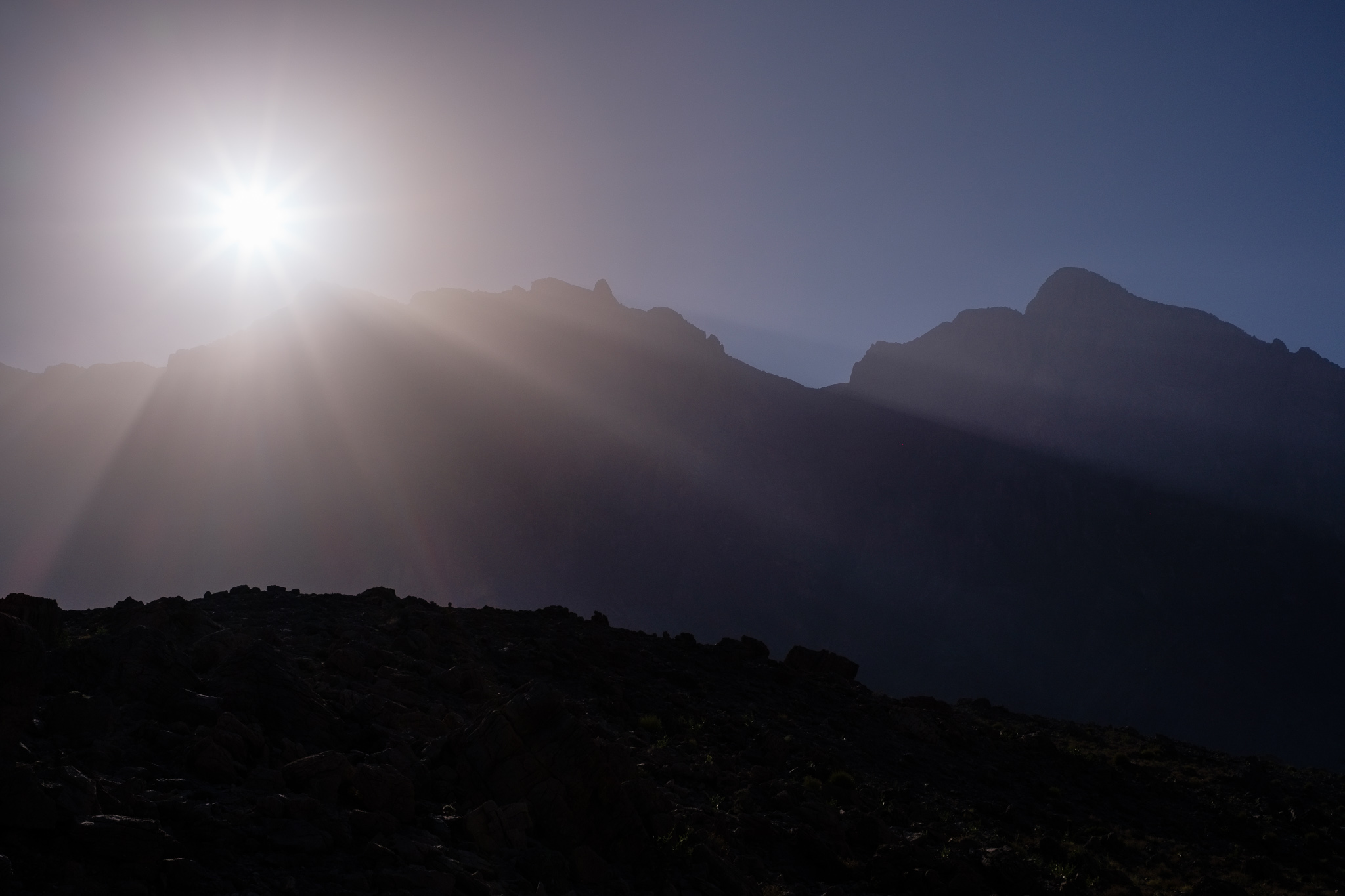
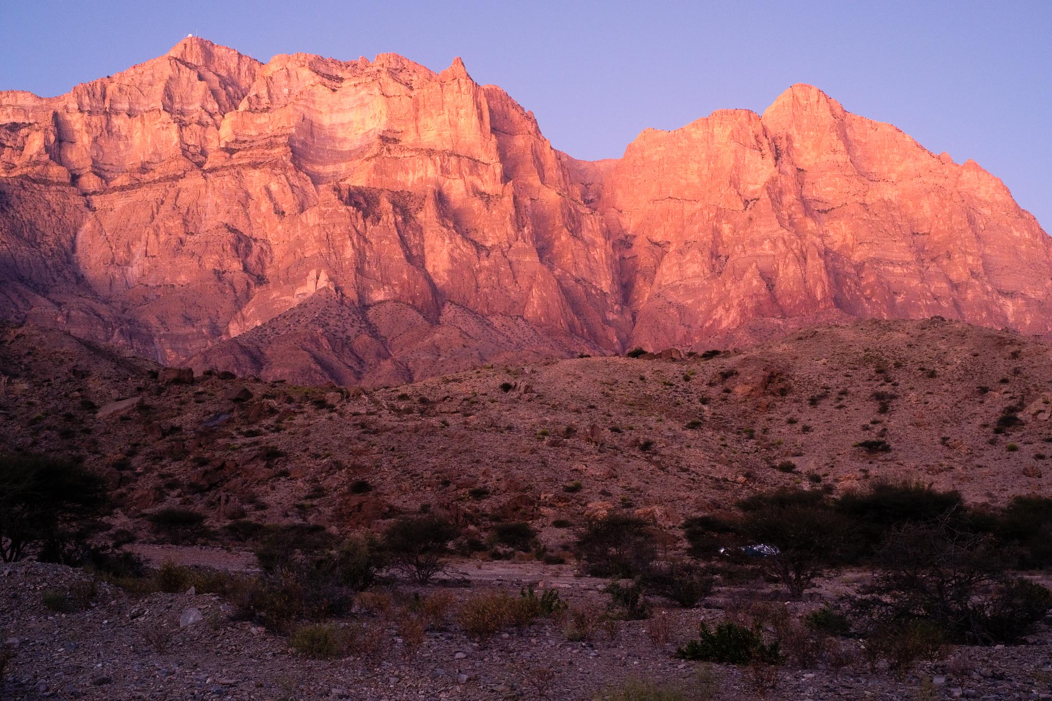
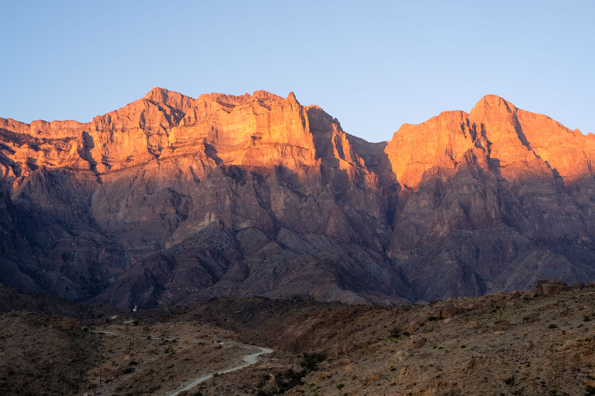
I woke up well before sunrise, to a cold and breezy morning with clear skies. I made my way to a vantage point facing the mountain I had scouted the day before, set up the camera on the tripod, and waited. As the first light of the morning started to appear on the eastern horizon, Jebel Shams started to glow in orange hues; a few minutes later, direct light hit the wall, first on its top edge, and then progressively made its way towards the bottom. I was making photos very quickly, admiring the full glory of this majestic mountain at sunrise. This show lasted for about 10 minutes, but it will be forever imprinted in my mind. The photos are only able to convey a hint of the real spectacle that was provided by Nature.
Once the morning light had reached the campsite, I went back to my tent for breakfast… with a fantastic view of that 2,000 m vertical rock face. Then it was time to pack up and head back home, already with plans to come back.
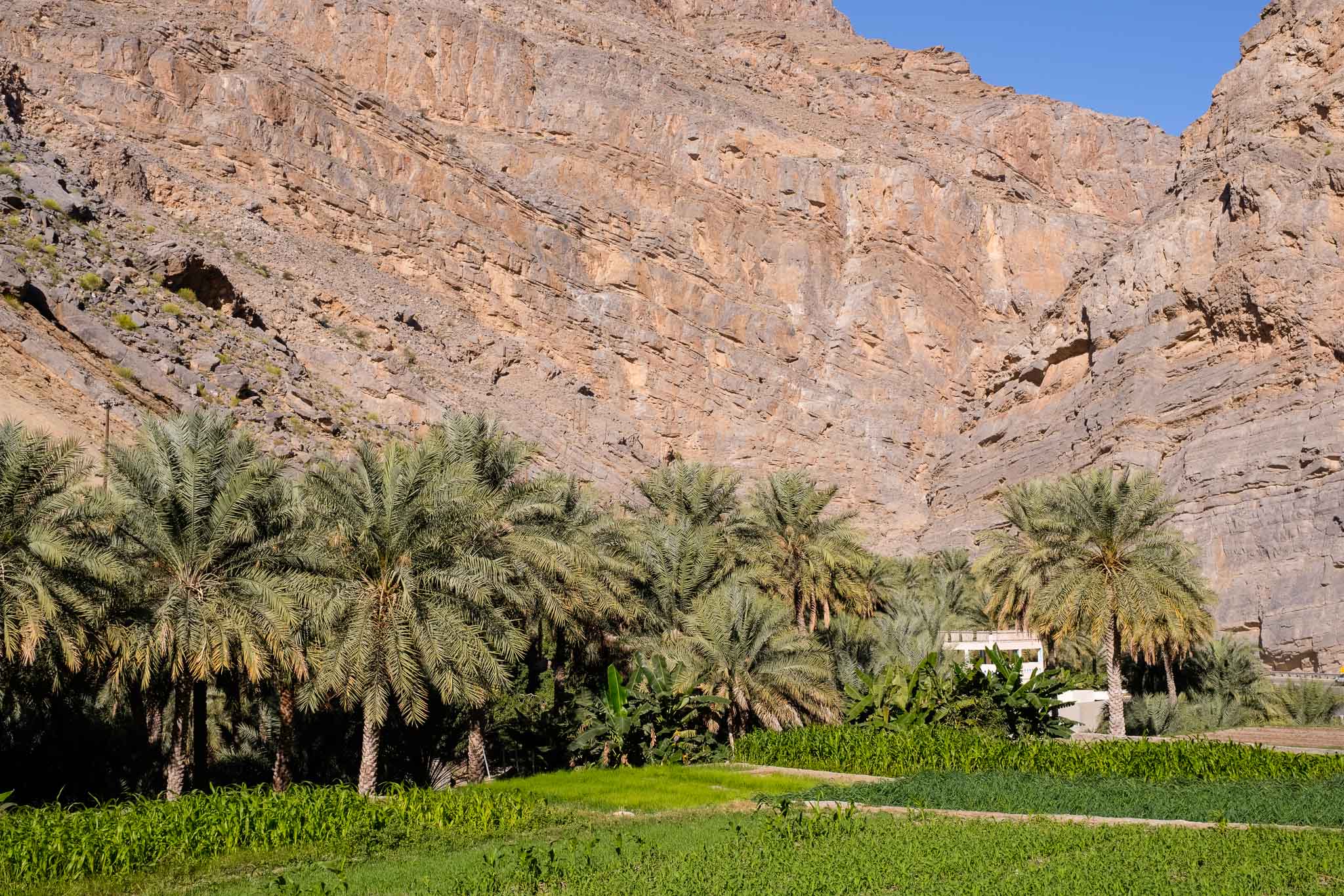
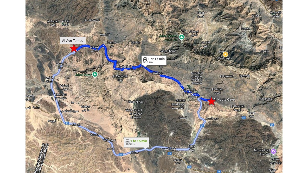
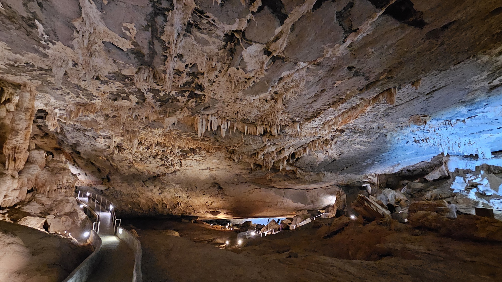
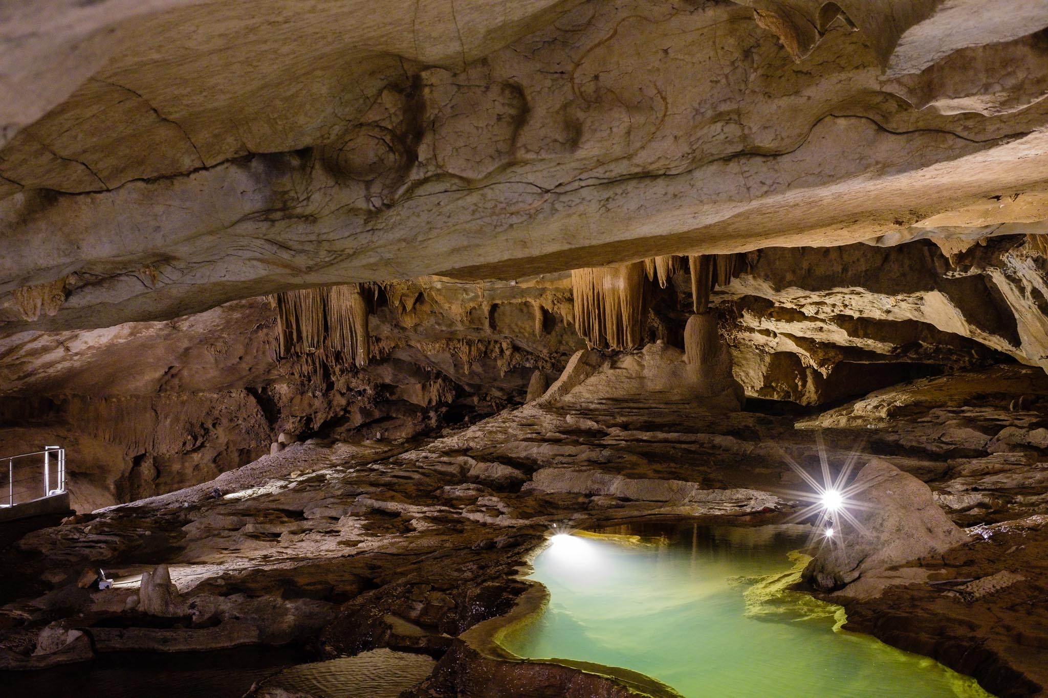
The Al Hoota cave (meaning “guide” in Arabic) is in the foothills of Jebel Shams, just before the village of Al Hamra. With its numerous stalactites, stalagmites, and halls, it is well worth a visit if you happen to be in the area. That is what I did recently, combining the visit to the cave with a visit to the Wadi Al Ayn Beehive Tombs; you can see the location of both sites in the map below.
Mao with location of the Al Hoota cave and Al Ayn Tombs.
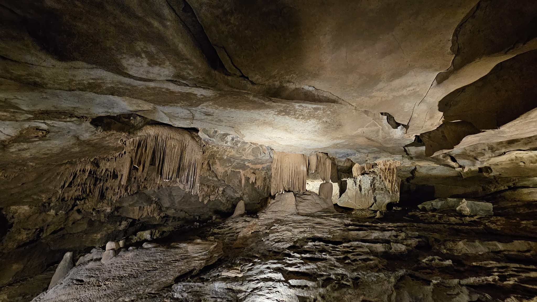
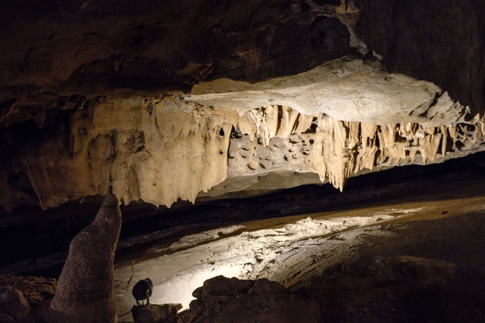
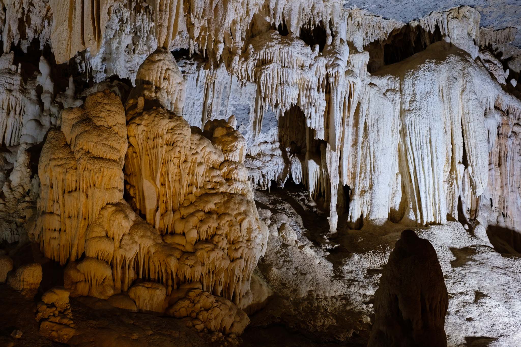
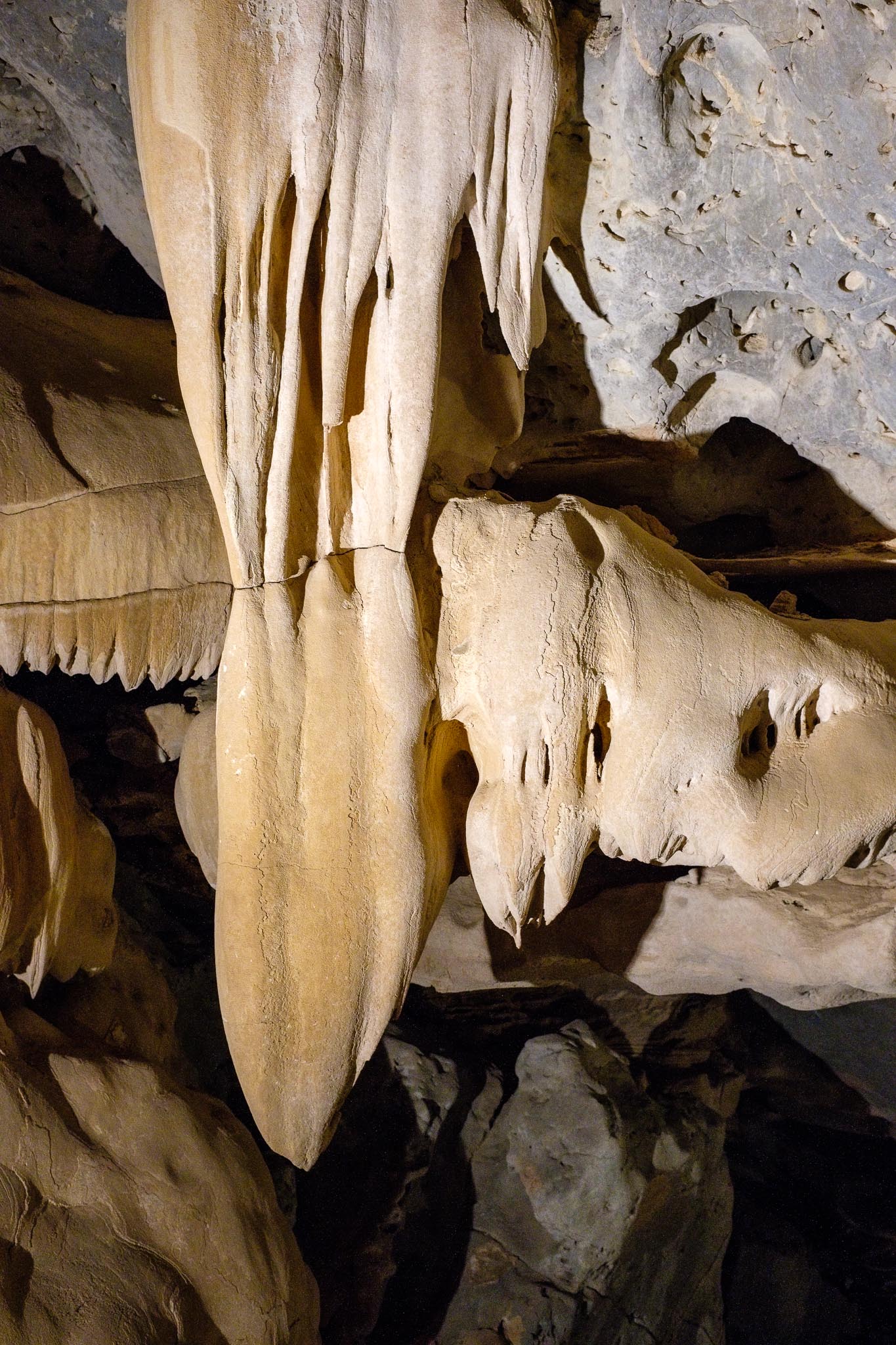
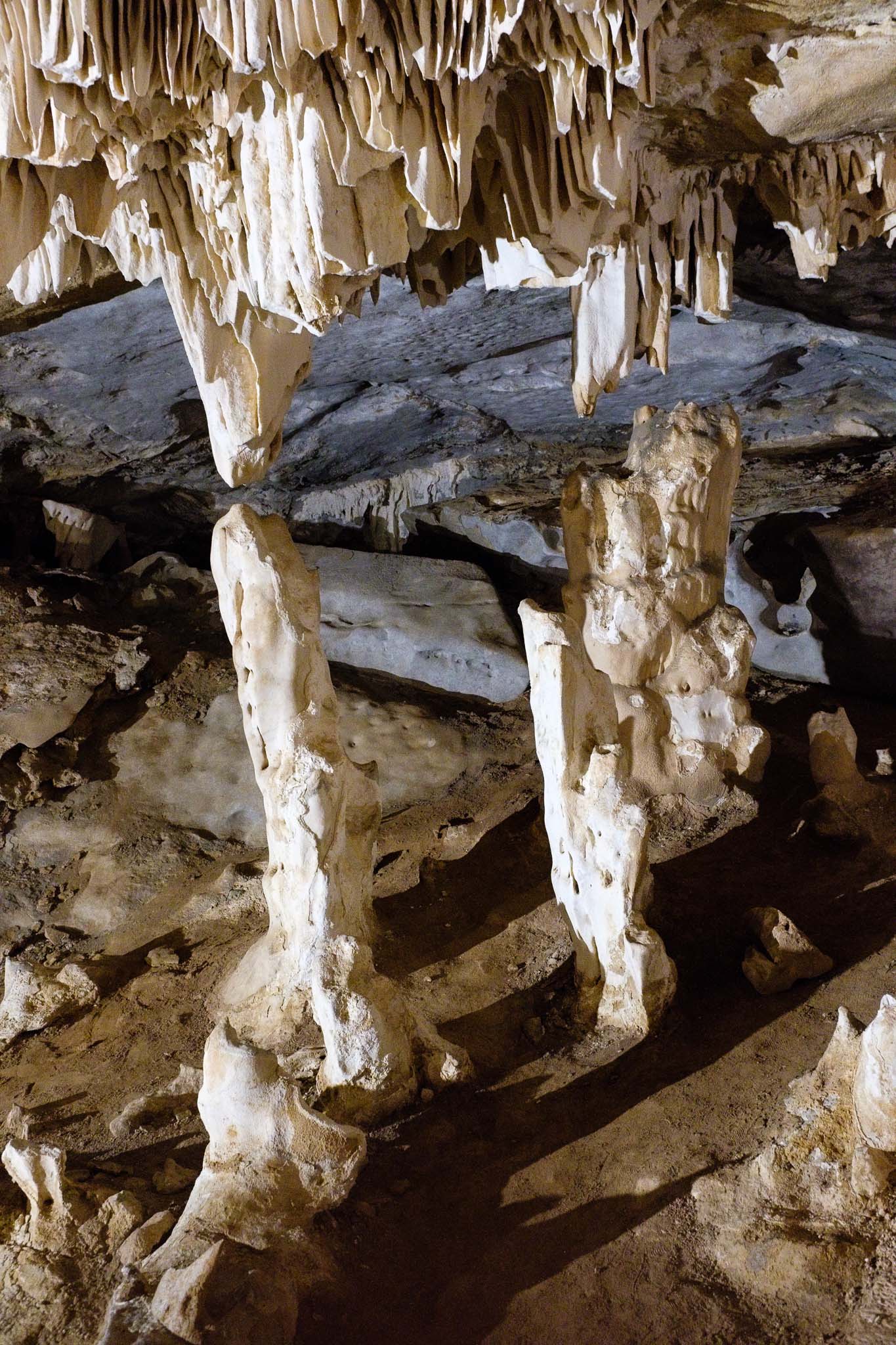
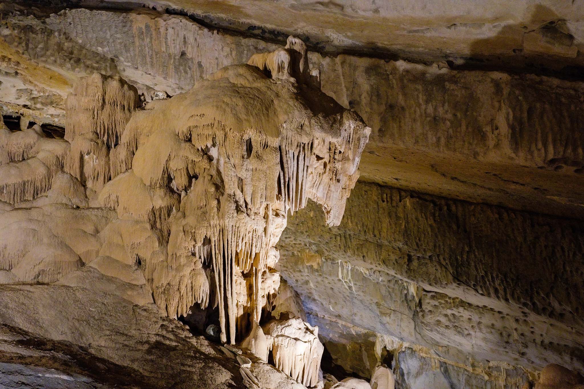
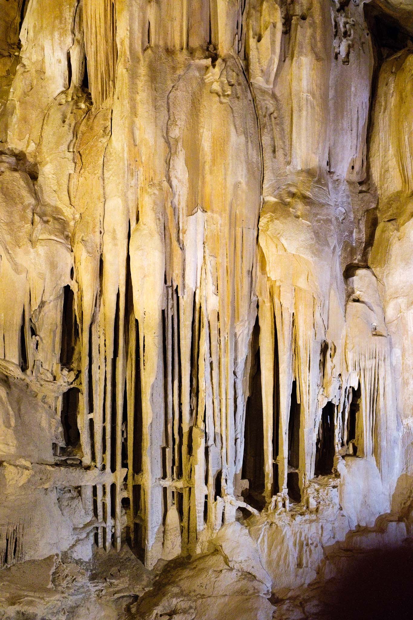
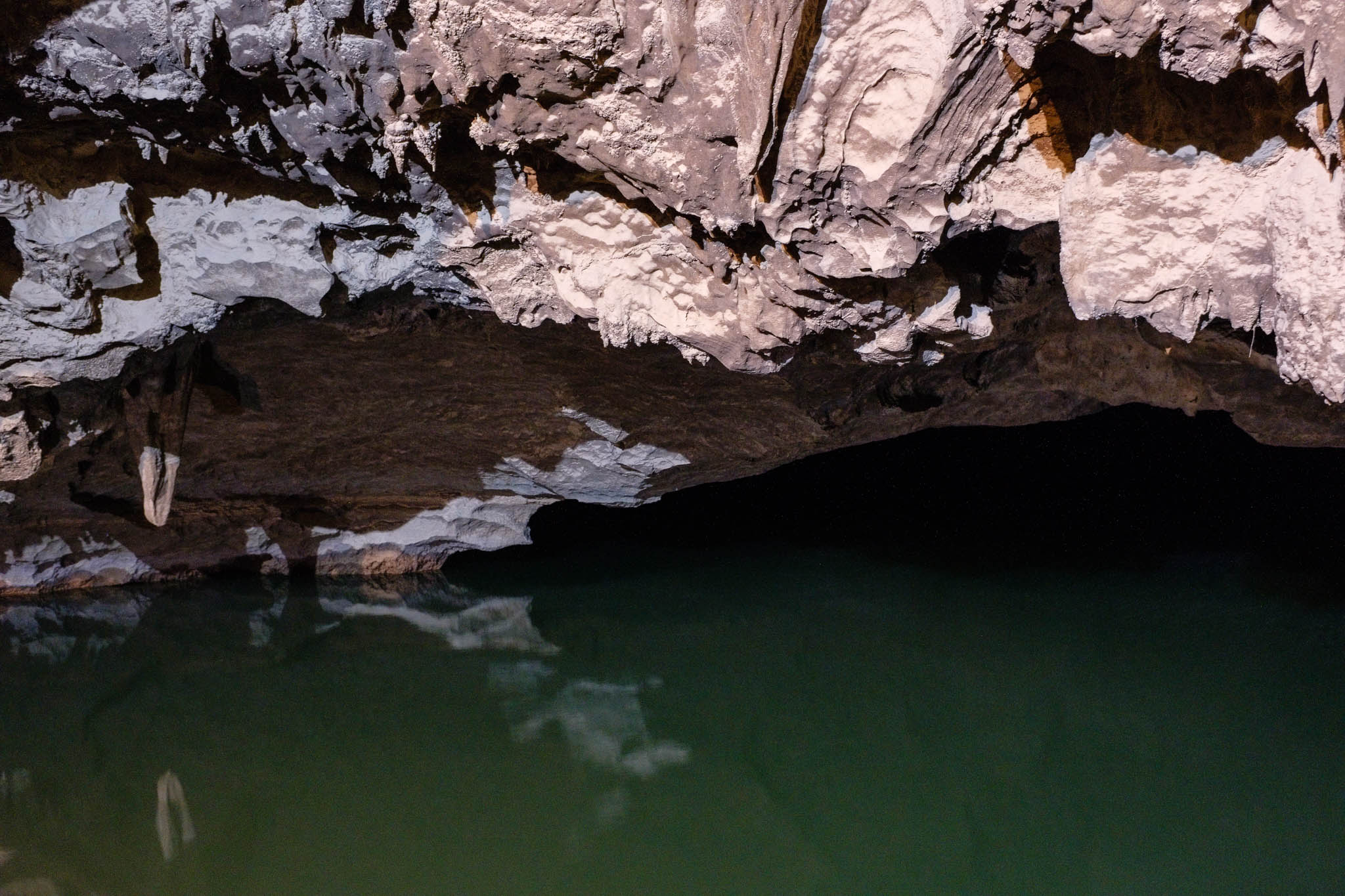
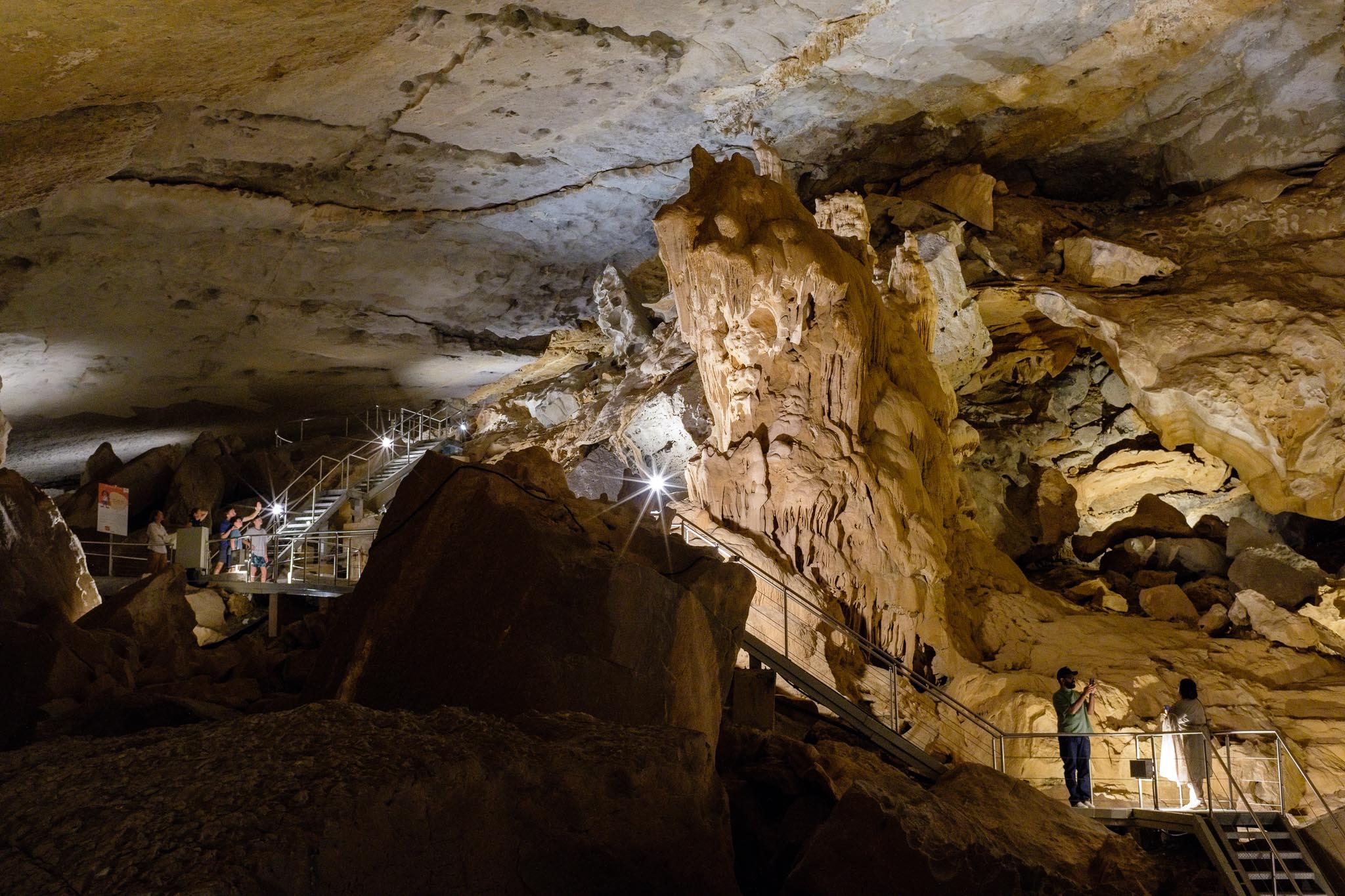
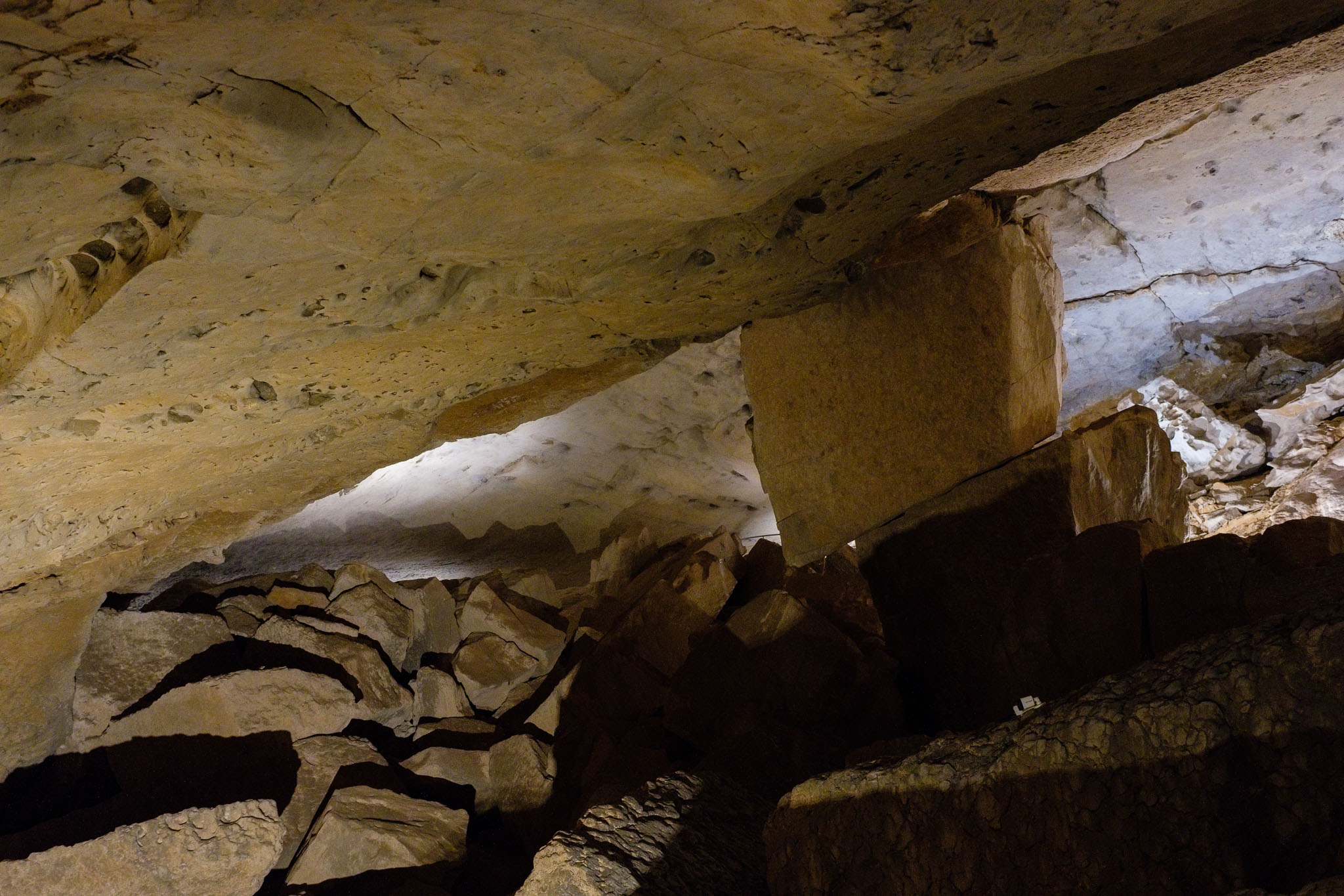
The cave was discovered by locals several hundred years ago, is around 5 km long and is believed to be the longest cave in Oman. It is home to many animal species, including blind cave fish, bats, and others. It is estimated to be over 2 million years old, and has been slowly carved out by water, as it dissolved the limestone rock. Given its sensitive ecosystem, there is a limit to the number of daily visitors, but you can plan and book your ticket online. Once inside the cave, you follow a path which is about 800 m long, and that allows you to admire the many rock formations, including the famous “lion”. The cave complex is much larger than the area open to the public; in fact, the cave extends for several km, including a few lakes; the path takes you close to the first lake, which is framed by complete darkness as it disappears into the distance.
It is possible to take photos inside the cave, without the use of flash. Light levels are low, but still I managed to come away with good photos, including wide views taken with the phone. Pay attention to the different types of illumination and lighting, which have been chosen to enhance specific features and formations. As a geologist, I enjoyed this visit very much, and highly recommend it. There is also a small geological museum in the main building, which describes the geological history of Oman and the development of the cave, complete with many rock samples.
General view near the entrance (Samsung S24).Inside the cave, wide view (Samsung S24).Small lake.Stalactites.Hanging.From above.Stalactite.Trying to connect.The Lion.Rock curtain.Into the deep.Hall of imagination.Keystone.
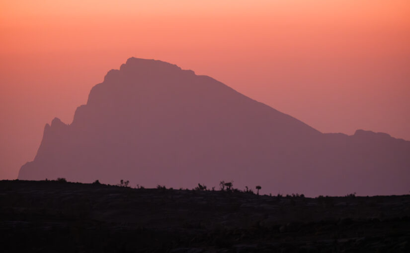
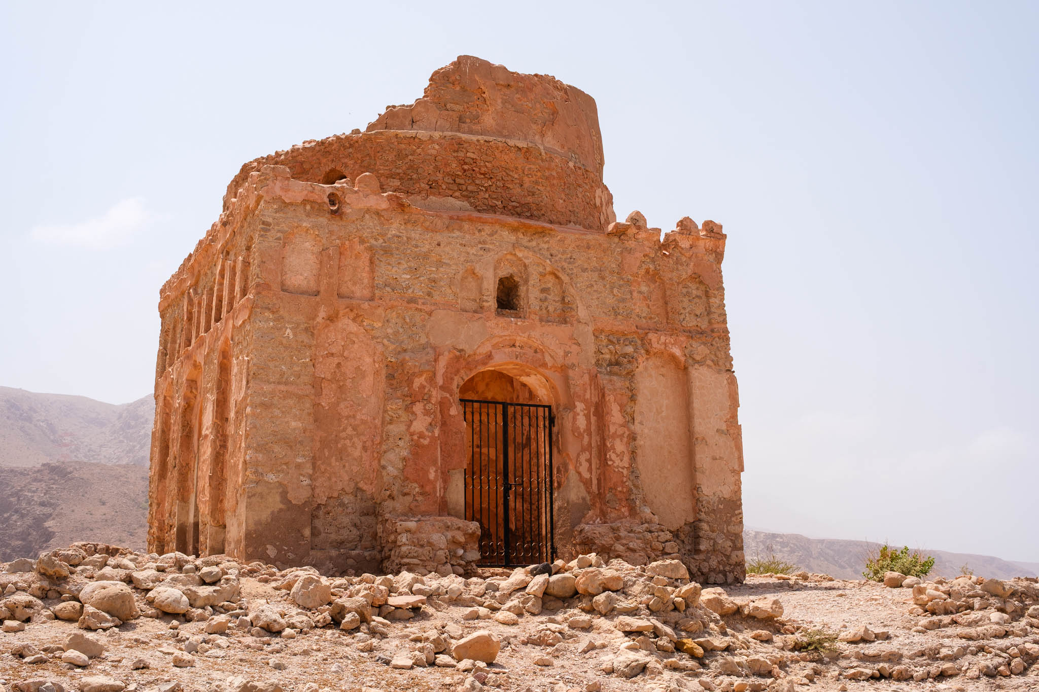
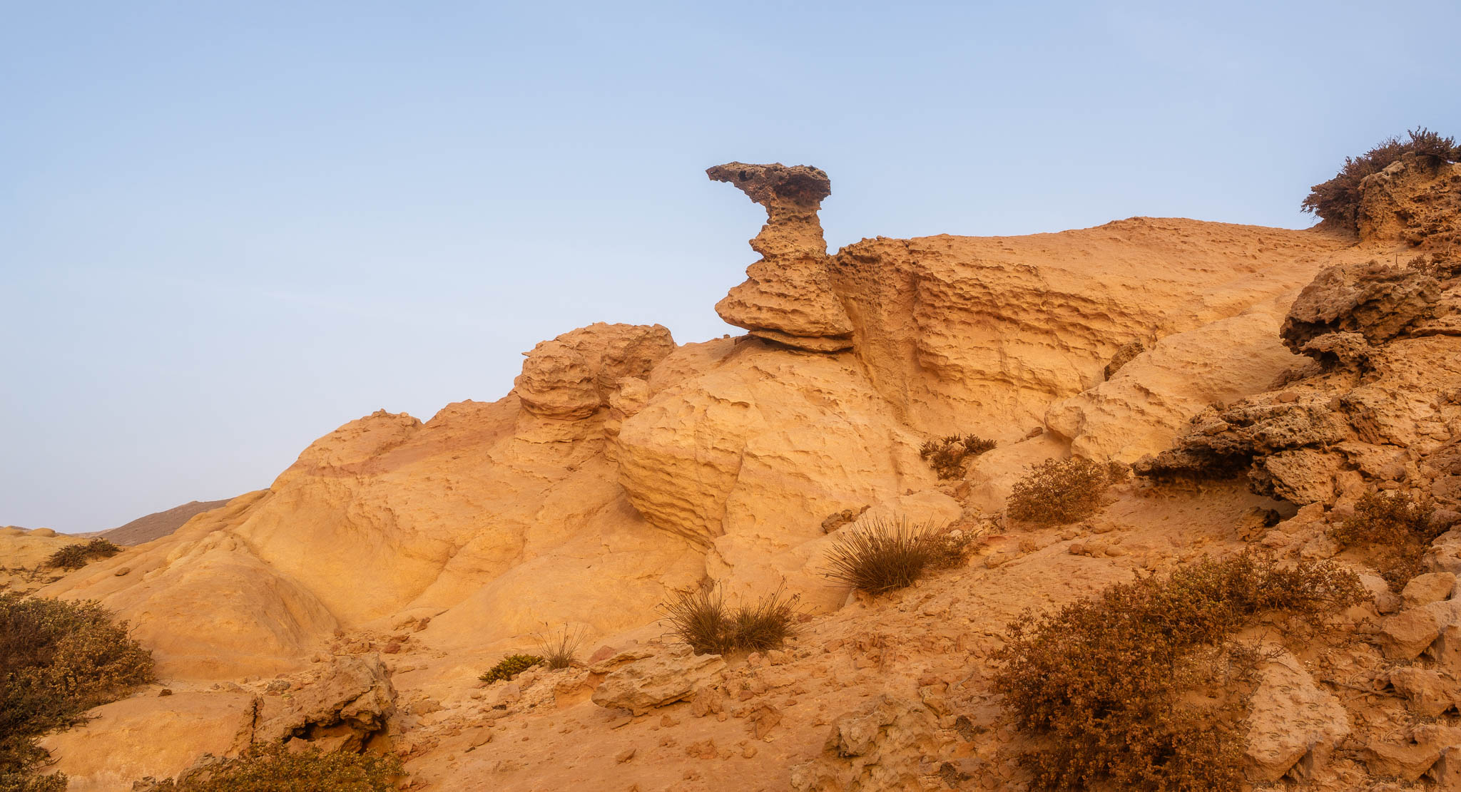
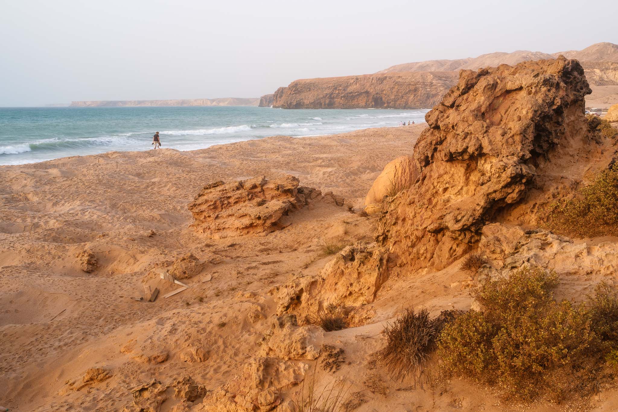
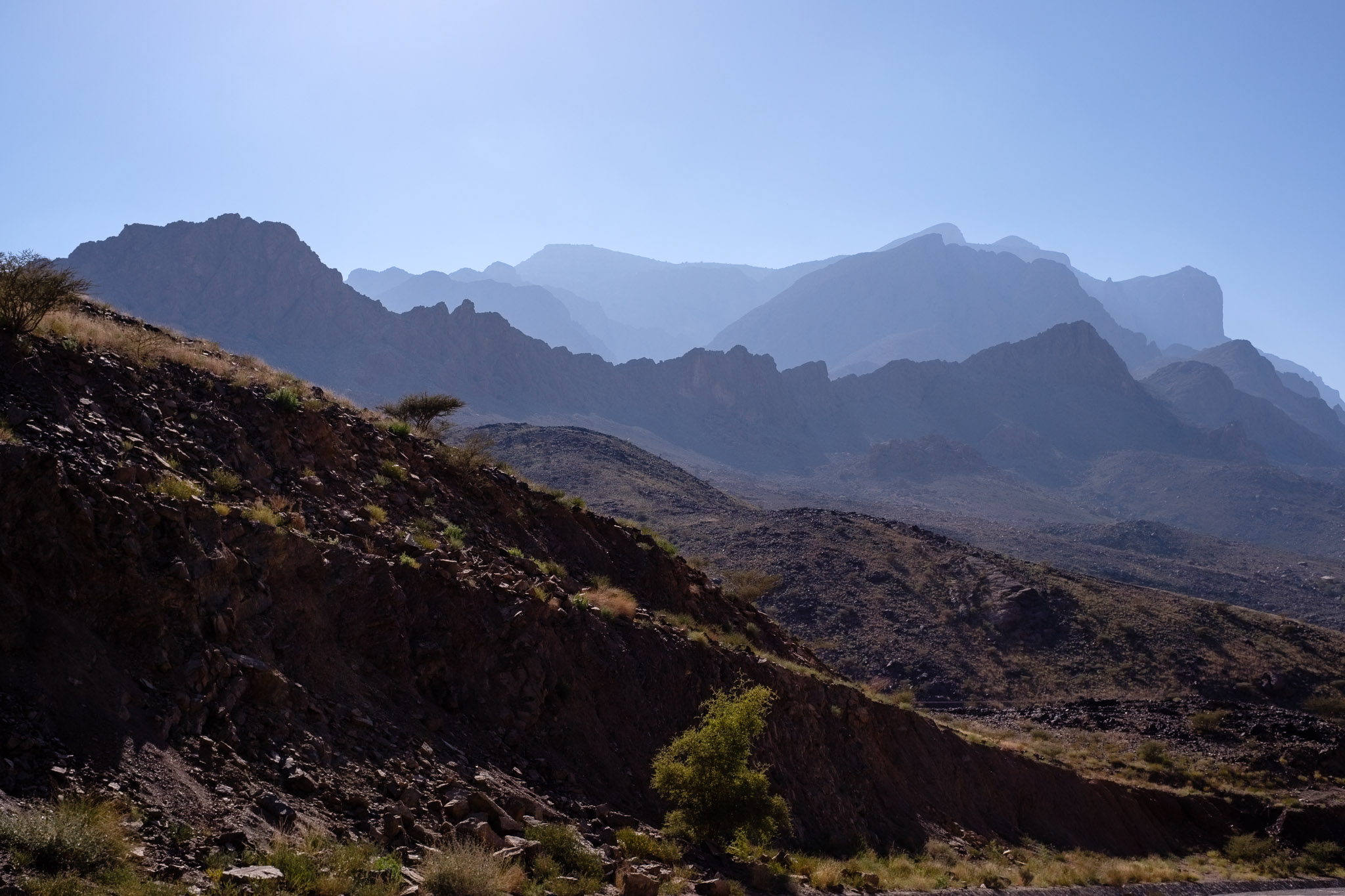
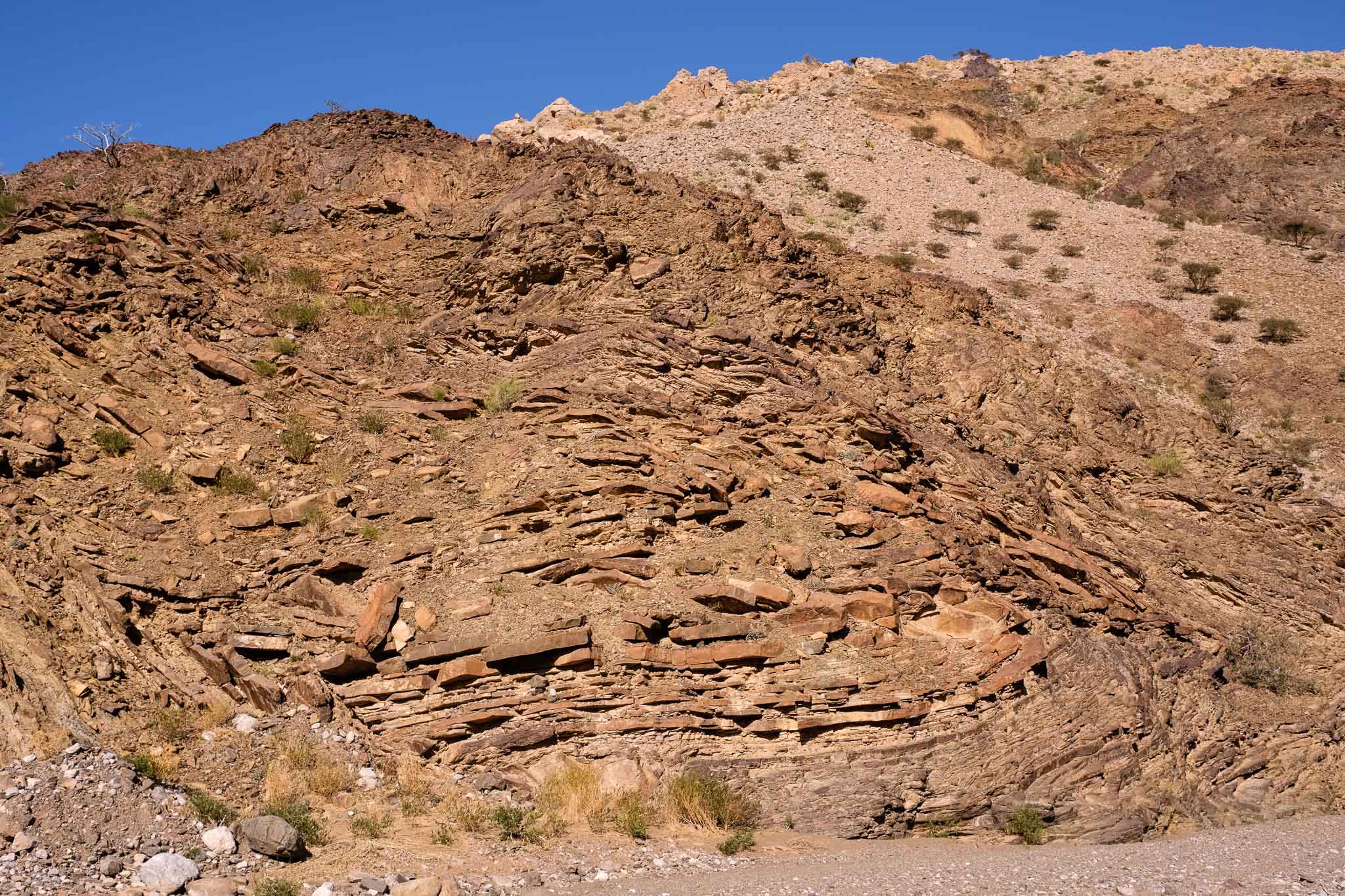
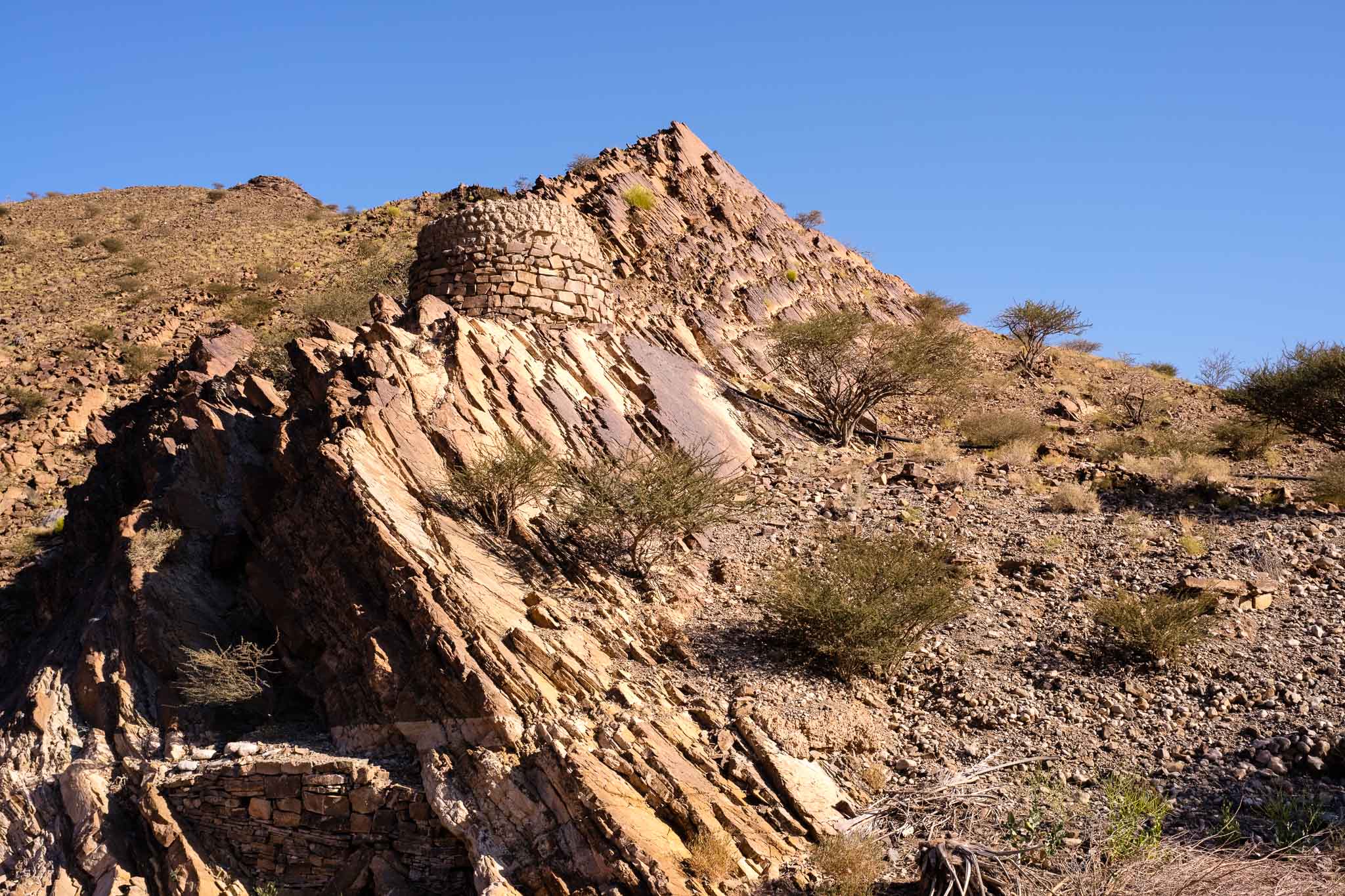
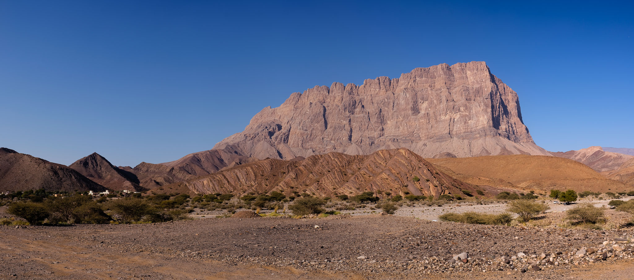
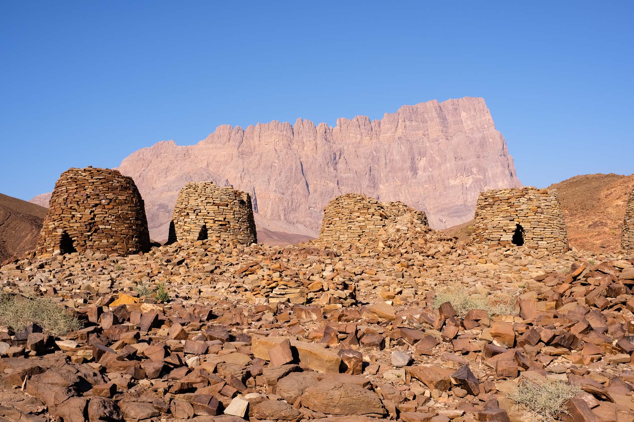
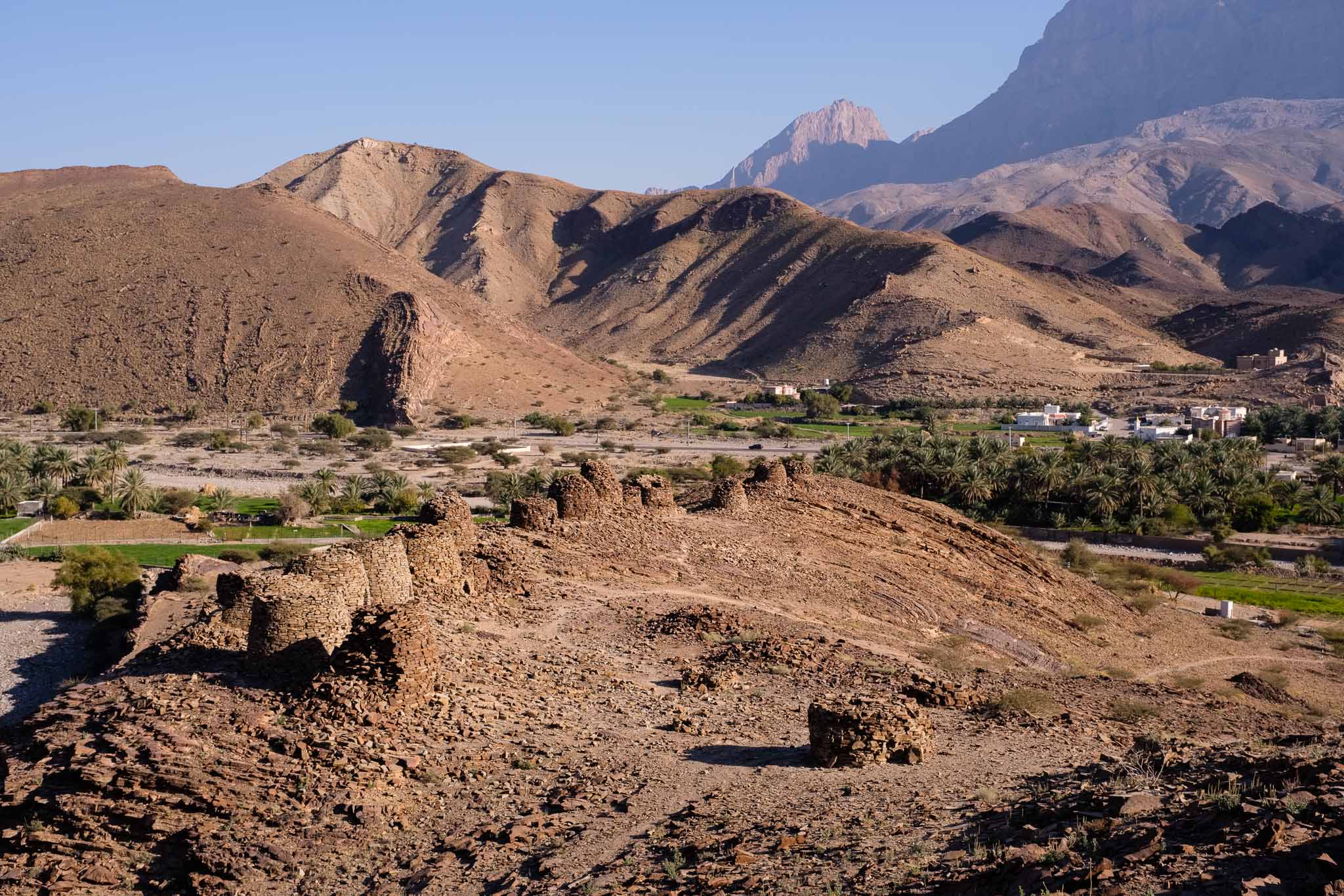
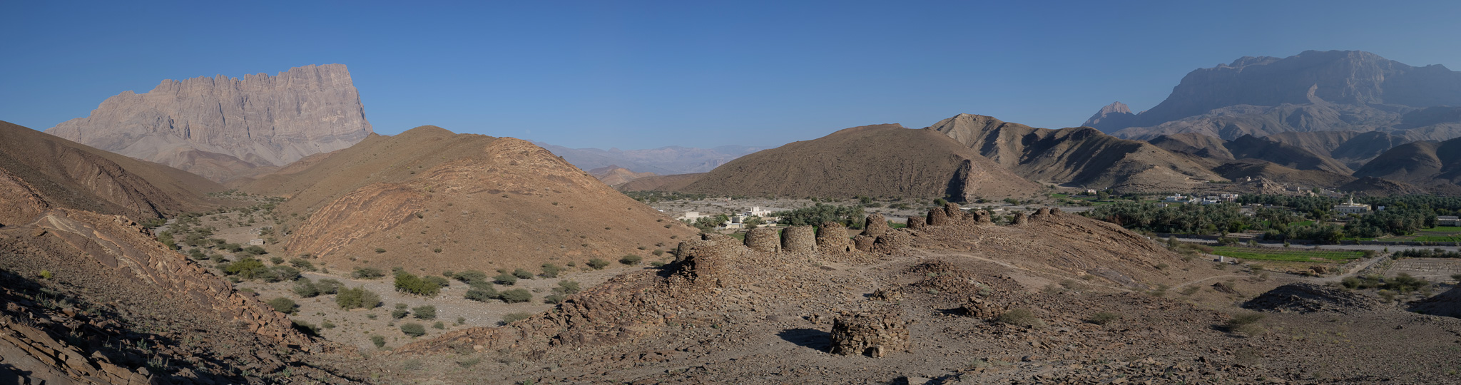
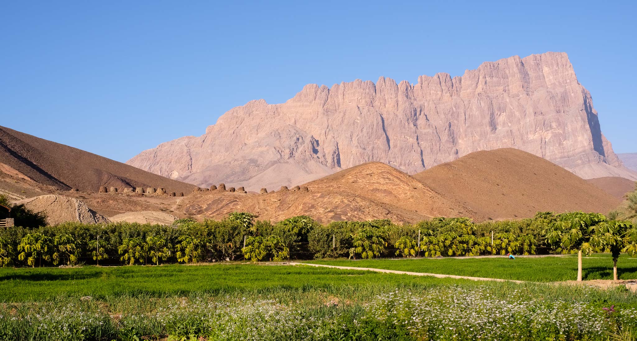
Once the visit was finished, it was time to have lunch, so I found some shade in a nearby wadi and had a nice picnic. The weather in January has been excellent, with lower temperatures and good visibility, without the typical heat haze obscuring the mountains. The plan for the afternoon was to drive to the next stop of my trip, the Al Ayn Beehive Tombs near Jebel Misht. I visited the place several years ago and remember being impressed by the scenery, so I was looking forward to returning. Jebel Misht is famous for its peculiar shape, rising prominently from the surrounding plain like a ship’s bow.
To get there, I chose to drive along a scenic gravel road a few km after Wadi Nakhr, crossing a couple of hills and valleys. I stopped a few times to take some photos and enjoy the landscape and the quietness. After some twists and turns, the road finally descends into a large plain, where it connects with the main blacktop road to Wadi Al Ayn. Soon it is possible to admire Jebel Misht, and after a while you will see the beehive tombs about 200m from the road. These are located along the ridge of a hill, with Jebel Misht as backdrop. This archaeological site was declared World Heritage by UNESCO in 1988, and it has been dated to the 3rd millenium BC. Copper and stone (diorite) have been extracted from the surrounding mountains for thousands of years, with evidence of trade with other regions.
I parked the car in the wadi and made my way uphill towards the tombs. The scenery is impressive, and I walked around for quite some time, feeling transported back in time. Today, we can see the nearby small village and the green farms; probably the setting was not very different 5,000 years ago, with settlements in the valley, and with more abundant rain? One thing I am sure of is that our ancestors already admired Jebel Misht, as much as we do today.
Beehive tombs and Jebel Misht.The tombs and the surrounding landscape.Panoramic view.Scenery.Roadside panorama.
All photos in this article were made with my Fujifilm X-T5 camera and Voigtlander X 27mm f/2 lens, complemented with my phone’s wide-angle lens module (inside the cave). I also made many overlapping images with the purpose of assembling them in panoramas later.
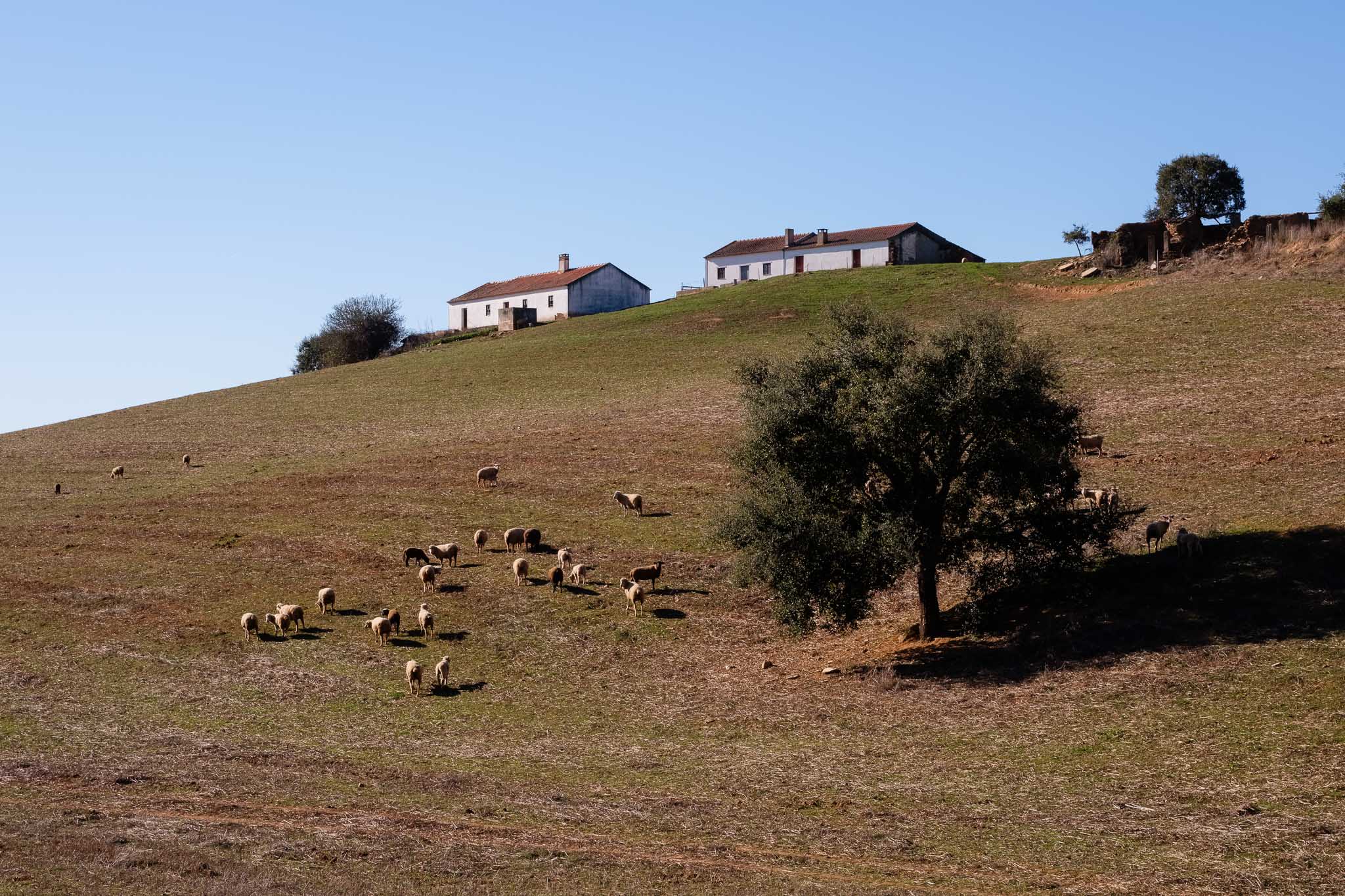
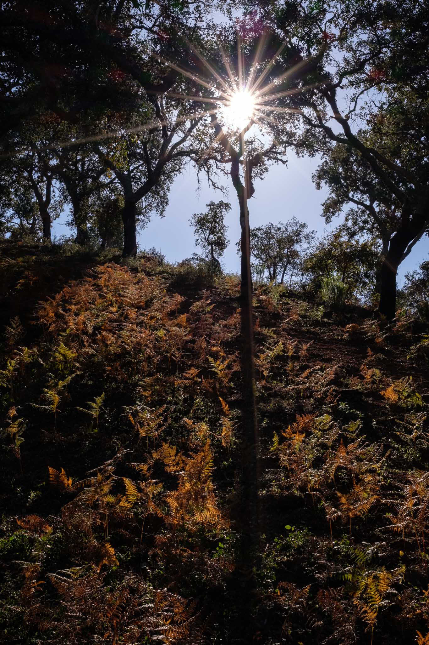
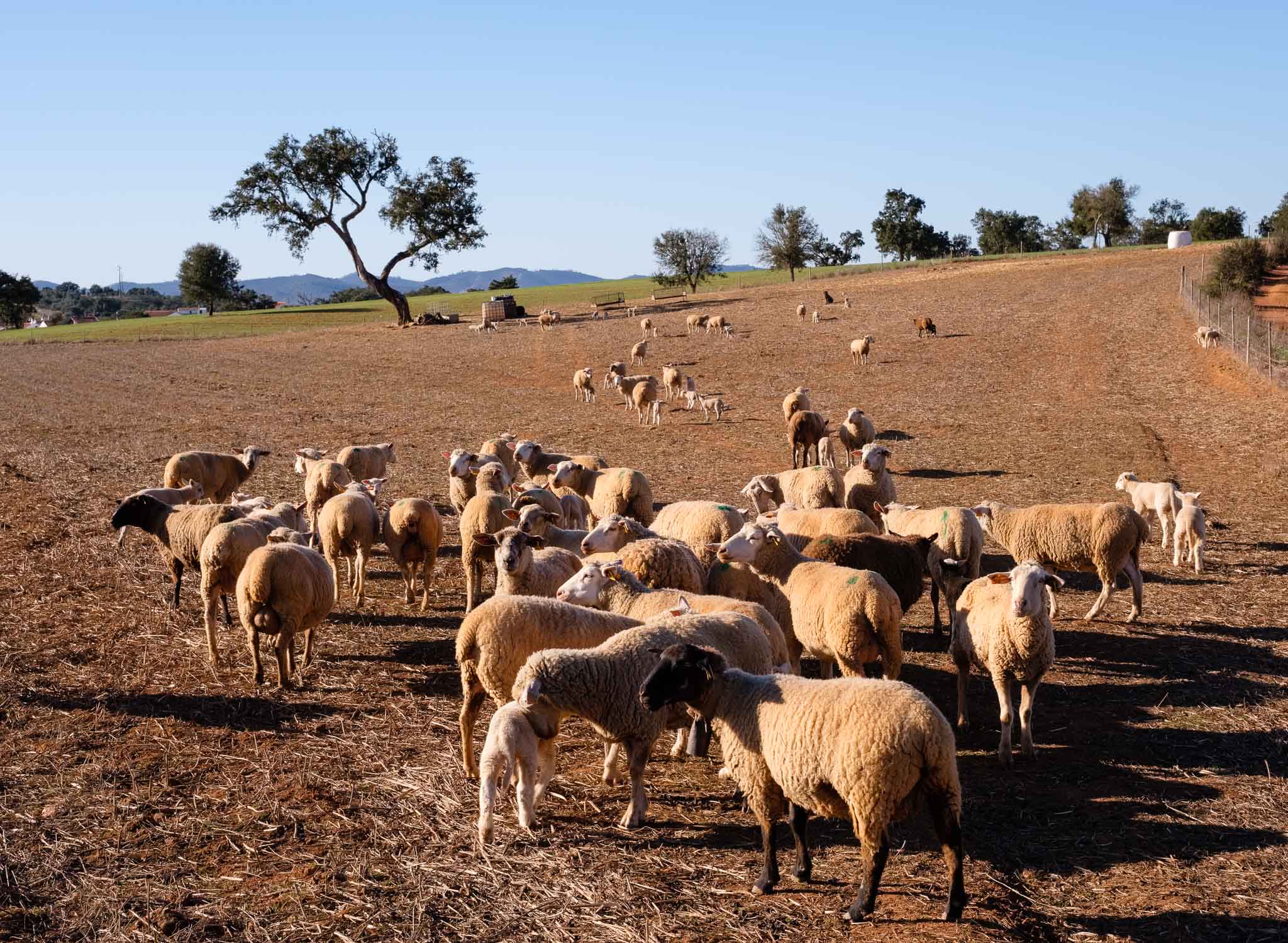
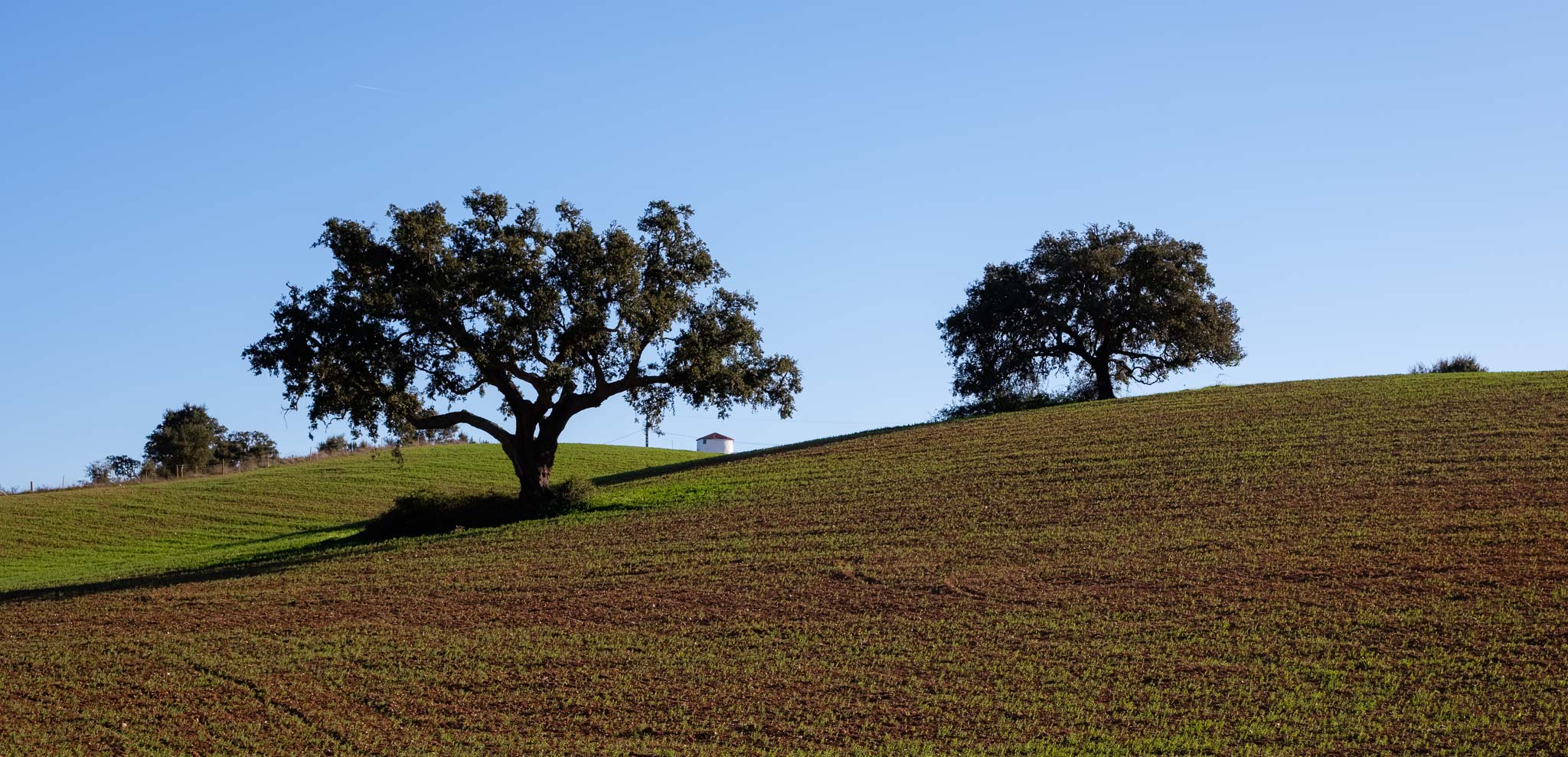
In December 2024 I took a couple of weeks vacation and went to Portugal. I had the opportunity to spend some time with the entire family, which is always good. I also spent a few days in Longueira, in the SW coast of Alentejo; the weather was cold but sunny, so excellent for trekking. Thus, one fine morning we decided to walk along the Nossa Senhora das Neves trail, which is part of the vast Rota Vicentina network.
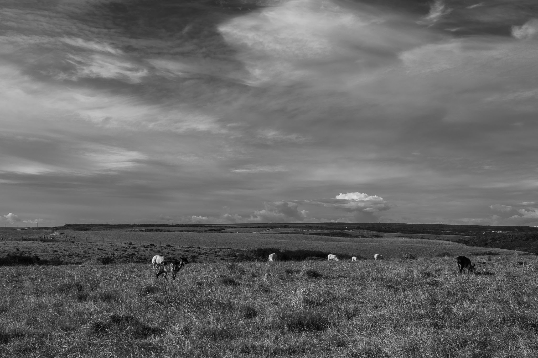
This is my wife´s favorite trail, and indeed it crosses a beautiful rural landscape. I have already written several articles about this trail, so this time I will only share a few photos.
Grazing.Along the trail.Sun burst.Sheep.Rural landscape.
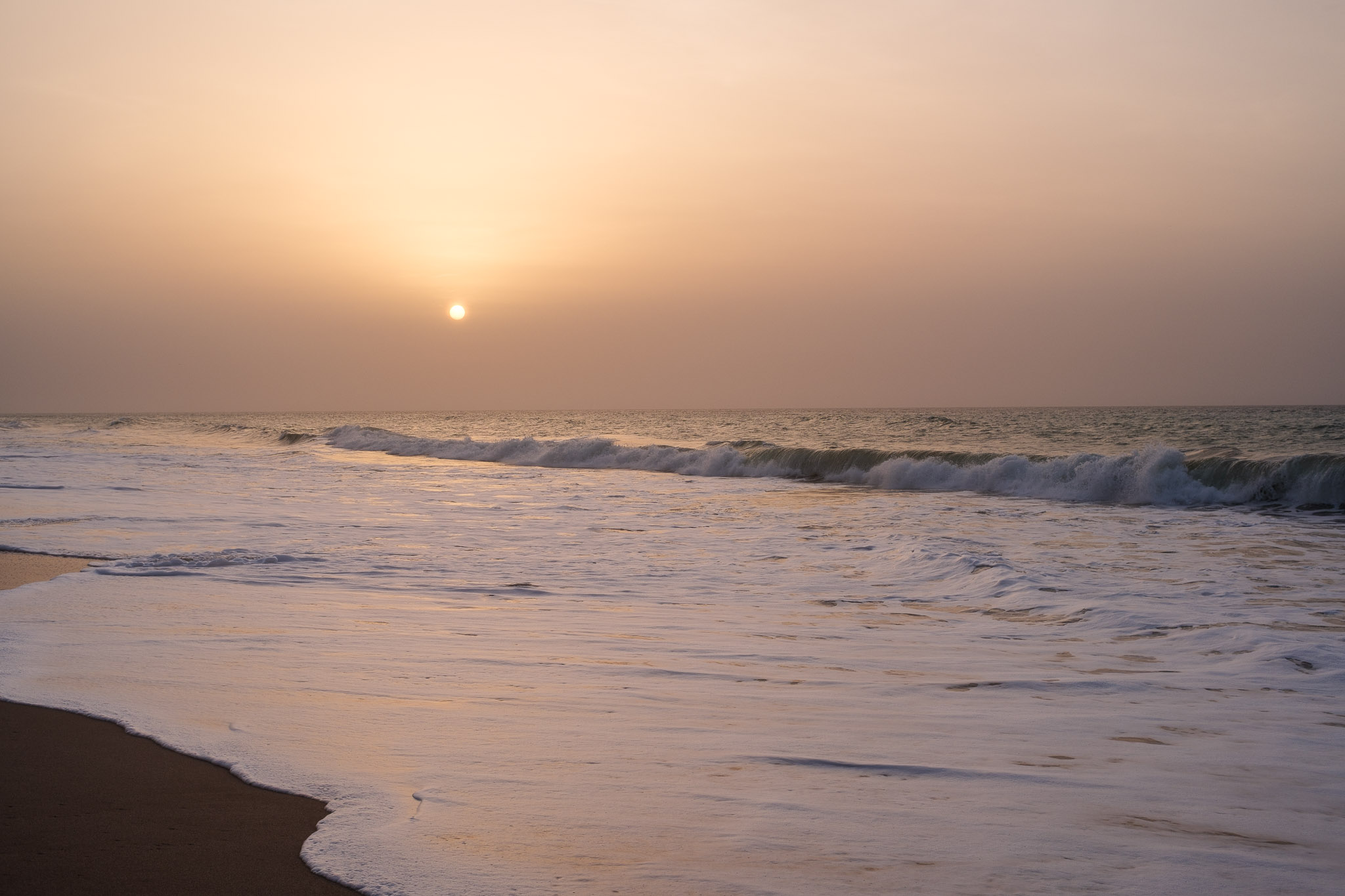
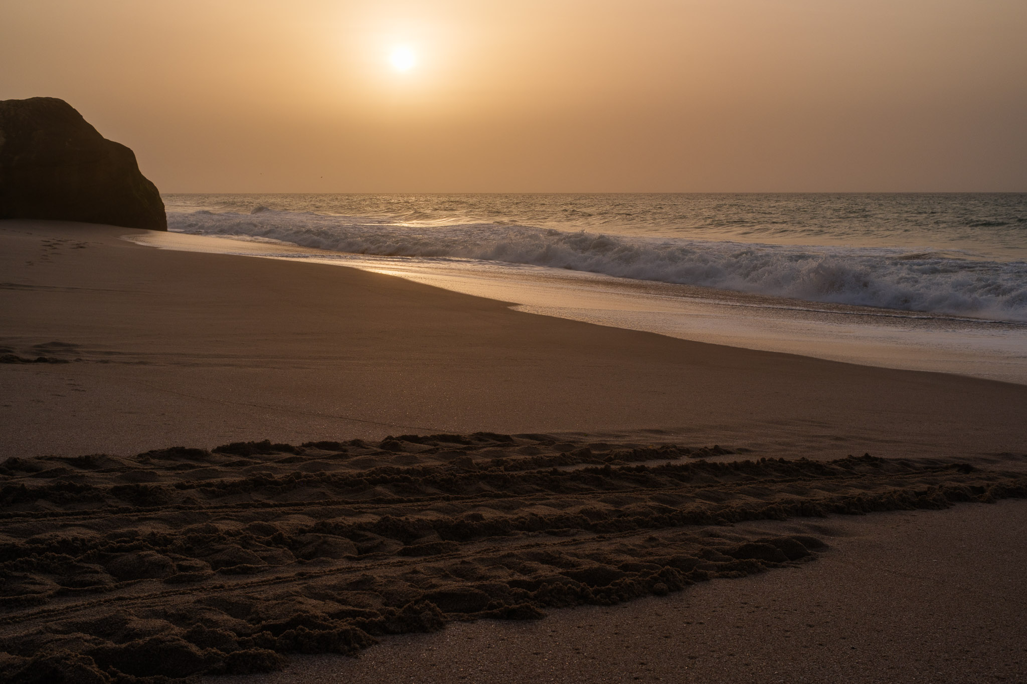
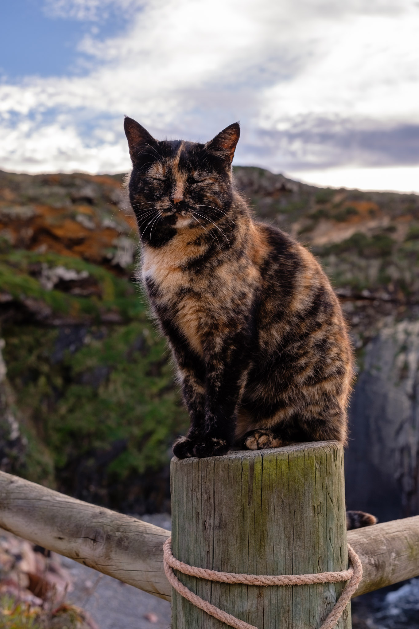
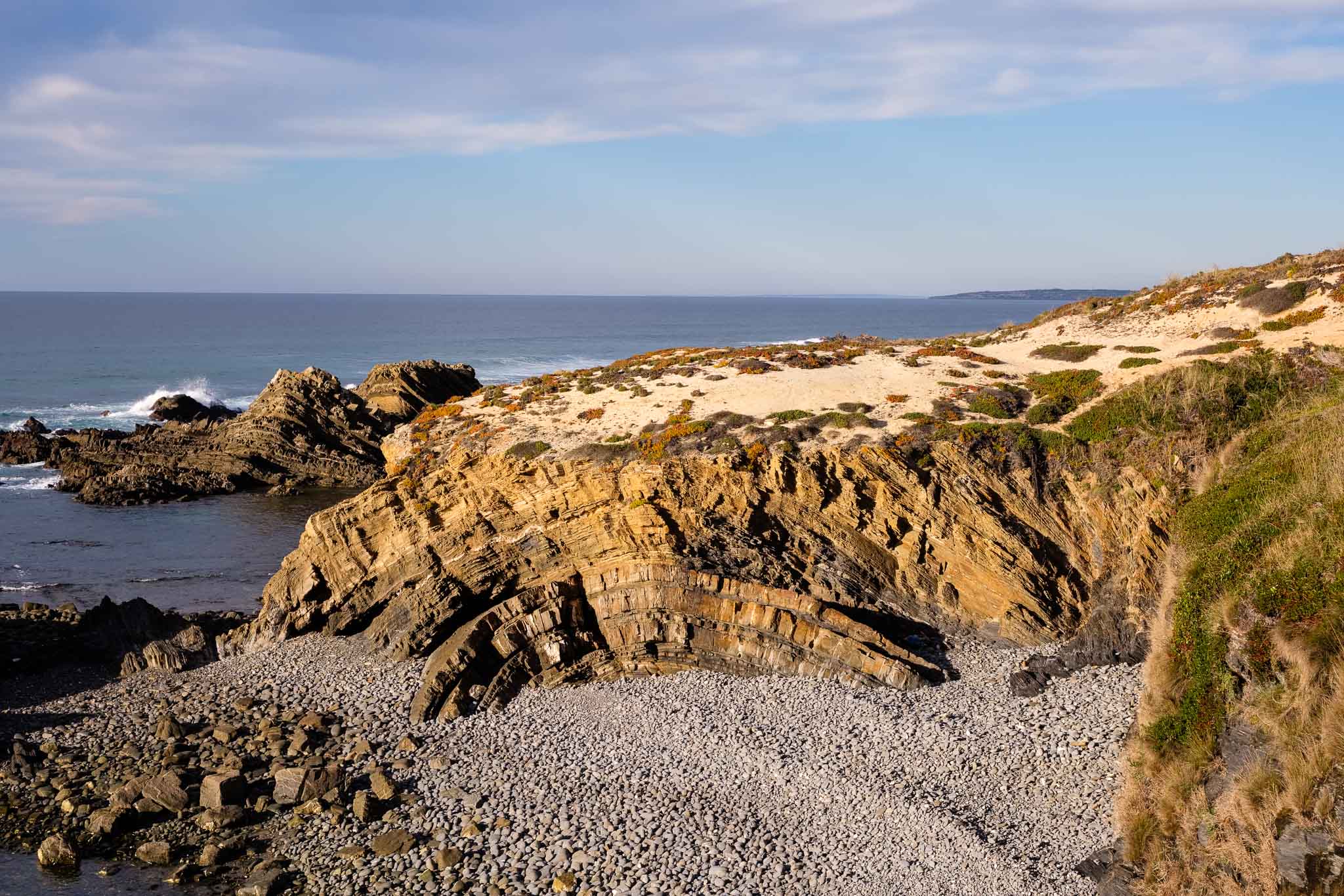
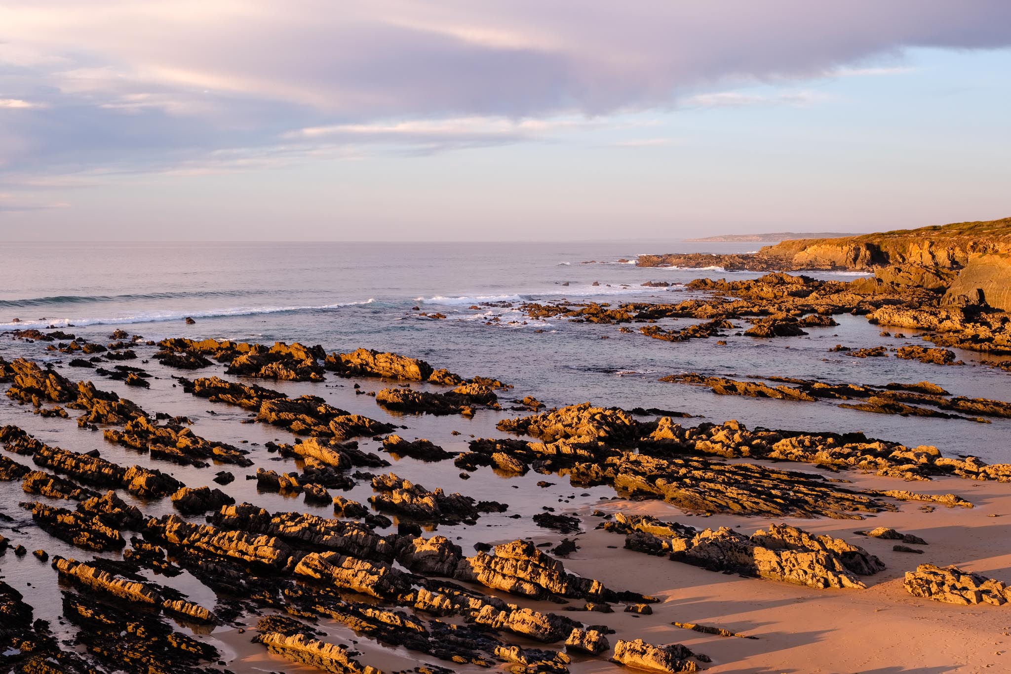
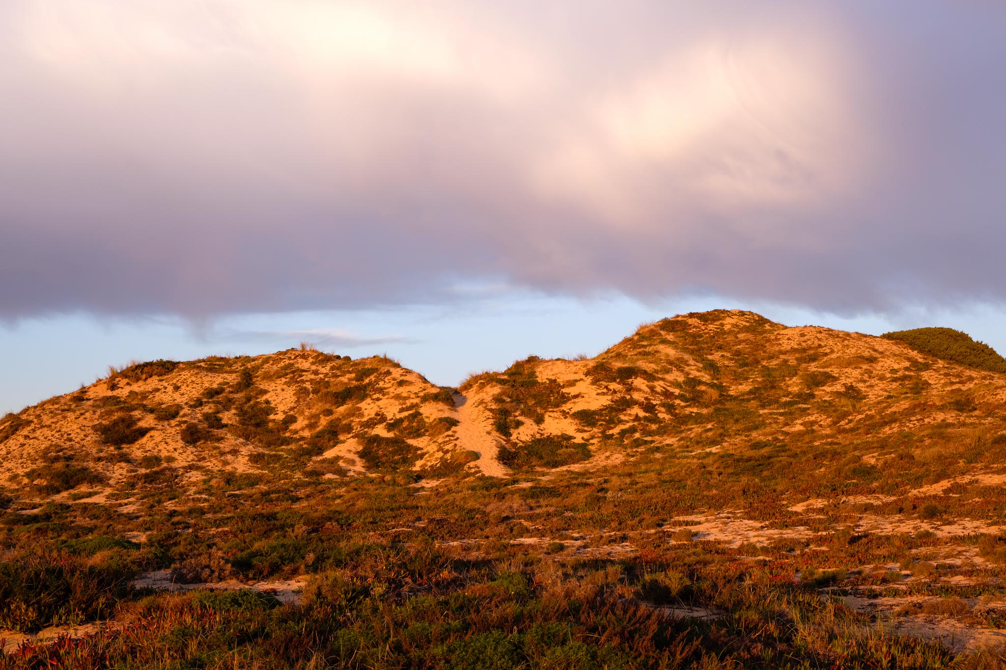
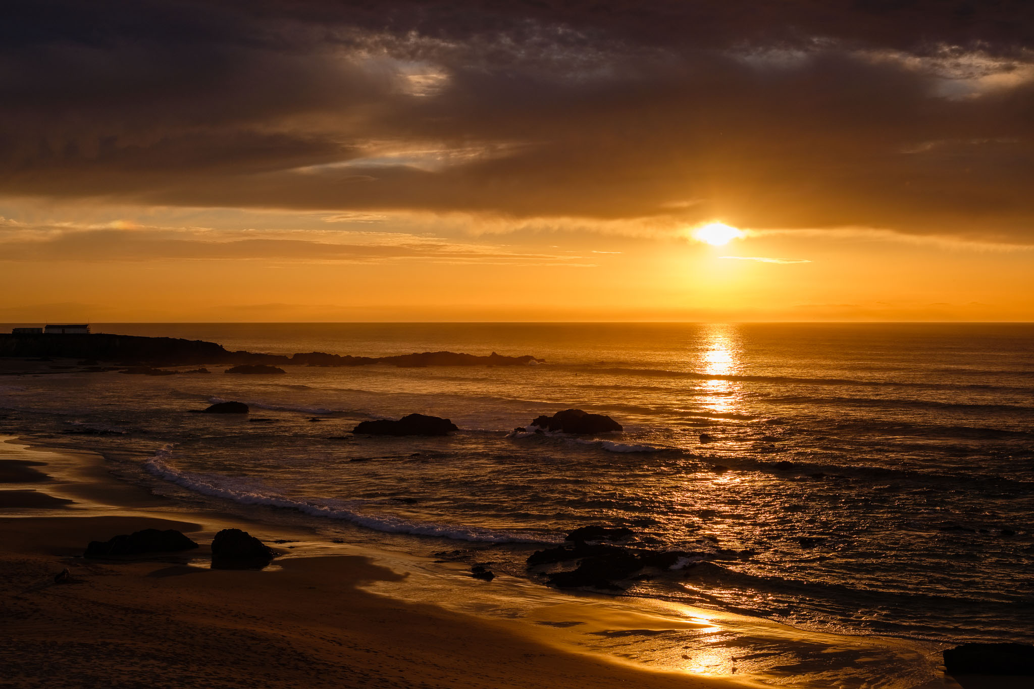
Another photo walk I did was along the coast, between Almograve beach and Lapa de Pombas fishing harbor. The late December light near sunset was wonderful, bathing the coastline in golden tones. The low tide was a bonus, revealing the spectacular geology of the area. Almograve is famous for its sunset, and it is easy to see why.
Local cat at Lapa de Pombas enjoying the sun.Folded rock formations.Golden light.Coastal dunes.Almograve sunset.The magic of sunset.
It was great to spend some time back home, and be able to take a few photo walks in the southwest.