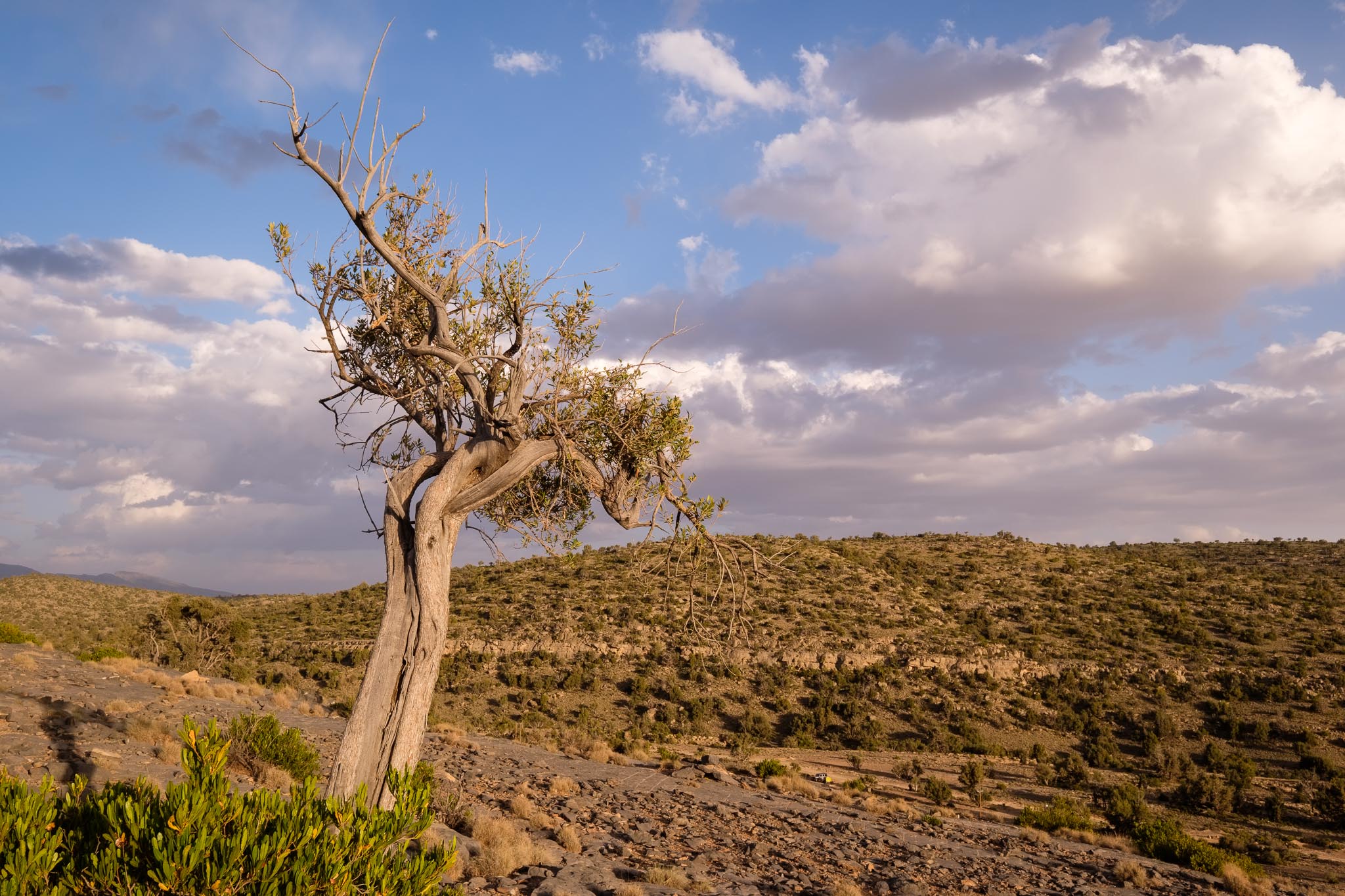
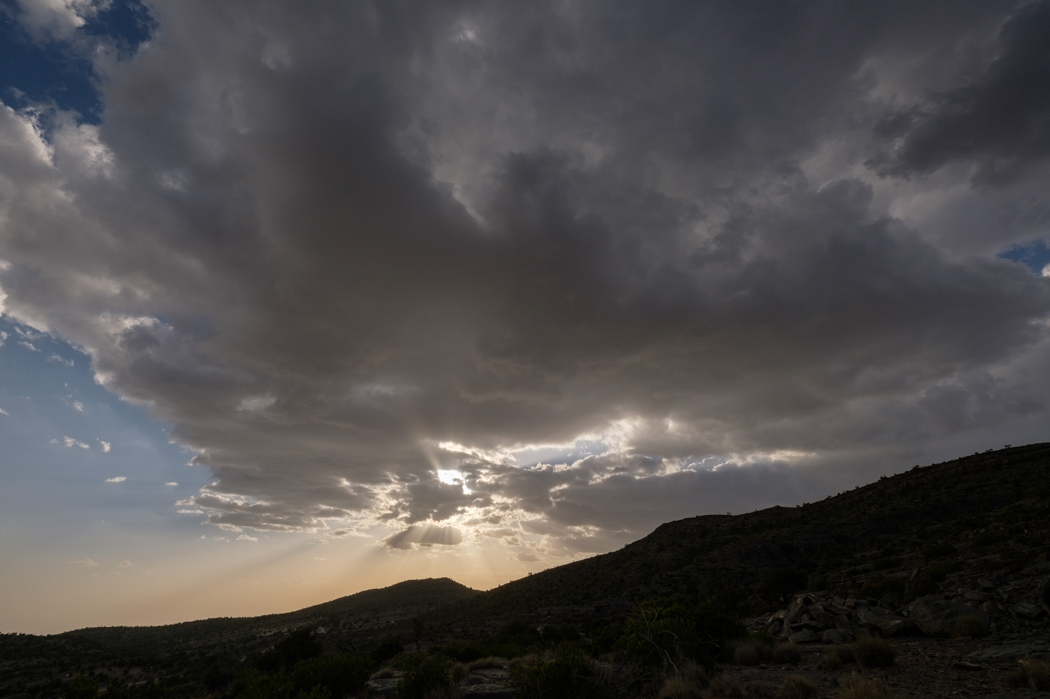
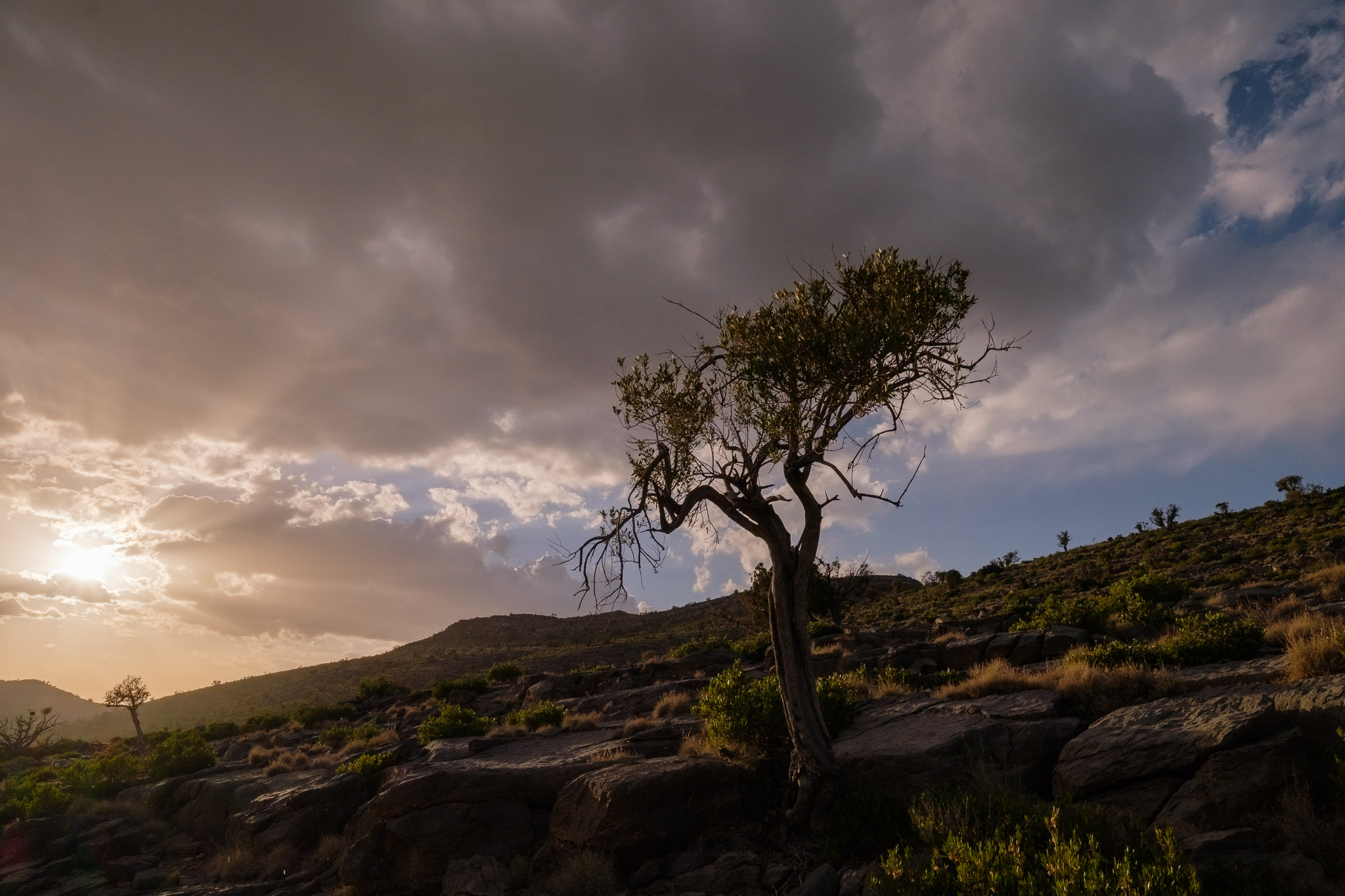
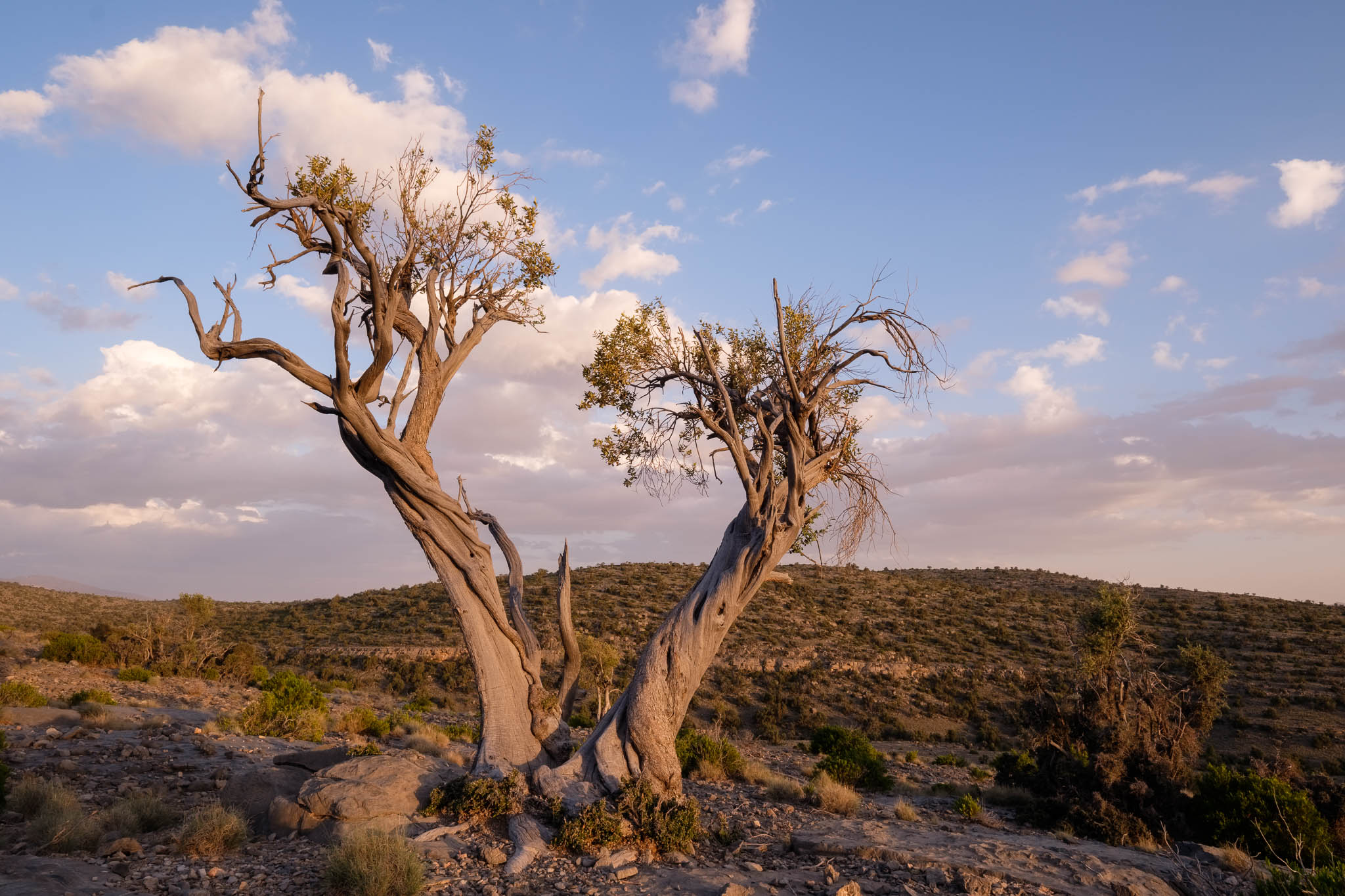
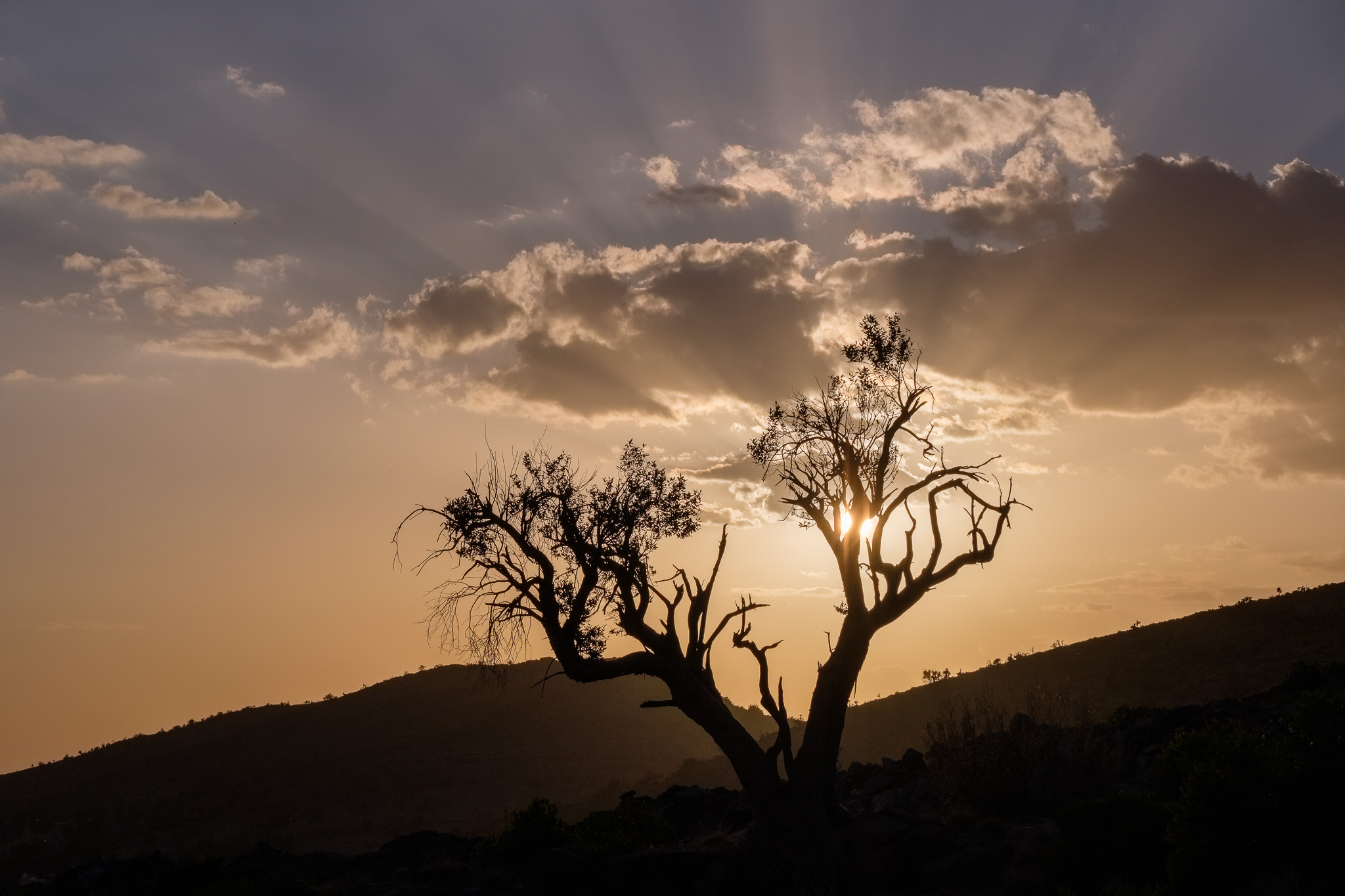
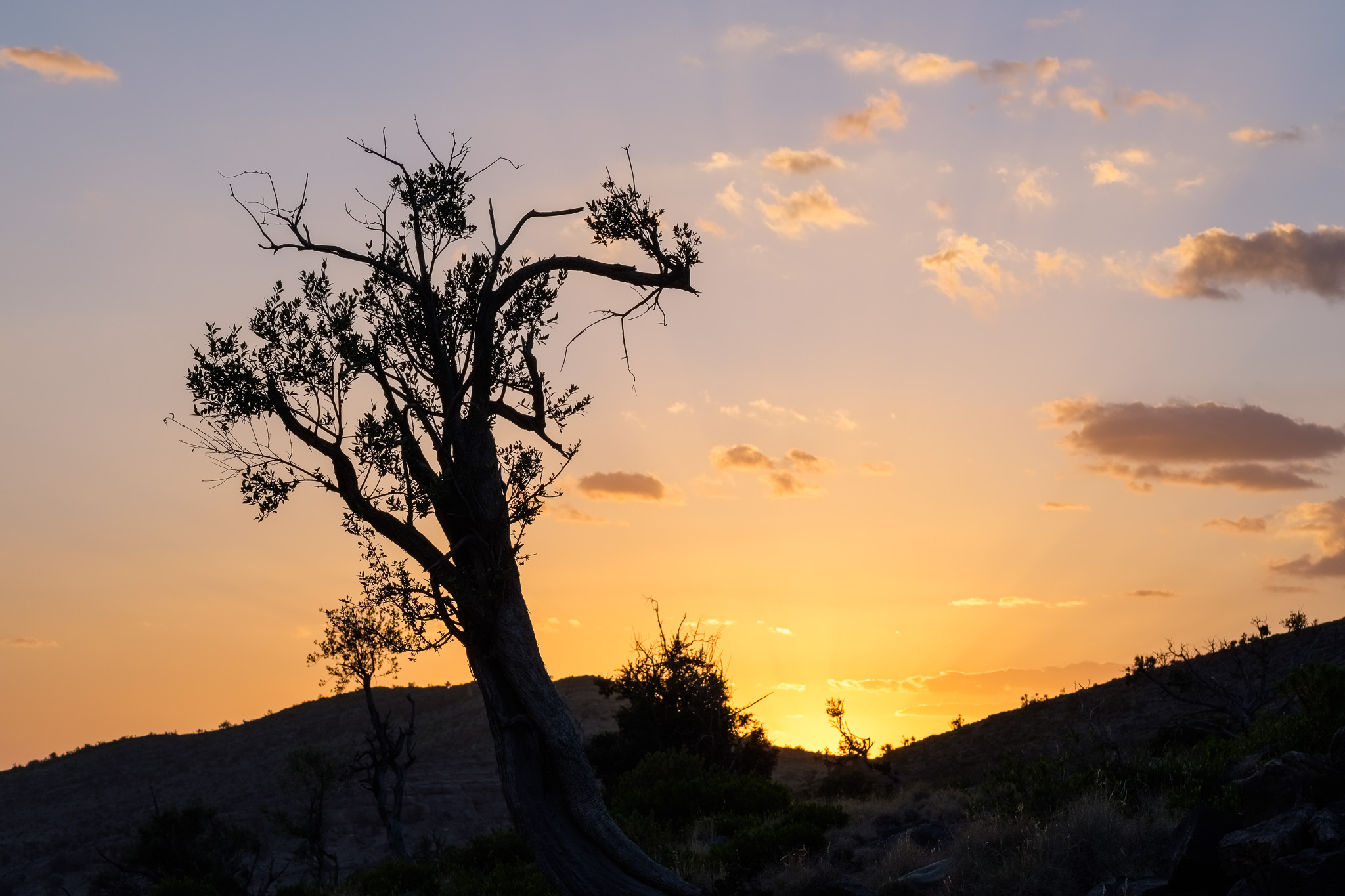
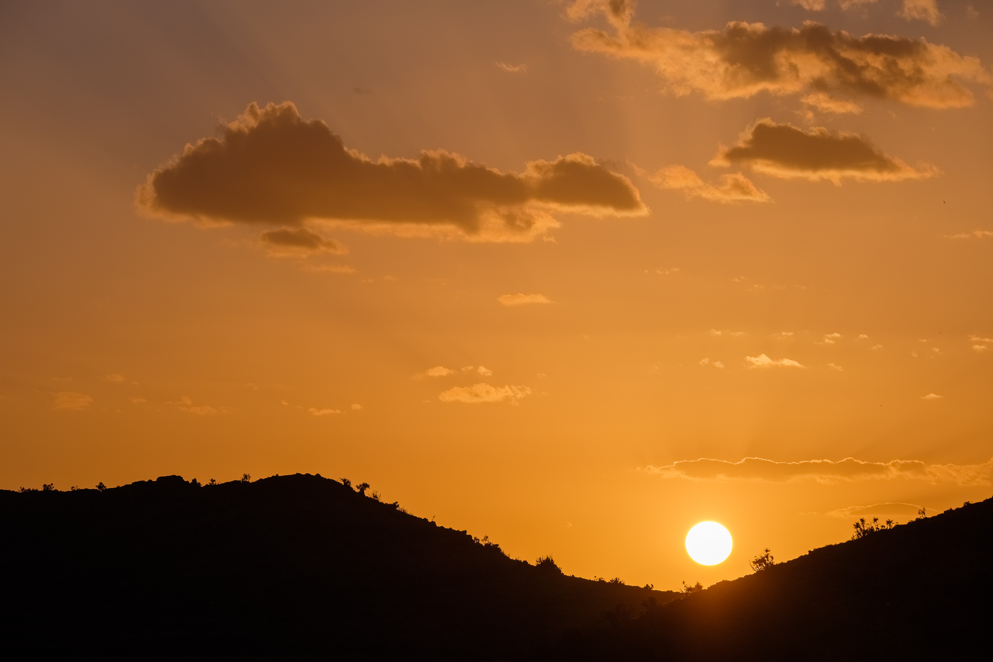
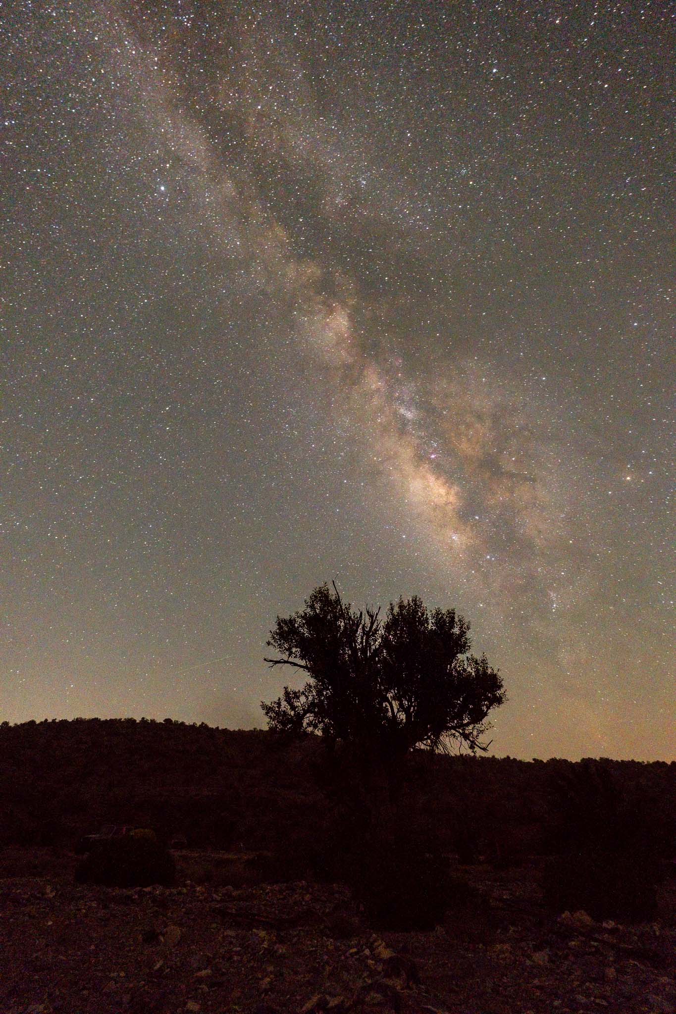
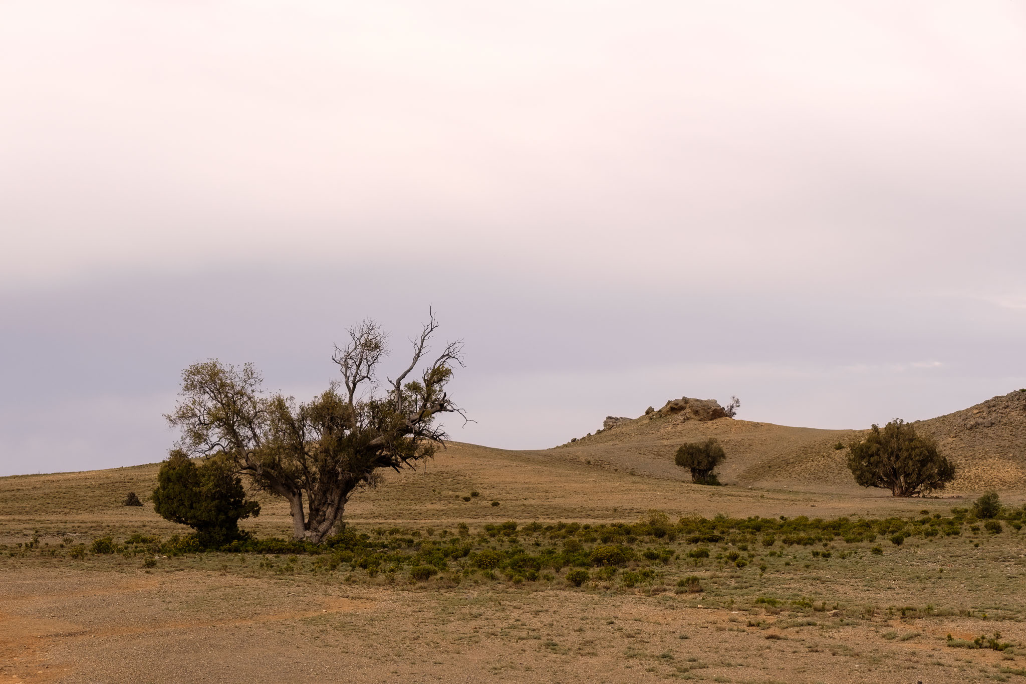
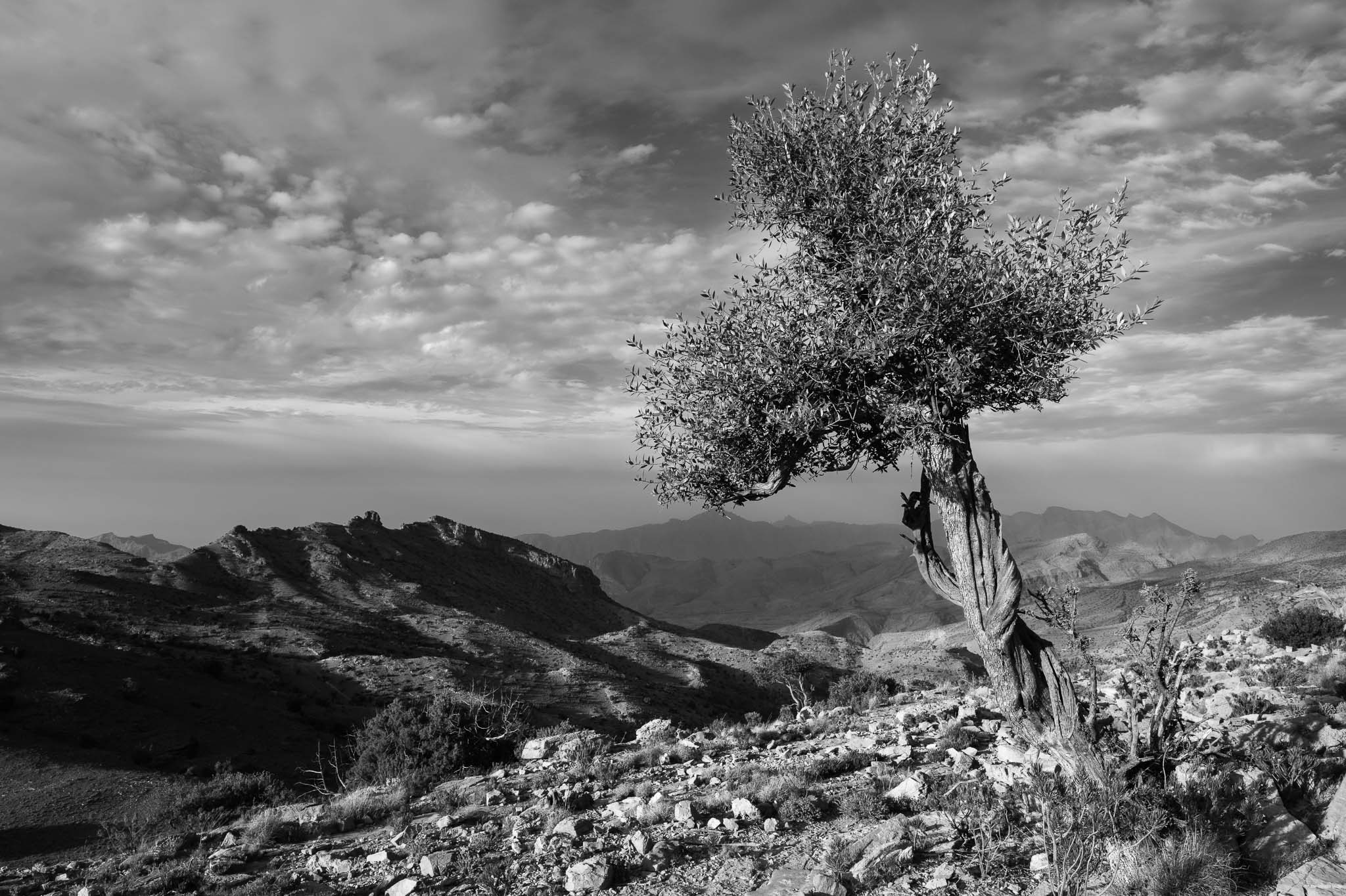
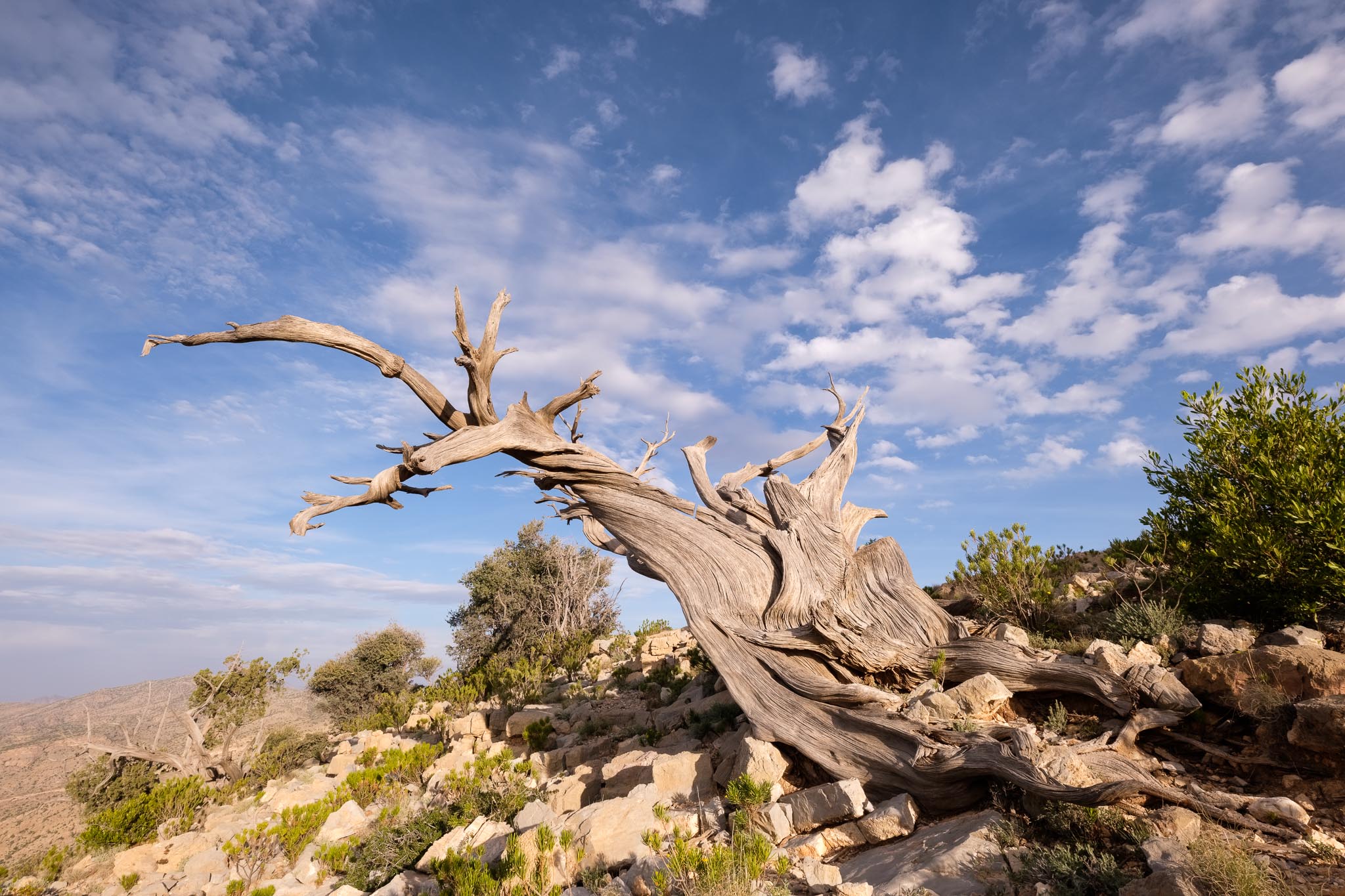
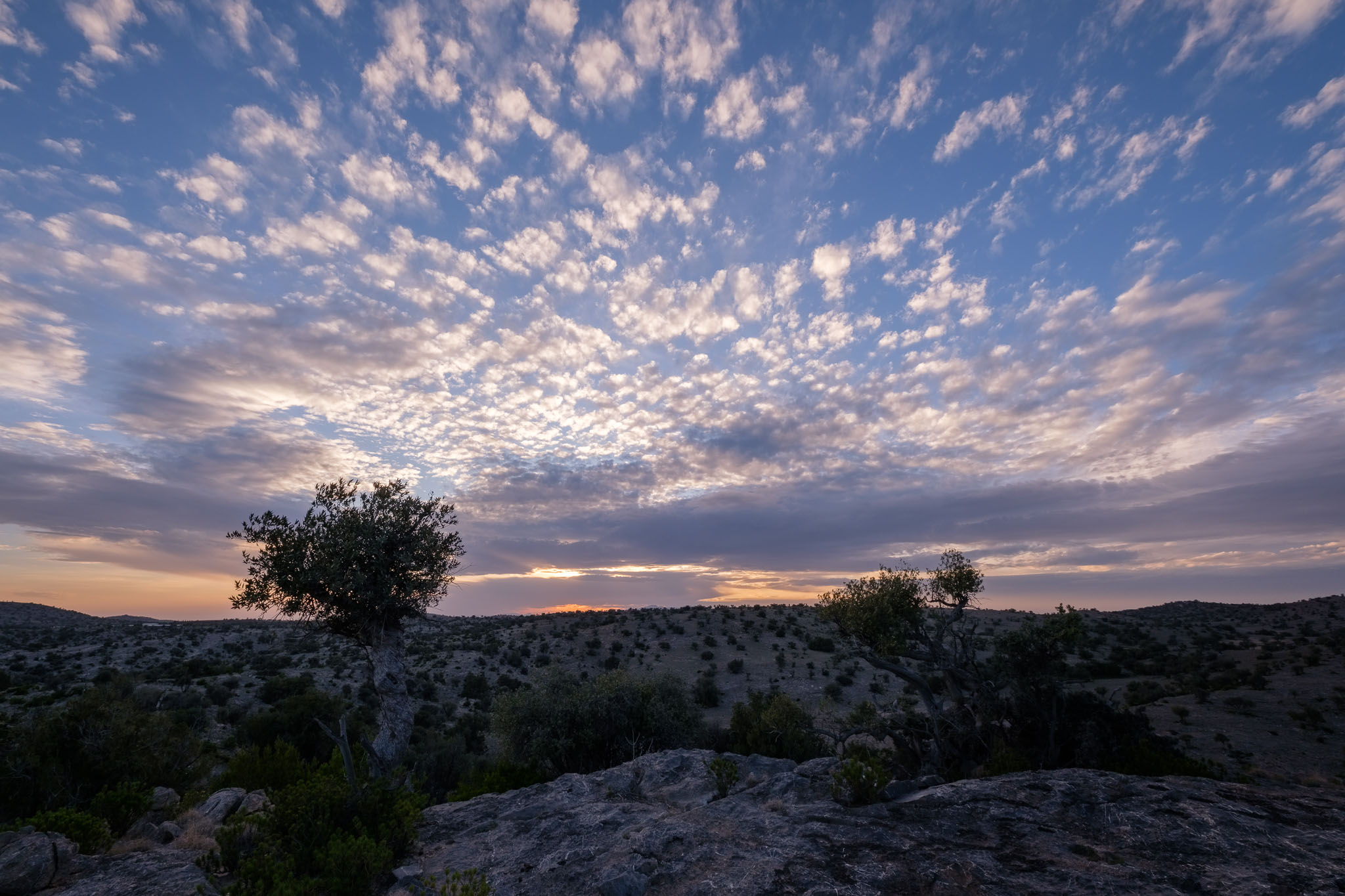
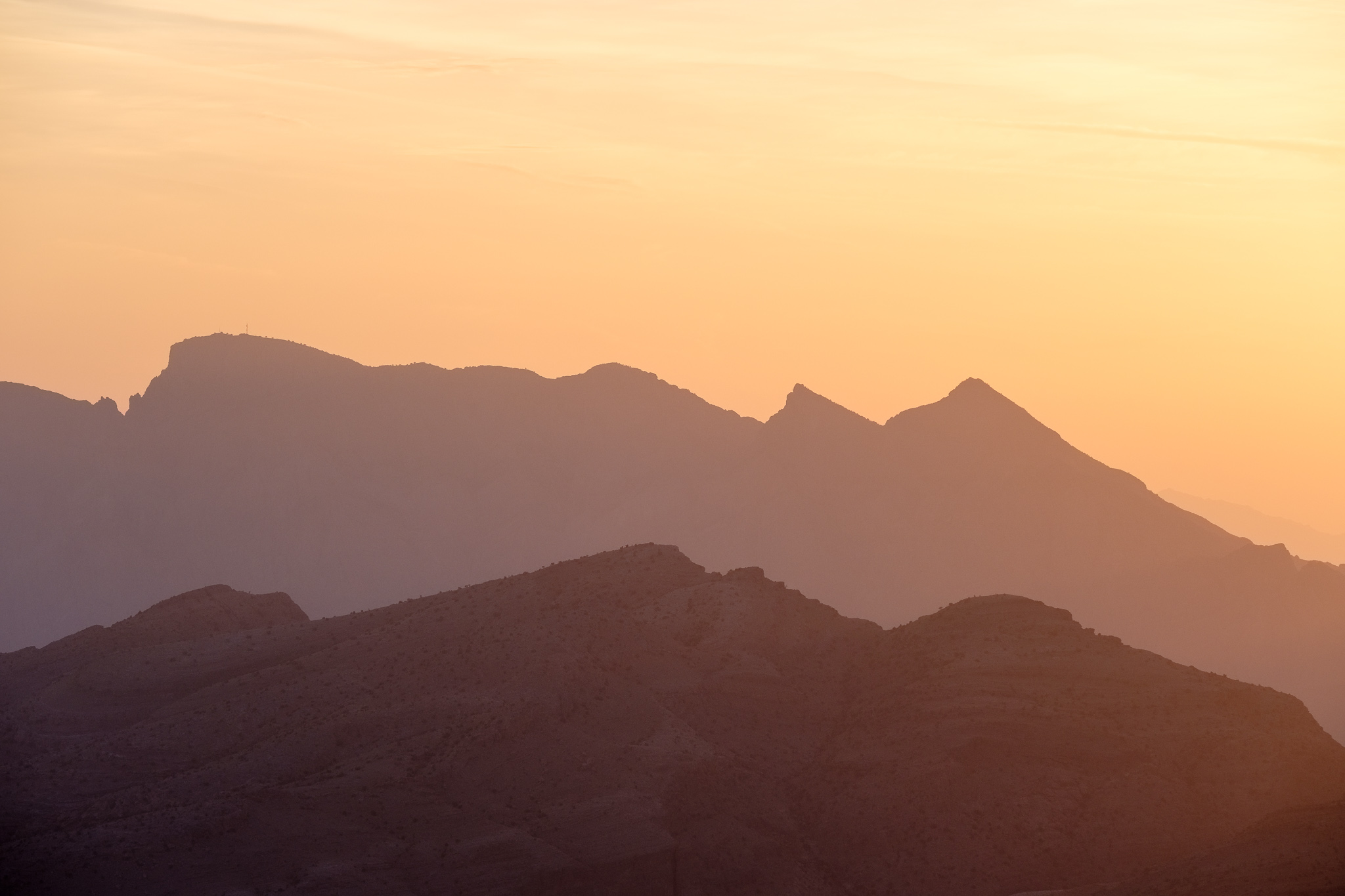
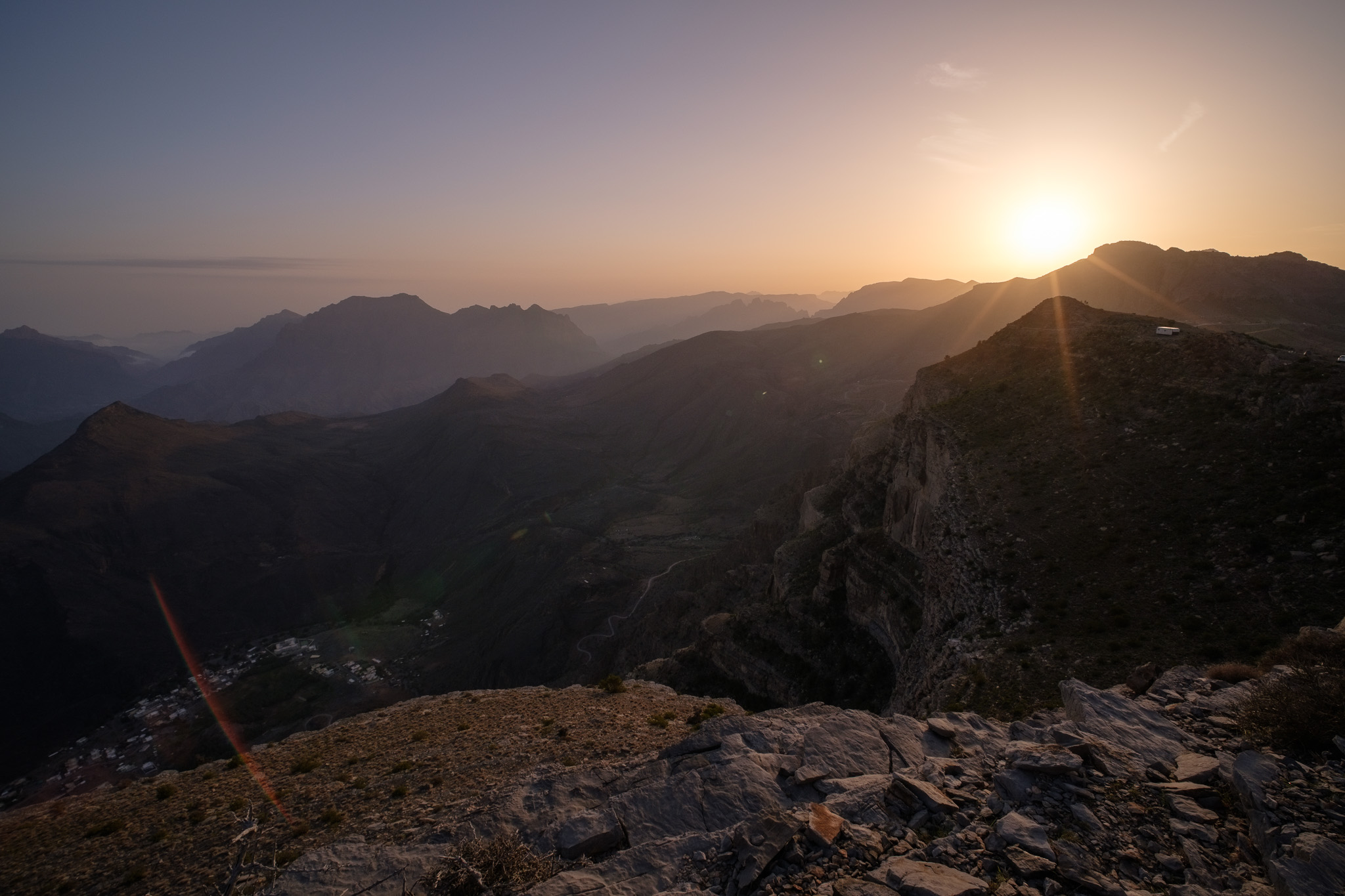
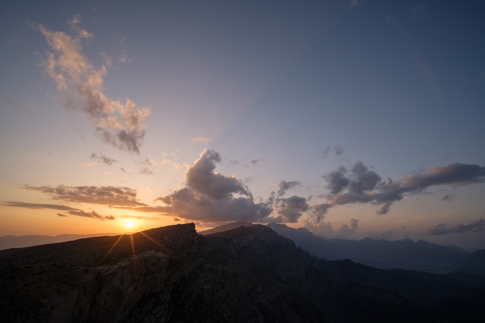
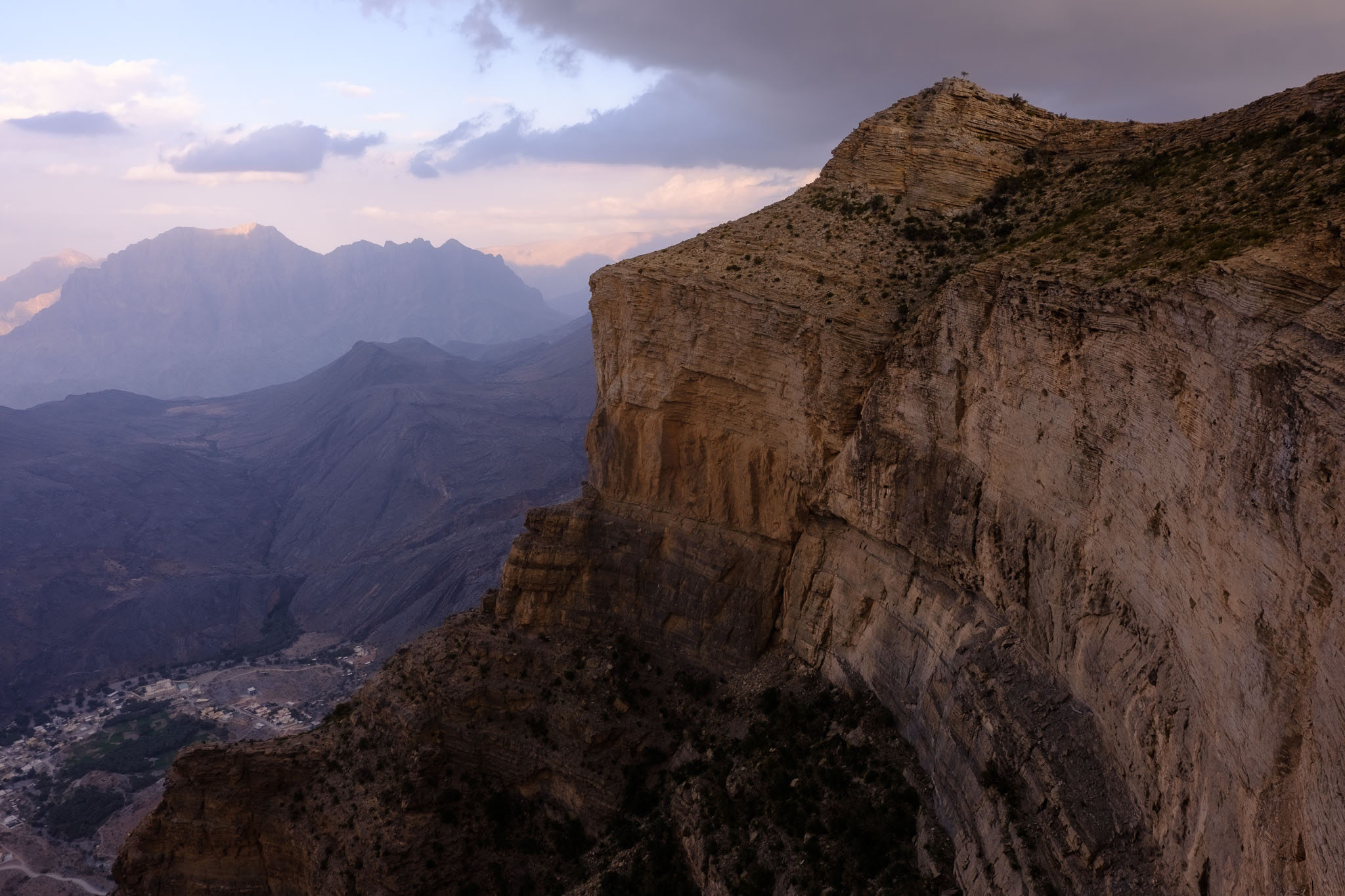
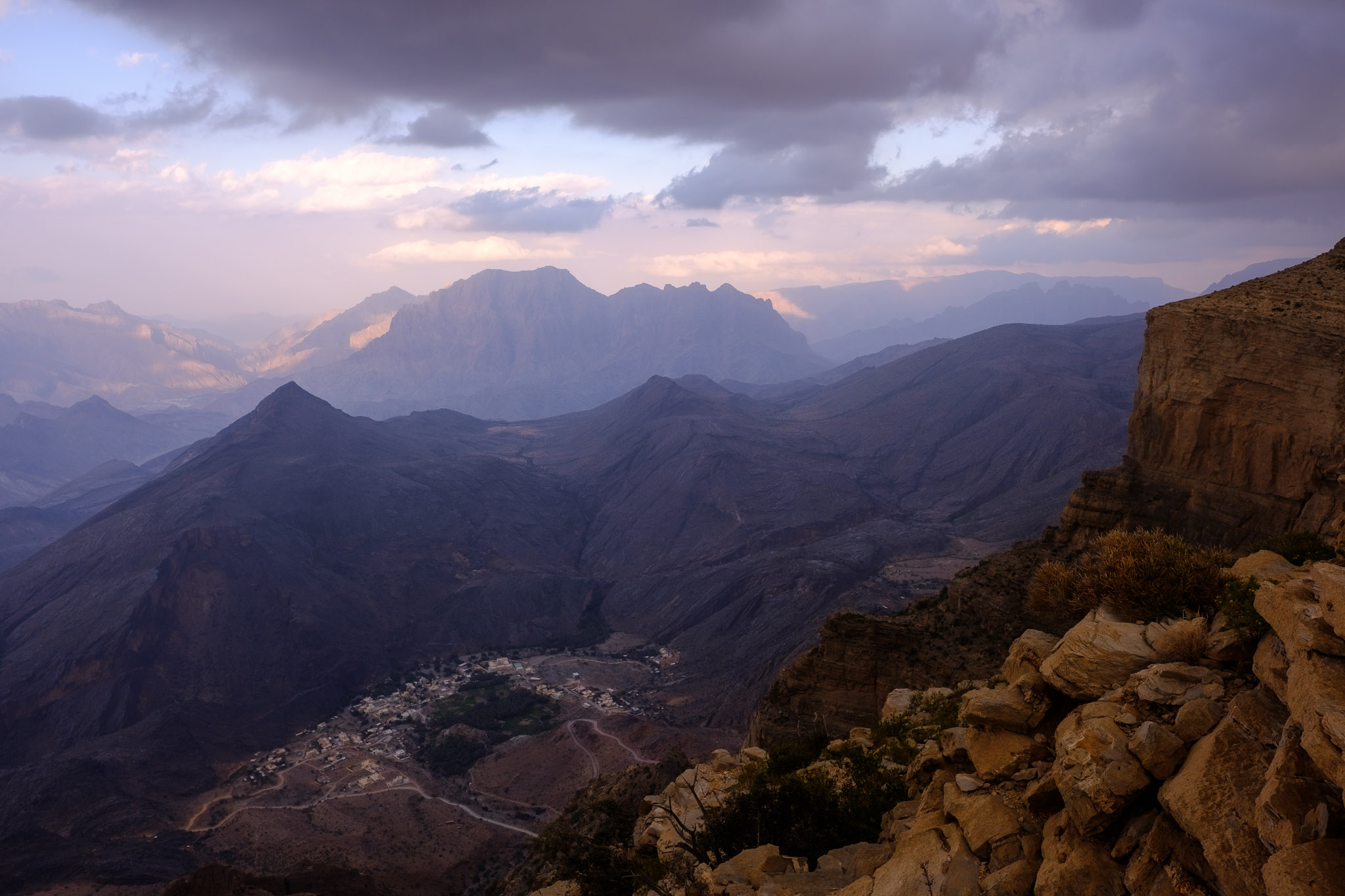
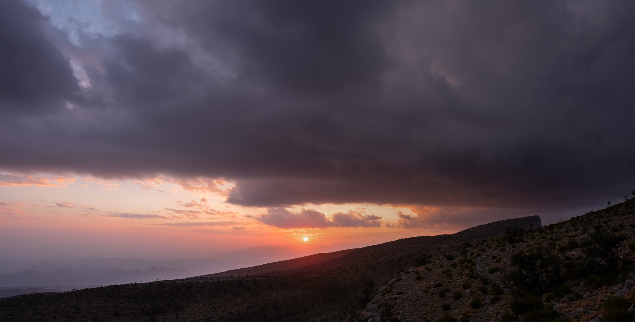
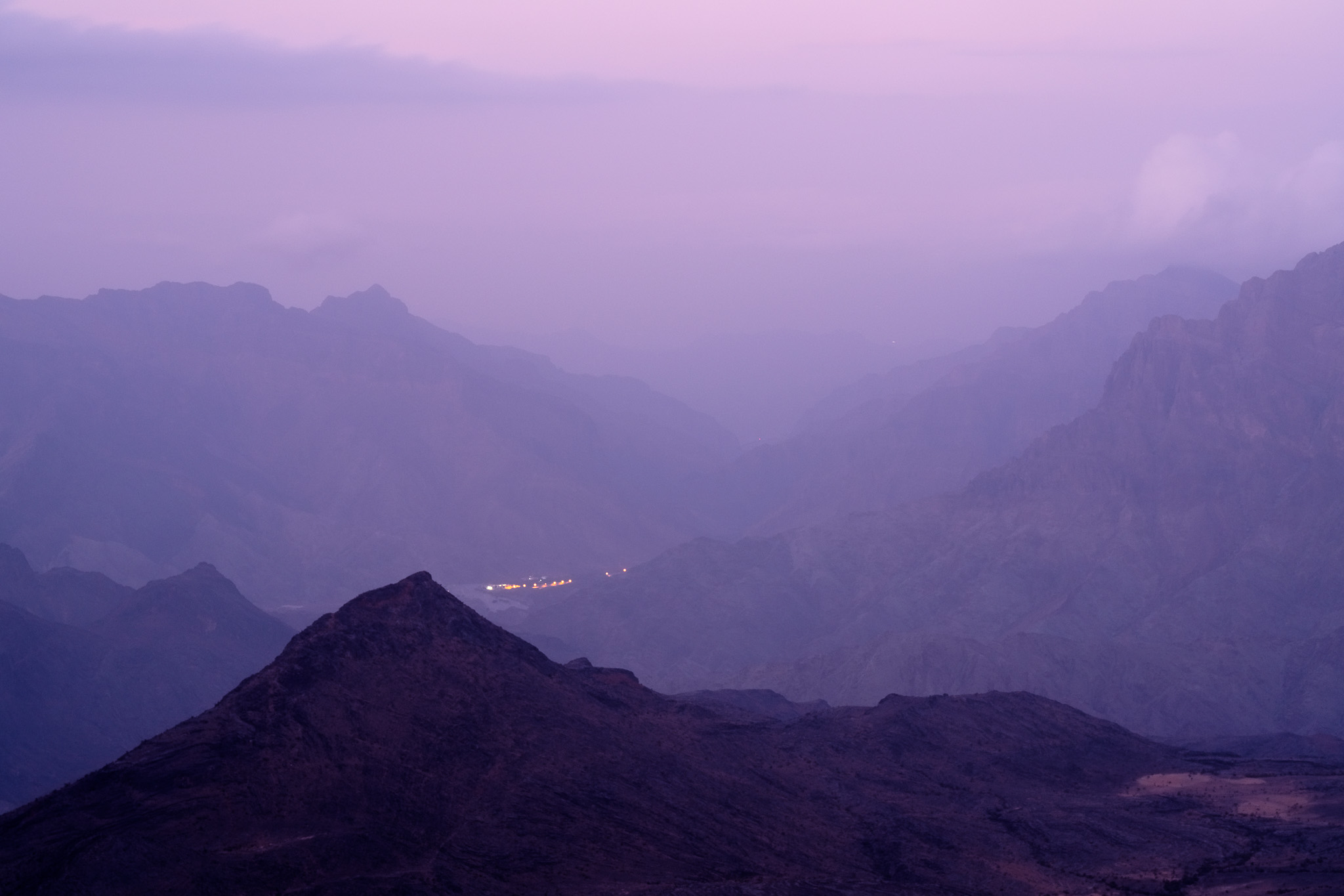
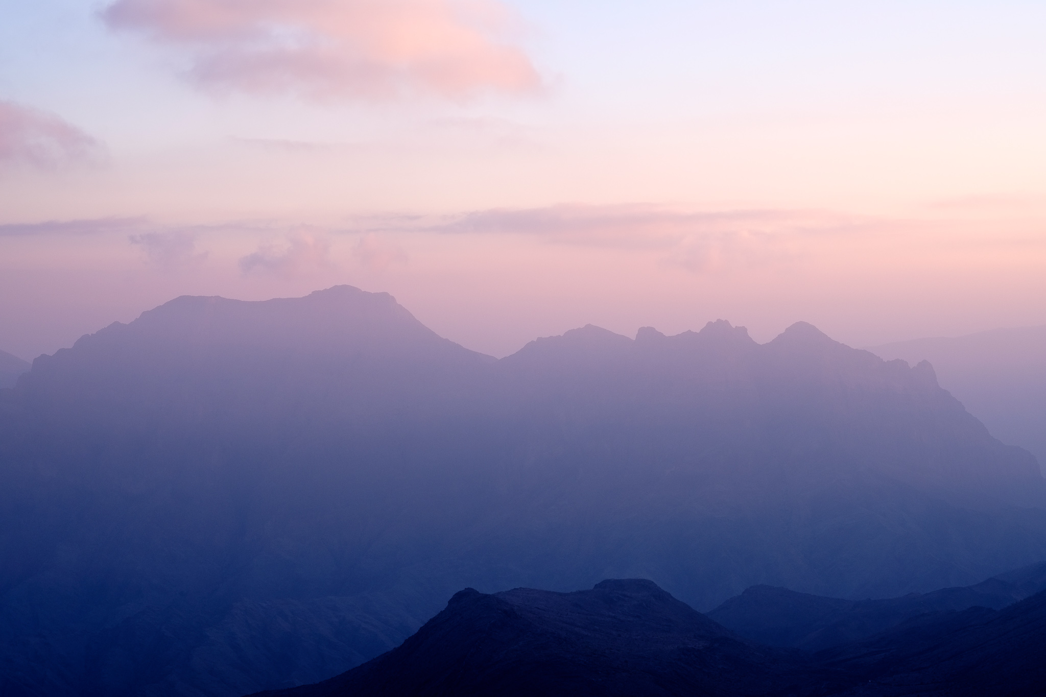
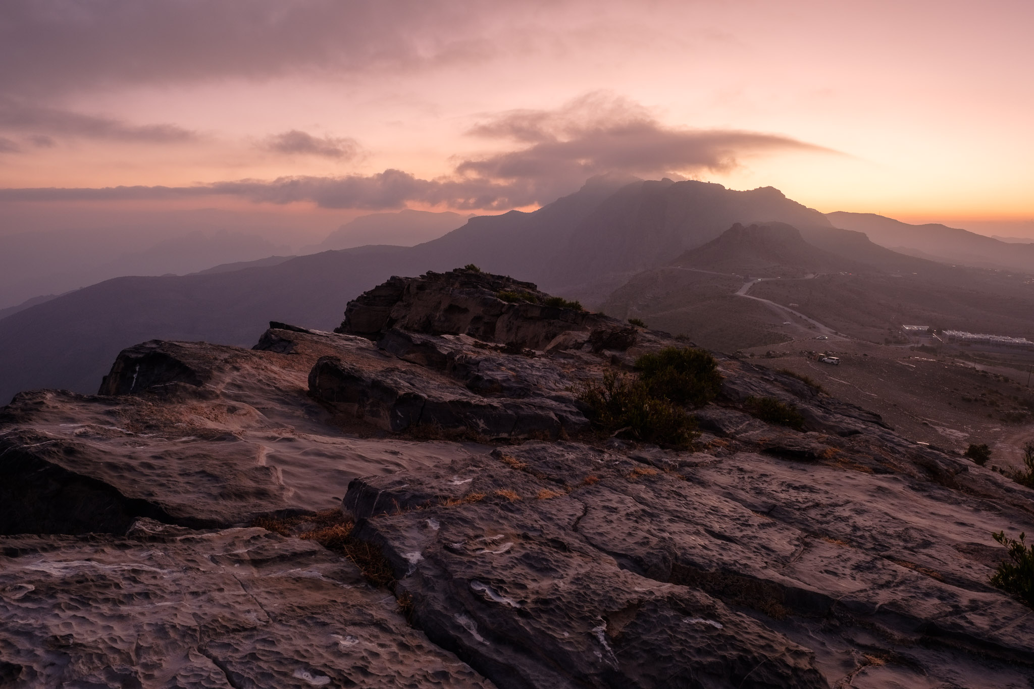
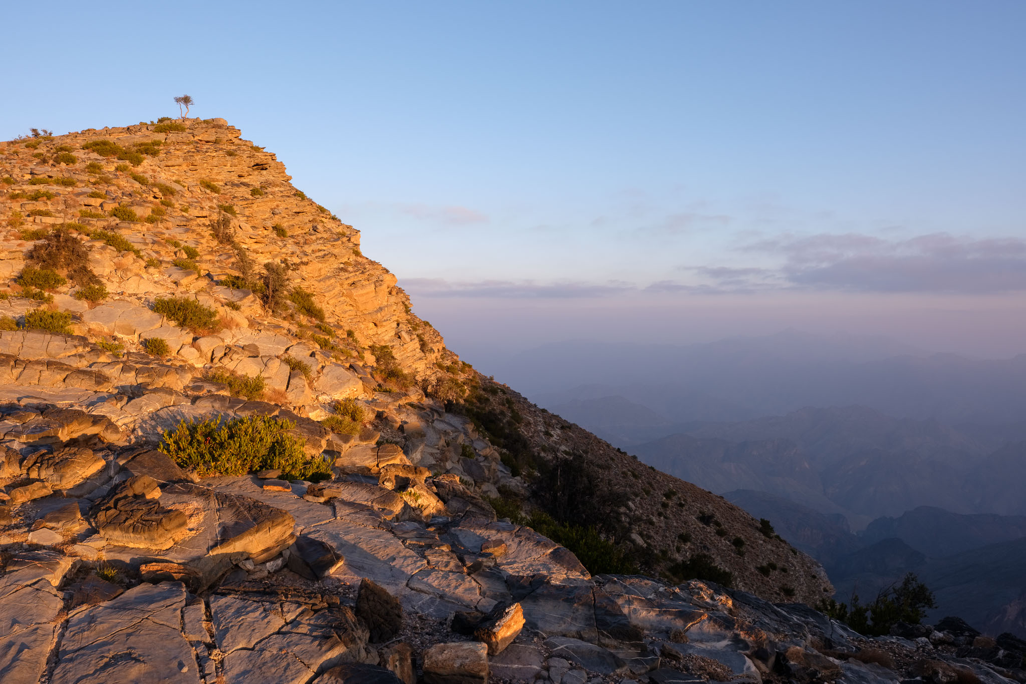
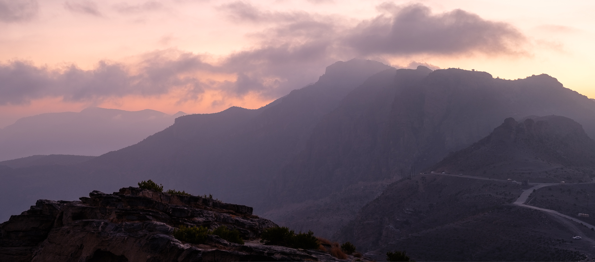
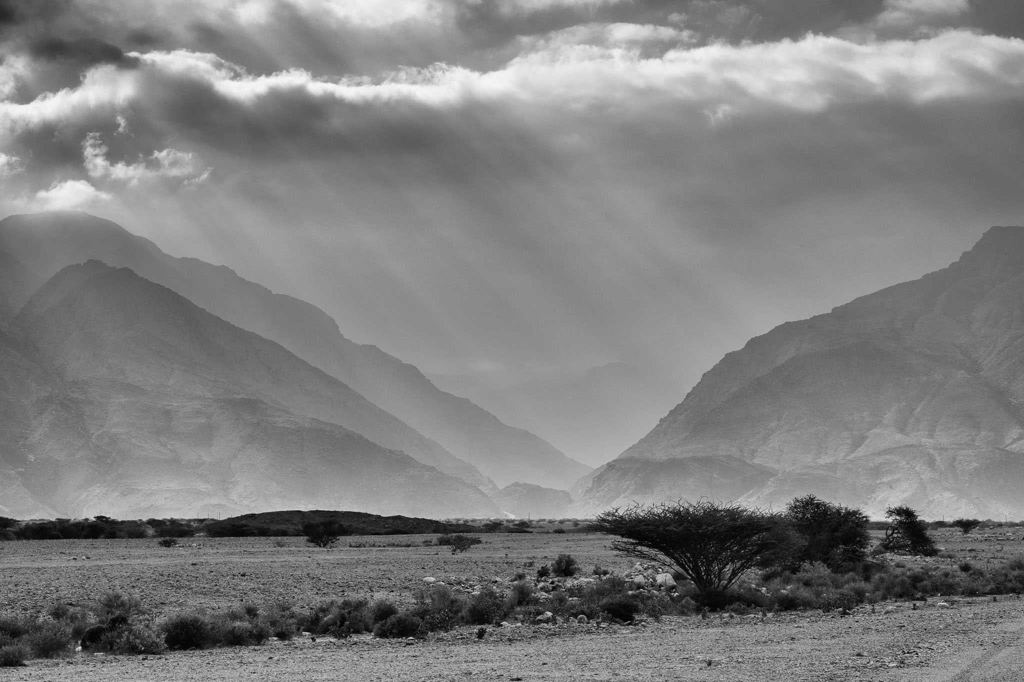
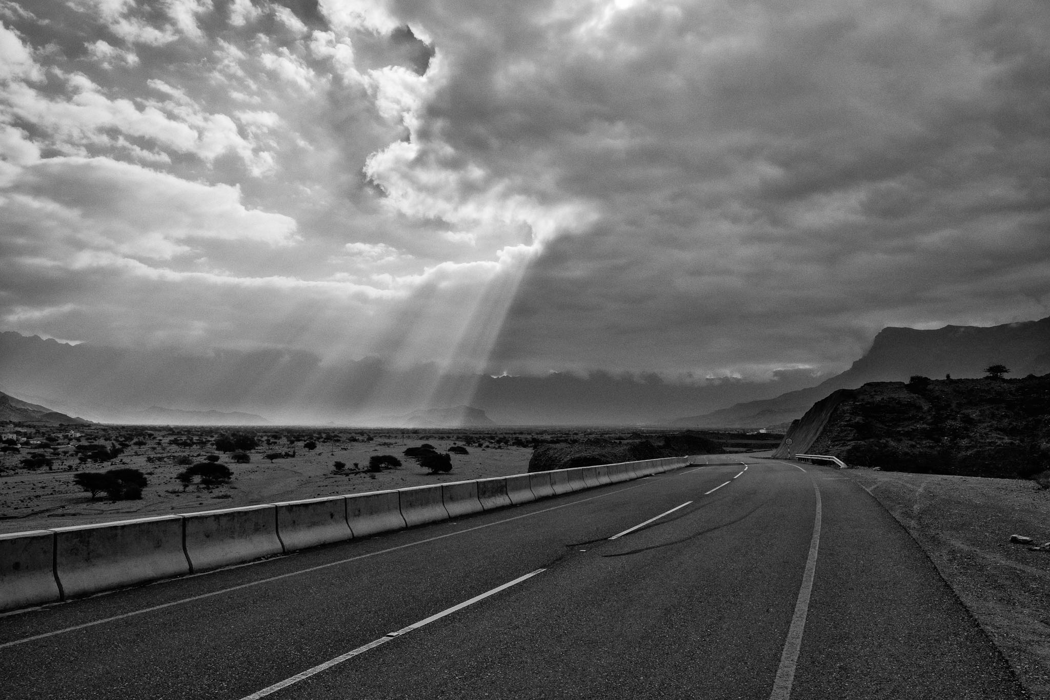
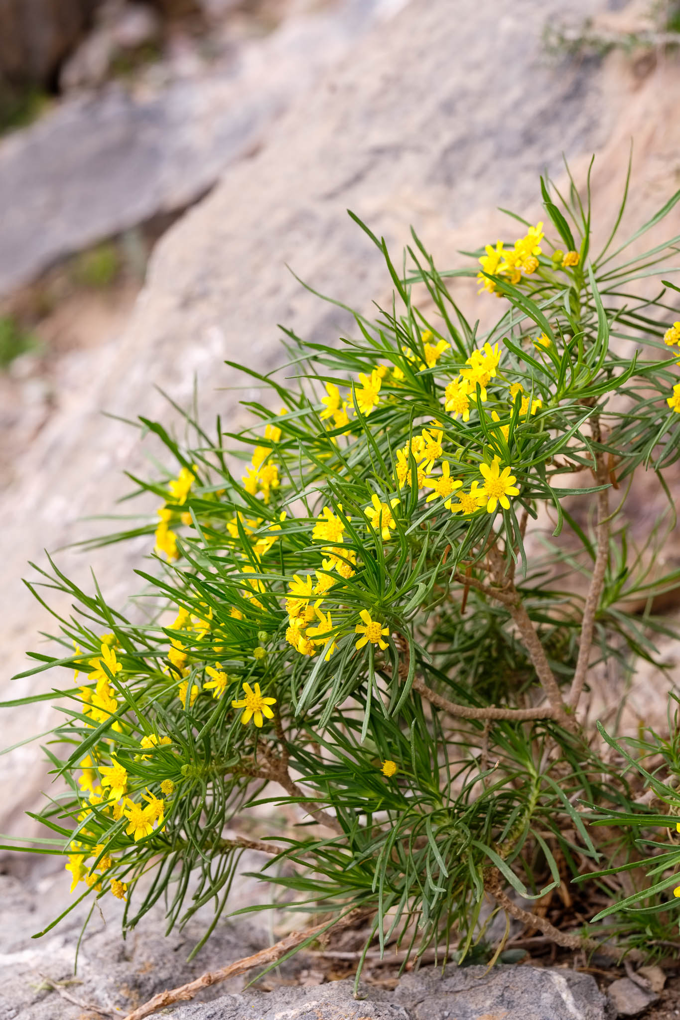
Going on a trip to the Jebel Akhdar mountains provides a good respite from the high temperature and humidity that prevail during the summer months. That is what I did by joining this month’s astronomy group trip to Jebel Sarra, a mountain plateau located near Jebel Shams. At an altitude above 2000 m, the weather is significantly cooler. We camped in a nice area surrounded by large trees, including the famous junipers. After setting up my tent, I walked around the hills waiting for the sunset, and took many photos of the beautiful landscape. Some clouds provided additional interest in the sky, making for an enjoyable end to the day.
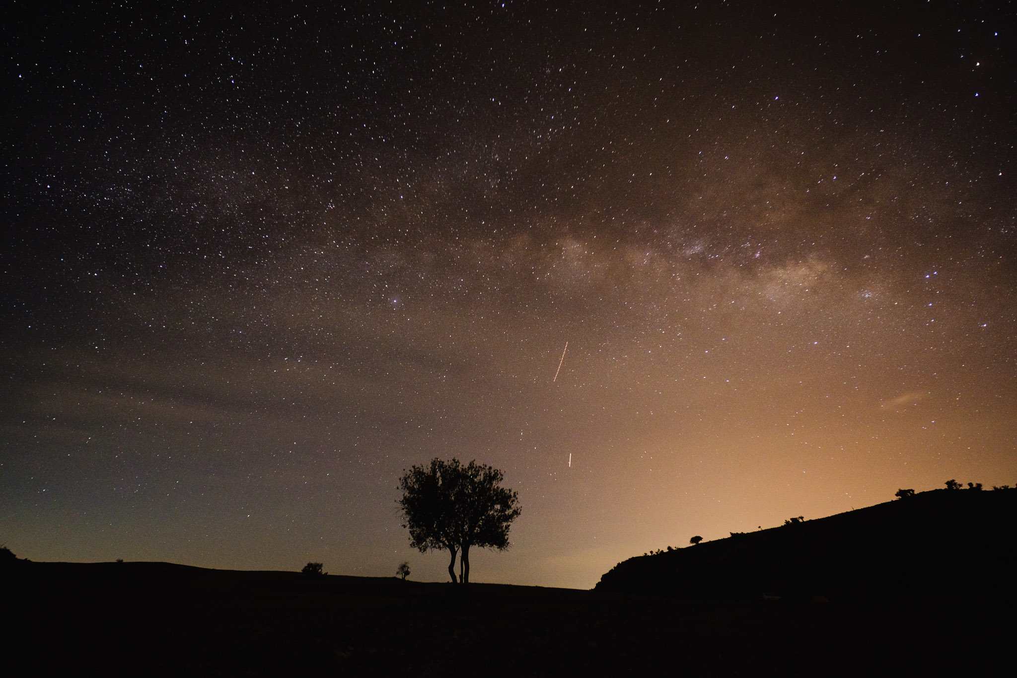
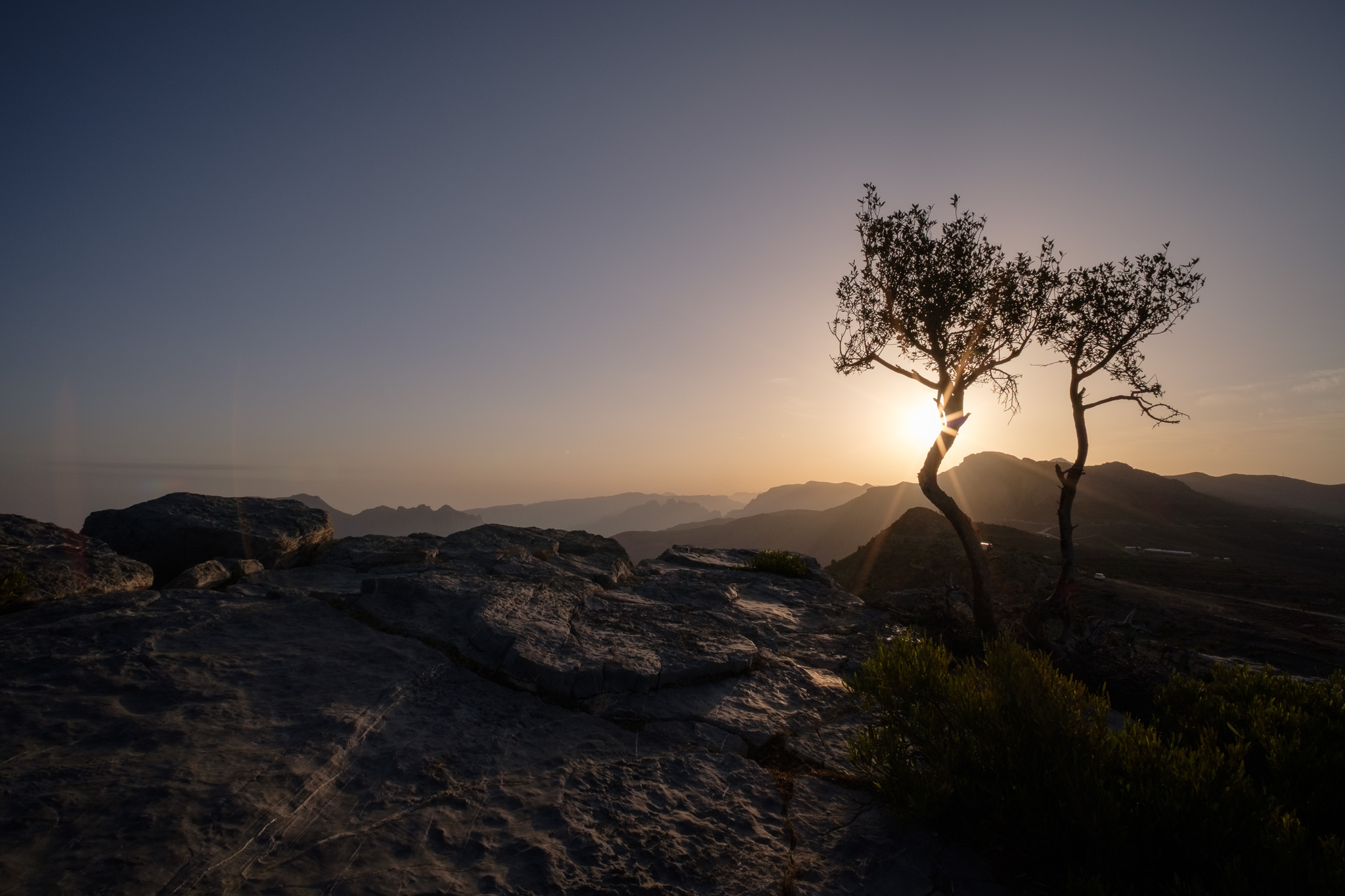
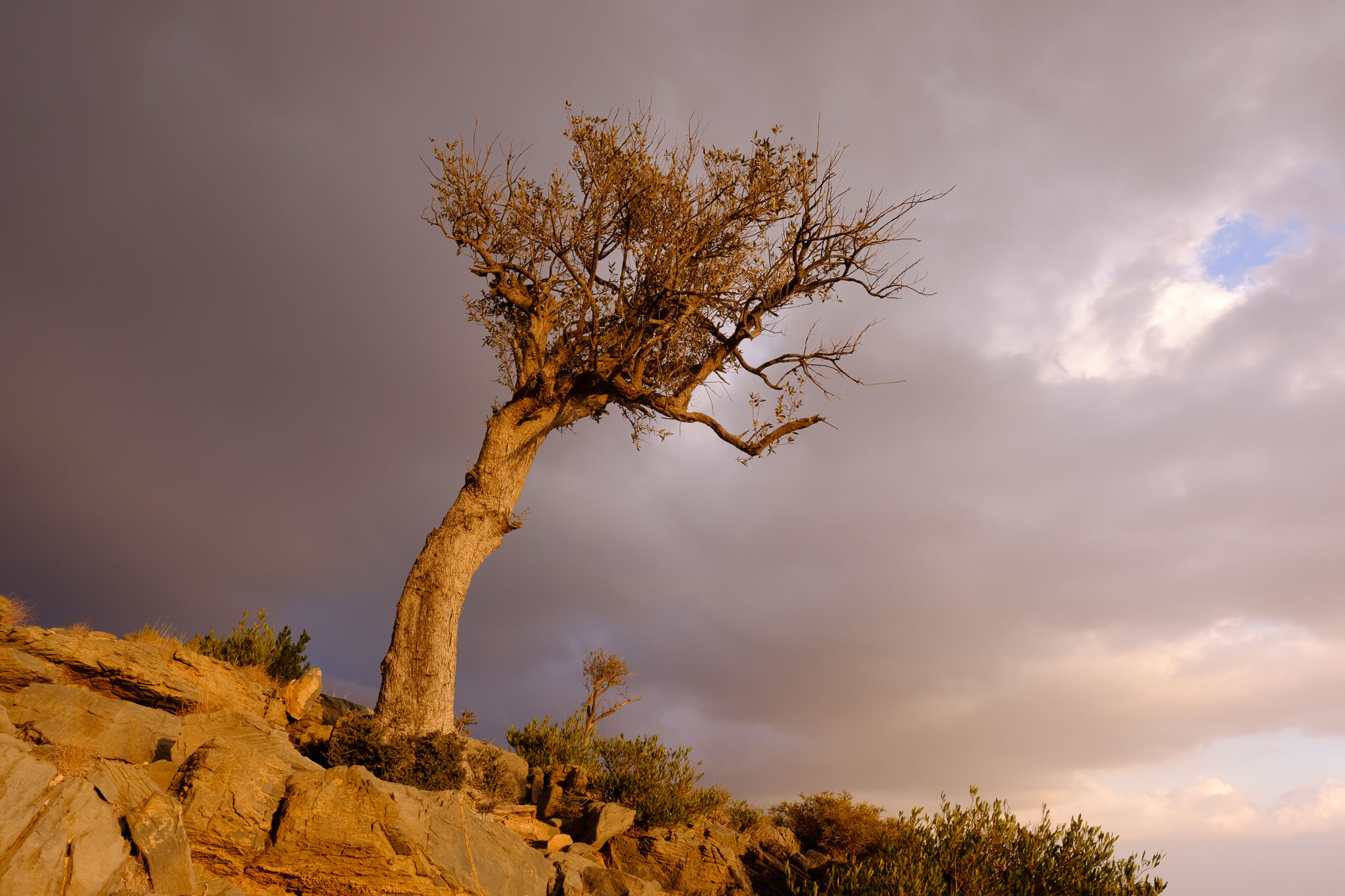
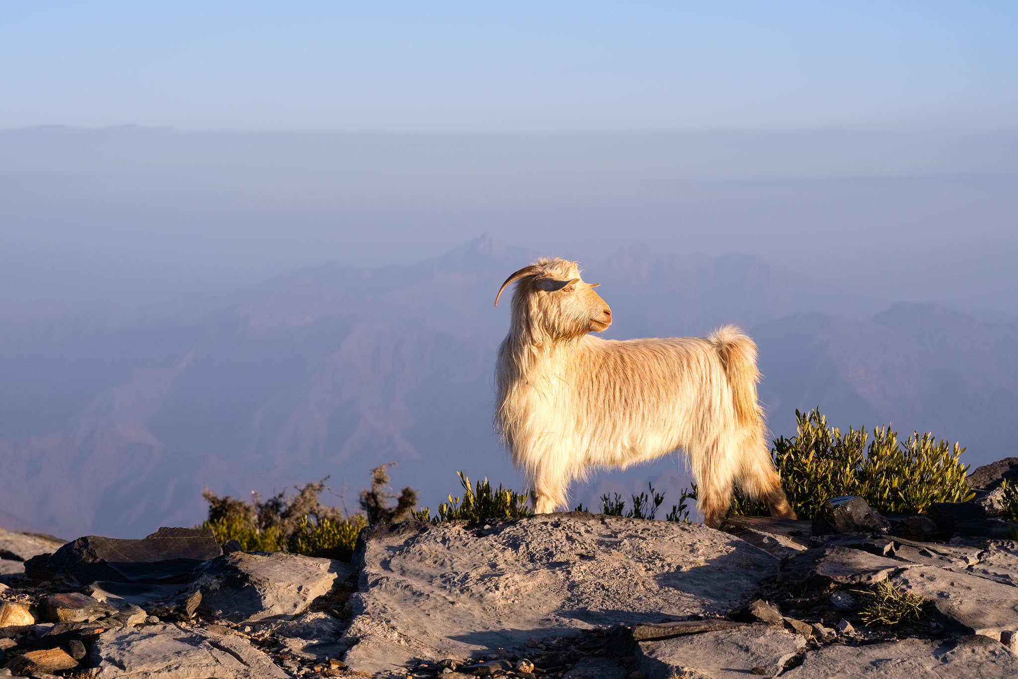
The trees with their twisted trunks create an interesting subject, especially under the golden light at sunset. A few goats were also roaming around. During this trip I chose to carry my two zoom lenses, the Fujifilm 10-24mm f/4 and the Fujifilm 50-140mm f/2.8; I also took the Voigtlaender 35mm f/1.2 for some night photos of the Milky Way.
Lone tree.Clouds at sunset.Sunset hills.Twins.Sunset tree.Twisting branches.Vigilant goat.Mountain landscape at sunset.Sunset.Sunset.
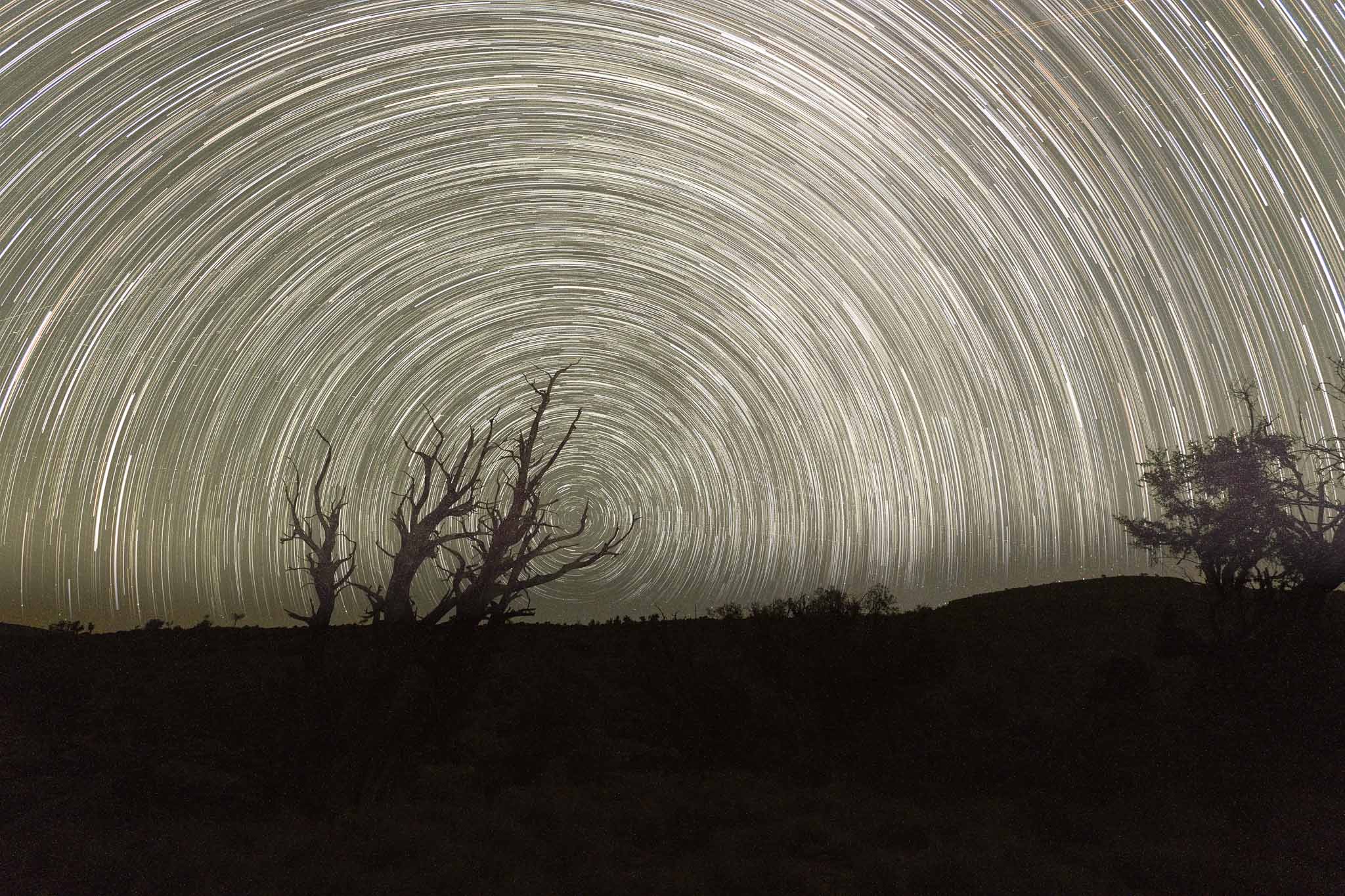
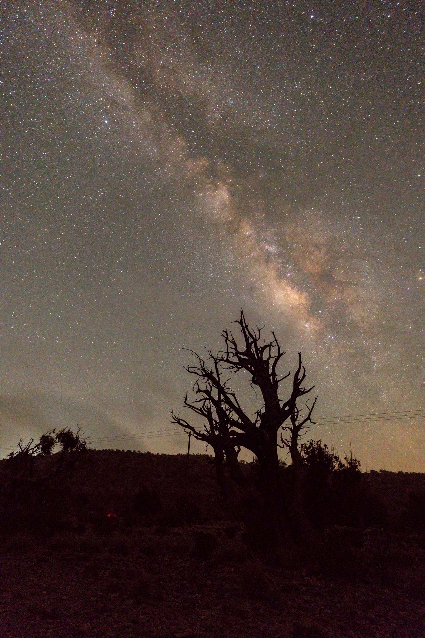
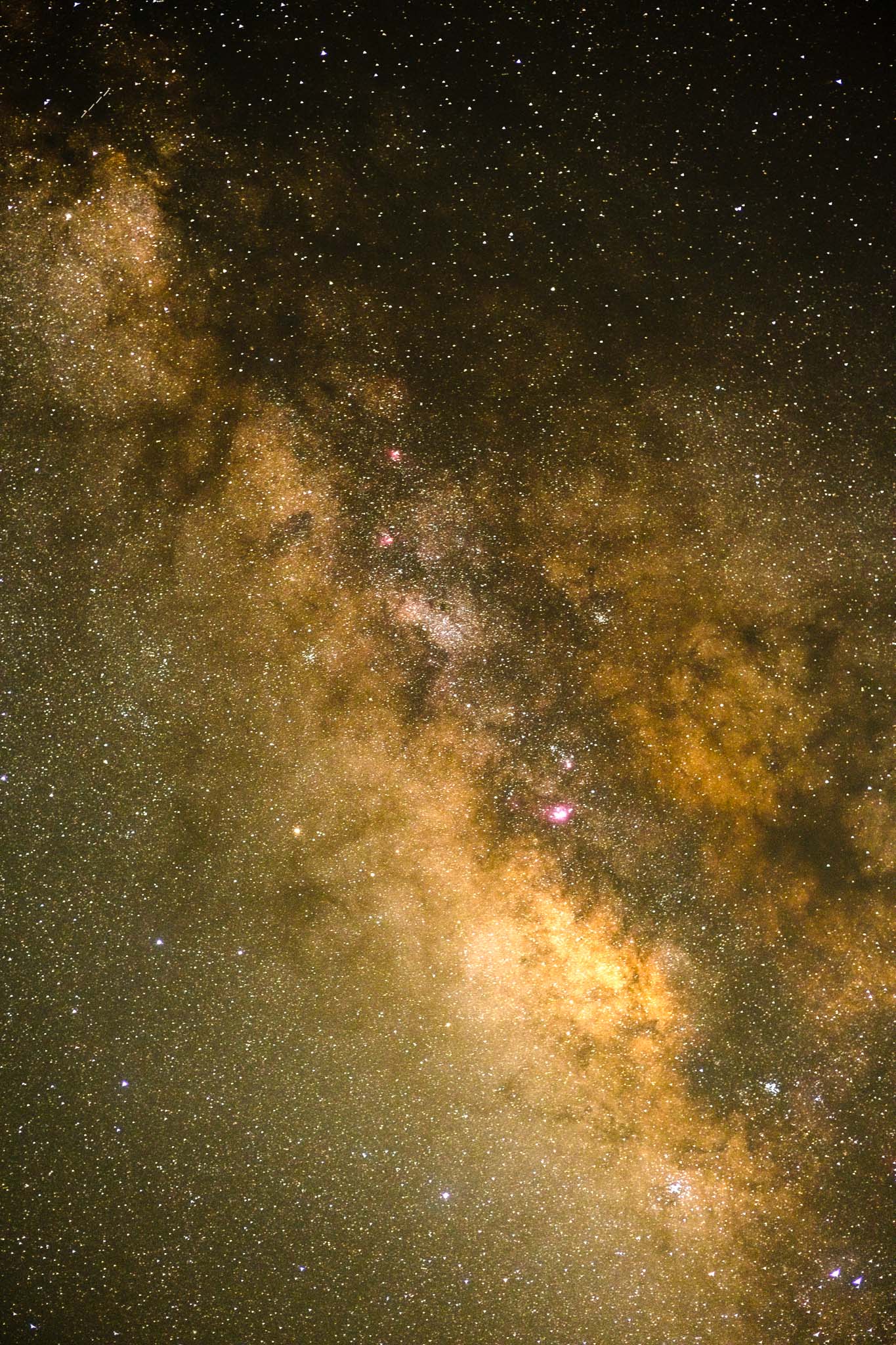
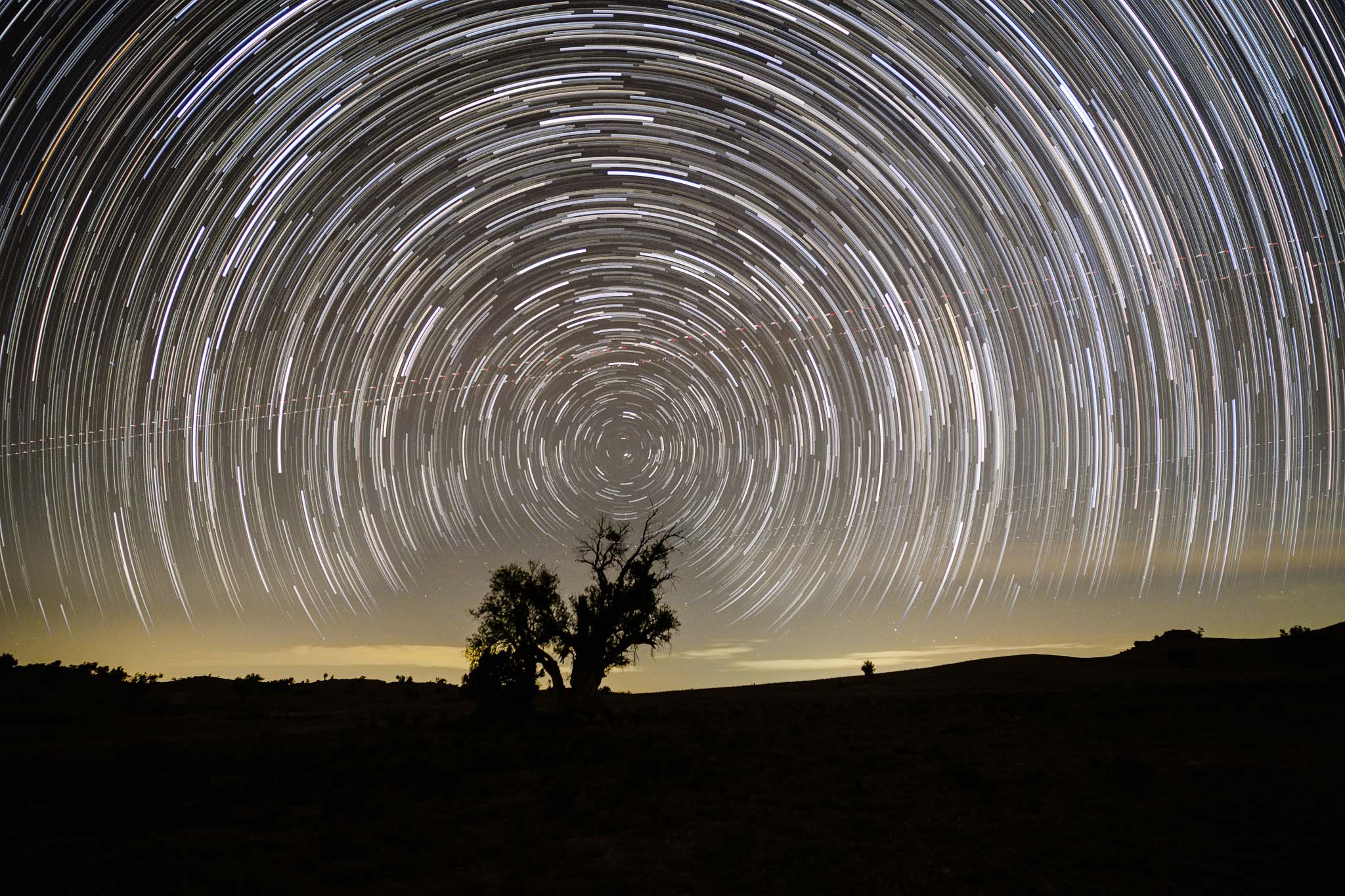
After the sun set, I had a nice dinner, and then joined the rest of the group for astronomical observation of several globular clusters and galaxies. I decided to make a star trail, setting the camera to shoot 150 photos of 30 seconds each, for a total time of 75 minutes; I also shot single images of the Milky Way. Finally I made 4 images of the Milky Way for stacking.
Star trail: 75 minutes total time.Milky Way: single photo.Milky Way: single photo.Milky Way: 4 stacked photos of 10 seconds each.
Being in a dark sky area is always a wonderful experience, and I was happy with the images I got. I wanted to photograph at sunrise, so I was not able to get much sleep; summer nights are short. Thus, in the early morning I took a few more photos of the surrounding trees. It was another great weekend in the mountains.
I finished that article with the following sentence: “I plan to return during springtime, when the roses will be in bloom”. Between March and May, the indigenous abundant pink damask roses burst into full bloom, coloring the terraced gardens, and filling the air with a wonderful perfume. During this season, the harvested petals are distilled according to ancestral traditions, to extract varieties of pure rose water and oil. In mid-April I was able to return for a couple of days to experience the rose season.
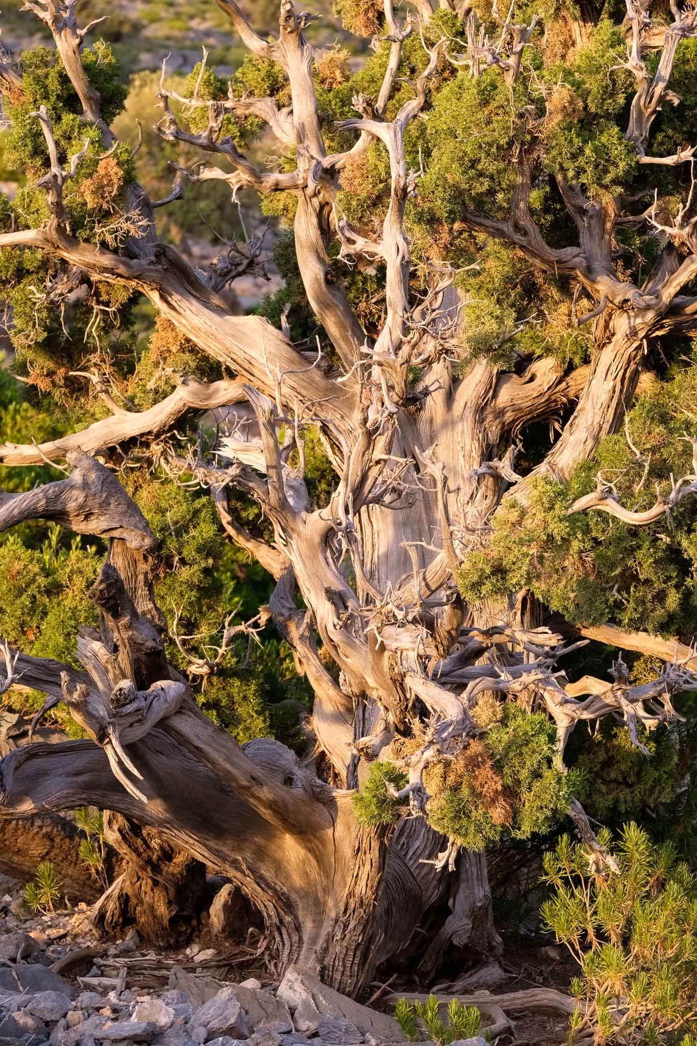
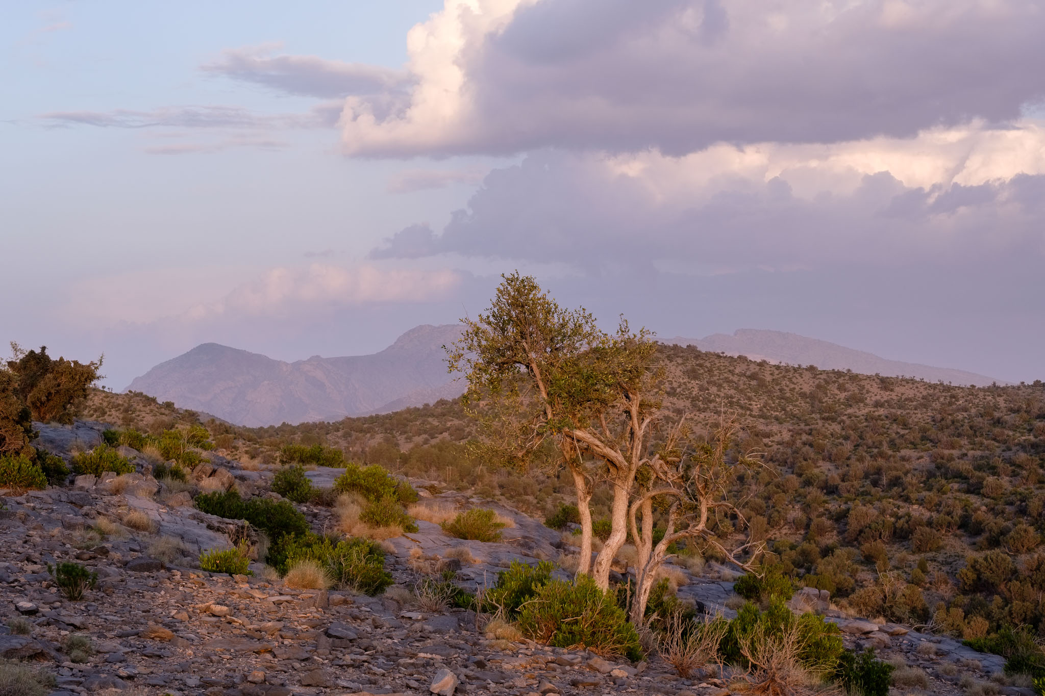
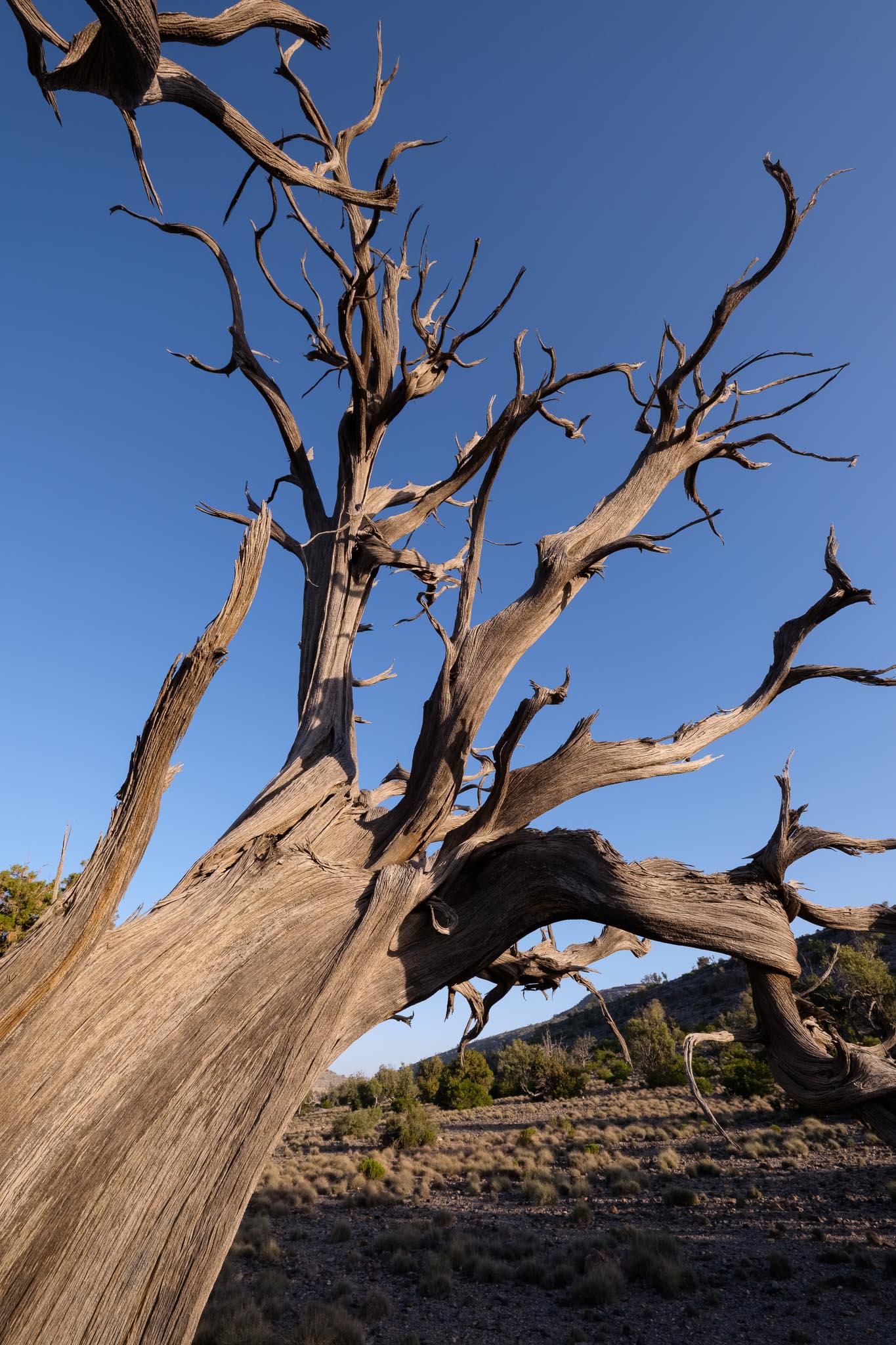
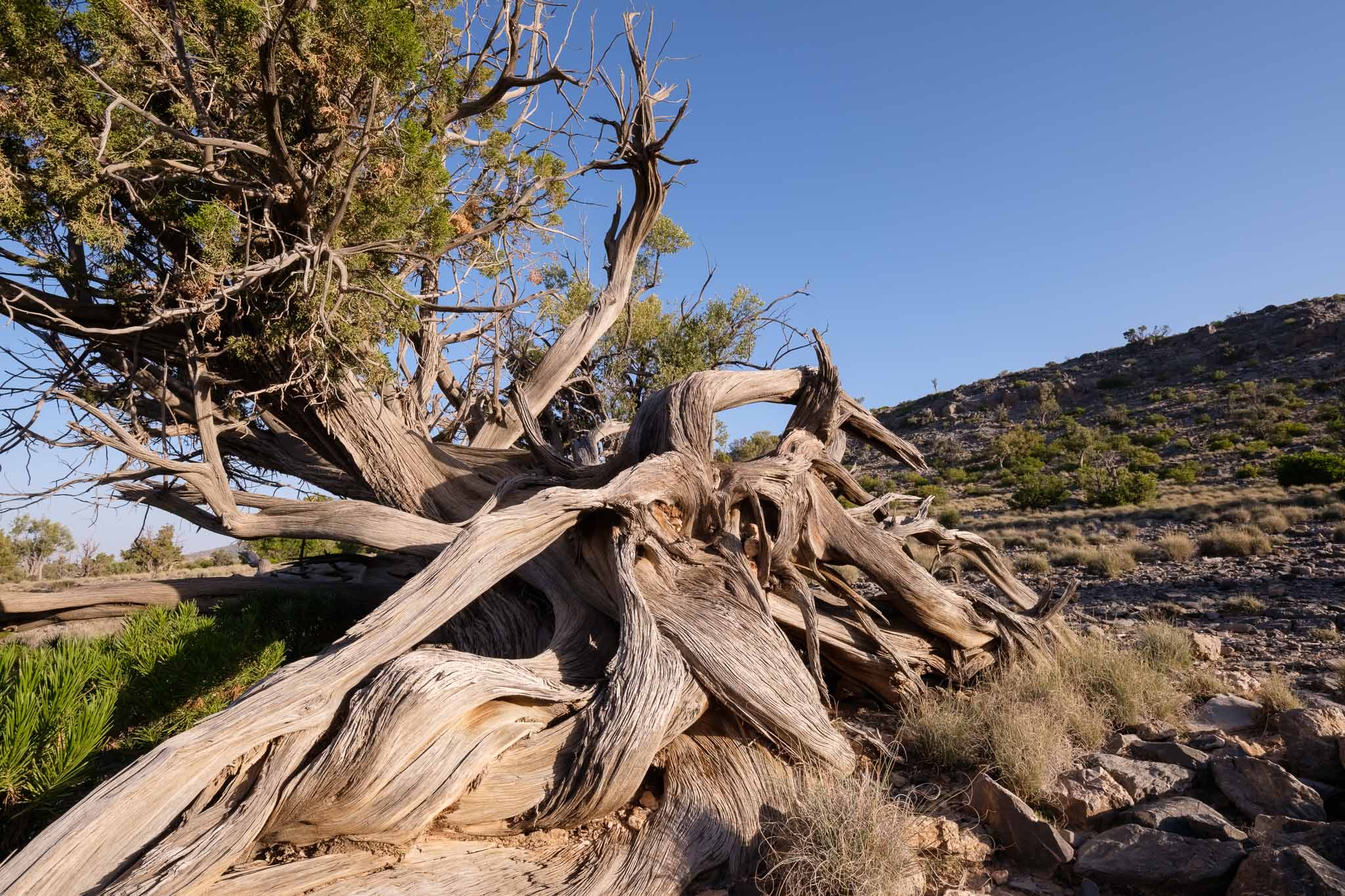
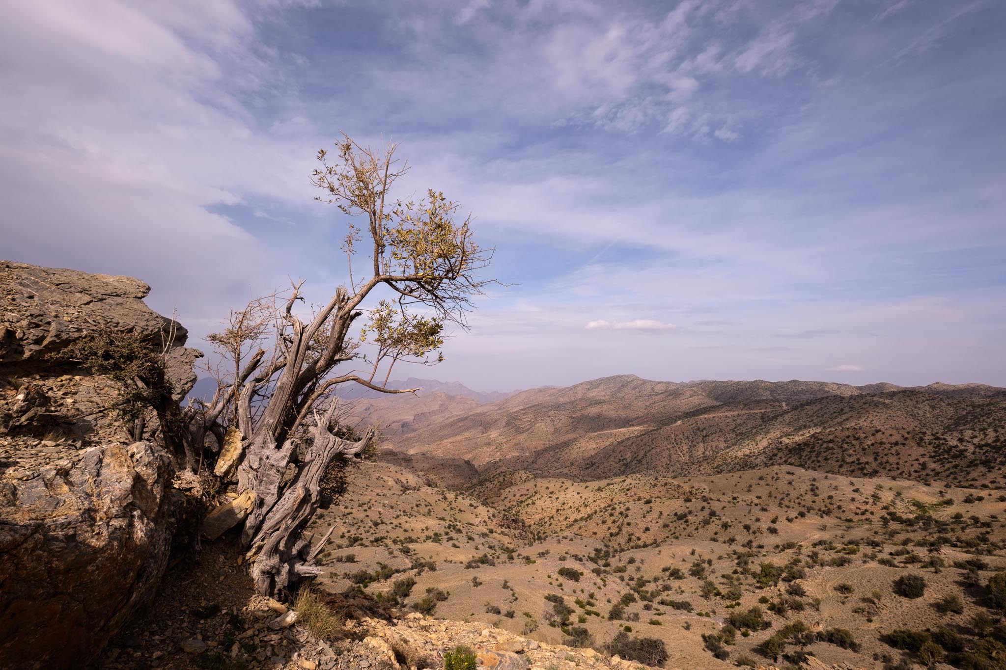
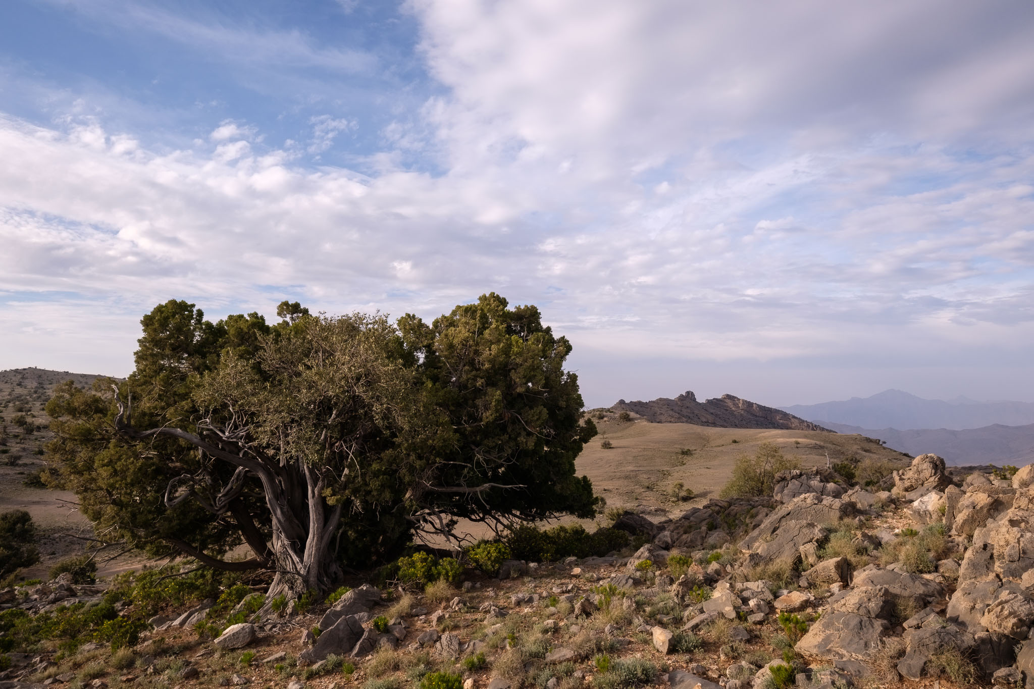
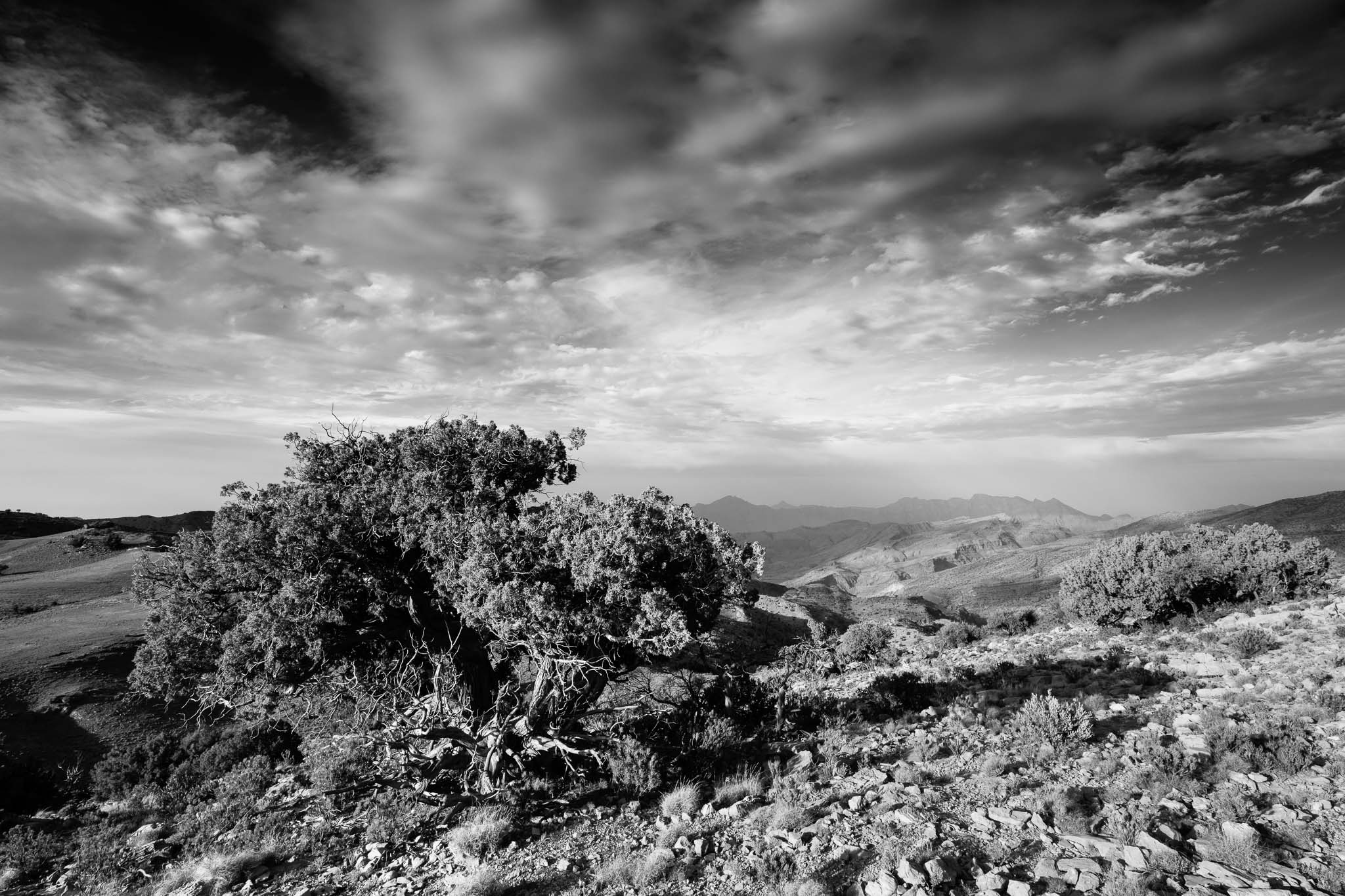
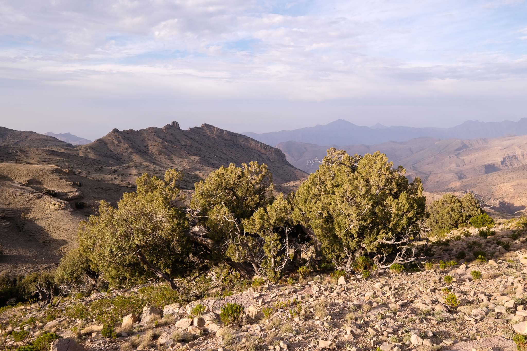
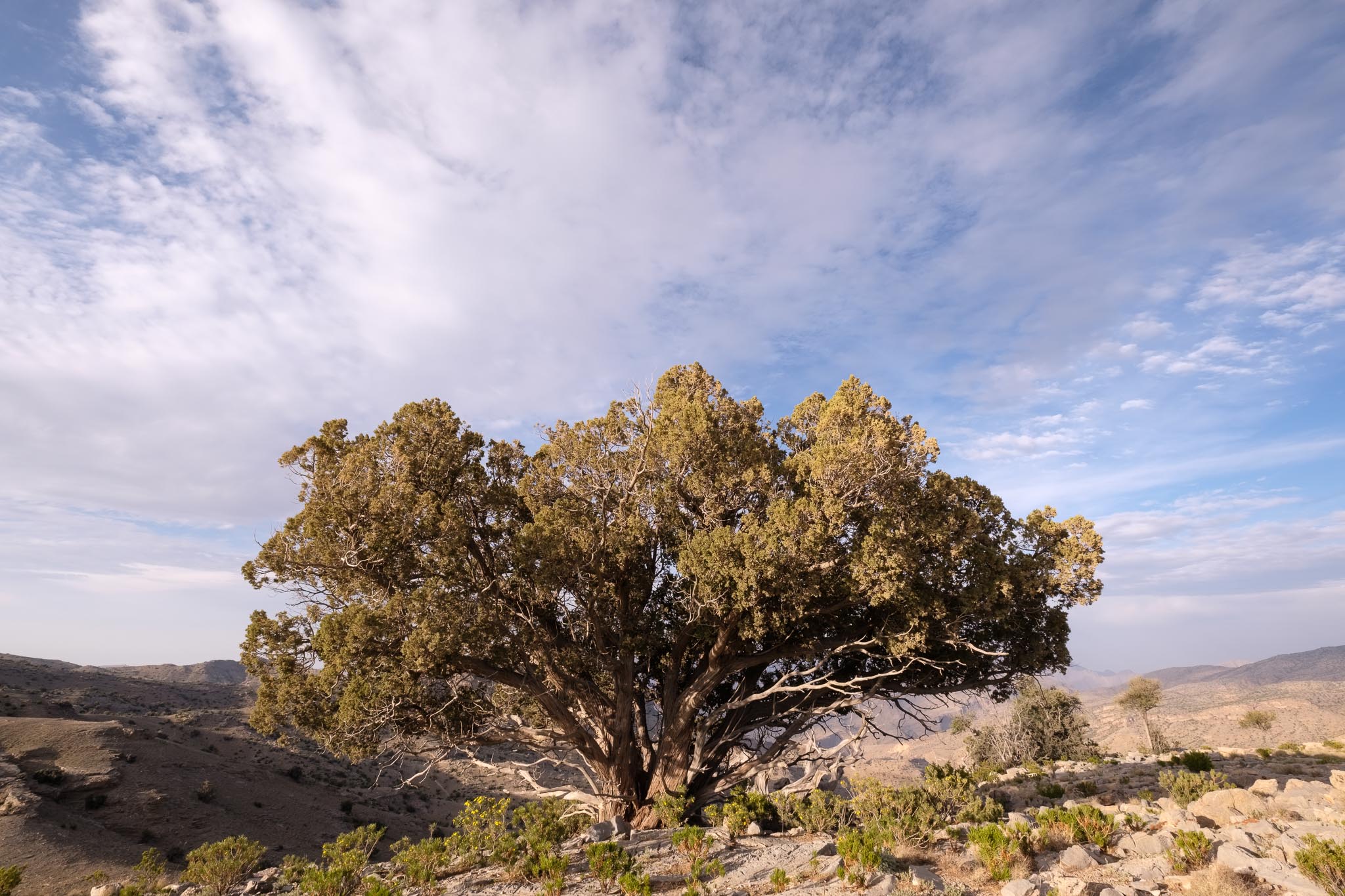
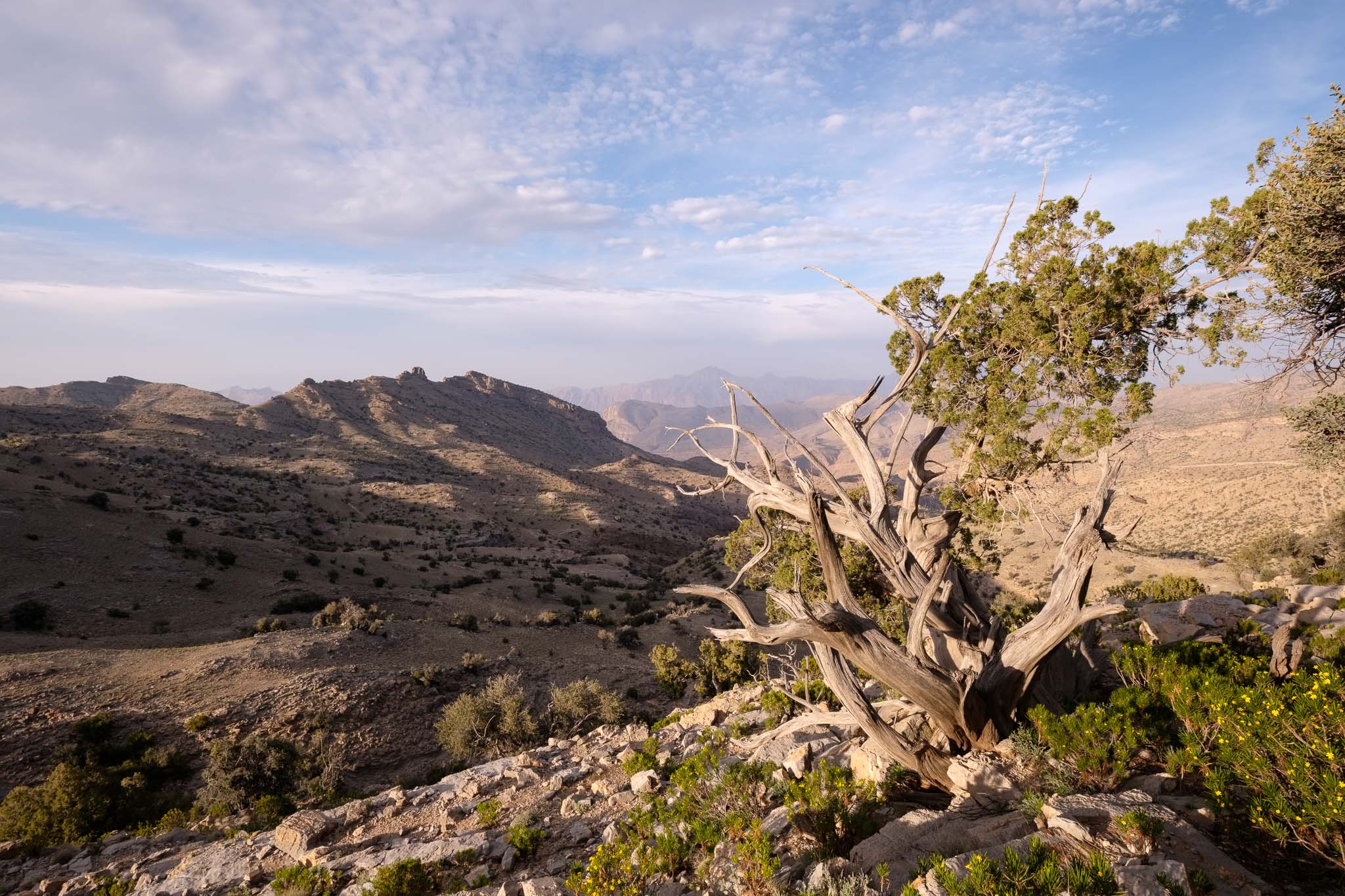
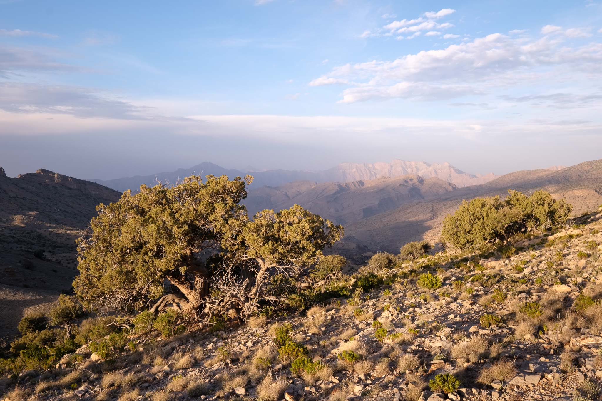
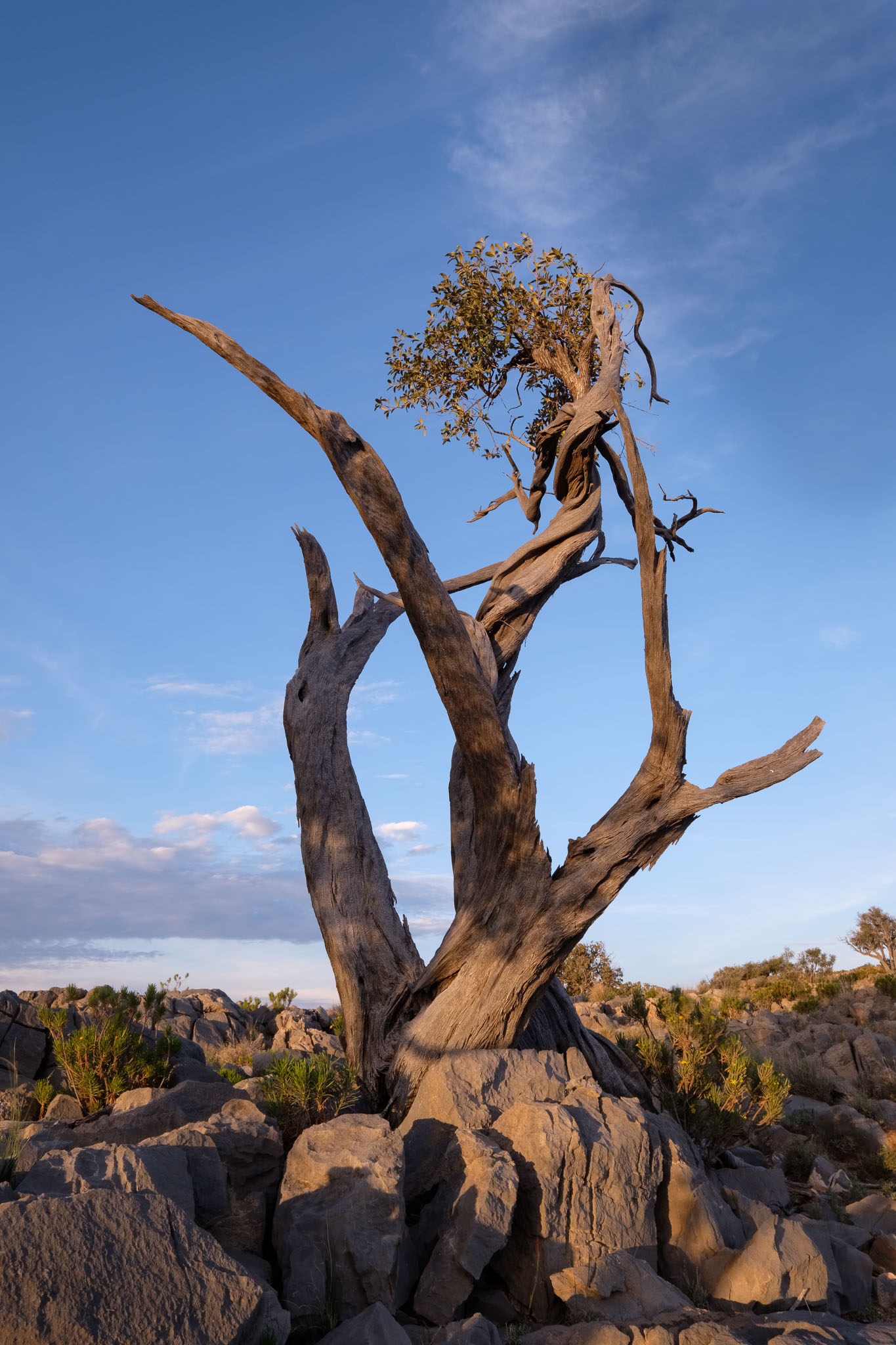
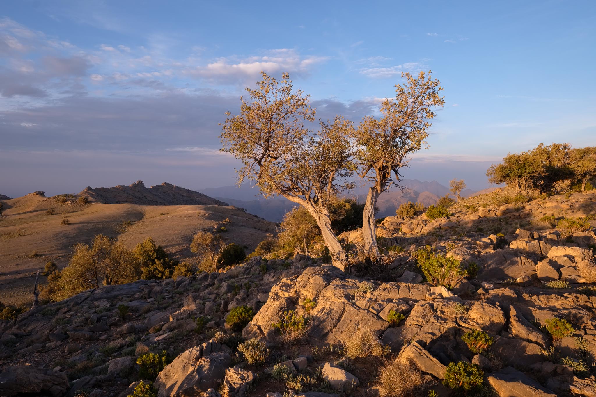
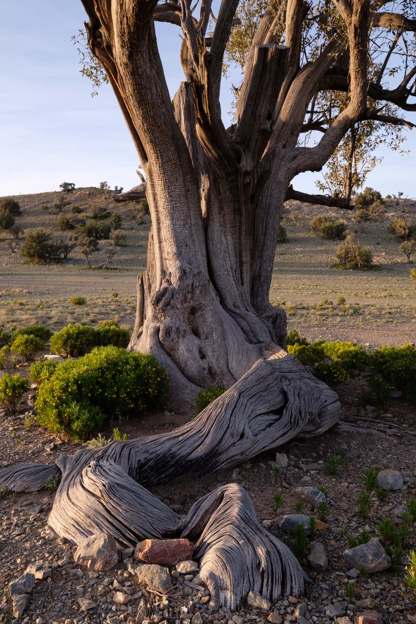
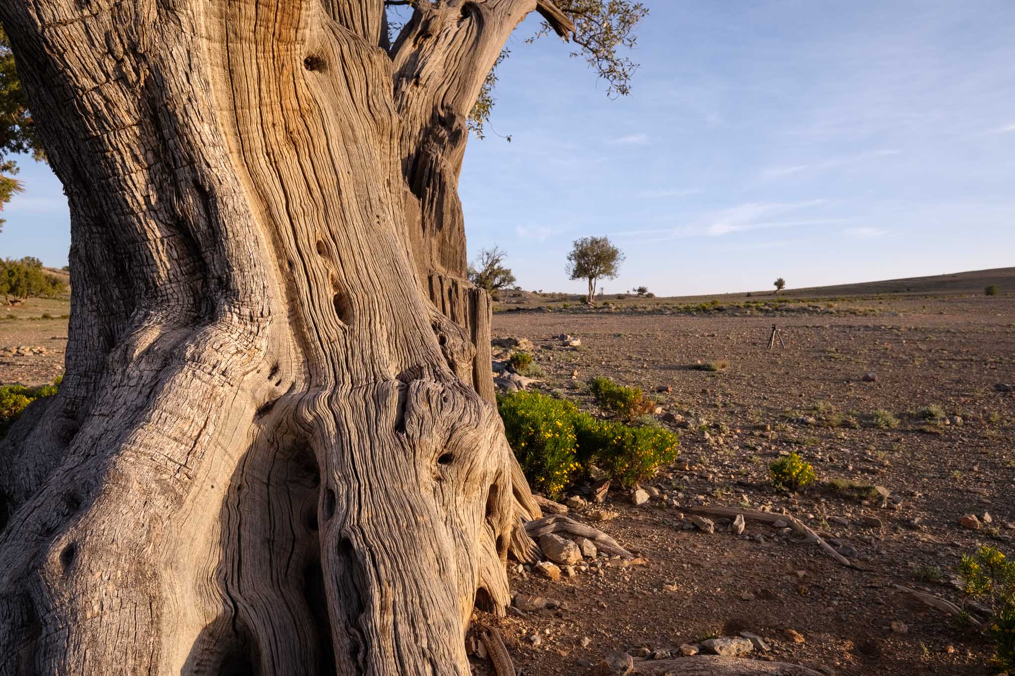
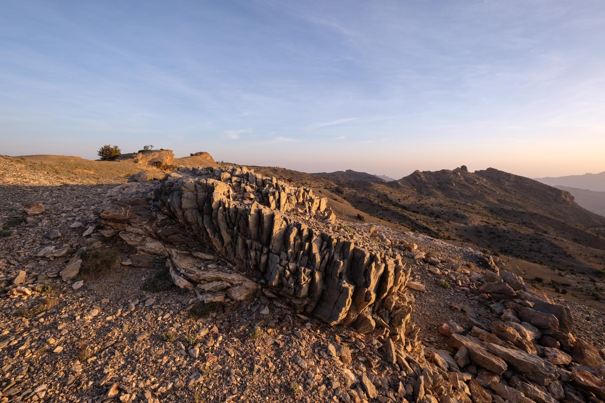
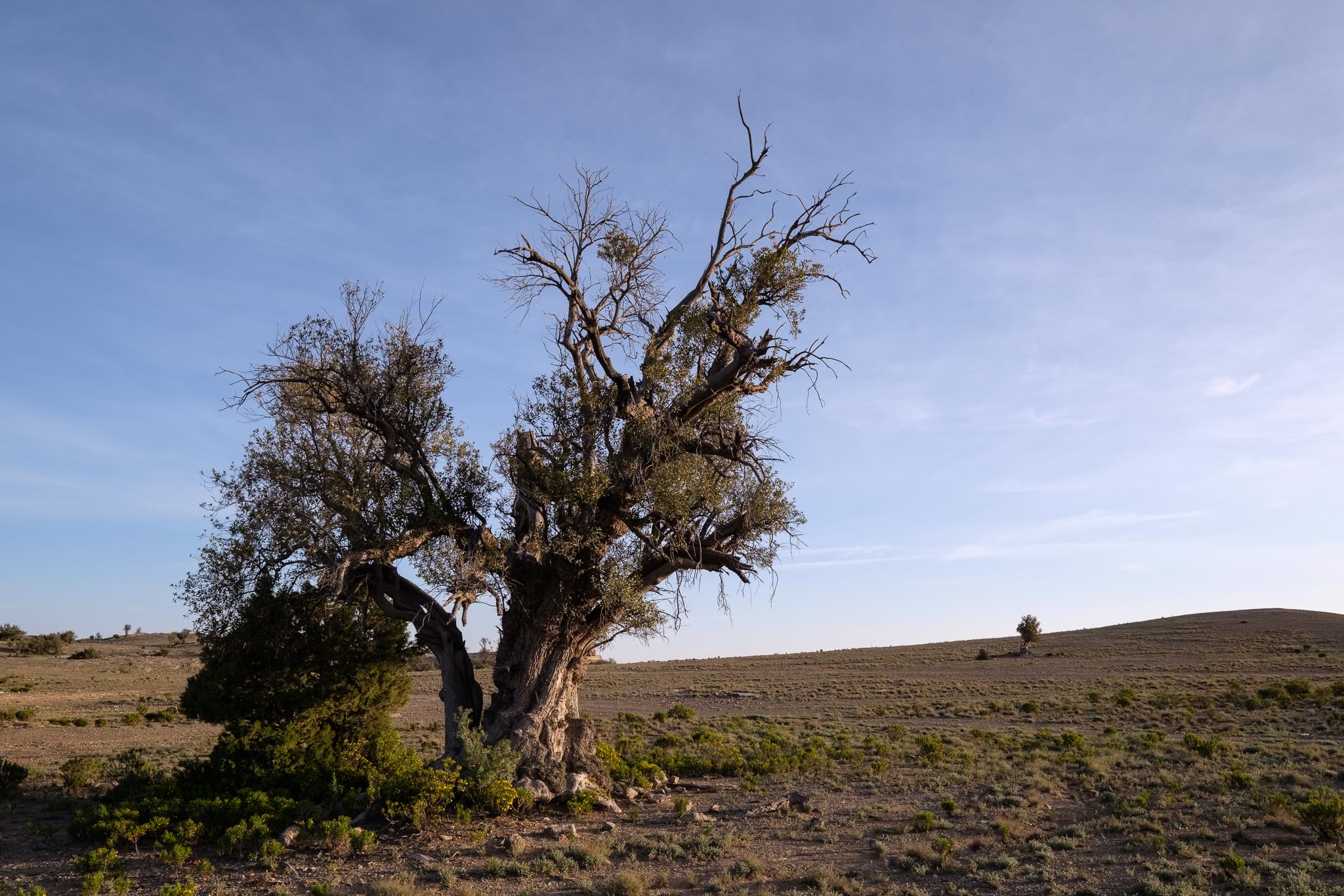
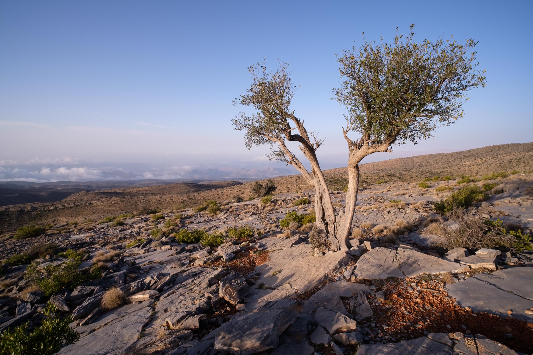
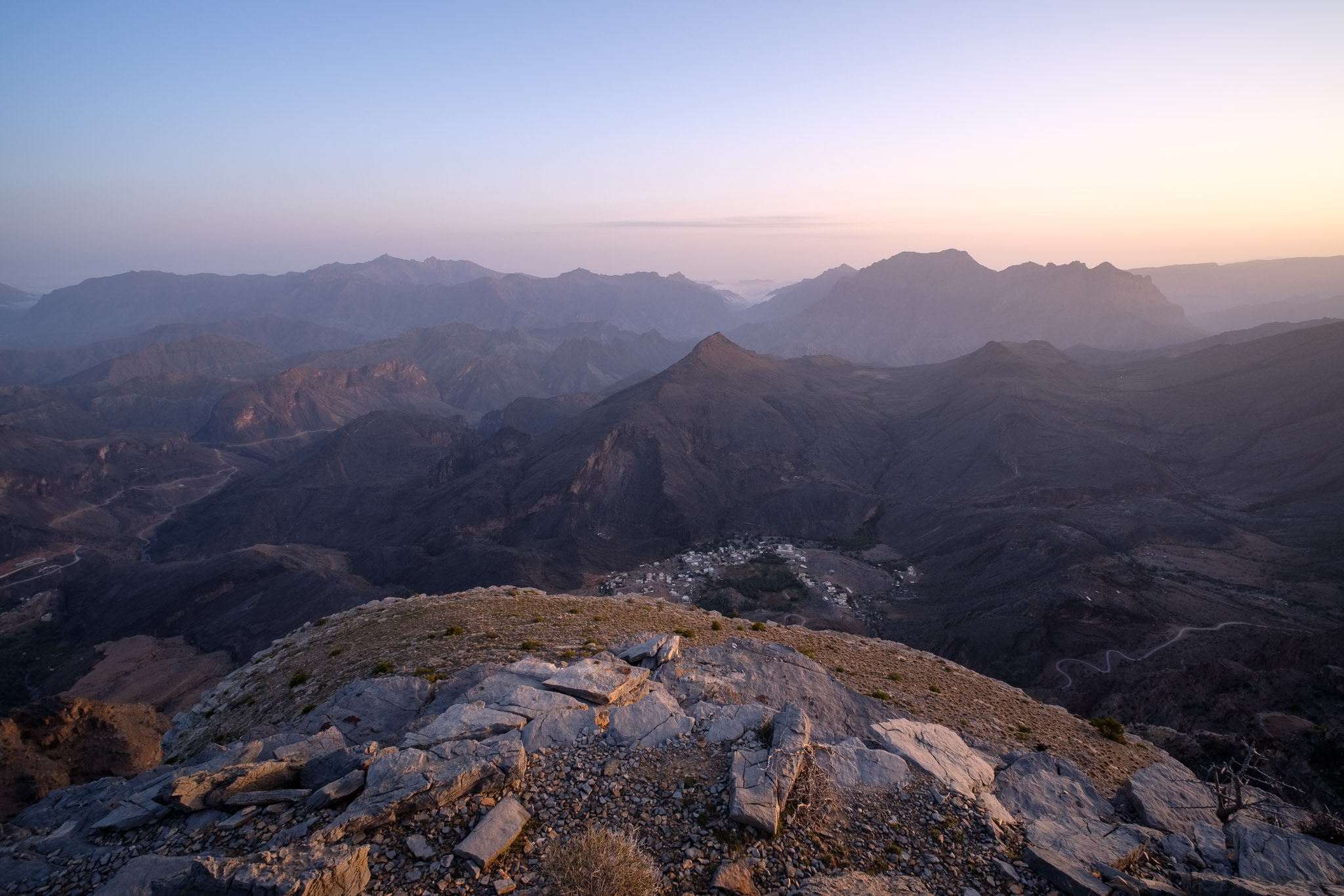
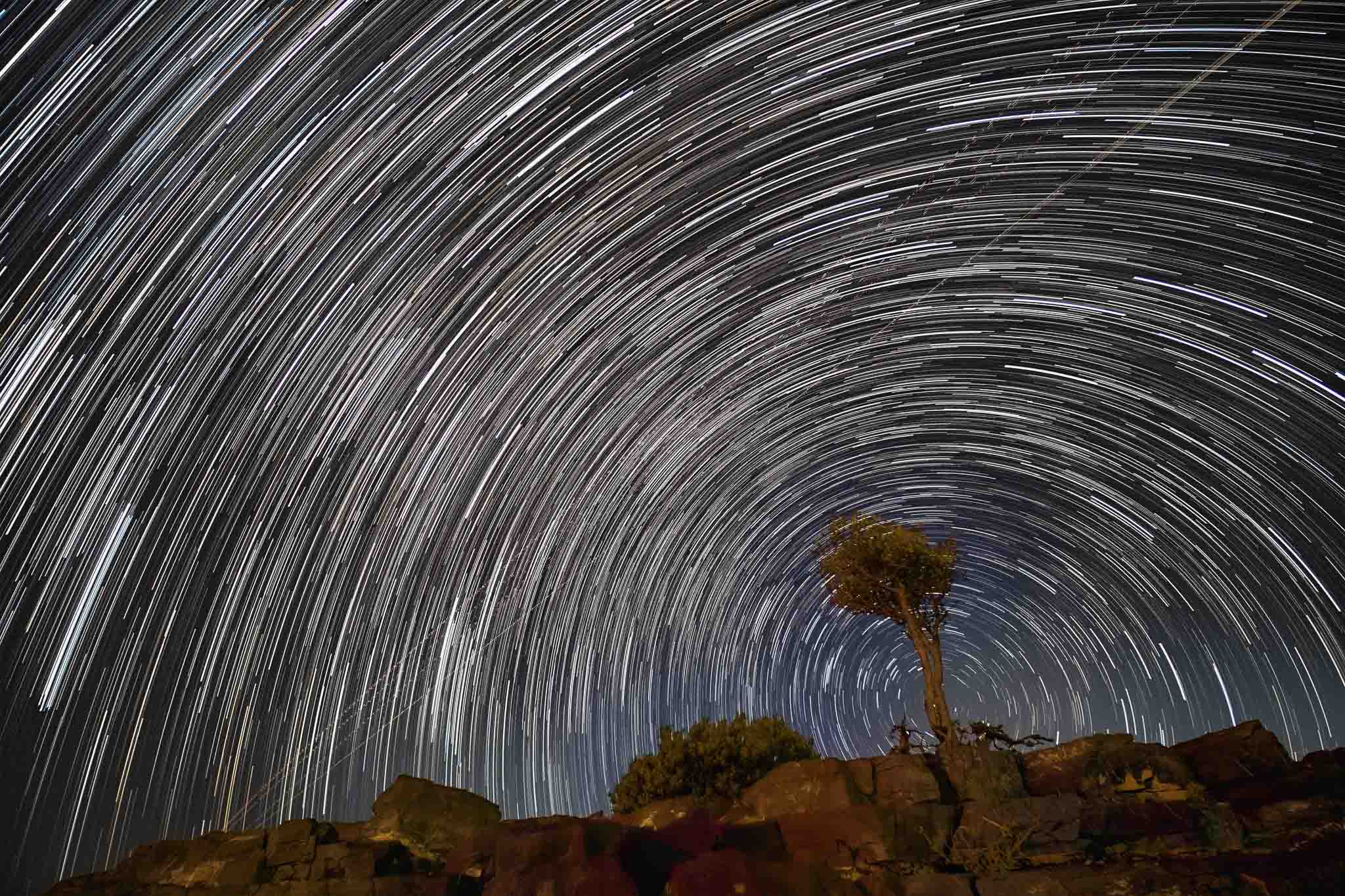
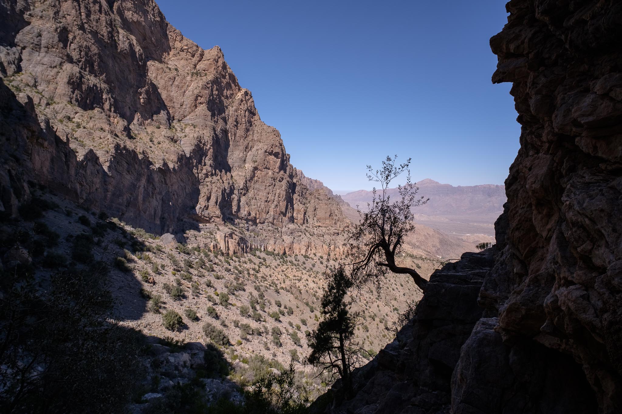
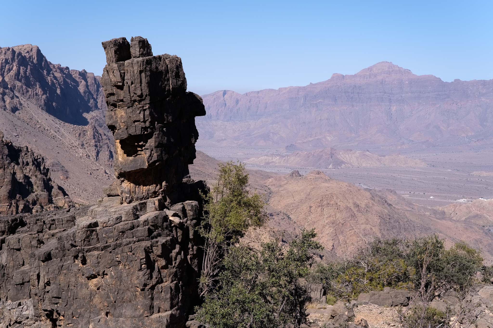
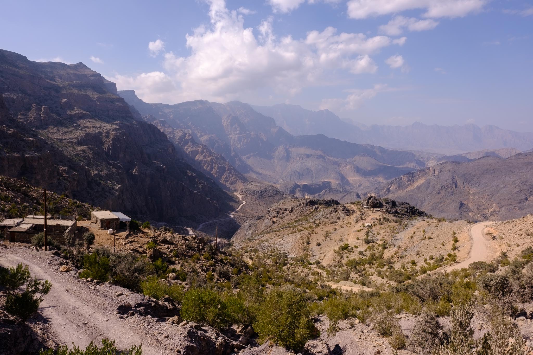
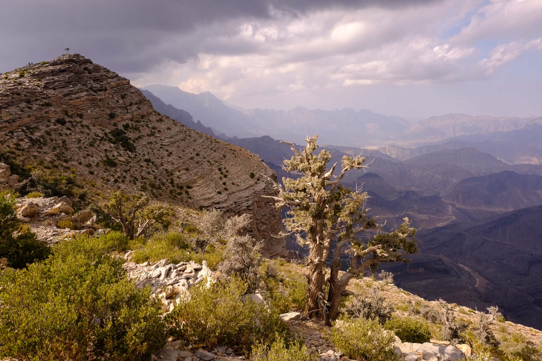
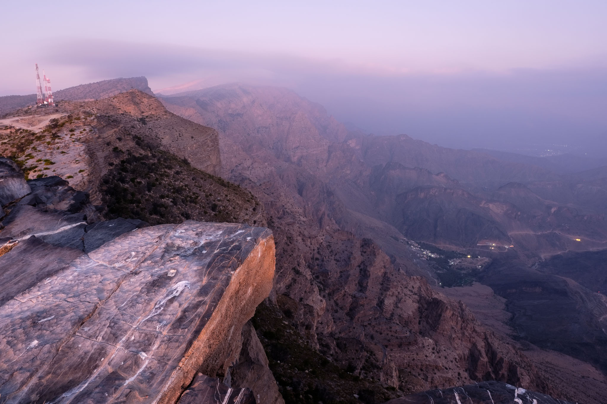
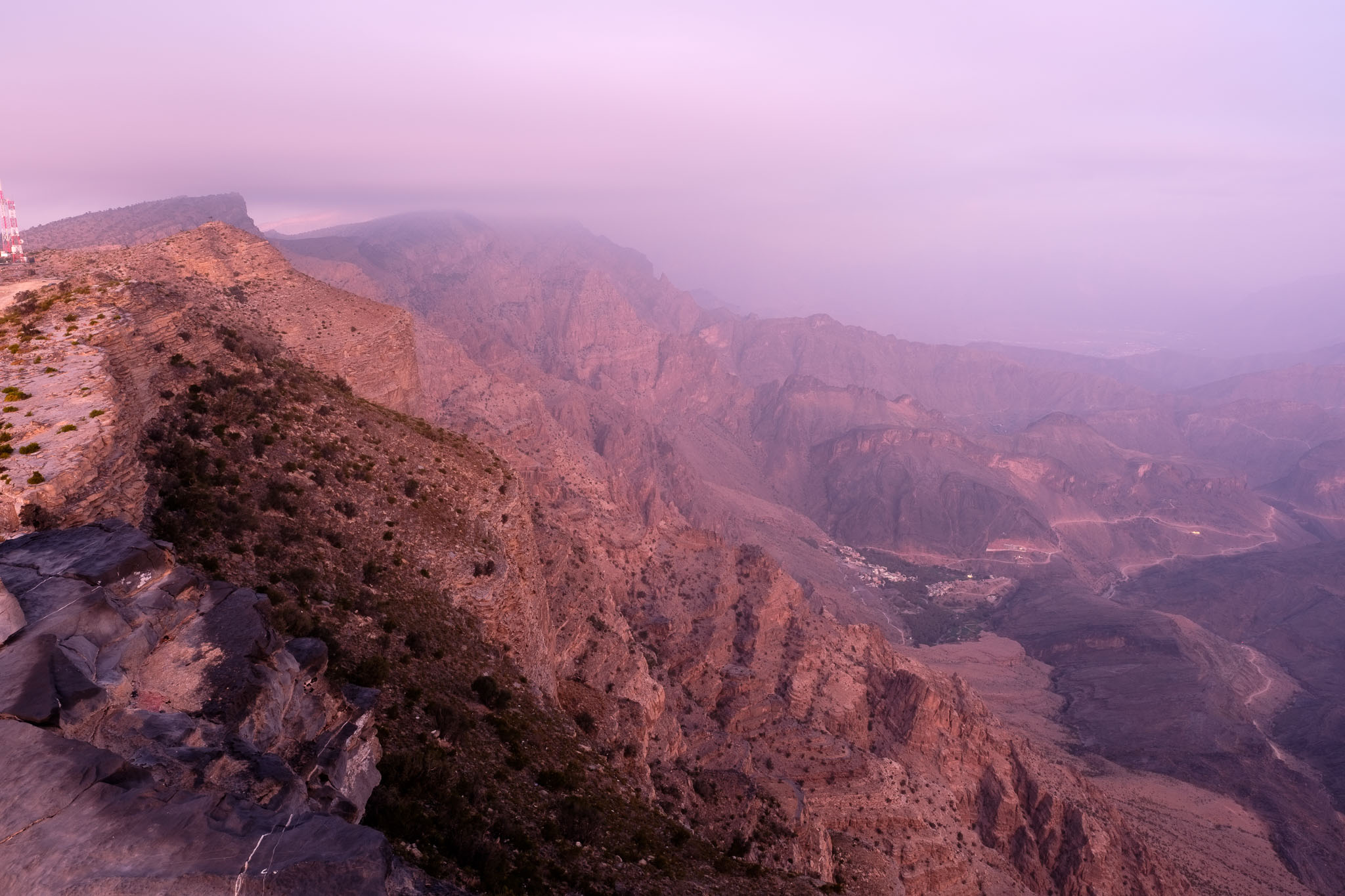
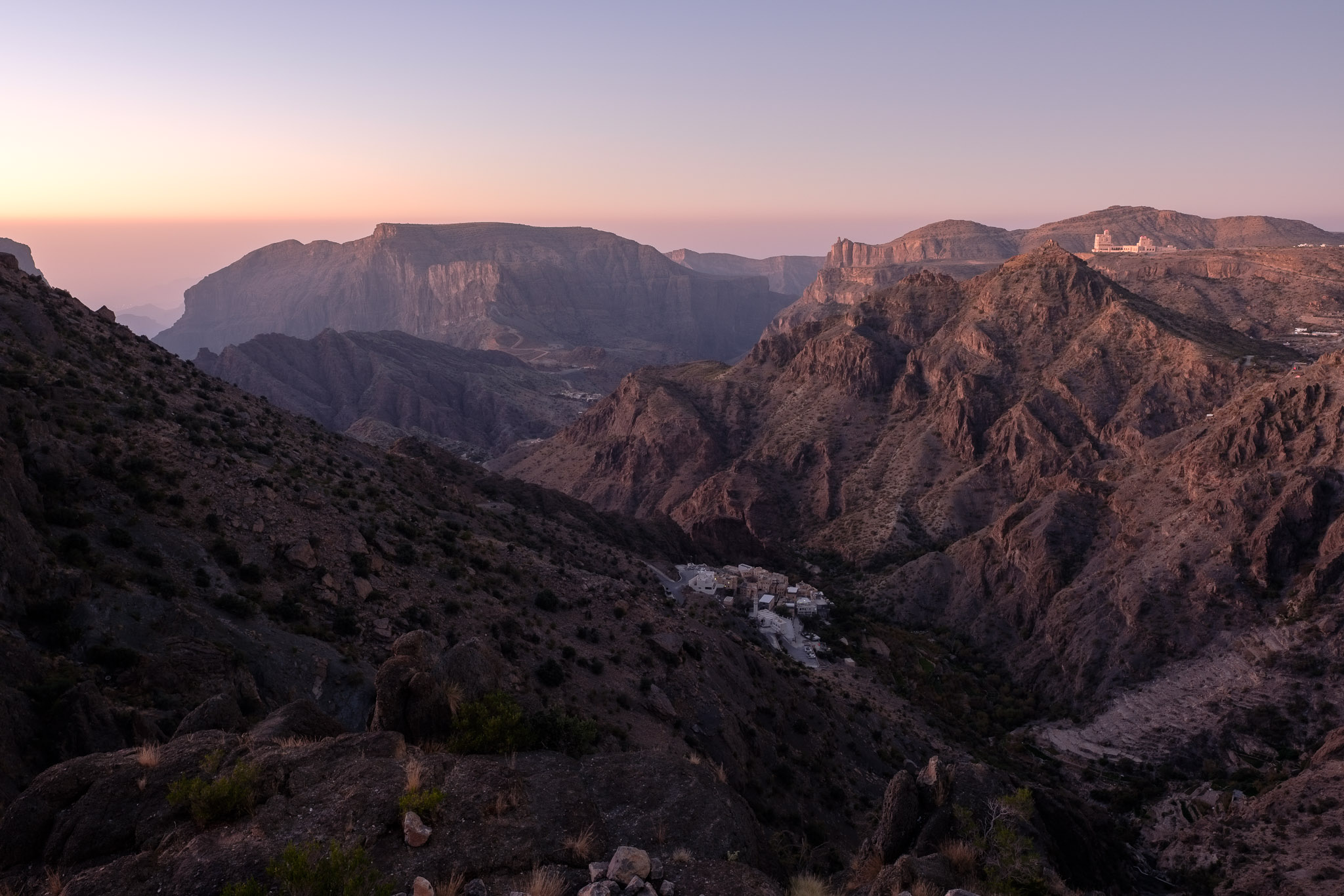
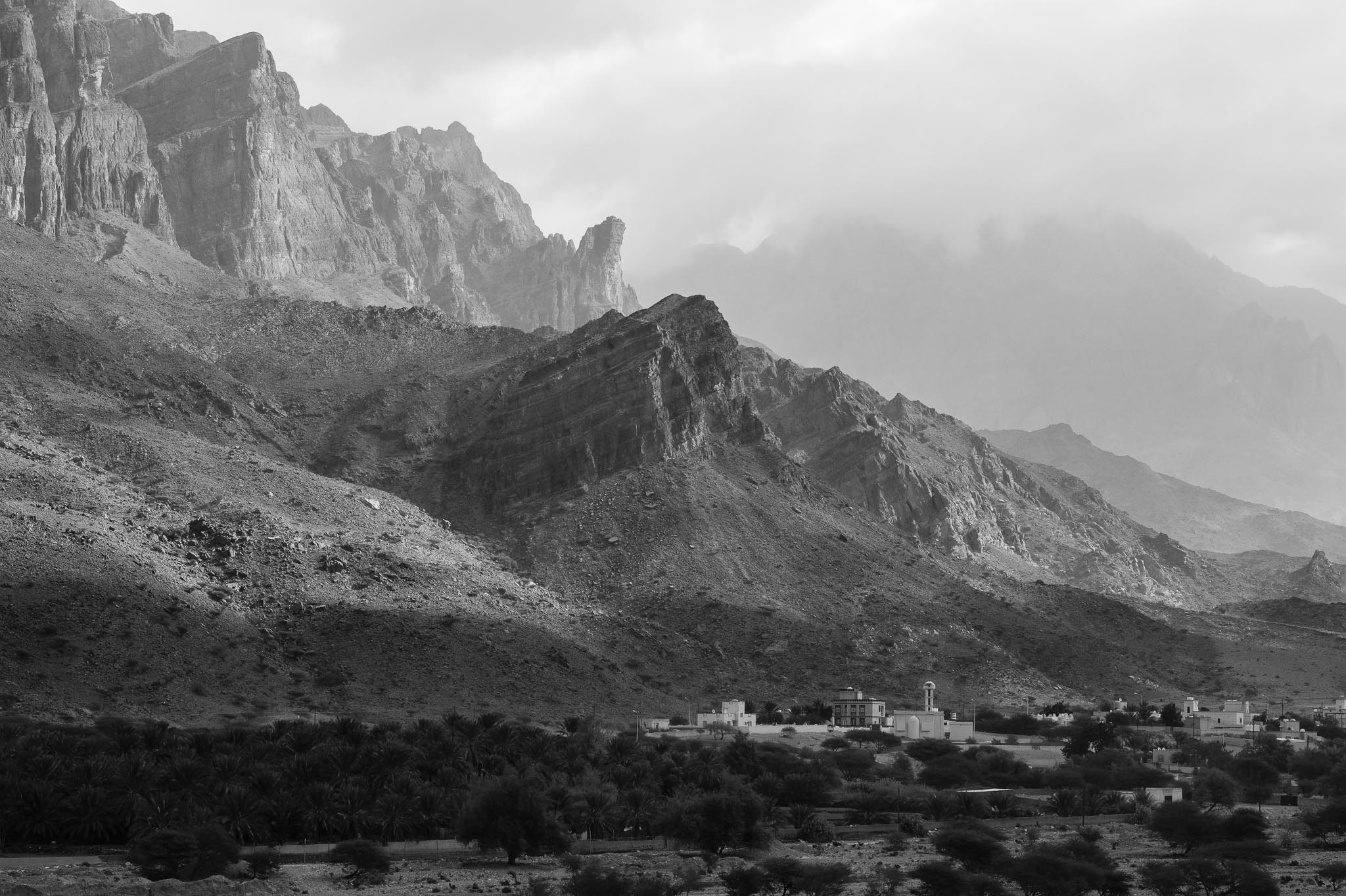
I drove from Muscat to the town of Birkat Al Mawz, which is the entry gate into the Green Mountain. From there, the road climbs until it reaches the Sayq plateau, at an altitude of around 2,200m above sea-level. My plan was to camp in the Juniper Woods, a preserved area where very old trees grow; besides junipers (Juniperus seravschanica), these woodlands also harbor other species, like native wild olives. The junipers are high altitude trees, hardy and evergreen, but extremely slow growing. Some of the trees are about 3,000 years old, which is impressive. Driving along a gravel road, I traverse a sparse woodland, and after a few kilometers I find a nice camping spot in level terrain, surrounded by hills and large trees. I am at the northern edge of the plateau, where the mountains descend into deeply cut valleys; in the far distance, I can see the rugged peaks of the Gubrah bowl, where Wakan is located. Wakan is another favorite place of mine, as you can see for example here:
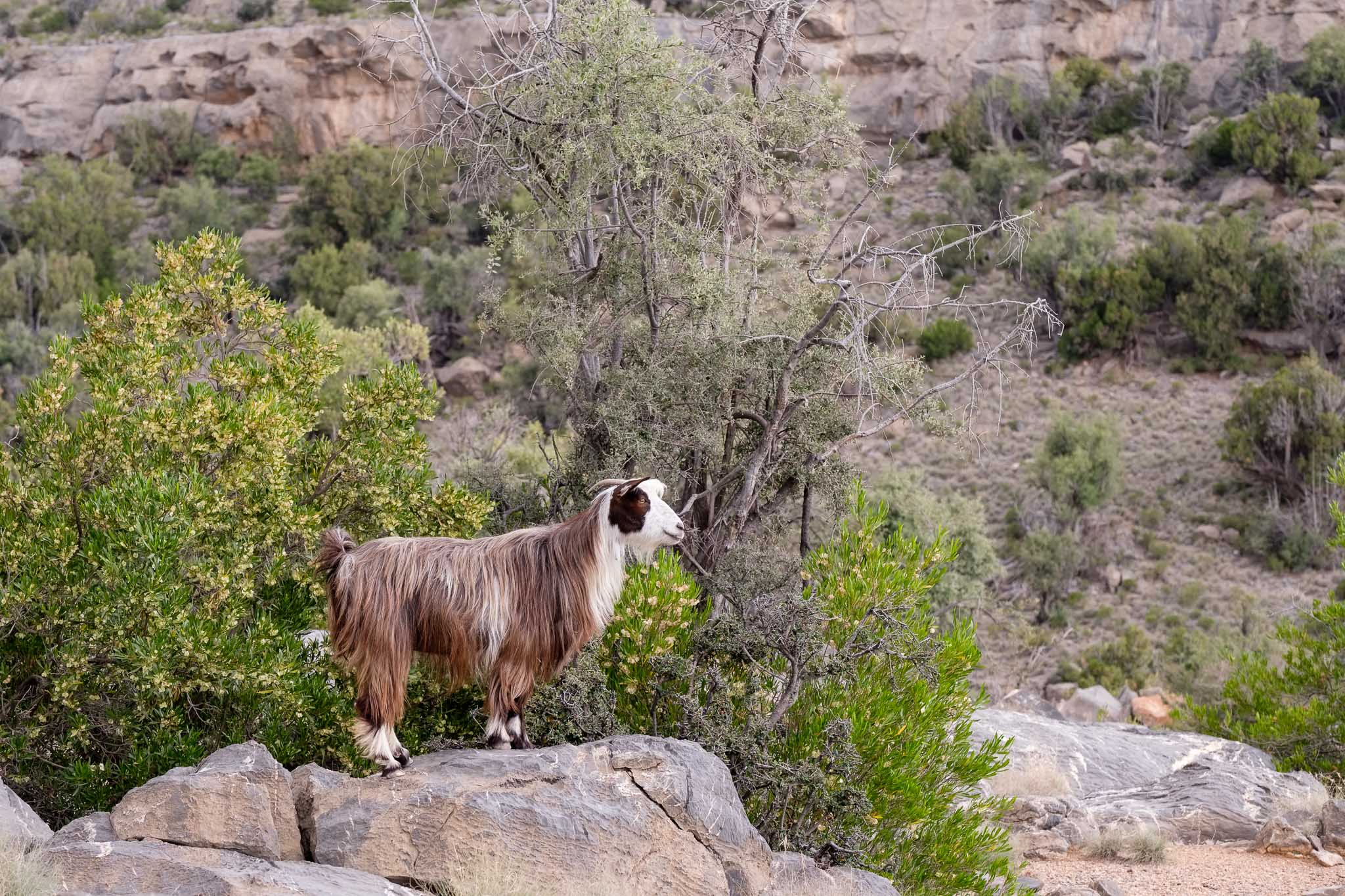
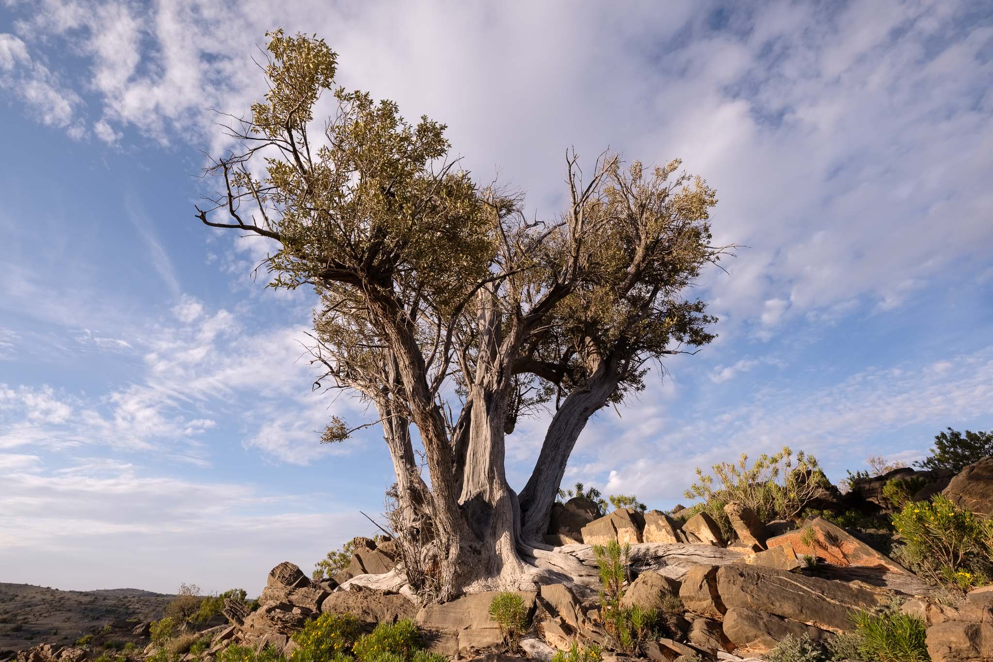
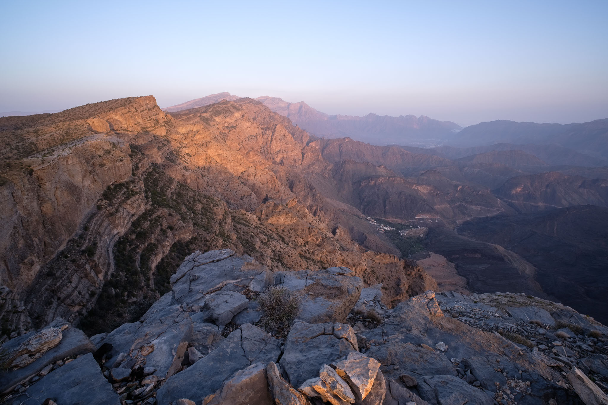
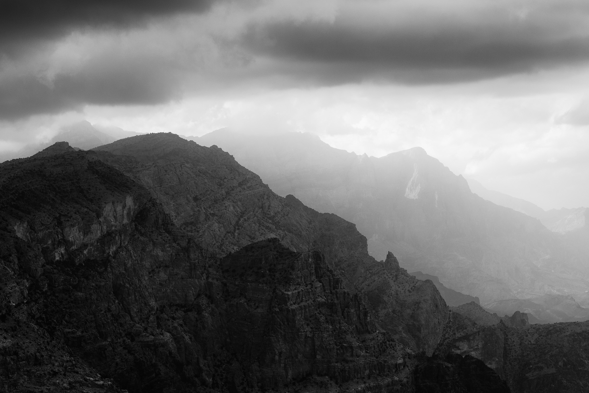
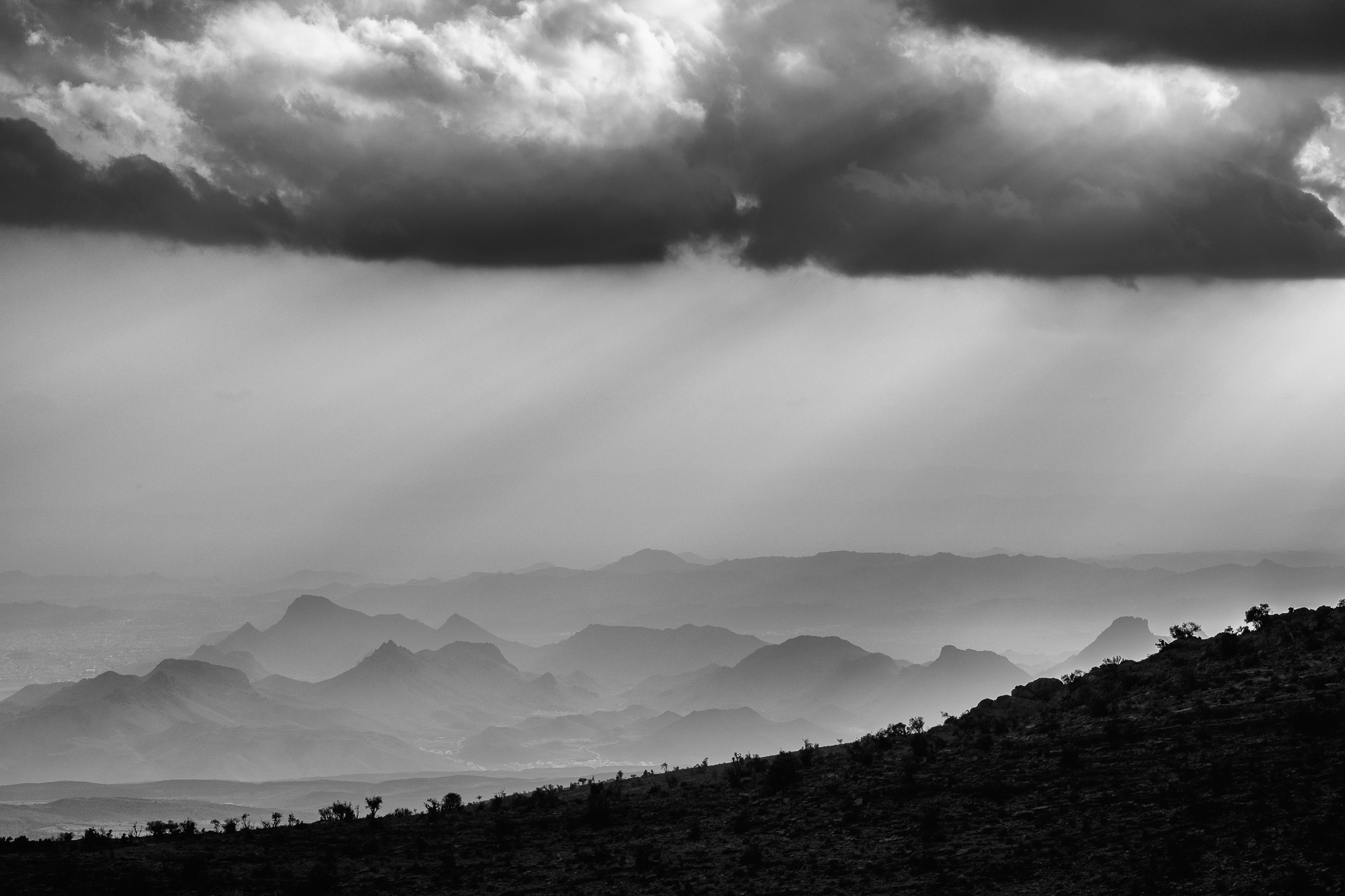
At this higher altitude, the cooler temperature and the relatively higher amount of rainfall have created the conditions for these beautiful trees to grow. Their trunks are twisted into themselves, and their roots are very long, often penetrating along the layers of rock. In recent years, the junipers have been threatened by climate change, human activity (their wood was normally used as firewood and medicine), and grazing (goats and donkeys). Hence, the creation of special preserved areas such as this one. I walk around the area until sunset, admiring the beautiful landscape, and taking lots of photos. For this trip I carried my usual Fujifilm X system kit, which consists of the 10-24mm f/4 and 50-140mm f/2.8 zoom lenses. These were supplemented by my “night sky lens”, the TTArtisans 10mm f/2.
Overcast sky upon arrival in the camping area.Nice viewpoint over the valley below.One of the large juniper trees in the Juniper Woods.I converted some images to black and white.Rugged landscape.Small olive tree.Juniper tree and sky.Dry and twisted.Pointing the way.Into the distance.The roots have developed along the rock bedding.Junipers at sunset.Out of the rocks.Split.Sunset sky.
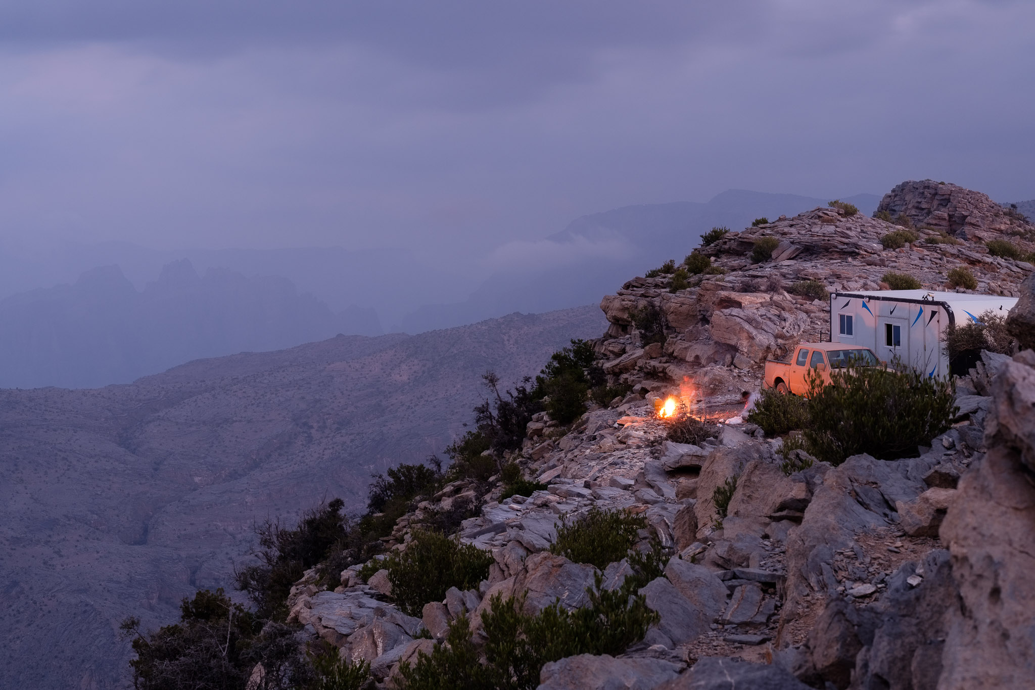
The sky is covered by clouds with the occasional sunshine break, so I am hoping that it will clear later at night, allowing me to have a good photo opportunity for star trails. This is a dark site, and it is close to new moon, so conditions are perfect. When I retired to my tent to have some sleep, the sky was still cloudy, but it cleared out around 3 am, allowing me to make a star trail for 75 minutes. The Milky Way was also prominent in the sky.
The Milky Way.Star trail.
I did not have much more sleep, because I was up before dawn to photograph the sunrise. This is always a magical time in the mountains, with the first color appearing in the east. Soon the thin clouds turn pink and orange.
Layers of rock and light.Sunrise panorama.First light in the valley.
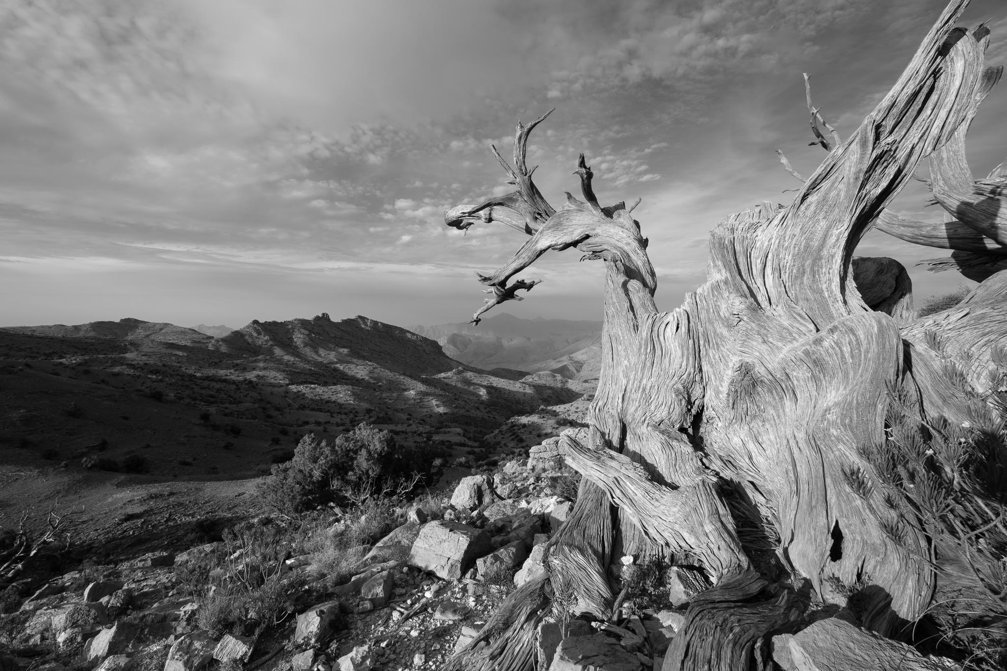
Taking advantage of the early morning light, I proceeded to photograph a few more trees and the surrounding landscape.
Twisted.Dry texture.Fractured.Morning warmth.
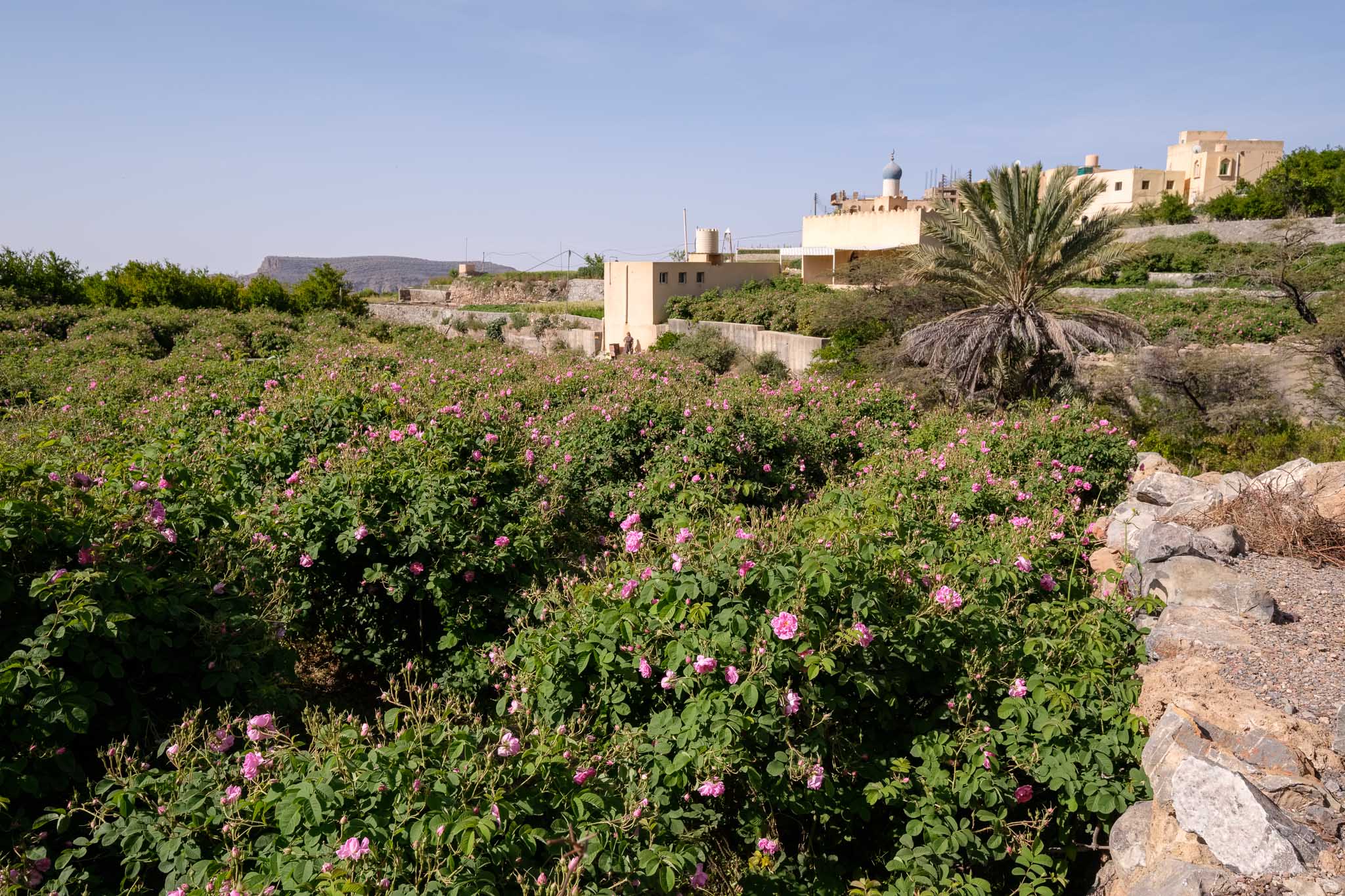
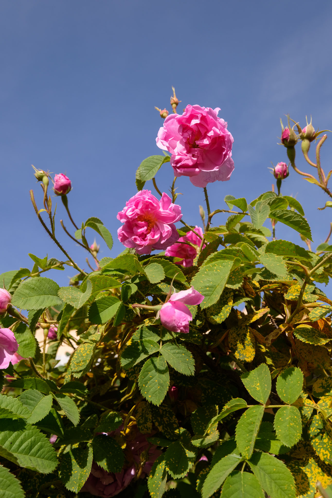
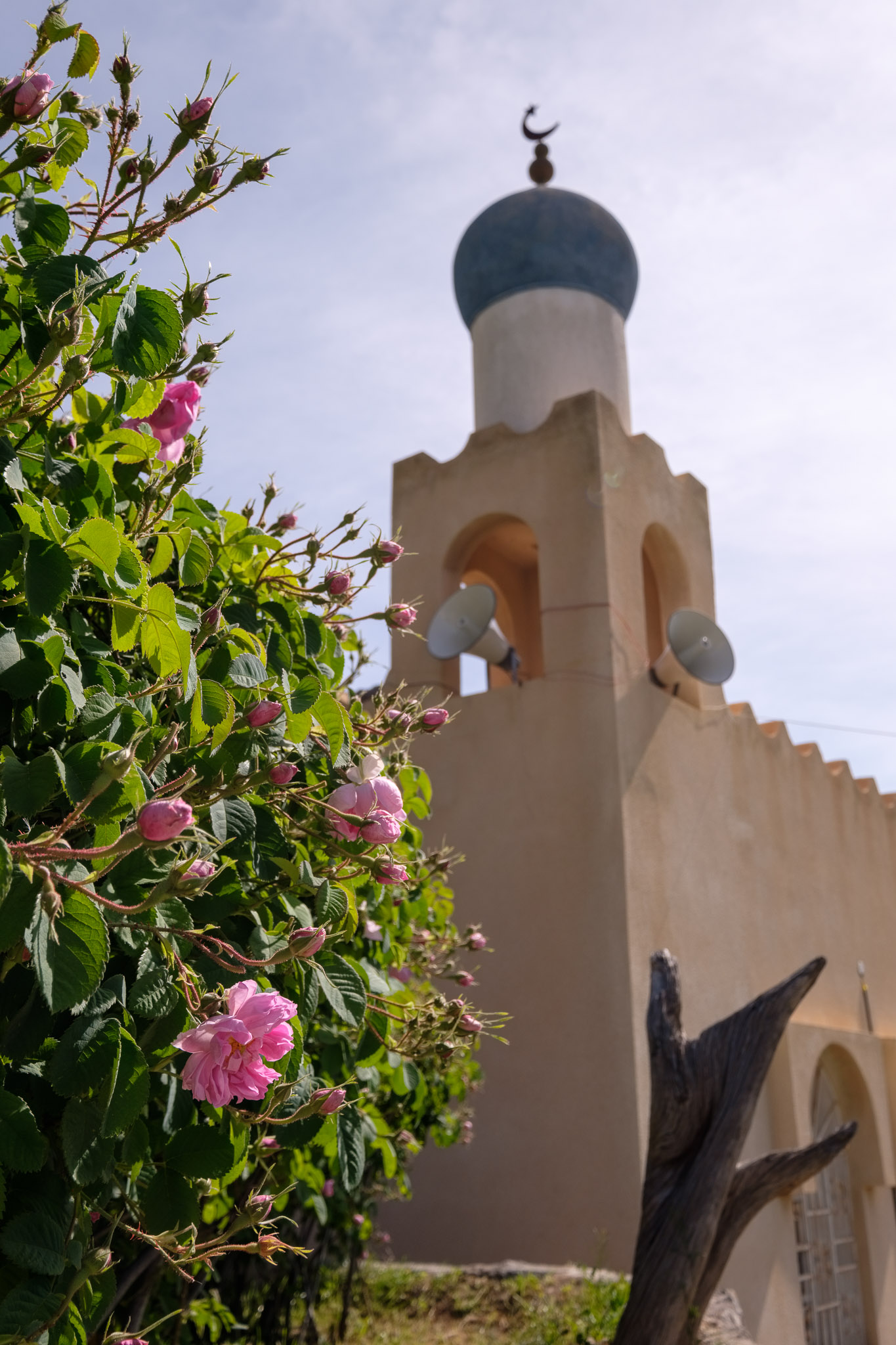
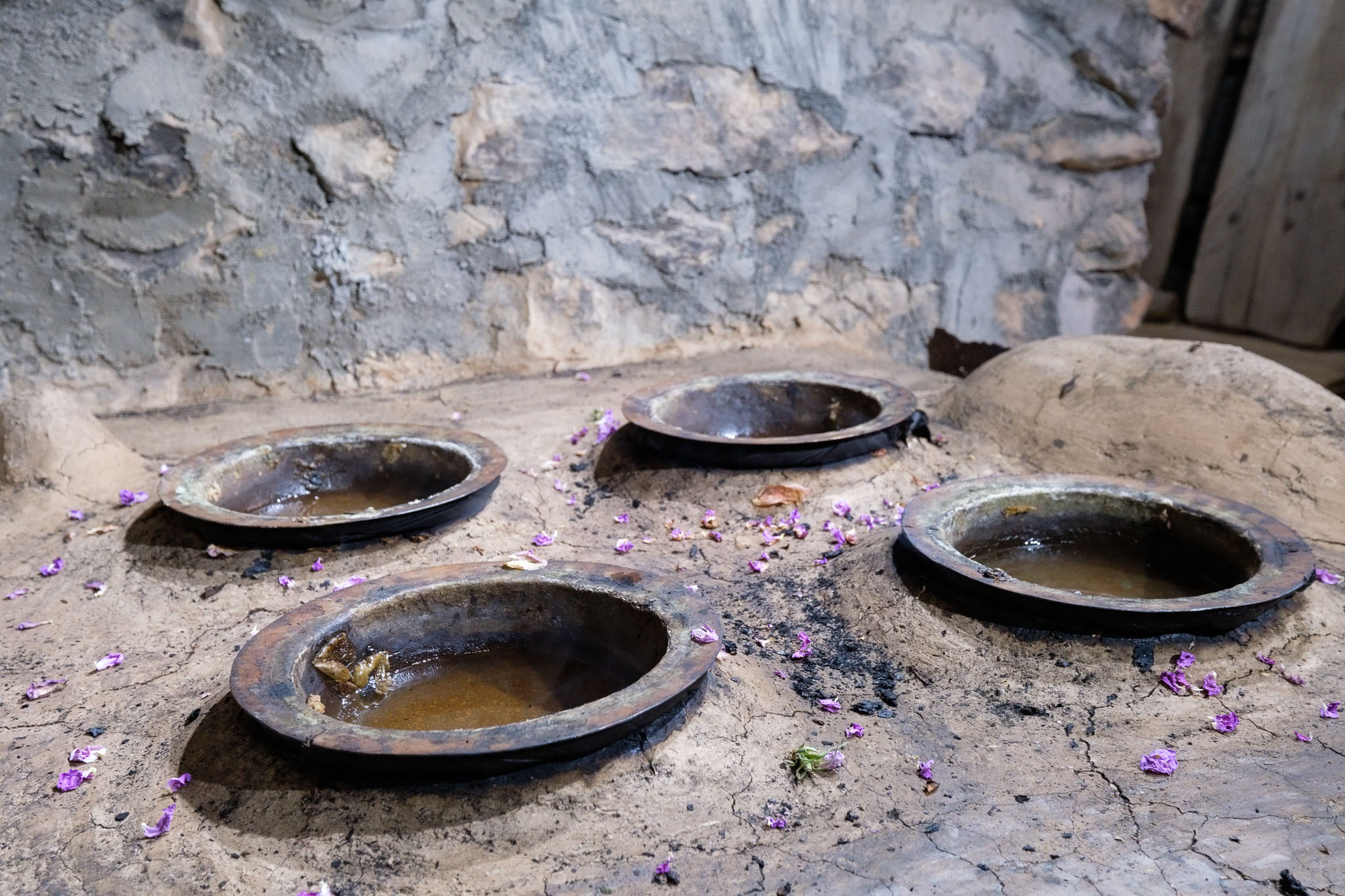
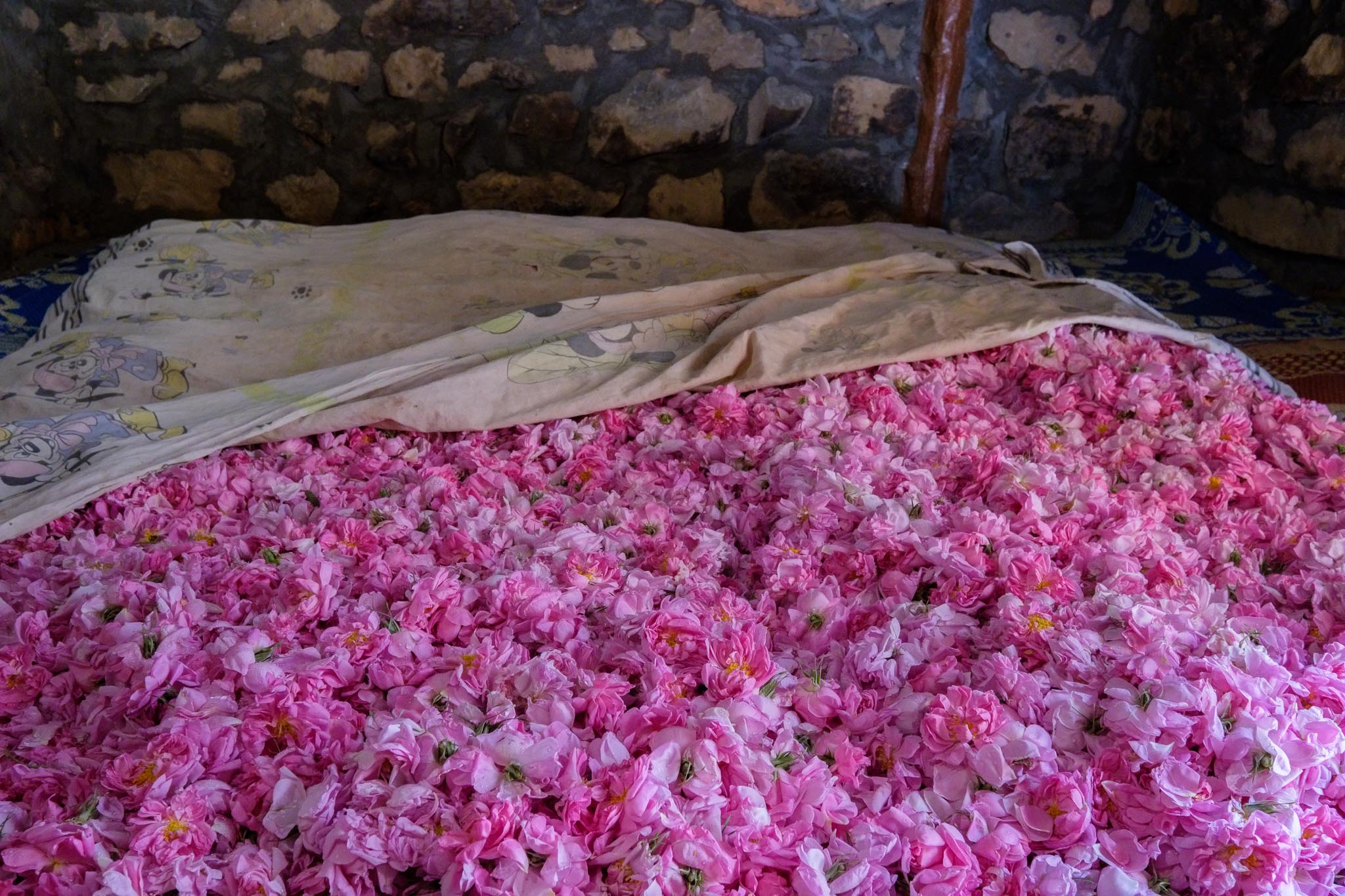
After breakfast I pack up and head for the village Al Ain to literally smell the roses. It is still early, 8 am, but the small car park is busy. Clearly, it is a popular time to visit the hanging terraces and rose gardens. The damask roses have been used to produce rose water and oil since pre-Roman times, and it is easy to understand why. They fill the terraces with their rich pink color and the air is alive with their scent. After walking along some of the gardens, I visit a local museum, where a traditional working distillery can be seen. This was a great way to end the trip, surrounded by the natural beauty of the Green Mountain, where each season offers something unique and different.
Rose garden.Damask roses.Roses.Traditional distillation room.Freshly harvested.
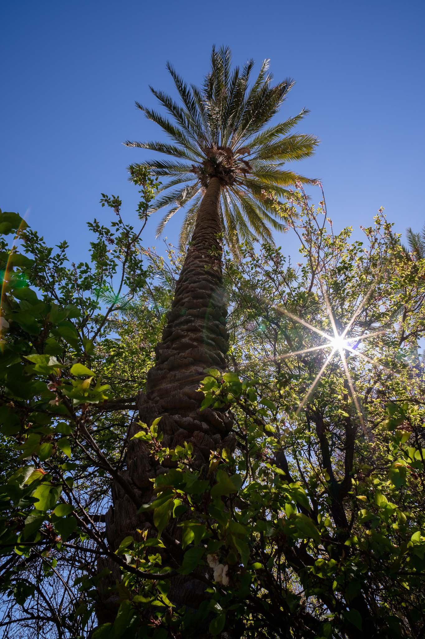
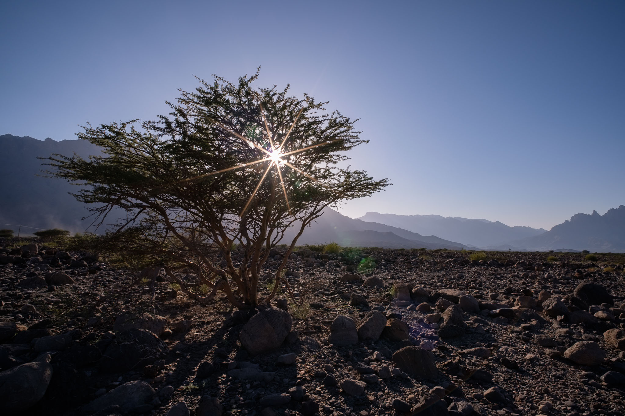
It is rare for me to write so called “lens reviews”, mostly because I do not have the technical ability or background to carry out that type of detailed analysis. Also, for many years my preference has been to skip this type of reviews and learn more from the opinion of trusted photographers that are kind enough to share their experiences with others. These days, with computer aided lens design, and complex manufacturing of exotic lens’ elements, it is hard to find a “bad” lens. Following this introduction, in the next paragraphs I will summarize my experience with a lens that I have recently acquired; its full name is TTArtisan Super Wide 10mm f2 APSC, in Fujifilm X mount.
I have always enjoyed photographing the nigh sky in a landscape context, with the Milky Way, or star trails. Given that I am now living in Oman (where there are still remote dark sites), and I have the opportunity of going out once a month with an astronomy group, I started searching for a dedicated ultra-wide and fast prime lens. I did not want to spend a lot of money, so I chose the above-mentioned lens; it is manual focus, and it does not feature electronic communication with the camera, but these are not important for the intended purpose. On the other hand, it is robustly built, all metal and glass. During the last couple of months, I have used the lens in several trips, photographing both during the day and night. What follows is a series of photos, where I will try to illustrate my key findings. All images were taken with the Fujifilm XT5, which has one of the most demanding APSC sensors, with its 40 mp.
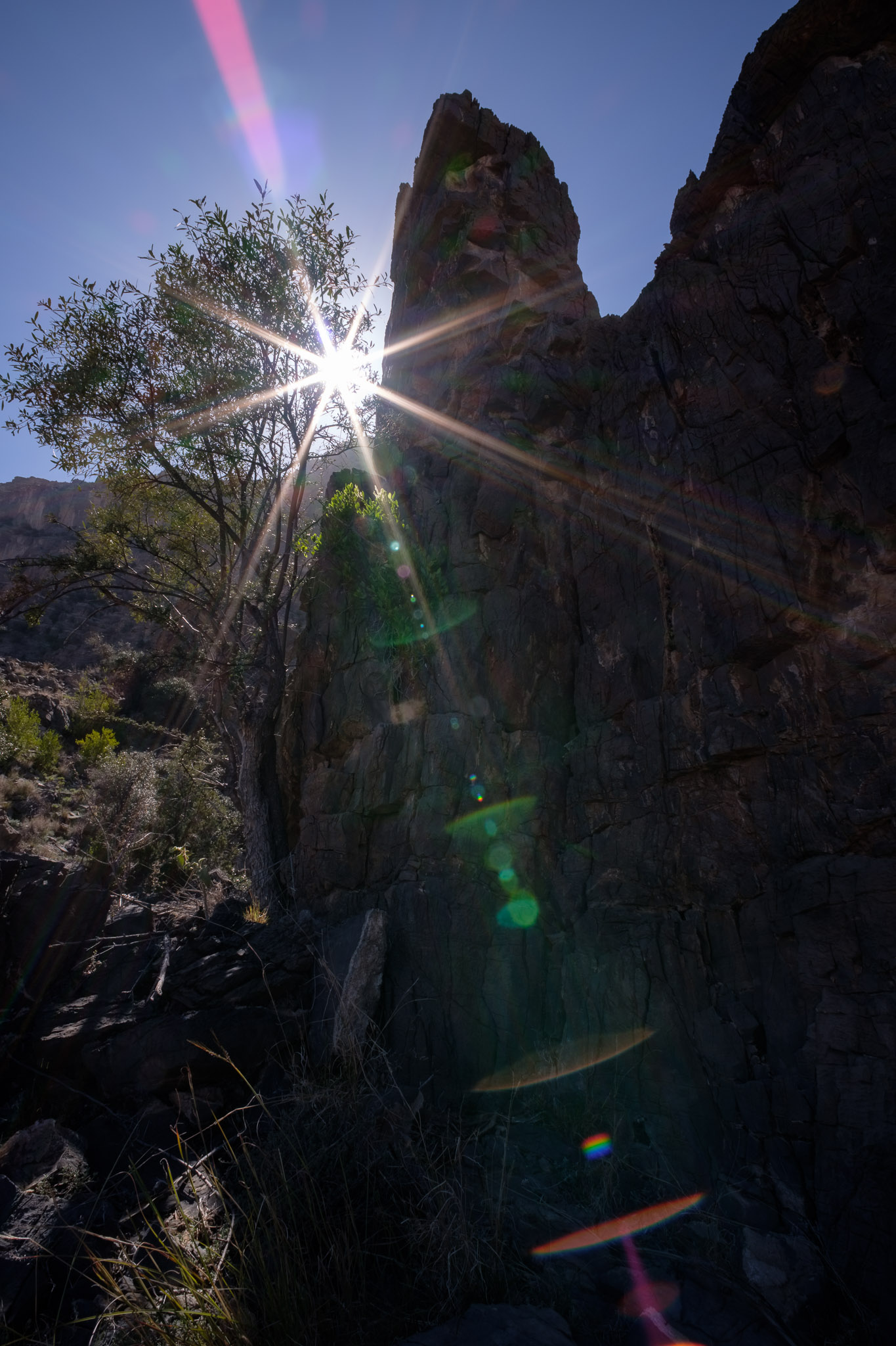
Sun stars – they are generally excellent, but you have to watch out for flare. The lens flares easily, which is probably its most significant downside for daylight photography. You can mitigate against this by slightly adjusting your framing or position. With the sun outside of the field of view, you can also get some minor flare, which you can eliminate by carefully placing your hand next to the lens; just be careful to avoid your hand showing up on the image. Even with this downside, I managed to get some really nice photos.
Wakan village, Oman.Wakan village, Oman.Gubrah bowl, Oman.Jebel Akhdar, Oman.Jebel Akhdar, Oman.Jebel Akhdar sunset, Oman.
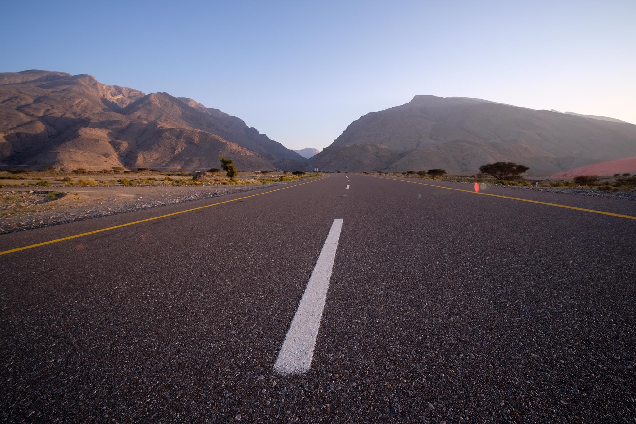
General landscapes – I am happy with the results. Sure there are better lenses, but for Fujifilm the other options covering 10mm are much more expensive. Remember, this is a lens that costs around USD 150. So far I have used it in the Oman mountains and desert, without a problem. The sharpness is actually excellent at normal landscape apertures, diminishing to the corners; still, A3 and even A2 size prints are fine.
Jebel Akhdar, Oman.Dawn, Jebel Akhdar, Oman.Jebel Akhdar, Oman.Nizwa, Oman. The geometric distortion is low, with straight lines not bending.Nizwa, Oman.Nizwa, Oman.
Night sky – this was the main reason why I got the lens. With such a wide angle of view and large aperture, it ticks the right boxes for those vast Milky Way and star trail images. Manual focus at infinity is easy to achieve using the magnification function of the camera, and carefully bringing a bright star into a pinpoint on the screen. Again, there are probably better lenses in terms of coma and other optical defects, but I am happy with the results I am getting thus far. I have used f/2.8 because it reduces those defects, compared to f/2. Vignetting is also present, but for Milky Way photos, it actually helps to guide the eye towards the important part of the frame.
Wahiba sands desert, Oman. 15 seconds exposure.Wahiba sands desert, Oman. About 150 shots stacked, 30 seconds each.Jebel Akhdar, Oman. Around 100 shots of 30 seconds each.
My conclusion is that for the price, this lens delivers the goods. Certainly I will keep using it for my night sky images. For day light landscapes, it is also perfectly usable, bearing in mind that it flares easily. The low distortion also makes it useful for interior photos. I keep repeating myself, but this lens delivers well above its cost.
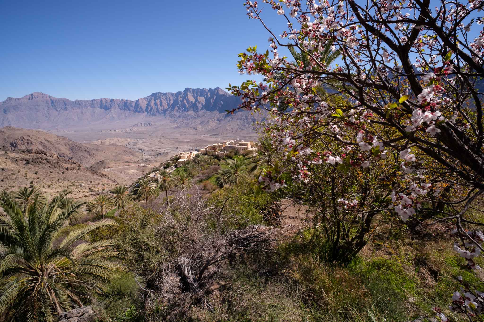
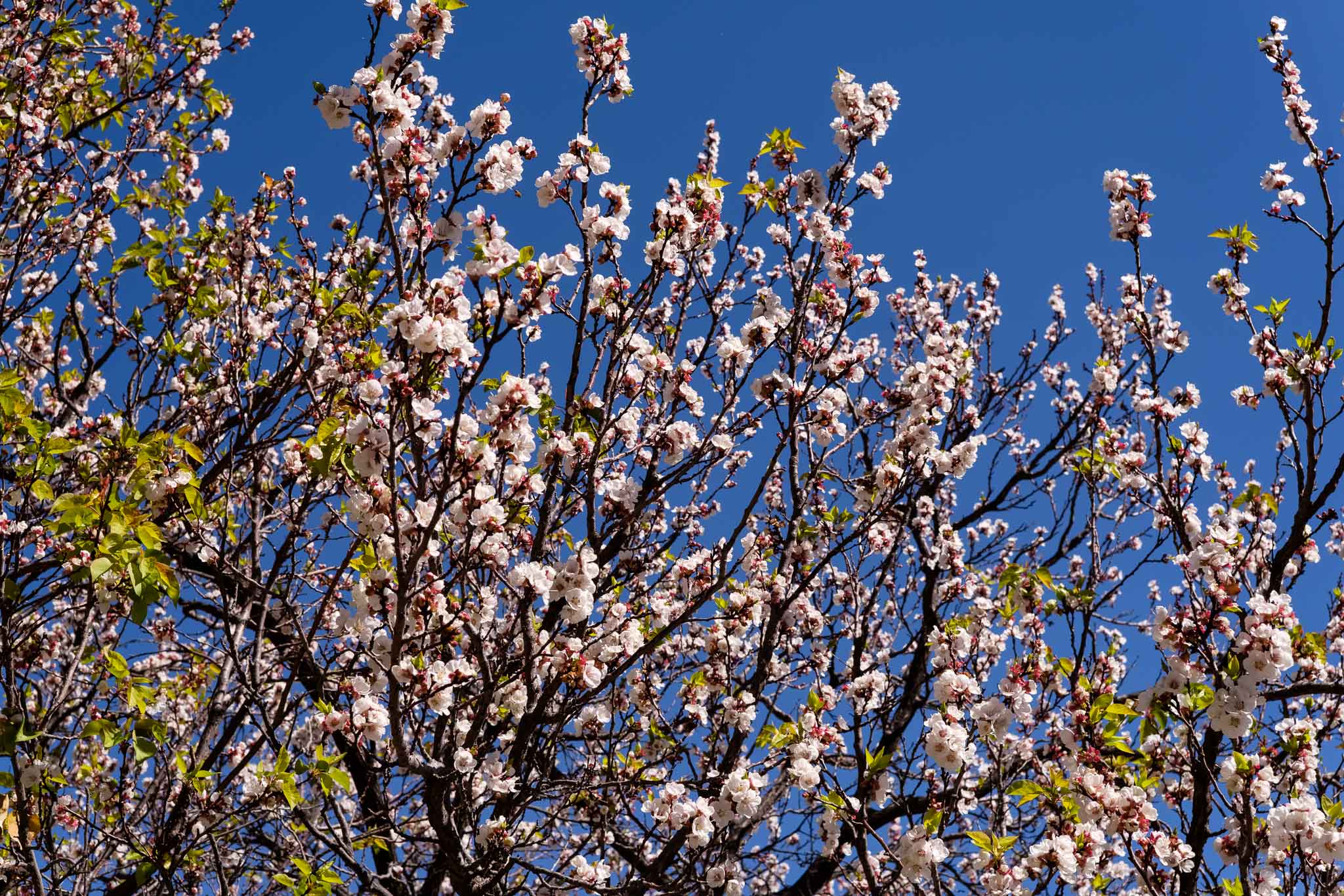
I have recently returned for another visit, to see the fruit trees in blossom. Typically, this occurs during February, and makes for a different experience in Oman, as the surrounding hills and gardens become alive with the white patches of flowering trees. My plan was to spend some time walking in the village and the fields, and then hike up the mountain following the well-marked trail. I have done this many times before, but once you gain altitude, the views are amazing; so, it is well worth the effort.
Last time I visited the weather was cool and cloudy, but this time it was warmer and there was plenty of sunshine. There were also lots of visitors, which created some traffic jams not only in the narrow gravel road that leads to the village, but also in the (small) parking lot. But, with a little bit of patience, all is well. People come to admire the Spring blossoms, mostly from the peach trees.
For this trip, I had with me a new lens, the TTArtisan 10mm f/2; my idea is to use this lens in astronomy trips, for general night sky photography, such as star trails, and Milky Way. It is quite challenging to use such a wide lens effectively, but I wanted to give it a try. Despite a few shortcomings (mostly lens flares), for the low price it carries and robust construction, the lens is quite interesting and useful. As a complement, I also carried the Voigtlaender 35mm f/1.2 lens, for more general photography.
I walked around the village and the fields for about 1 hour, framing some interesting shots of Wakan against the mountainous backdrop and the “bowl” down below. The surrounding mountains are bare of vegetation, apart from small bushes; their peaks are characterized by jagged edges, well defined against the crisp blue sky. I am used to the beauty of fruit tree blossoms, as we have many areas in Portugal where they occur; but here in Oman the setting is different, because of the geography and climate.
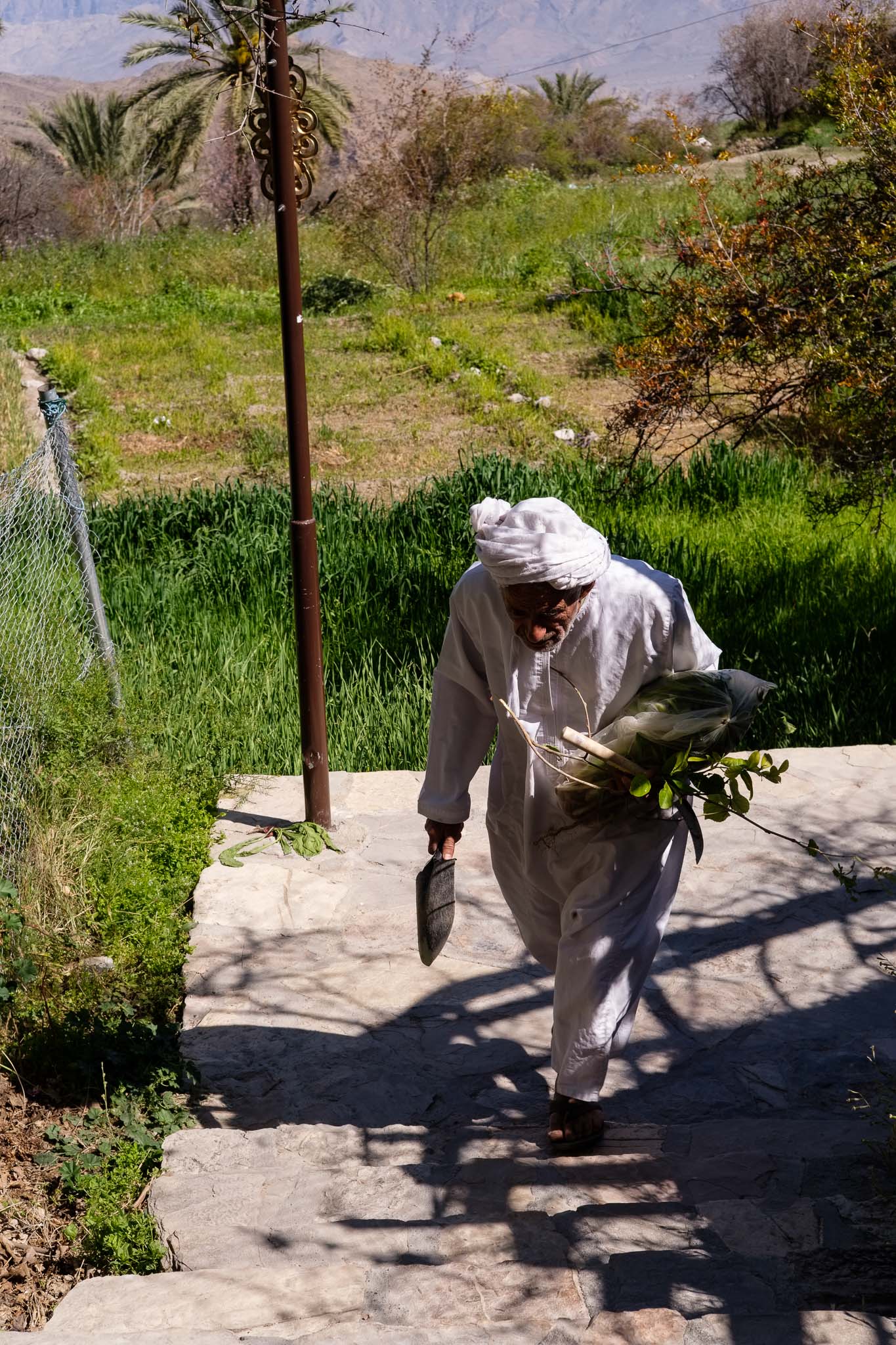
Sun burst.View from above.Blossoms.Old man.
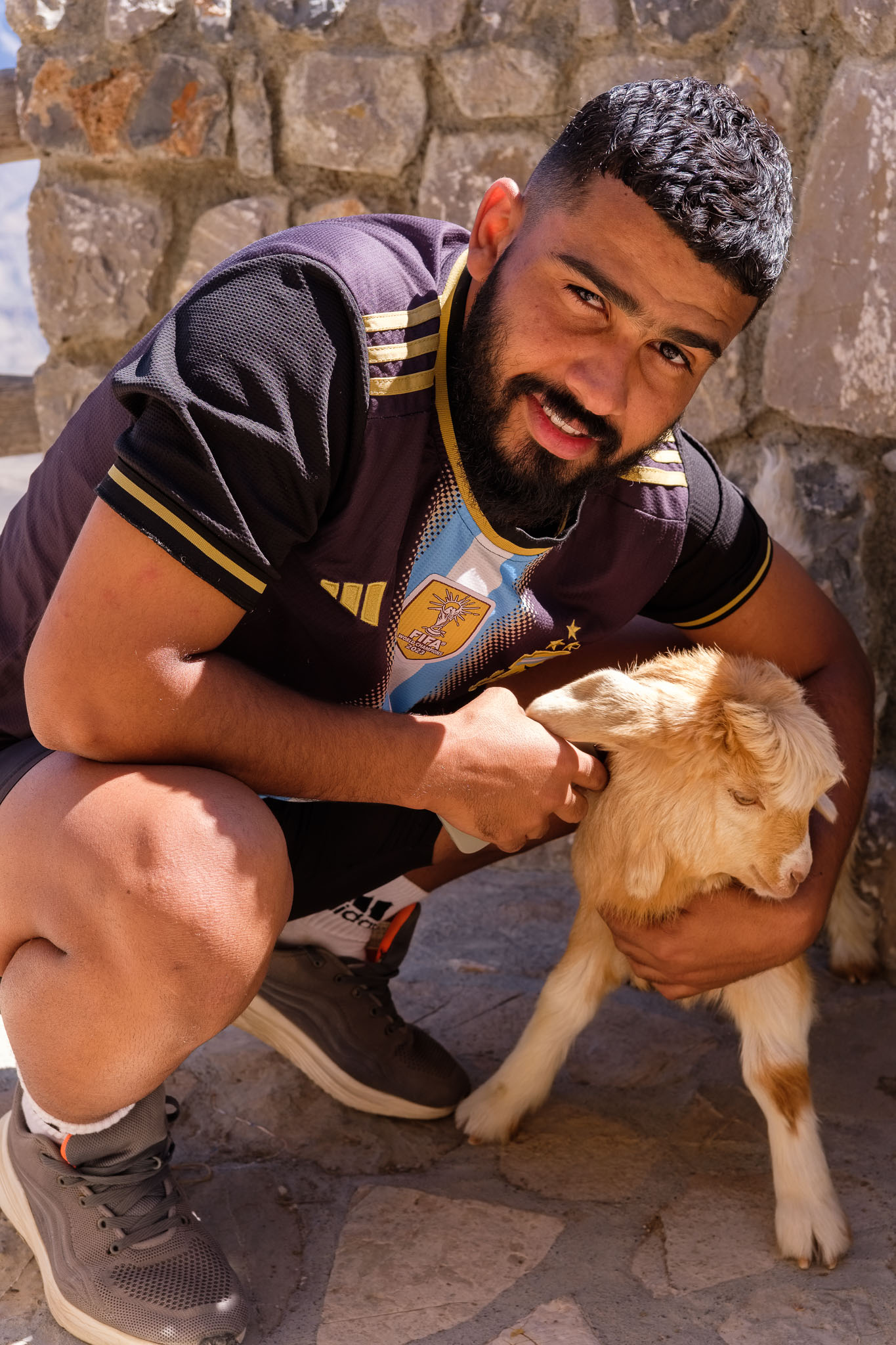
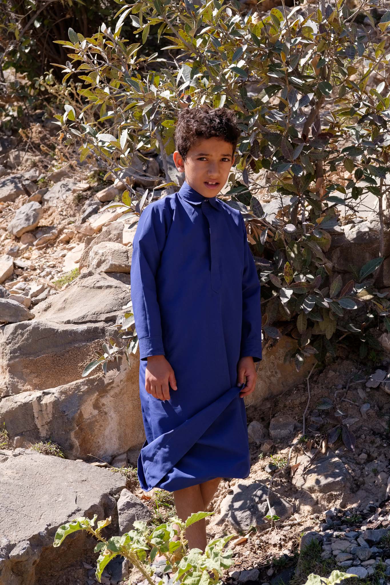
As the visitors and tourists walk about admiring the views, the locals try to carry on with their daily chores. Life in this, and other more isolated, villages, is still hard; it is necessary to take care of the small parcels of planted land, of the trees, and the goats that roam the hills. Once you leave the village behind and enter the rocky trail that leads up to the top, you will hardly see anybody else. In one of the viewpoints a group of youngsters asks me to take a picture of them using my camera, not a phone. I suppose cameras look cool these days, especially the Fujifilm ones with their retro design! We exchange contacts so that I can send them the photos later.
With the small goat.Boy.
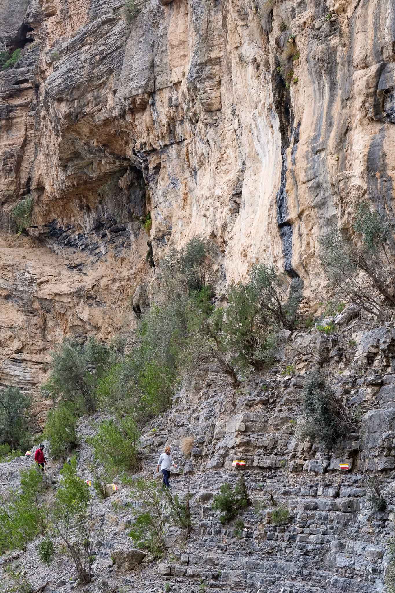
I stop a few times along the trail to take some photos, and to eat a picnic lunch, before negotiating a tricky section of the path. This is where the trail hugs the base of a huge vertical wall above, and one needs to follow along the bedding planes of the rocky outcrops. Even though it is noon, this area is in the shade, and some drops of water fall from the rocks above, creating small stalactites and stalagmites as it dissolves the limestone. After that, it is an easy walk again, and the views are remarkable. After a while, it is time to head back to Wakan, which I reach after meeting a few more goats on the way.
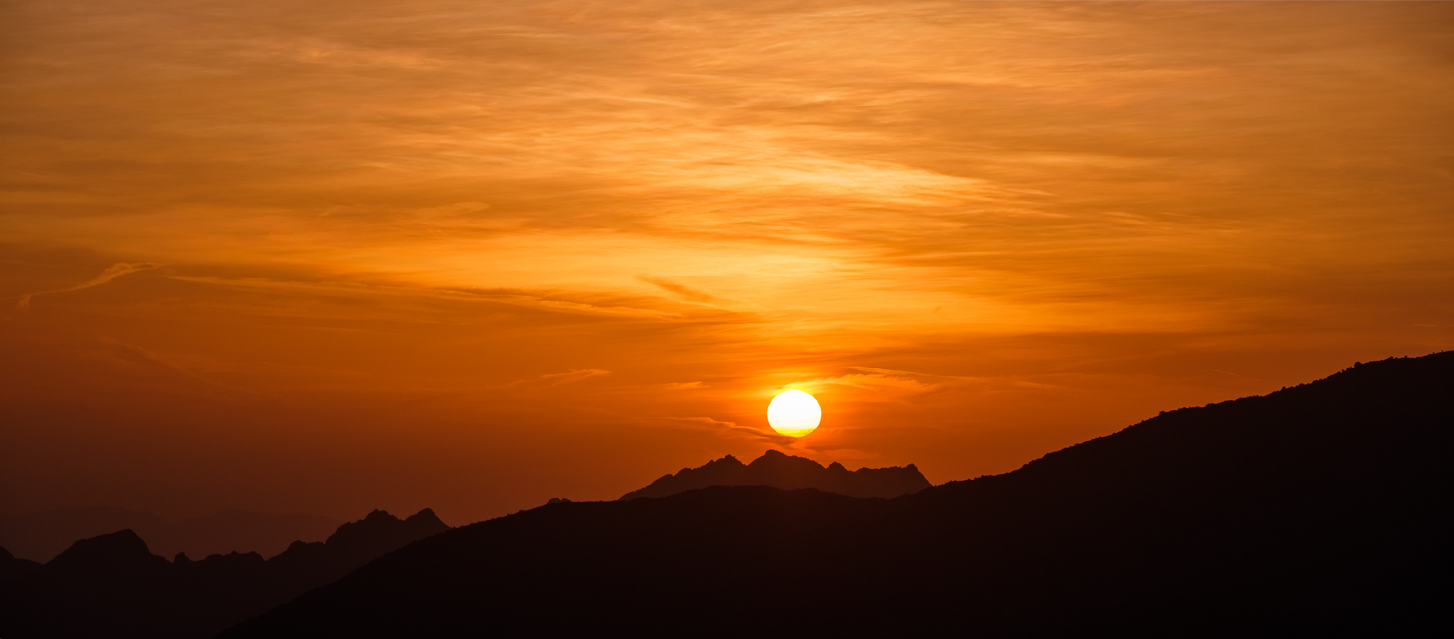
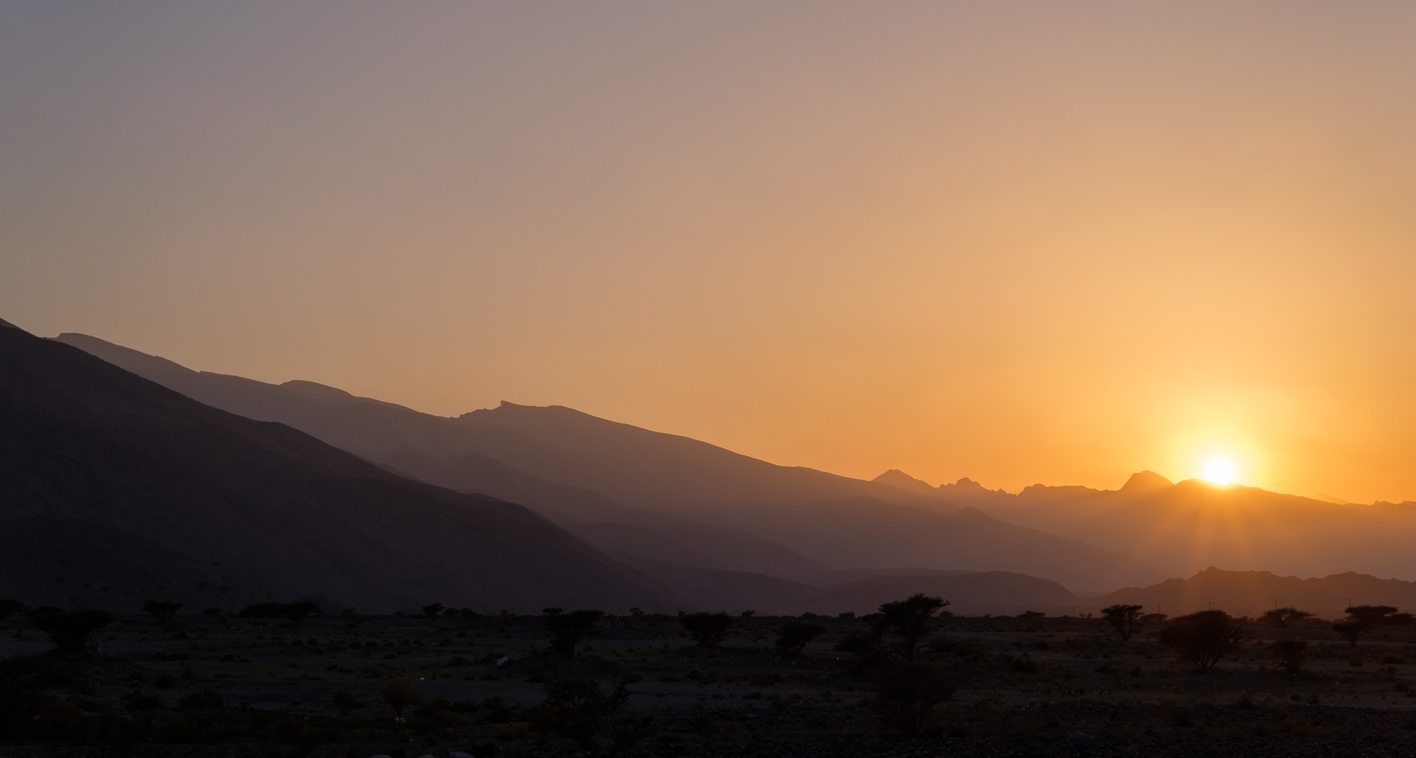
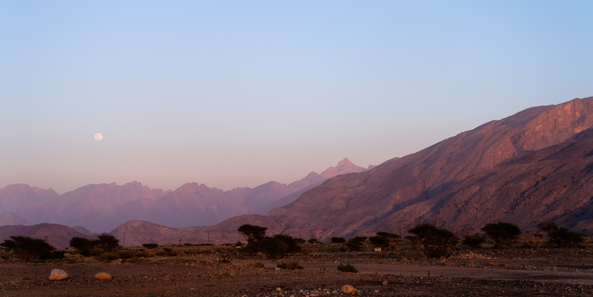
On my way out of the Gubrah bowl I stopped in the valley plain to take more photos. The sun is approaching the crest of the mountains, and the quality of the light is getting better, so I frame some of the thorny bushes against the stark surroundings. At the exit of Wadi Mistal, I stop again, waiting for the sunset, and for the full moon rising in the East. I never get tired of visiting these mountains and experiencing their beauty.
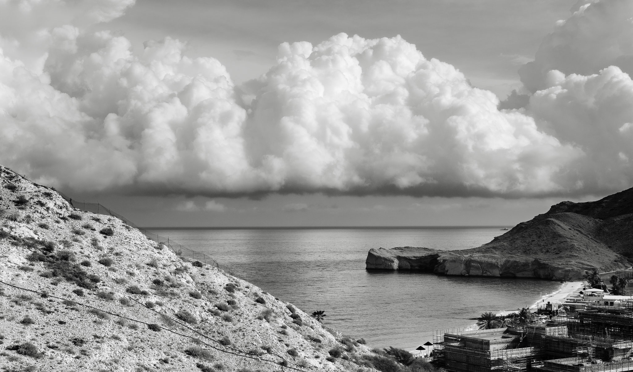
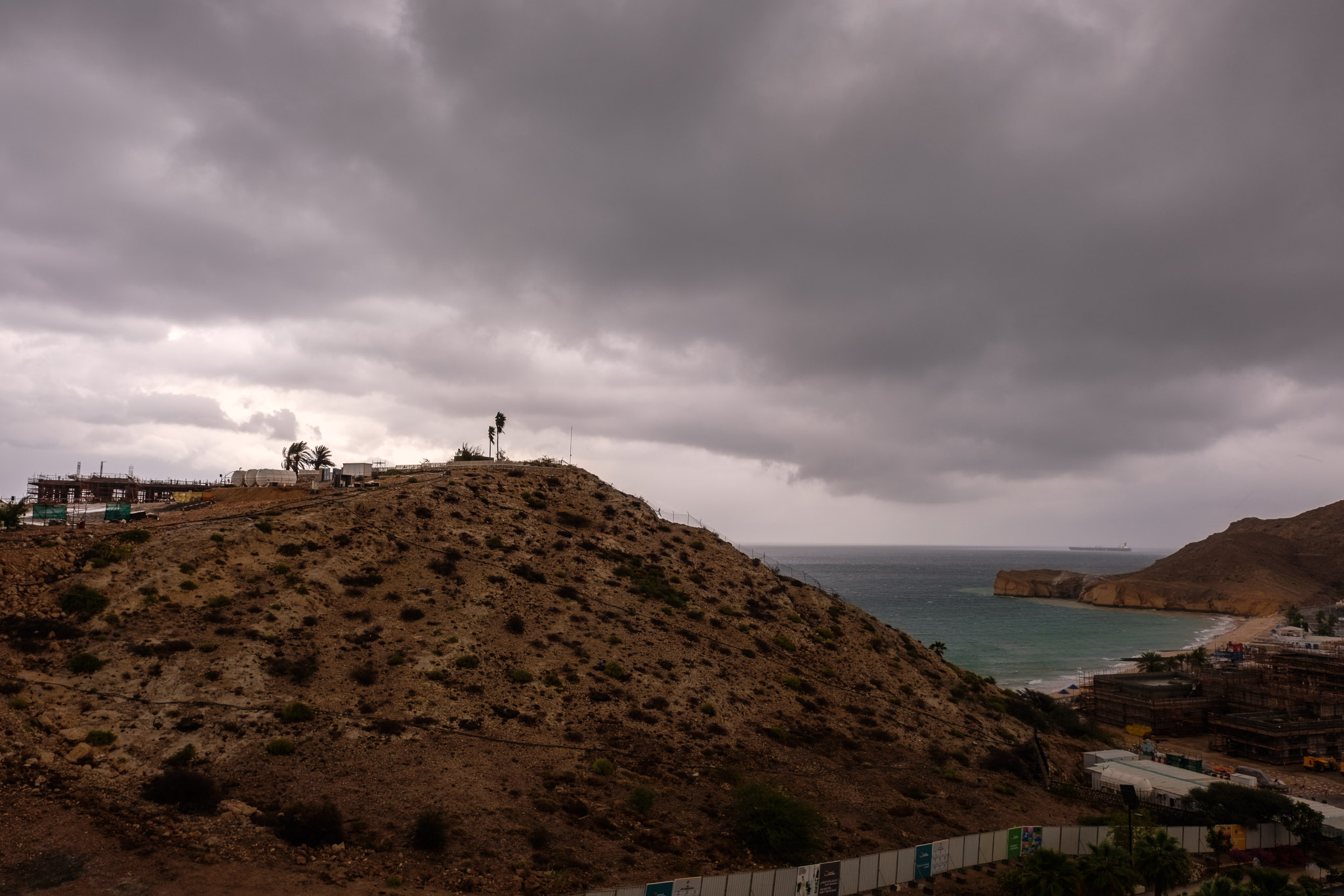
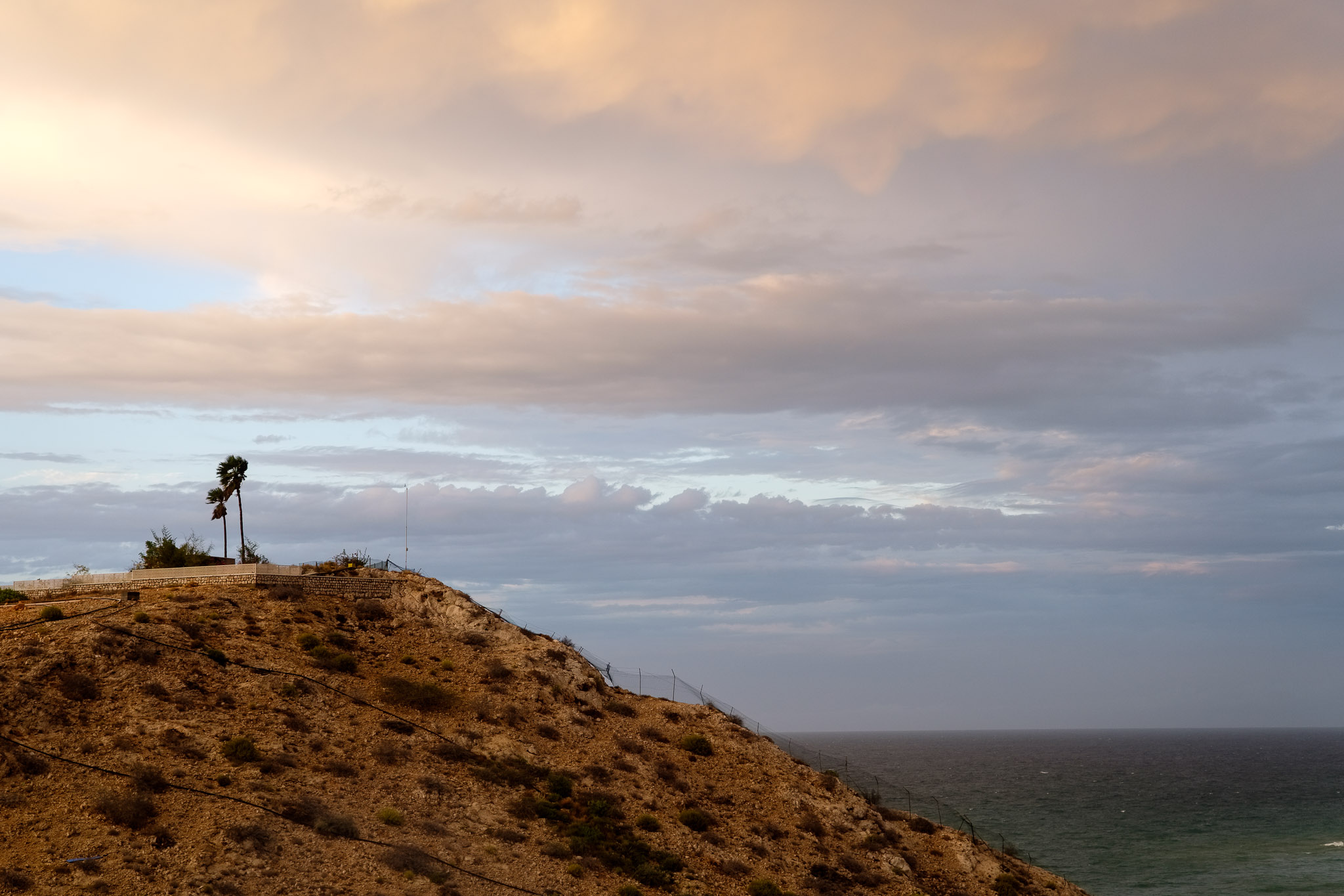
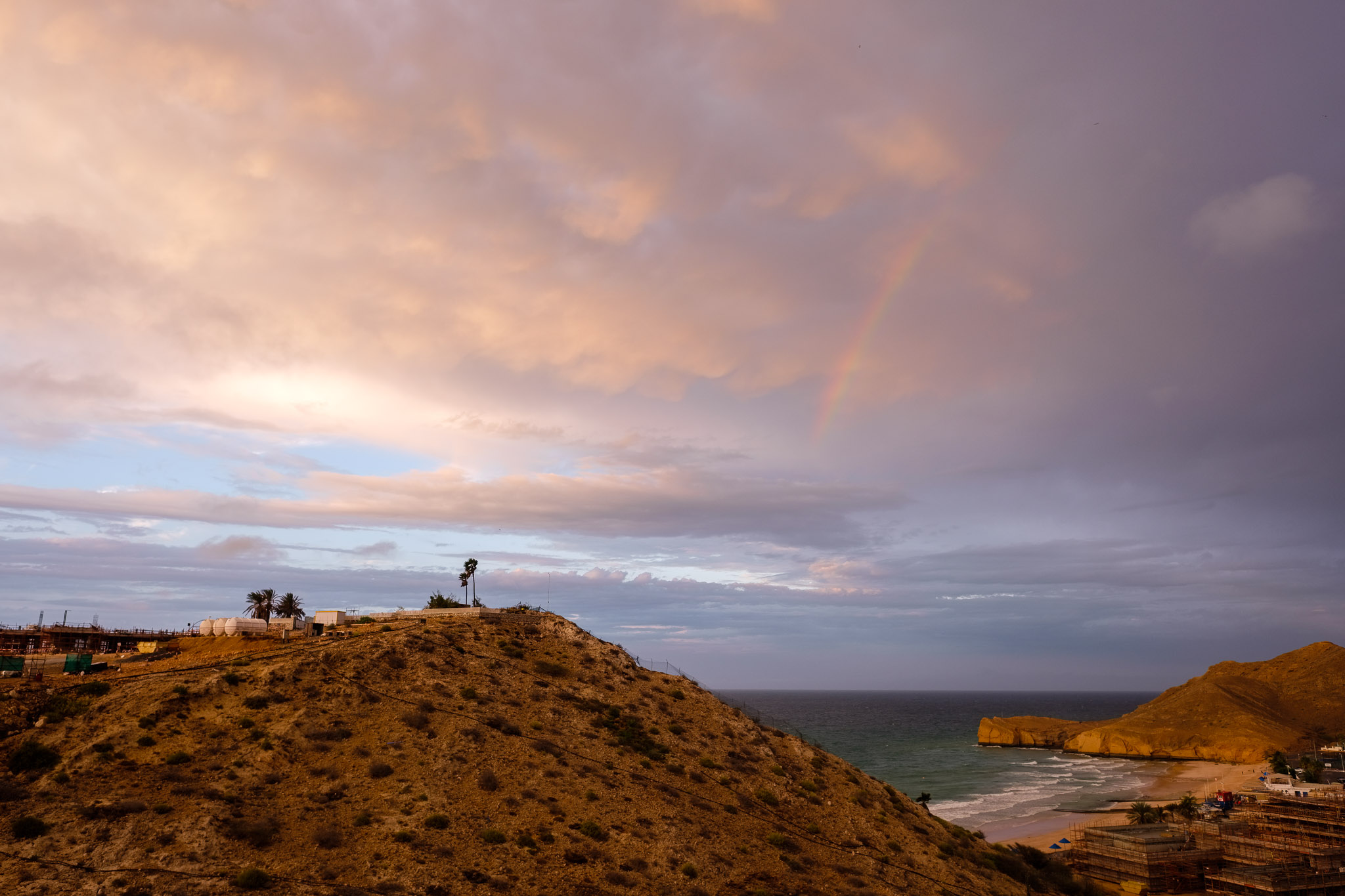
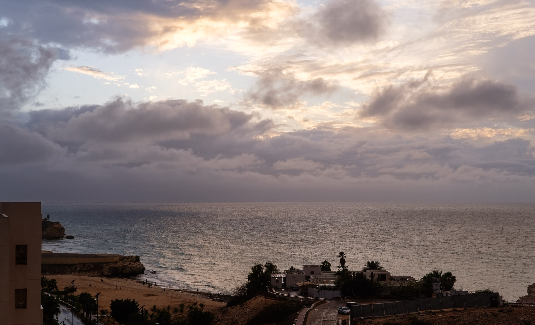
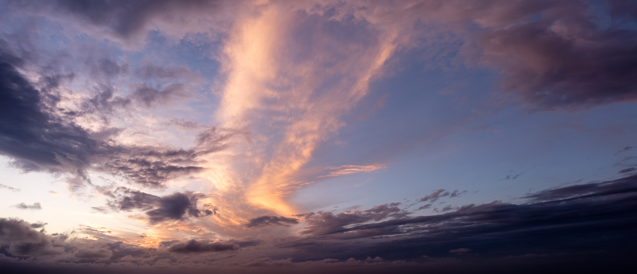
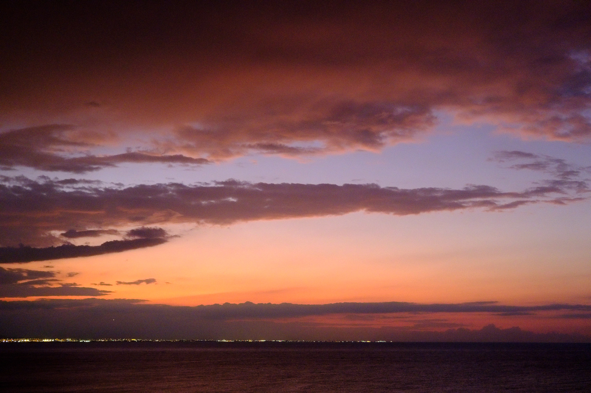
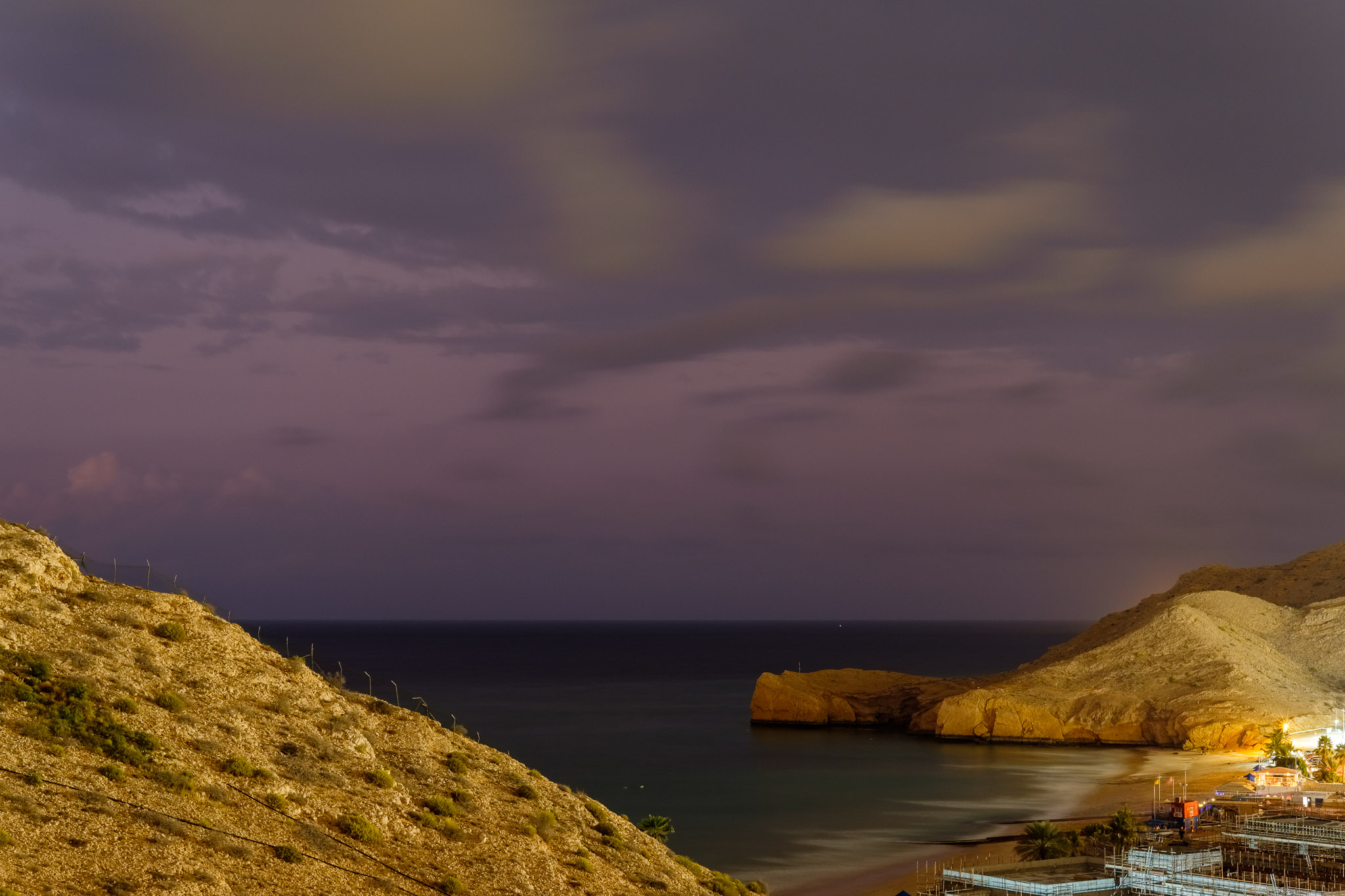
Raining in Oman is a rare event, especially in large amounts. On average, the amount of yearly rain in Muscat is 100 millimetres, mostly during wintertime. A few days ago, a depression hit the northern part of the country, including the capital city, with heavy rainfall and strong winds affecting the region. Muscat is located in a narrow area between the mountains and the sea, so the rain very quickly travels between them; in large amounts, it fills the wadis and carries the danger of floods. In such circumstances, people are encouraged to stay home, to avoid driving under such conditions.
I am fortunate to live in an apartment that faces the sea, so during the day of the storm, I had the opportunity to take several photos from my balcony. In between the rainy periods, there would be brief spells where the sky cleared up a little bit; this resulted in interesting compositions with dark and dramatic clouds sweeping over the coast. From the early morning until sunset, I kept an eye on the developing weather; whenever a dramatic cloud formation appeared, I would pick up my camera to photograph it. It was interesting to see how the clouds varied during the day, from large dark masses coming in from the ocean to smaller banks passing by the horizon.
It turned out that staying at home due to bad weather resulted in a collection of nice photos. I have used my 3 lenses for this set, that is, 16mm, 35mm, and 56mm. Each one provided a different approach, depending on composing wide for the sky and clouds, or framing a bit more tight.
Momentary morning sunshine.Approaching rain.Blowing wind.Timid rainbow at sunset.Obscured sunset.Sky panorama with sunset colors.Sunset colors.At night.
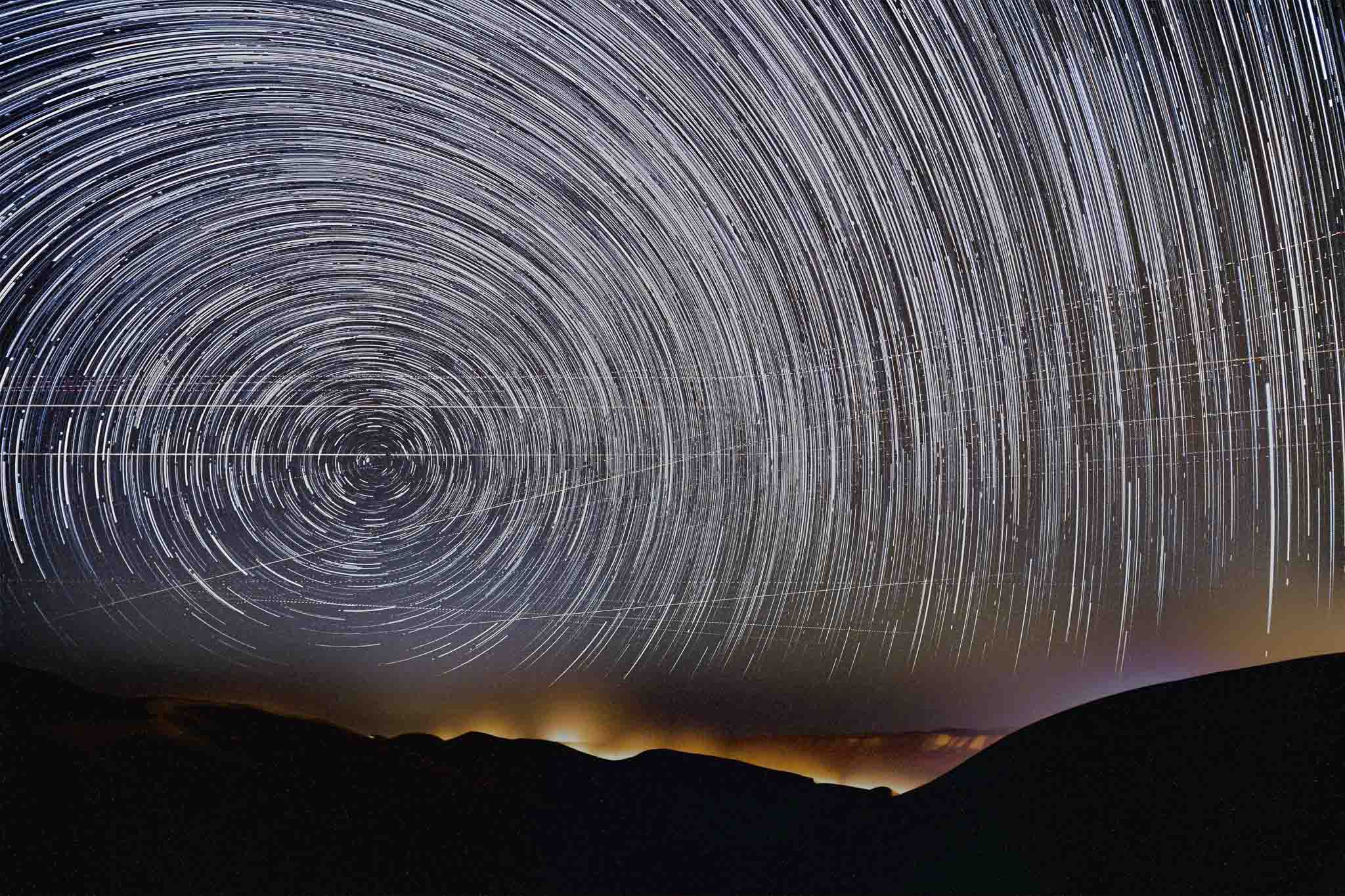
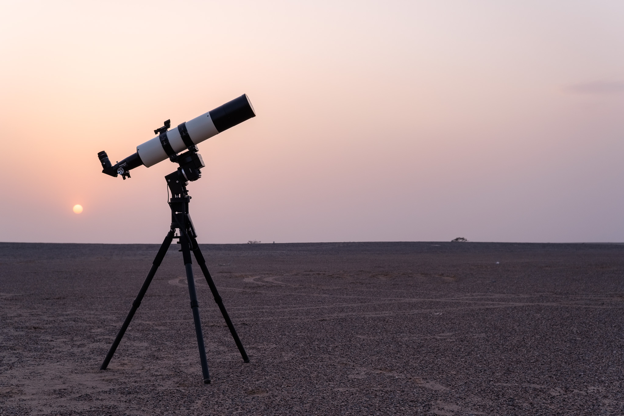
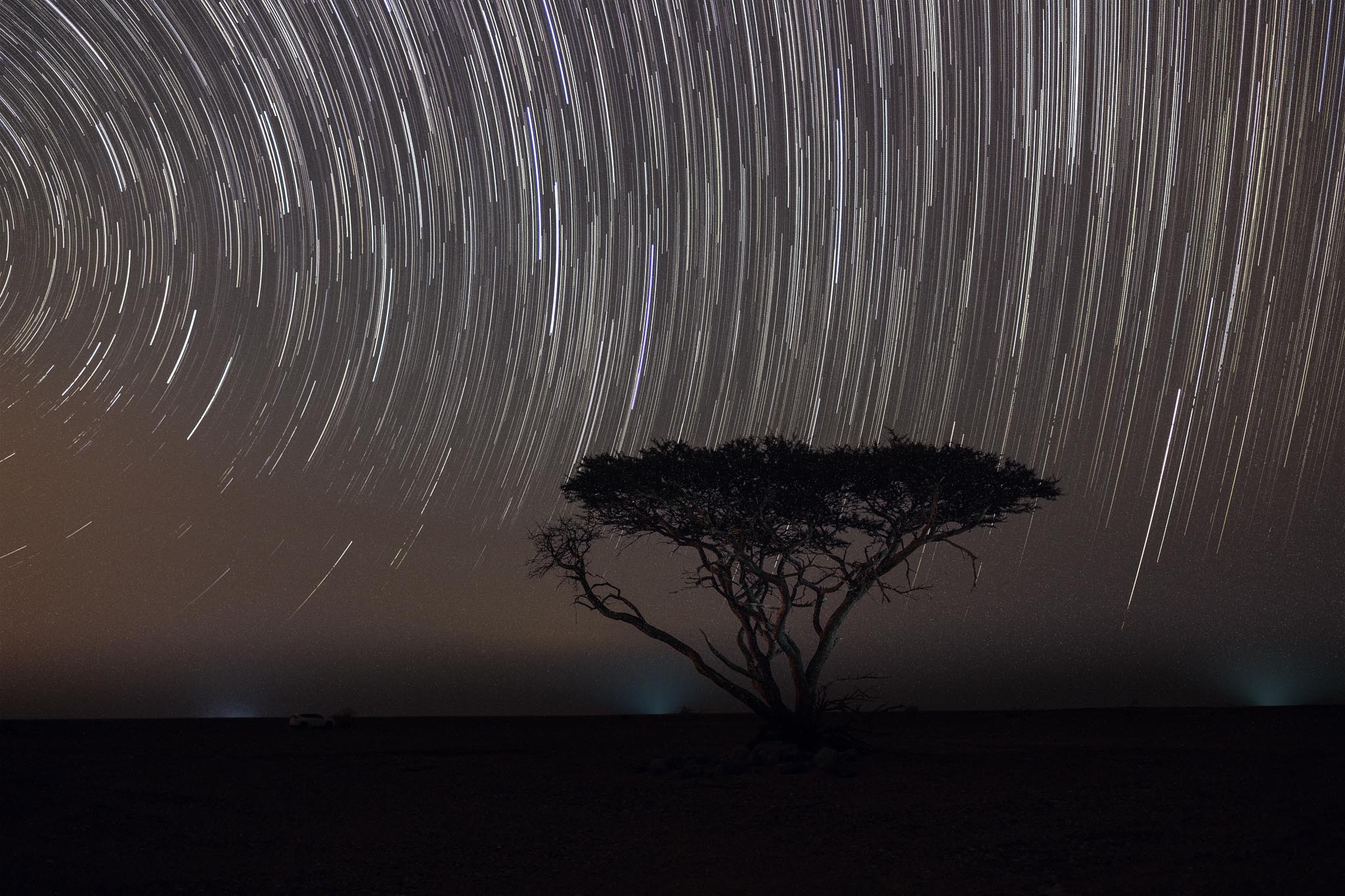
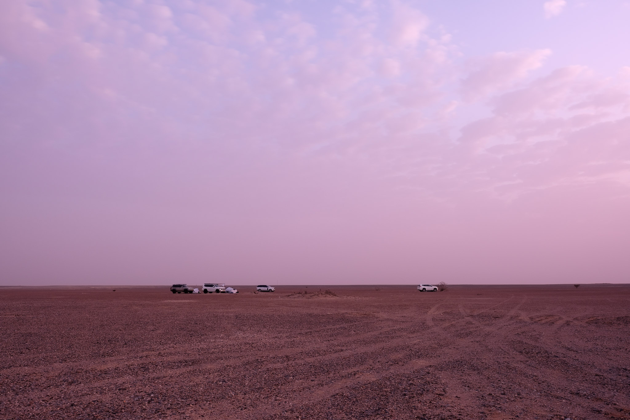
This article is about a recent trip of the local astronomy group to a dark observation site, located south of the town of Adam, about a 2.5-hour drive from Muscat. During my first stay in Oman, I used to be part of the astronomy club, so I was glad to learn that it was still active. Every month, the group goes to a dark site during the weekend closest to the new moon, for some great night sky observation. There are some good experts in the group, with new telescopes and imaging gear, that can produce some stunning images of planets and deep sky objects; in my case, I simply enjoy looking through the telescopes, and take some photos to stack later, using trailing or accumulation options.
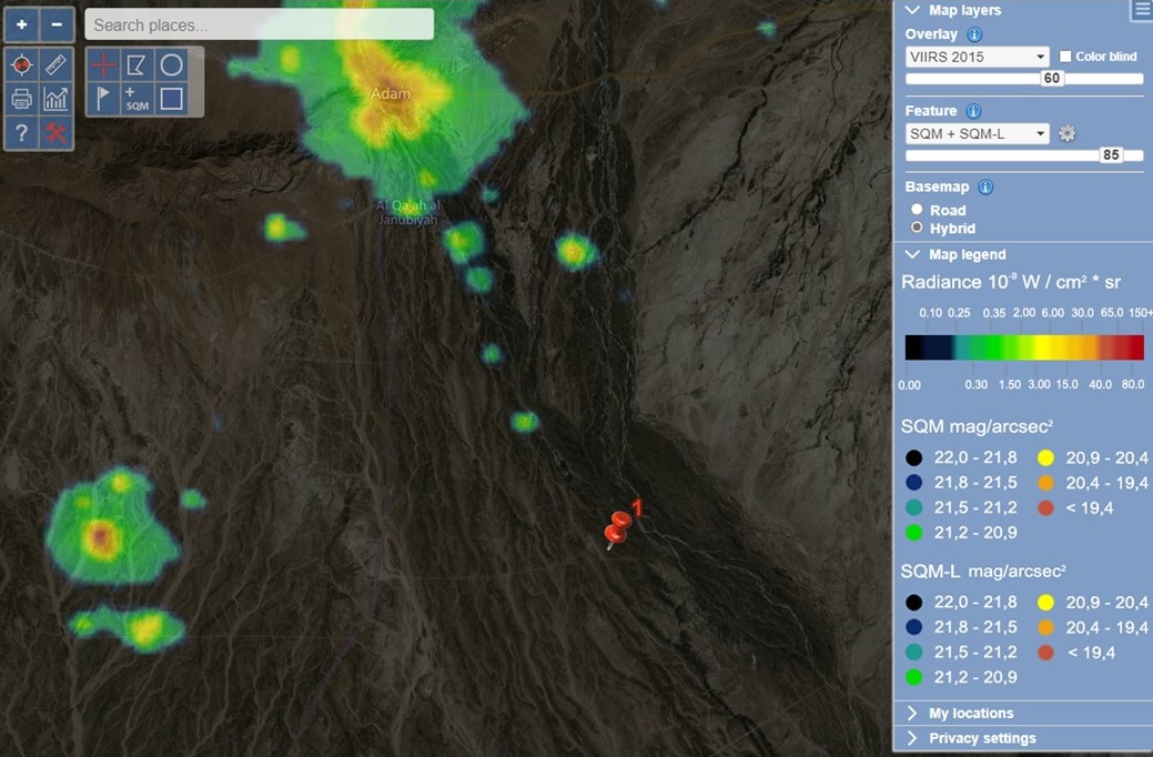
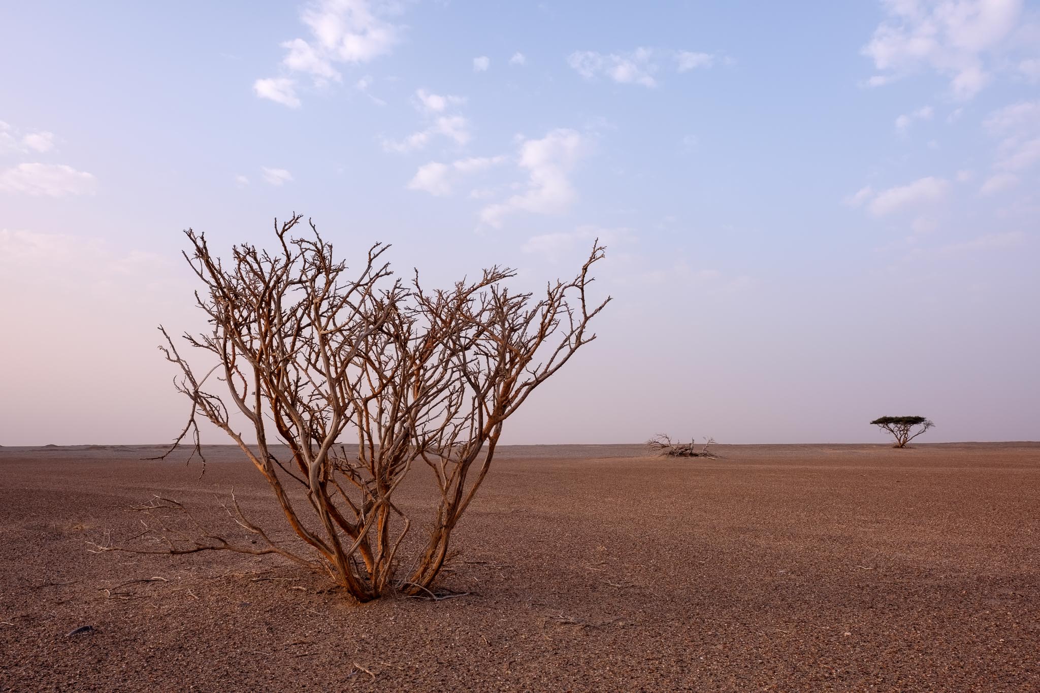
After an uneventful drive, we arrived at the site, which is in a flat gravel desert area that extends in every direction until the horizon. Most of the interior of Oman is like this, vast areas of flat landscape, where only a few shrubs appear here and there. As you can see on the following map, the light pollution levels are very low, which makes for excellent observation conditions.
Dark site location.
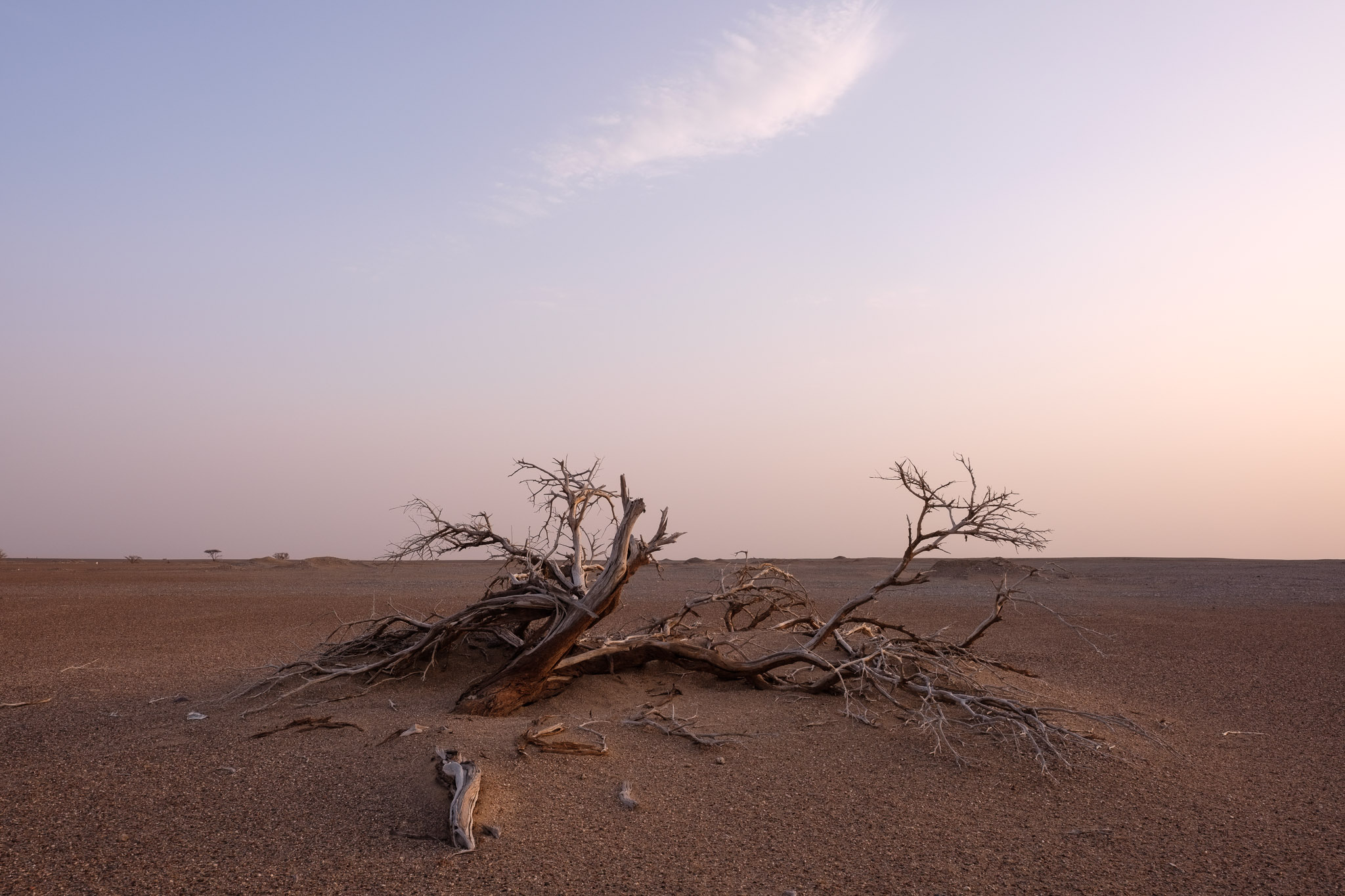
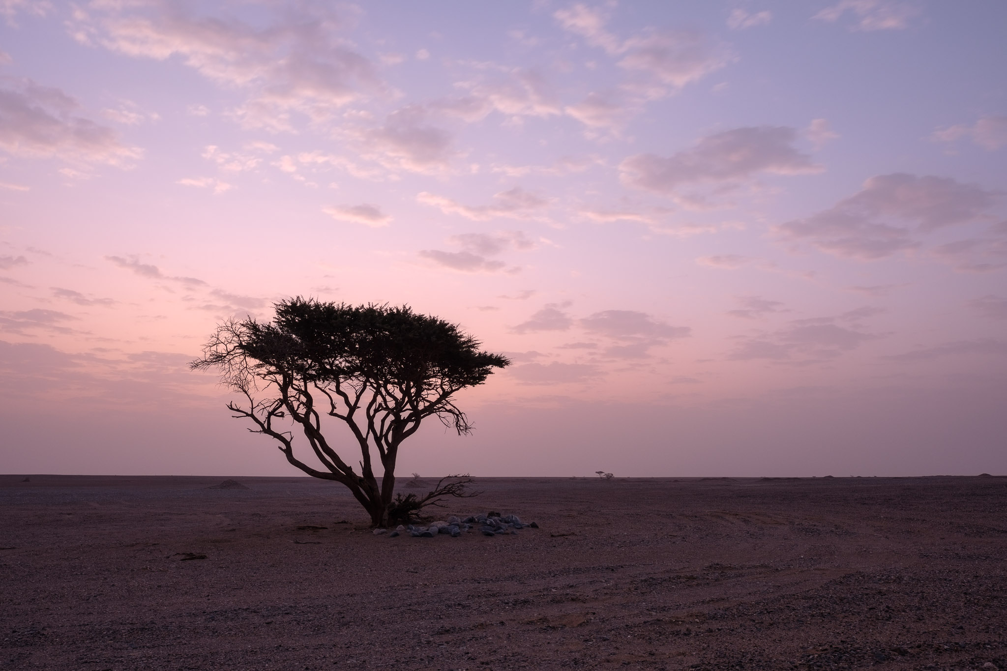
The wind had been quite strong during the day, kicking dust into the air, and we were concerned that might affect our viewing conditions. During the sunset, rather than abating, the wind picked up even more, bringing more dust with it. I walked around the campsite taking some photos and noticing potentially interesting compositions. The scarce shrubs provided interesting foreground subjects while framing the photos against the featureless landscape.
Dry.Sunset.Waiting
Fortunately, the dust cleared around 9 pm, but the wind continued to blow strongly. We were able to see some interesting objects, like Jupiter and a few double clusters; the highlight was the Orion nebula, with its dust and gas clouds clearly visible around the stars. Due to the wind, the telescopes were shaking a bit, so it was not possible to take images. Despite the strong wind, I decided to set up my Fujifilm XT-5 camera with the Fujinon 16mm f/1,4 lens on the tripod, and shot about 120 images at 30 seconds each, which resulted in 1 hour of total time. I framed a tree in the foreground, to provide a focal point against the night sky. After finishing the images for the star trail, I then mounted the XT-4 with the Voigtlaender X 35mm f/1.2 lens and took 10 photos of the Orion constellation. I used Sequator to stack both sets of images, the first one as a star trail, and the second one as accumulation.
Star trail.Orion.
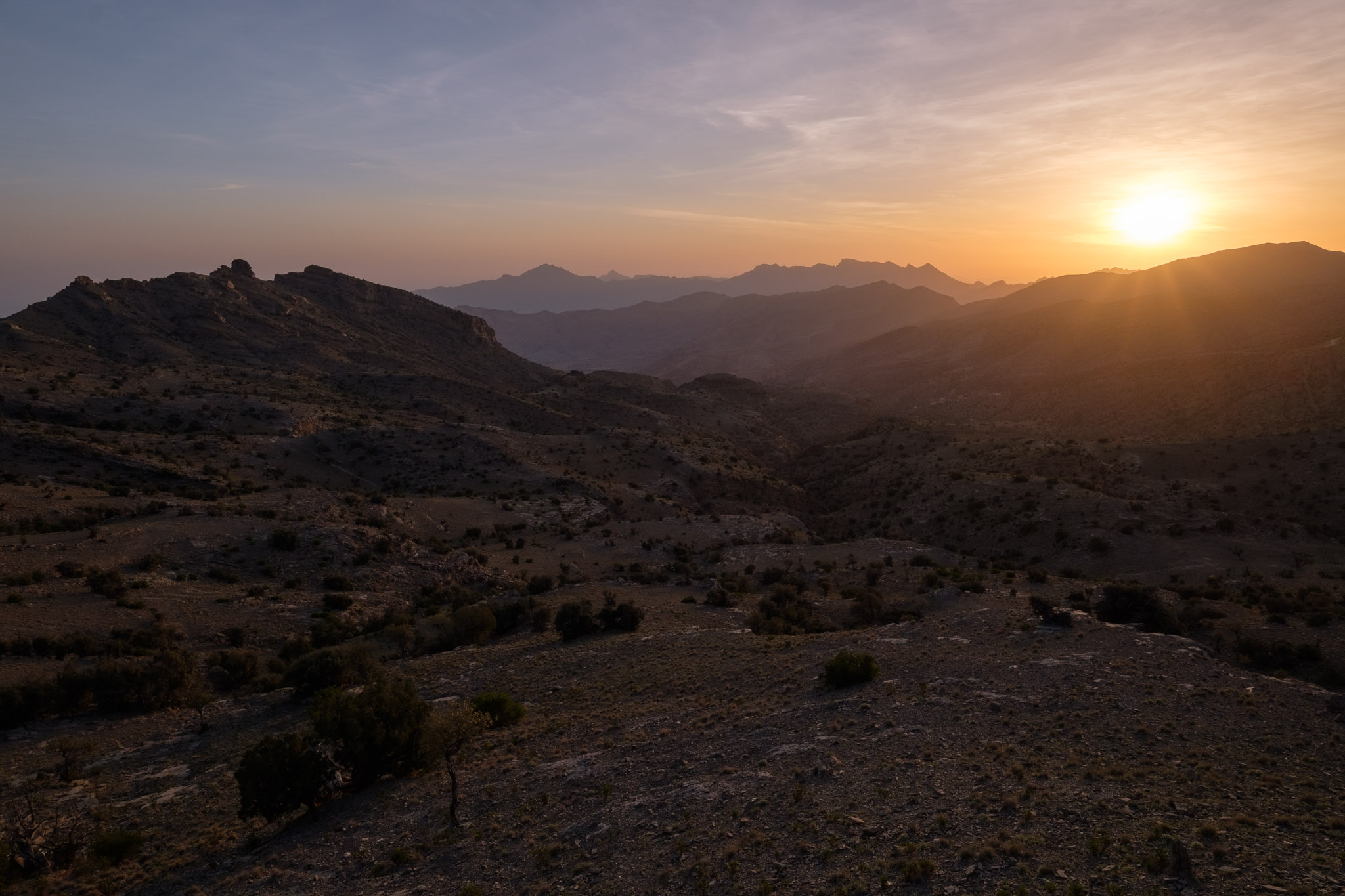
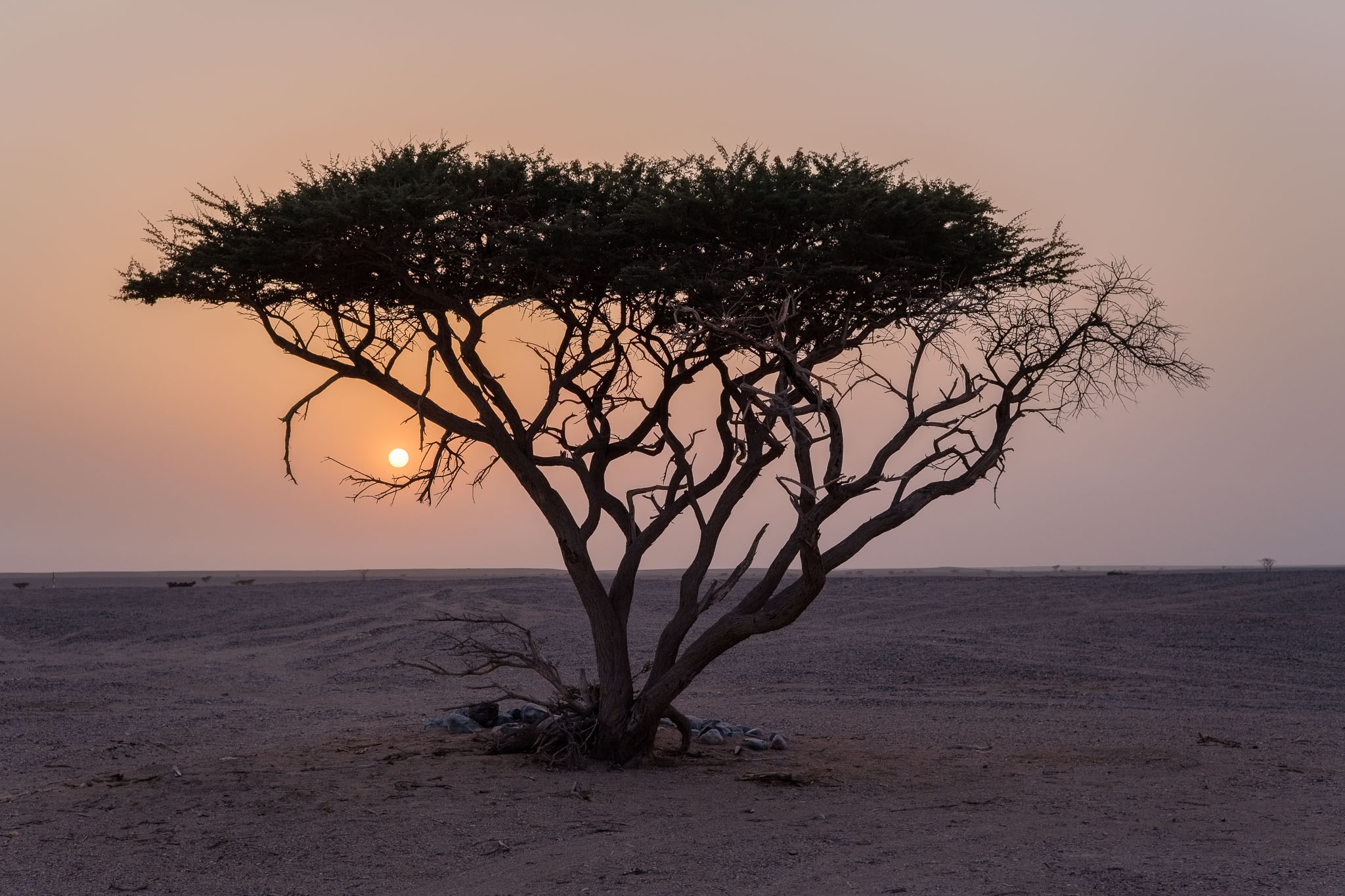
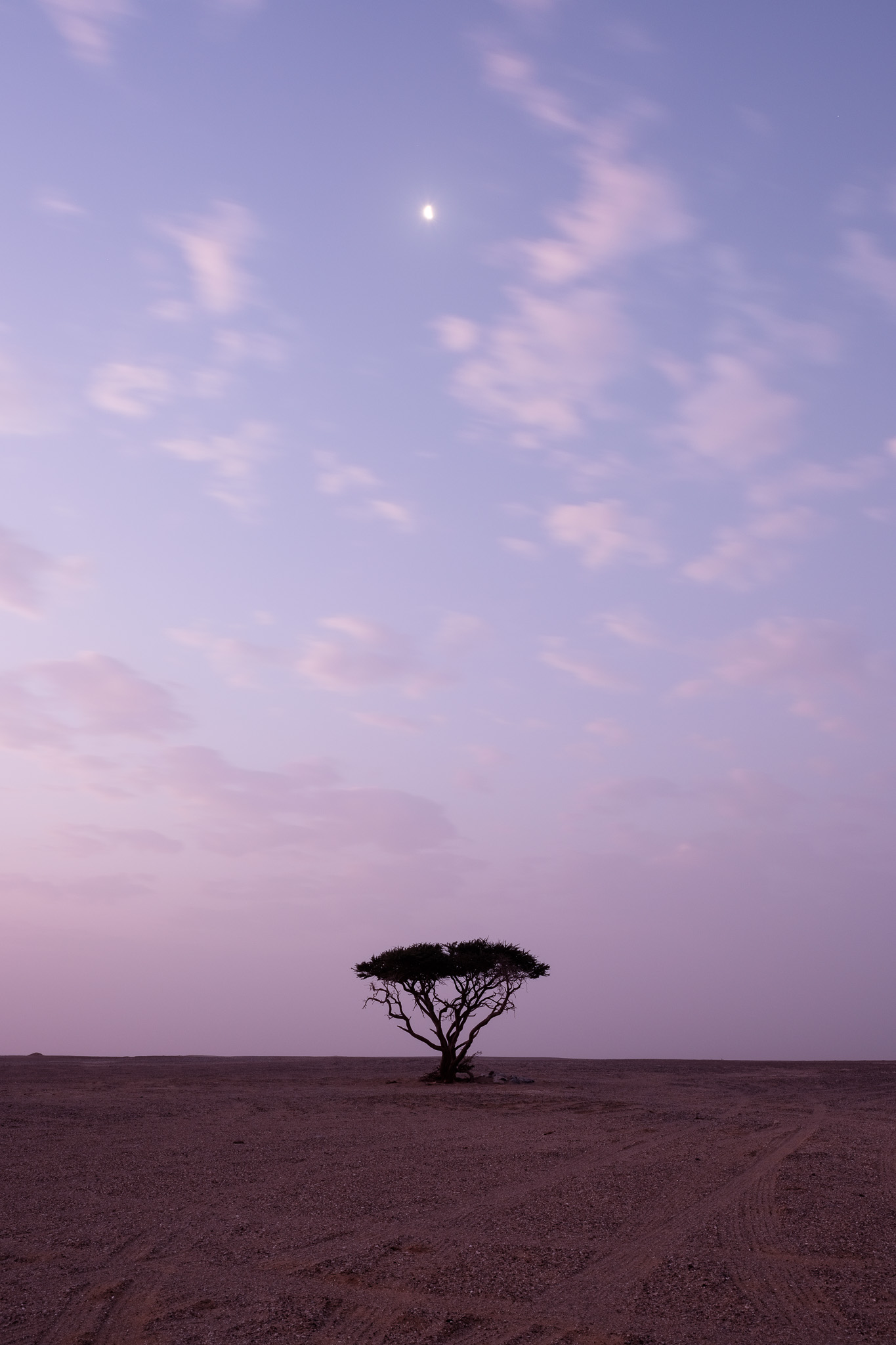
The following morning, before sunrise, the wind had died, and there was an eerie quietness due to the prevailing silence. A few crows were flying overhead. I walked around taking photos of the small trees and shrubs. There was still a lot of dust in the air, so when the sun came up, the light was diffused; I used this to shoot some photos of the trees against the rising sun, to good effect. Even with the wind and the dust, it was a nice trip, it is always good to go out in the field and spend the night under the stars.
Earth and moon.Sunrise colors.Emptiness.Near and far.
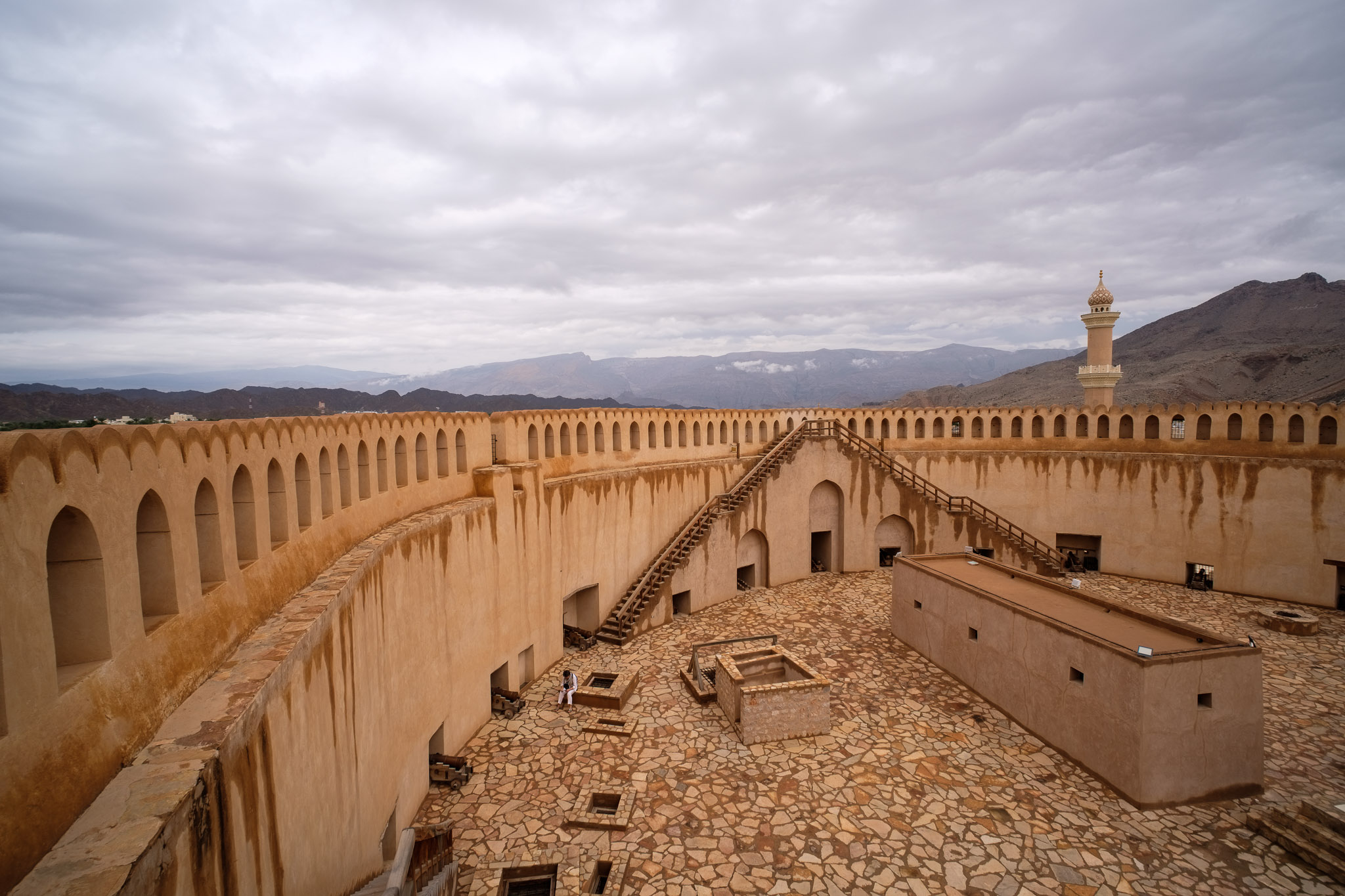
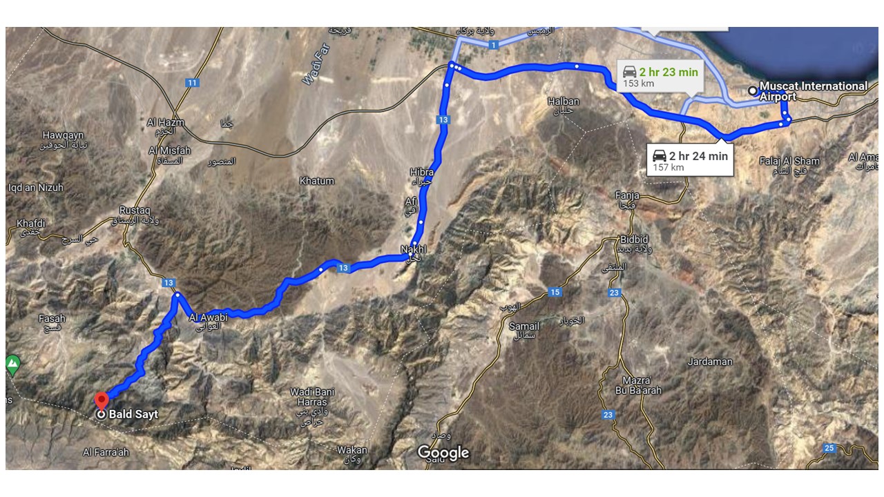
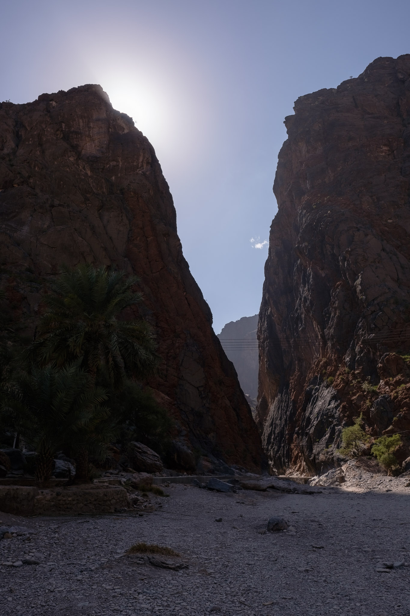
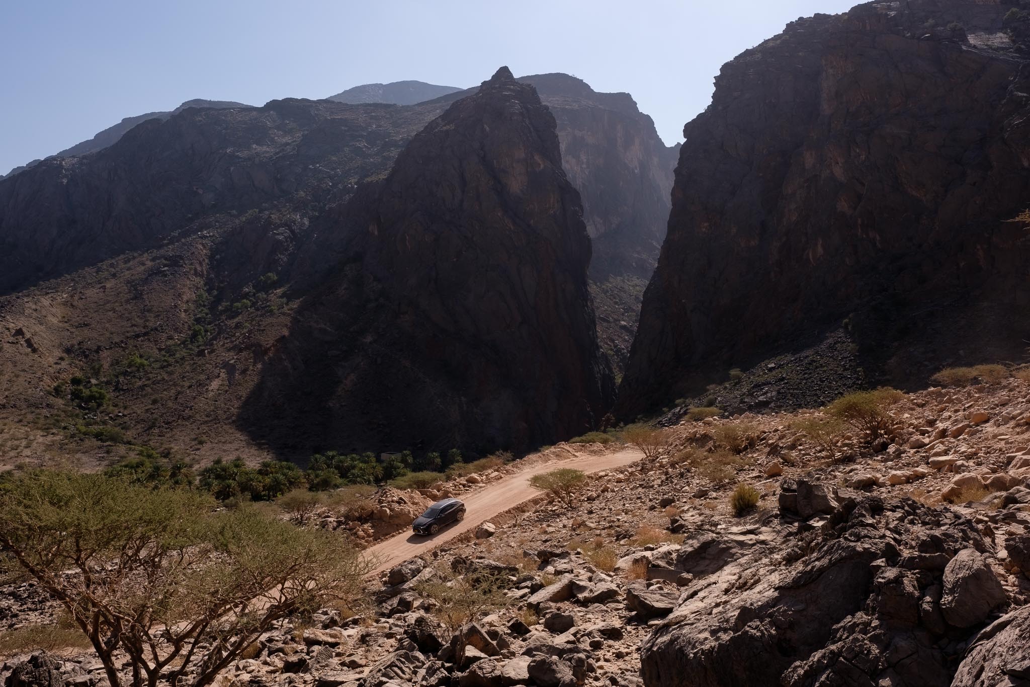
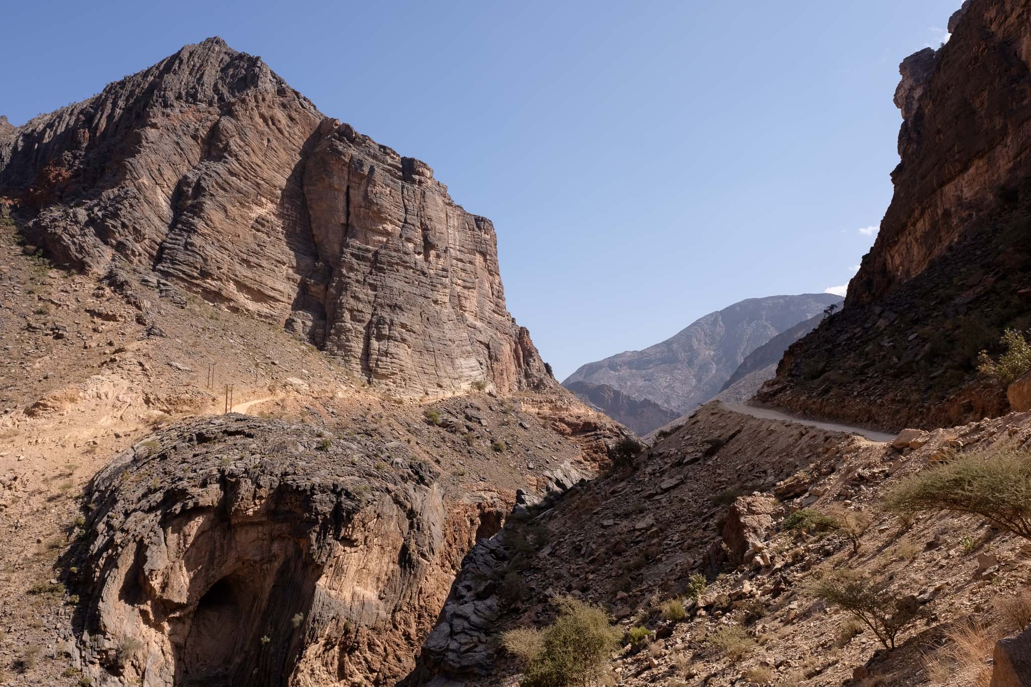
The Al Hajar mountain range in north Oman spans almost the entire country from east to west. This vast region is home to some of the most beautiful and wild places that you can visit and explore. One of my favorite places is located close to the picturesque village of Bilad Sayt (see map below for general location). To reach this spot are two main alternatives: you can drive from Muscat to Al Hamra and go up the gentle southern flank of the mountain via a nice blacktop road; or you can drive from Muscat to Nakhl and go up the steep northern flank. The latter option is the one I prefer, as it involves driving along a very scenic gravel road that crosses some beautiful landscapes and mountain villages. It requires a 4WD vehicle, and careful driving, but it is well worth the effort.
Location map.
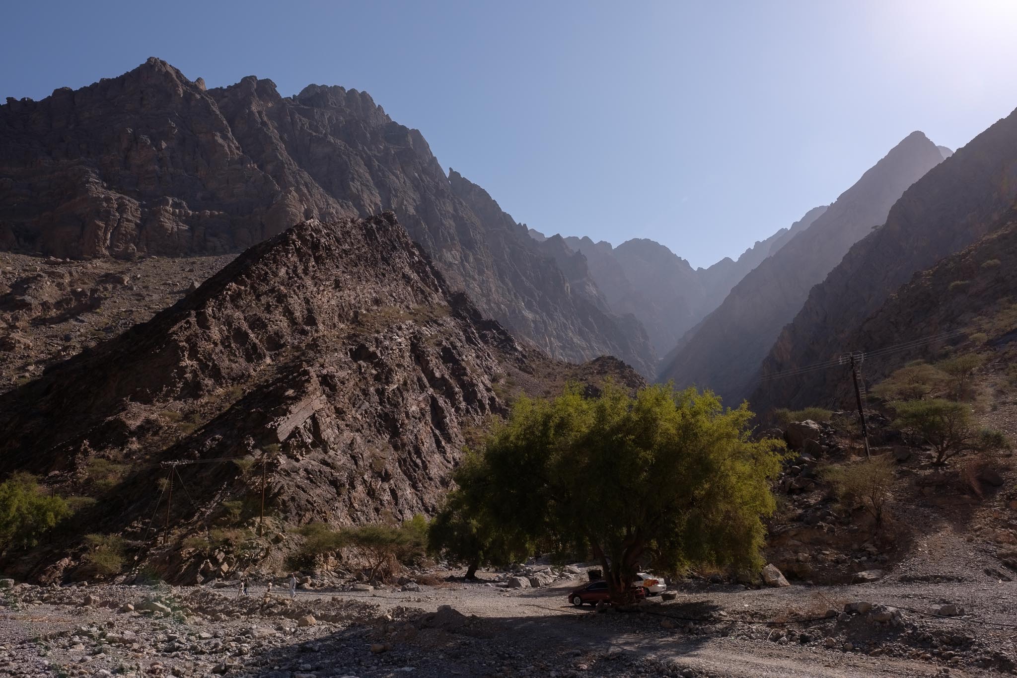
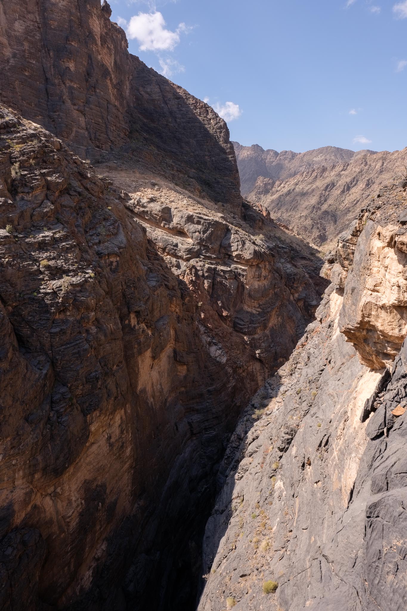
Once you leave the black top, you will enter Wadi Bani Awf, and its labyrinth of canyons surrounded by jagged peaks. After a few km of driving through the valley floor, with some green farms along the way, the road starts to climb, along a series of sharp curves. This part of the trip will take you to Bilad Sayt, a village that is nested on the flank of a hill, surrounded by mountains and green cultivated fields. Just before reaching the village, don’t miss one of the entry points for the famous Snake Gorge, a deeply cut and narrow canyon where the sun rarely shines; it is one of the most popular adventure destinations in Oman, involving some rough trekking and swimming through a few pools. I did it back in 2003, and it was a thrill.
Inside wadi Bani Awf.Small farm in wadi Bani Awf.Geometry.Going up.Looking down into part of Snake Gorge.Before Bilad Sayt.General view of Bilad Sayt.Bilad Sayt.
Bilad Sayt is a good place to take a leisurely walk in between the farms and houses, to experience a way of living that is centuries old. Omanis are very friendly and will be invited to have coffee and dates. After the village, the road becomes quite steep, as it ascends the flank of the mountain, which on this side is almost vertical. Be prepared to negotiate hairpin bends and use low gear. The upside is that some fantastic views will open in front of your eyes, encompassing the mountain range and wadis. It is impossible not to stop a few times to take photos.
Half way up the mountain.
It is early January, so when I finally reach the top, it is colder than in the valley; after all, we are roughly 2,000 above sea level. Compared to the last time I was here, in 2009, a couple of tourist projects have been built, but it is still quiet and peaceful. There are other people around, mainly sightseeing; as I mentioned earlier, it is easier just to drive up the northern side of the mountain. I pitch up my tent and sit down for a while, enjoying a snack and taking in the views and feel of the place. I am close to the edge of the steep cliff, and the panoramic views are amazing. A few goats are grazing in this rocky landscape, which is mostly barren and dry, apart from a few bushes and some trees.
View from the cliff’s edge.The wall.Rugged.Lone tree.Tree at sunset.
I walk around taking photos and waiting for the sunset. Down in the valleys below, the nighttime is already encroaching, while towards the west, the sky and clouds take on the warm colors of the setting sun. It is a magical part of the day. During the night, the temperature dropped considerably, to only a few degrees above freezing. Some heavy clouds also rolled in, but only a few raindrops fell. Looking at the image files later, I decided to convert a few to black and white, to enhance the light and the shapes in the landscape.
Sunset panorama.Shadows and clouds in black and white.Waves of rock in black and white.Nighttime.At night.
The following morning, I woke up before sunrise and had another great photo session. I walked along the ridge taking photos as the sun was rising, with some great light. I was only surrounded by windy silence, the same goats from the previous day, and a couple of eagles flying above me. After an hour or so, it was time to have breakfast and break out camp. It was a wonderful experience to come back to this place and see that it remains unspoiled.
First light.First light.Soft colors.Day breaks.Sentinel.Goat.Goats.Sunrise panorama #1.Sunrise panorama #2.
As a final note, all photos were taken with my Fujifilm kit, namely the XT-4 and XT-5 cameras, with the 16mm f/1.4 and 56mm f/1.2 lenses.
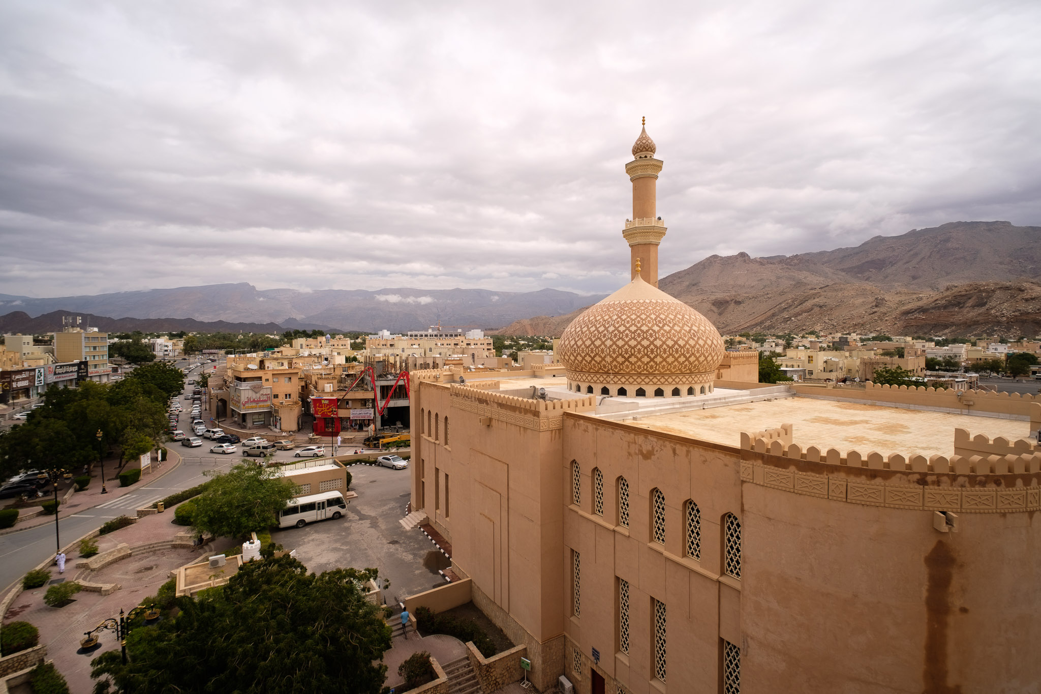
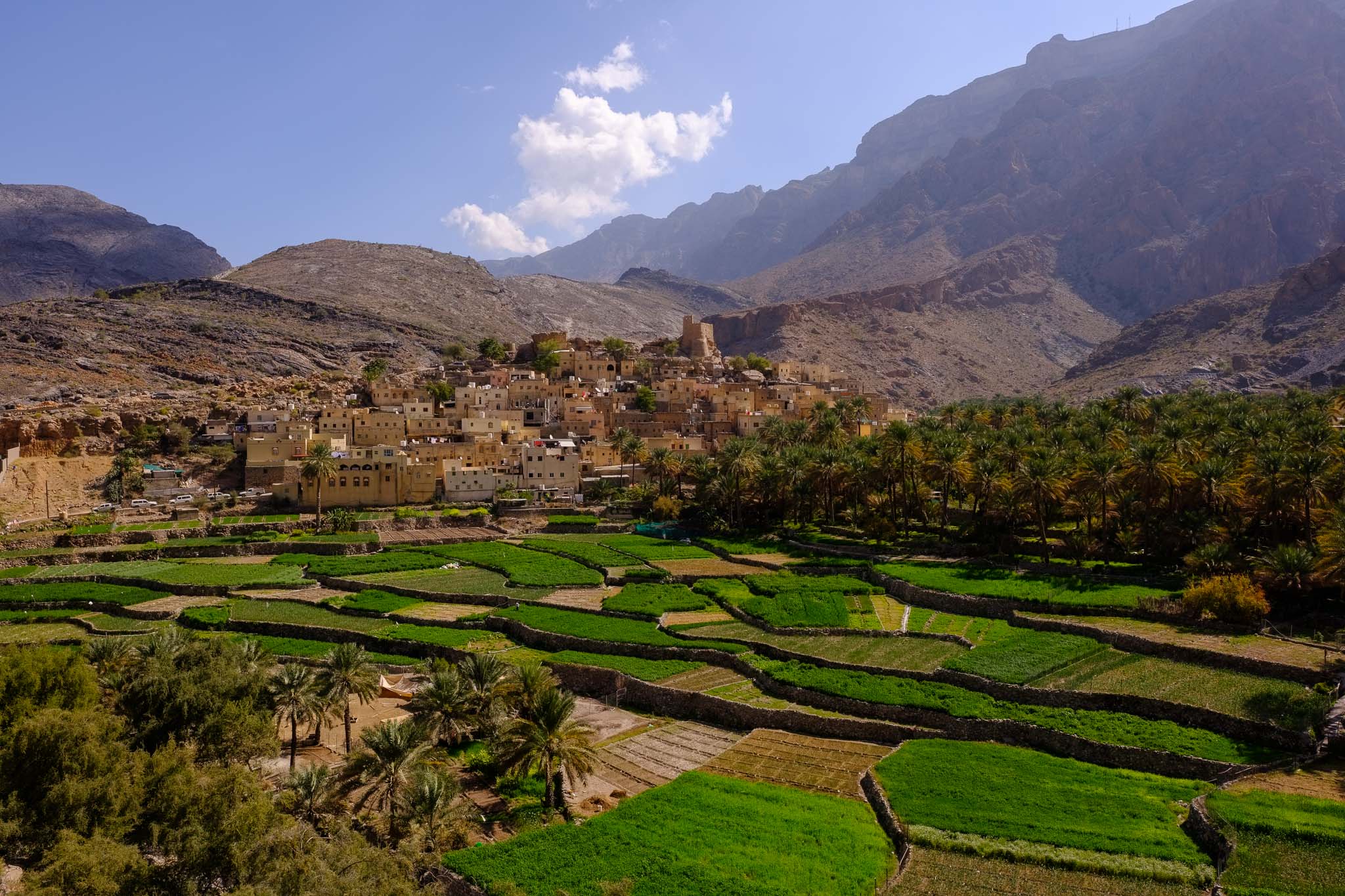
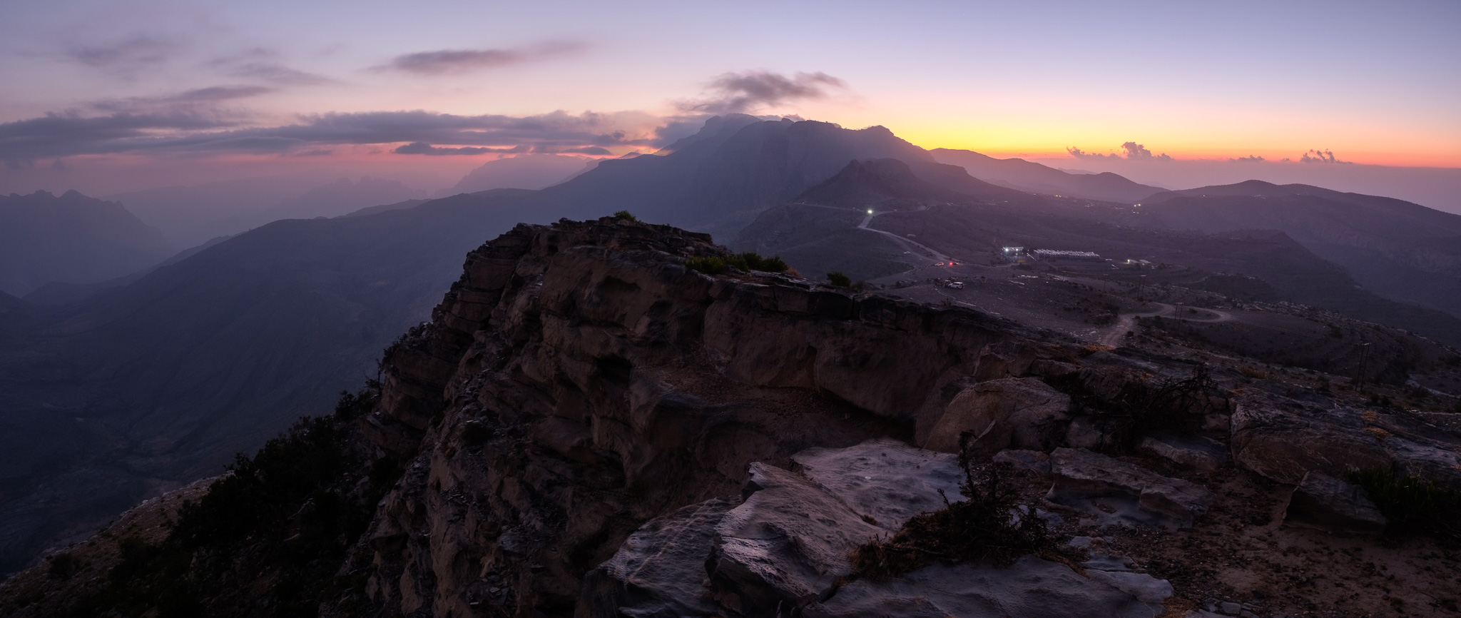
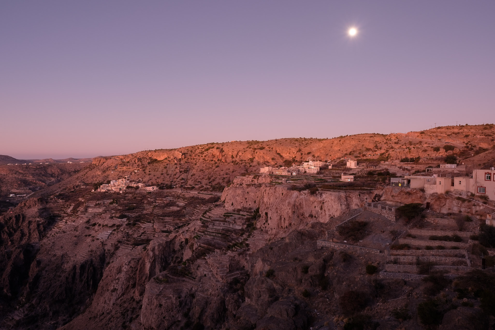
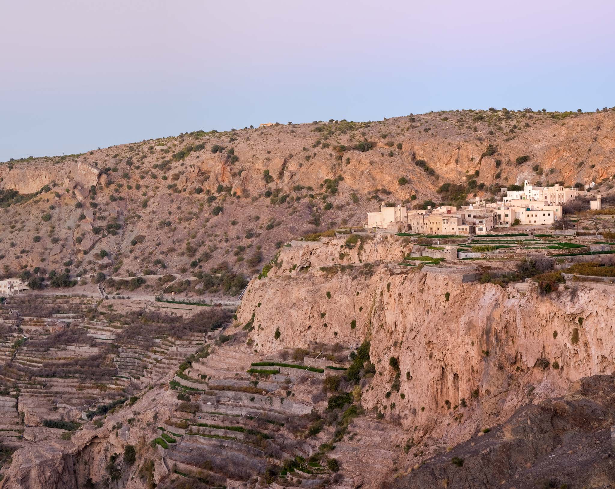
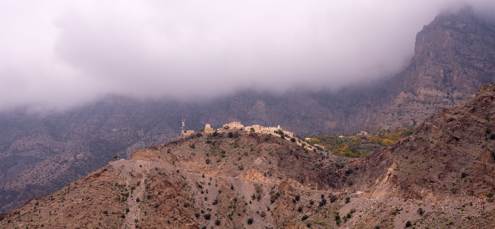
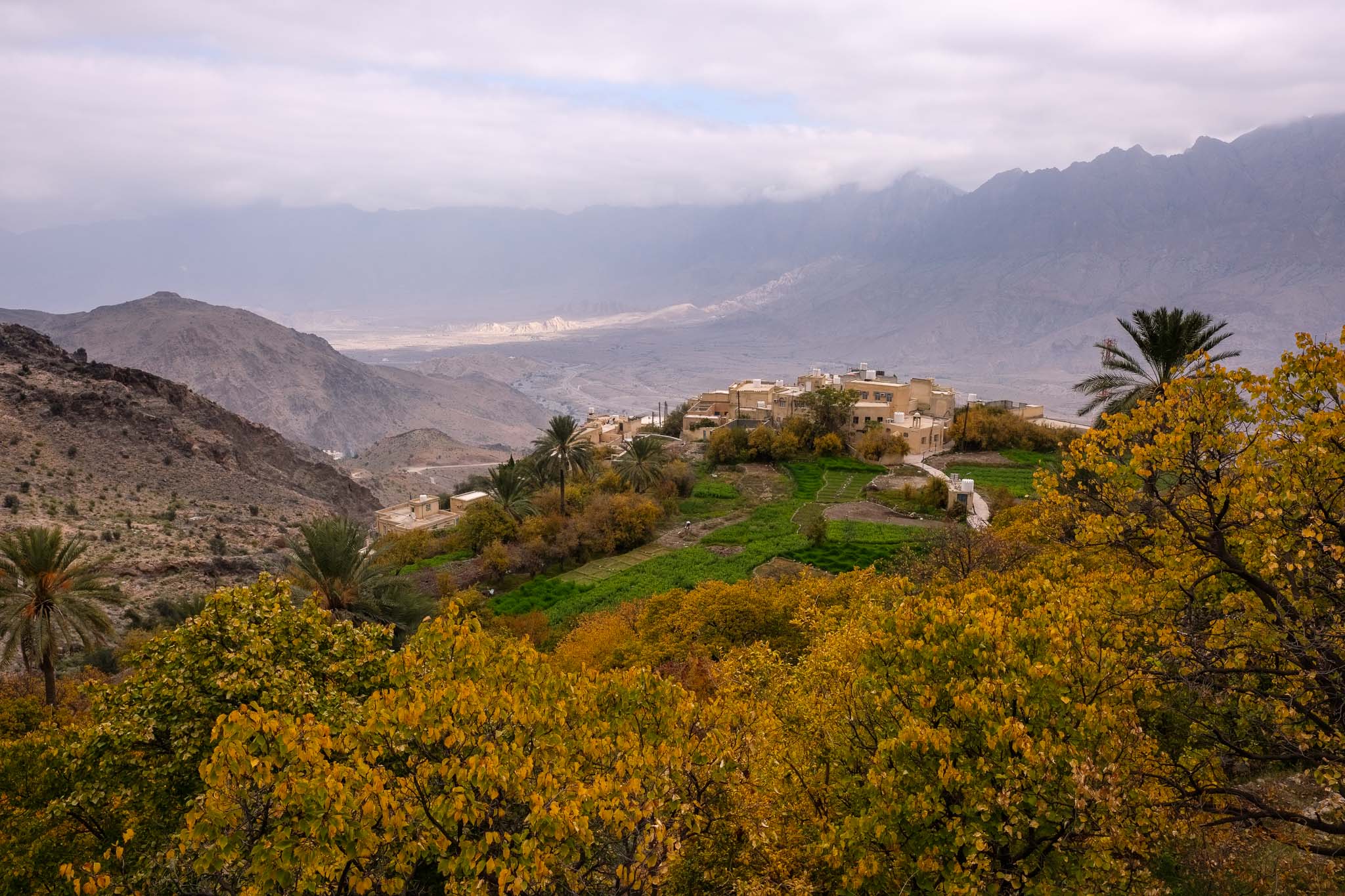
The Jebel Akhdar (Green Mountain) rises to a height of nearly 3,000 m and is part of the Hajar mountain range. It includes the Saiq Plateau at 2,000 m altitude and receives enough rainfall and moisture to sustain agriculture. The area is famous for its maze of wadis and terraced orchards, where roses, pomegranates and apricots are abundant. These patches of lush vegetation, in stark contrast with the surrounding dry and rugged land, are what give this region its “Green Mountain” name.
Jebel Akhdar is one of the obligatory places to visit and experience in Oman and has been designated as a nature reserve since 2011. The region became notorious after Princess Diana’s visit in the 1980’s; she admired the sunset from a viewpoint that has since been known as “Diana’s point”. I first visited Saiq Plateau in 2004, and back then there was only 1 hotel and a few scattered houses, plus the old villages nested in the terraced farms. Today there are many hotels and resorts, but the beauty of the landscape still enchants visitors.
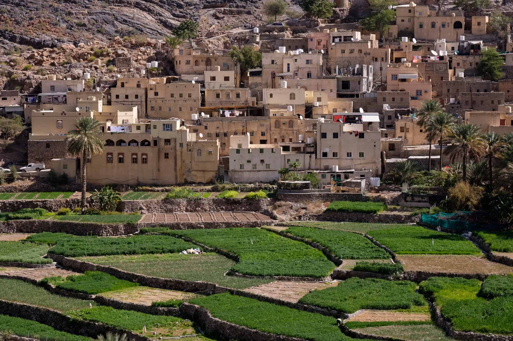
I went back to the Green Mountain a few weeks ago, to walk the trail that goes along the terraces and the old villages. It is impressive to see the human effort that was required to mold the terrain into terraces that border precipices with hundreds of meters, where different cereals and fruit trees are grown. The water is supplied through an old falaj network, narrow channels dug in the rock. After driving around to get reacquainted with the area, I stopped near the terraces to admire the sunset. Lady Di was right, it is a magical experience. I took several photos as the sun went down behind the distant mountains.
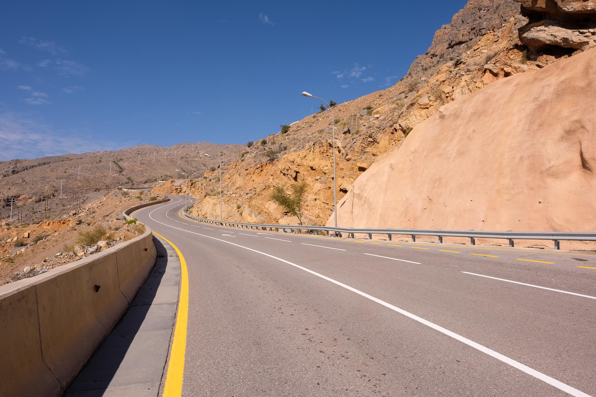
Going up. The Royal Oman Police (ROP) only allows 4WD vehicles to access the Saiq Plateau. This is for safety reasons, as the road is really very steep.Warm mist at sunset.Sunset.Sunset over the terraces and old villages.
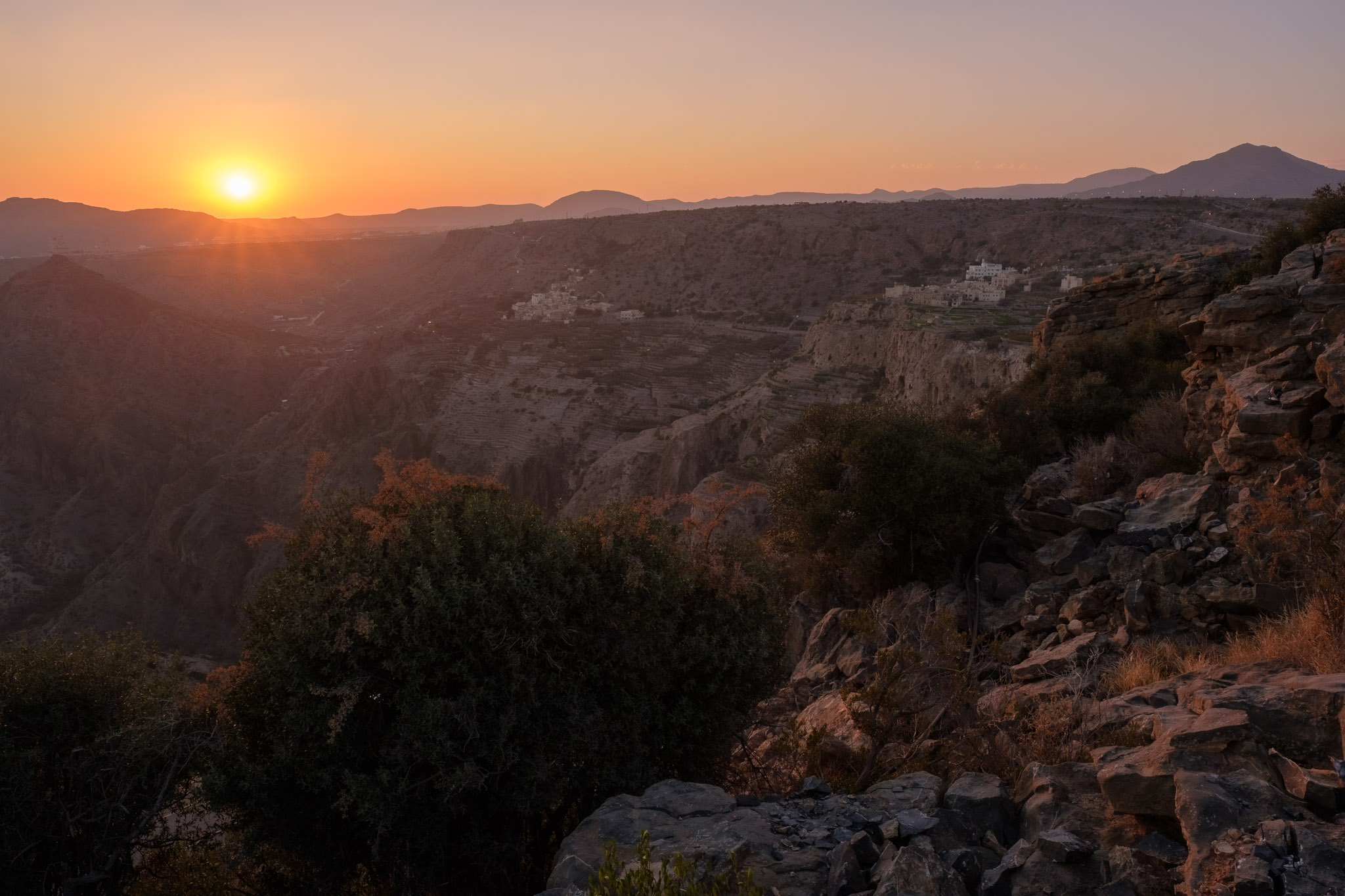
The following morning, I woke up well before sunrise, to photograph the terraces and villages as the first light was appearing. There was nobody else around, and the silence was complete. It was cold too. As the night transitioned into day, a soft pinkish light started to fall upon the cliffs.
Dawn under the Moon.Terraces at dawn.Rugged.
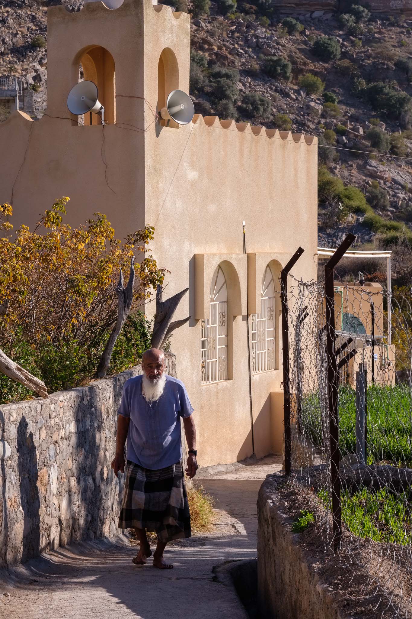
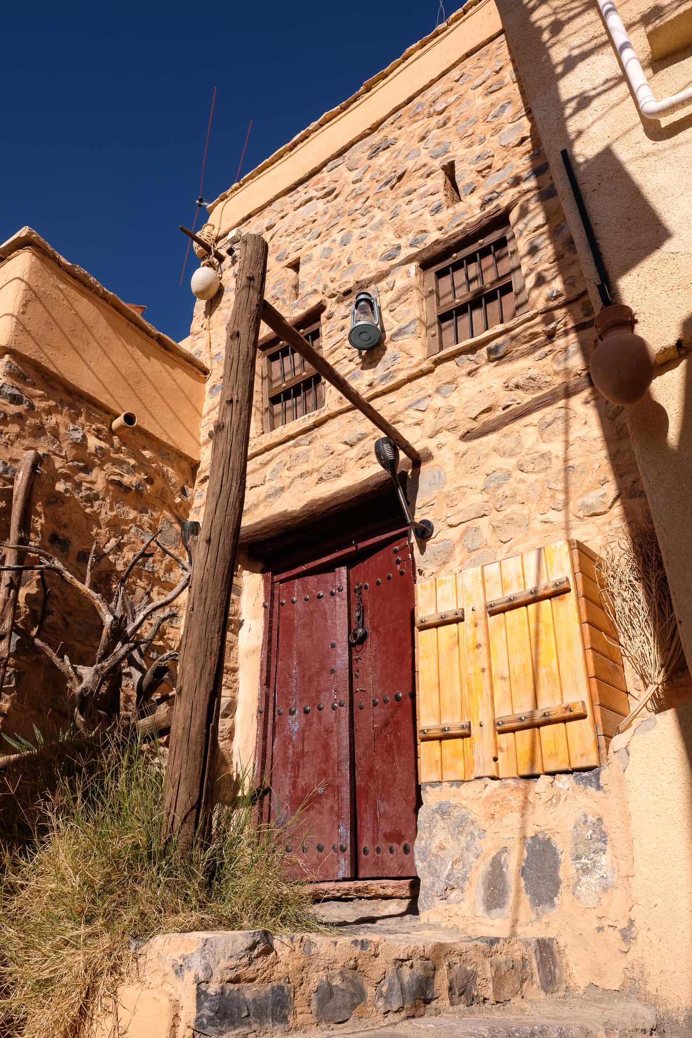
After a well deserved breakfast, I walked the terrace trail; it was still early, so I had the path all to myself. I suggest walking this trail early in the morning, when the air is crisp and cold, to appreciate the tranquility present in the narrow streets that wind between old mud and adobe houses. If you do so, you will also avoid other visitors. It takes around 3 hours and affords beautiful views.
Green fields and hard work.Old man.Old village.
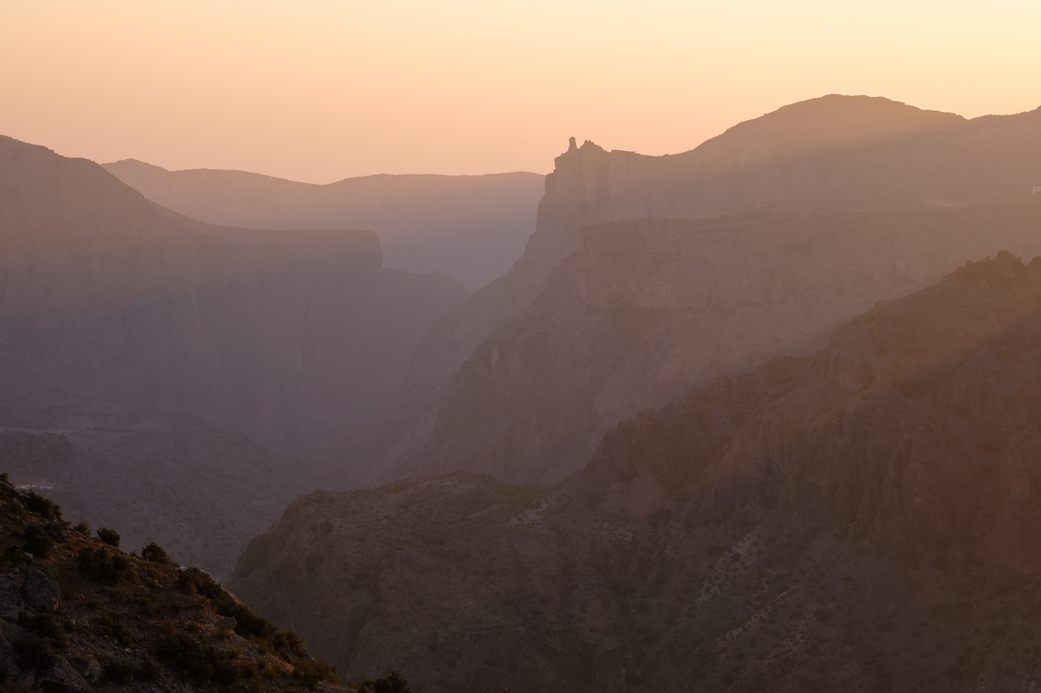
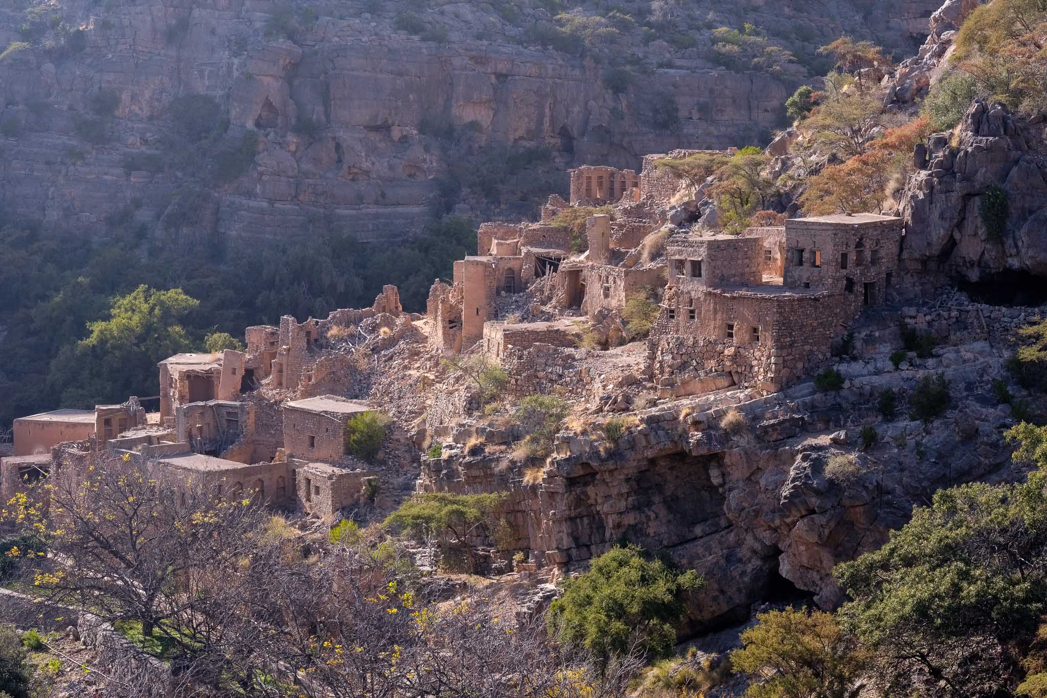
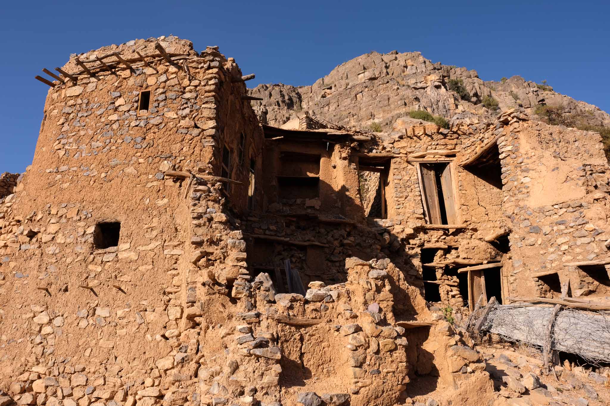
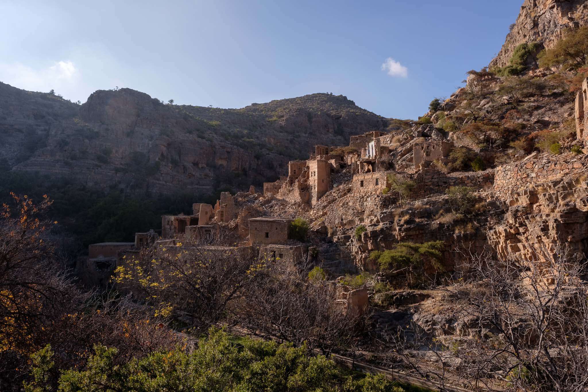
Besides this popular terrace walk, there are many other interesting places to visit, including historical abandoned villages (such as in Wadi Bani Habib and Al Sugra), and remote viewpoints that overlook the deeply cut mountain canyons at the head of major wadis. At this higher altitude, the plateau is also home to a good number of juniper trees, the largest of which are centuries old. You will also see several birds of prey, flying effortlessly against the blue sky.
View over the abandoned houses in Wadi Bani Habib. The village is uninhabited, but the fields are still cared for. Not long ago, the only access was by donkey.Old houses, Wadi Bani Habib.In the valley, Wadi Bani Habib.
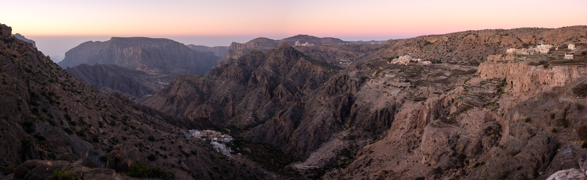
Given the wide landscape, I made a few panoramas as well.
Dawn panorama.Panorama in the mountains.Panorama of Moon and mountains.
Even if you are not a photographer, simply sitting down enjoying the beauty of the landscape, in complete silence, is a unique experience. I plan to return during springtime, when the rose gardens will be in bloom. This is one of the few remaining regions where the Damascus rose is still grown, for oil and water.
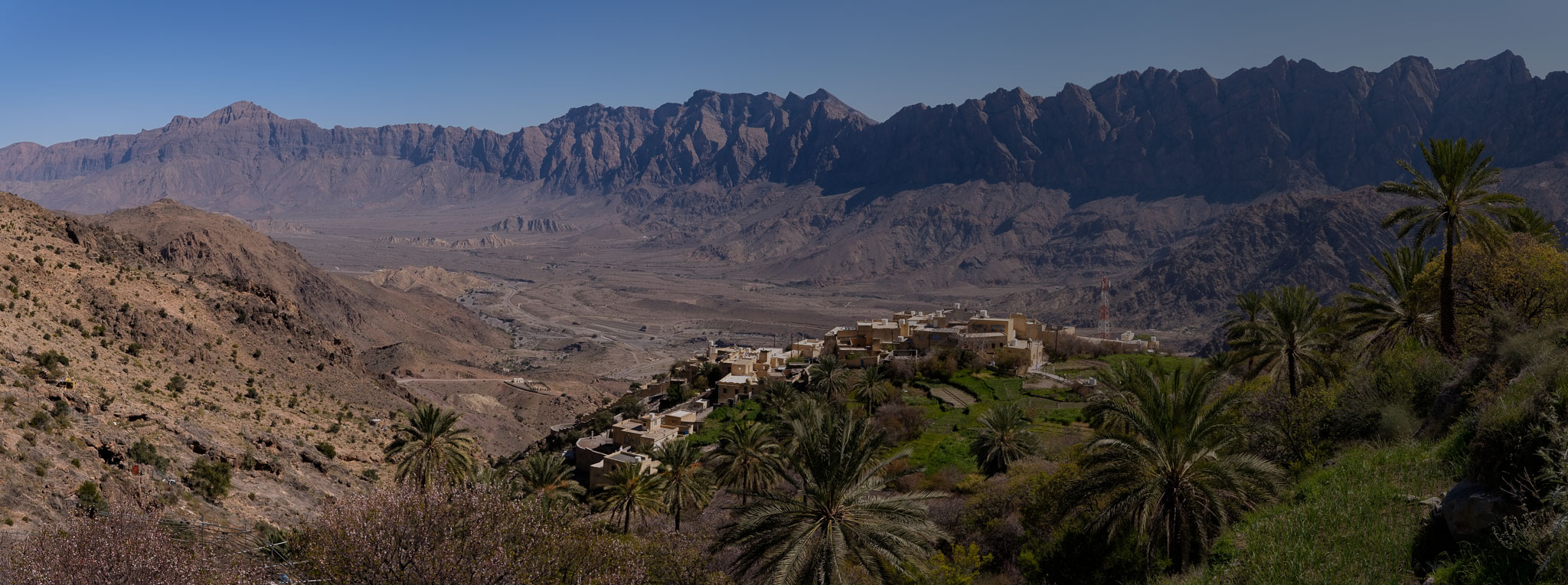
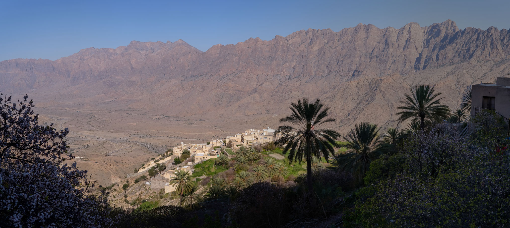
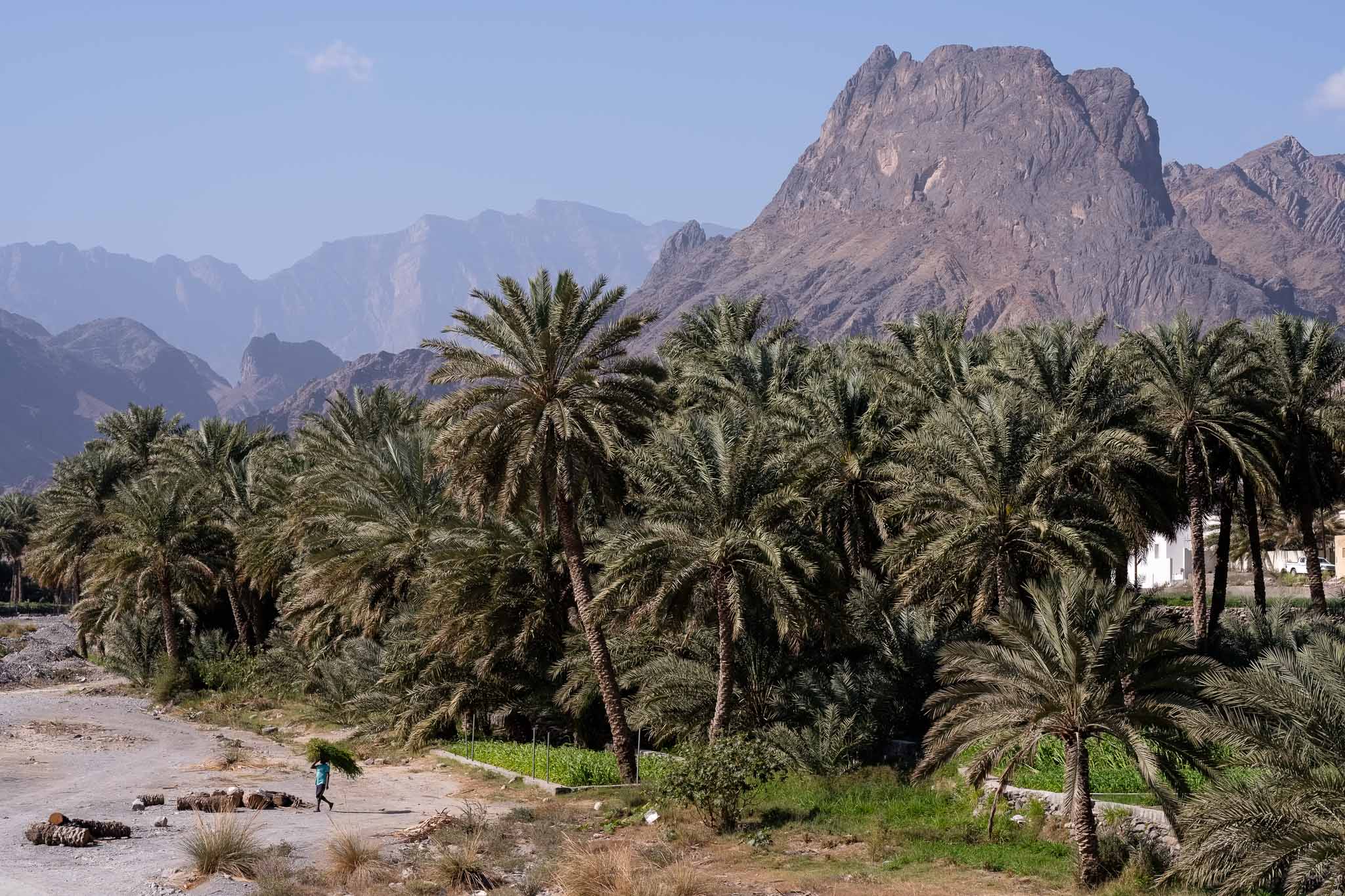
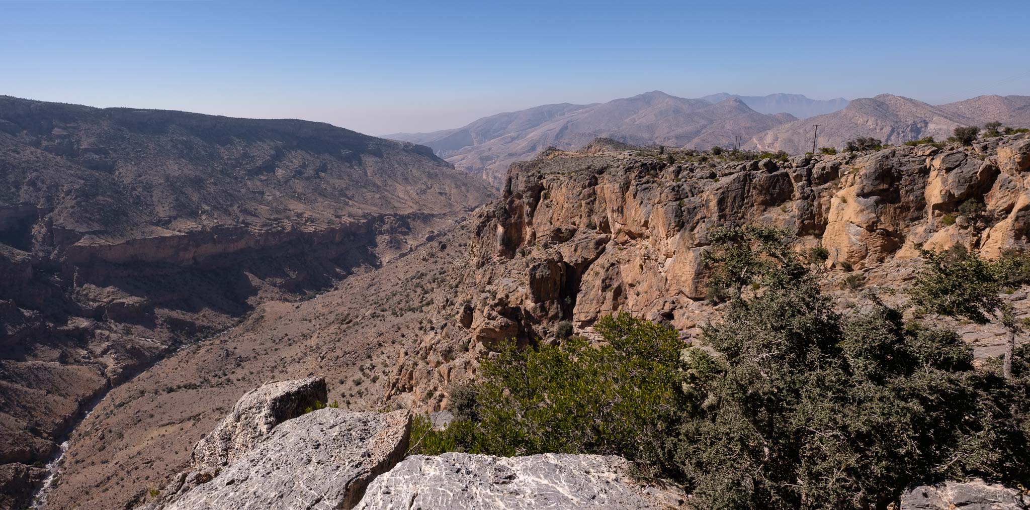
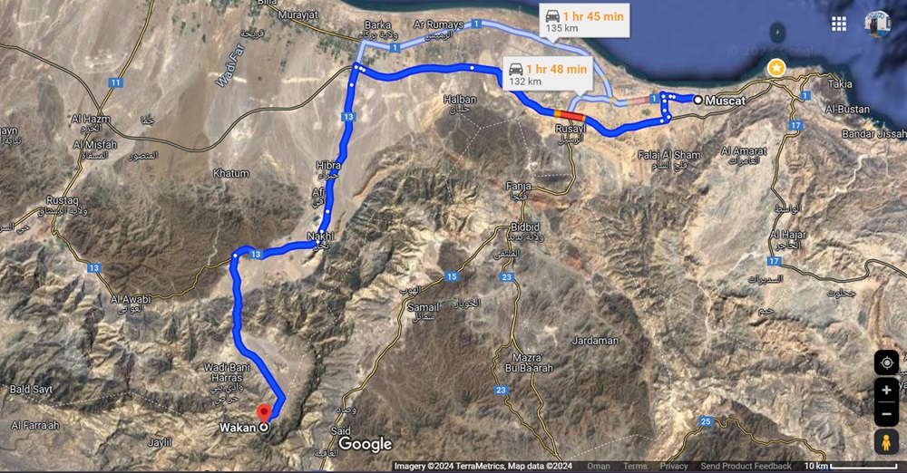
The small village of Wakan sits atop a hill, at the end of the Gubrah bowl, in the heart of the Jebel Akhdar mountains. During my first stay in Oman several years ago, this was one of my favorite places to visit; there are a few hiking trails in the area, and the views from above the village are stunning. The Gubrah bowl is literally a window into the (geological) past, as the erosion has carved out into the mountain range, resulting in a large flat area surrounded by tall and rugged peaks. The region is easily accessible, being less than a 2-hour drive from Muscat (see location map below).
Location map.
Even though the main road going through the Gubrah bowl is now blacktop, to reach Wakan you will need a 4WD vehicle, to negotiate the short but steep gravel road. Due to this limitation, the village is still relatively quiet, with a reduced number of tourists. For this visit, my plan was to walk the trail that starts in Wakan and climbs up the mountain, affording magnificent views over the mountains. The weather happened to be great, with a cloud cover that added an extra sense of mystery to the area. In my backpack, I had my usual Fujifilm kit of 2 cameras and 2 lenses, namely the X-T5 with the 16mm f/1.4 lens, and the X-T4 with the 56mm f/1.2 lens.
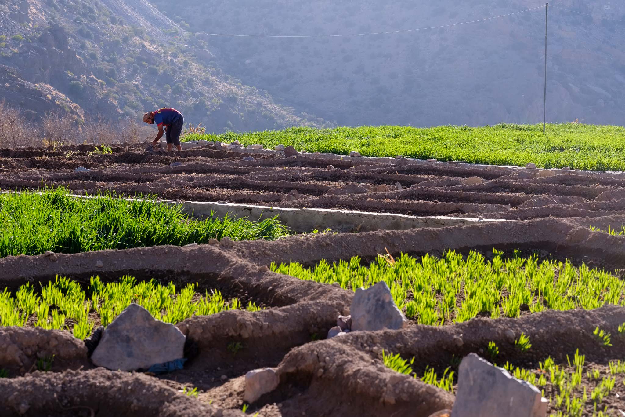
The village consists of a few houses, which are nested against cultivated terraced hills; people grow fruit trees (pomegranate, almond, peach, among others) and several types of cereals and vegetables. At an altitude of 1400m, the climate is cooler than in the valley below, and there is plenty of water that comes from the mountain through a network of falaj, or channels excavated in the rock.
Mountain’s gate. Approaching the entrance of Wadi Mistal.Inside the Gubrah bowl.On the road.Surrounded by mists and mountains, Walkan sits at the top of a ledge (panorama assembled from several photos).
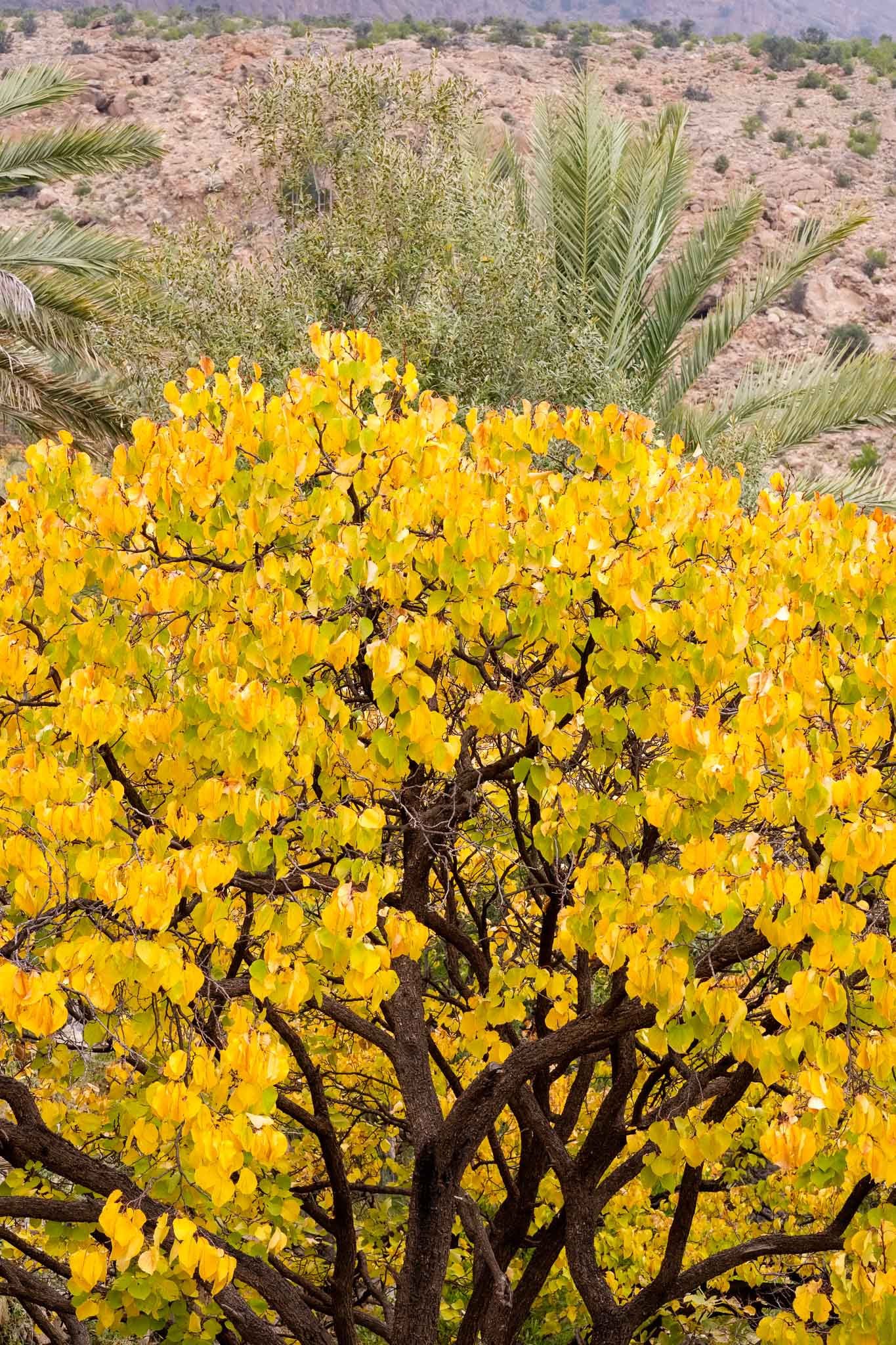
The first part of the hike is easy going, as you cross the village and the fields. The trees are showing the colors of Autumn, with rich oranges and reds. I stopped several times to take a few photos. The clouds and the mist add to the sense of quietness that emanates from the mountains. After a few hundred meters, the paved steps end, and you start walking along a narrow and rocky mountain trail, that has been used for centuries, as it connects Wakan to the Sayq Plateau, which is located higher, around 4 km away. Every now and then, I stop to take photos and enjoy the scenery. Sometimes the sun breaks through a gap in the clouds, shining upon the valley below.
Wakan from above, with the green fields and the Autumn colors.Autumn colors.
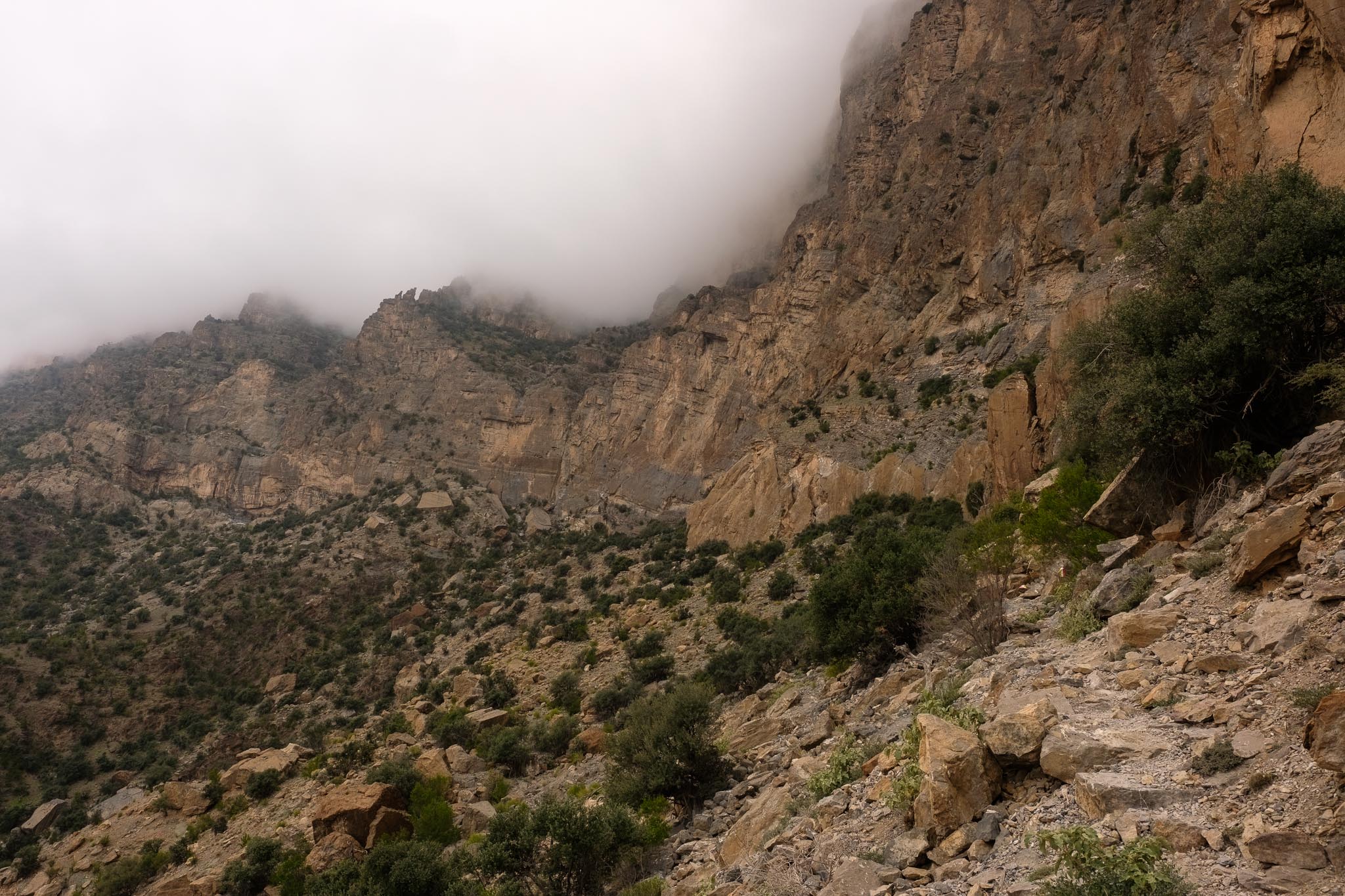
The way is always up, but after a while the trail levels a bit, next to a huge cliff face. This is a good spot to rest and admire the view. This time, I decided to return to Wakan, rather than walking all the way to Sayq Plateau, which requires a bit more time. But even if you walk only up to this point, it is already a great experience.
On the trail.Clinging to the rocks.Fellow walkers.
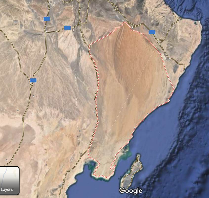
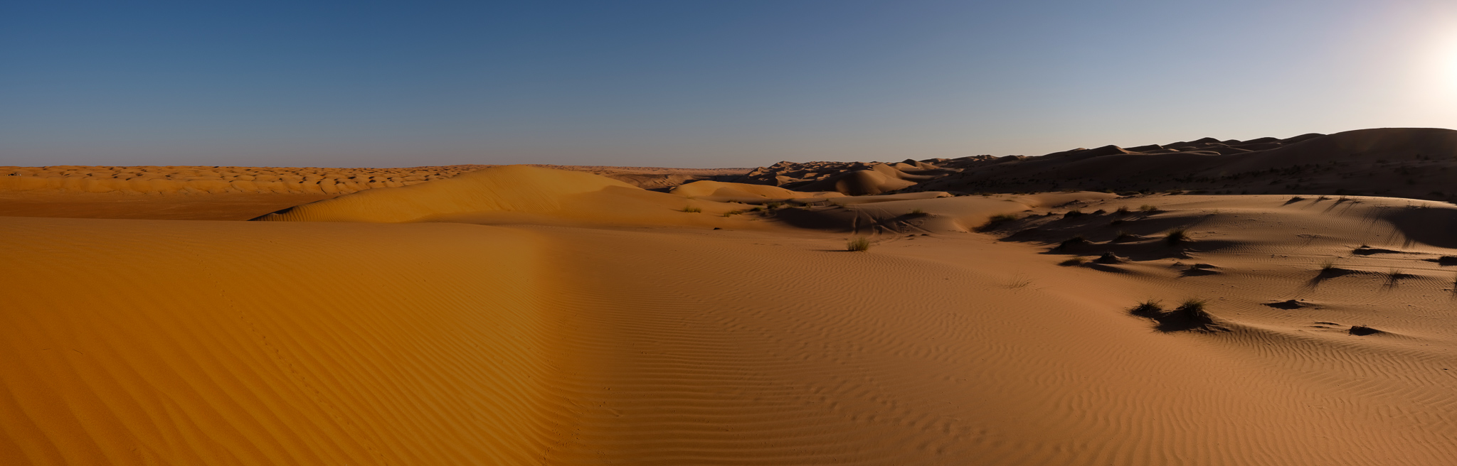
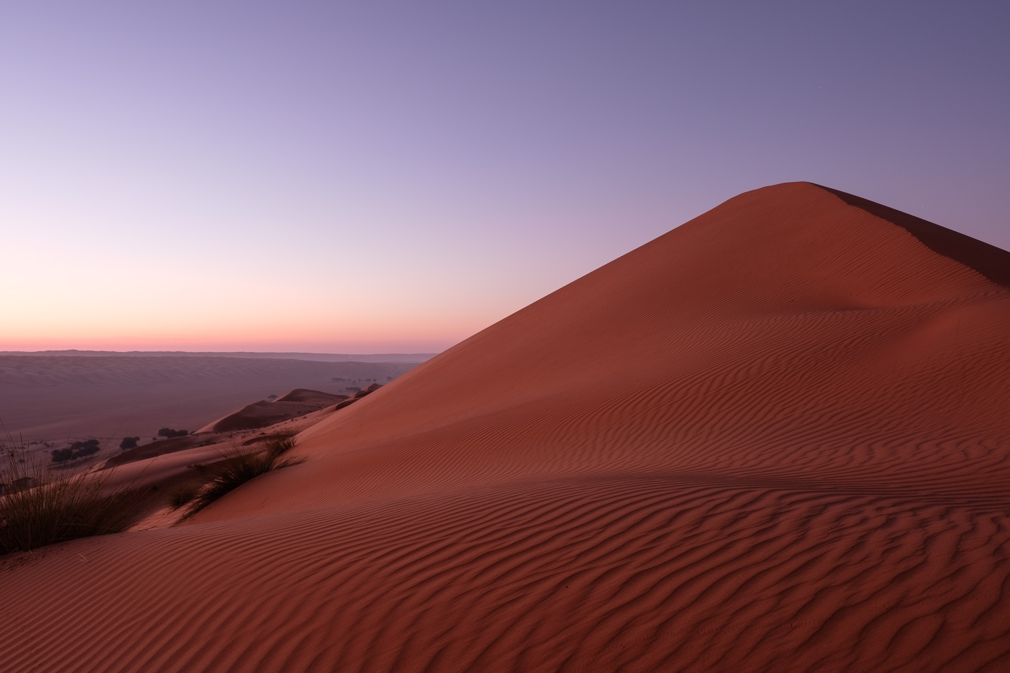
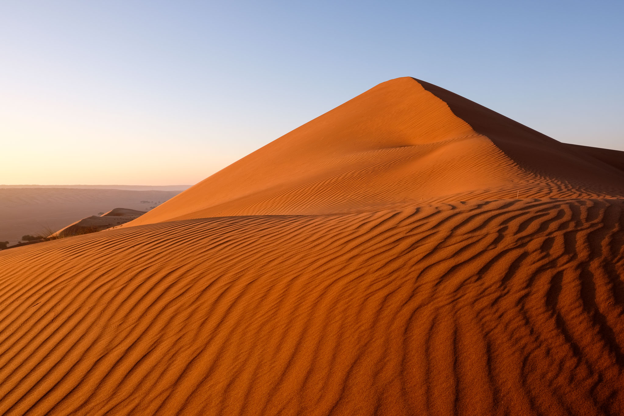
The Sharqiya Sands, also known as Wahiba Sands (named from the local tribe), are a desert with an area of around 12,500 km2. The desert was formed by a combination of south-western monsoon and northerly trade winds, forming long linear sand ridges that can reach to 100 m high. Located to the southeast of Muscat, they are easily accessible via a nice blacktop road, taking about a 2-hour drive. Below is a general location map.
Wahiba sands location map.
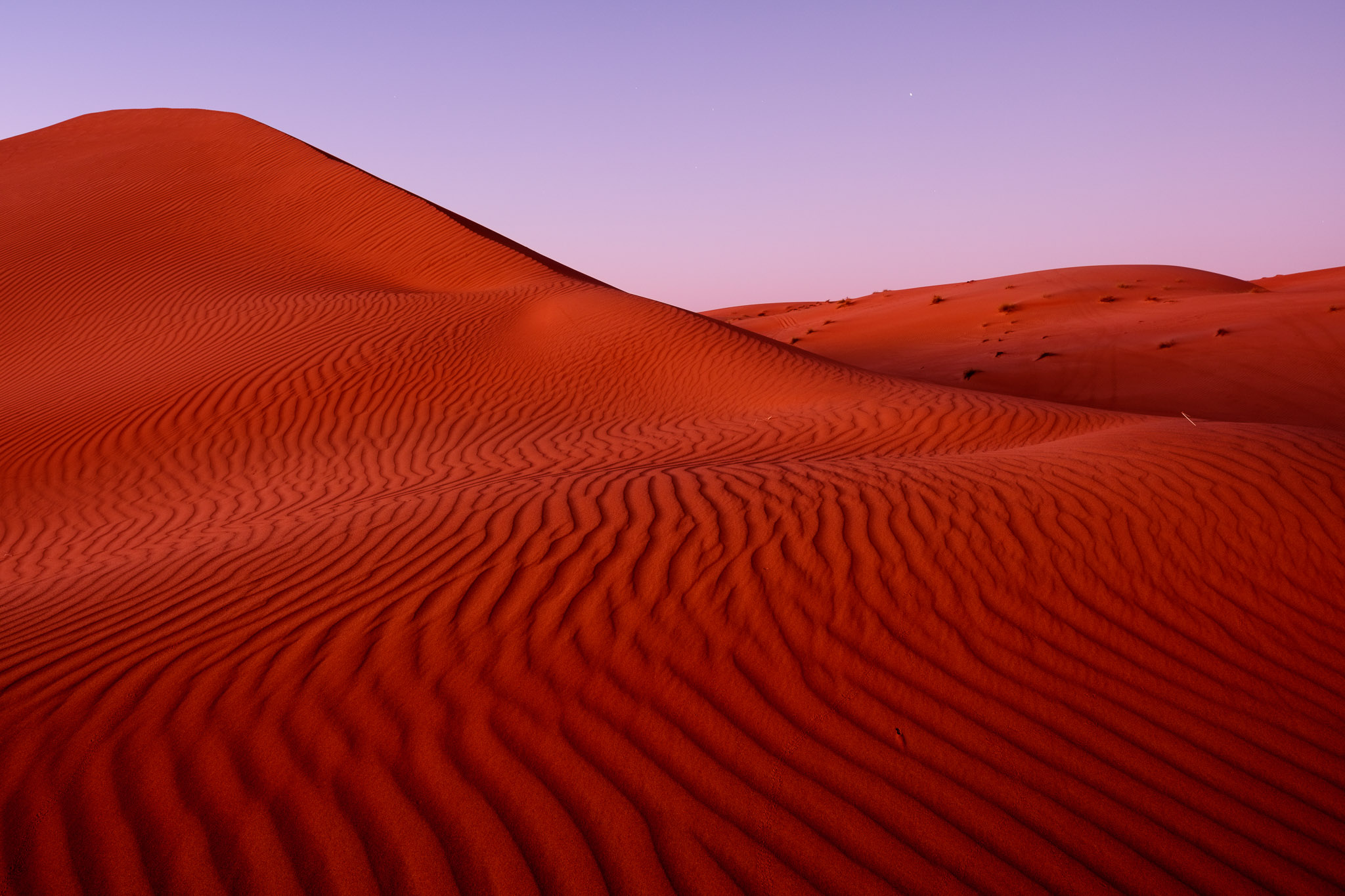
During my first stay in Oman, I used to visit the Wahibas regularly; there is something special about being in the desert, watching the sunset or sunrise, surrounded by complete silence. With the sun lower in the horizon, the shapes and patterns of the dunes are highlighted by the interplay of light and shadow. Sand colors are variable, from subdued yellows to rich orange and red. The last time I had visited the Wahibas was in 2009, so I did notice some changes after 14 years. Namely, the number of tourist camps has increased, and there is mobile network coverage. Even though the area is visited by many tourists, especially during the winter months, you can easily find a nice spot all for yourself. You can choose to book accommodation in one of the several desert camps, or simply camp on your own. The camps are always located in the interdune valleys, which are easy to drive to.
In terms of photography, I used my 2 cameras (Fujifilm X-T4 and X-T5) with 2 lenses (Fujinon 16mm f/1.4 and Voigtlaender 35mm f/1.2). The wide-angle saw a lot of use for large vistas and sand patterns, while the standard lens allowed me to shoot the more general subjects. As the sun is low in the horizon, it is necessary to work quickly, because the light changes fast. It is better to allow yourself some time in advance to climb the dunes and find a good spot. Wind can be a problem, as it carries sand everywhere; the sand is very fine and can adhere to your camera gear and tripod. I was careful to always replace the lens cap and store the gear in the backpack when moving between locations. This is normal procedure when shooting in this type of environment. And of course, the wind is what created the desert to begin with, so it comes with the territory.
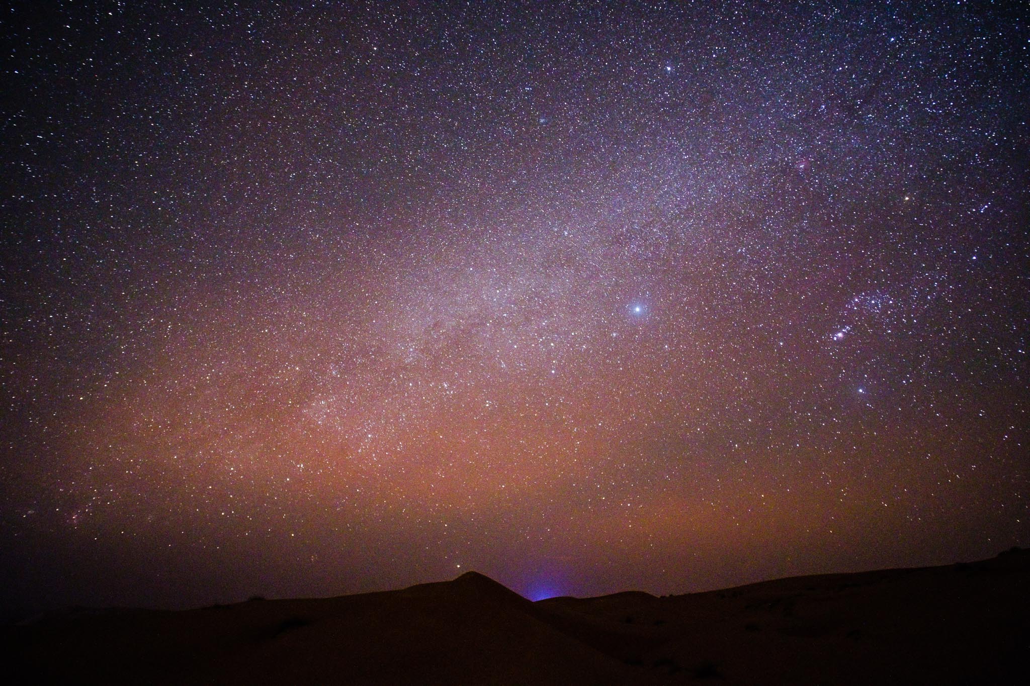
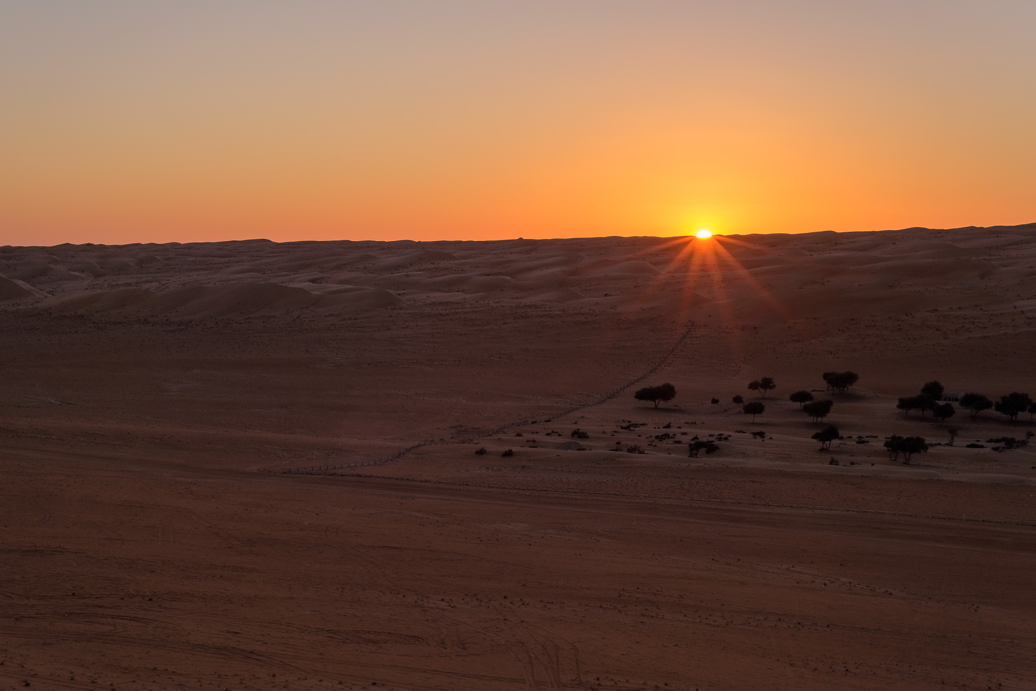
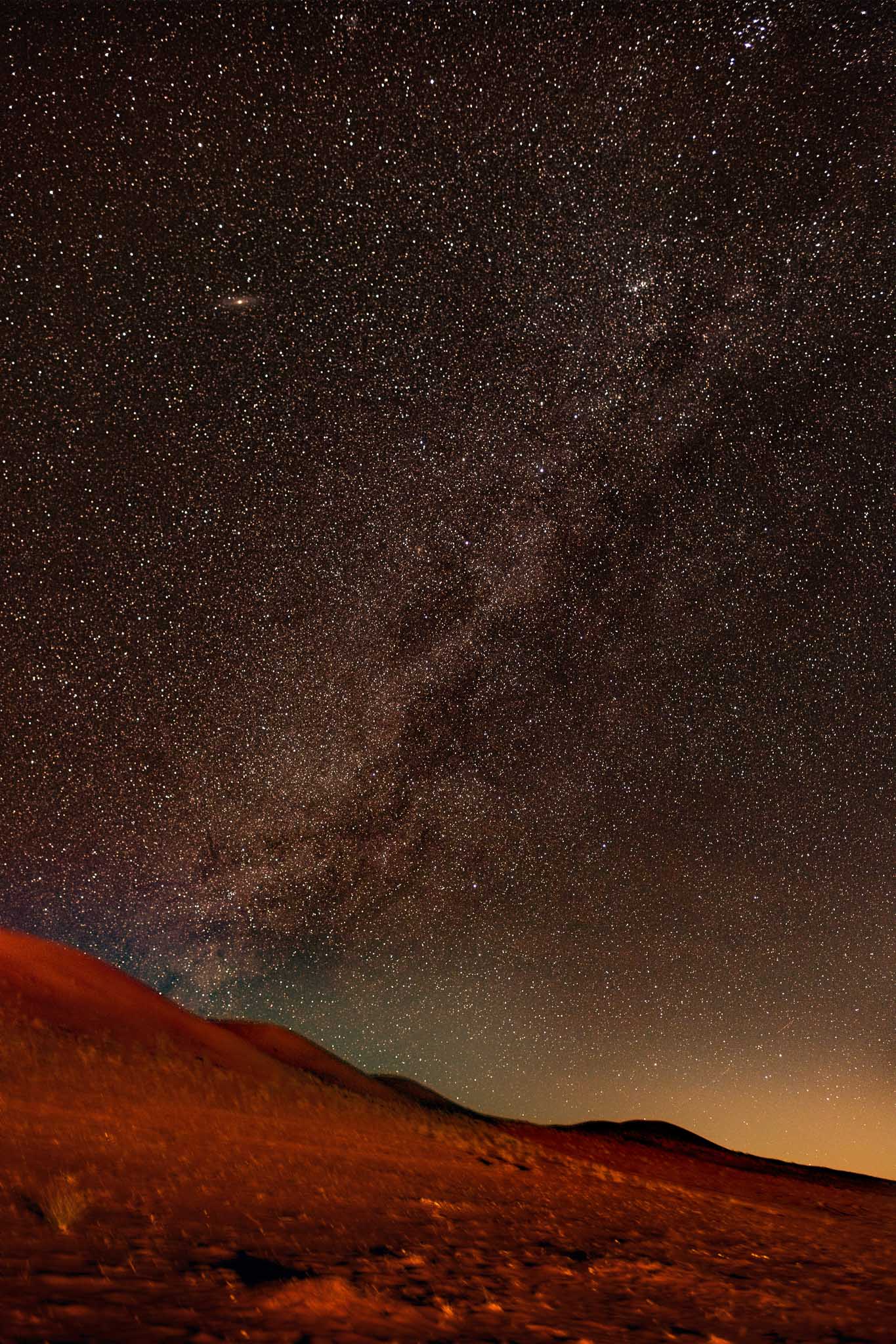
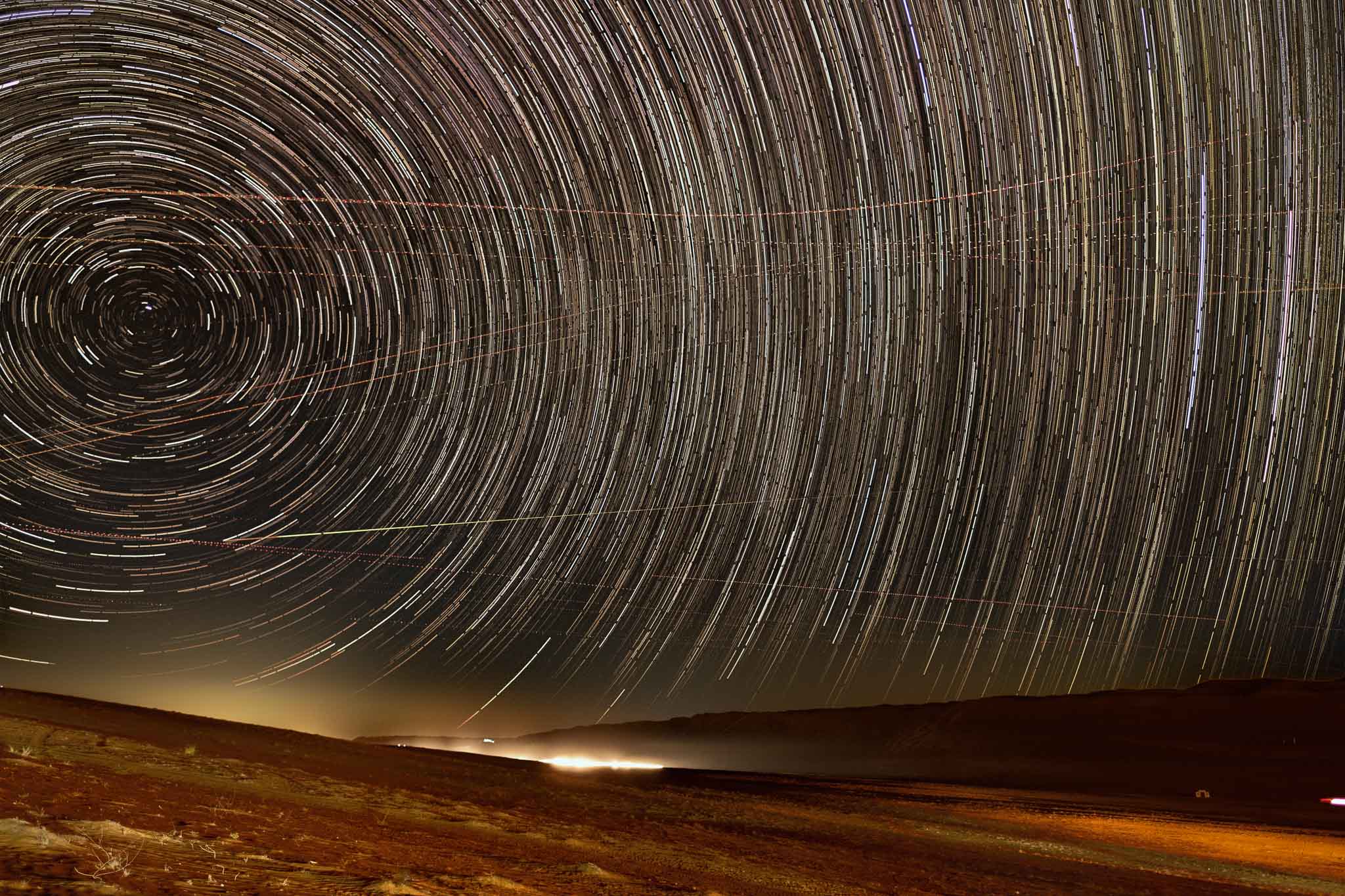
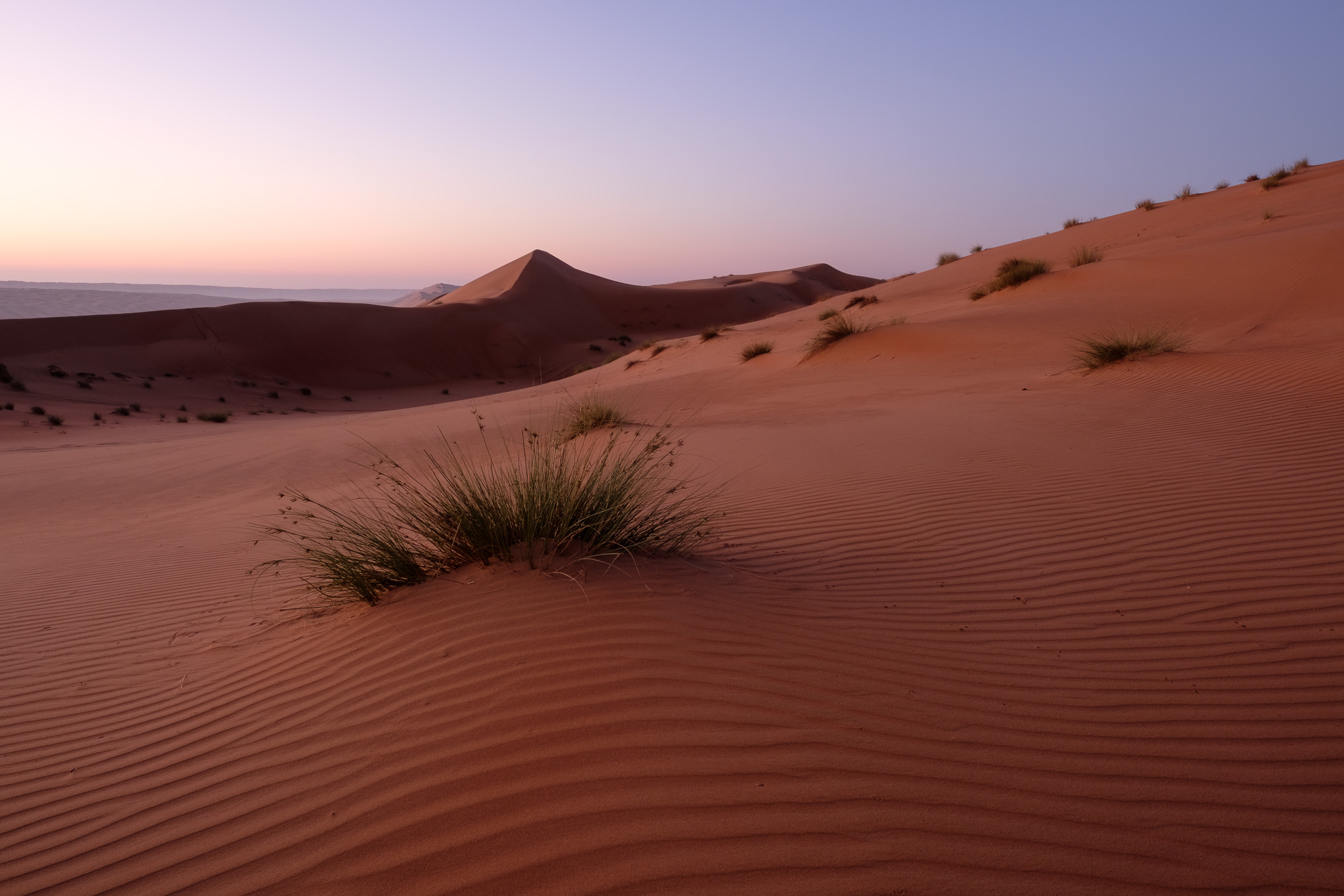
After settling in, I went out for a photo walk at sunset, climbing the western dunes to reach a high location. Interesting vistas and subjects are everywhere, so I just kept shooting. There are plenty of patterns in the sand, and the rare green bush here and there. The experience of watching the sunset surrounded by all this natural beauty is unforgettable. At night I also carried out a session aiming at getting some nice star trails and Milky Way photos. The area was dark enough, even though there was light pollution coming in from the camp itself, and some vehicles driving through the valley.
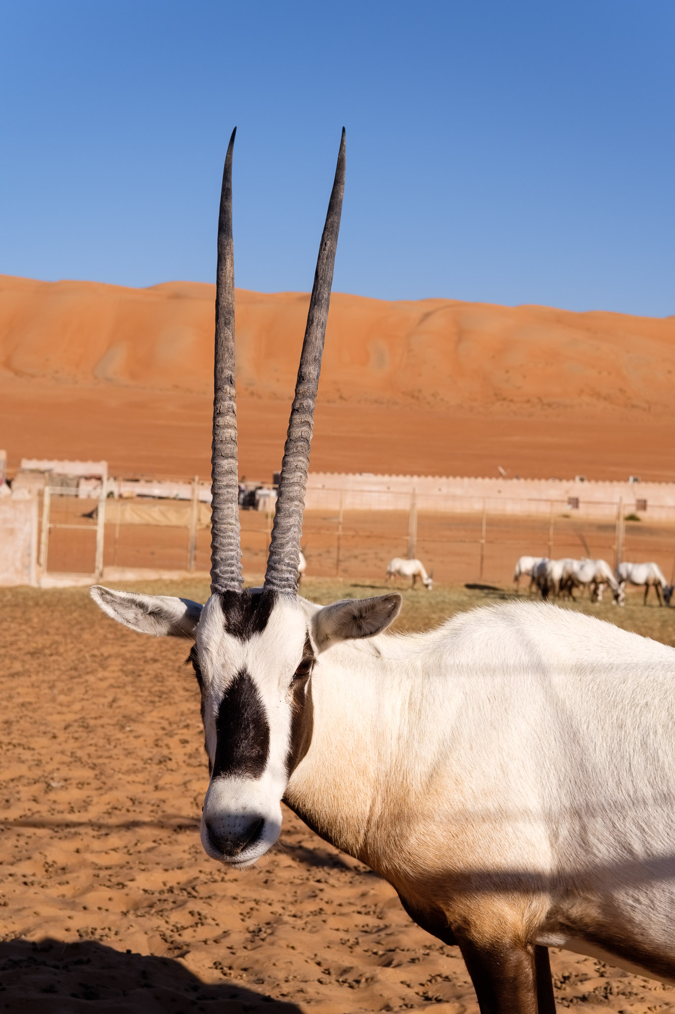
The Arabian Oryx.Desert panorama.Desert sunset.The Milky Way. 6 images stacked.Star trail. 1 hour total time.
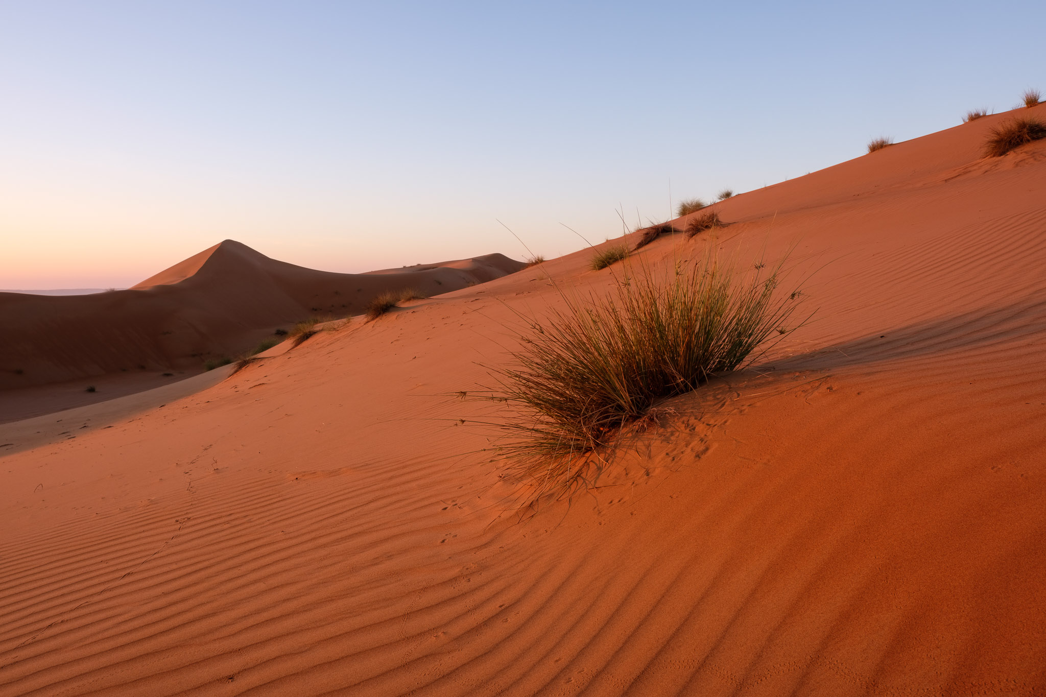
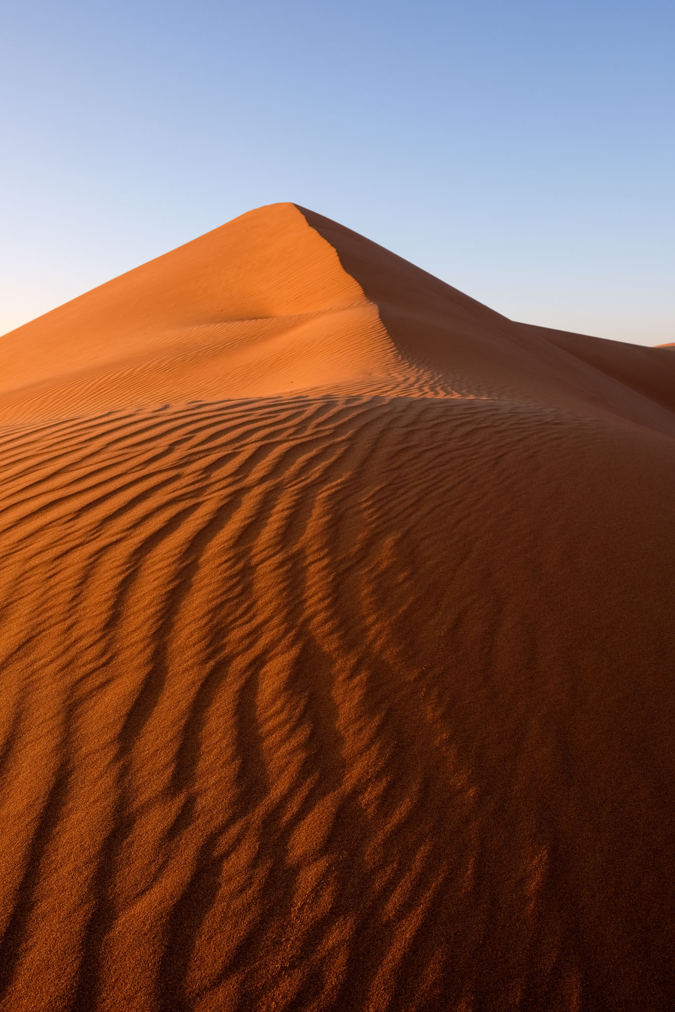
The following morning, I went out for a pre-sunrise walk; climbing the dunes, the sand was cold, as the temperature at night had dropped significantly. I kept photographing as the light slowly changed, painting the sand with soft colors, that became more intense as the sun climbed over the top of the opposite ridge. Again, it was magical simply to sit on the top of the dunes, watching Nature’s beauty unfolding in front of me. It was wonderful to go back to the Wahibas after 14 years.
Dawn in the dunes.Textures.Soft tones.Sunrise.Ripples and shadows.Pyramid. #1.Pyramid #2.