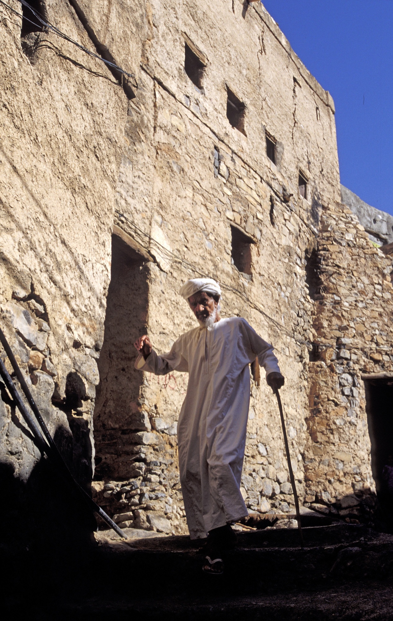
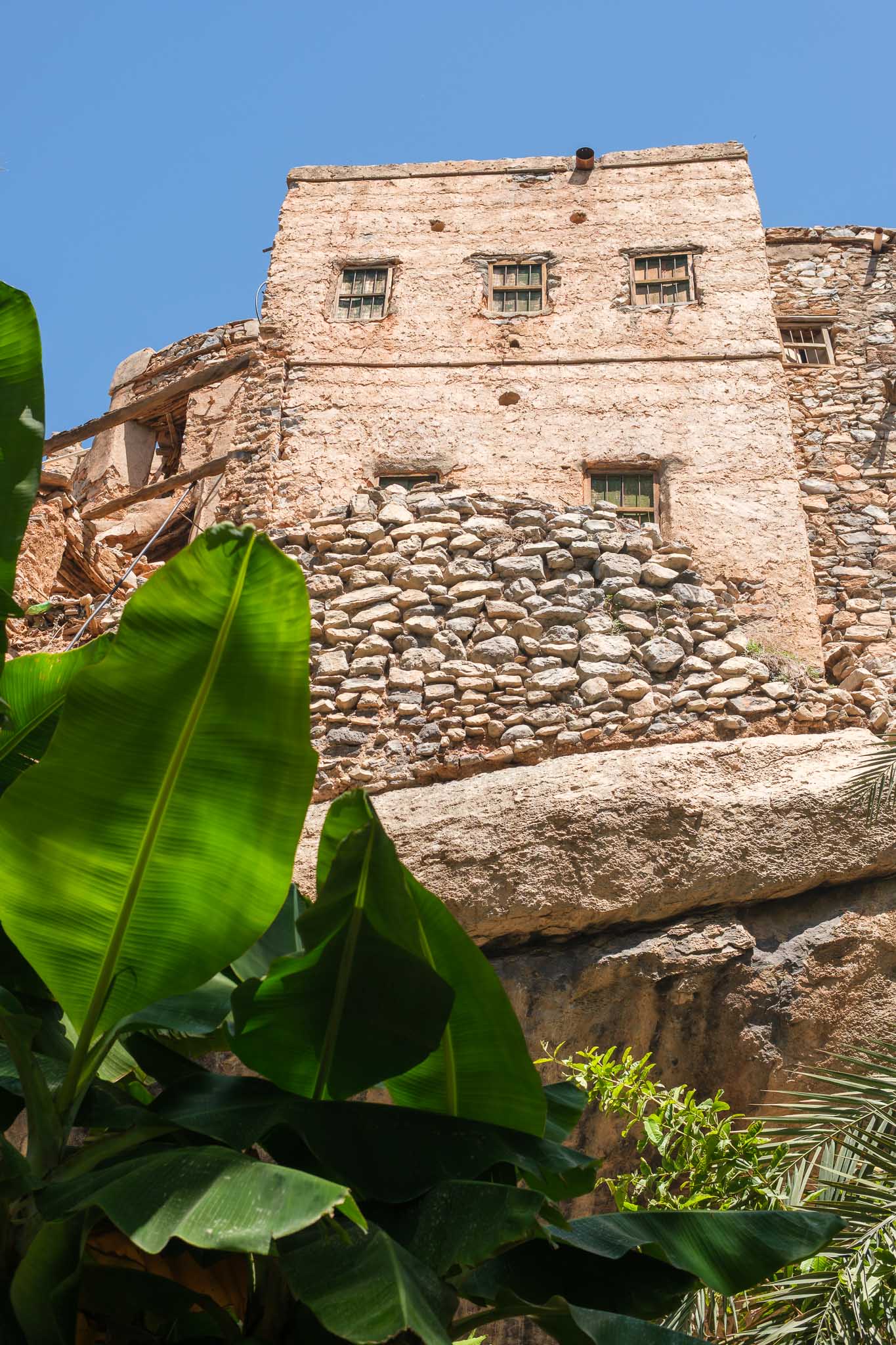
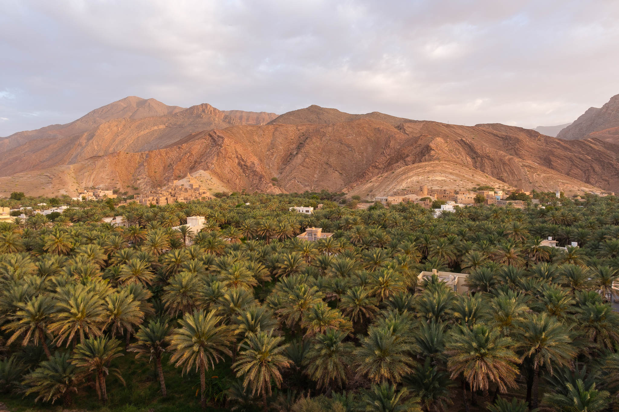
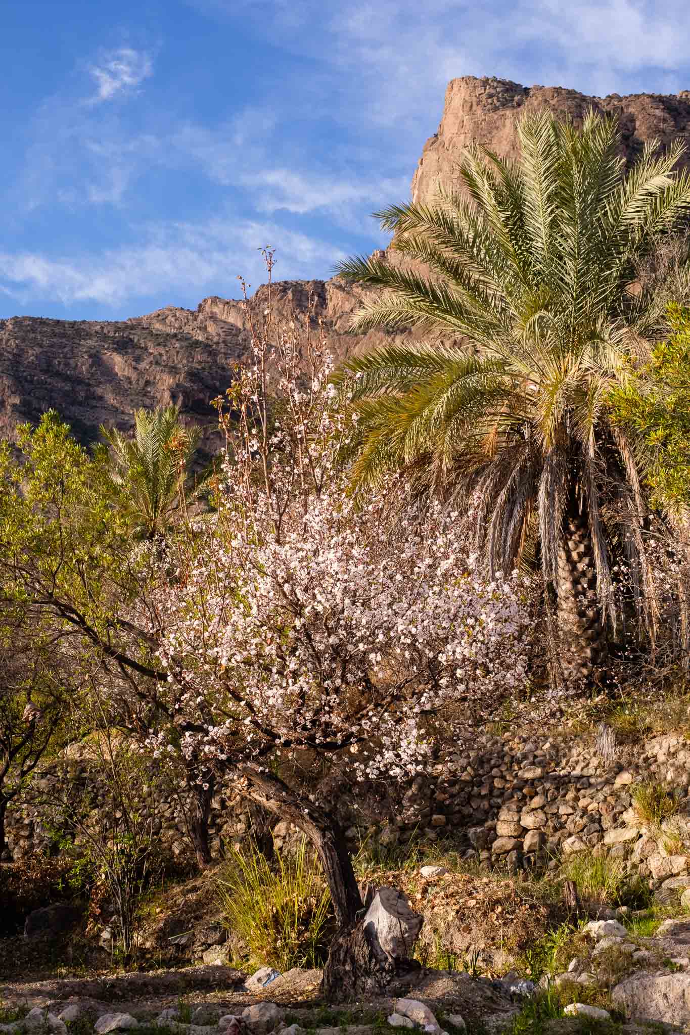
Misfat Al Abriyeen is one of Oman’s most picturesque and historic villages, located on the mountainside in Al Hamra. After spending the night camping in Jebel Hat, I always stop in this traditional Omani village for a nice walk (and coffee) amongst its green terraced farms. Despite the recent increase in tourism and visitors, walking along the narrow streets beside ancient mud-brick houses, and intricate falaj (irrigation) system, is still a nice experience. If you ignore the signs of modern times, Misfat seems like a place untouched by time, providing a window into the country’s past, with a rich heritage and traditional lifestyle. There is evidence of Persian occupation dating from 1,500 years; Misfat itself is at least 500 years old but the falaj system that maintains the terraces of palm and banana trees is said to be even older.
Photo from 2002. Scanned slide film.Photo from 2002. Scanned slide film.
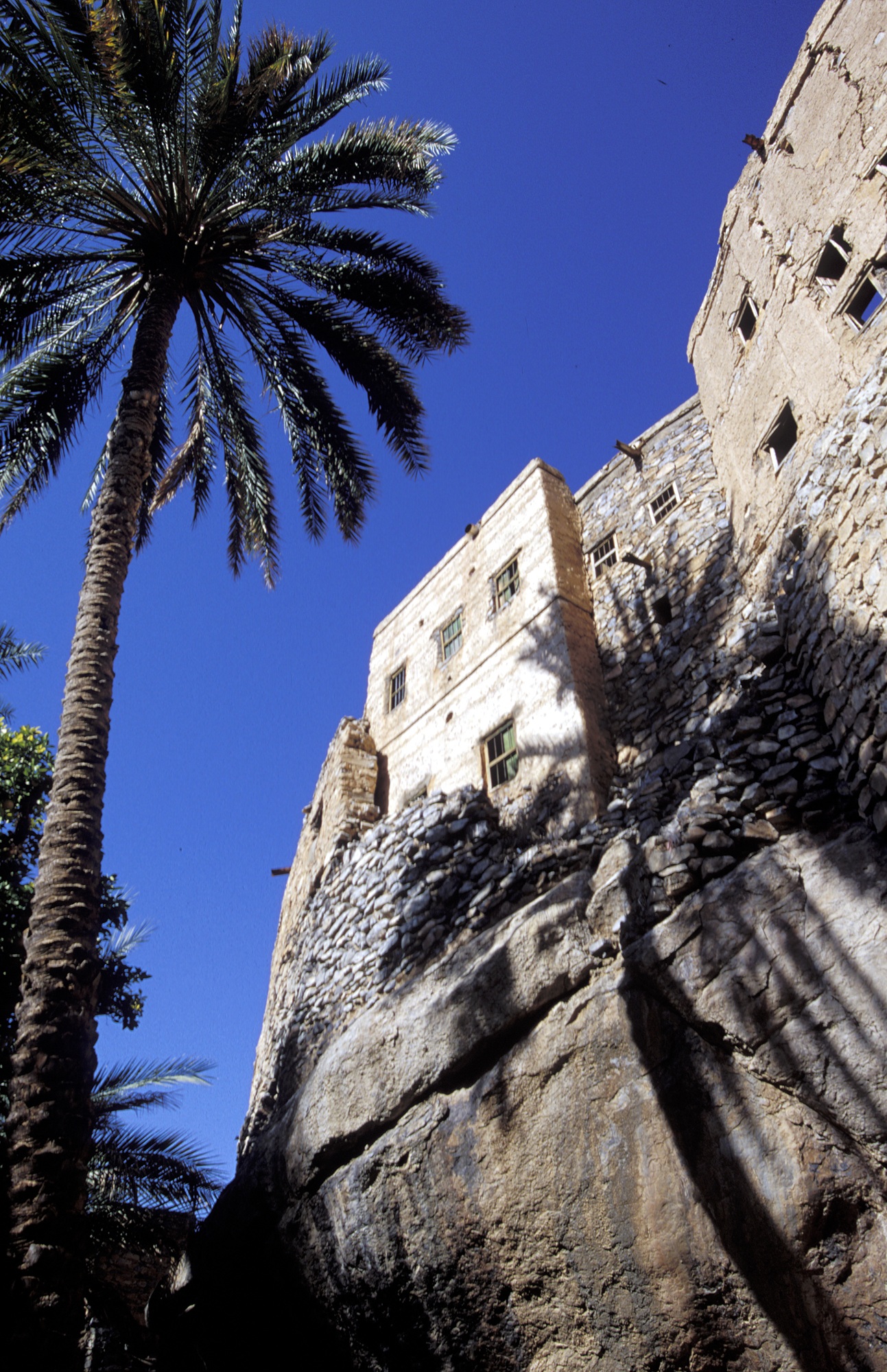
The best (and really the only) way to visit Misfat is on foot; before exploring old Misfat, it is worth making a stop in the modern village across the valley, where most of the population lives. They still take care of the plantations, and slowly the old homes are being turned into guest houses. I still remember the first time I visited Misfat about 20 years ago; it was an abandoned village, with houses falling into disrepair and crumbling. There are several marked trails in the area that are worth exploring, as they will take you across the shaded green terraces. I walked around for a while, but the temperature and humidity were rising as the morning went on; thus, I stopped in a local coffee shop for a refreshing drink before driving back to Muscat.
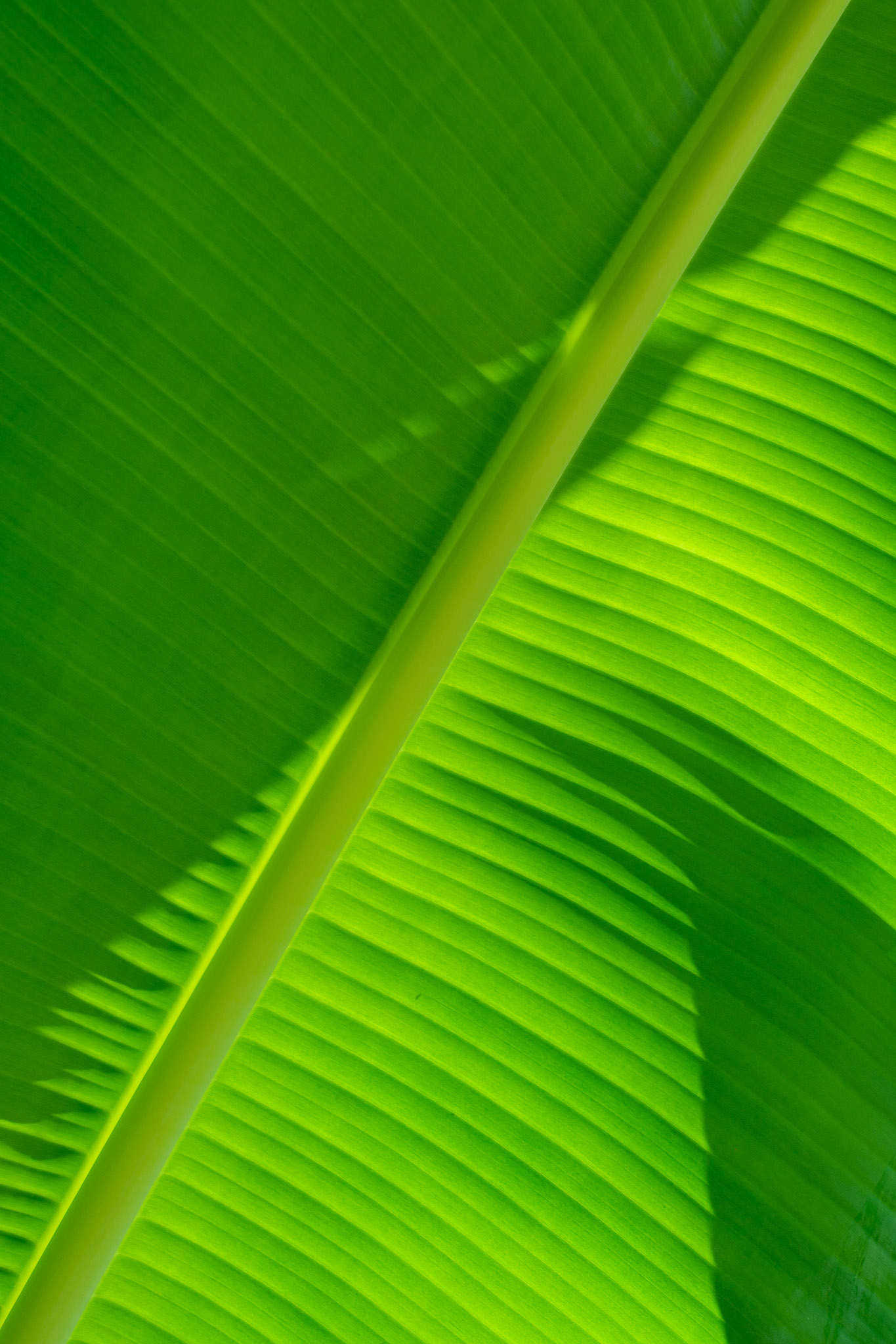
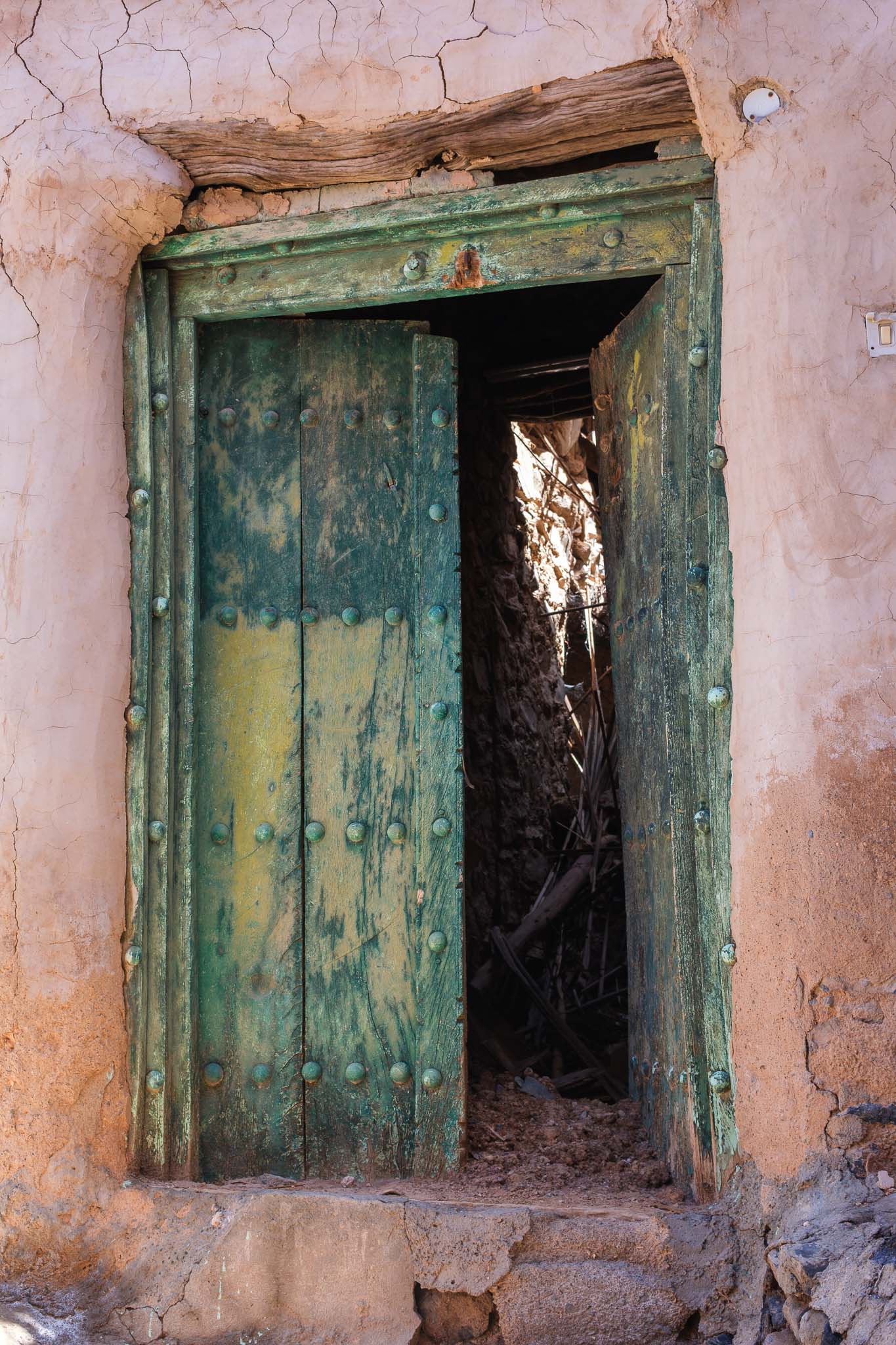
View from across the valley. Fujifilm X-T5, Voigtlander 50mm f/1.2.Old house. Fujifilm X-E5, Voigtlander 27mm f/2.Banana leaf. Fujifilm X-E5, Voigtlander 27mm f/2.In the village. Fujifilm X-E5, Voigtlander 27mm f/2.Door. Fujifilm X-E5, Voigtlander 27mm f/2.
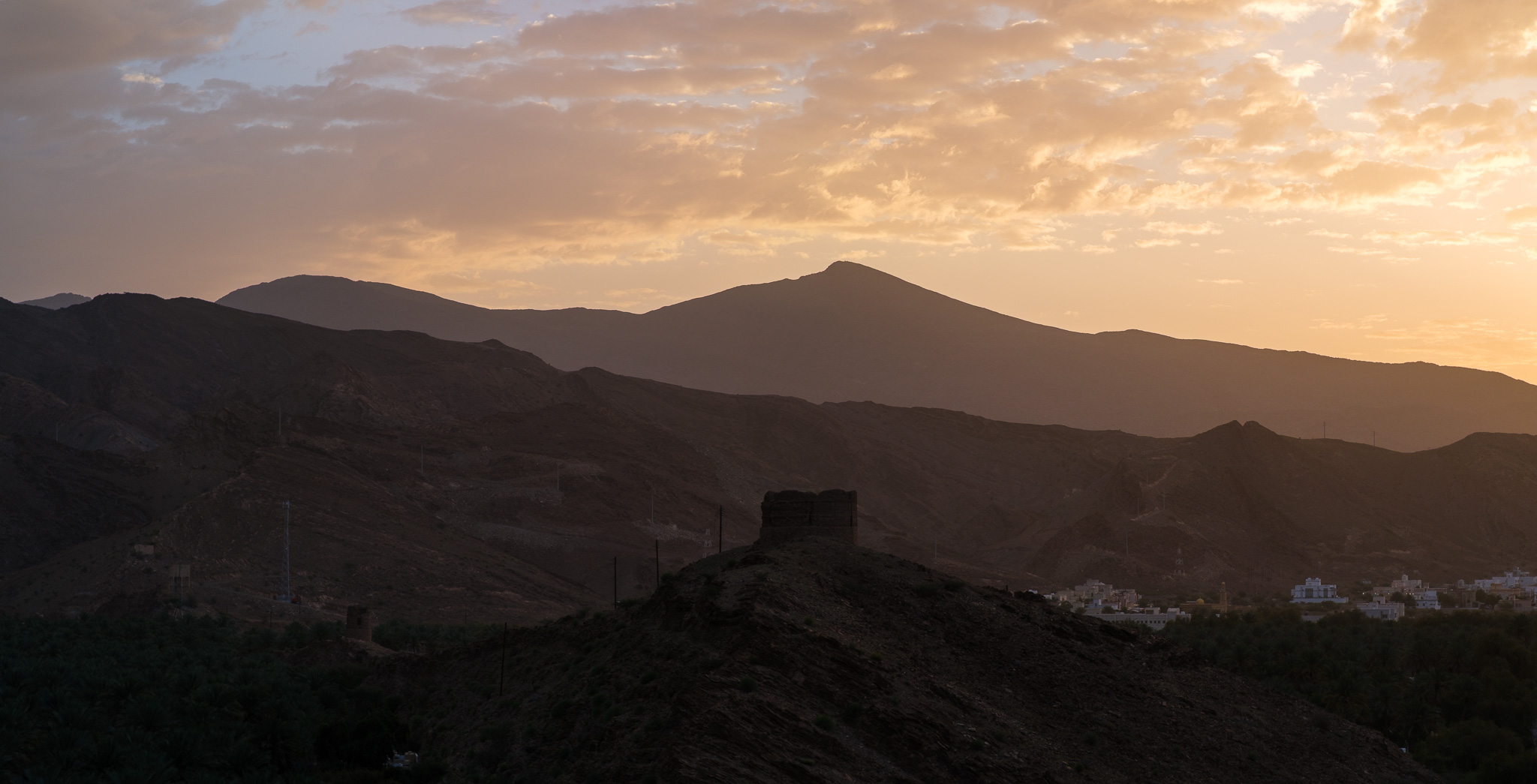
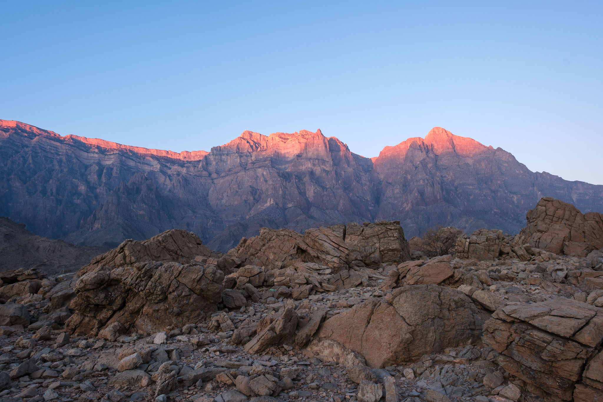
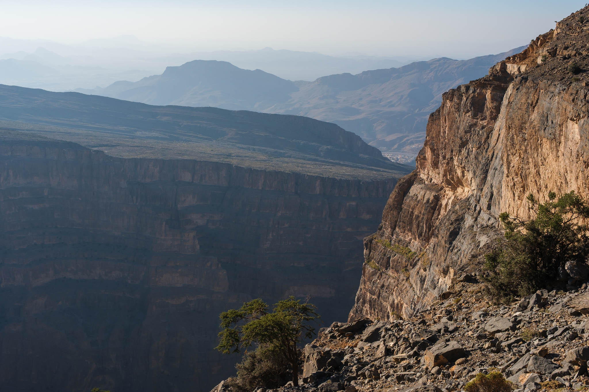
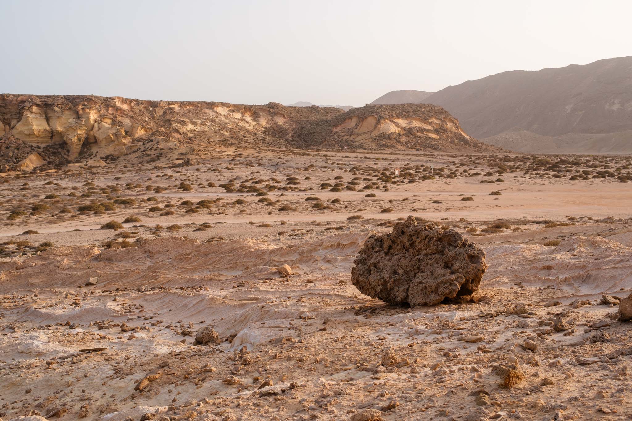
Now that the heat has come to stay, visiting the mountains is one way to escape it. That is what I did a couple of weeks ago, with a weekend camping trip to my favourite camping place in Oman. I had not been there since October 2024, so I was excited to go back. This time, instead of taking the adventurous gravel road coming up from the north side via Wadi Bani Awf, I took the leisurely tarmac road that starts in the southern side, near Hamra.
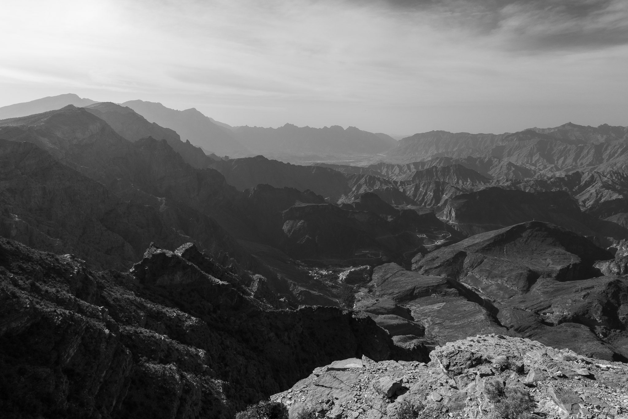
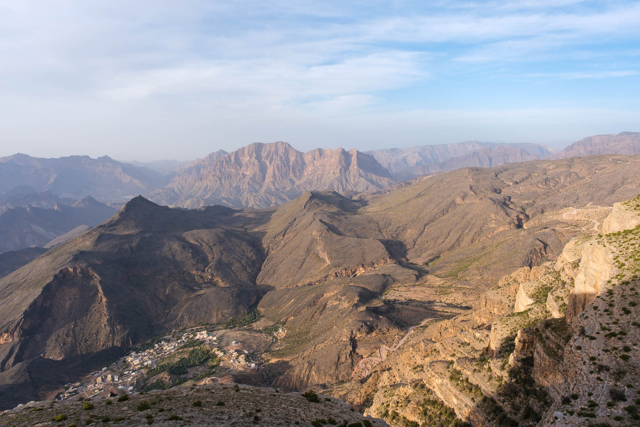
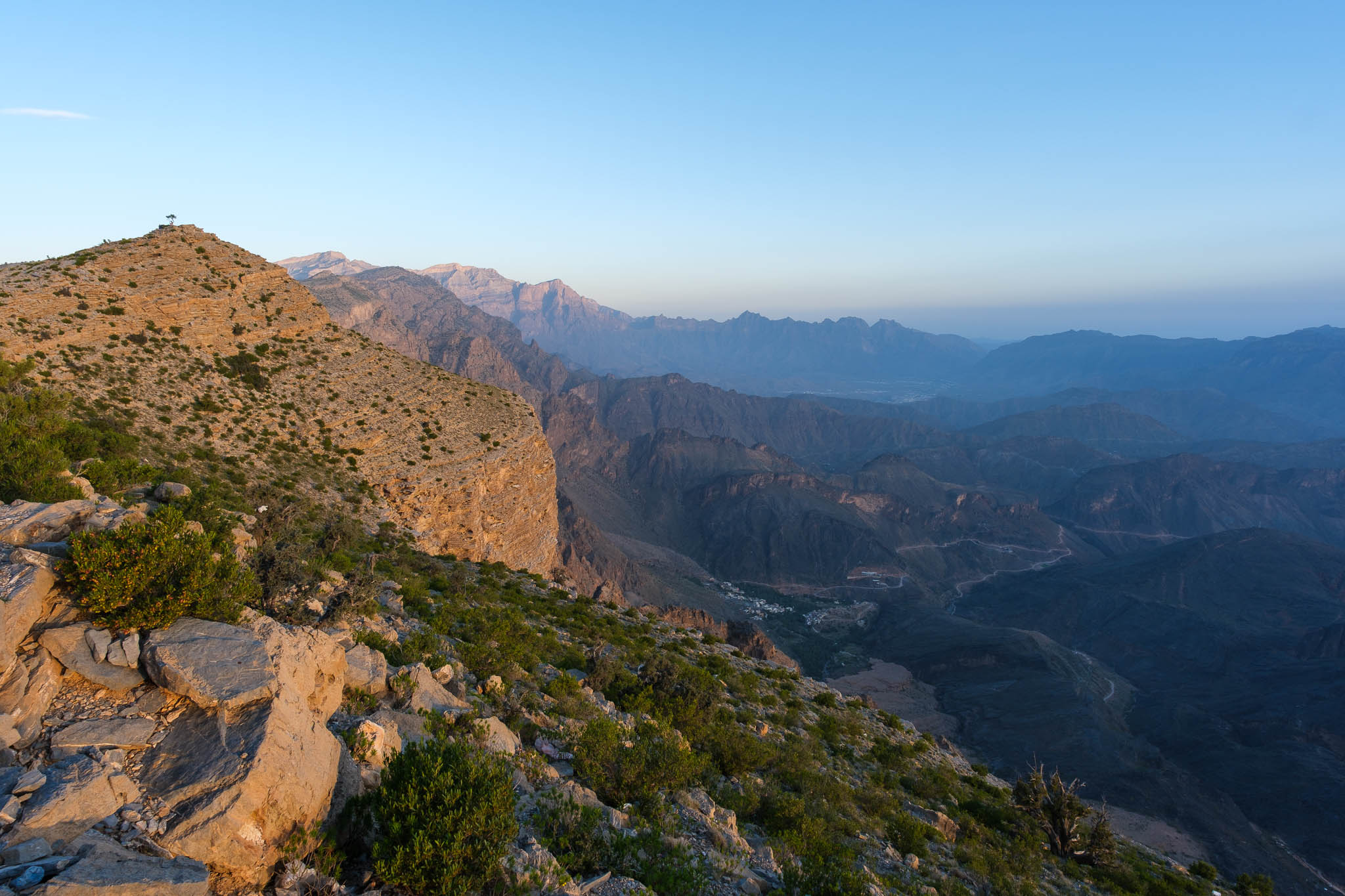
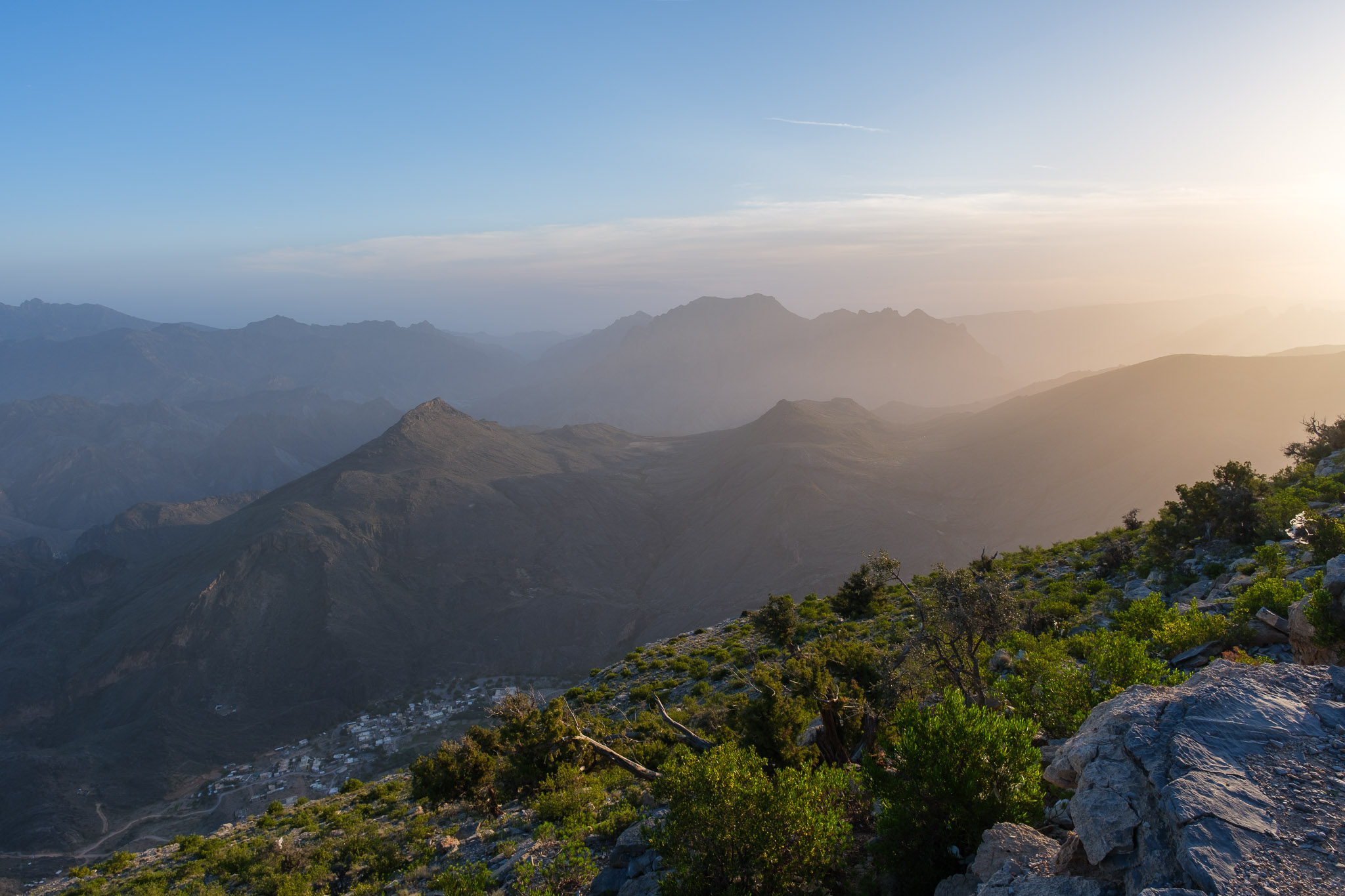
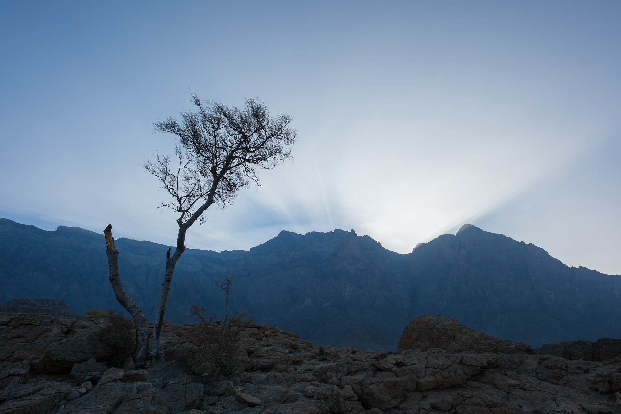
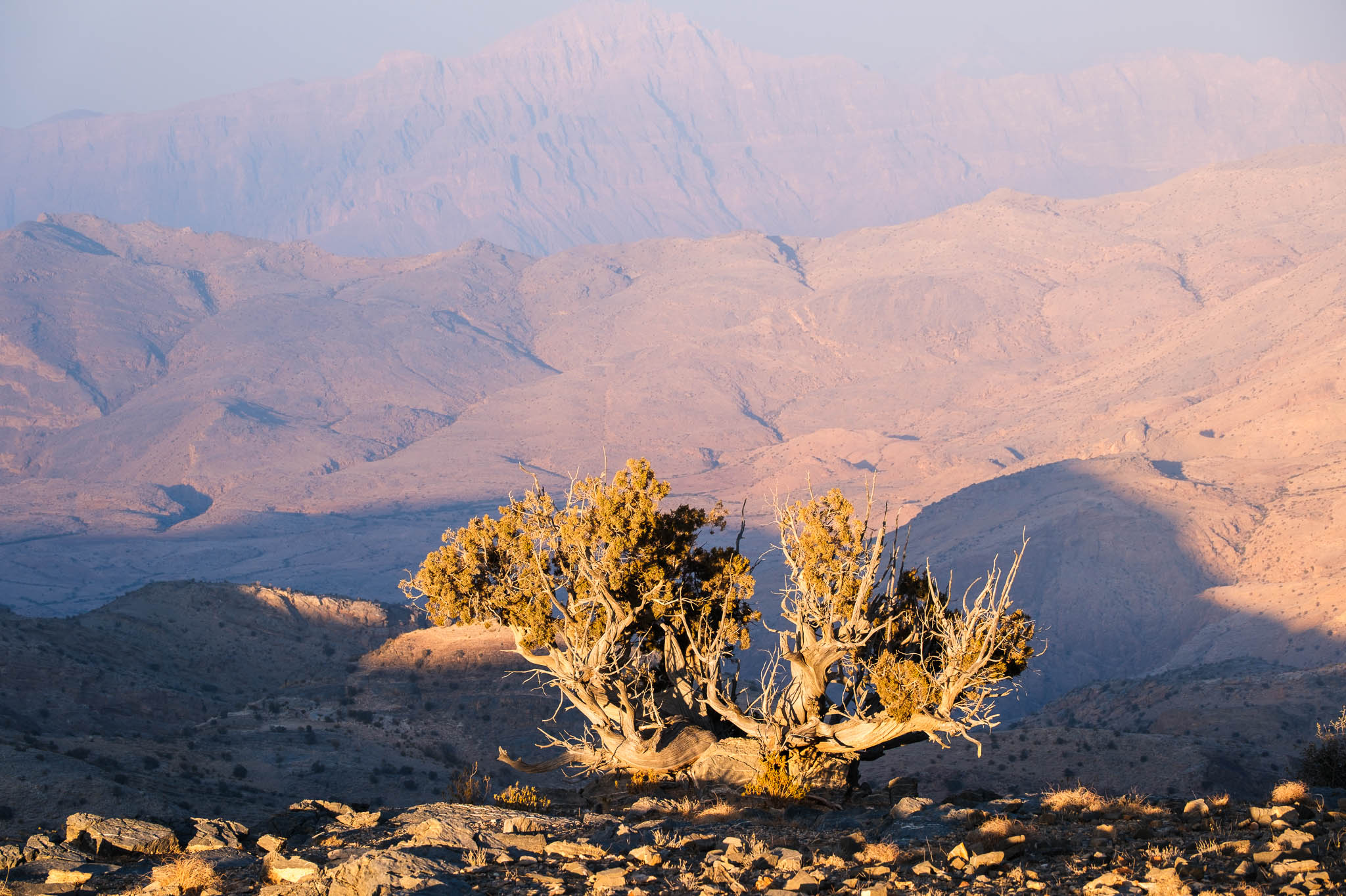
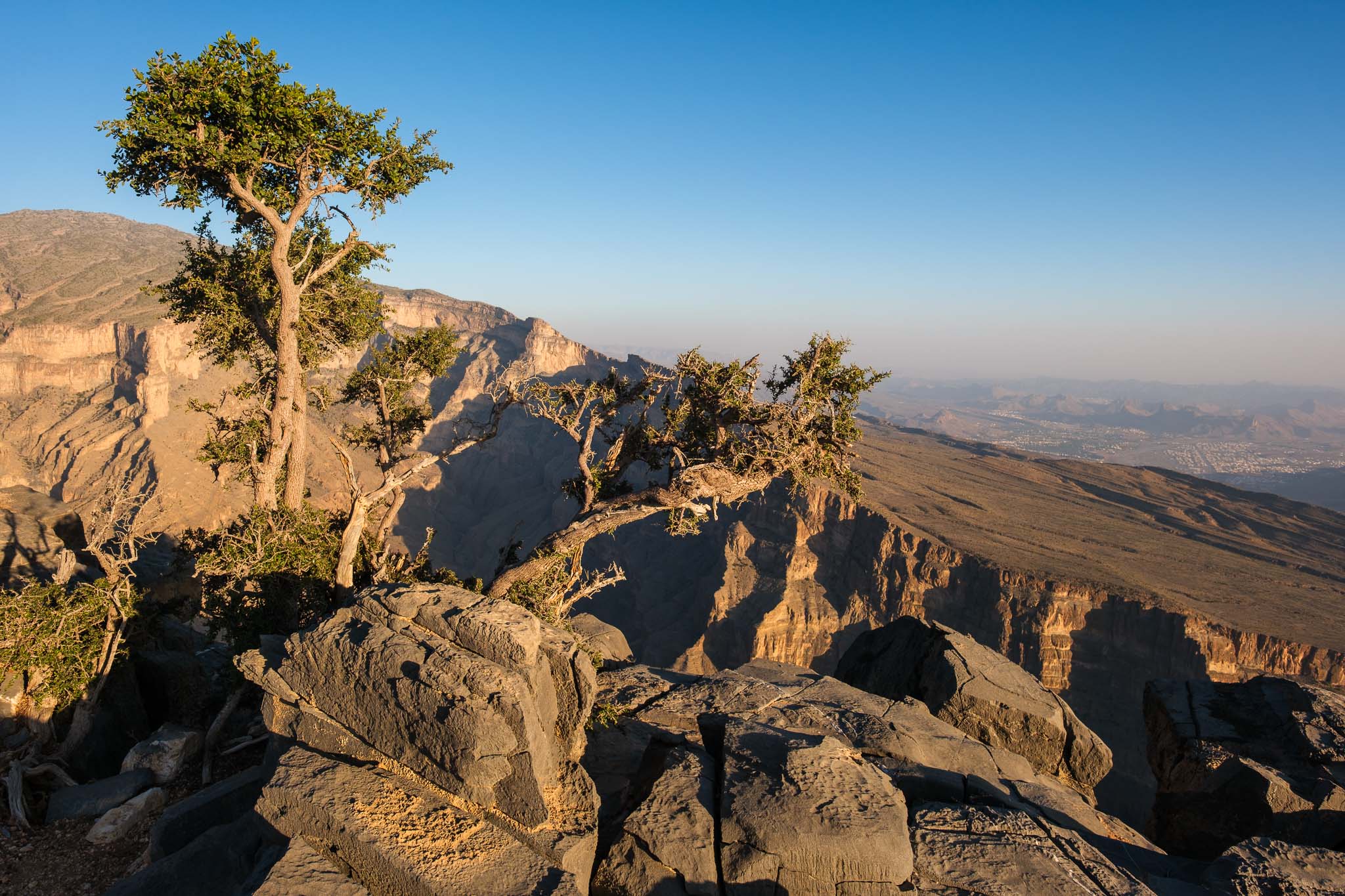
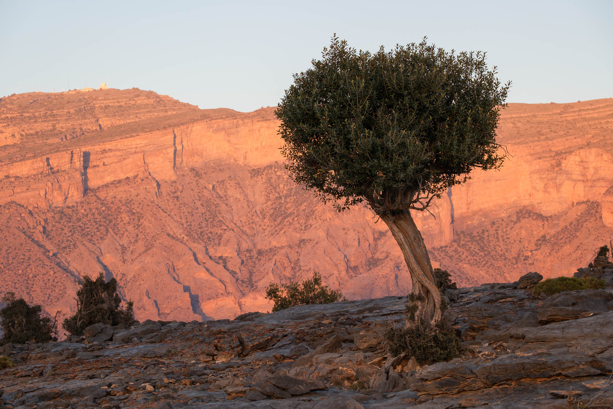
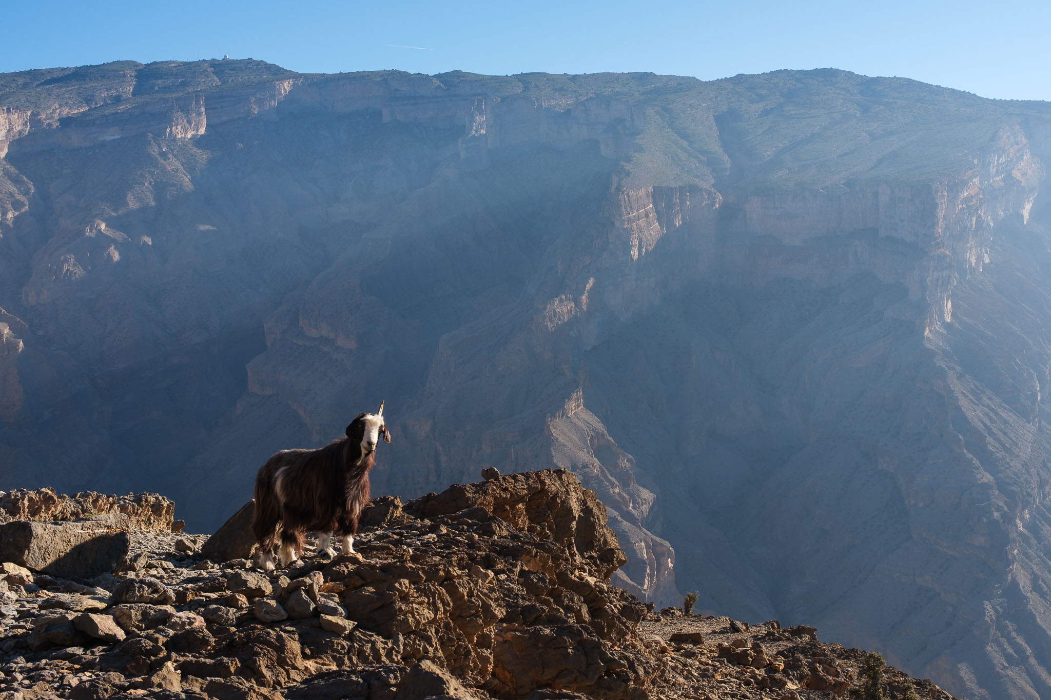
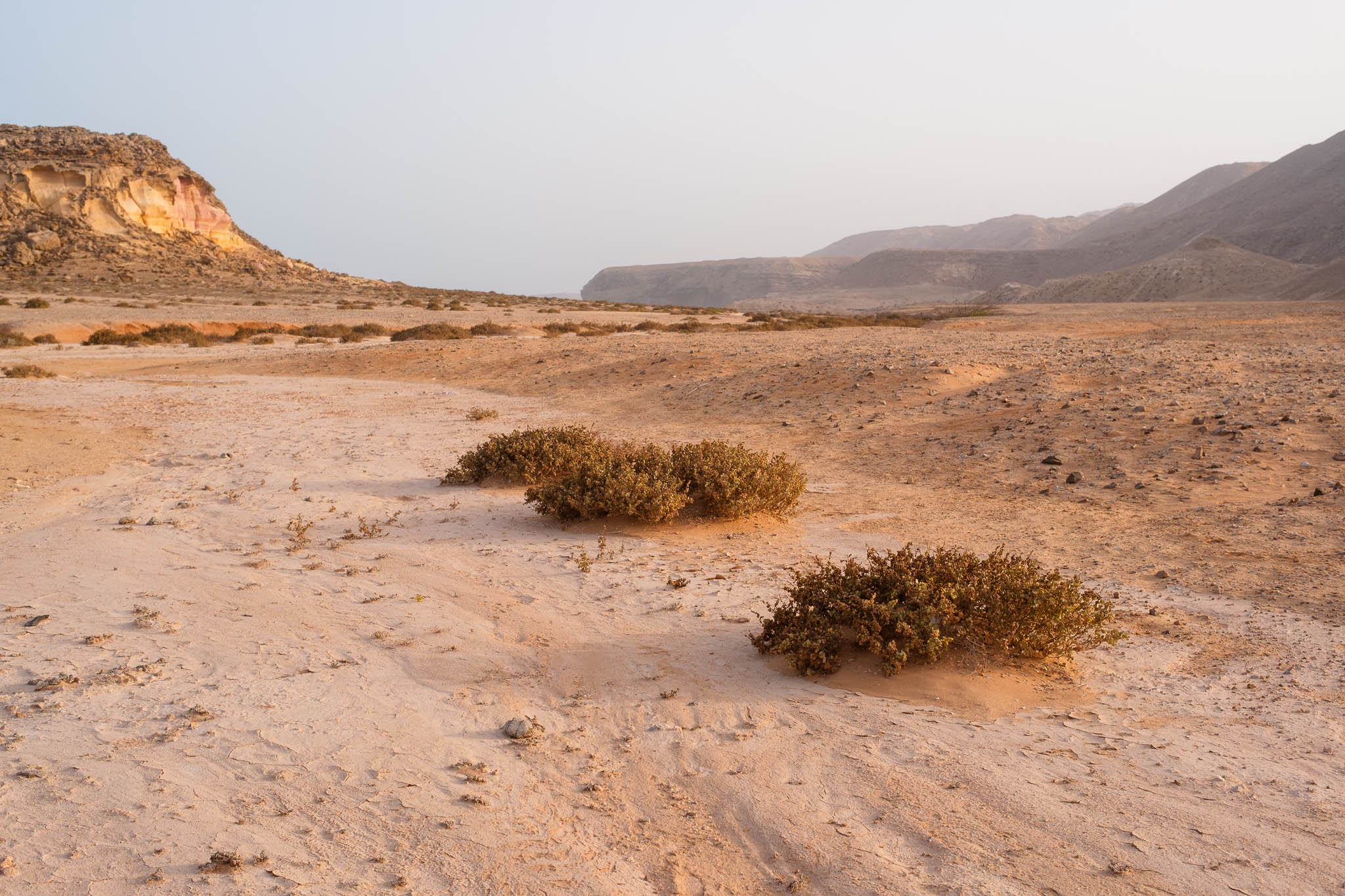
Arriving in time for a late picnic lunch, I setup camp and took a stroll to the edge of the mountain, admiring the fantastic view over Jebel Shams, Wadi Bani Awf and Wadi Sahtan. I never tire of this scenery. First time I was here was in February 2003, during my first time in Oman.
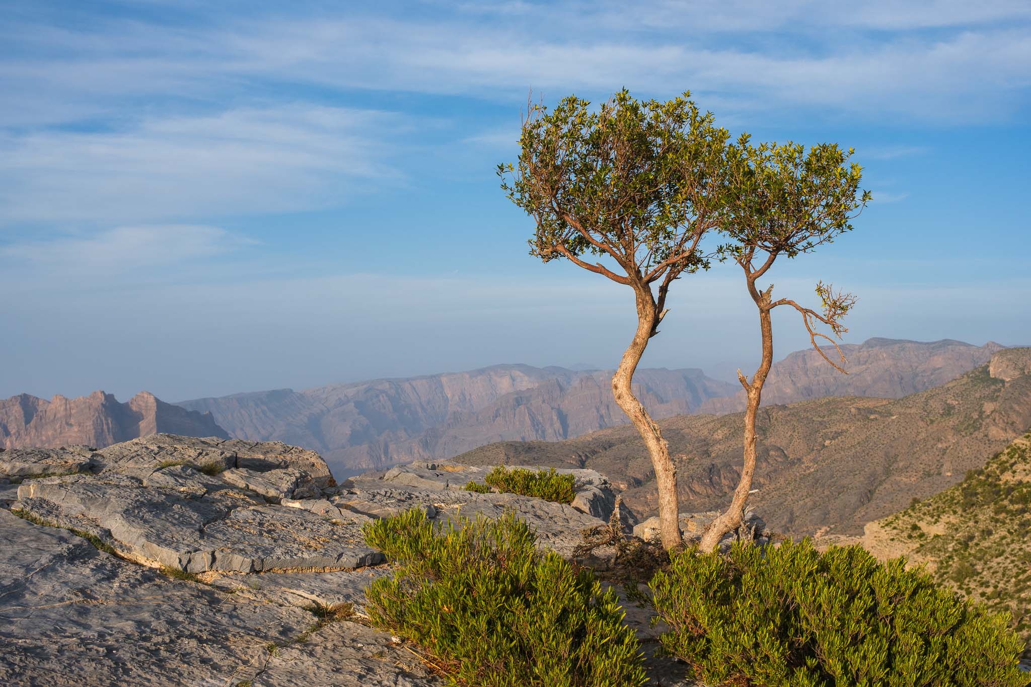
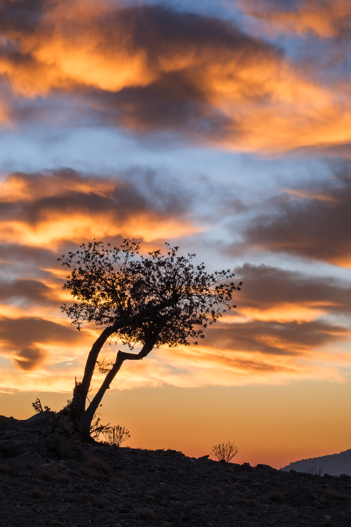
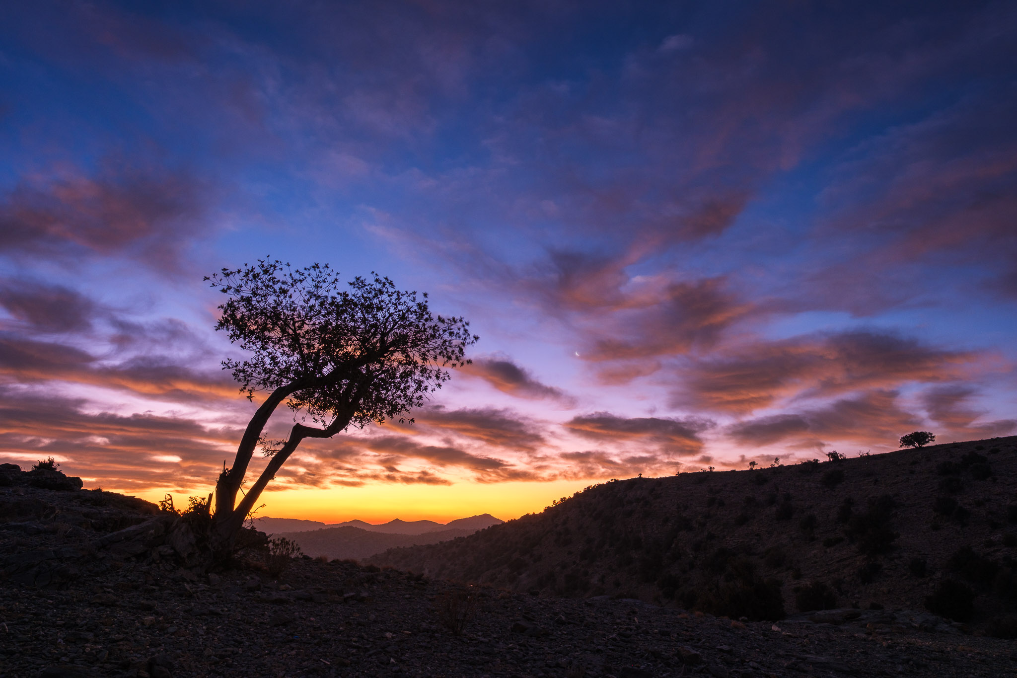
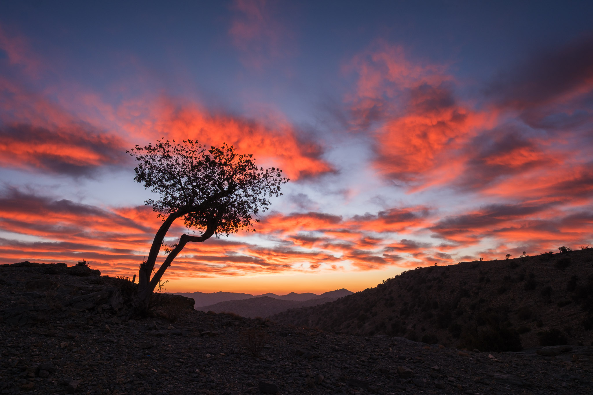
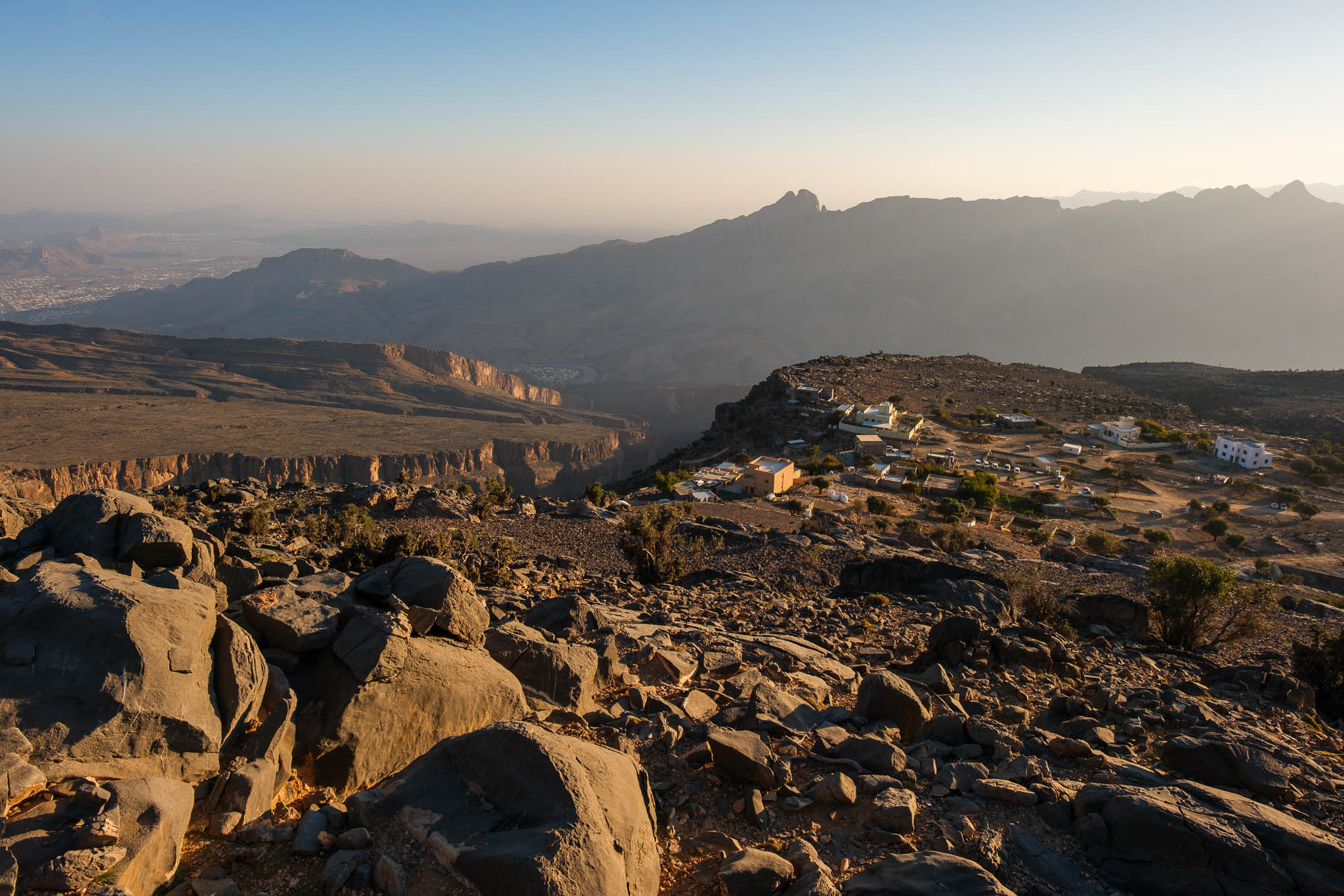
The hill in the previous photo is a privileged spot to admire the view; the small tree at its top provides an interesting photographic subject too. The village of Hat can be seen nested against the mountain, way down.
Fujifilm X-E5, Voigtlander 27mm f/2.The village of Hat. Fujifilm X-T5, Sigma 15mm f/1.4.
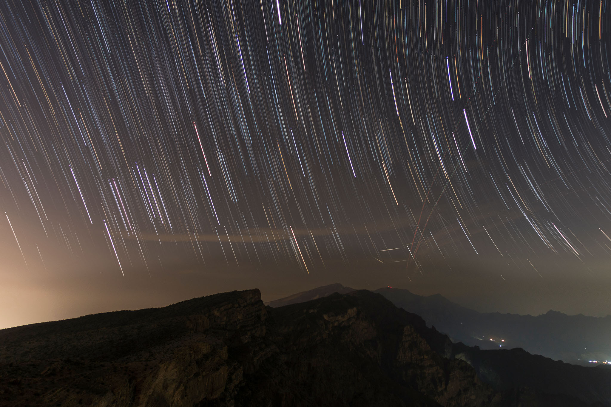
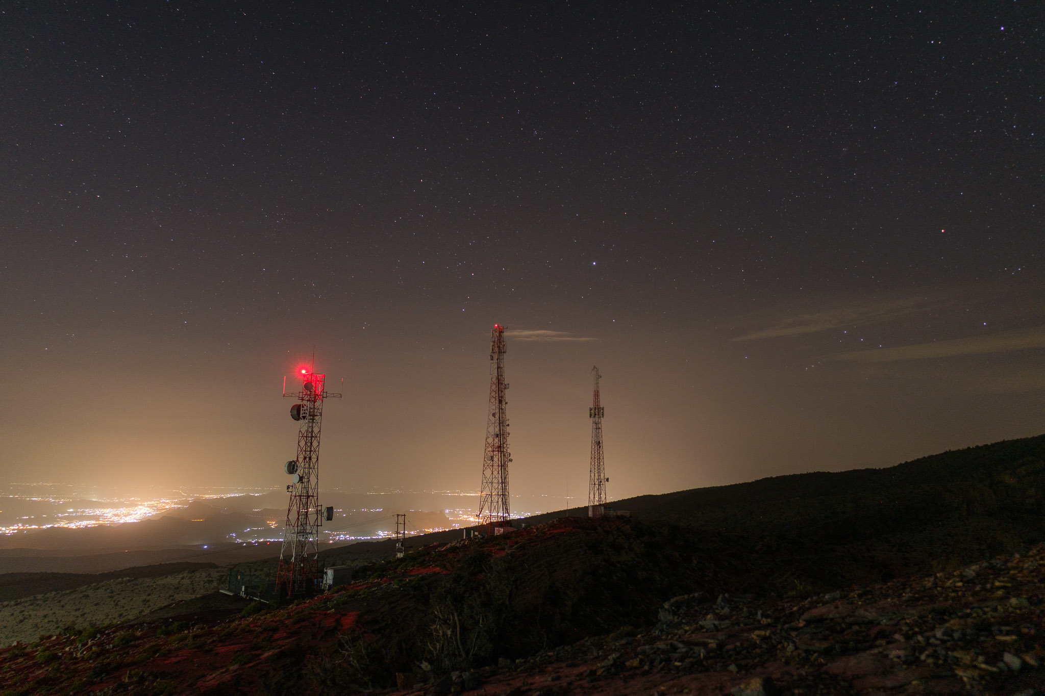
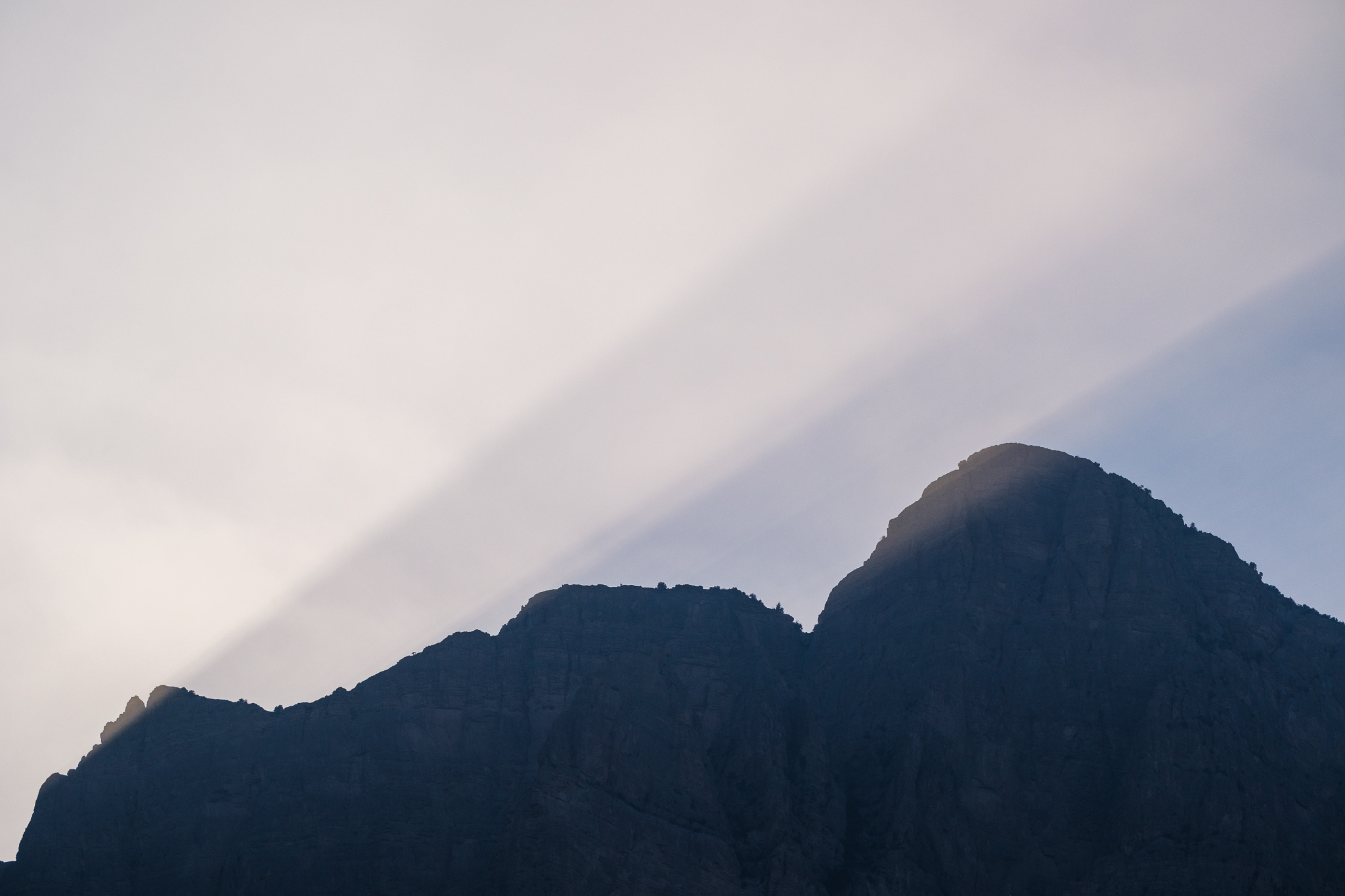
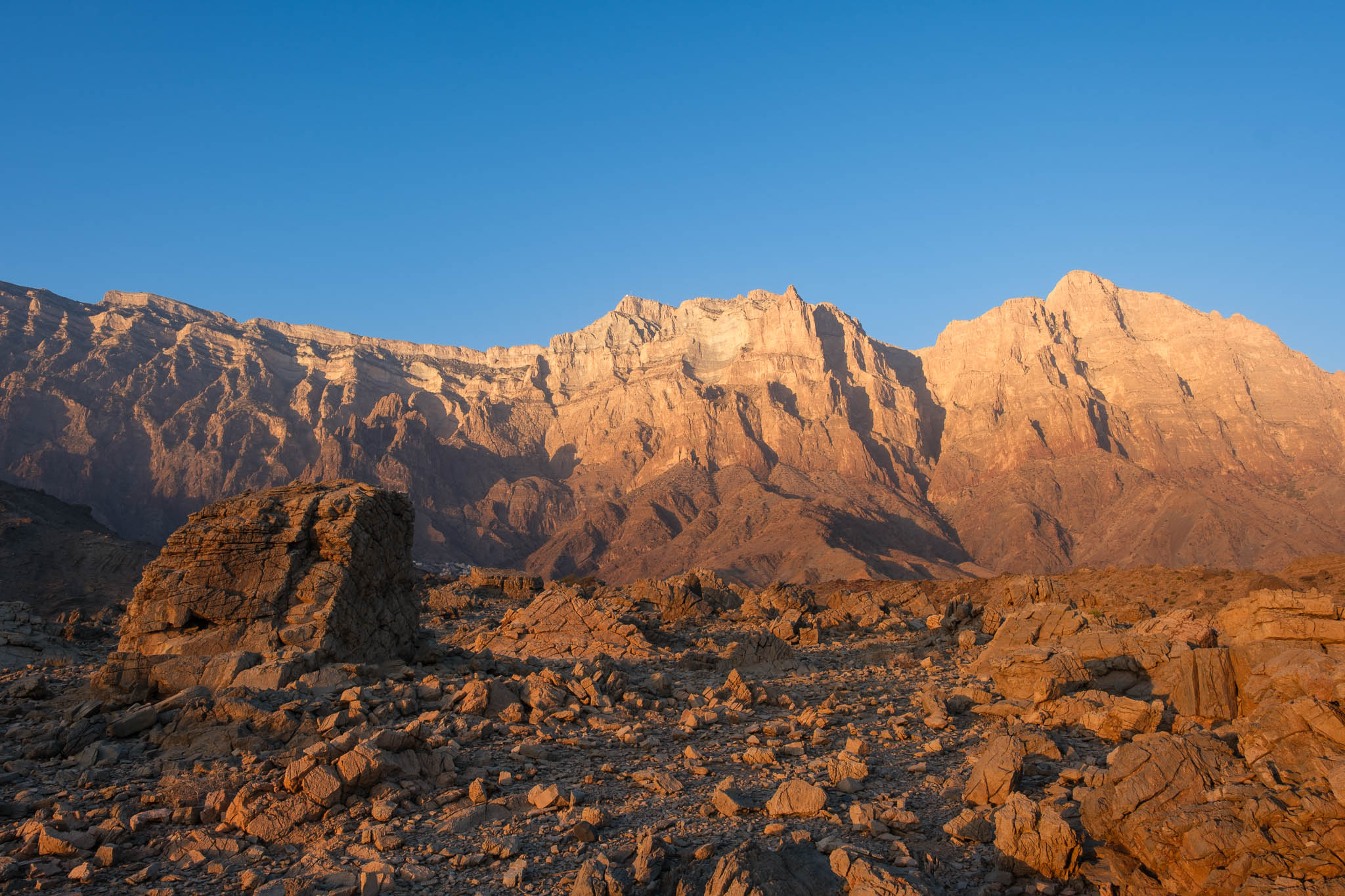
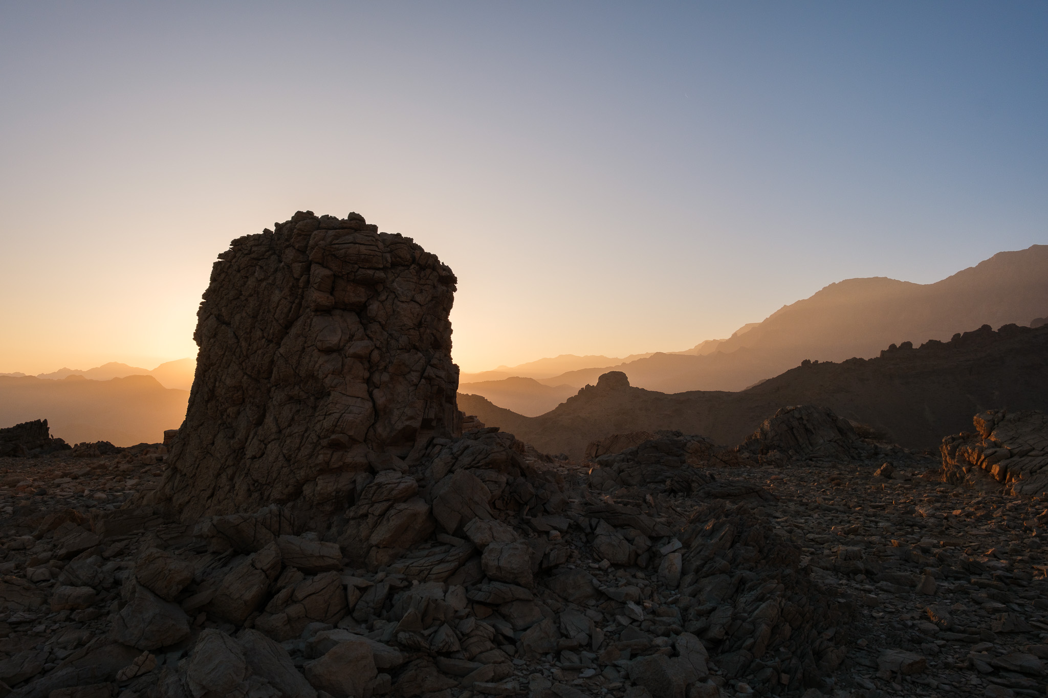
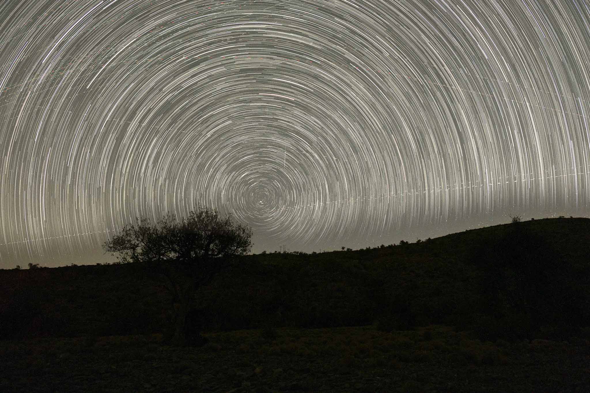
After this initial photo session, I rested for a while and had a nice dinner by a fire. My plan was to set up my camera and wide-angle lens to photograph a star trail; however, a strong wind forced me to cut the session short, and I only got about 30 minutes of total time. In the distance, roughly 30 km away, I could see the lights from the Jebel Shams antenna station.
Star trail over Jebel Shams. Fujifilm X-T5, Sigma 15mm f/1.4.Looking down the southern flank, towards Hamra. Fujifilm X-T5, Sigma 15mm f/1.4.
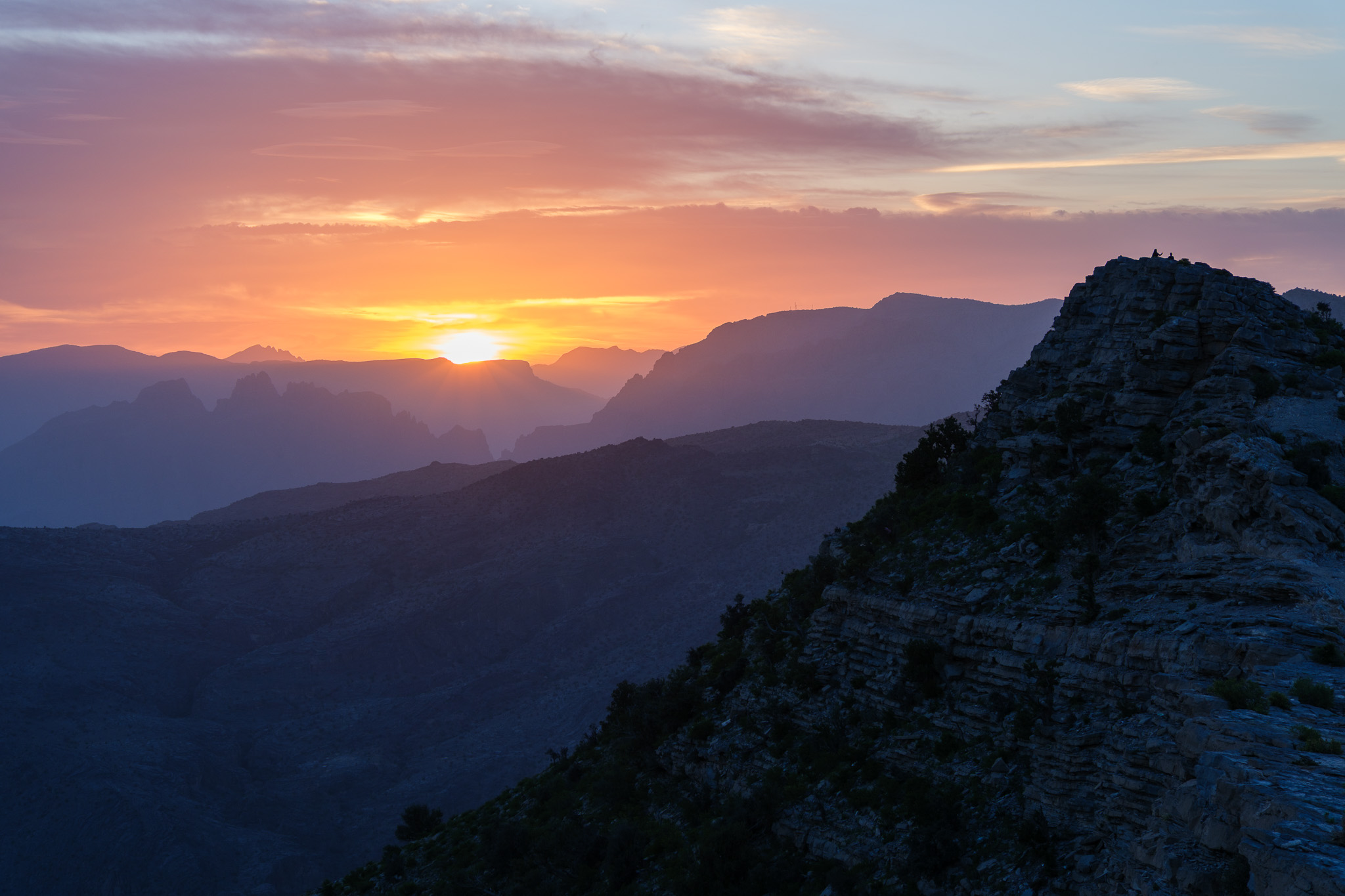
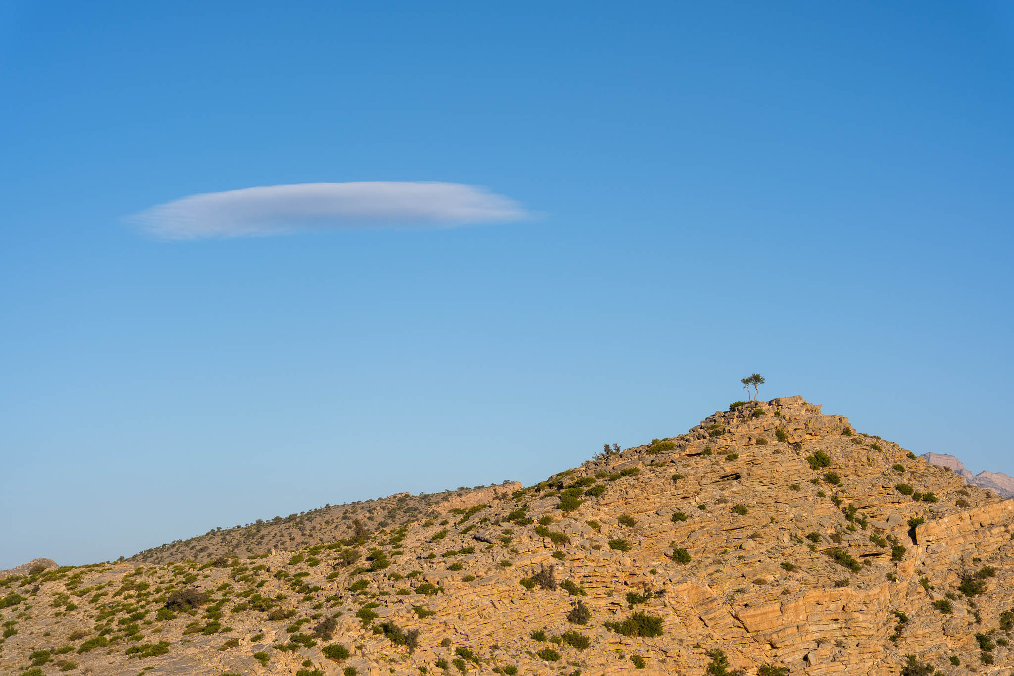
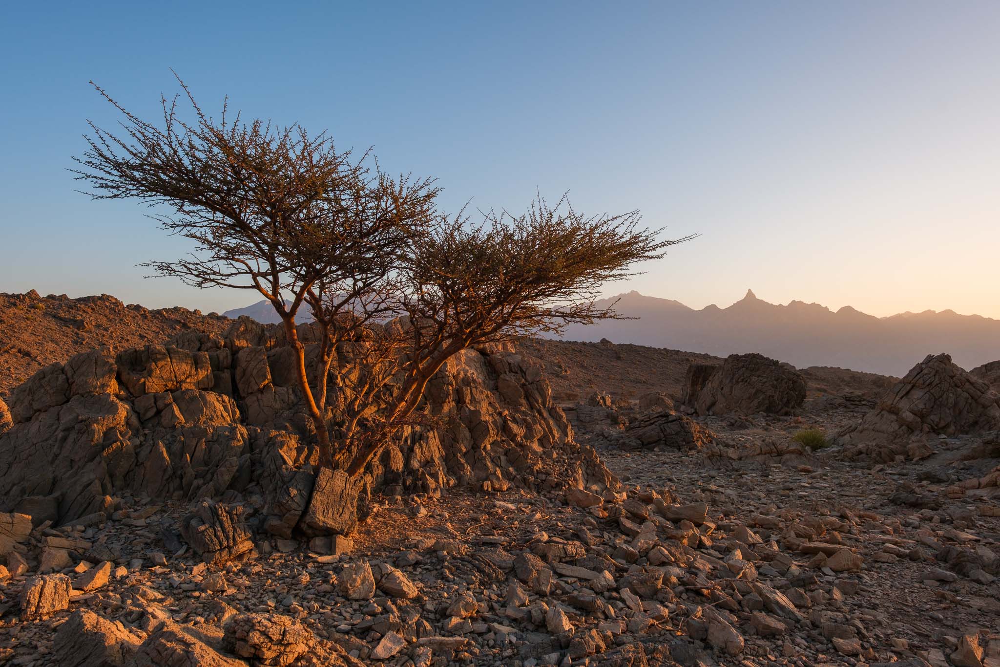
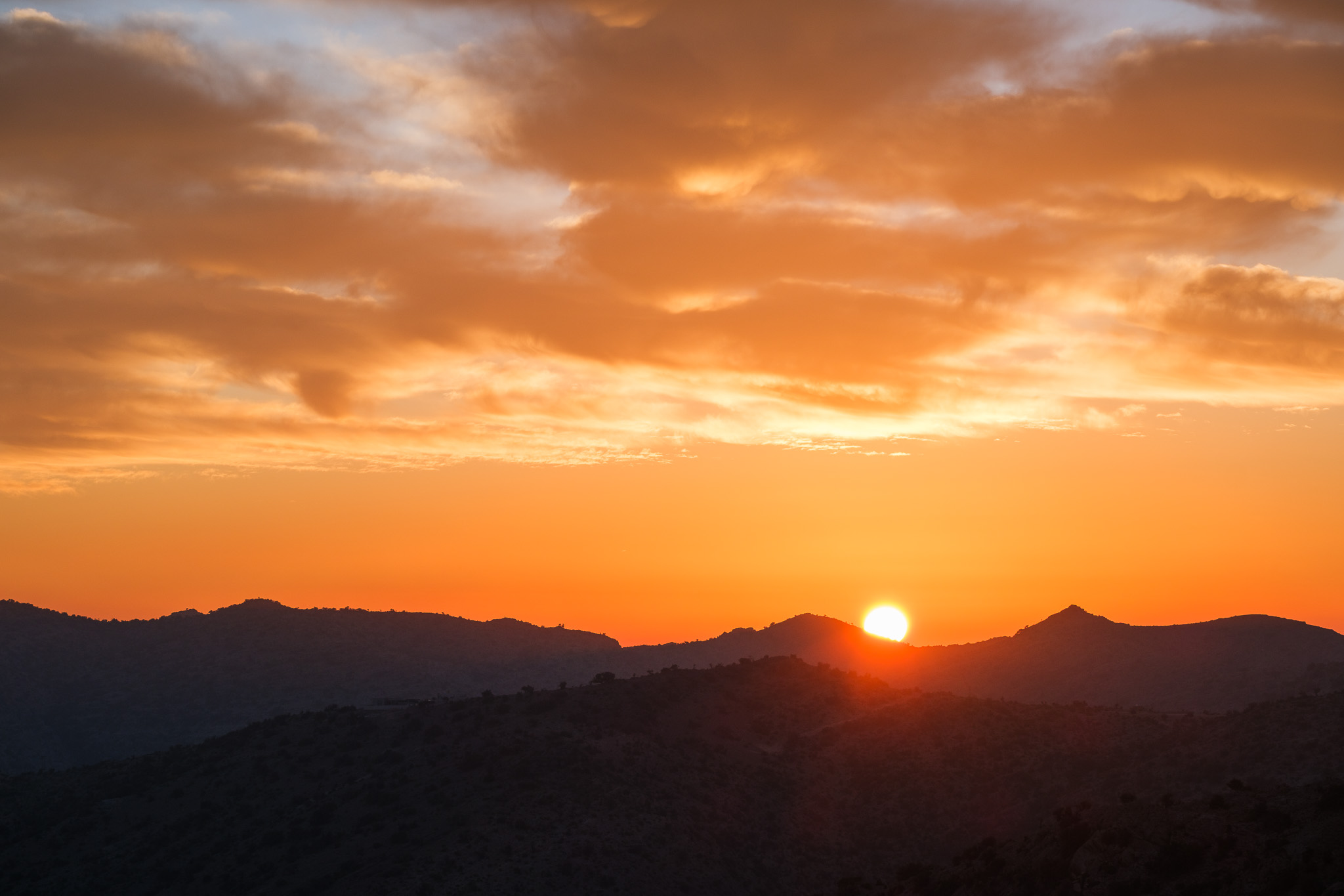
Following a good night´s sleep in the tent, I woke up to photograph a beautiful sunrise. To the north, the light started to illuminate Jebel Shams, slowly creeping down towards the village of Bilad Sayt. I always enjoy this time of the day, when everything is still quiet with no wind and crisp atmosphere.
First light over Jebel Shams peak and North Wall. Fujifilm X-T5, Sigma 15mm f/1.4.Sunrise. Fujifilm X-T5, Voigtlander 50mm f/1.2.Ranges. Fujifilm X-T5, Sigma 15mm f/1.4.Cloud. Fujifilm X-T5, Voigtlander 50mm f/1.2.
This type of light is brief, but while it lasts it is magical. After a well deserved breakfast, I packed my camping gear and left. I know I will return, of course. In the meantime, that day I drove down to Hamra to visit the picturesque village of Misfat Yabreen, but that will be another blog post.
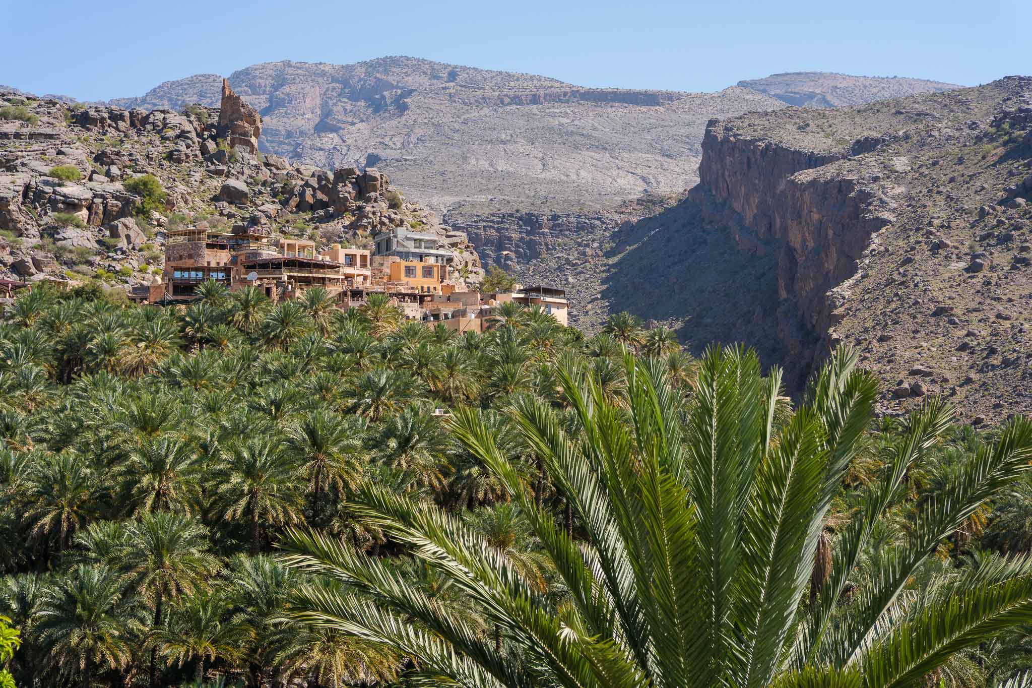
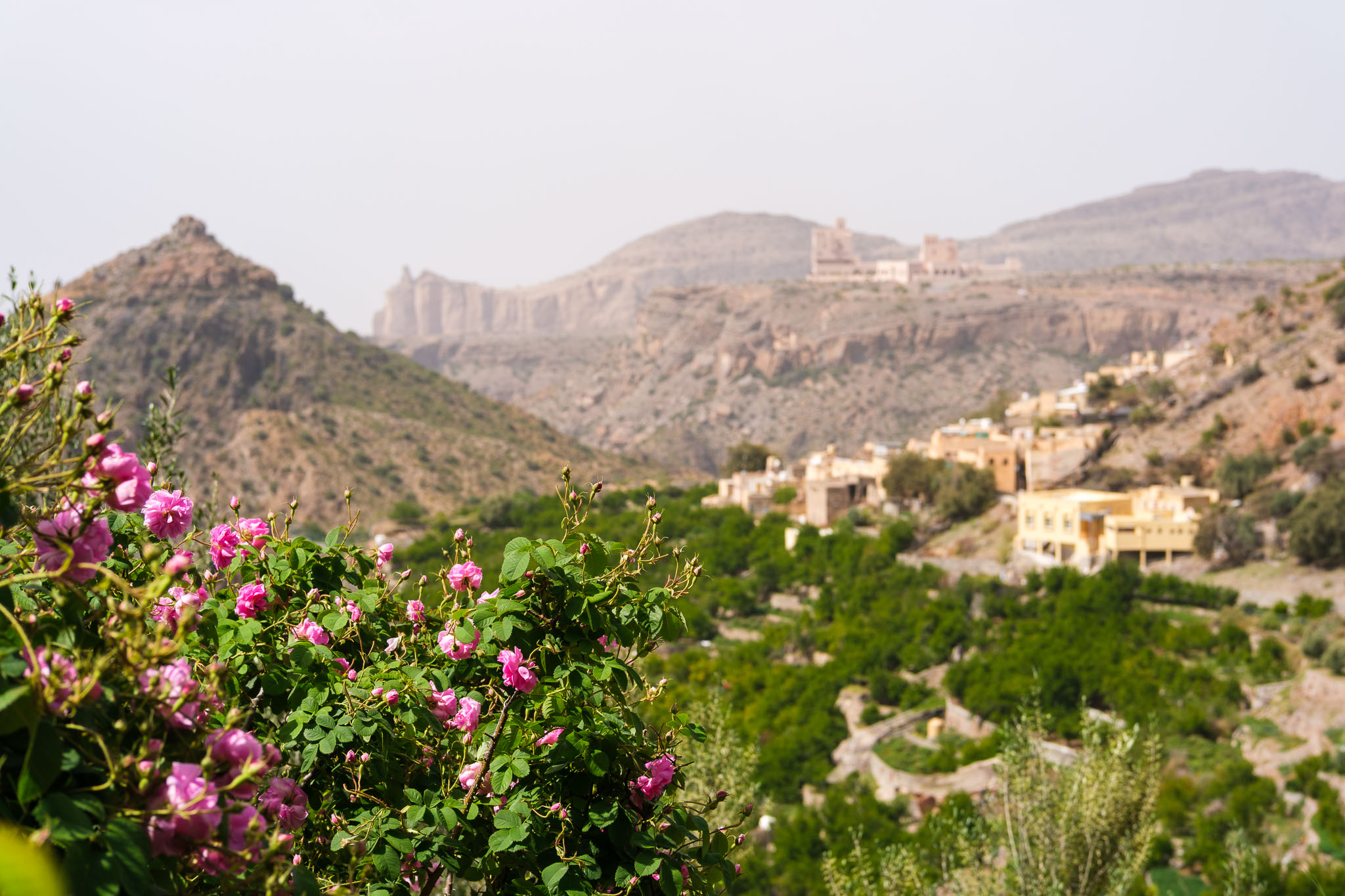
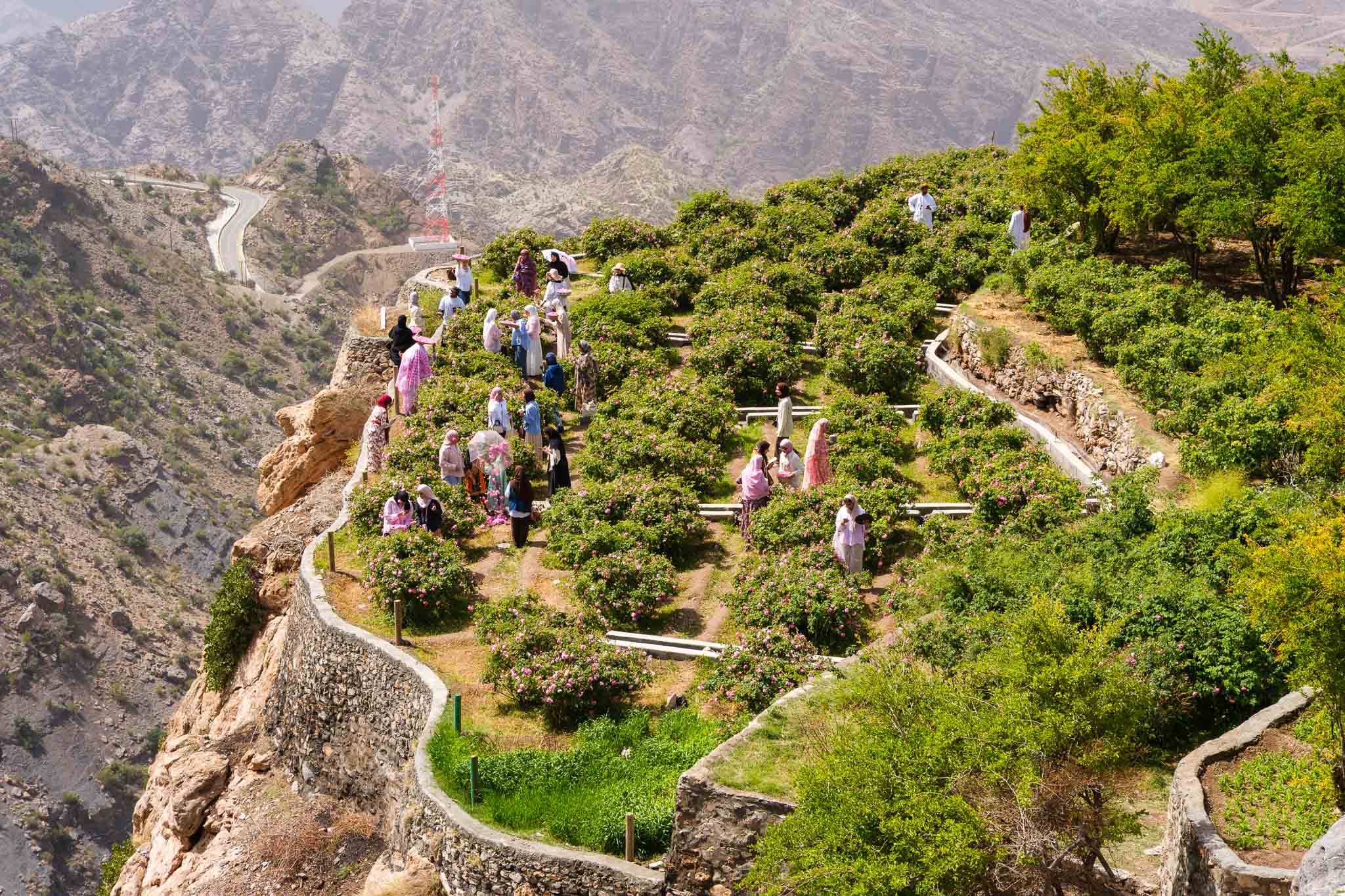
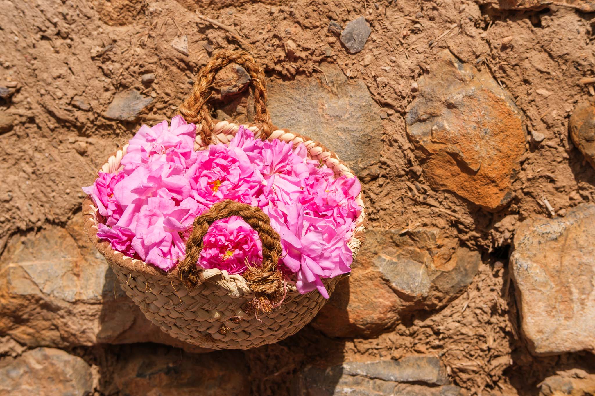
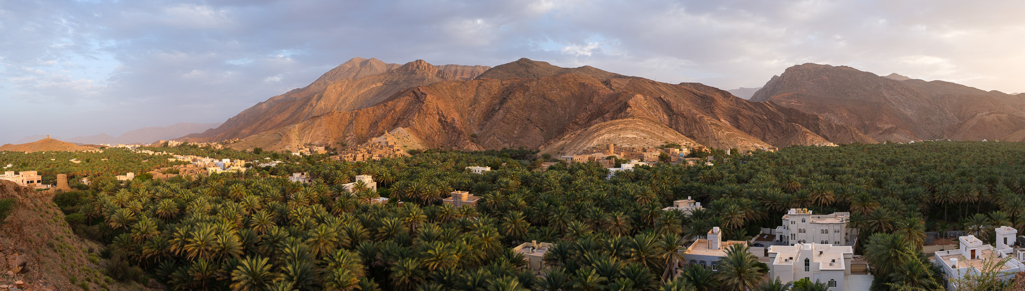
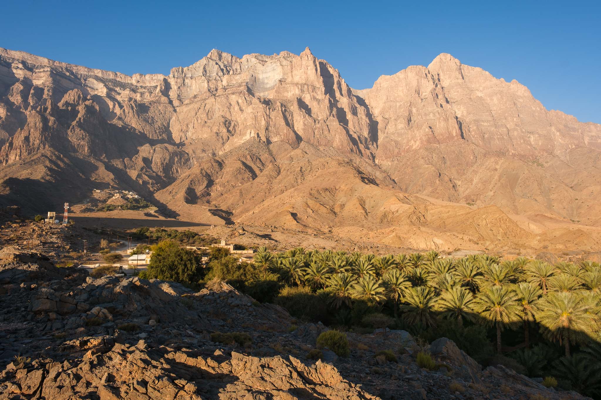
Every April the “rose season” attracts many visitors to the mountain terraces of Jebel Akhdar. Walking amongst the pink flowers that fill the air with their perfume is a unique experience, which can be complemented by visiting a traditional rose water distillery. The temperature at this higher altitude is pleasant and cool, inviting leisurely walks. This year I visited the area again, enjoying the mountain scenery and the picturesque villages. As always, Omanis are friendly and welcoming. However, I spent less time up in the mountain, because I wanted to visit Birkat Al Mawz (which translates to “Banana Pool”), a famous village located at the foothills of Jebel Akhdar. It is a historic village featuring UNESCO-listed falaj irrigation channels dating back 1,500 years, abandoned mud-brick ruins, lush date palm groves, and nice walking trails.
Mountain roses in Jebel Akhdar (Fujifilm X-T5, Voigtlander 50mm f/1.2).Picking the flowers in Jebel Akhdar (Fujifilm X-T5, Voigtlander 50mm f/1.2).Flower basket, Jebel Akhdar (Fujifilm X-T5, Voigtlander 50mm f/1.2).
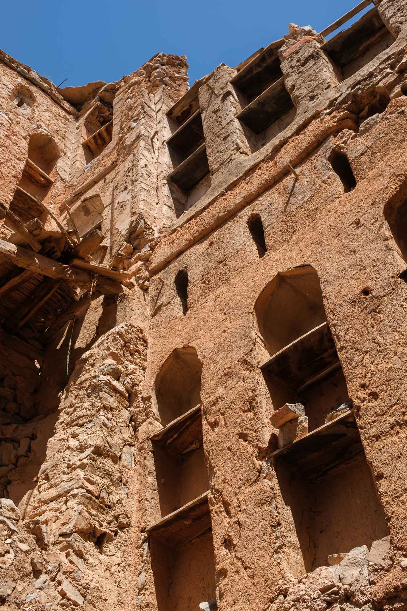
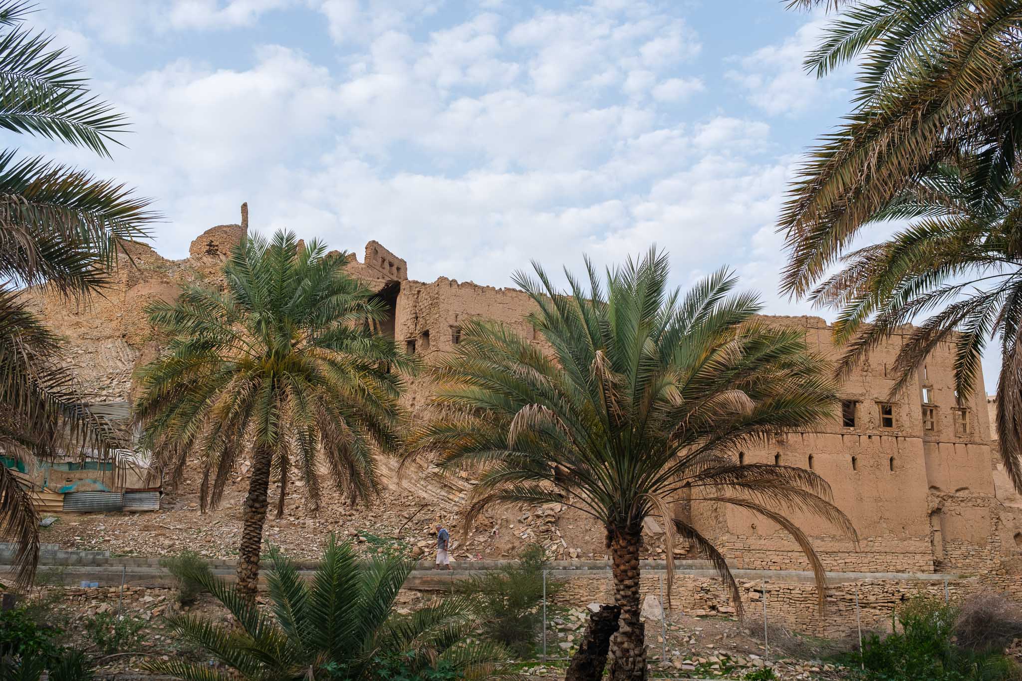
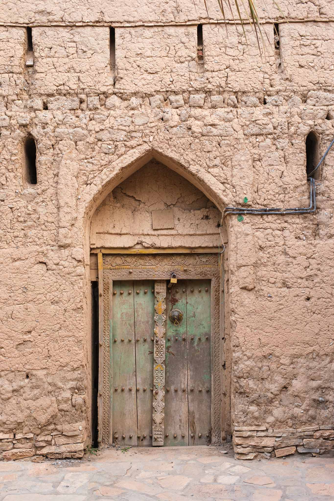
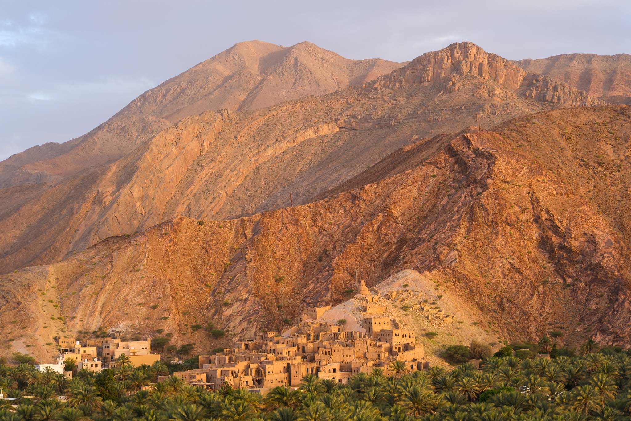
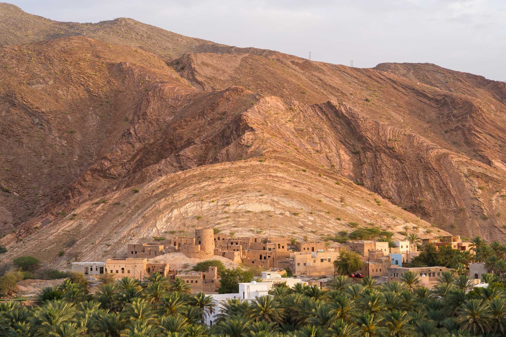
The road that takes you up to Jebel Akhdar passes through Birkat Al Mawz; as a result, I have driven many times through it, but never really explored it. Strategically located, the village guards the entrance to Wadi Muadin, which is a gateway to the mountains. It is one of Oman’s historically significant villages, providing the experience of a strong connection to a traditional agricultural past, which is preserved in the stone water channels and mud-brick houses frozen in time. These old houses were abandoned 50 – 60 years ago, as families moved to coastal cities attracted by new employment opportunities.
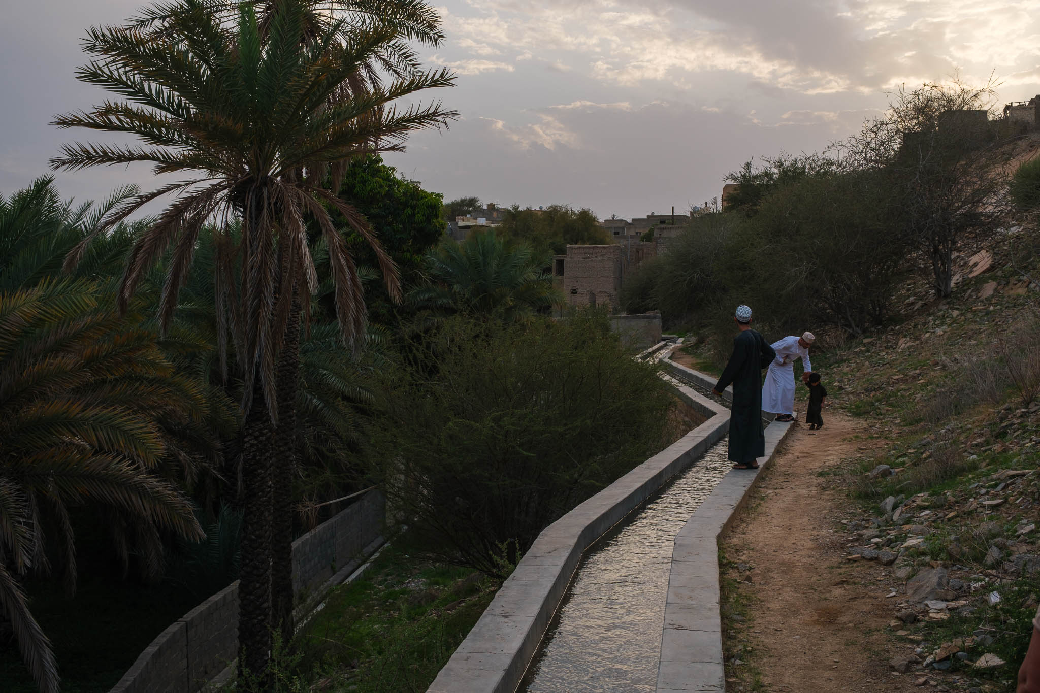
The ”falaj walk” starts near the parking area and is easy going, as it follows the irrigation system. The village’s ancient falaj system continues to perform its 1,500-year-old function, channeling mountain spring water through gravity-fed canals to irrigate date palms, banana plantations, and vegetable gardens. I visited during the late afternoon and really enjoyed walking along the old buildings and lush plantations, with the sound of running water for company. I wanted to photograph the village and its plantations against the mountain background, but the light was poor, with a heavy cloud cover. As always, landscape photographers depend on the light quality, but I decided to come back the following day before sunrise.
Historical walk (Fujifilm X-E5, Voigtlander 27mm f/2).Door (Fujifilm X-E5, Voigtlander 27mm f/2).Along the falaj (Fujifilm X-E5, Voigtlander 27mm f/2).
It turned out that I was lucky and at sunrise the next day there was a brief period where sunlight broke through the clouds. I was ready at a nearby viewpoint overlooking the beautiful landscape in front of me. I had to work very quickly, as the light only lasted for a few minutes. The mountains, abandoned villages and the lush plantations acquired a new life, very different from the previous day. The following photos were taken with my usual Fujifilm X system cameras and lenses, which I carried in my backpack.
Viewpoint sunrise (Fujifilm X-E5, Voigtlander 27mm f/2). Panorama assembled from 2 photos.Scenic sunrise (Fujifilm X-E5, Voigtlander 27mm f/2). Panorama assembled from 13 photos.Old village (Fujifilm X-T5, Voigtlander 50mm f/1.2).Old village (Fujifilm X-T5, Voigtlander 50mm f/1.2).Old villages and plantations (Fujifilm X-T5, Sigma 15mm f/1.4).
After less than 30 minutes of this high quality of light, the sun was again obscured by clouds, effectively ending my photo session. However, I was fortunate to photograph this beautiful landscape with such excellent sunrise light.
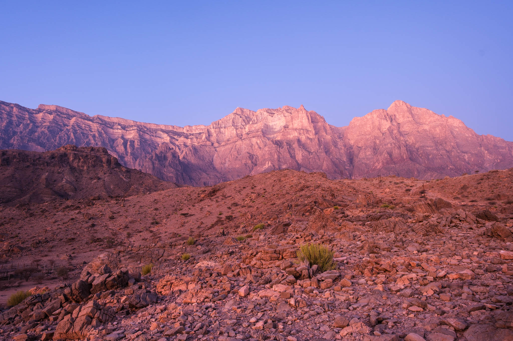
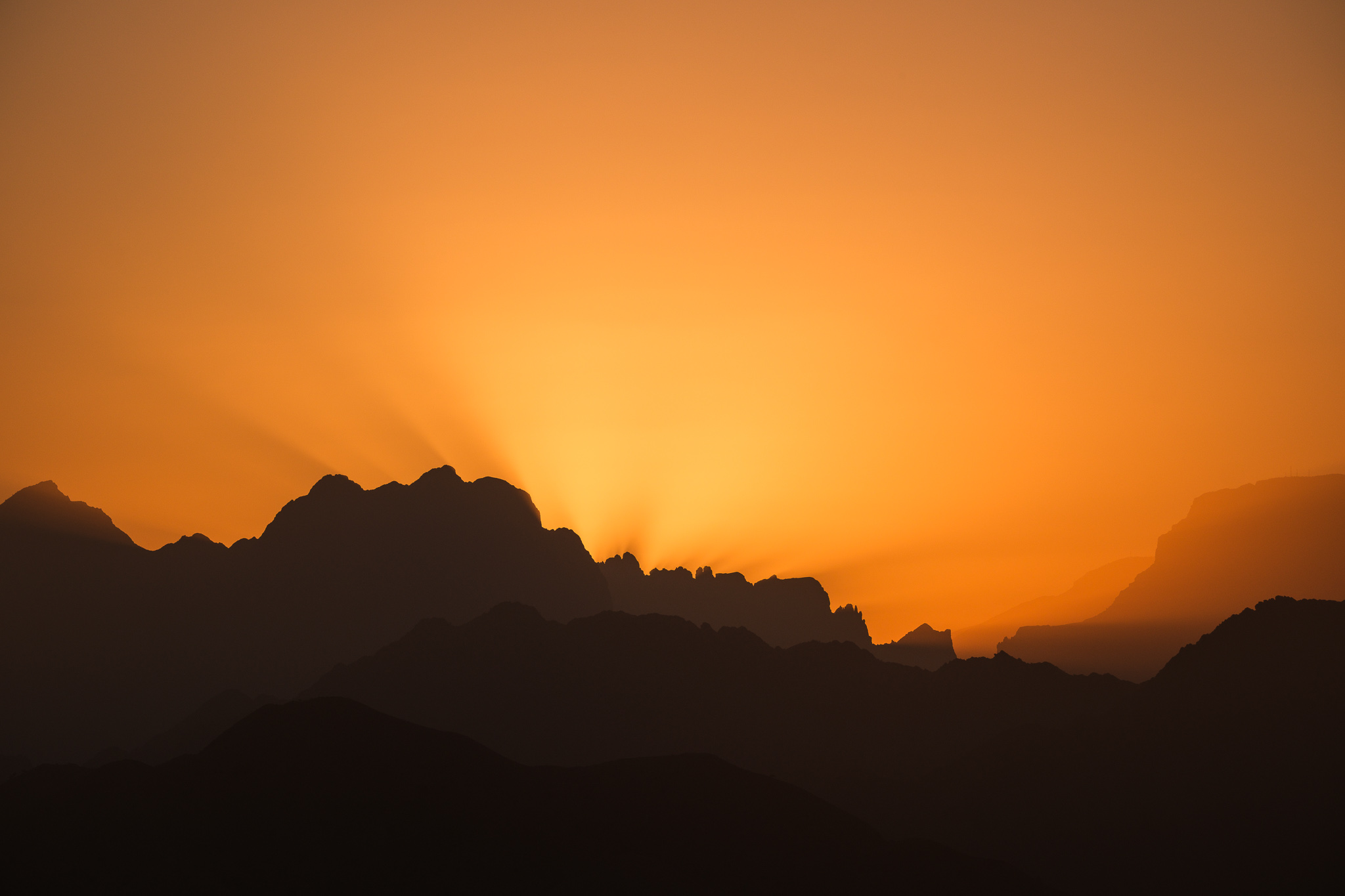
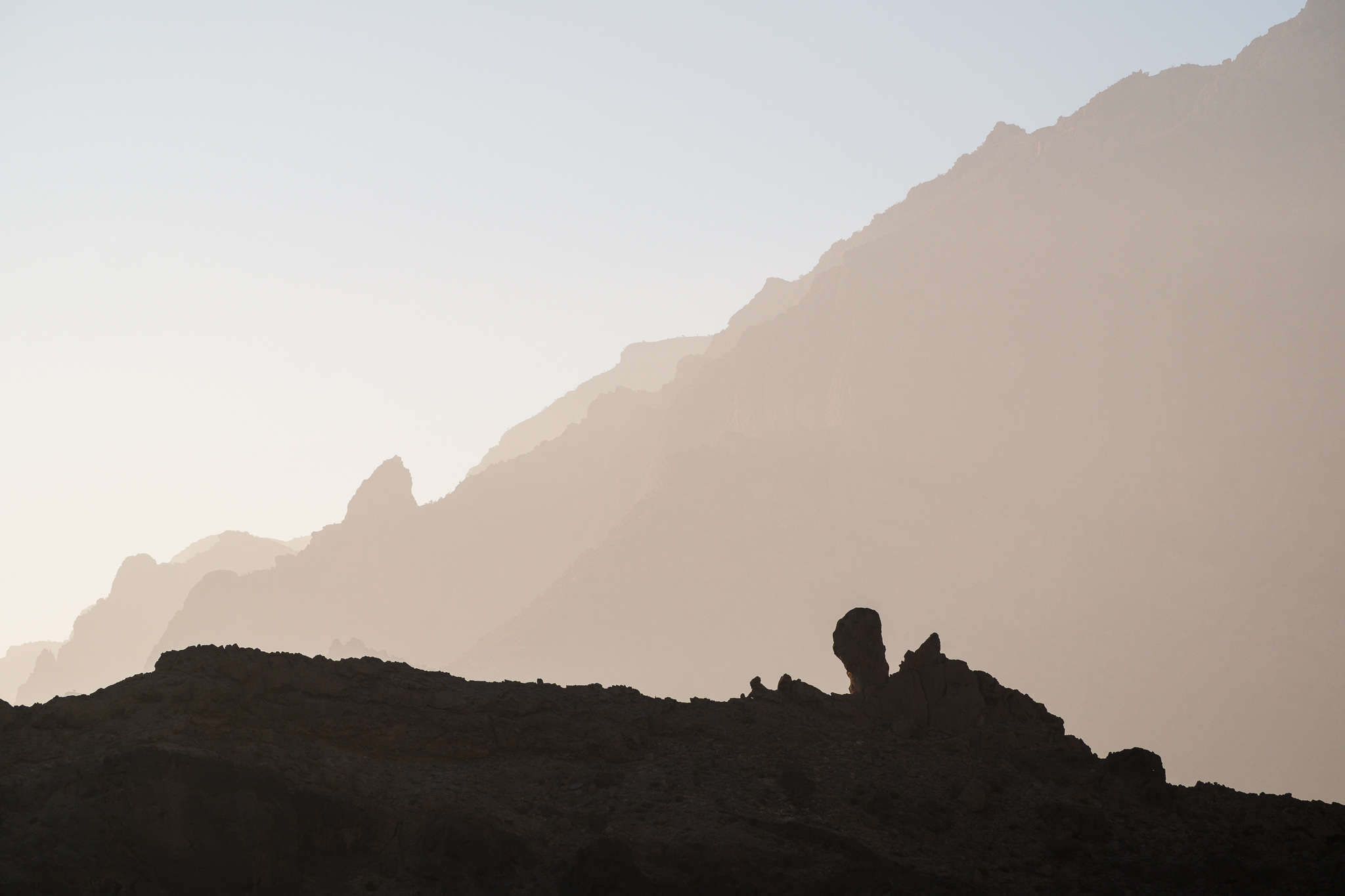
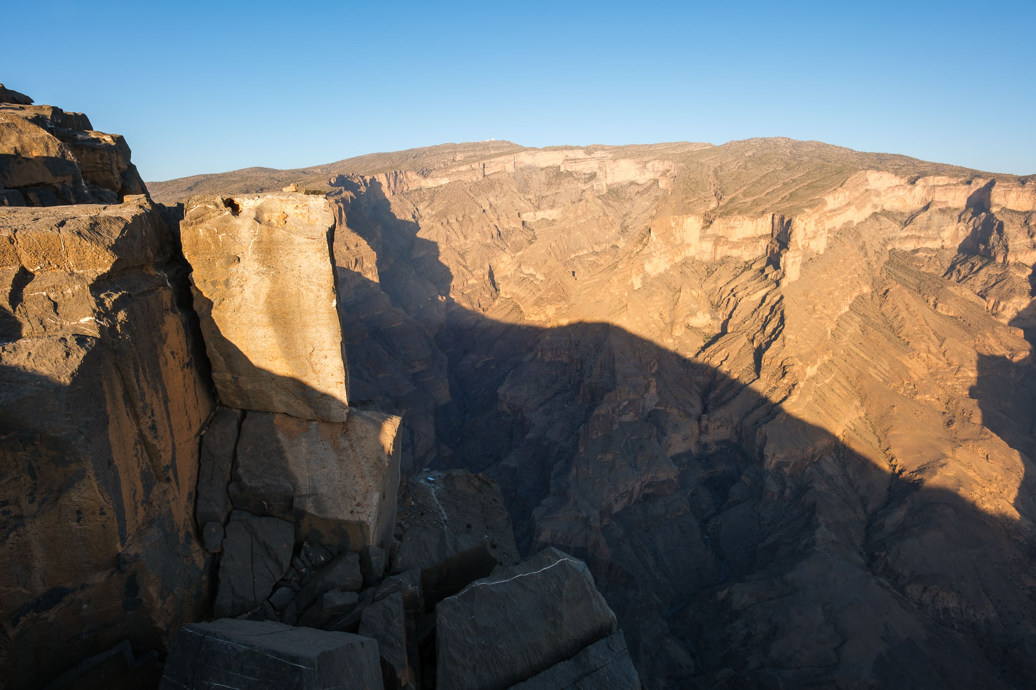
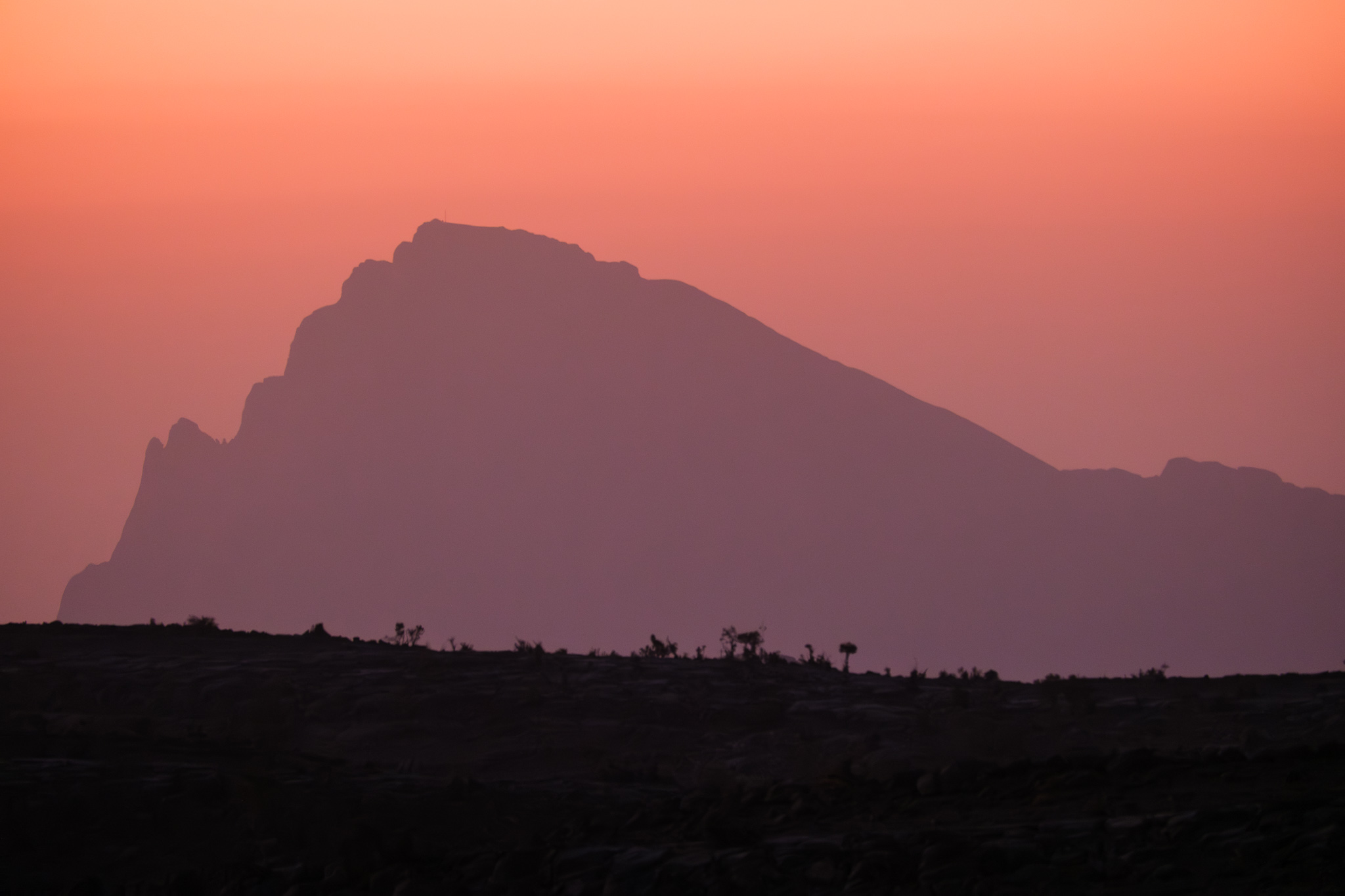
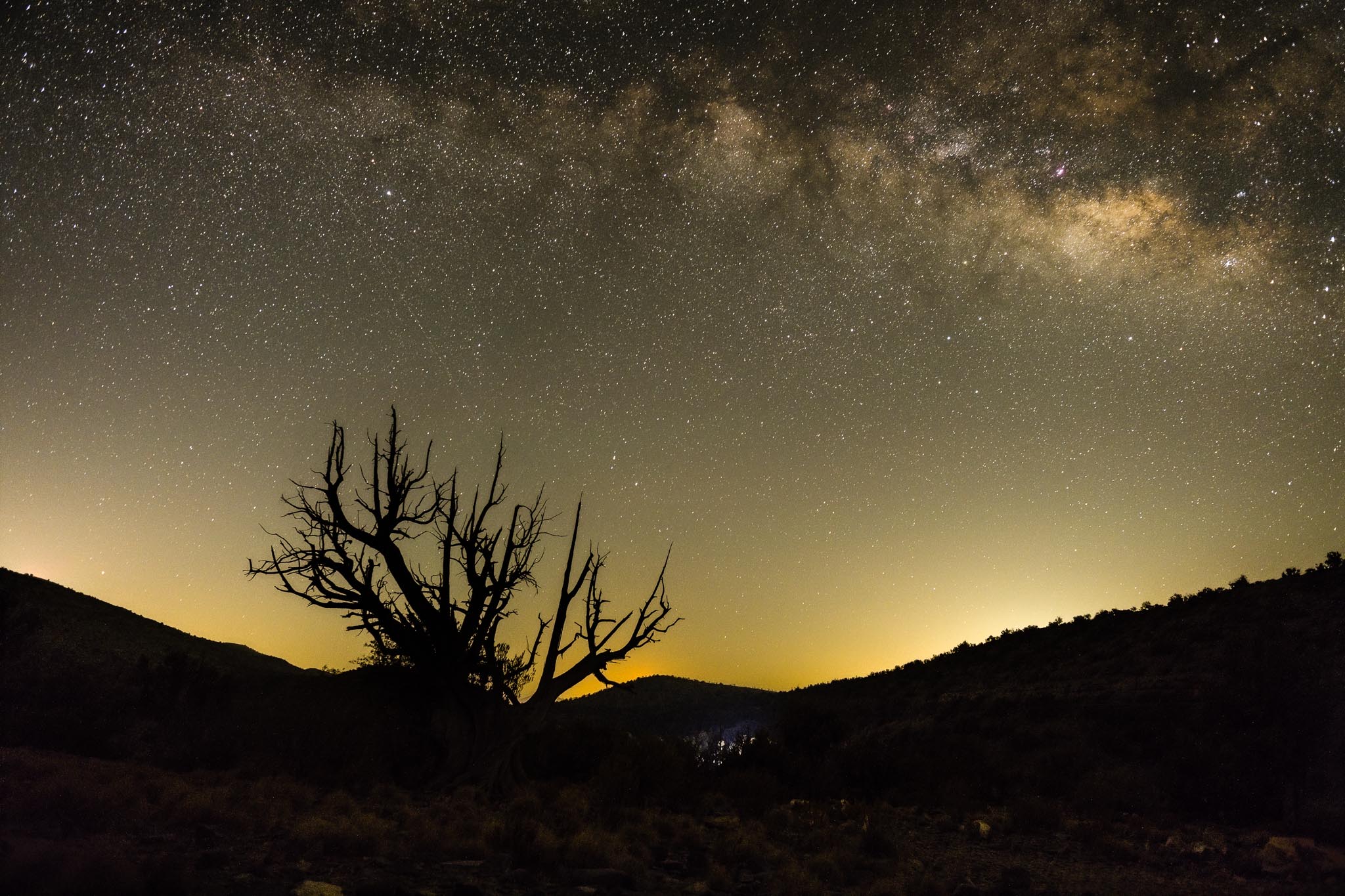
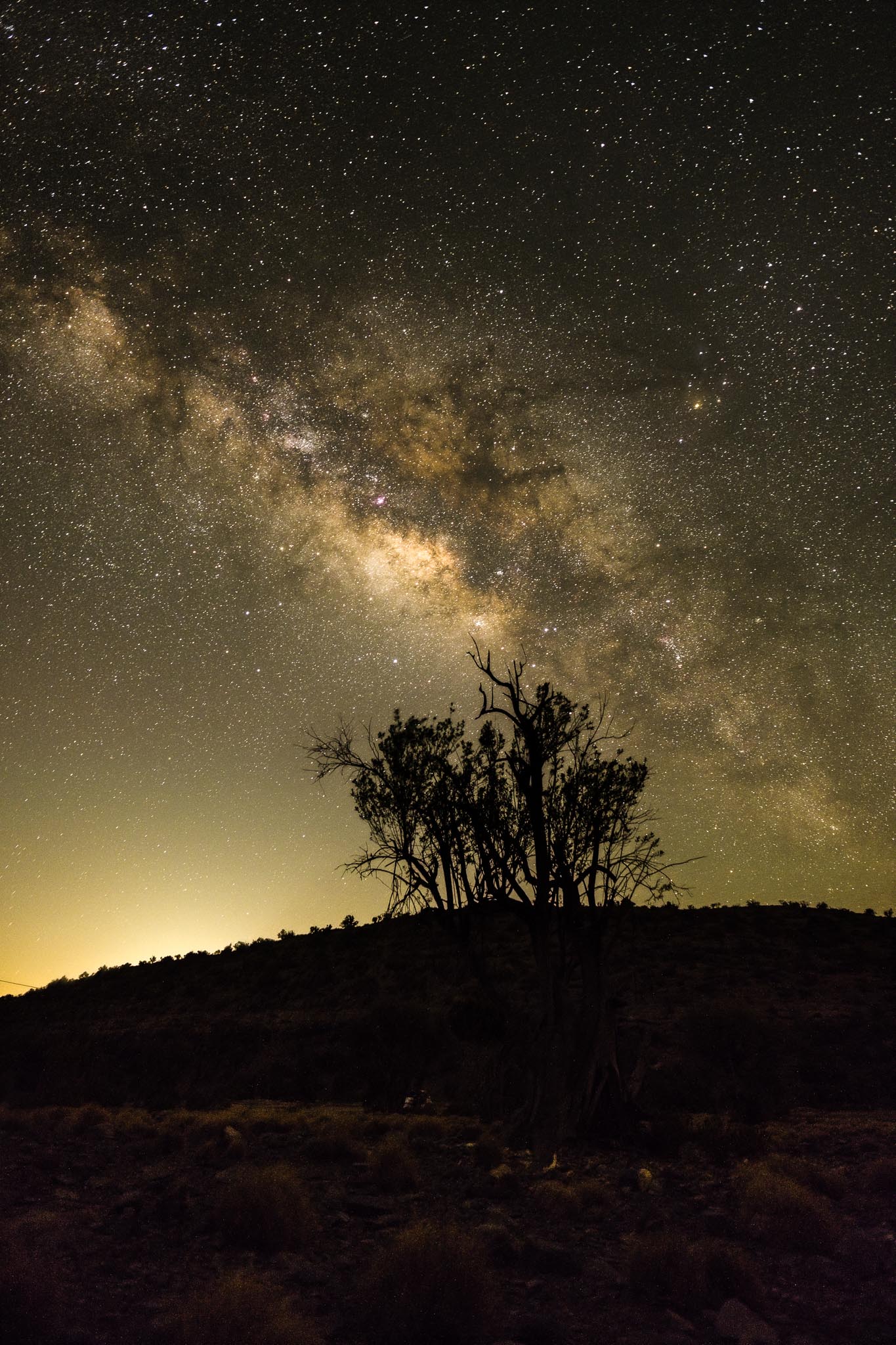
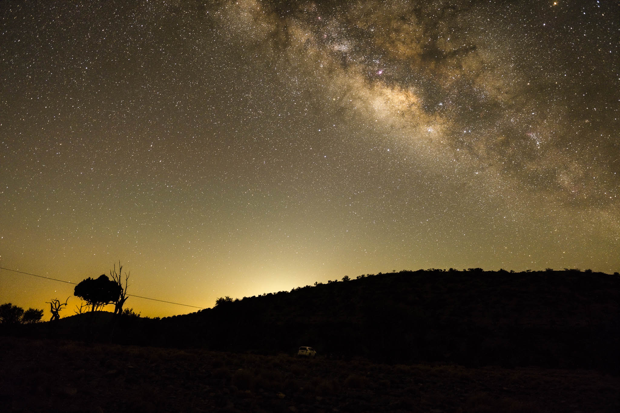
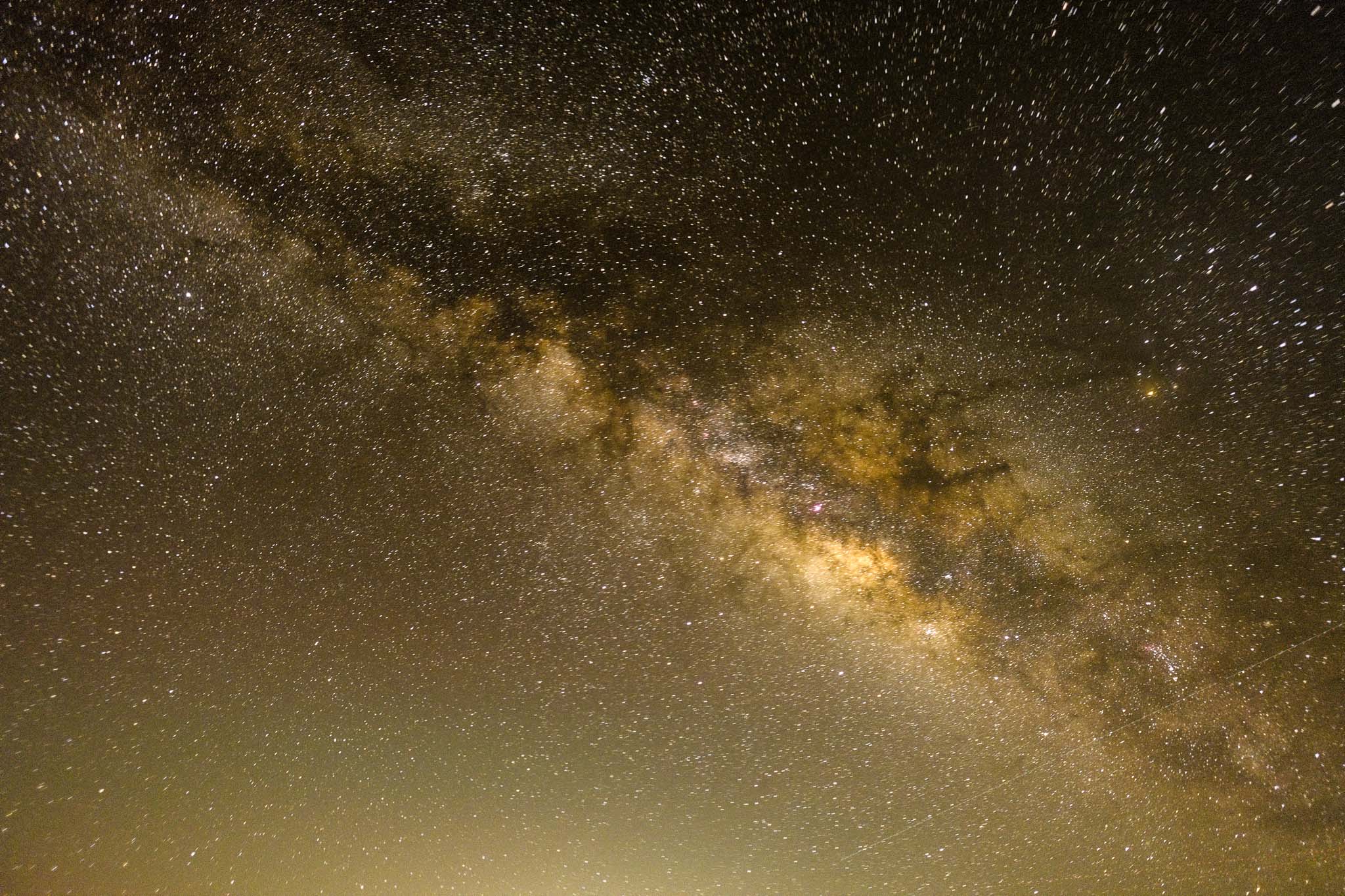
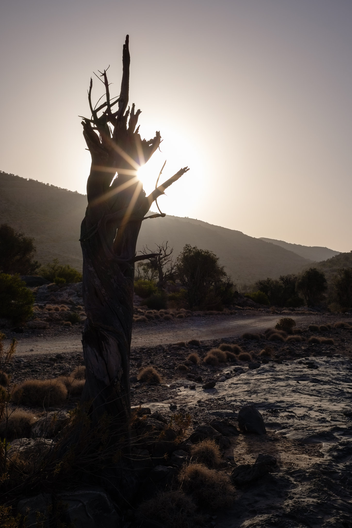
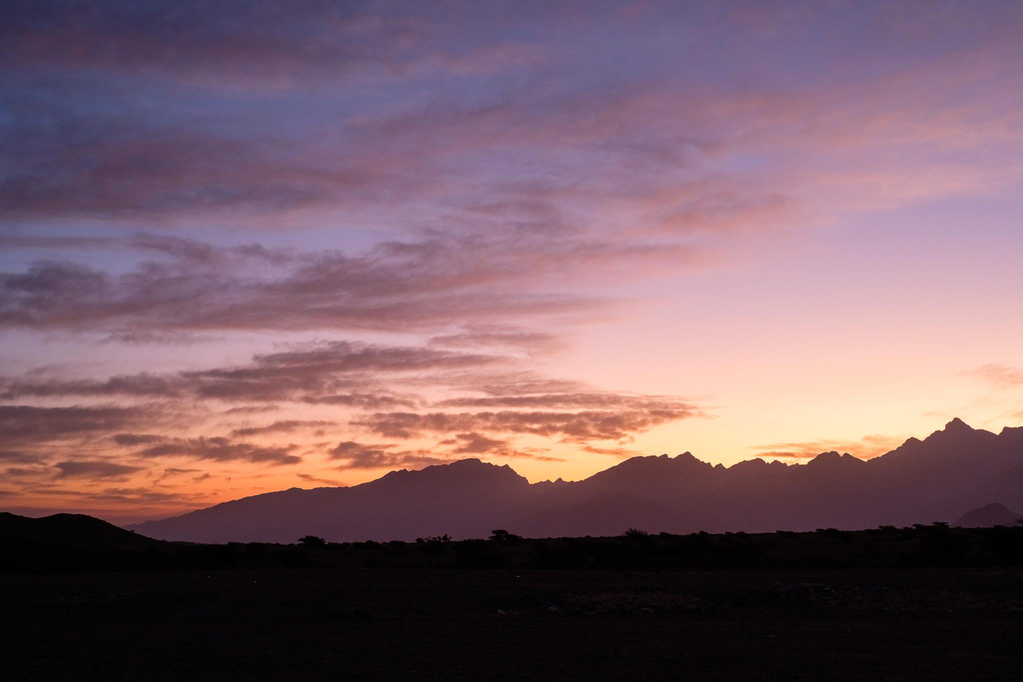
These photos were taken during a recent astronomy trip to Wadi Sahtan, near Rustaq. This is a good dark site for sky observation, but besides that, it is also located at the foot of the northern face of Jebel Shams, the highest mountain in Oman. This face is a sheer vertical wall of around 2,000 m height, which is really impressive. In February the temperature is still on the cold side at night, with the crisp air providing excellent visibility.
After a 2 hour drive from Muscat, our group arrived at the site and set up camp. As the sunset was approaching, I walked around for a while, scouting potential locations for a sunrise shoot. At sunrise, that wall of rock would be illuminated by the early morning light. Sunset itself provided a good show, with the light being dispersed by the edge of the mountain.
Tree and mountain. Fujifilm X-T5, Fujinon 14mm.Light. Fujifilm X-T5, Fujinon 70-300mm.
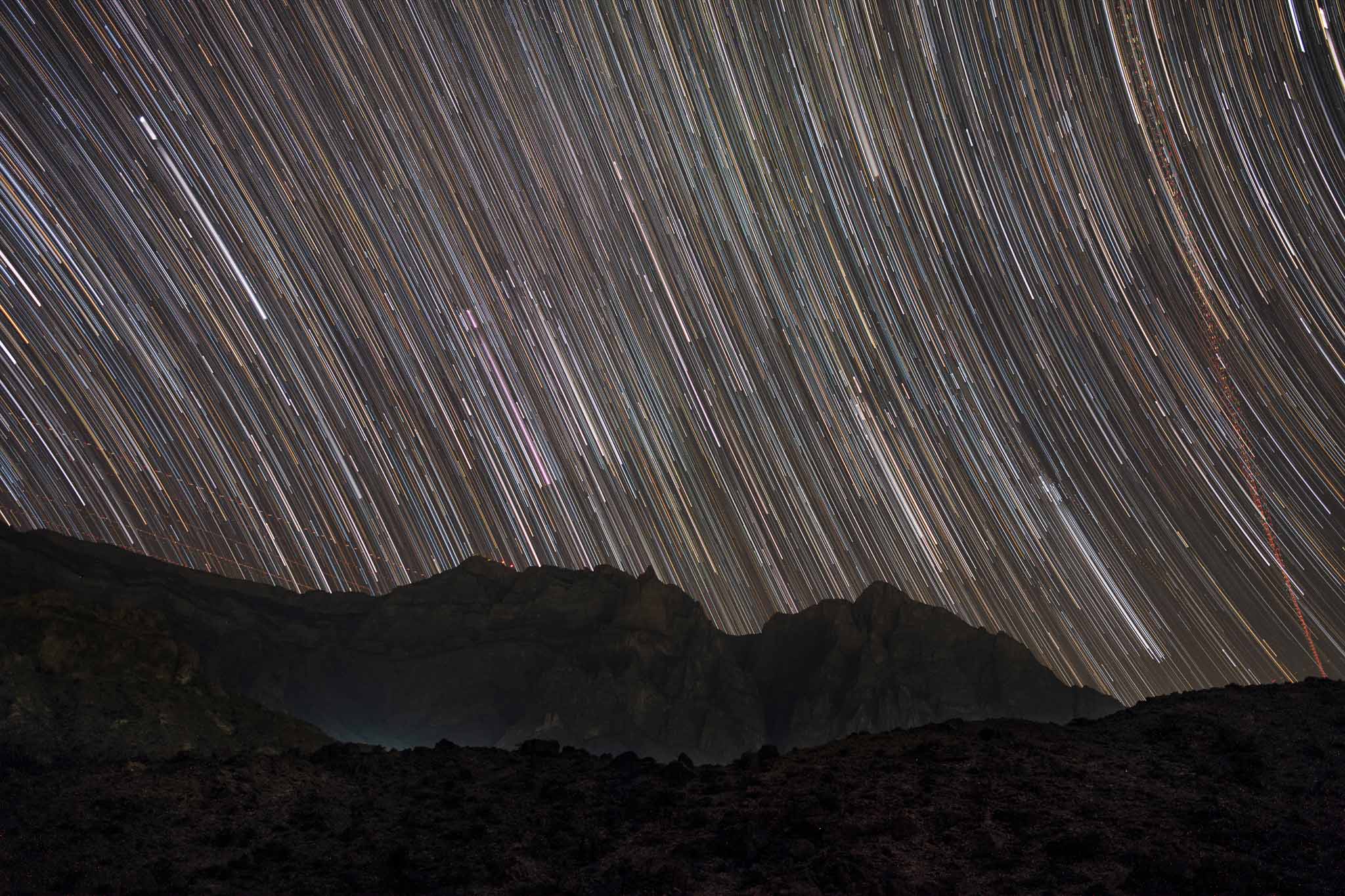
With the approach of darkness I returned to camp to have dinner and prepare for some observation. Our group managed to had a good look at several planets (Saturn, Neptune, Uranus and Jupiter), plus a few star clusters and nebulae. Before I went to sleep, I set up my camera on the tripod to shoot a few hundred images for later assembly as star trail. The result was the image below, with a total time o 100 minutes (200 photos of 30 seconds each).
Looking west. Fujifilm X-T5, Fujinon 14mm.
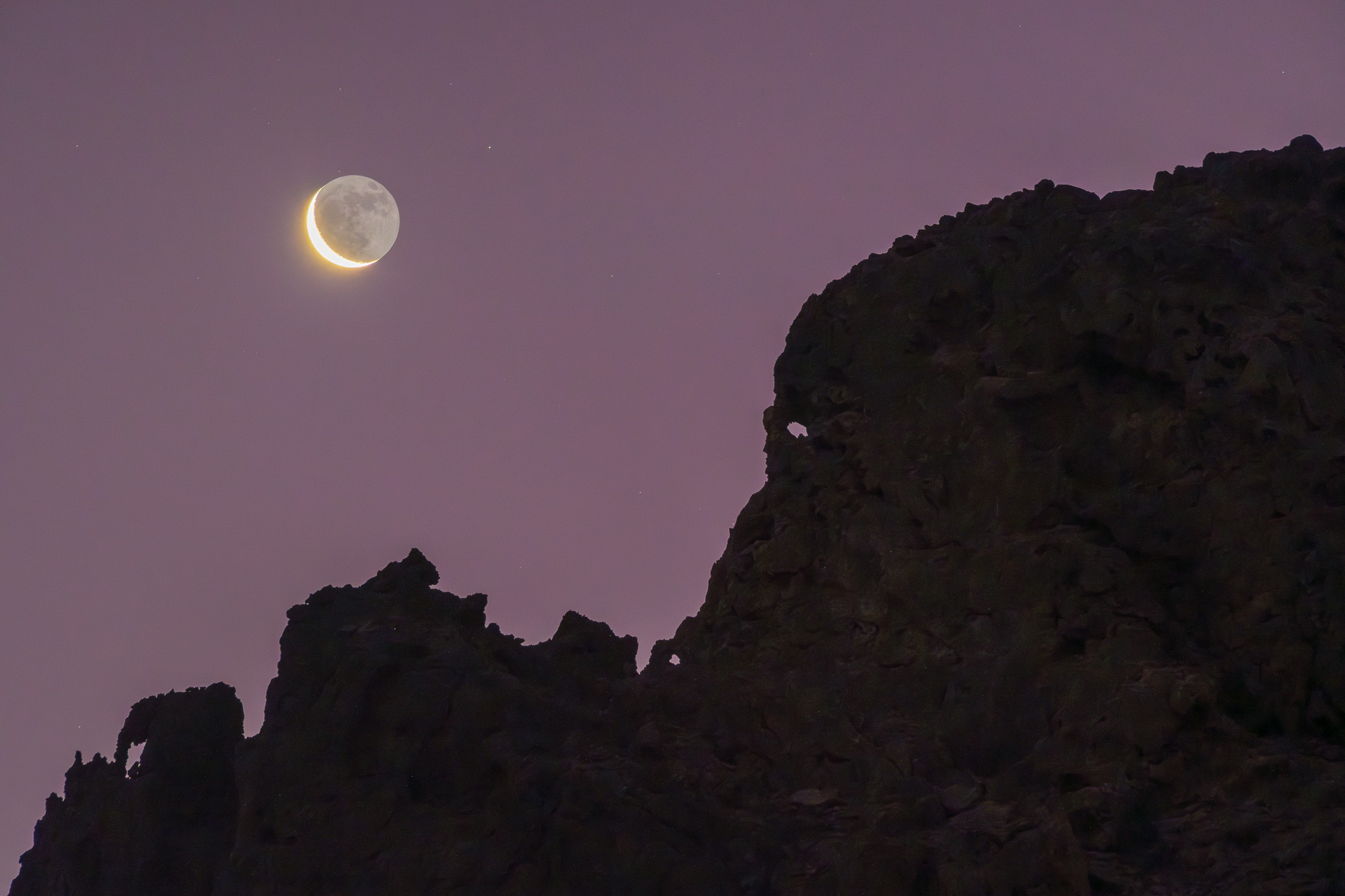
The following morning, as planned, I woke up before dawn, to be greeted by the crescent moon.
Rising. Fujifilm X-T5, Fujinon 70-300mm.
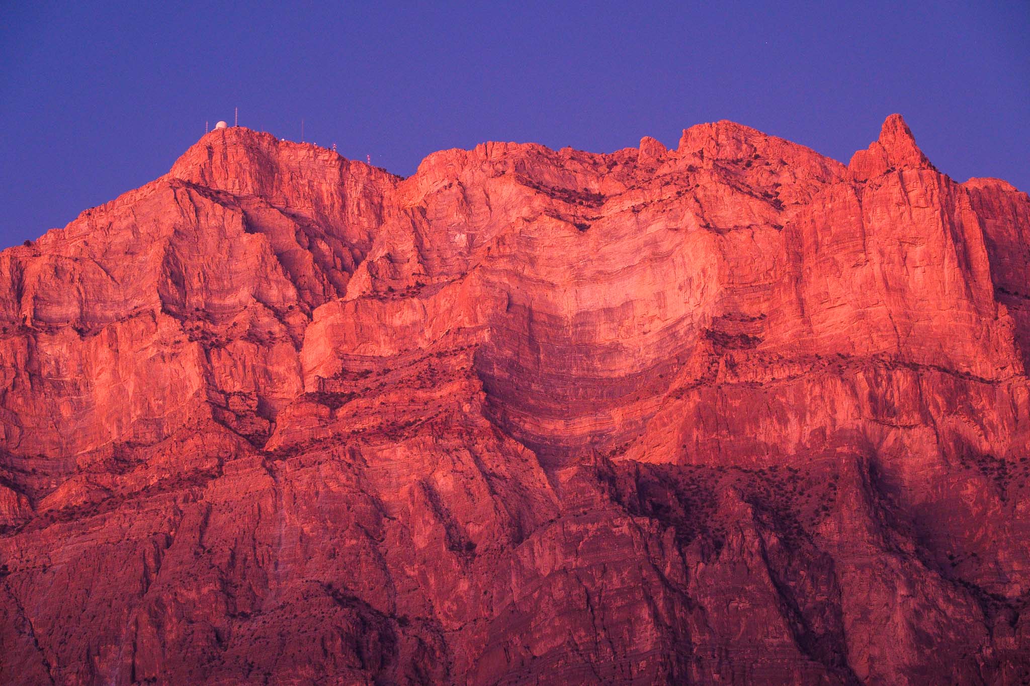
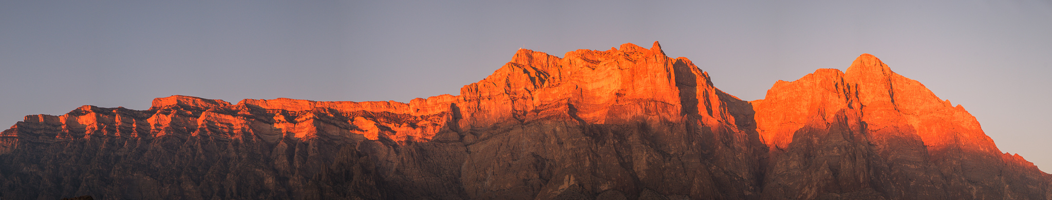
After that, I walked up a nearby hill and started to shoot as the early morning light slowly bathed the mountain in a wonderful light. It was an incredible experience just watching the progression of the light over the landscape.
First light. Fujifilm X-T5, Fujinon 14mm.Glowing. Fujifilm X-T5, Fujinon 70-300mm.Panorama of 30 vertical photos. Fujifilm X-T5, Fujinon 70-300mm.Edge of light. Fujifilm X-T5, Fujinon 14mm.Rusty colors. Fujifilm X-T5, Fujinon 14mm.
Of course on my back the sun was rising, which presented further opportunities for interesting photos too. Like the nearby village of Wahjma, at the foot of the mountain, with its oasis of palm trees.
Dry land. Fujifilm X-T5, Fujinon 14mm.Obscured. Fujifilm X-T5, Fujinon 14mm.Sunrise. Fujifilm X-T5, Fujinon 70-300mm.Wahjma village in the distance. Fujifilm X-T5, Fujinon 14mm.Layers. Fujifilm X-T5, Fujinon 70-300mm.
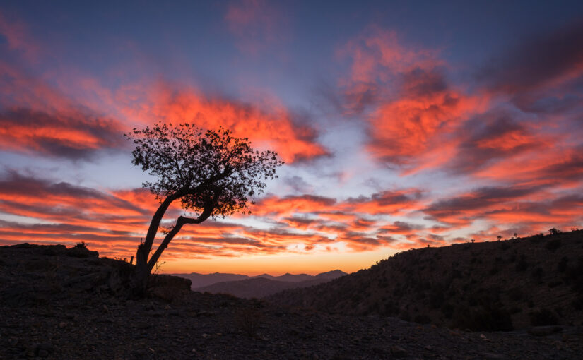
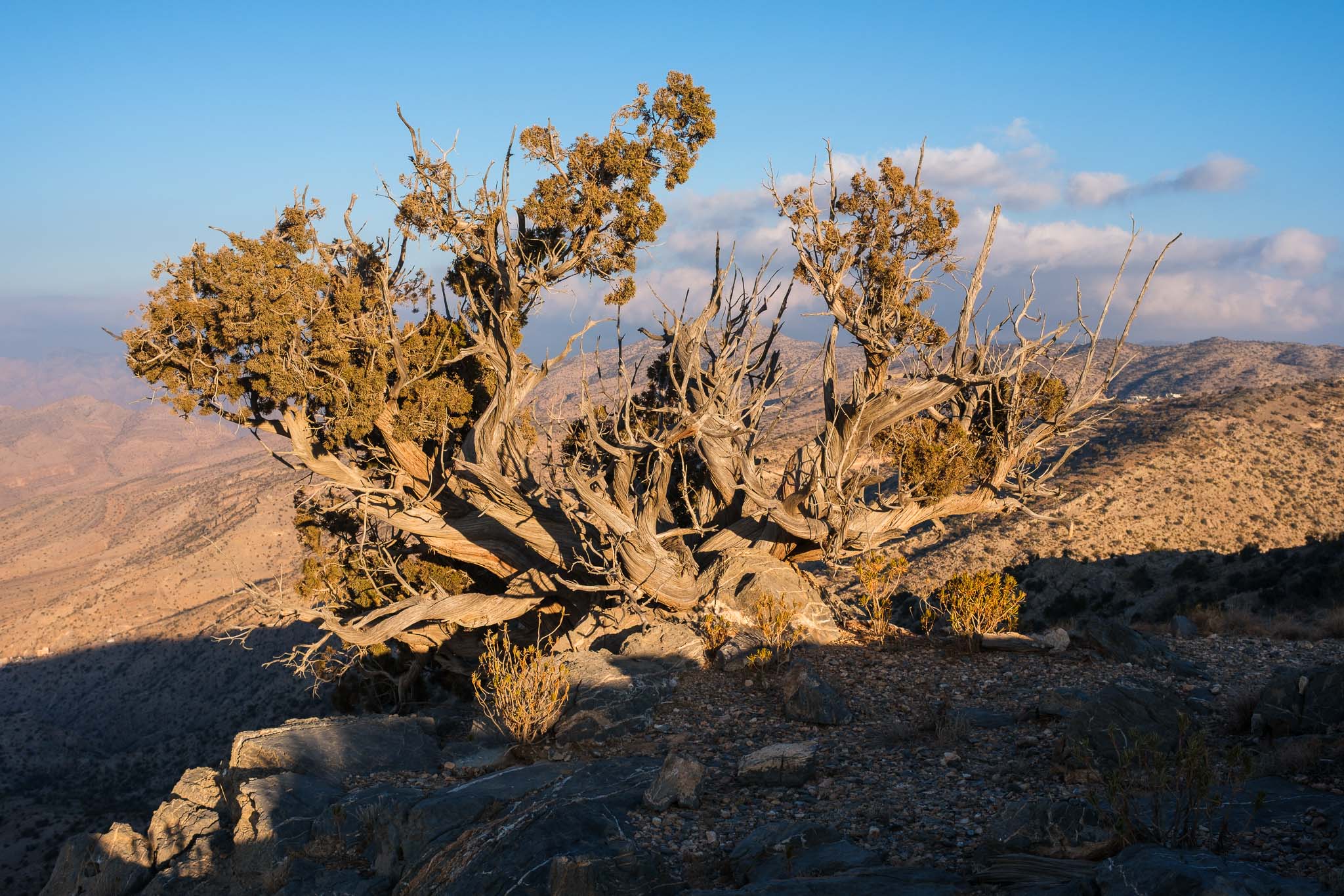
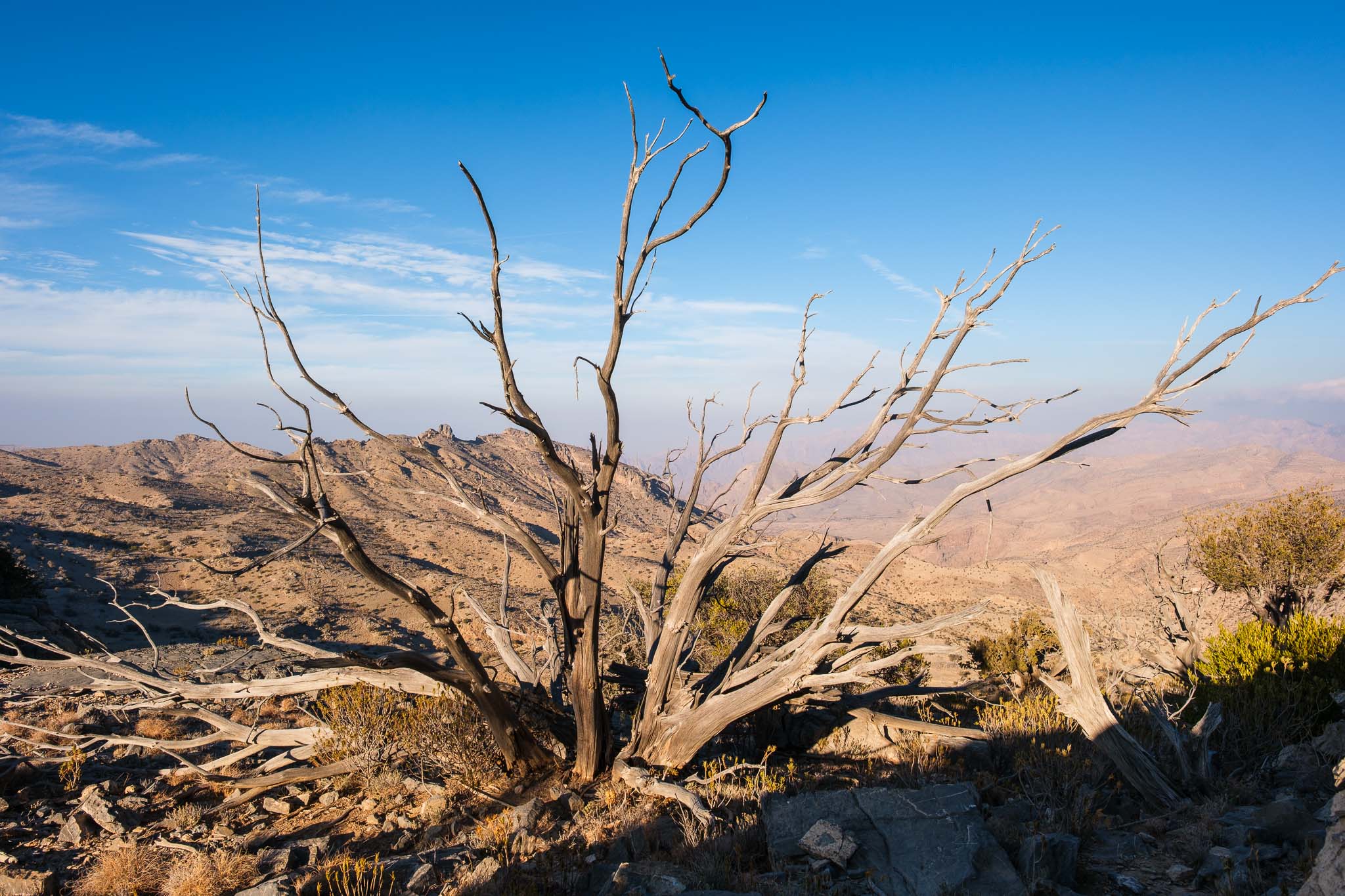
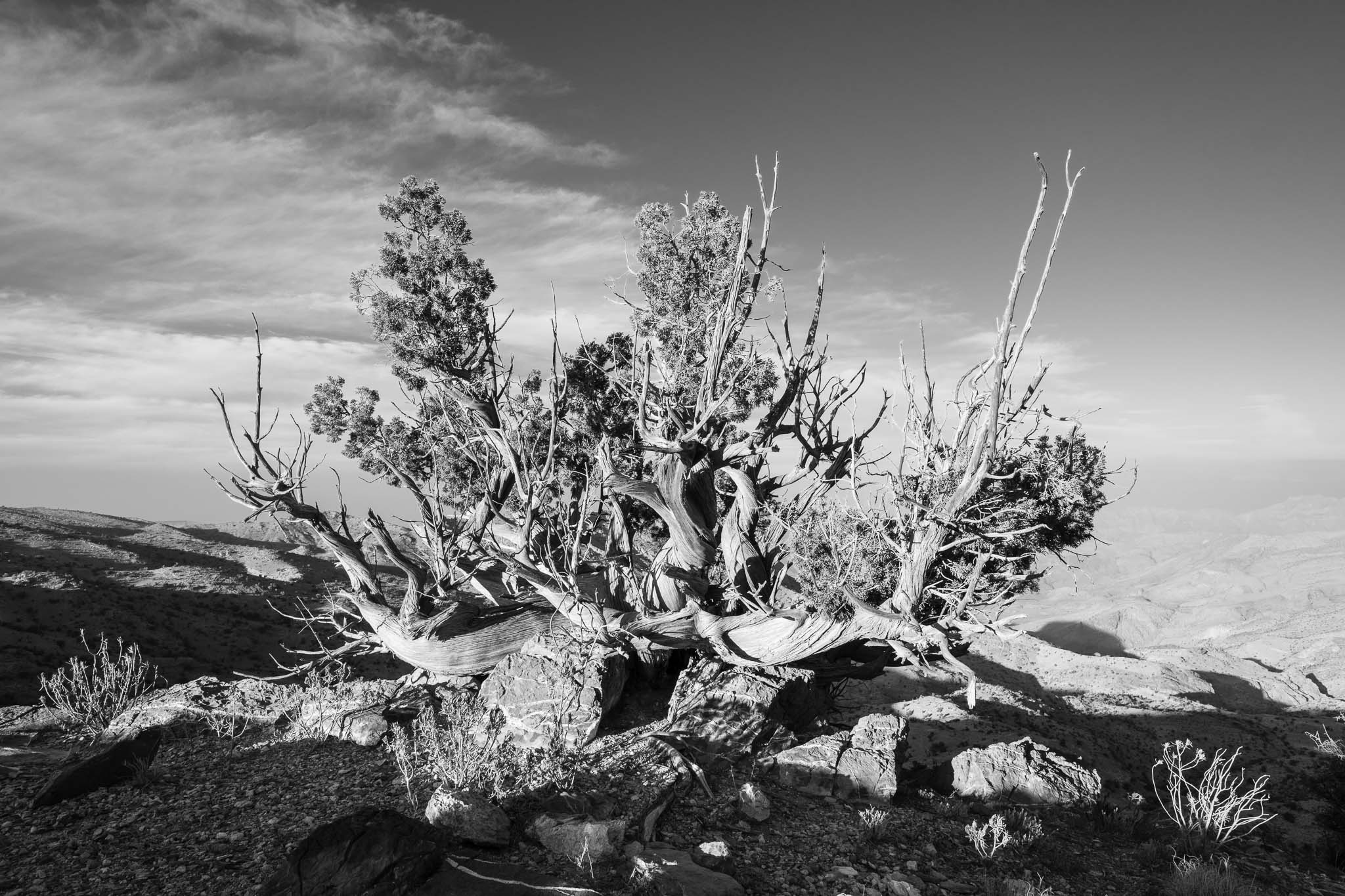
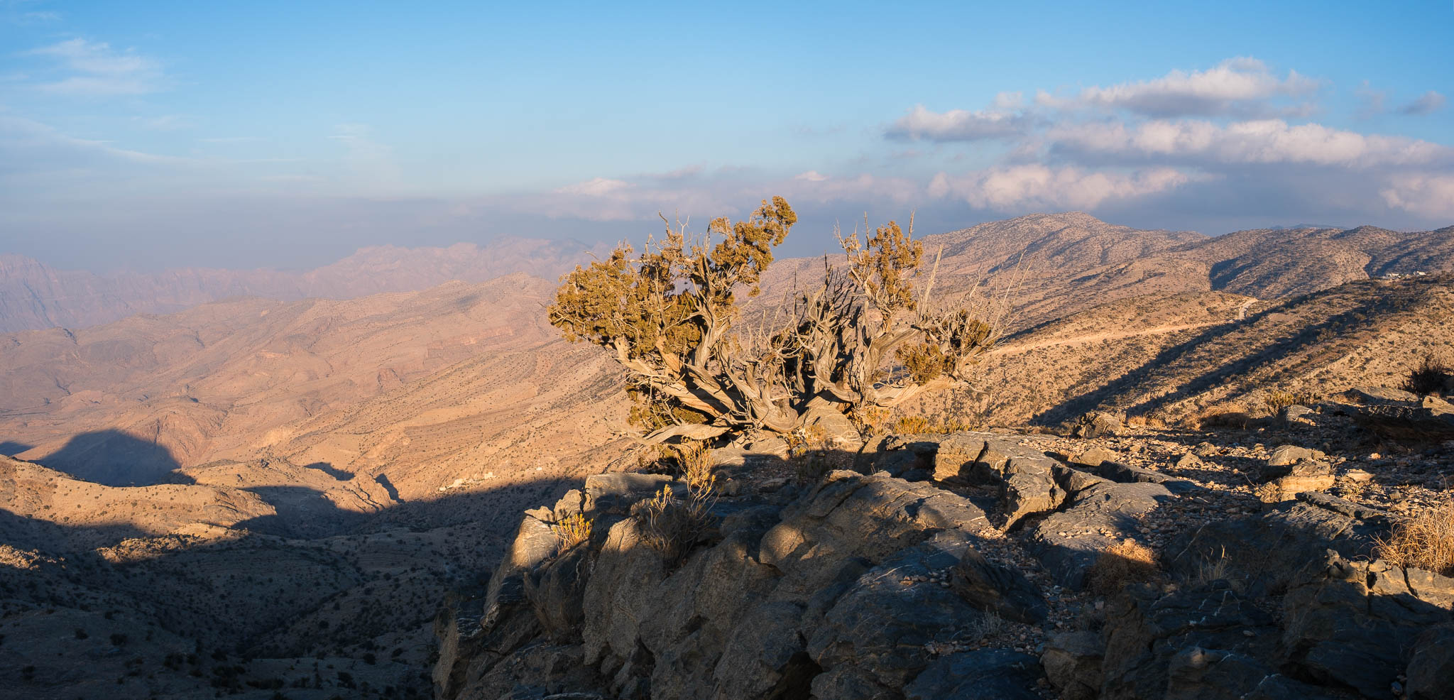
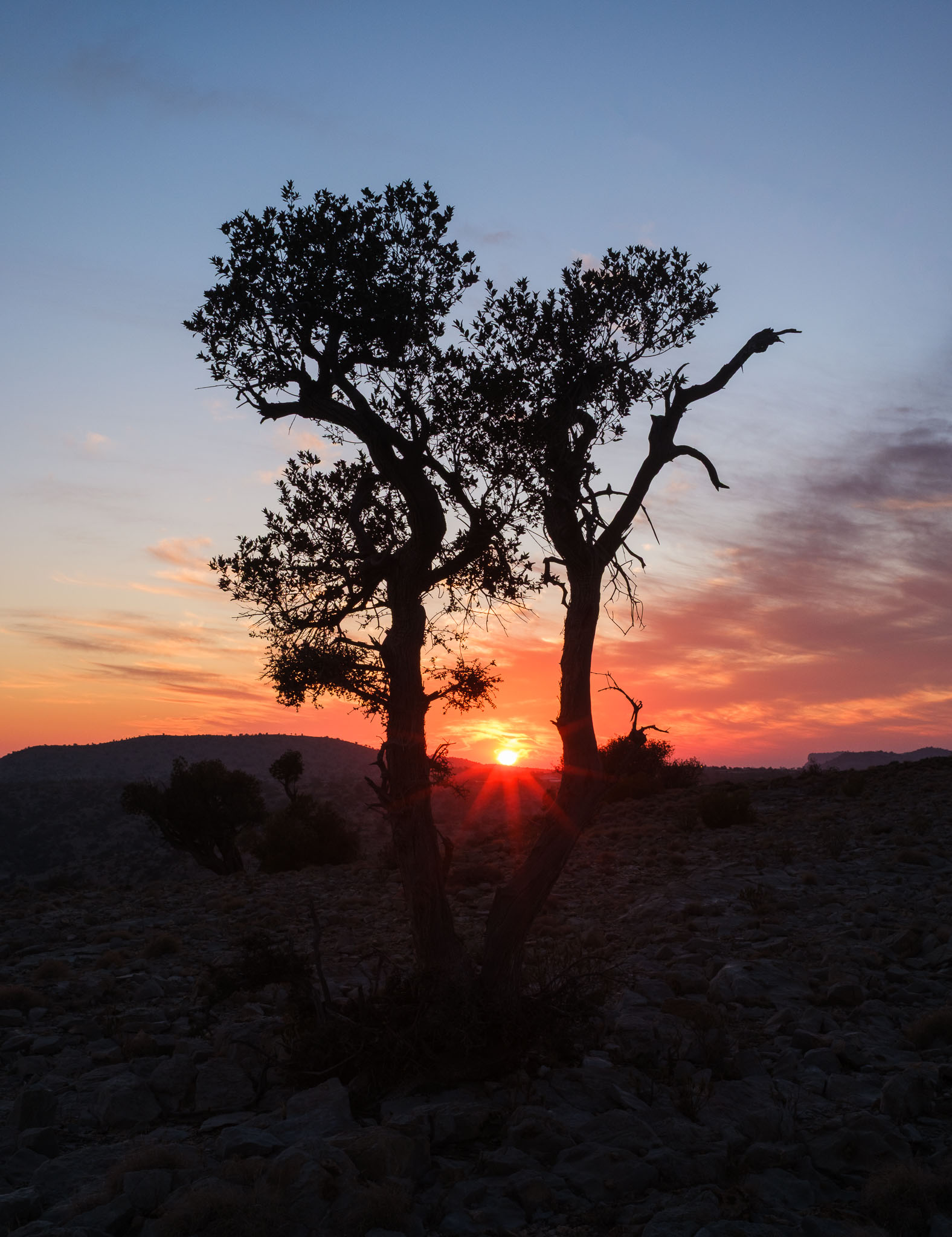
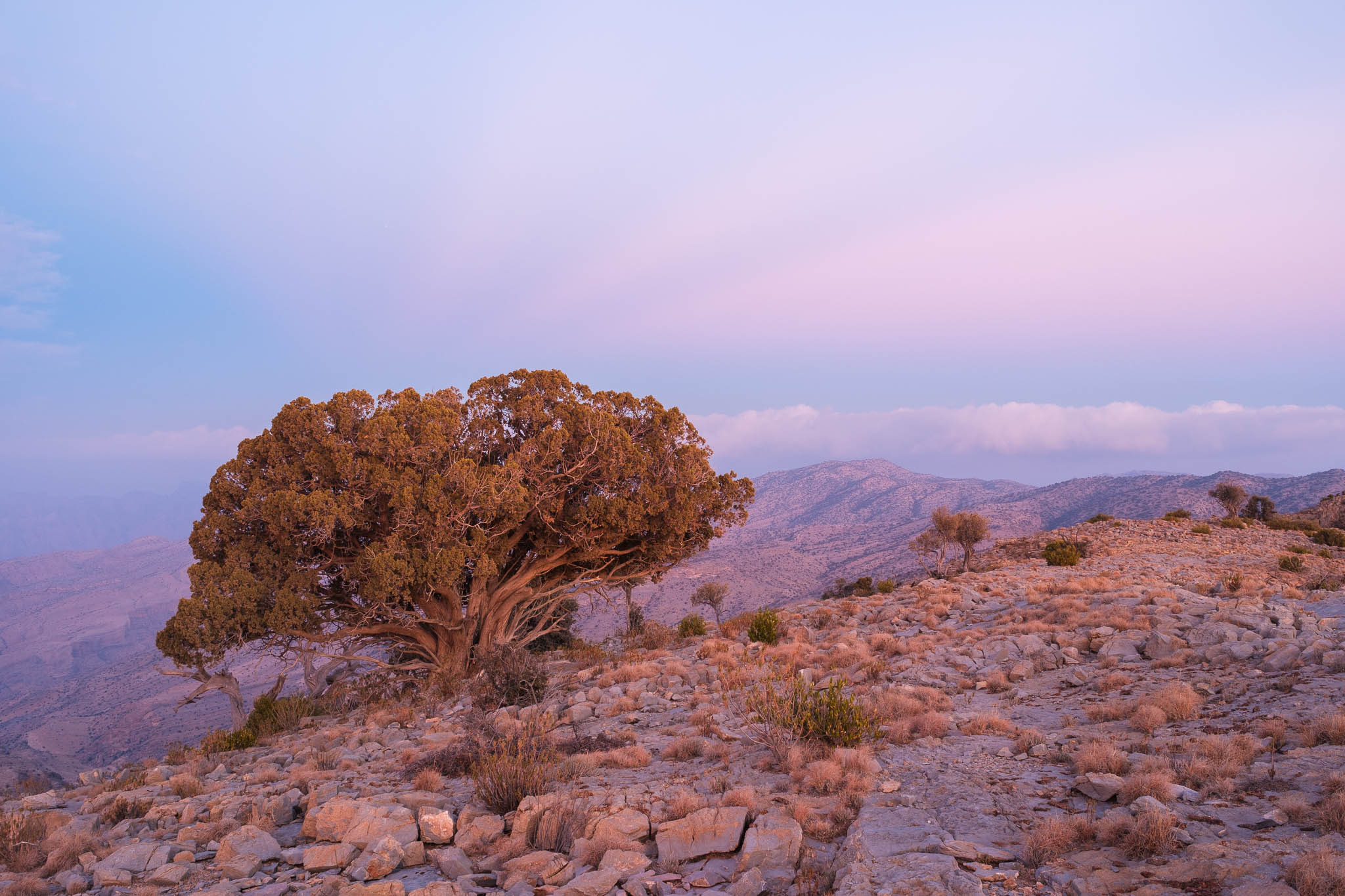
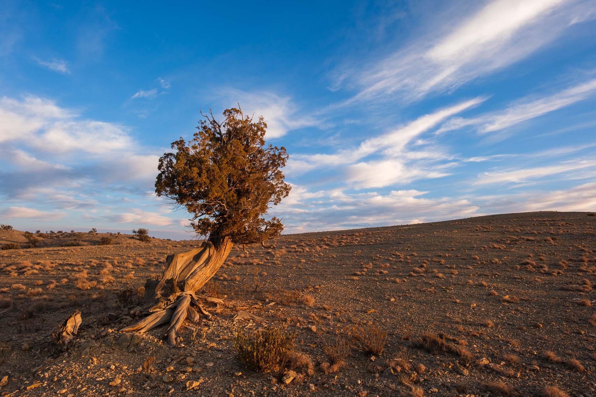
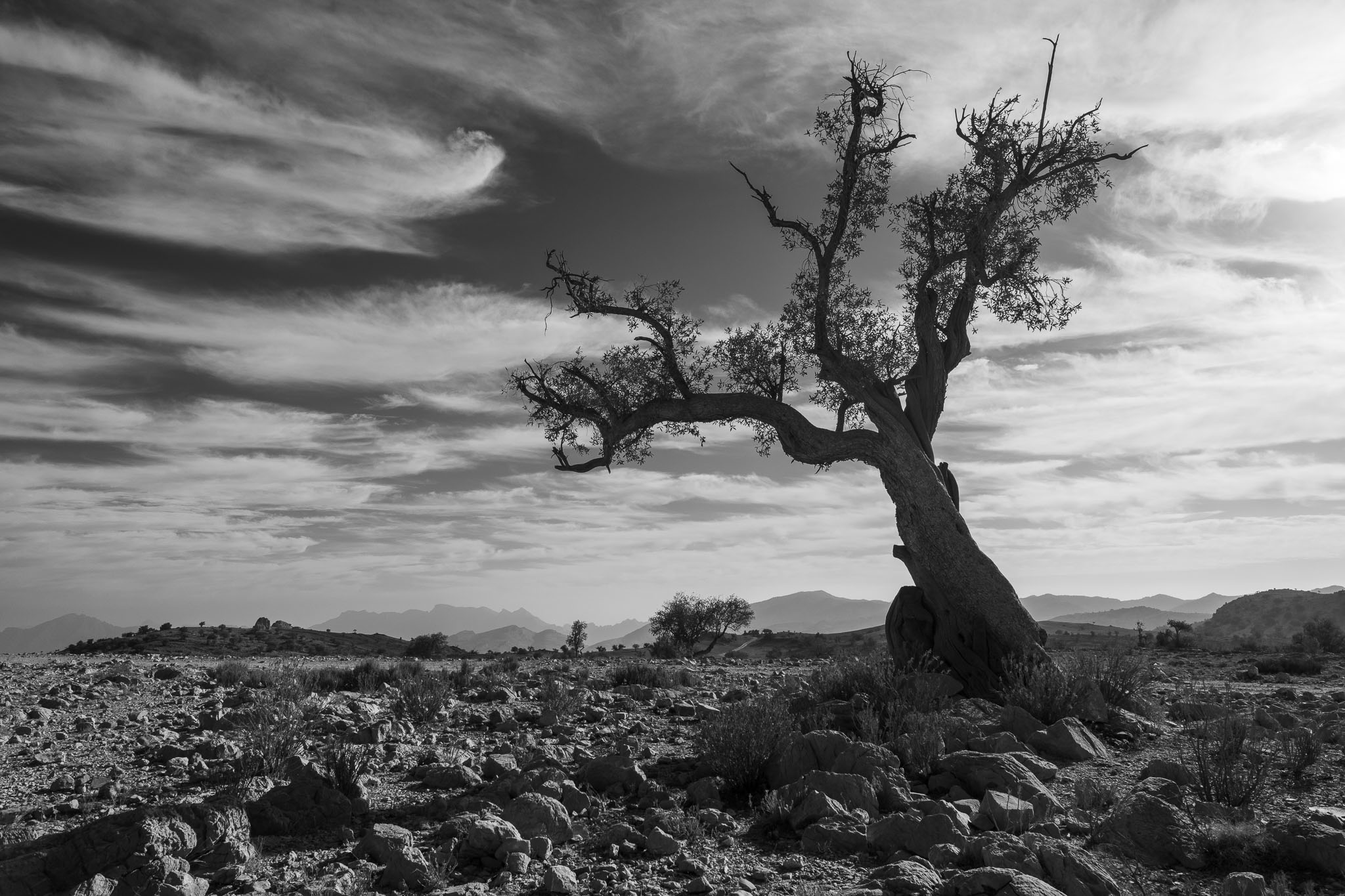
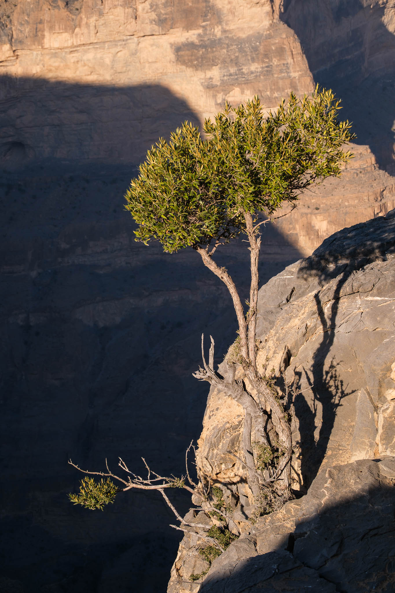
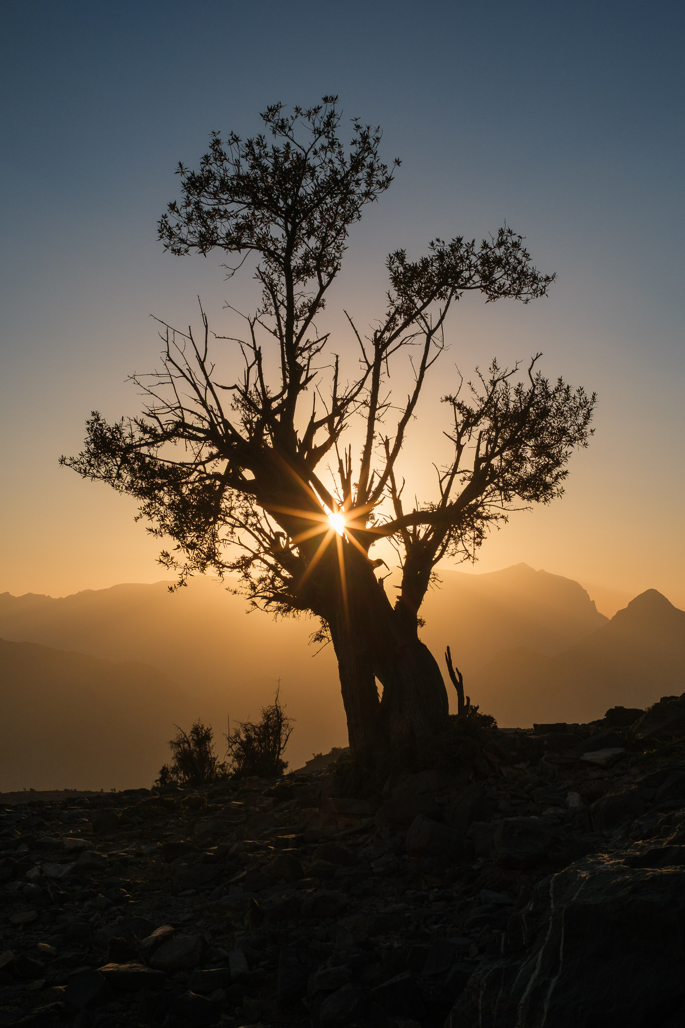
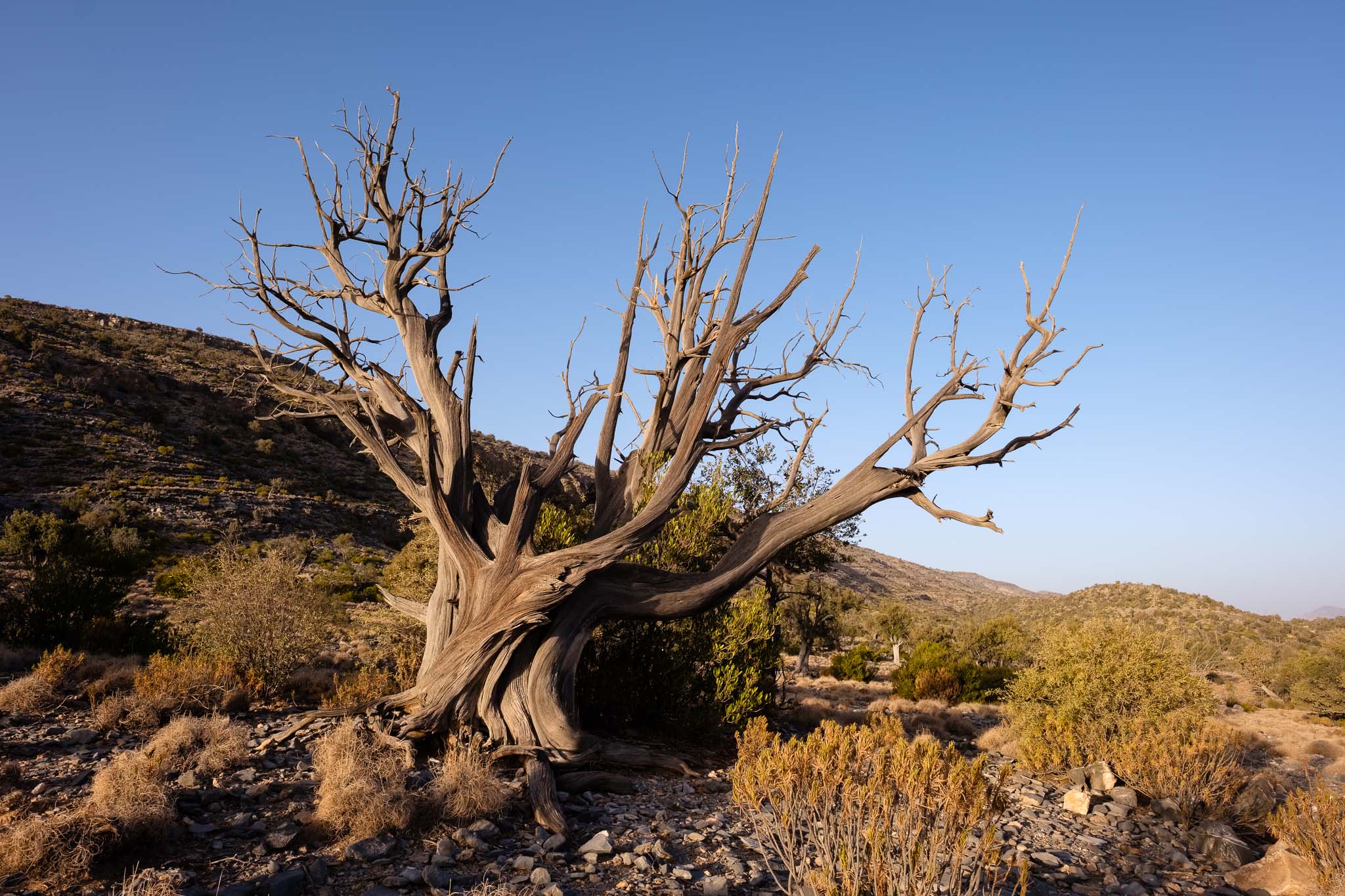
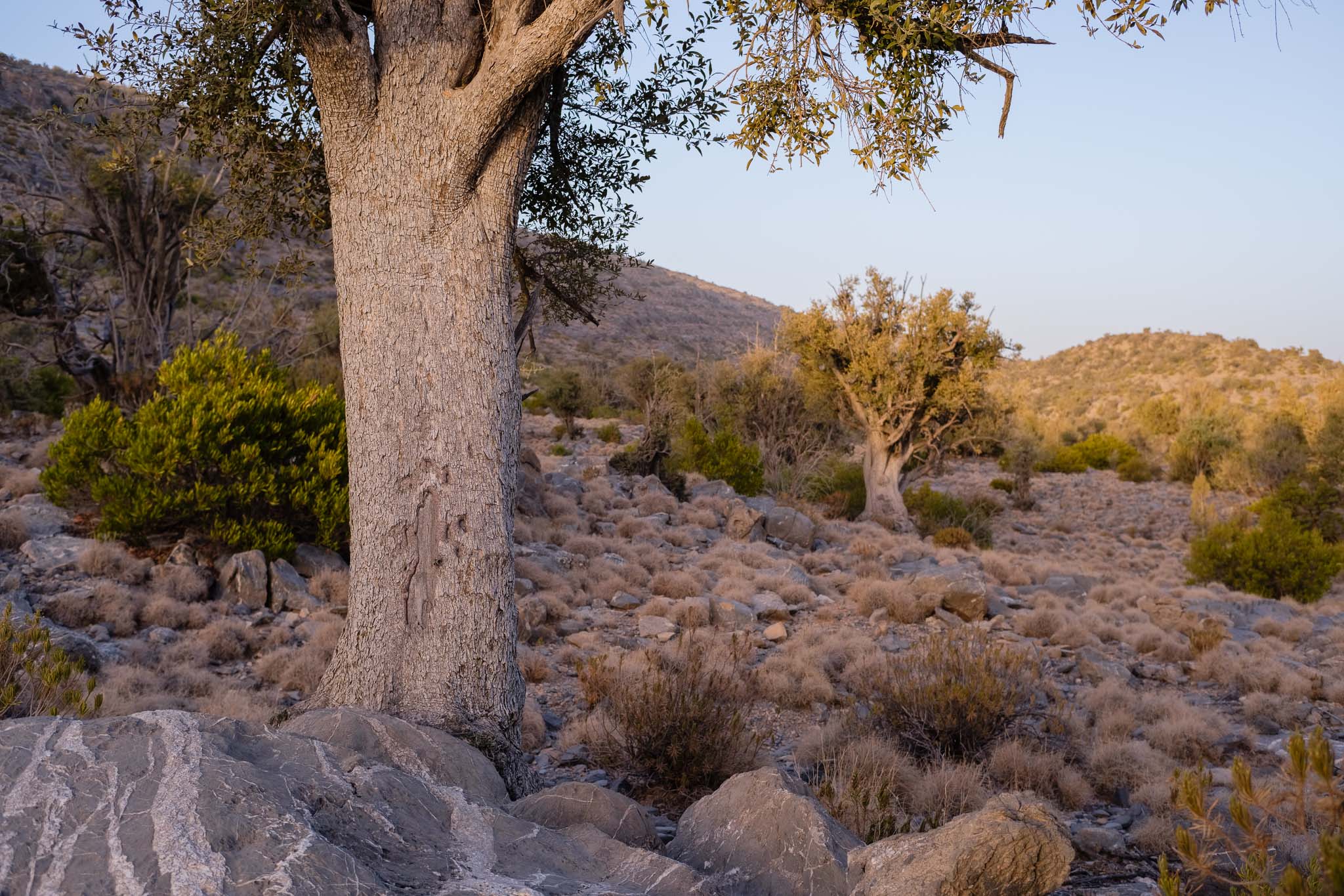
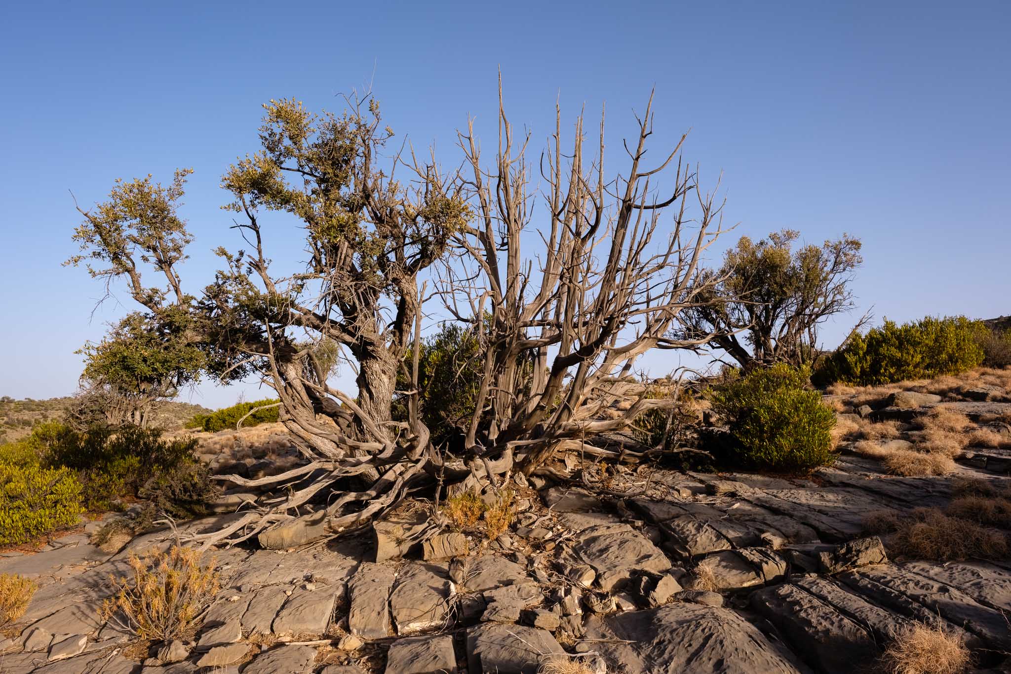
Trees have always been one of my favourite subjects. When I am out photographing landscapes, I am constantly on the lookout for an interesting tree that could provide that extra element. Oman is an arid country, but in the Jebel Akhdar mountains there are several places where trees present; thanks to increased rainfall, there are woods where it is possible to find junipers, bristlecone pines, and olive trees. They survive at high altitude, and often have twisted trunks full of character.
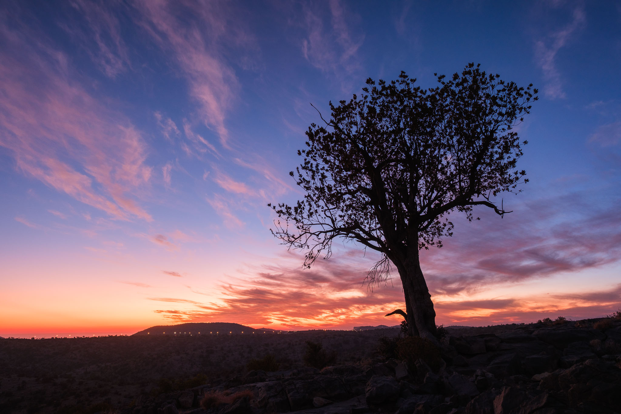
During a recent camping trip to the Sayq Plateau in Jebel Akhdar, I was lucky to find some interesting trees; I photographed them both at sunset and sunrise, and below are some of the resulting photos. Starting with the sunset photo session.
The following morning I woke up to a wonderful sunrise display, with colourful clouds and great light quality. Battling the near freezing cold, I photographed some more trees.
Fujifilm X-E5, Voigtlander 27mm lens.Peeking sun. Fujifilm X-T5, Fujinon 70-300mm lens.Fujifilm X-T5, Fujinon 14mm lens.This photo was taken just a few minutes after the previous one. The light was changing fast. Fujifilm X-T5, Fujinon 14mm lens.A small tree near my campsite, golden hour. Fujifilm X-T5, Fujinon 14mm lens.Black and white often works quite well too. Fujifilm X-T5, Fujinon 14mm lens.
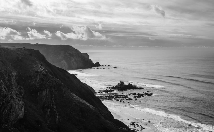
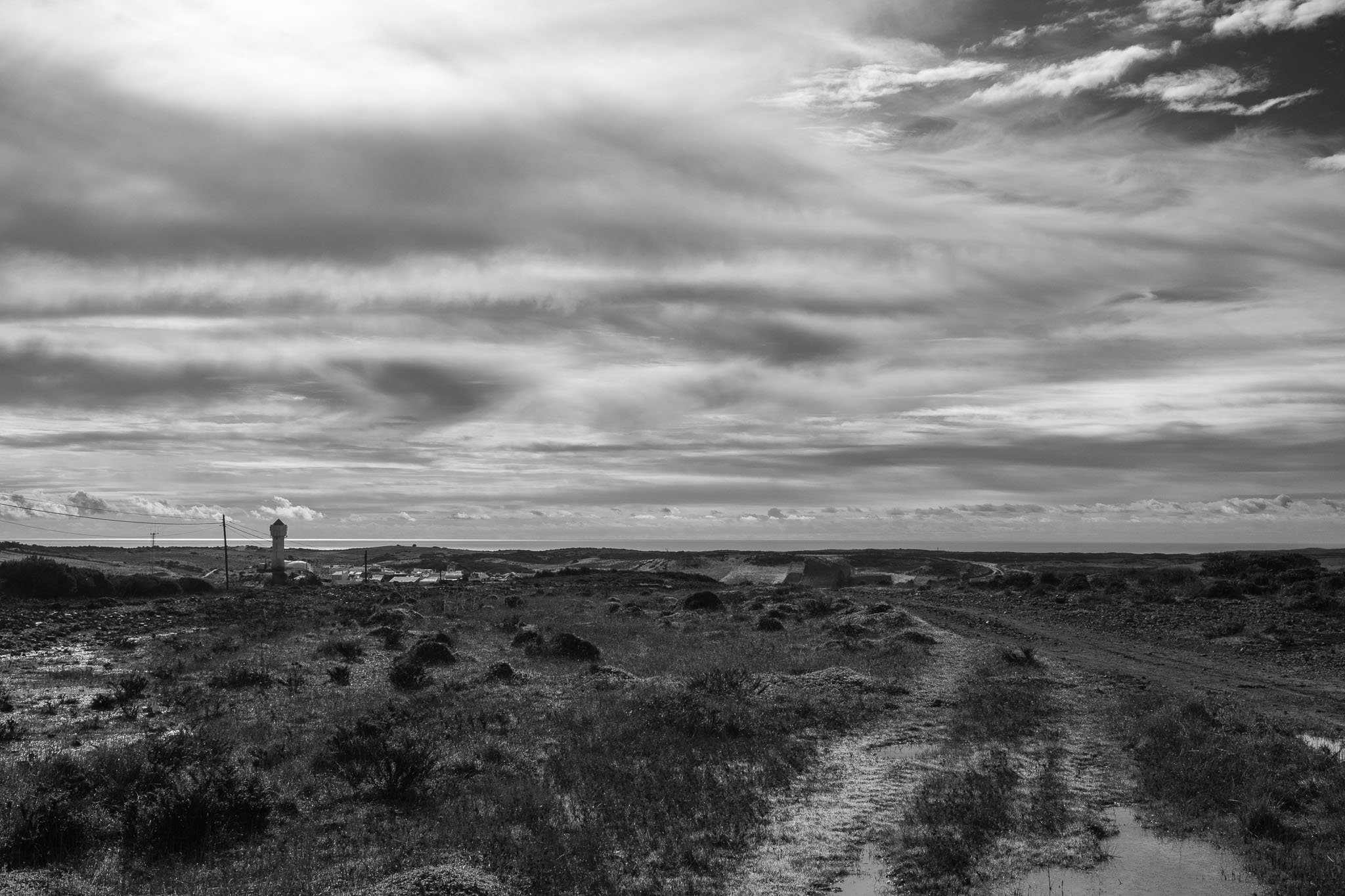
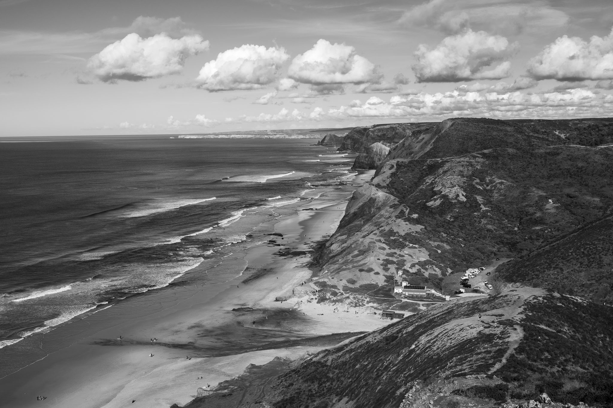
I took a couple of weeks off during Christmas and New Year, spending some time with the family in the Alentejo coast in southwest Portugal. The weather was cold but often sunny, so we walked a couple of the Vicentina Route trails in the region. I particularly enjoy the circular trail (Route 24) in the Vila do Bispo area; you can find more details in the following web page:
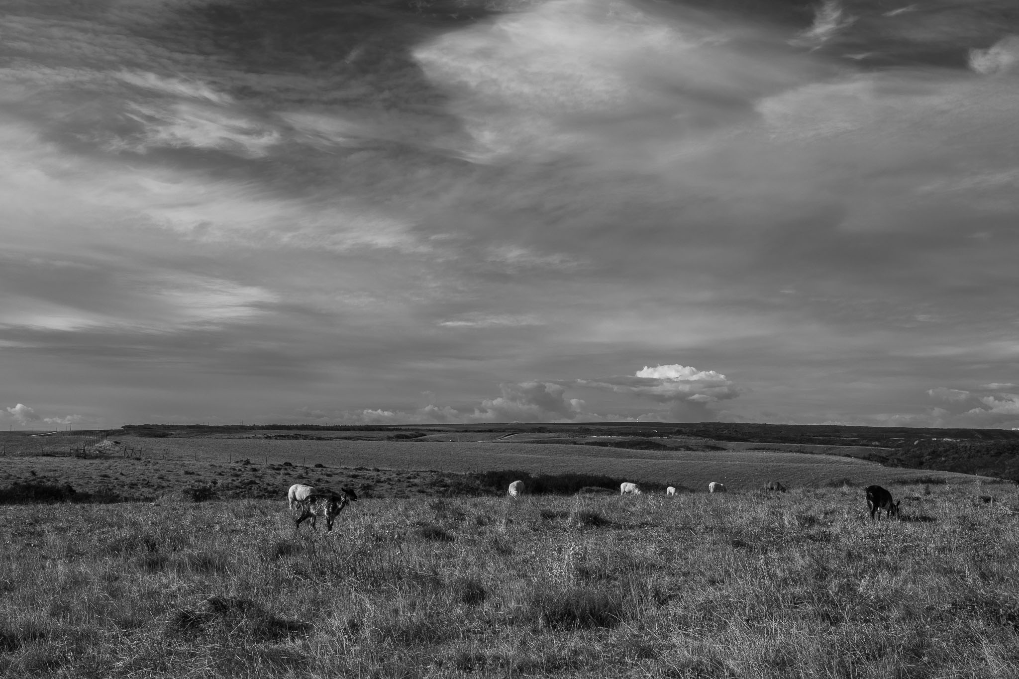
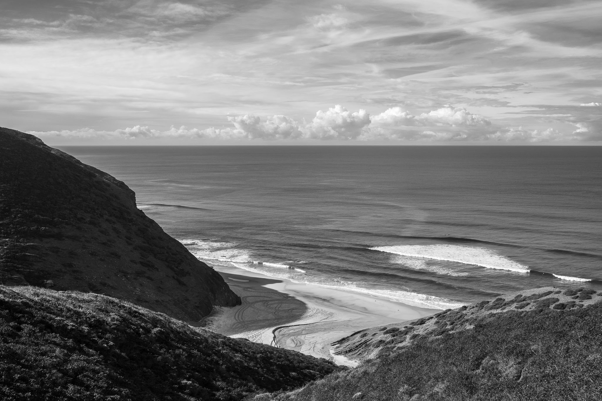
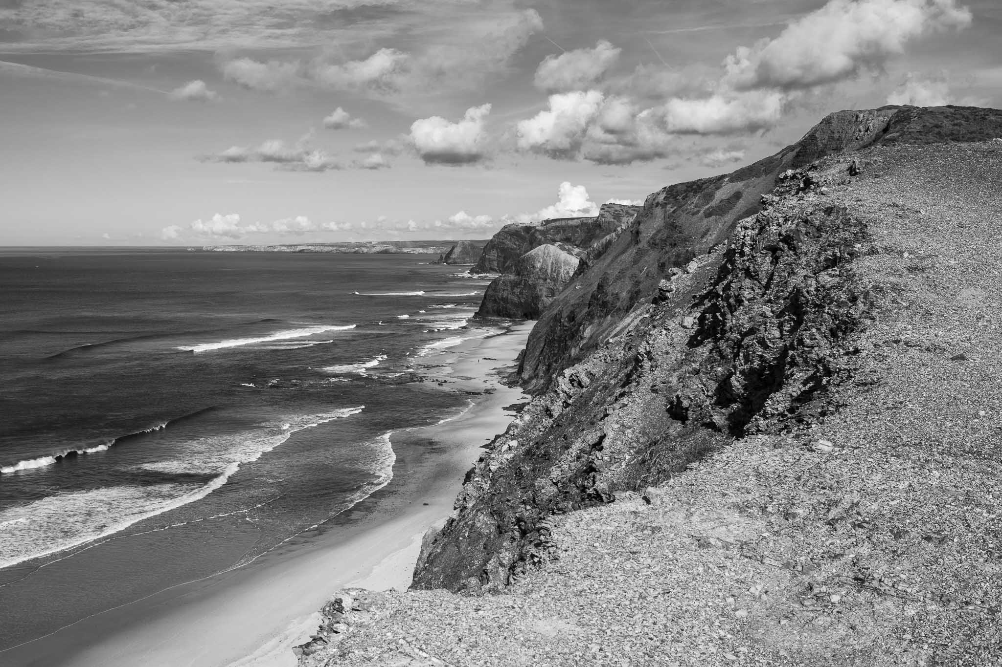
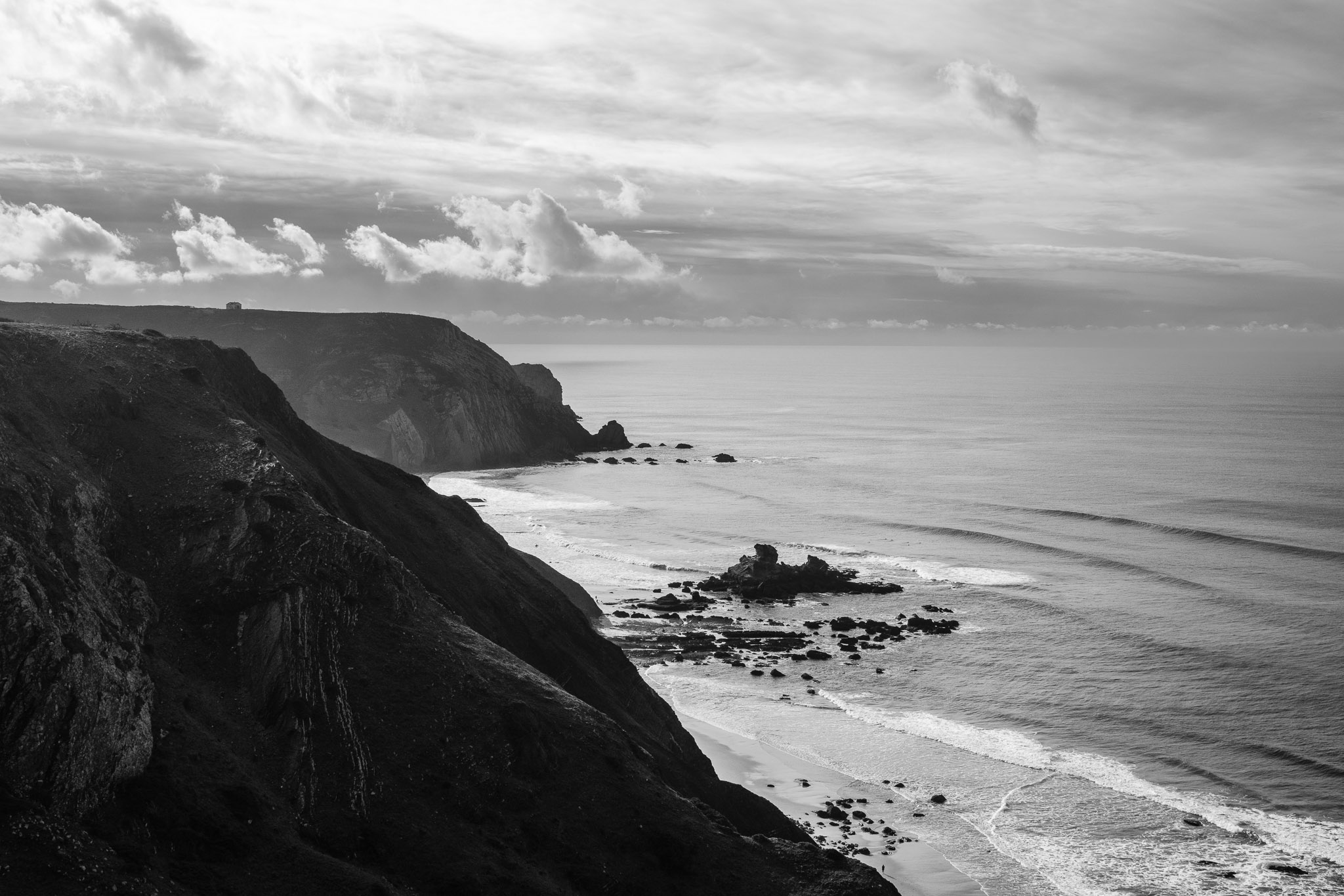
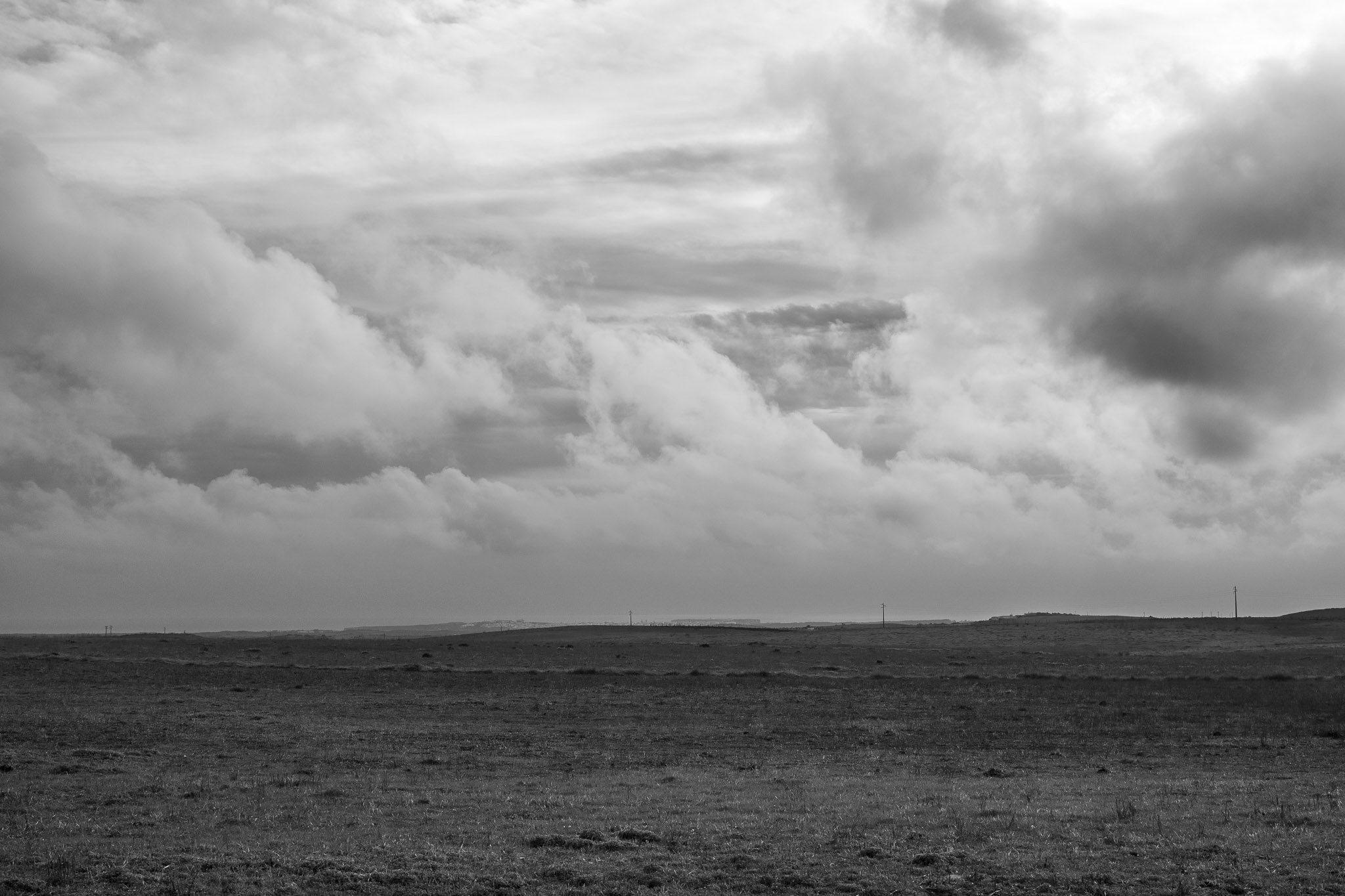
Starting in Vila do Bispo, the trail crosses gentle and rolling green hills that form the coastal plateau, which is always buffeted by strong winds. After a few km, the road starts descending towards the beaches, which are worth spending some time visiting. Names like Barriga, Cordoama and Castelejo are famous for their wild beauty, and quite popular with surfers. There are a couple of steeper climbs, because the coastal cliffs are vertical and tall; the upside is that you can catch your breath admiring the wonderful views. In the winter, with clear visibility, you will be able to spot Carrapateira and Arrifana in the far distance.
All the photos were taken using my by now favourite travel combination, the Fujifilm X-E5 camera and Voigtlander 27mm f/2 Fuji X mount lens. I converted some of the photos to black and white in Lightroom, to convey a different mood. I hope you enjoy the photos and Happy New Year!
Leaving Vila do Bispo.Along the way.View into Barriga beach.Descending into Cordoama beach.The Castelejo beach seen from Cordoama´s viewpoint.Looking north, with Carrapateira in the horizon.Menacing skies on the way back. Sagres can be seen in the distance.
As the title says, some photos from an overnight camping trip to Jebel Shams. In the winter is very cold at such altitudes, but the visibility extends for a long distance. And there is always the attractive and famous Balcony Walk, which I did the following morning.
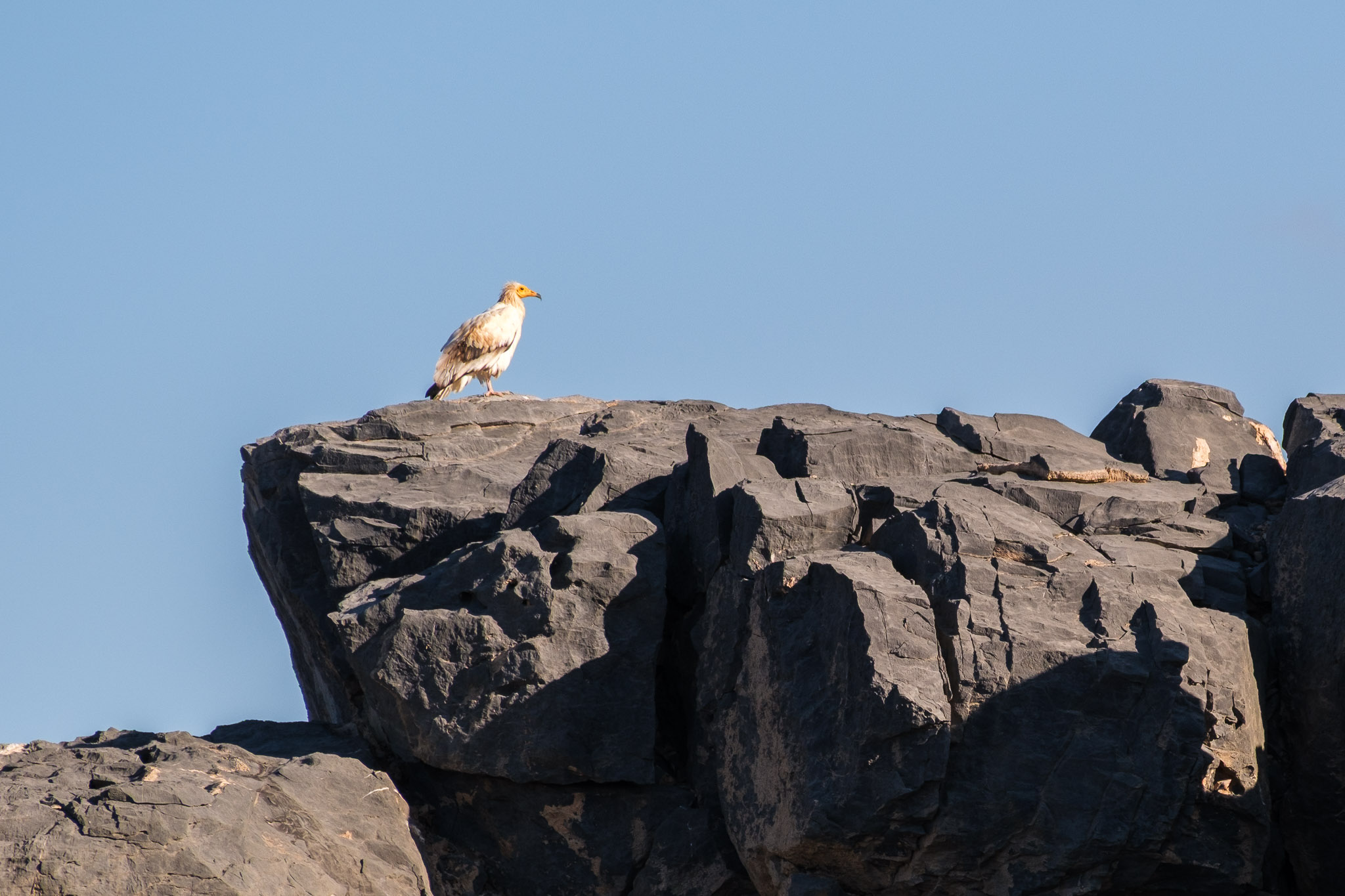
Vertigo. Fujifilm X-T5 and Fujinon 14mm f/2.8 lens.From the rocks. Fuji film X-T5 and Fujinon 14mm f/2.8 lens.Village. Fujifilm X-T5 and Fujinon 14mm f/2.8 lens.Vigilant. Fujifilm X-T5 and Fujinon 70-300mm f/4 – 5.6 lens.Perched. Fujifilm X-T5 and Fujinon 70-300mm f/4 – 5.6 lens.Light and shade. Fujifilm X-T5 and Fujinon 70-300mm f/4 – 5.6 lens.Jebel Misht sunset. Fujifilm X-T5 and Fujinon 70-300mm f/4 – 5.6 lens.Cannot resist a star burst! Fujifilm X-E5 and Voigtlander 27mm f/2 lens.Massive cliff at sunrise. Fujifilm X-T5 and Fujinon 14mm f/2.8 lens.Along the trail. Fujifilm X-E5 and Voigtlander 27mm f/2 lens.I had to stop for the photo. Fujifilm X-E5 and Voigtlander 27mm f/2 lens.Caught in mid air. Fujifilm X-E5 and Voigtlander 27mm f/2 lens.
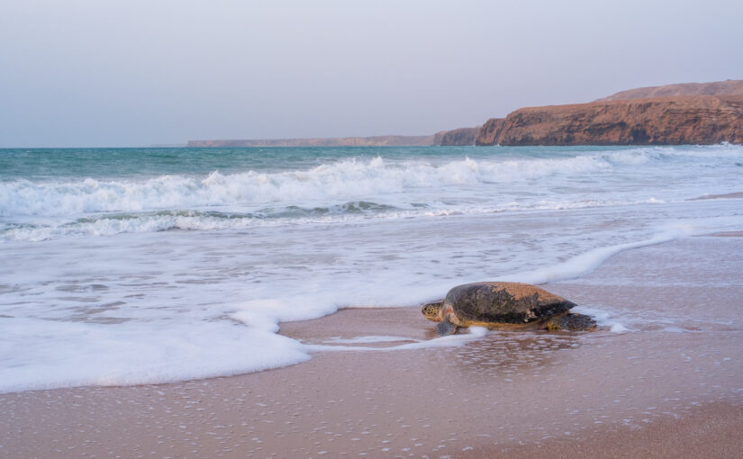
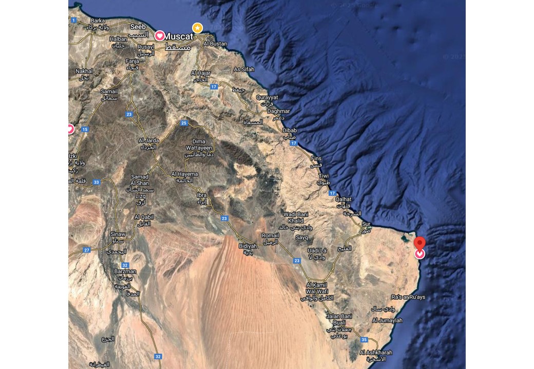
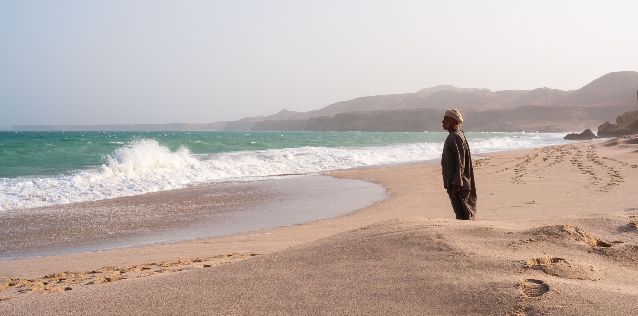
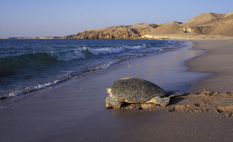
After almost 2 years of being back in Oman, I finally visited the Ras Al Jinz Turtle Reserve. The reserve was established in 1996 to protect 45 km of Oman’s Eastern shore and conserve the nesting ground of sea turtles. The Ras Al Jinz beach is world famous for the nesting of the endangered green turtle (Chelonia mydas) and probably is the most important nesting concentration on the Indian Ocean. It is also the only official place where the public can visit and watch this unique experience.
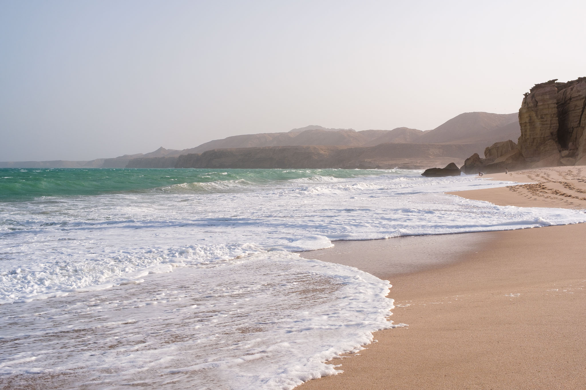
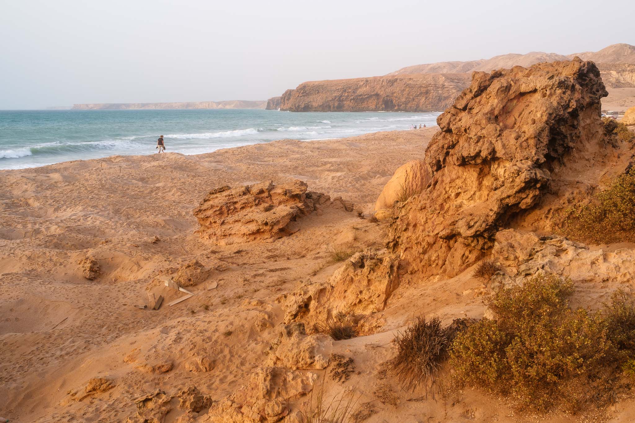
Ras Al Jinz is part of the Ras Al Hadd coastline, an area of rugged beauty, with rocky cliffs overlooking the azure waters of the ocean. As the easternmost point in the Arabian Peninsula, it is the first location to see the rising sun every morning. The last time I visited the reserve was in 2004 when driving from Muscat required a 4WD vehicle to negotiate the gravel road from Quriyat to Ras Al Jinz. Today, a modern 250 km long dual carriage way connects Muscat to Sur (route 17), and from there to Ras Al Jinz is only another 50 km or so along a black top road. Of course, this means that a lot has changed in the intervening years, with more people visiting the reserve.
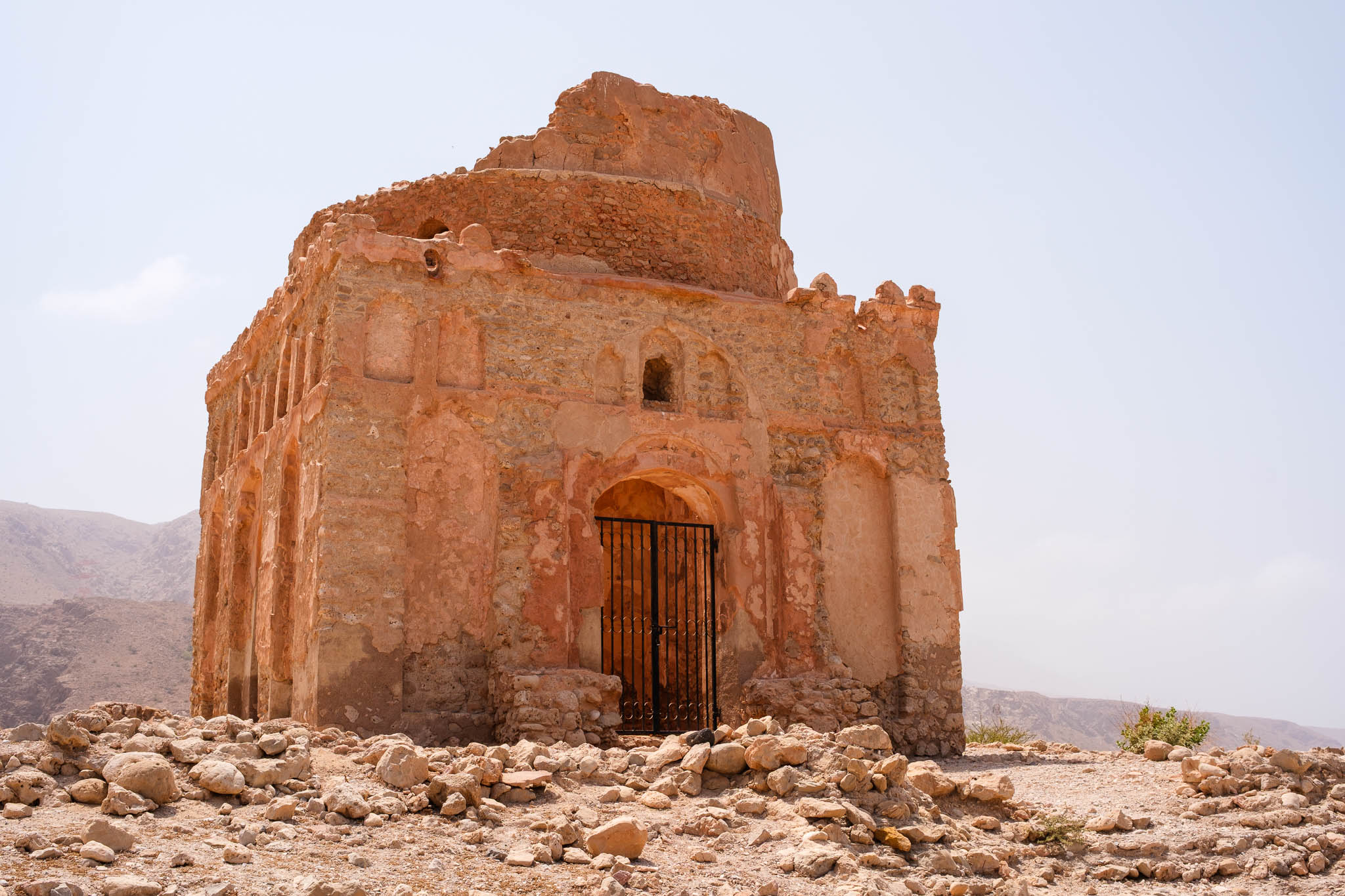
There are many interesting stops along the way, like the Bimah sinkhole, a collapsed cave that has a beautiful lake; several nice beaches along the coast between Tiwi and Fins, with white sand and warm sea water; Wadi Shab, for a great wadi trekking along several pools; and the archaeological site in Qalhat, just to name a few. Thus, I recommend allowing extra time to check these places. Without stopping, it takes roughly 3 hours from Muscat to Sur.
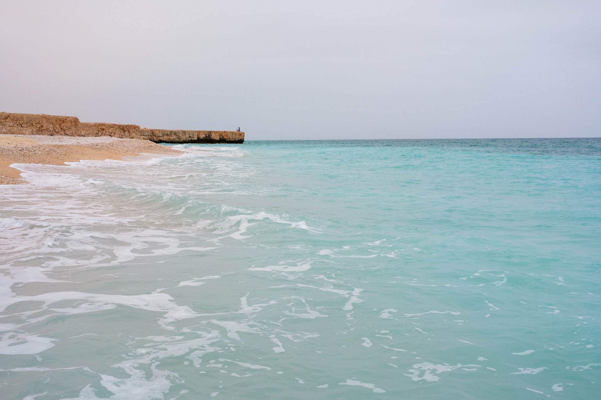
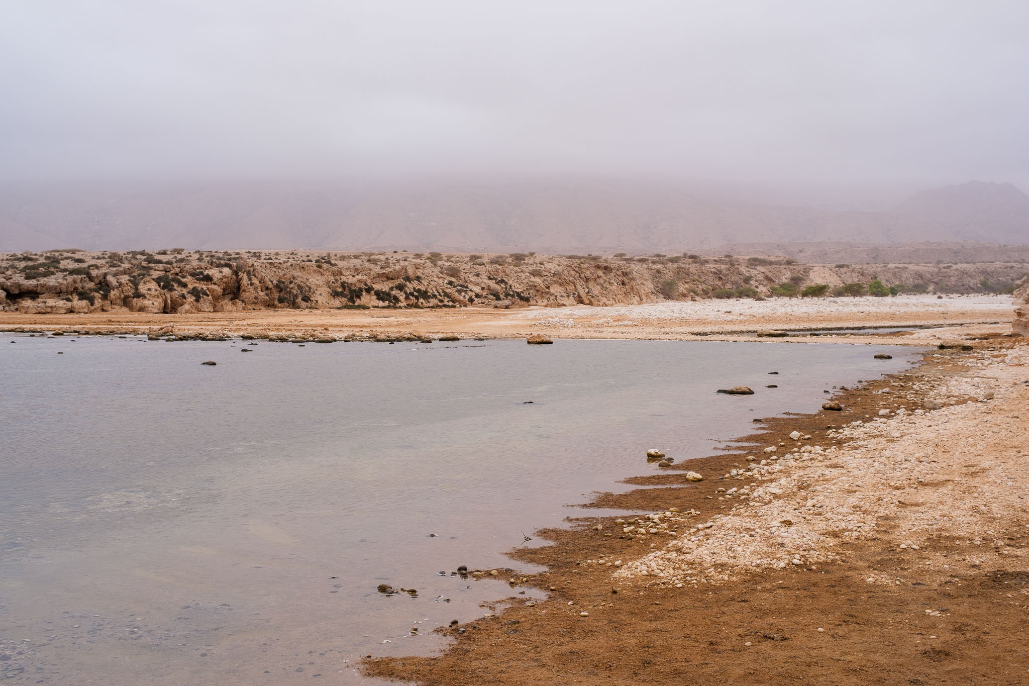
Location of Ras Al Jinz turtle reserve.A beach in Tiwi.Mountains covered by monsoon fog.Old city of Qalhat.
The best time to see the turtles in during the months of July and August, when hundreds of turtles arrive after sunset to lay their eggs. Even though the summer is hot in Oman, this coastline is buffeted by strong winds during the monsoon season, which reduces the temperature. There are two guided visits daily, one at 9 pm, and one at 5 am.
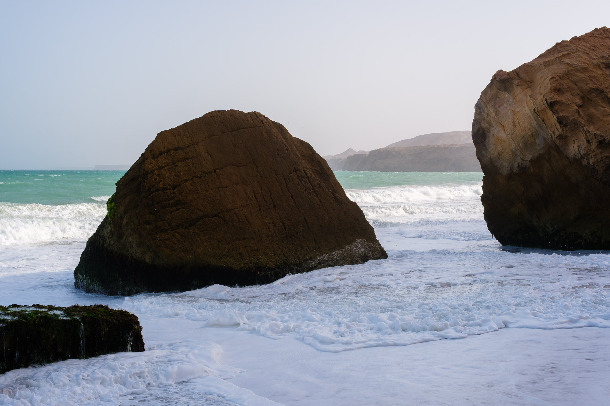
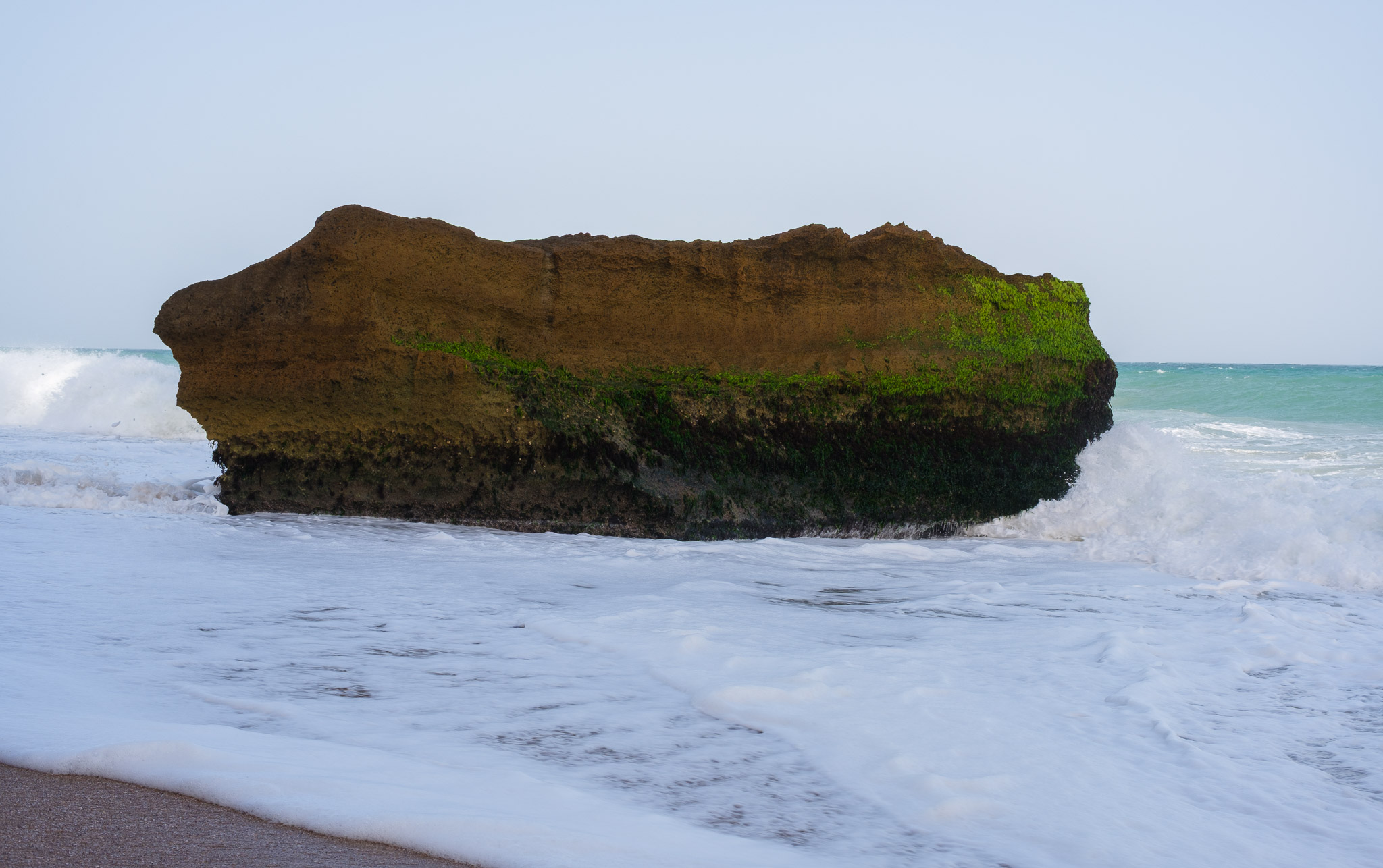
There are several choices for accommodation near the reserve, we decided to stay in the Ras Al Jins Reserve hotel, where the visitor centre is located. This was more convenient, as it makes logistics easier. After arriving at the hotel, we rested for a while and then walked the 1 km or so to the beach. The area is characterized by dry and rocky coastal plain, where eroded limestone and sandstone cliffs rise above the landscape. The wind was really blowing strong, picking up dust and sand; the sea was quite rough as well.
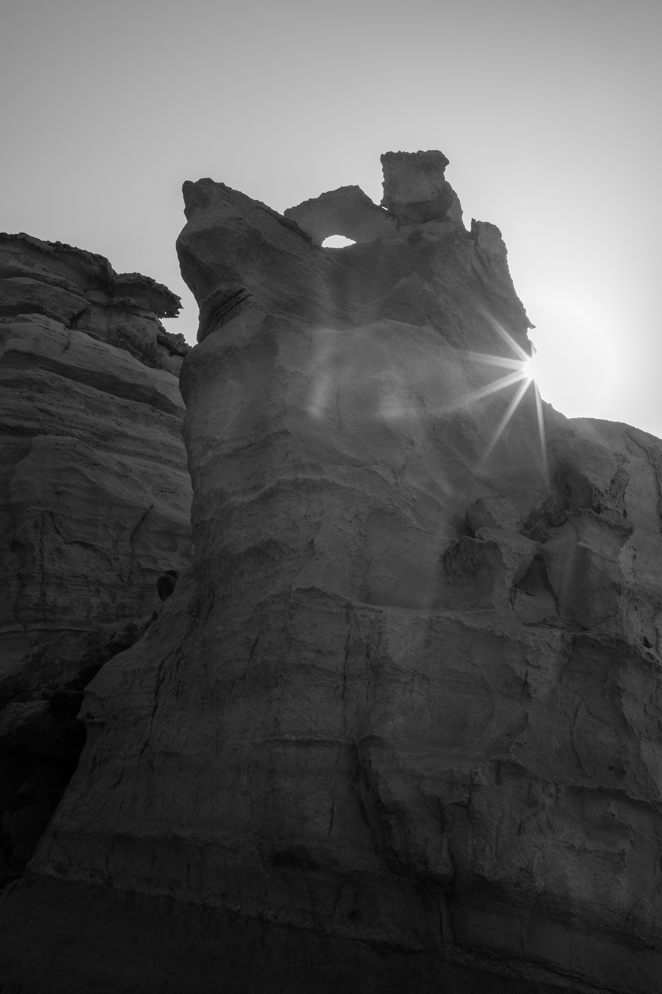
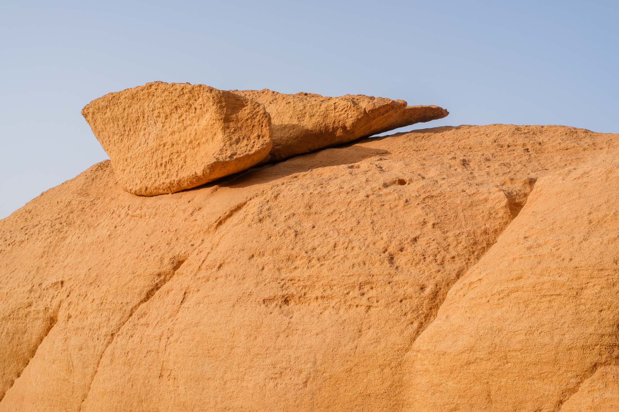
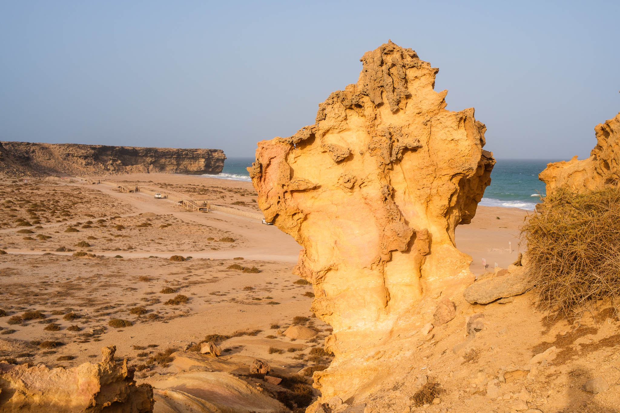
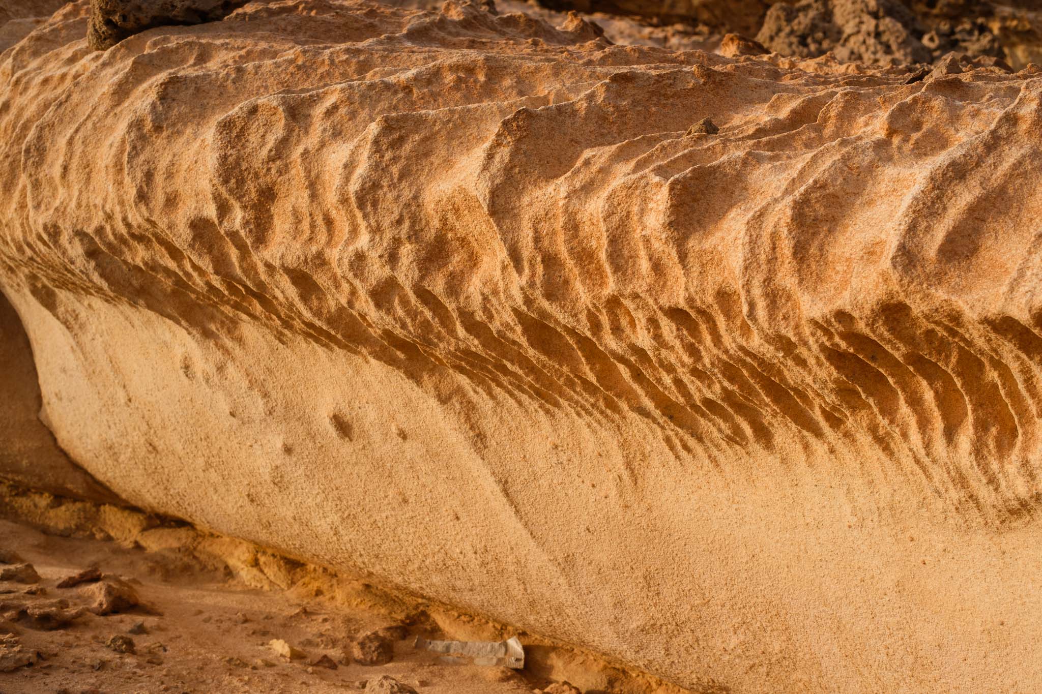
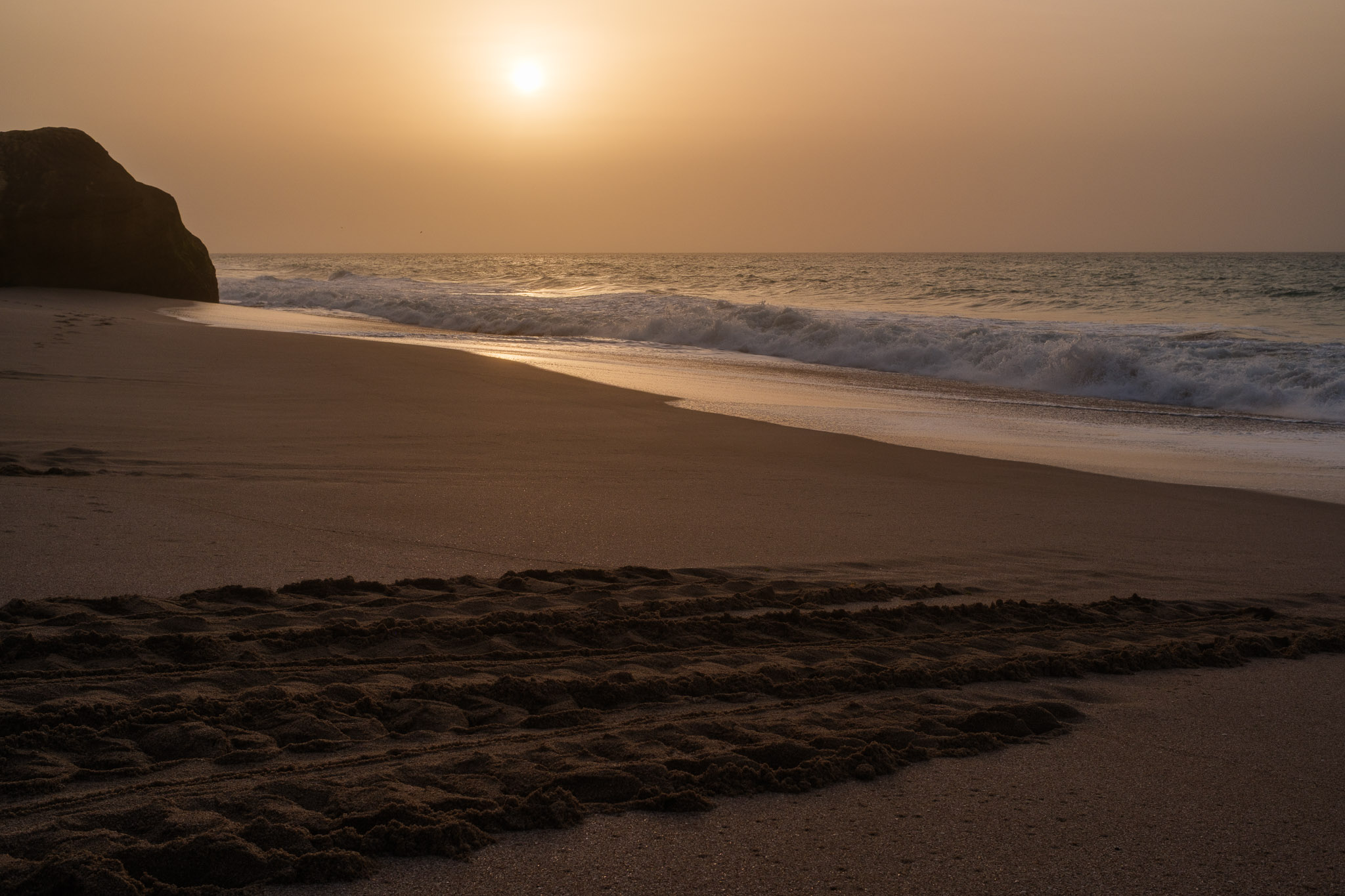
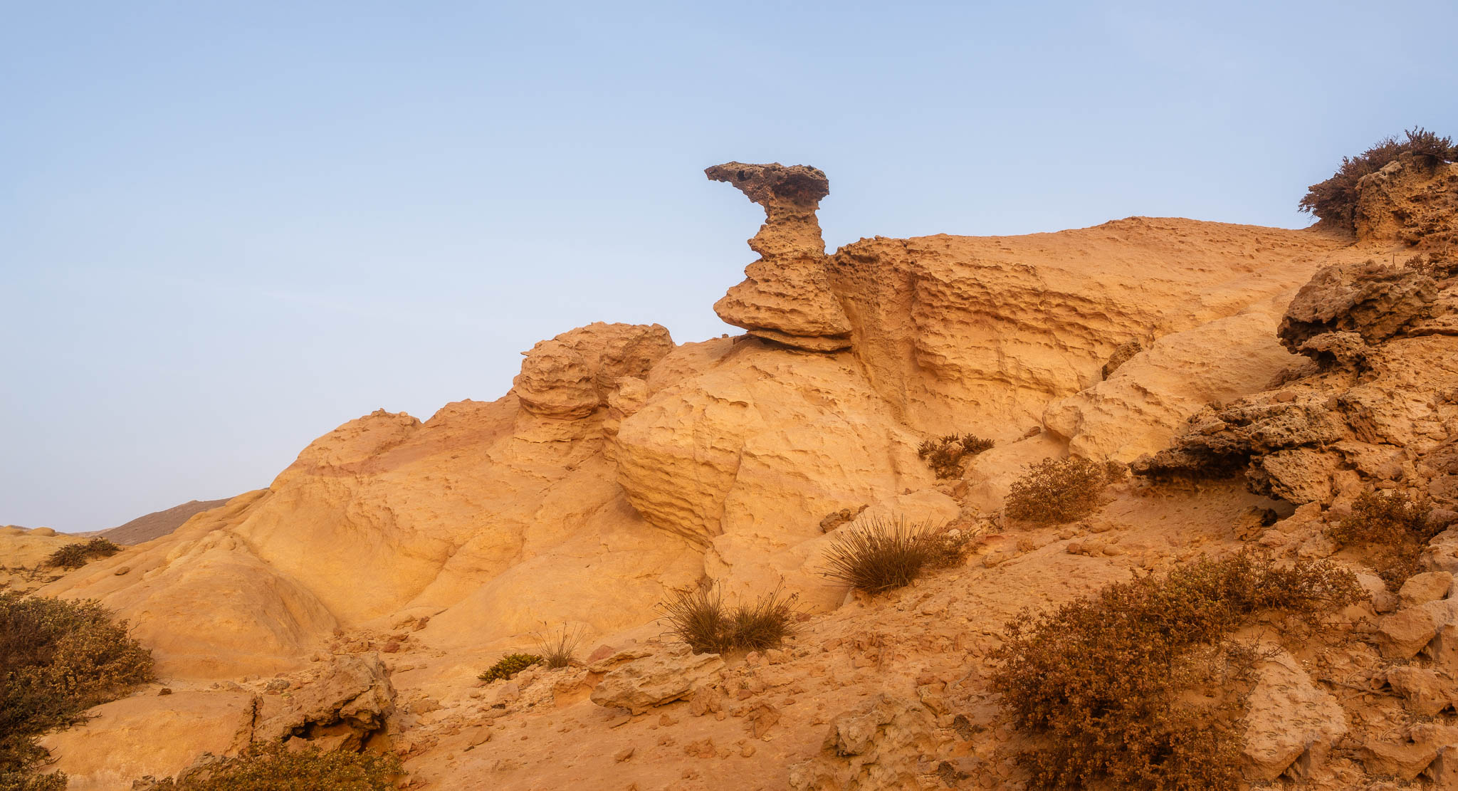
It is possible to stay in the beach until 5.30 pm, when it closes to the public, so I walked around taking some photos and remembering the previous visit from 20 years ago. It was impossible not to notice the large number of “craters” in the sand, where the turtles had excavated their nests. Egg shells were also conspicuous. I made several photos of the beach and its surrounding rocky outcrops, which have been sculpted by wind and water for millennia. The whole Ras Al Hadd peninsula was also home to pre-historic human settlements dating to 5,000 – 3,000 years ago, when the climate was less dry. Several signs describe these archaeological sites, dispersed along the region.
In the shade.Resisting.Wolf rock.Rough monsoon ocean.Watching.On the back.Pinnacle.Erosion.Left behind.Near the coast.
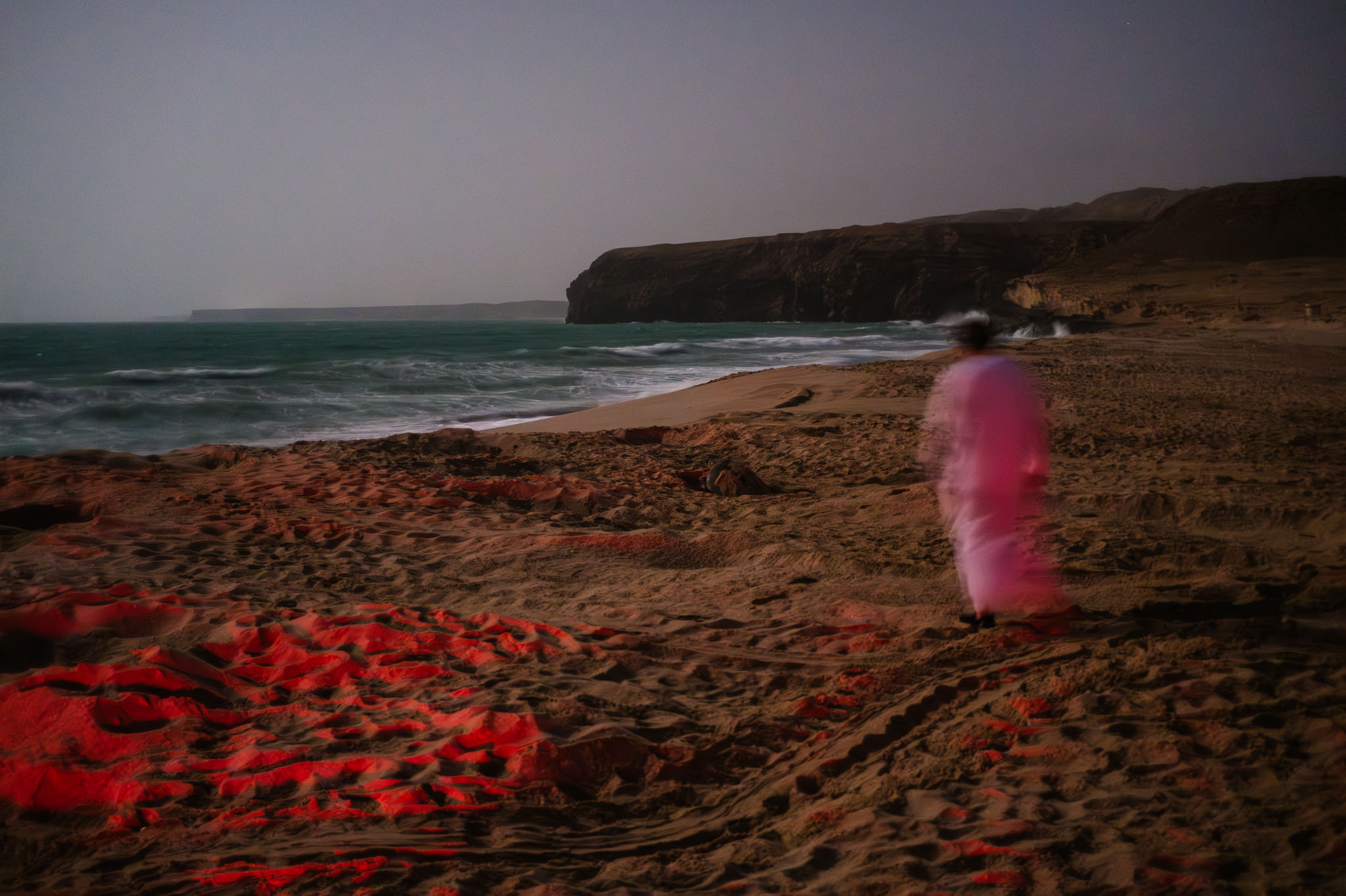
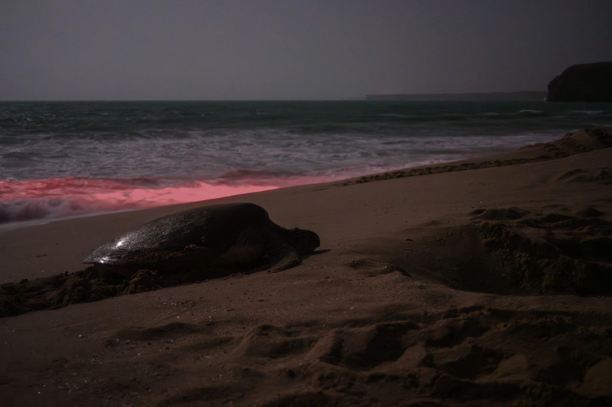
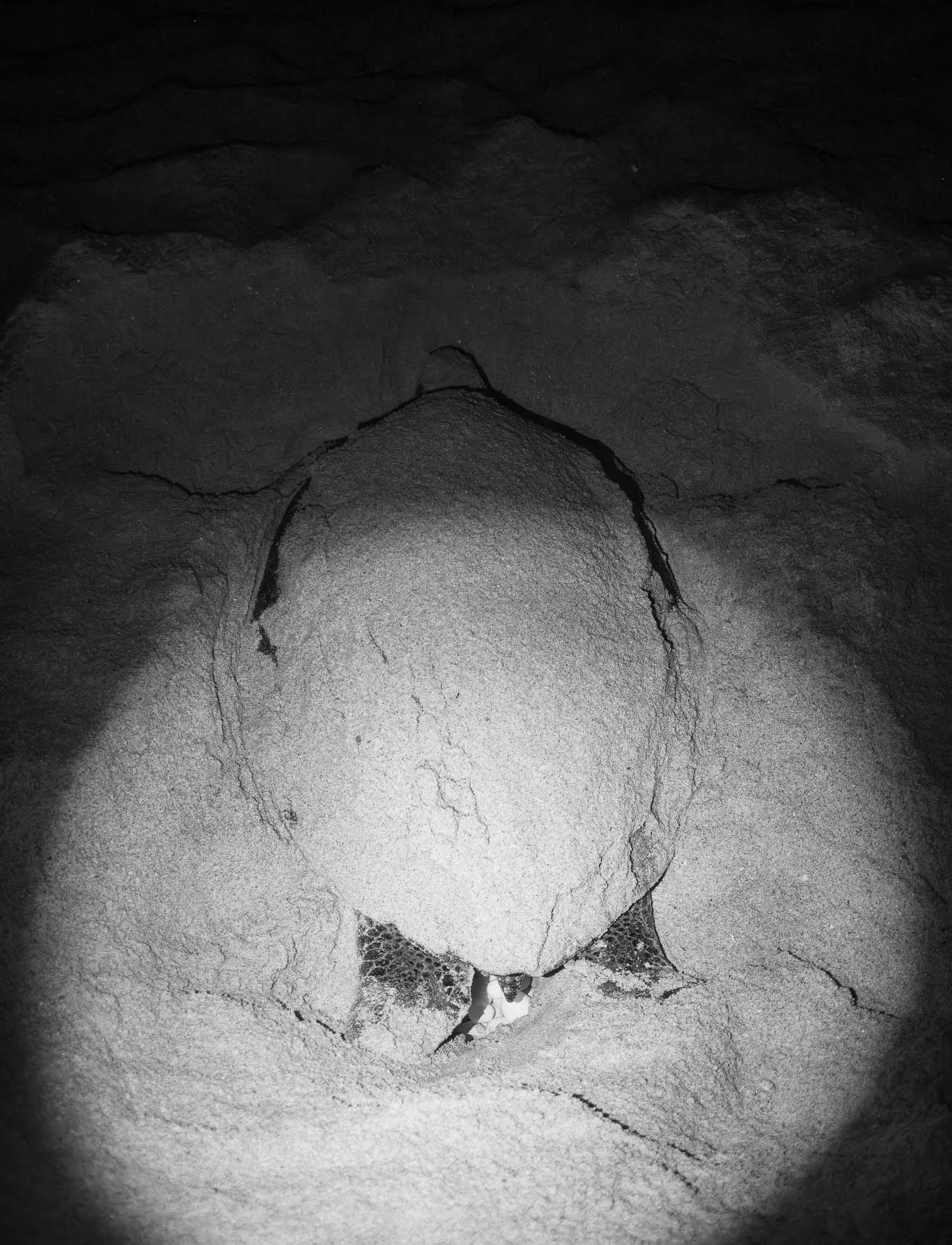
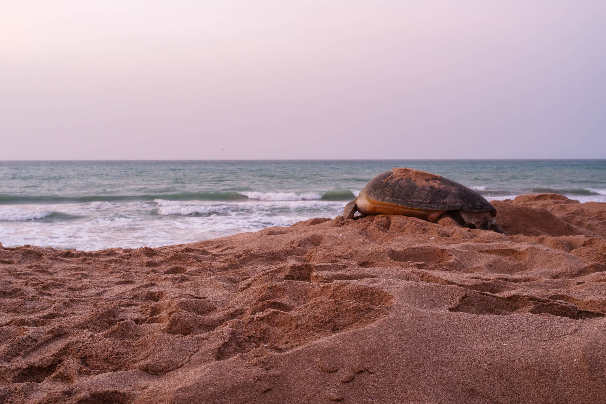
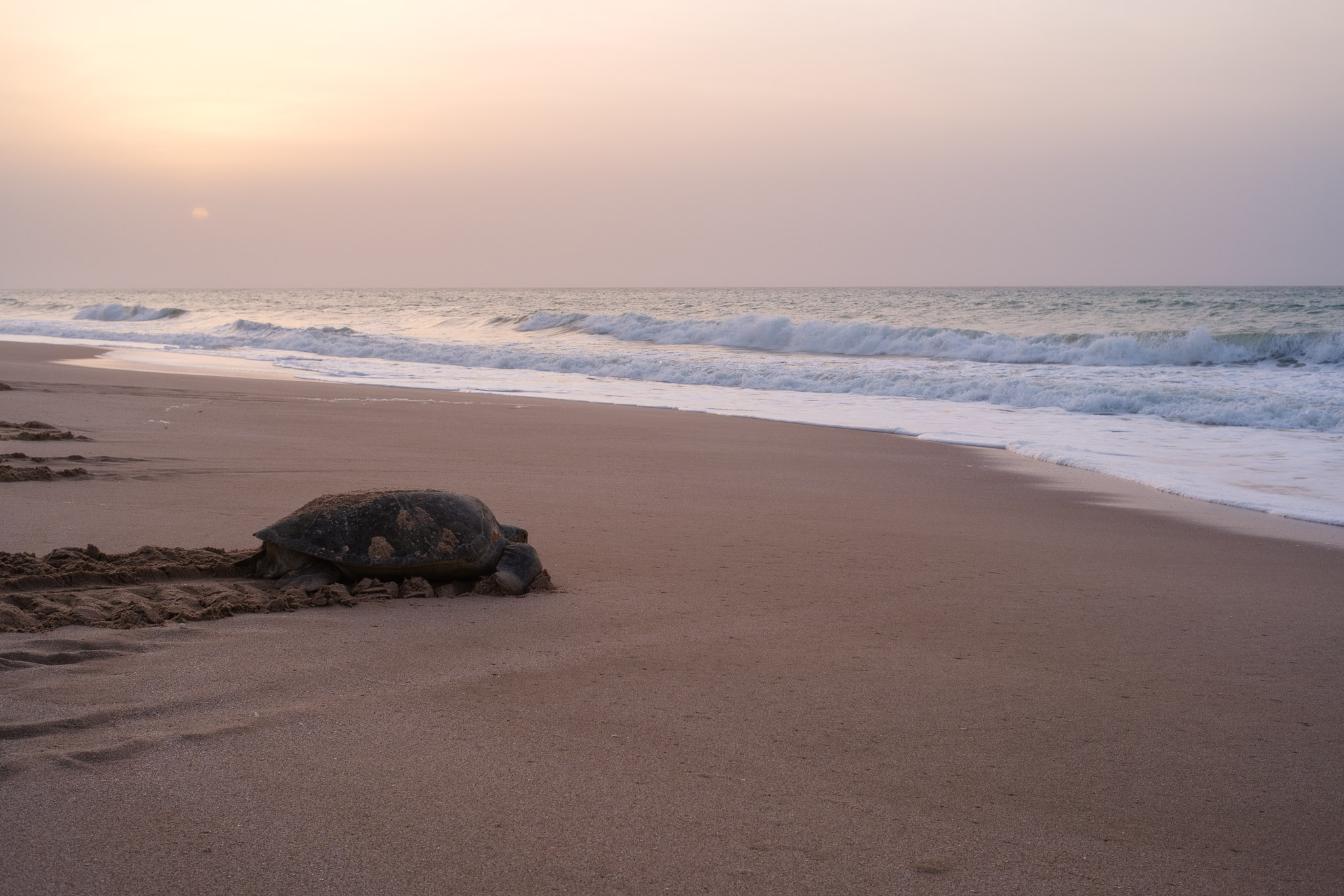
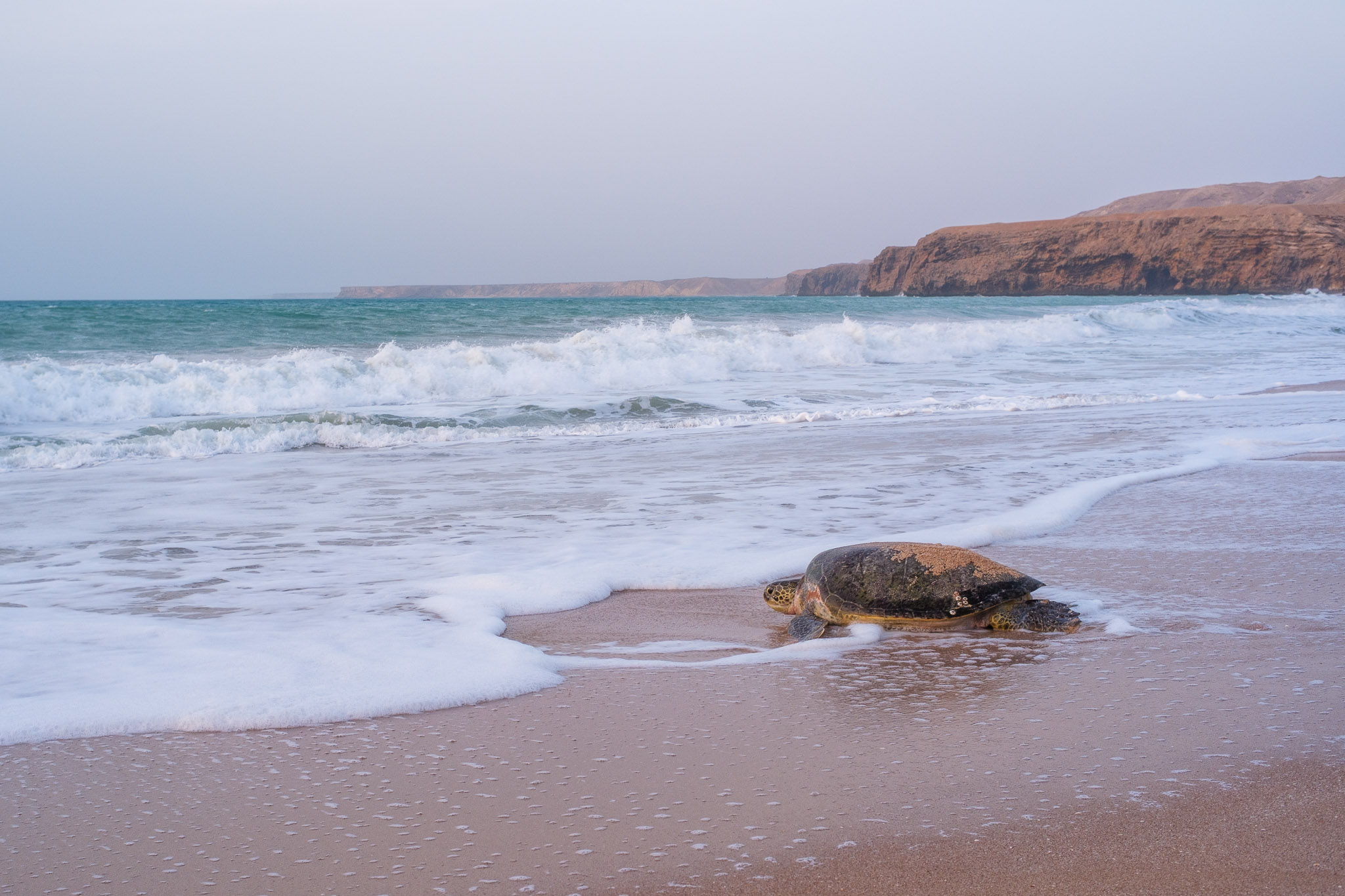
As the sunset was approaching, I returned to the hotel for an early dinner, and to be ready for the night visit. The visitor centre was busy, with maybe 50 to 60 people waiting; the guides separated us into groups, and off we went on a minibus to the beach. The night was beautiful and clear under the light of full moon. We were given a series of instructions to avoid disturbing the turtles and waited until our guide would waive us to see one of them in the nest. These turtles reach maturity at 25 years of age and can live up to 80 years old; they return to the beach where they were born to lay their eggs, hence starting the next cycle. It is truly a magical and humble experience to watch them arriving from the sea after swimming thousands of km and start climbing up the sand to dig up their nest. They arrive exhausted and still take around 3 hours to lay their eggs, in an impressive effort. Then they exit the nest and return to the ocean.
Photographically speaking, of course no flash is permitted. The guide has a flashlight with a red colored bulb to help observation, and in general people are well behaved and follow instructions. I had a 27mm f/2 lens on my Fuji camera and with the full moon I was able to use apertures between f/2 and f/4 with ISO around 3200. Later at home, I decided to convert the Raw files to black and white to get rid of the intense red color cast.
Guide going to check the turtle leaving the nest.Arriving under the full moon.Baby.Mother.Laying the eggs.
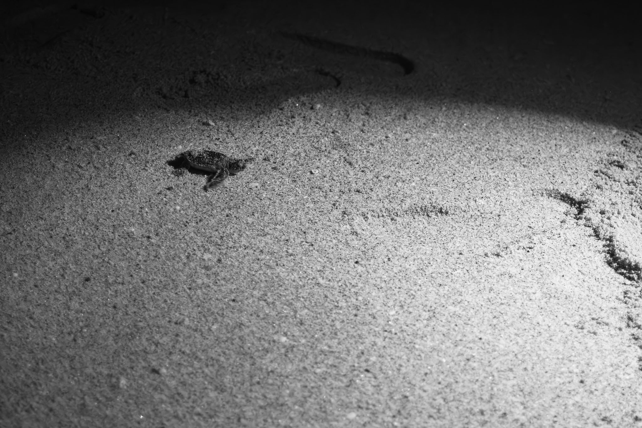
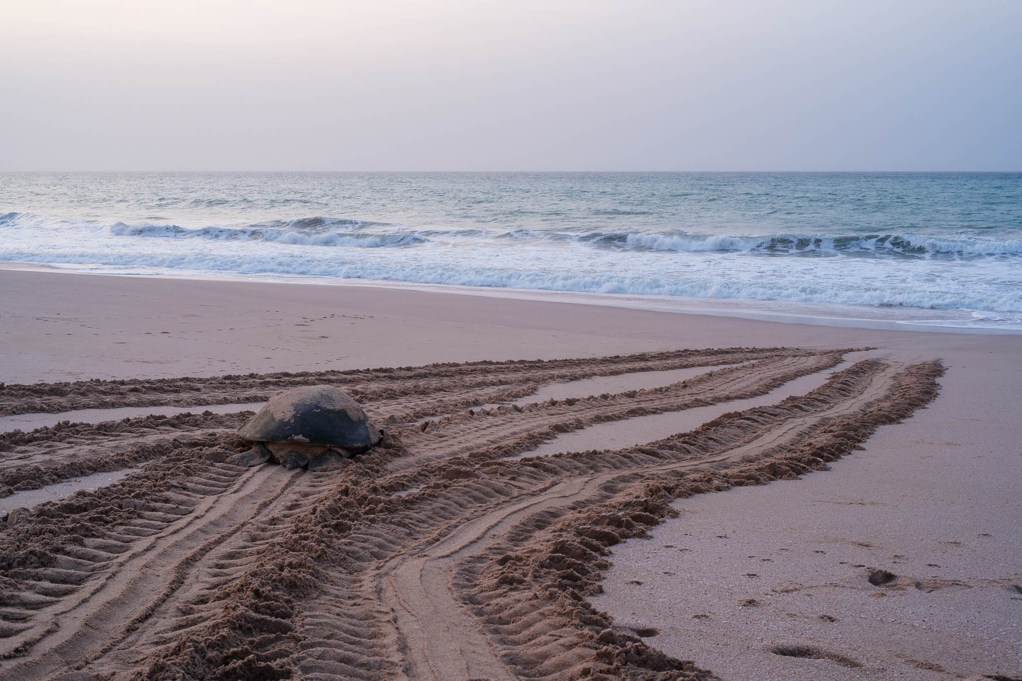
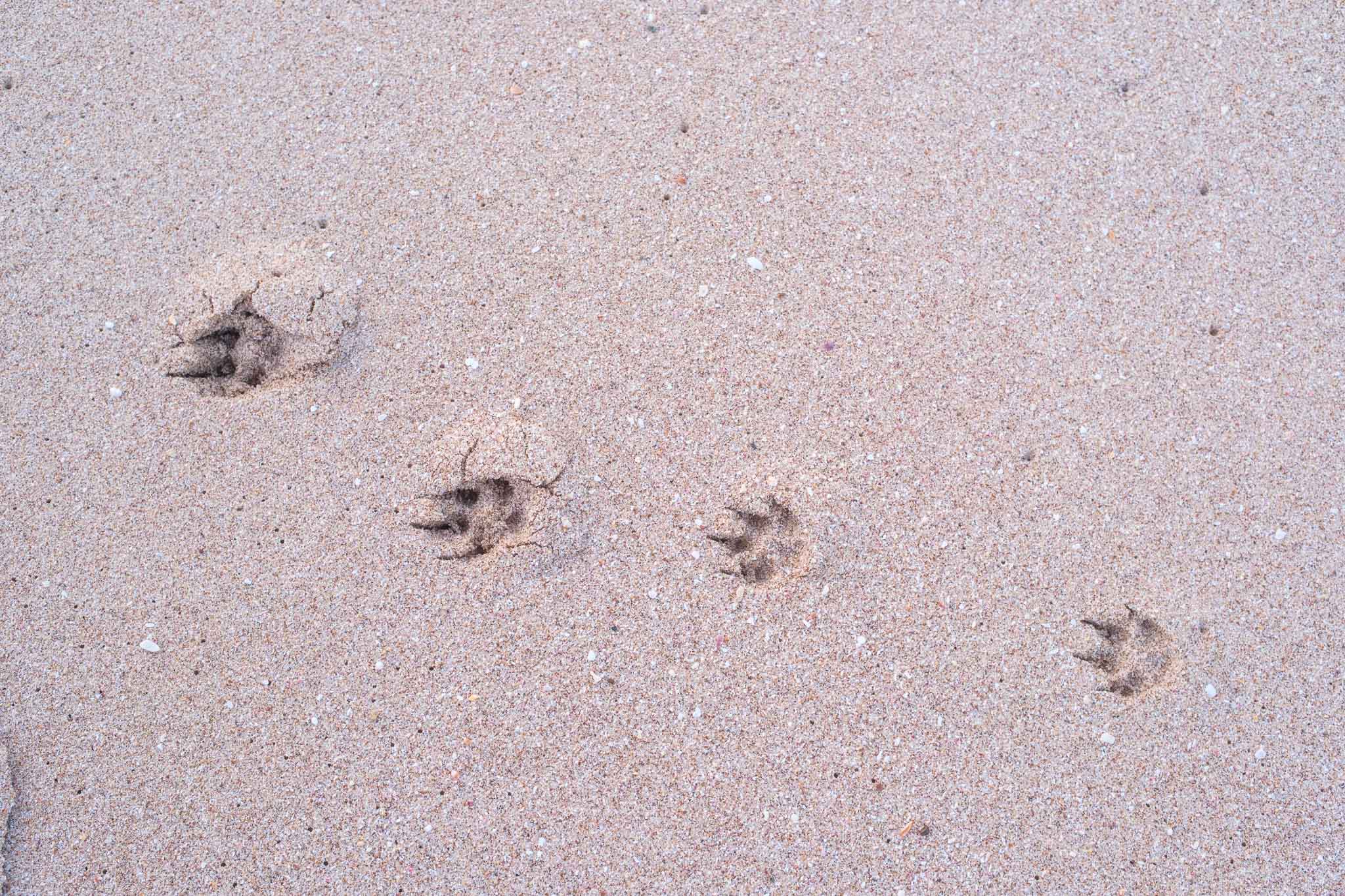
Upon arriving at the beach for the morning visit, the sand was full of tracks, many from the turtles climbing the up the sand; but also, numerous ones from foxes, who prey on the eggs buried in the sand. Abundant eggshells provide testimony of the baby turtles hatching; their journey is a daunting one because as soon as they hatch, they must climb out of the crater and negotiate their way to the water. The distance is small for us, but it is big for them, and they also must survive the sea birds and crabs. About 1 in 500 baby turtles make it to safety, which is a clear indication of the risks these animals face since the day they are born.
Even with more visitors, the Ras Al Jinz Turtle Reserve still provides a unique experience, one to be enjoyed with respect for these wonderful animals.
Dawn at the beach.Exiting from the nest.Busy route.Fox.The return journey begins.Returning to the sea.First light in the Arabian Peninsula.Tracks at sunrise.Erosion (panorama of 2 photos).Morning walk.
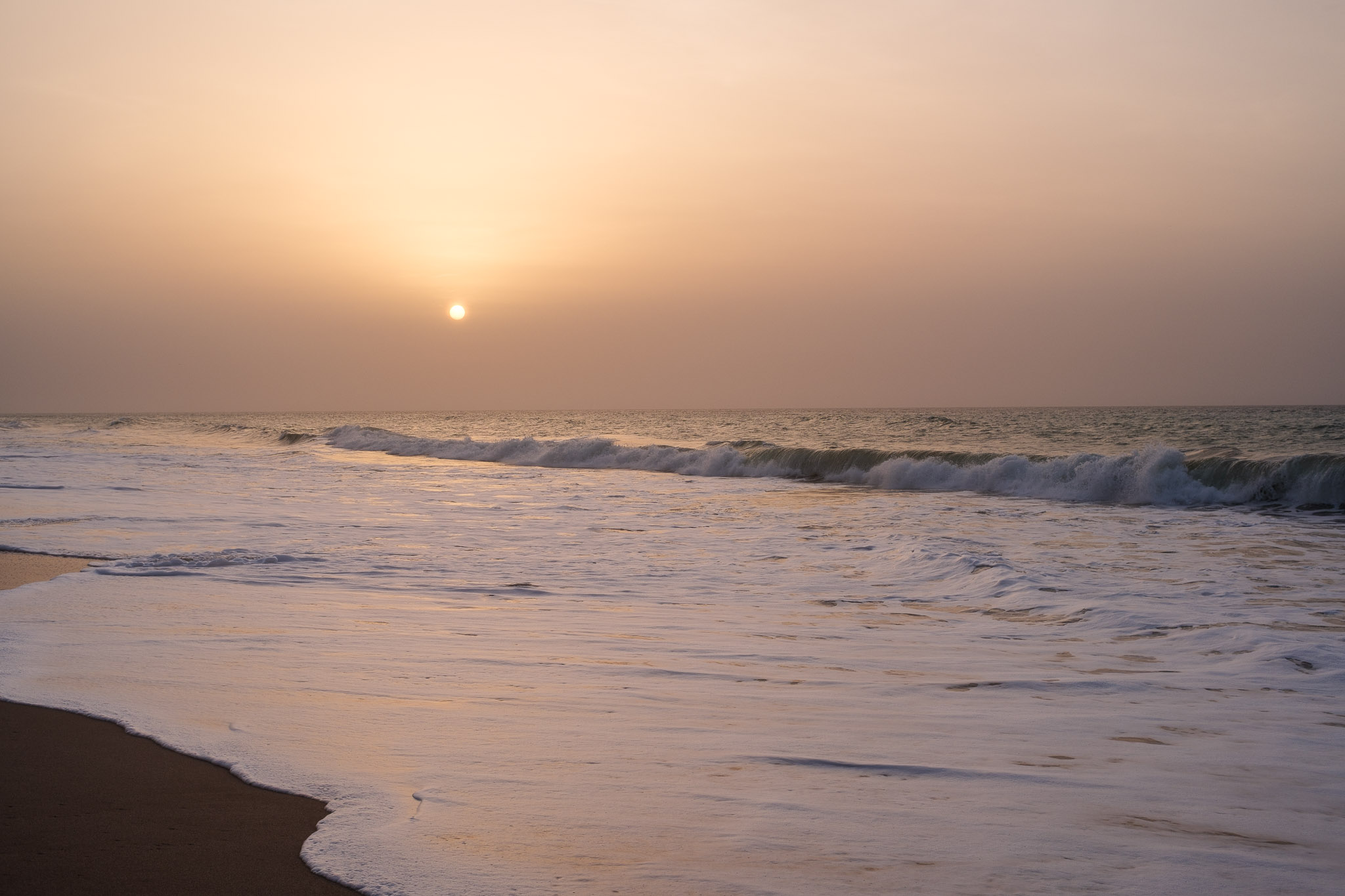
I would like to end this piece with a photo from 21 years ago. Same place, same magic.
April 2004 (Canon EOS with EF 35mm f/1.4 lens, slide film).
I recently went with the astronomy group here in Oman to the periodic weekend trip during new moon. We normally try to go to a dark place; during the summer, this means heading to the mountains to escape the high temperatures that prevail elsewhere. The chosen location this time was Jebel Sara, a mountain area close to Jebel Shams. At 2,300m above sea-level, the temperature is significantly lower, around 24 centigrade. The drive from Muscat took about 4 hours and was uneventful. A 4WD is required, to negotiate the gravel mountain roads. After setting up camp, I walked around making some photos of the interesting trees in these Juniper woods.
General view of the Jebel Sara mountain landscape. Twisted.Near and far.
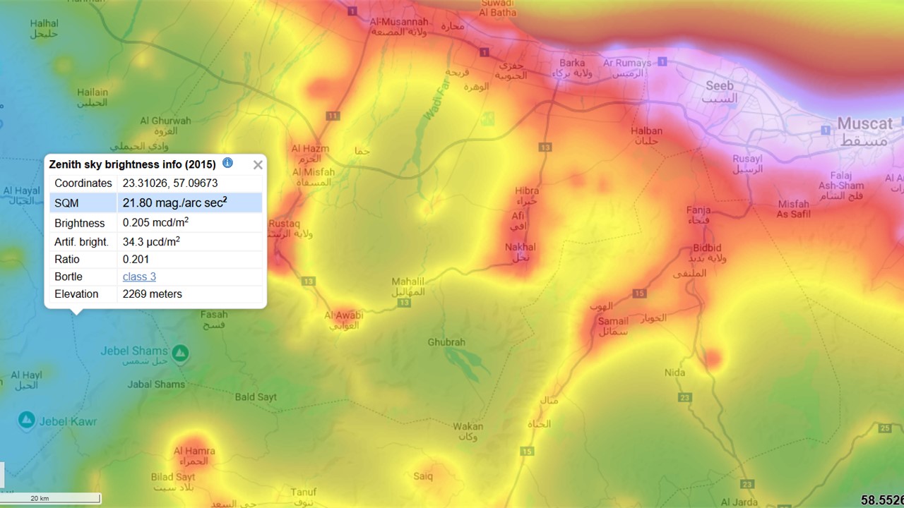
Our camping spot is in a Bortle class 3 location, which corresponds to “rural sky”; this means good dark sky observation properties, with some light pollution in the horizon (see map below).
Map with Jebel Sara location.
For this trip my plan was to shoot enough images for a good star trail, plus some good photos of the Milky Way. For that, I had with me my Fujinon 14mm f/2.8 wide angle lens, plus the Fujifilm X-T5 camera and tripod. My approach is to set up the camera and lens for star trail shooting and then go and get some sleep. For example, this time I selected 150 exposures in the camera’s intervalometer, 30 seconds each; this gives a total time of 75 minutes.
Waking up around 12am, I checked the status of the star trail shots, which was fine. I then proceeded to set up the camera and lens to frame the Milky Way, which in the meantime had risen in the sky. I had previously scouted the area for interesting foregrounds, thus saving some time. You don’t want to stumble in the dark looking for compositions. Again, I shot using the intervalometer, but this time 10 images only; later I would stack them in Sequator.
Star trail.Milky Wai #1.Milky Wai #2.Milky Way #3.Milky Way #4.
Happy with the results, I went back to sleep for a while, knowing that sunrise was only 3 or 4 hours away. Not sleeping much is a compromise of night sky photography, but it is worth it. Besides getting images of star trails or the Milky Way, it is fascinating to observe deep sky objects like globular clusters or galaxies through the telescopes.
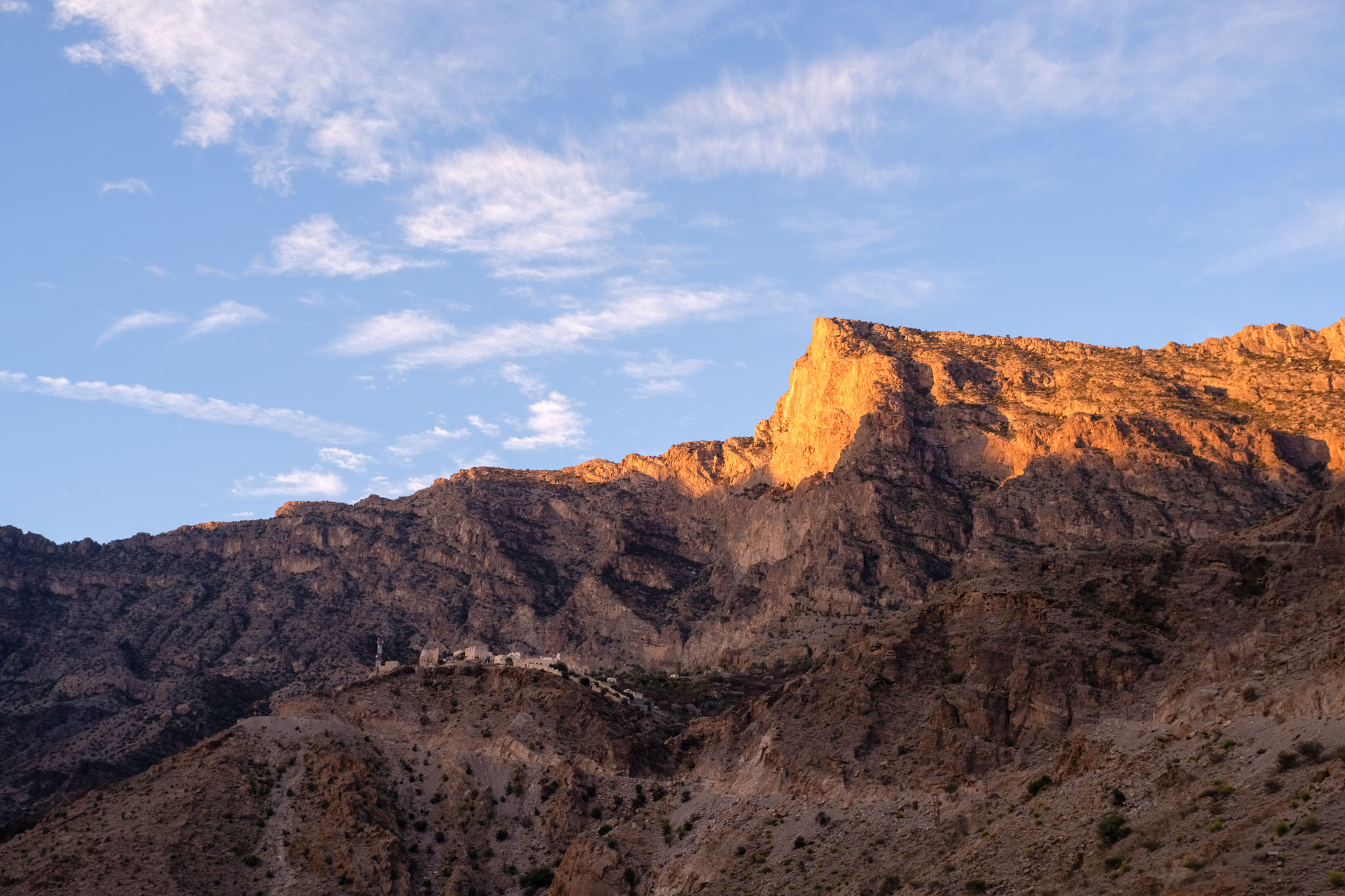
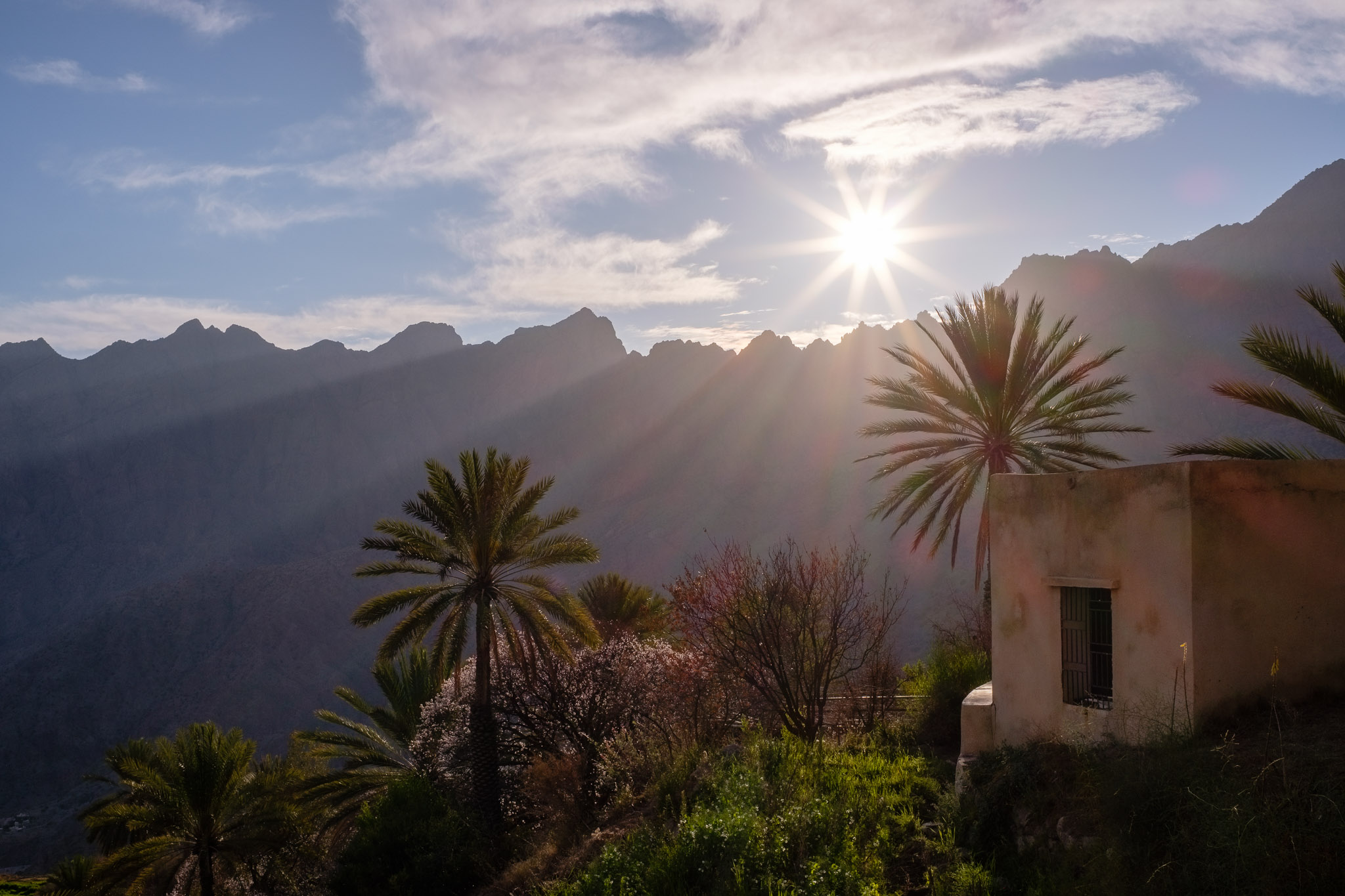
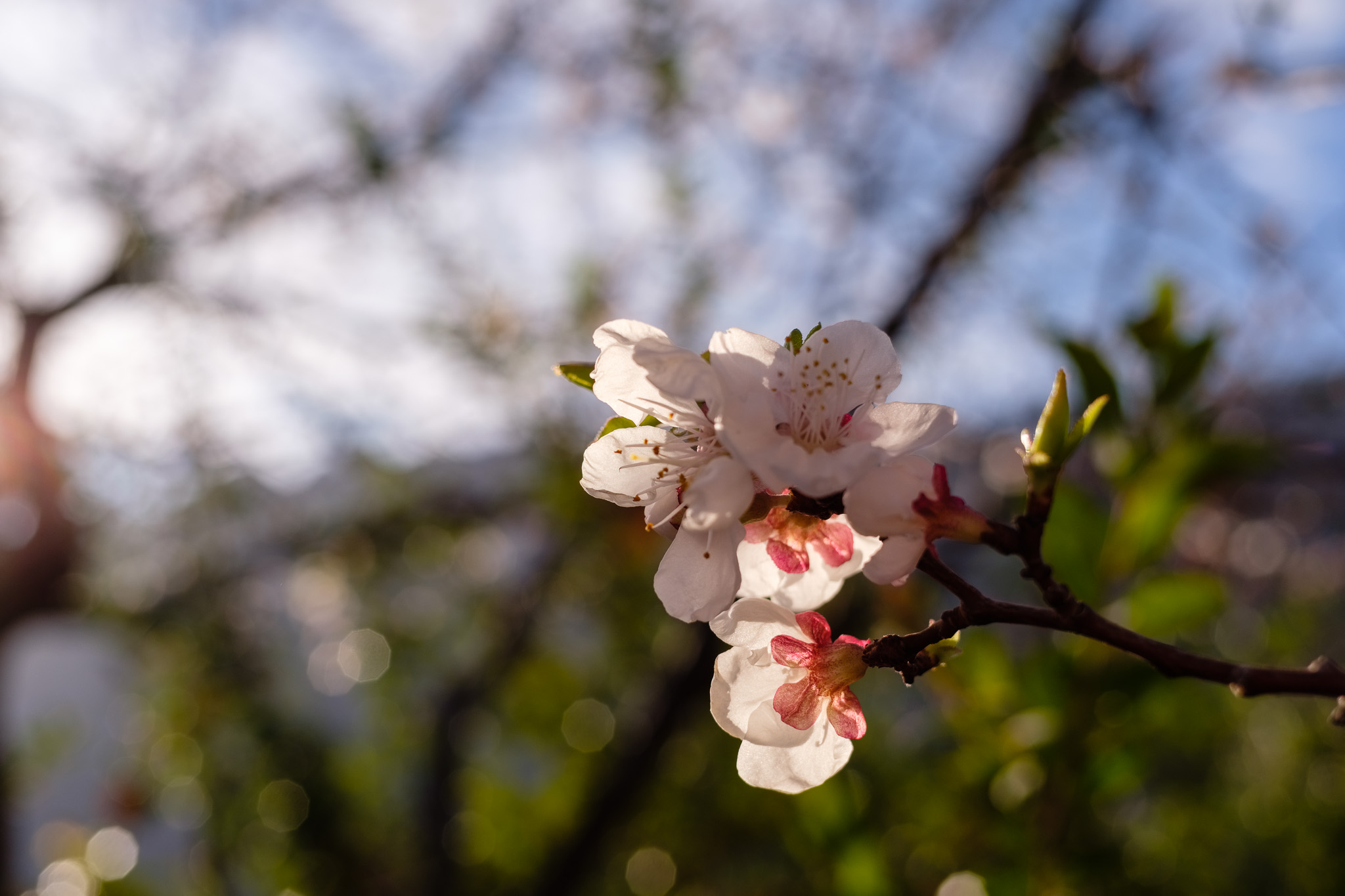
It is mid-February, and springtime is arriving fast in Oman. This means that in many mountain villages, the fruit trees are already in blossom, creating a very special natural tableau. Whenever possible, I like to visit such places; in my home country of Portugal, the almond trees in bloom cover large areas of the Algarve and Tras-os-Montes provinces, blanketing the hills in white and pinkish hues. In Oman, the small village of Wakan, in the Jebel Akhdar mountains, has become quite popular with tourists all year round, but particularly so in the spring. I went there in the spring of 2024 and wrote about it in the following article.
This time I arrived earlier, to avoid the predictable weekend crowds, and to benefit photographically from the higher quality early morning light. I carried with me my trusty Fujifilm X-T5 and a single lens, the Voigtlander X 27mm f/2. This small pancake lens is manual focus only but is perfect for these trips. In case I required something wider, I simply took more images to assemble later as panoramas.
Dawn approaching near the entrance to Wadi Mistal.
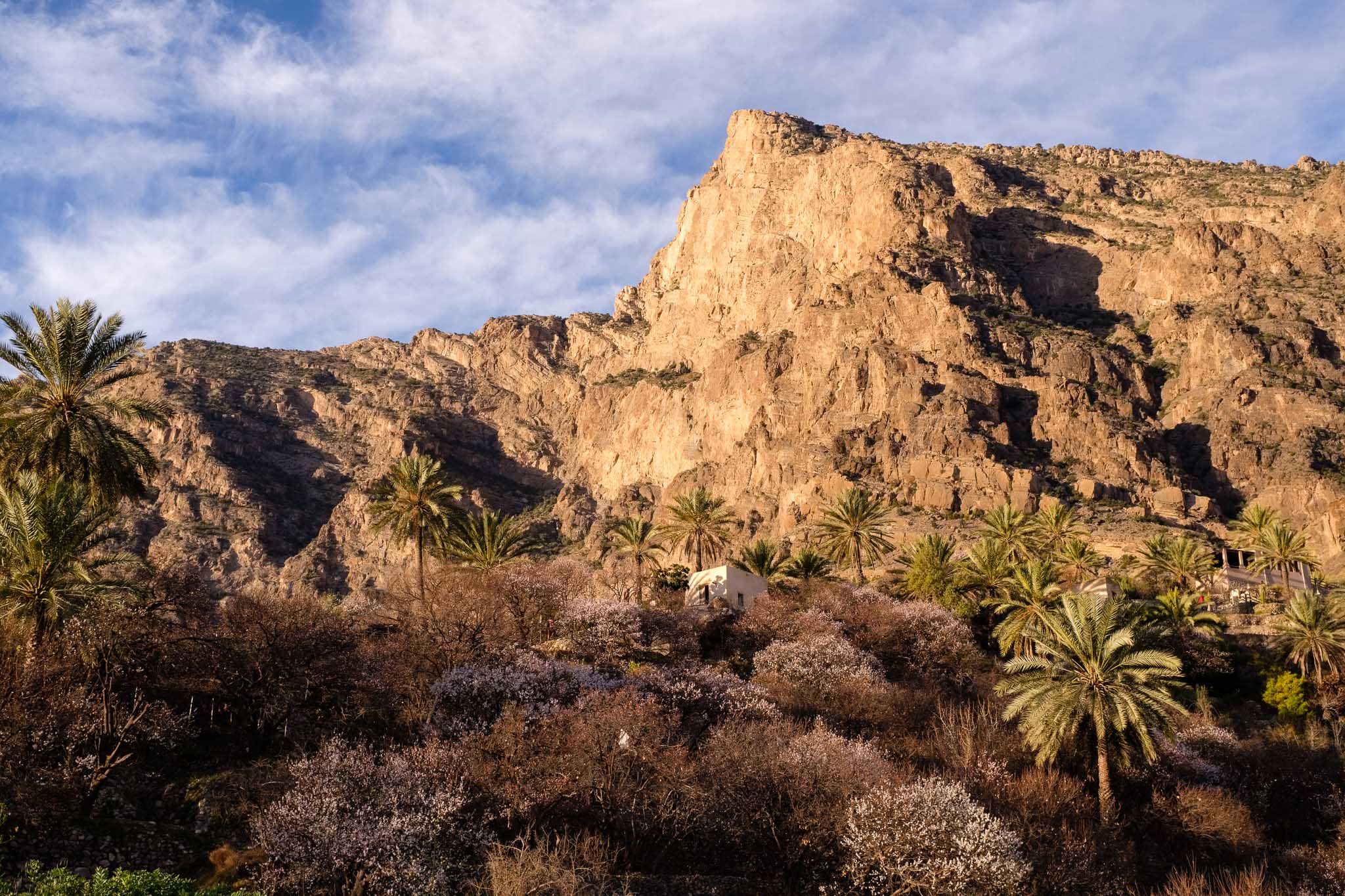
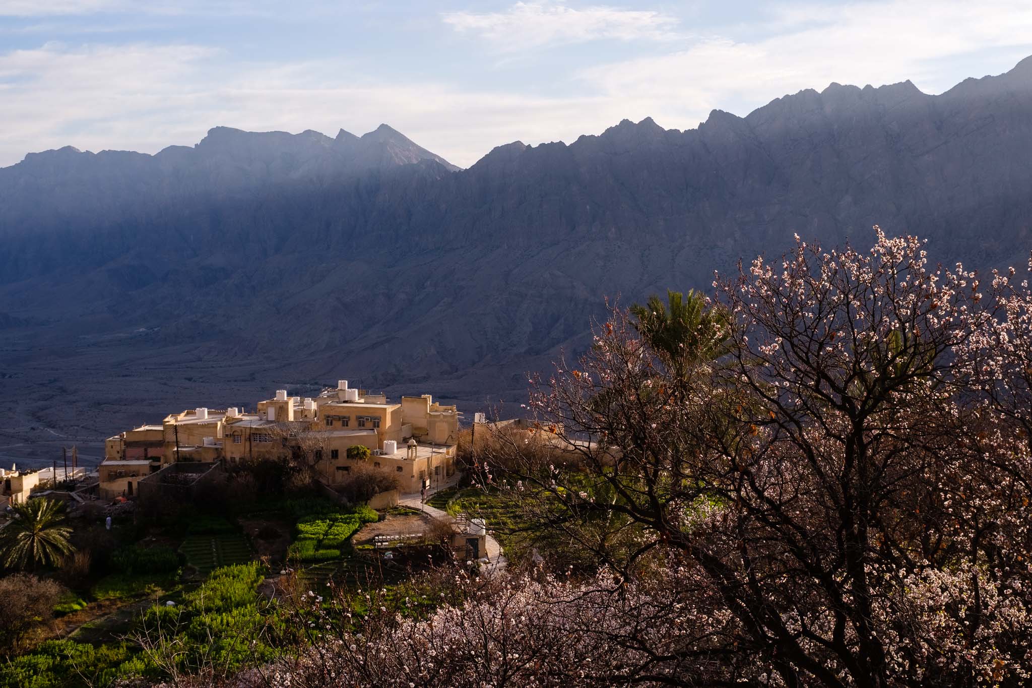
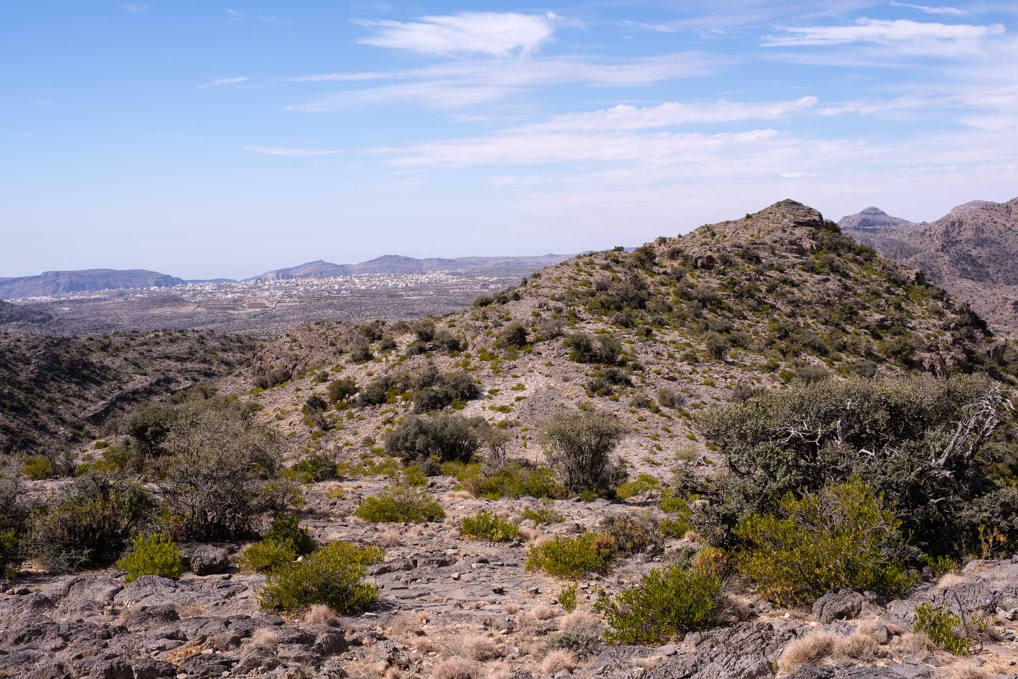
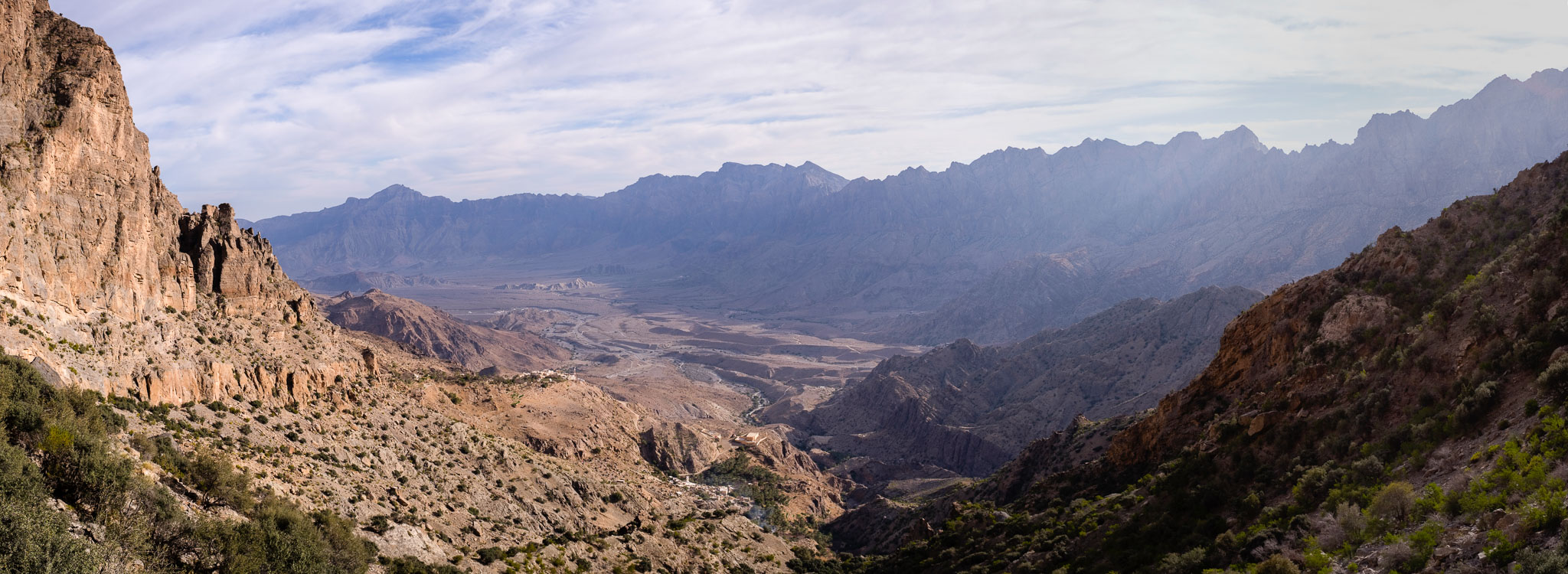
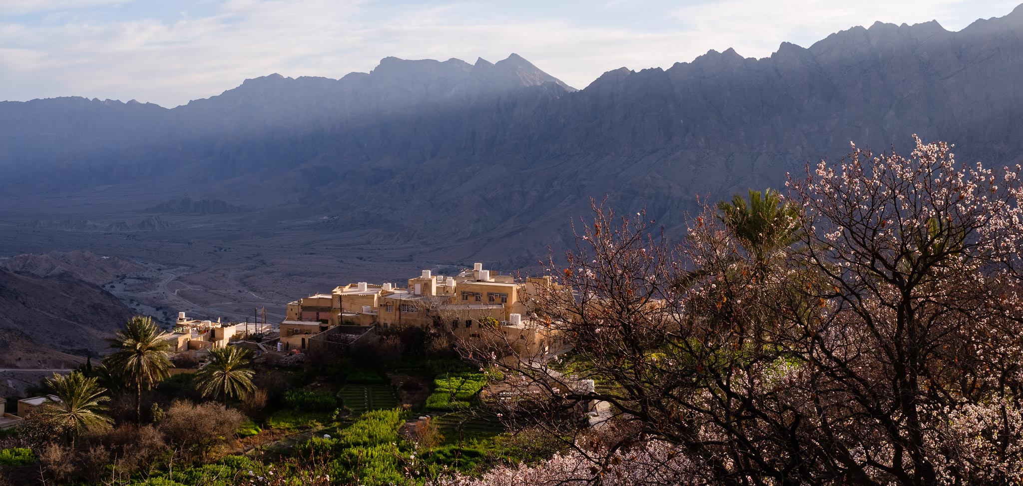
Leaving Muscat at 5 am, I had the first glimpse of Wakan, perched on a hill at 1,400 m altitude, at around 7 am. I parked the car and took a few photos as the first light of the day started to illuminate the surrounding mountain range. I am always impressed by the beauty of this scenery, with the tiny village dwarfed against the jagged mountain peaks that reach up to 2,300 m above sea-level. I drove the final stretch of the (gravel) road and had no problem in finding a parking space in the small local car park. I strolled in the cultivated terraces and fields for a while, in the middle of the peach trees in bloom; daylight first hit the peaks above, slowly moving down along the mountain face. I waited a few more minutes until the sunlight bathed the orchards, and then started walking along the trail that connects Wakan to the Sayq Plateau to the south, and to the village of Hadash to the east.
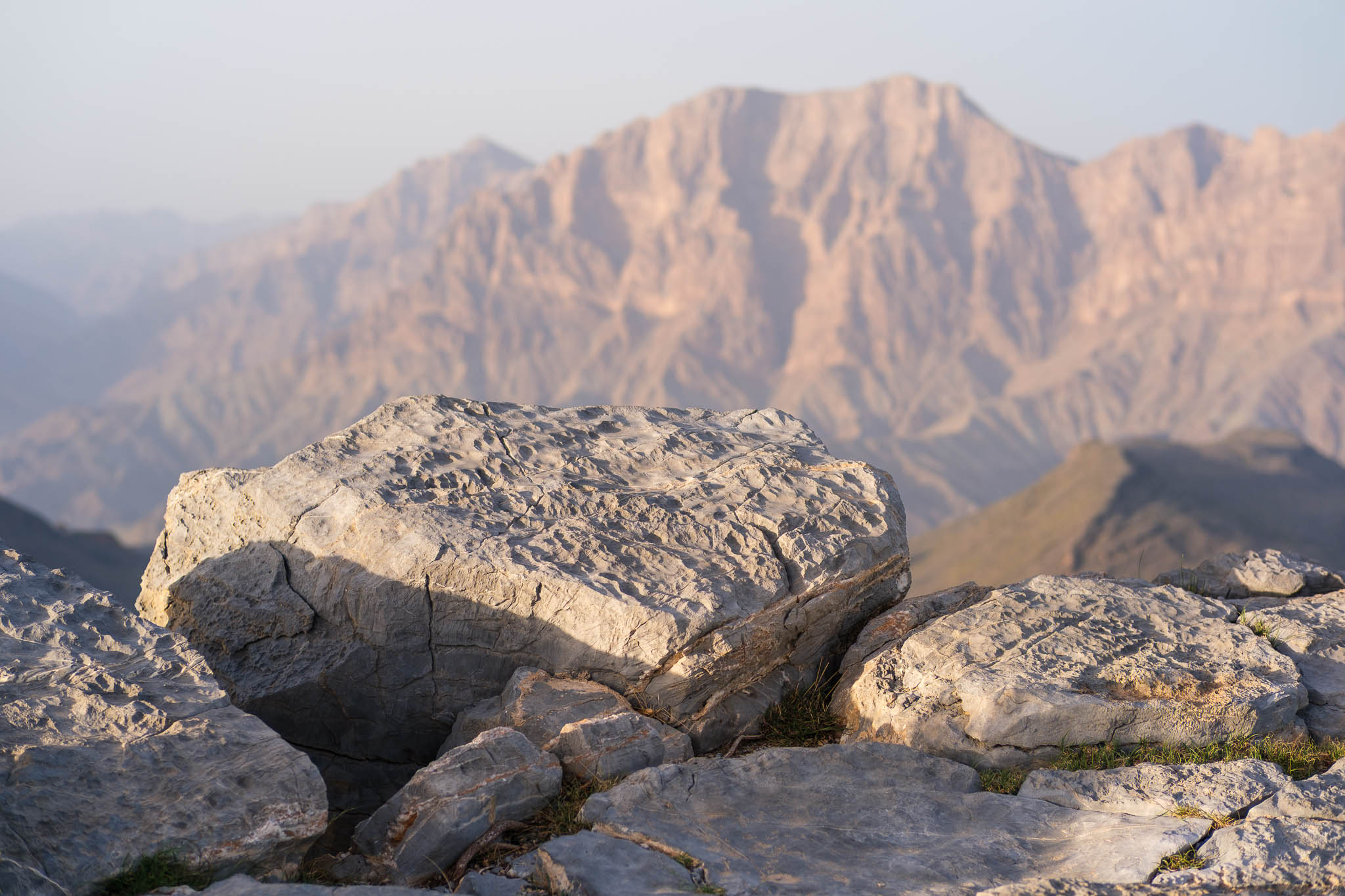
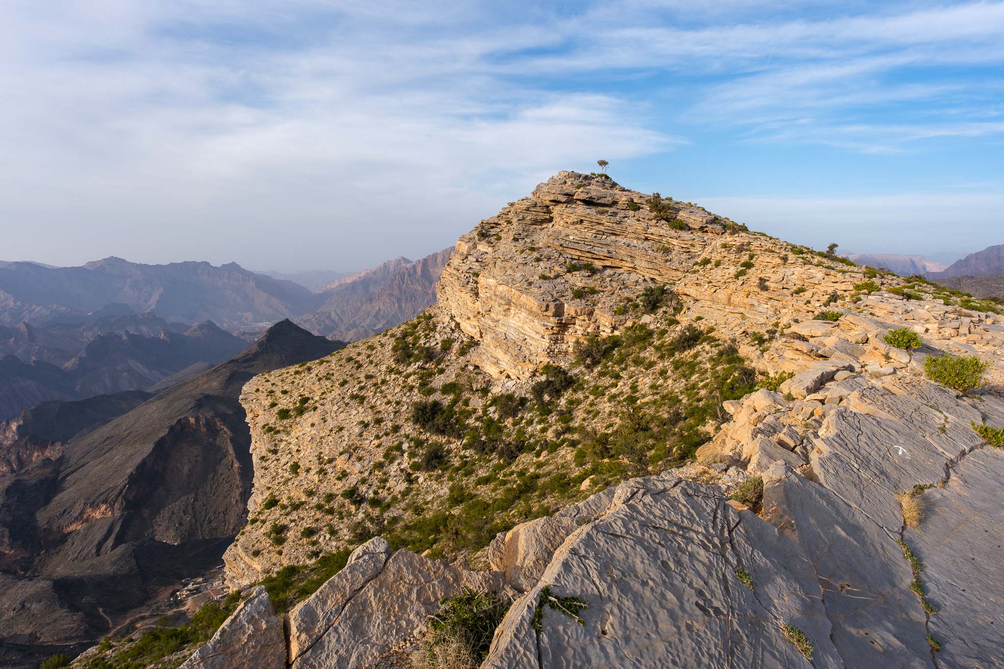
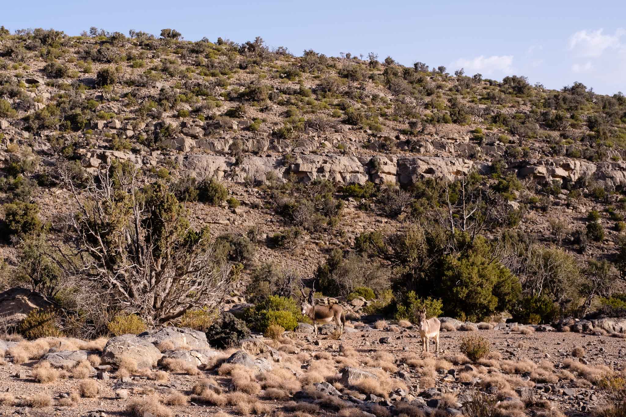
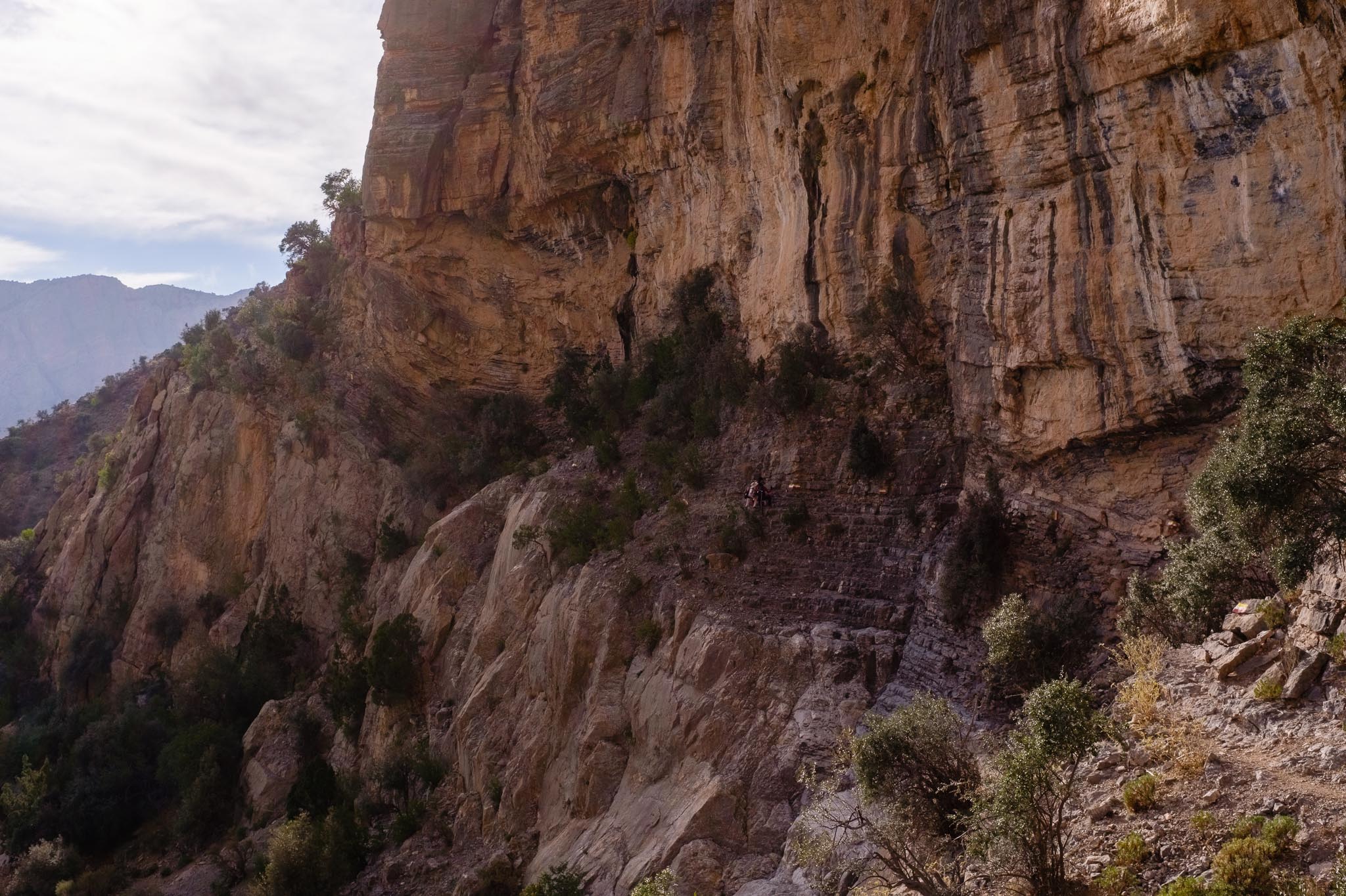
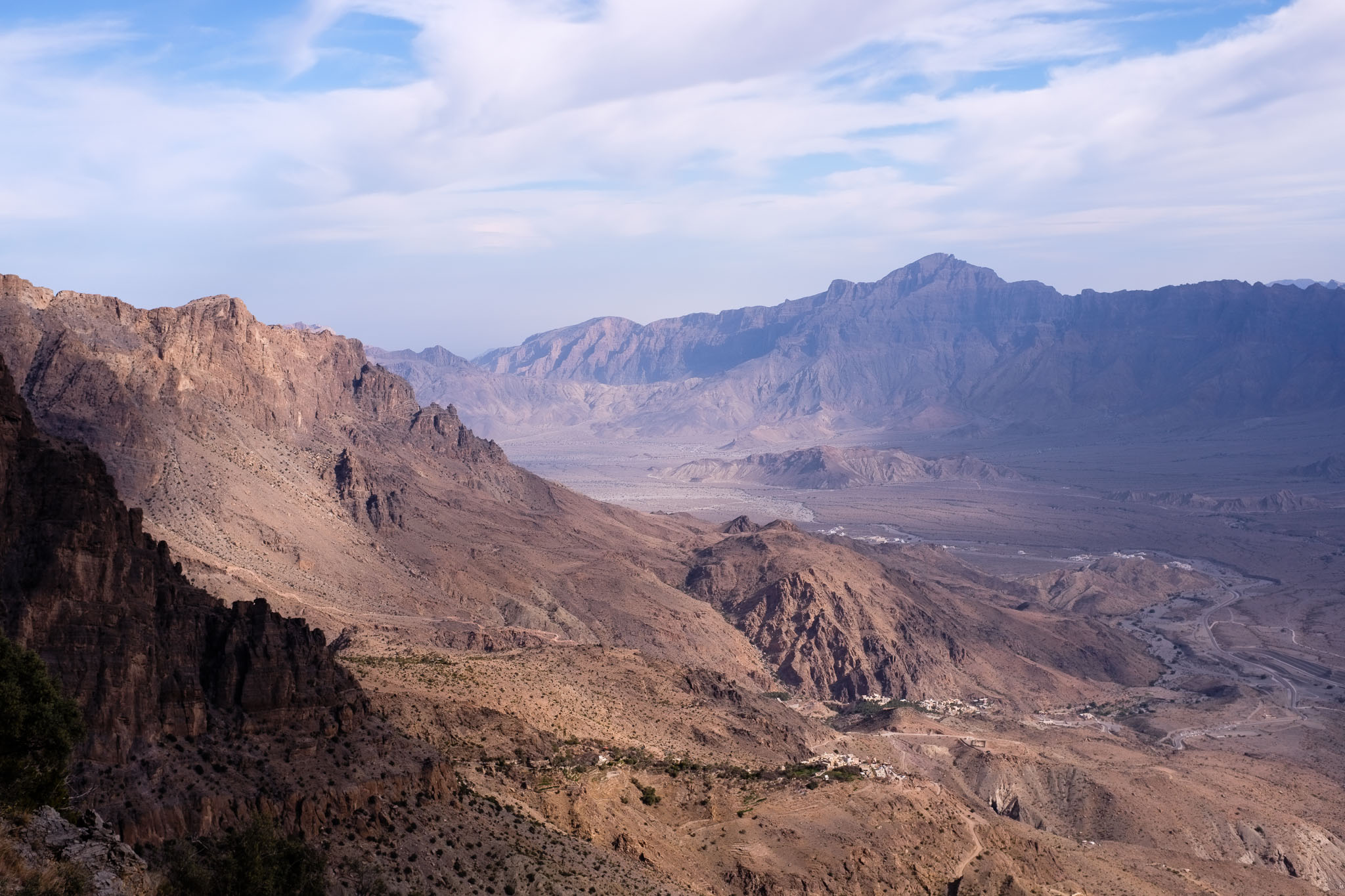
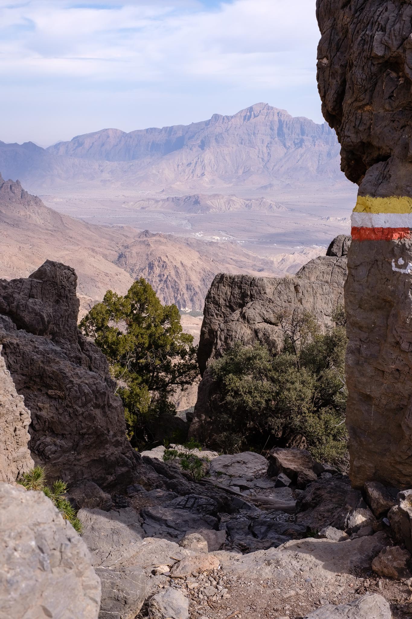
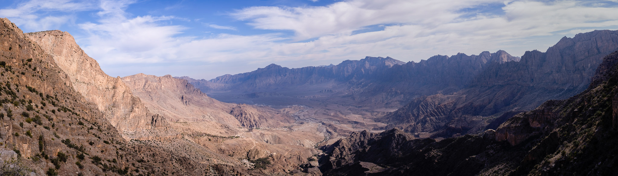
I walked along this trail several times in the past, and it is one I always enjoy, due to the peacefulness and the amazing views over Wadi Mistal. This time my plan was to go all the way up to the Sayq Plateau via the Wakan Pass, a gap in the mountain at 2,300 m altitude. In total, I walked around 14 km, going first to the top, and then coming back. This is not an easy walk, because in places the trail crosses several steep rocky parts and patches of loose rock, but it is well signaled with conspicuous colored markers. One can only imagine how in the past people would travel along these narrow trails on foot or in donkeys. You can see that in some parts, the rocks are well polished from people walking on them.
It took me about 3 hours to reach the top, including lots of stops for photo opportunities of the incredible landscape. The weather was sunny but cold, with fresh winds in the exposed plateau, so it is a good idea to bring extra layers of clothing. I leave you with a selection of images of this wonderful day spent visiting this magical mountain village. Even if you do not walk the entire trail, you can adjust the distance to your requirements; by walking only a few hundred metres, you will get a nice view of the village and the magnificent landscape that surrounds it.
Wakan and first light over the mountains.Trees in blossom.Filtered light.Over the eastern ridge.Delicate.In the terraces.Running water in the falaj.Tricky trail.Quick pause and overview over the landscape.Wakan pass at 2,300 m of altitude.Sayq Plateau.Panorama #1 (27 vertical photos).Panorama #2 (21 vertical photos).Panorama #3 (14 vertical photos).