I was born in Lisbon in 1966, and I am a geologist. My main interests as a photographer are Landscapes, Travel, and People. I have been fortunate enough to work in different places and contacted diverse cultures. I am also fortunate to live in a small, but beautiful country, Portugal.
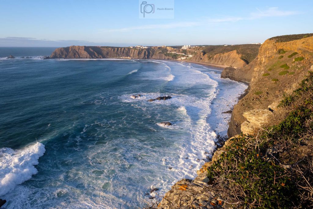
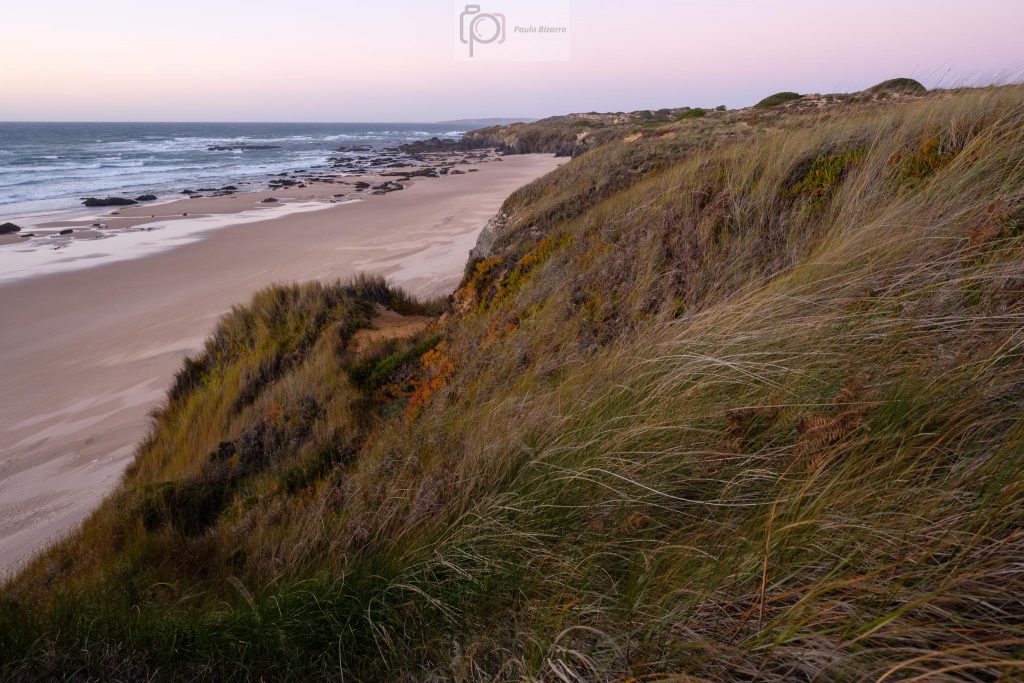
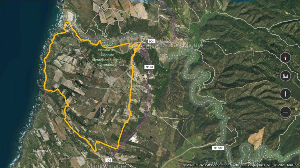
The coastal region between Odeceixe and São Vicente is part of the Southwest Alentejo and Vicentina Coast Natural Park, and throughout the years I have written many times about the region. Today I would like to make a visual summary of the main points of interest along this coastline. This comes as a result of the several Rota Vicentina trails that I have been walking in the last few years.
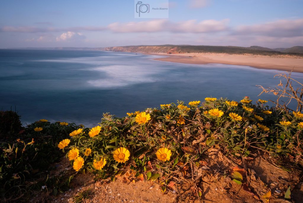
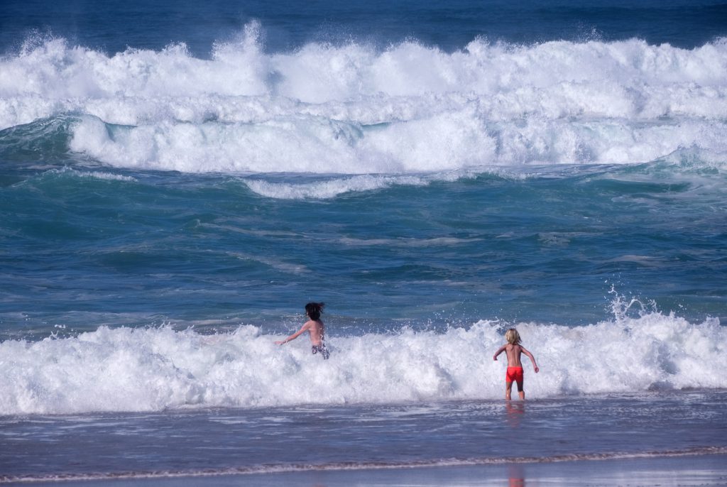
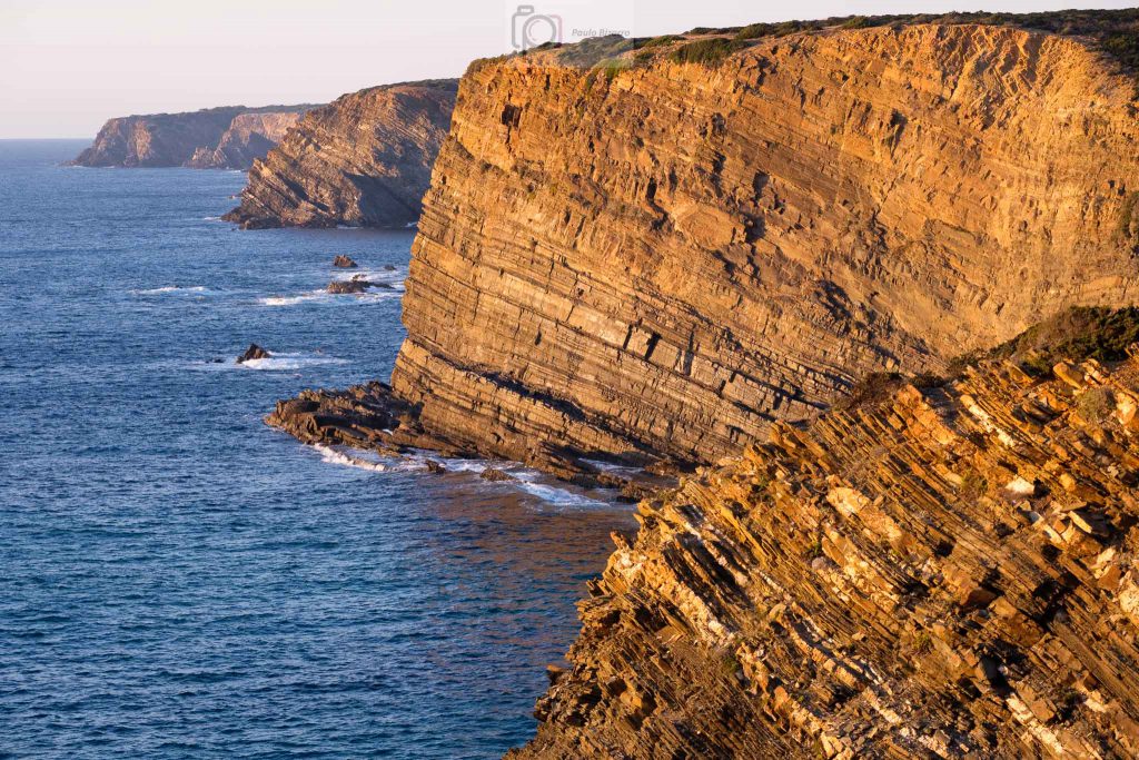
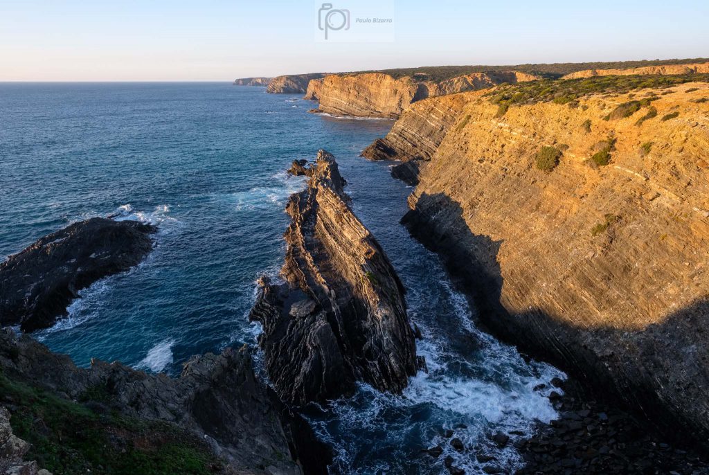
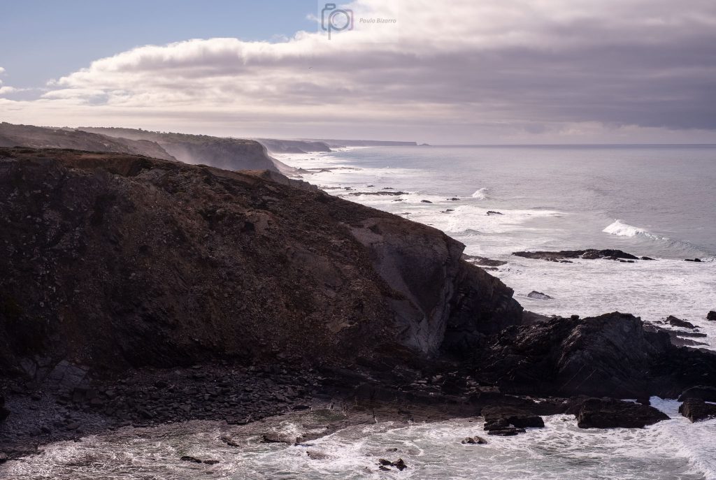
The main reference points along this coastal region are often associated with a few villages and/or nearby beaches. From North to South, we will find: Odeceixe, Aljezur (Amoreira, Arrifana and Monte Clérigo beaches), Bordeira (Carrapateira, Amado, and Murração beaches), Vila do Bispo (Cordoama and Castelejo beaches), and finally Sagres/Cabo São Vicente (Telheiro and Ponta Ruiva beaches). In all of these it is possible to admire wonderful seascapes, which are dominated by tall cliffs that drop precipitously into the azure ocean.
These cliffs are formed by heavily compressed, folded and faulted Paleozoic rock formations with around 300 million years of age. Quite often, it is this geologic complexity that shapes the topography of the coastline. Given the nearby mountains, like Monchique, several small rivers and brooks make their way to the coast, where their estuaries lead to the formation of several of the beaches mentioned above (like in Amoreira, Bordeira, and Odeceixe). What follows is a compilation of photos from these beaches, most of them taken off-season, when the silence and tranquility prevail.
Panorama of Odeceixe beach, shaped by water and wind.Panorama of the river Seixe looking towards the sea.Sunset time in Arrifana, where its golden sands are protected by a cove.Looking South from Arrifana.Carrapateira beach.Carrapateira beach and village.Amado beach.Amado beach and its red rocks.Light from above in Murração.Waves in Murração.Surfboards in Cordoama.View of Cordoama and Castelejo beaches from Torre da Aspa, the highest point in the Algarve coast.Telheiro beach at sunset.Looking North, with the red rocks of Ponta Ruiva in the middle distance.Ponta Ruiva.Fiery sky in Telheiro.São Vicente lighthouse at the end of the day.
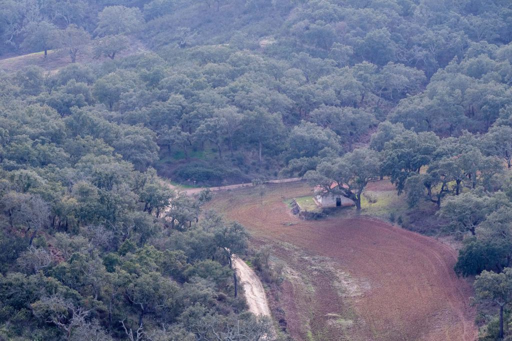
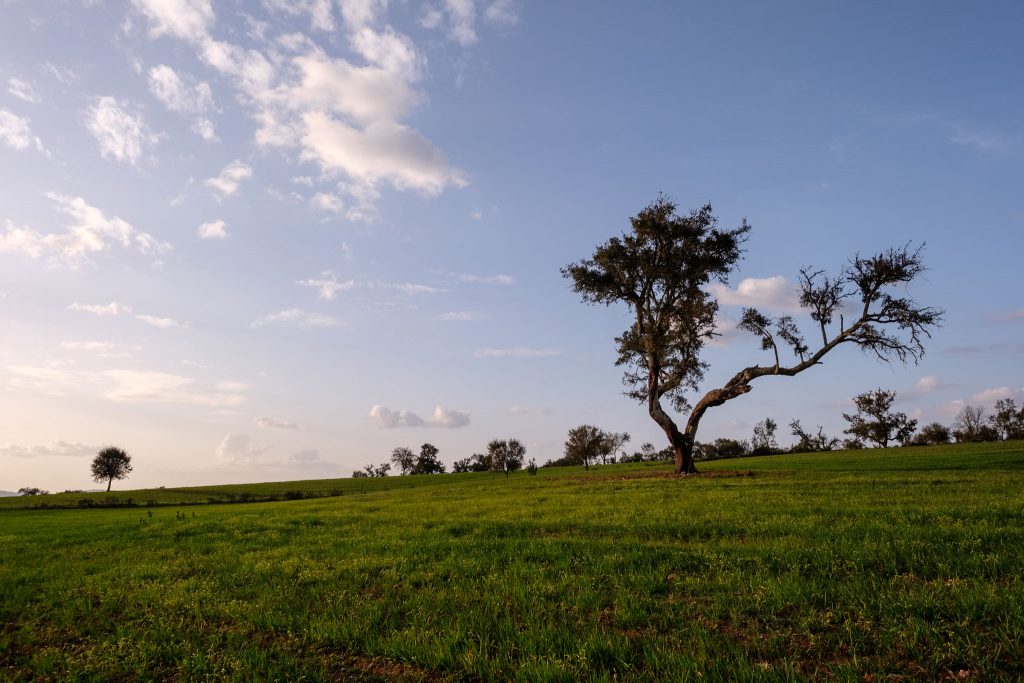
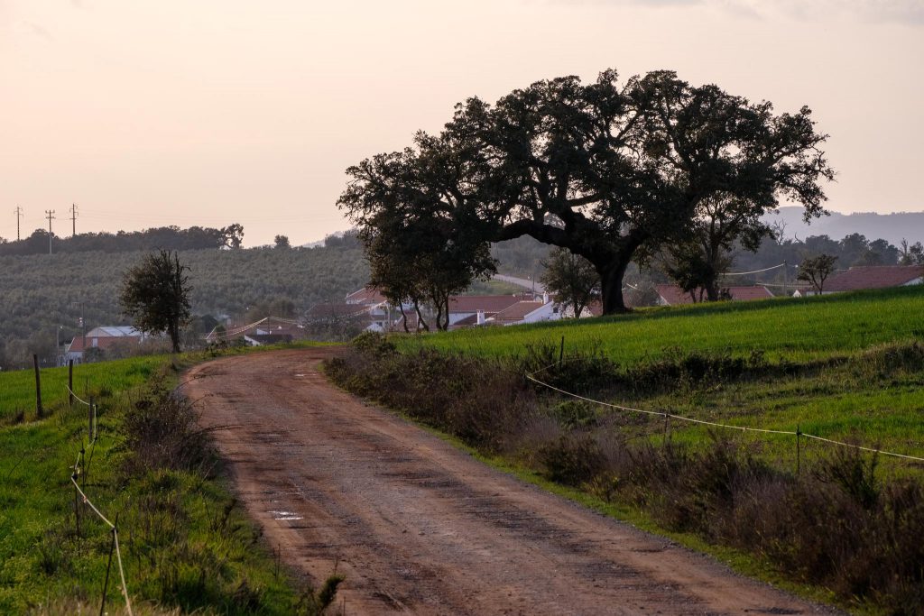
A few days ago I spent some time in the region, and I took the opportunity to walk this trail again. Revisiting familiar places is always a challenge when it comes fresh ideas for photos, but I have tried to do so. I decided this time to walk the route in the afternoon, as my previous walks had been in the morning. As such, I was hoping to benefit from some late afternoon light over the local rural landscape. One other difference was that I am currently testing a new lens, the Fujinon 70-300mm. This lens allowed me to isolate some elements in the landscape, such as old houses and the large cork oak trees that are typical of the area. With me, I also had the 14mm wide-angle lens, which was useful to frame the large trees and the hilly landscape.
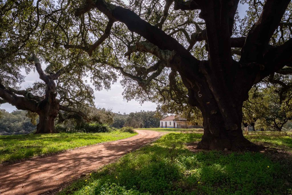
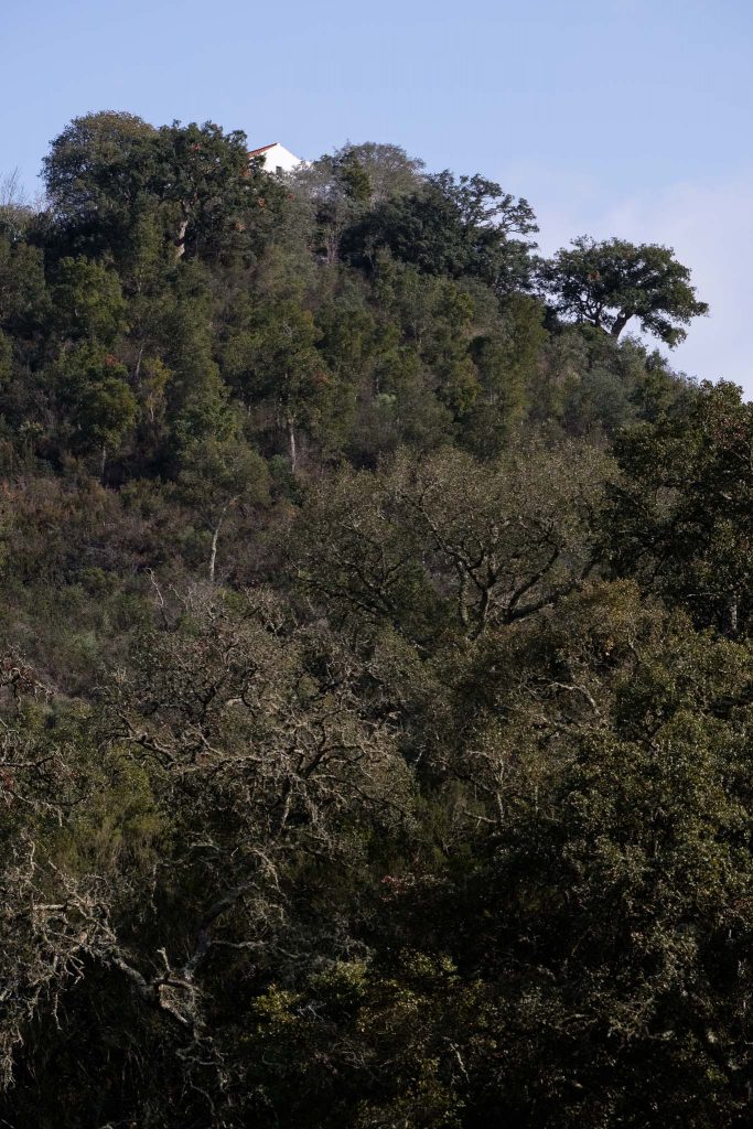
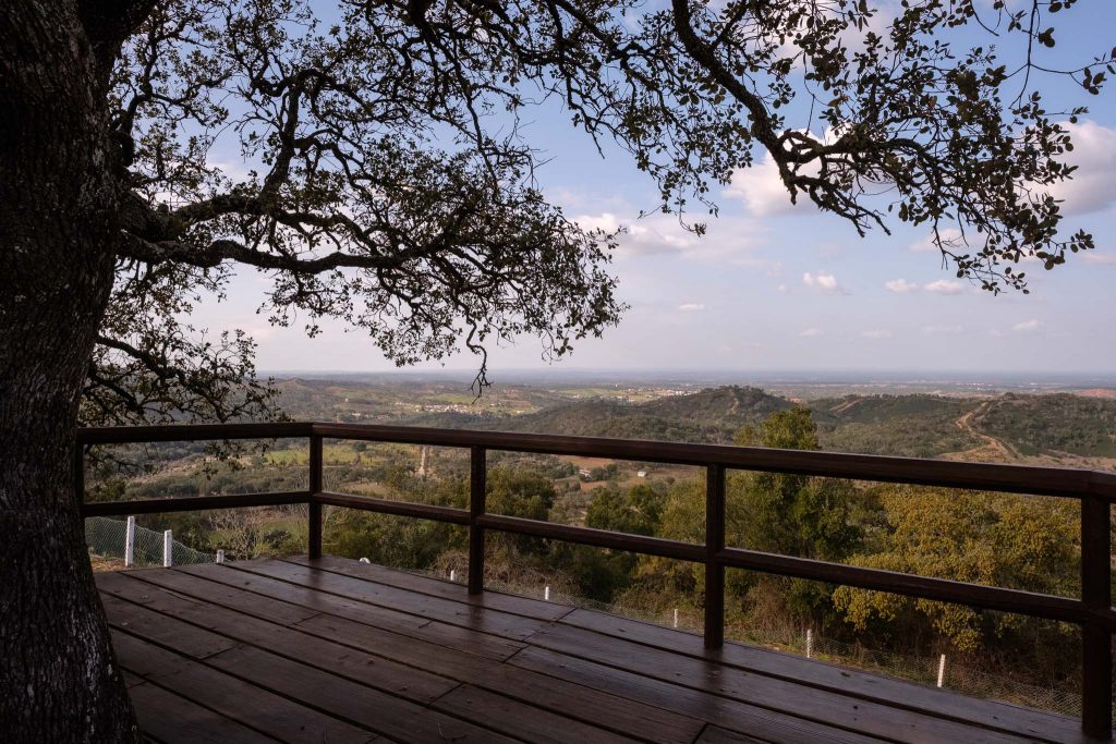
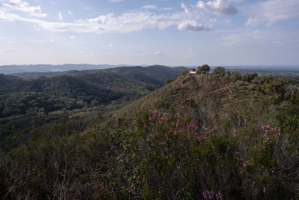
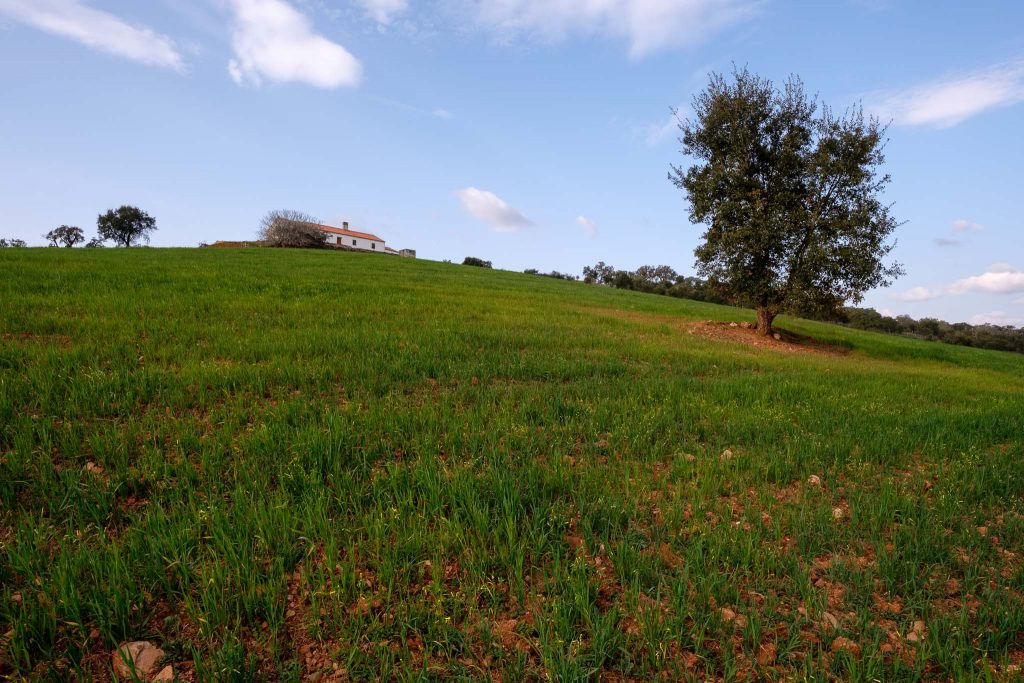
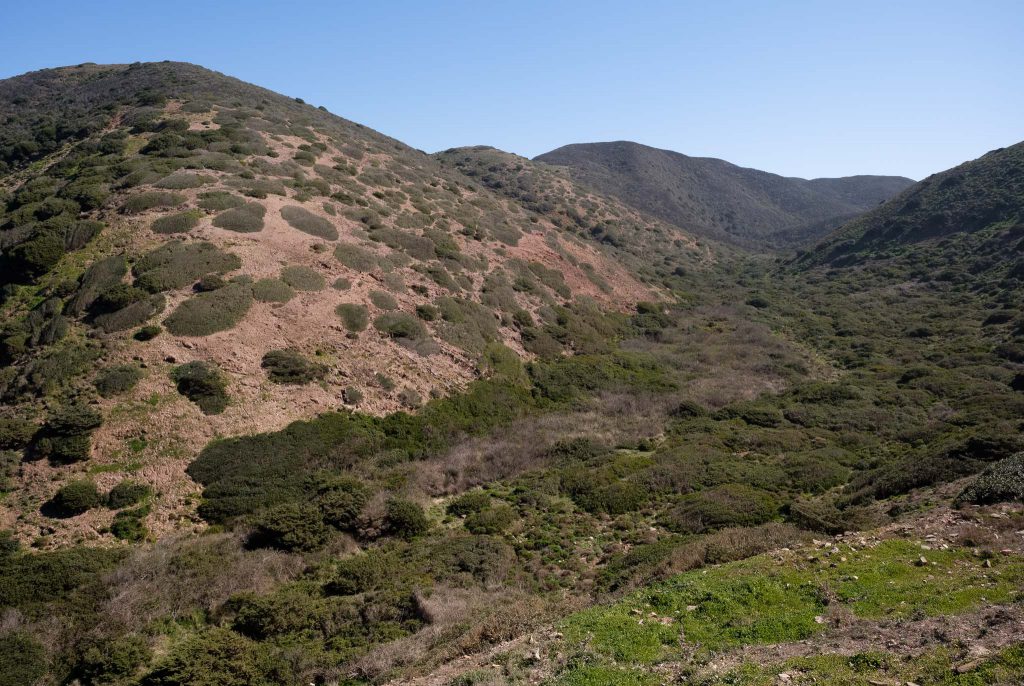
The weather was nice, already with a touch of Spring in the air. Rain has been very scarce this Winter, but some recent rainfall revitalized the crops that local farmers had cultivated. This turned the hilly landscape into patches of browns and greens. For me, one of the highlights of this trail are the very large cork oak trees that dominate the landscape. Also the view from the Nossa Senhora das Neves chapel, at the top of the hill, is always a must.
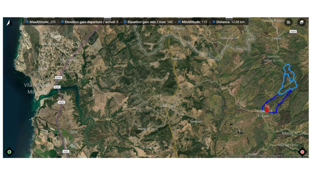
Map of route 7 of the Rota Vicentina.
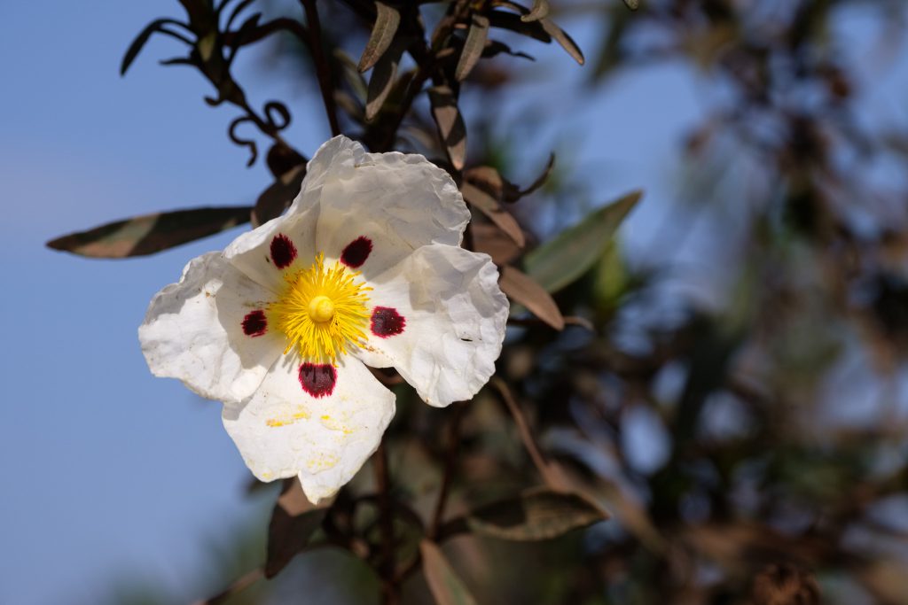
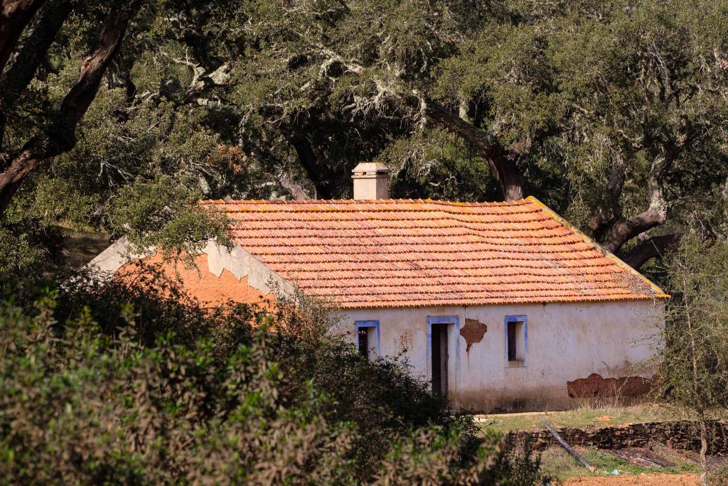
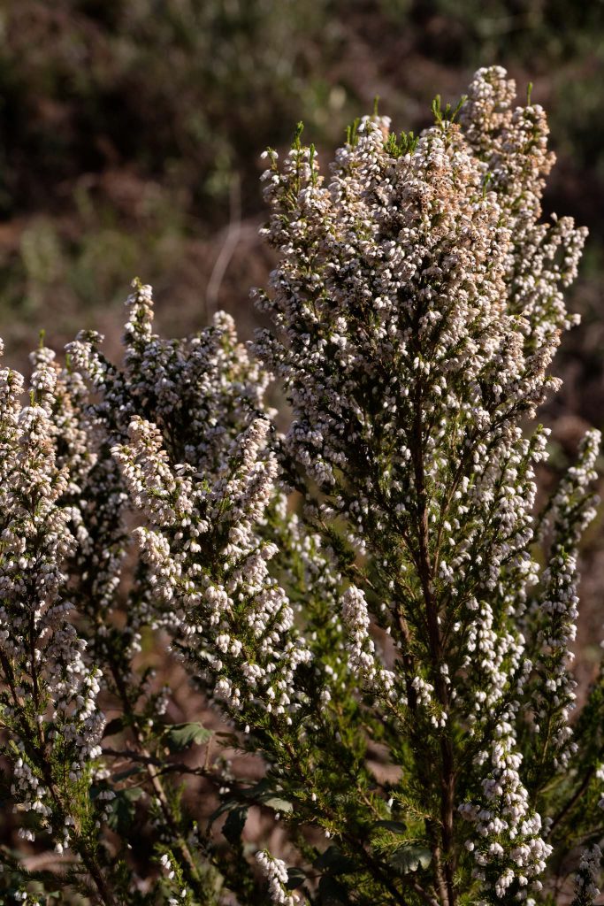
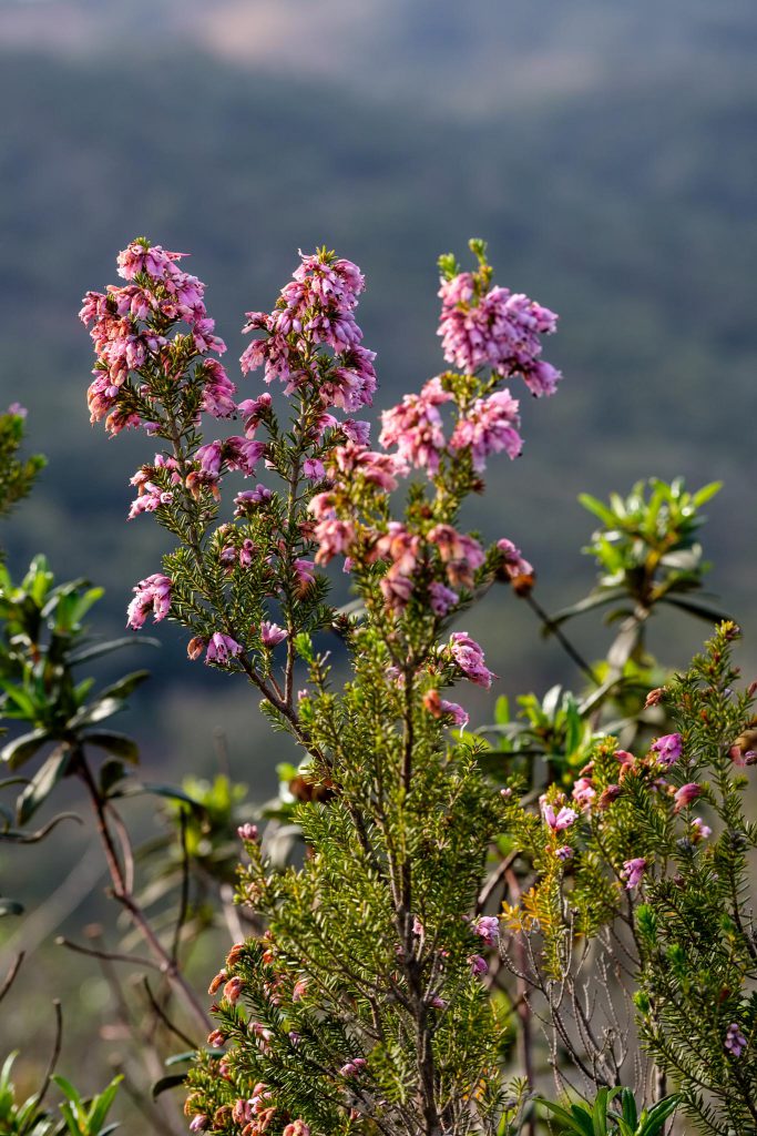
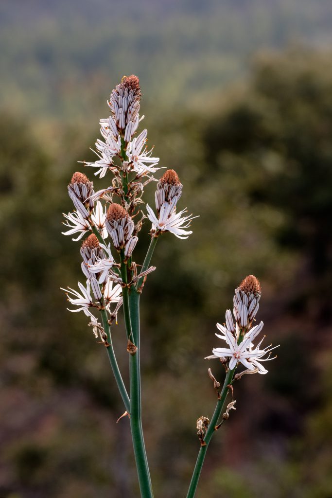
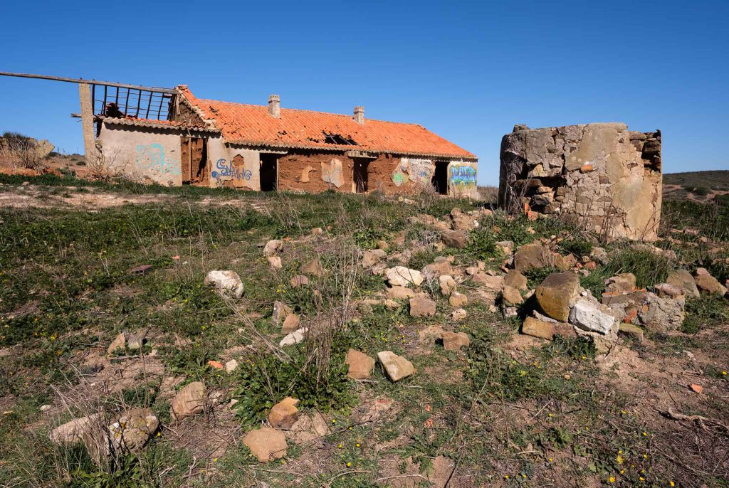
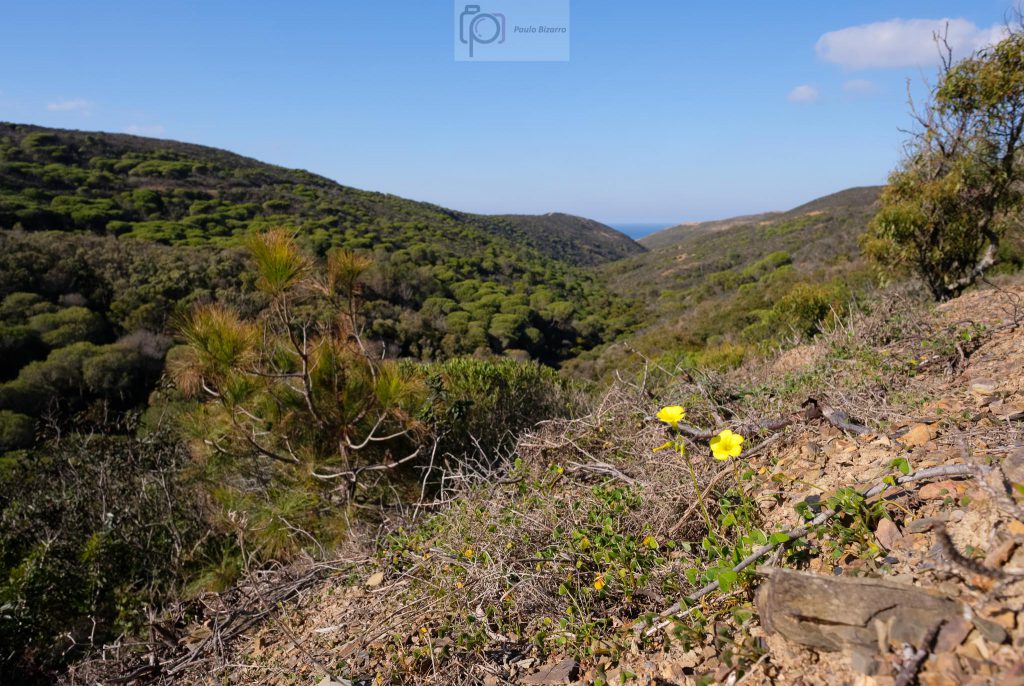
The first half of the walk crosses rural farmlands, with crops of wheat, large cork oak trees, and some abandoned old farm houses. Some plants are in bloom, adding color to the landscape. The sense of tranquility and isolation is strong.
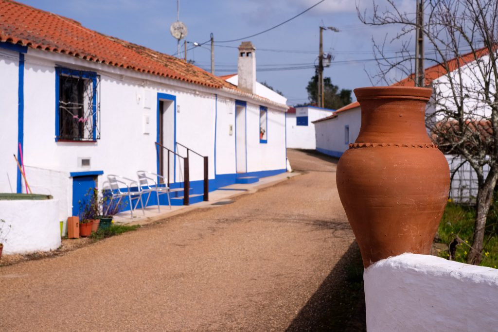
Monte da Estrada village, at the beginning of the trail.Framed house.Rockrose flower.Old farm house.Heather in bloom. Source of delicious honey.Pink flowers.
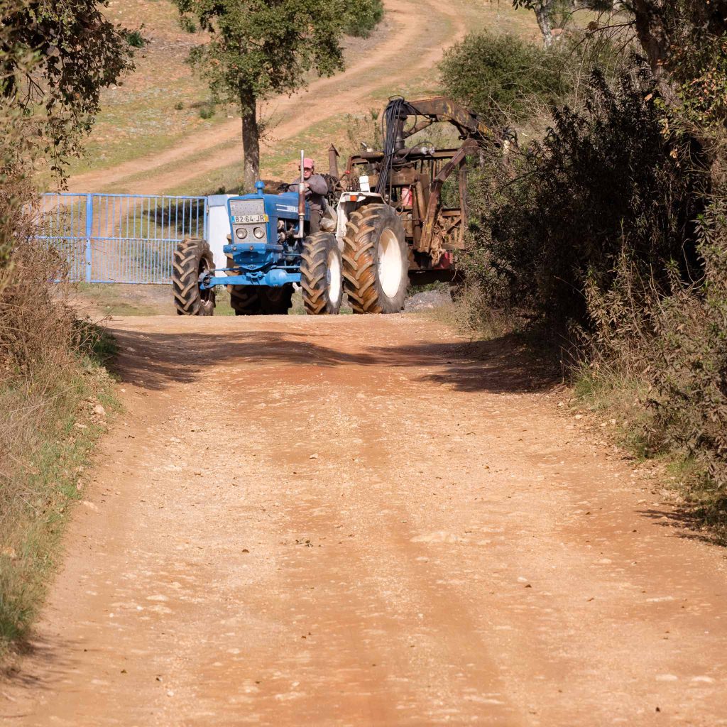
After a few kilometers, the Nossa Senhora das Neves chapel, located in the top of a high hill, becomes visible from the valley below. Soon, the path starts to climb steeply, but the view from the top is well worth the effort. Next to a curve, a farmer drives by in a tractor. It was the only person I have crossed with during my walk.
The small chapel at the top.Along the way.Nossa Senhora das Neves belvedere. A good place to rest and enjoy the view.Hilly landscape, with the chapel in the distance.
I put the 70-300mm lens to good use, zooming in into some distant elements. It is also good for some close-ups o flowers along the way.
Looking down.White flowers.
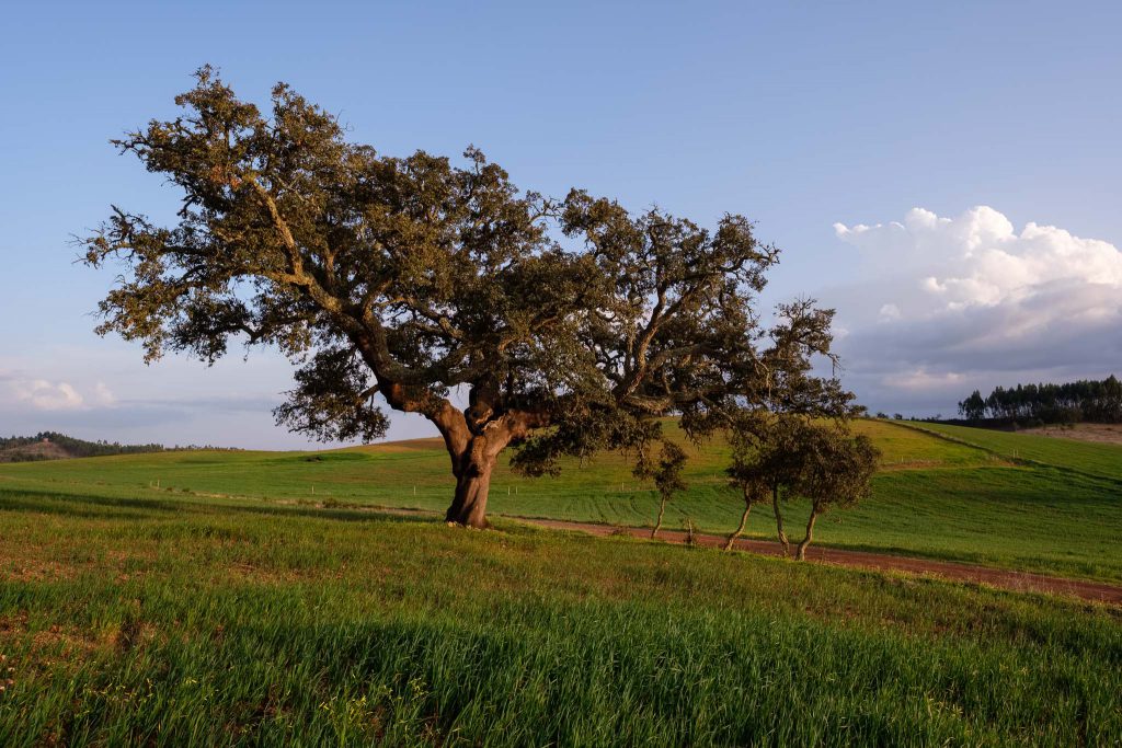
The rest of the walk continues to cross farmland, and I photograph a few more houses and interesting trees along the way. The sunset light imparts a different character to the landscape, precisely what I had hoped for.
Spring crops.Twisted bark.
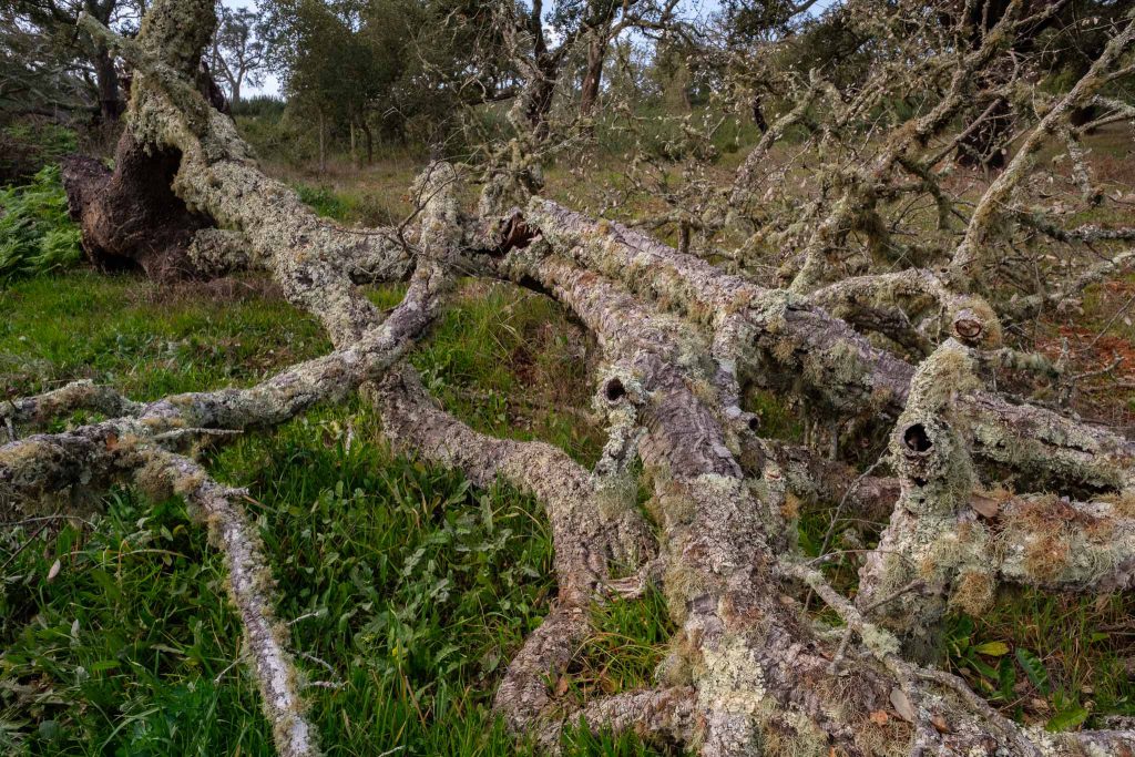
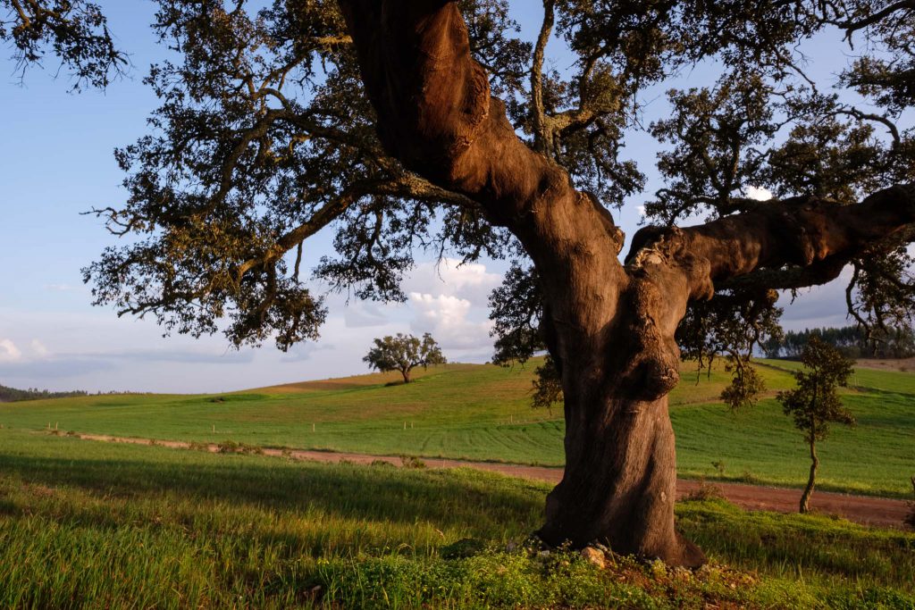
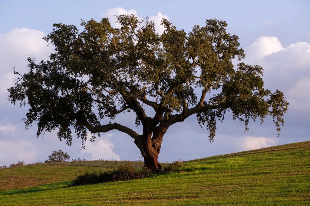
Just before arriving back at Monte da Estrada, there is a nice cultivated area with scattered cork oak trees, and I spent some time photographing it. I try different compositions, such as isolating the trees in the landscape, or moving up close to better show the characteristic rough and twisted tree trunks.
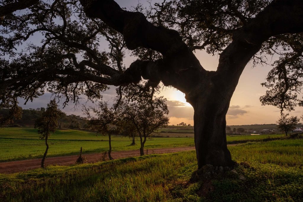
Rural landscape at the end of the day.Cork oak tree.Down to earth.Cork oak tree in silhouette.End of the trail.Lone cork oak tree.Old house.
I had walked this trail last October, when the fields were all brown and dry. A few months later, it was nice to go back and see the change, with the landscape covered in large part by the green of the cultivated fields. I am sure I will go back to this route in the future, every time it offers something different.
In the previous post, I wrote about the wonderful route 23 of Rota Vicentina, that connects the beaches of Amado and Murração. Following the road to the South, near Vila do Bispo, there are many other interesting places to visit and photograph, including Castelejo and Cordoama ( see post linked below).
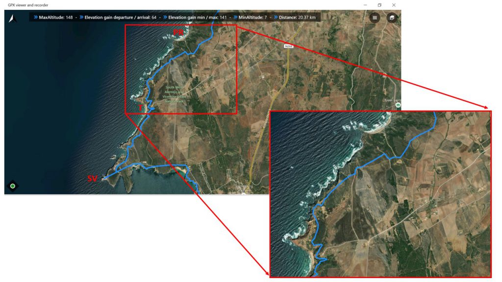
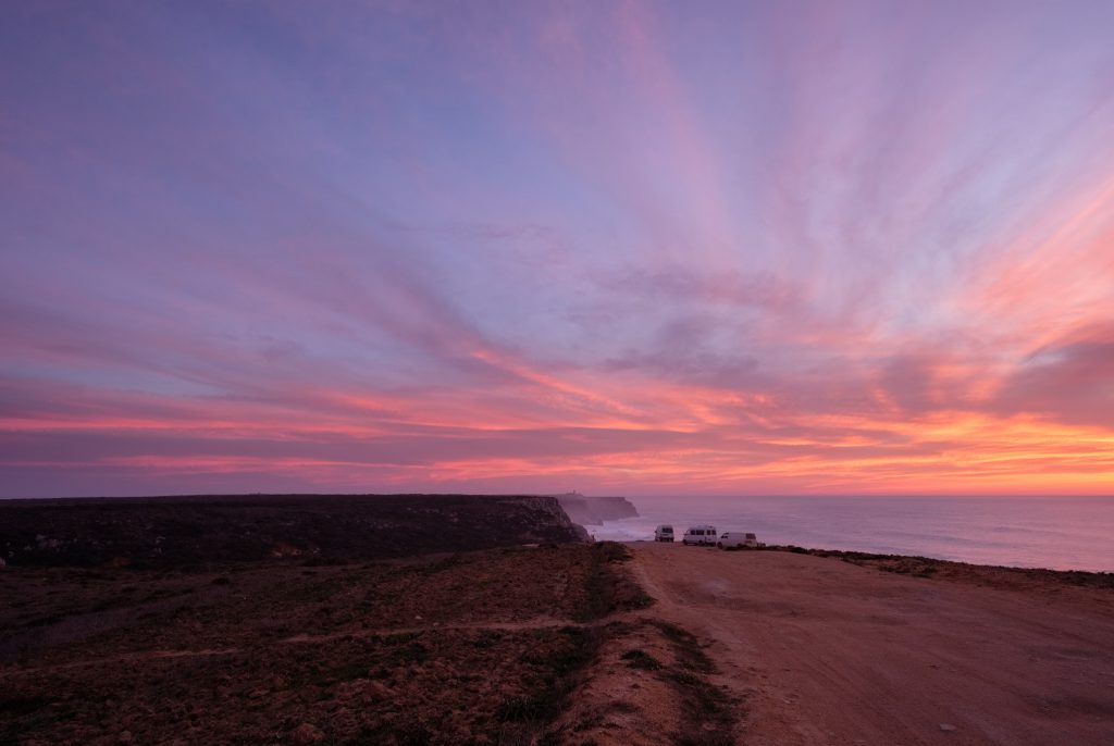
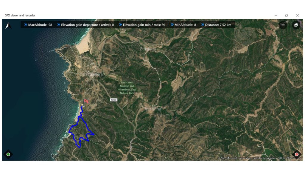
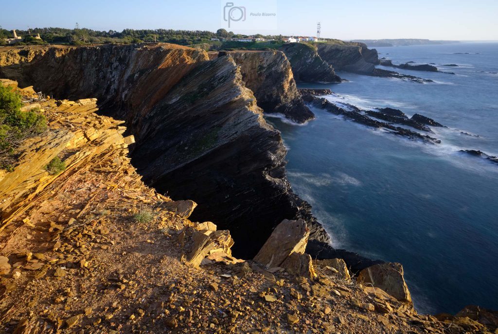
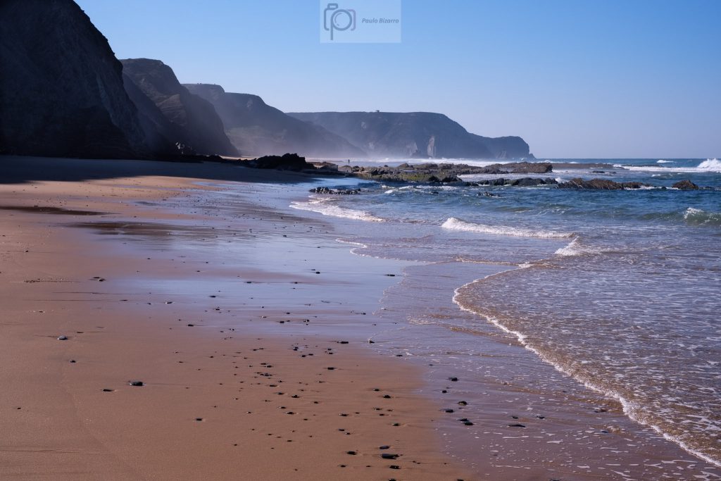
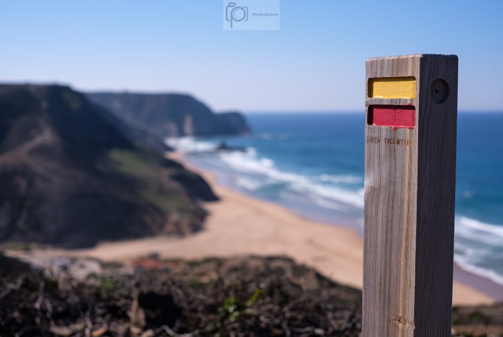
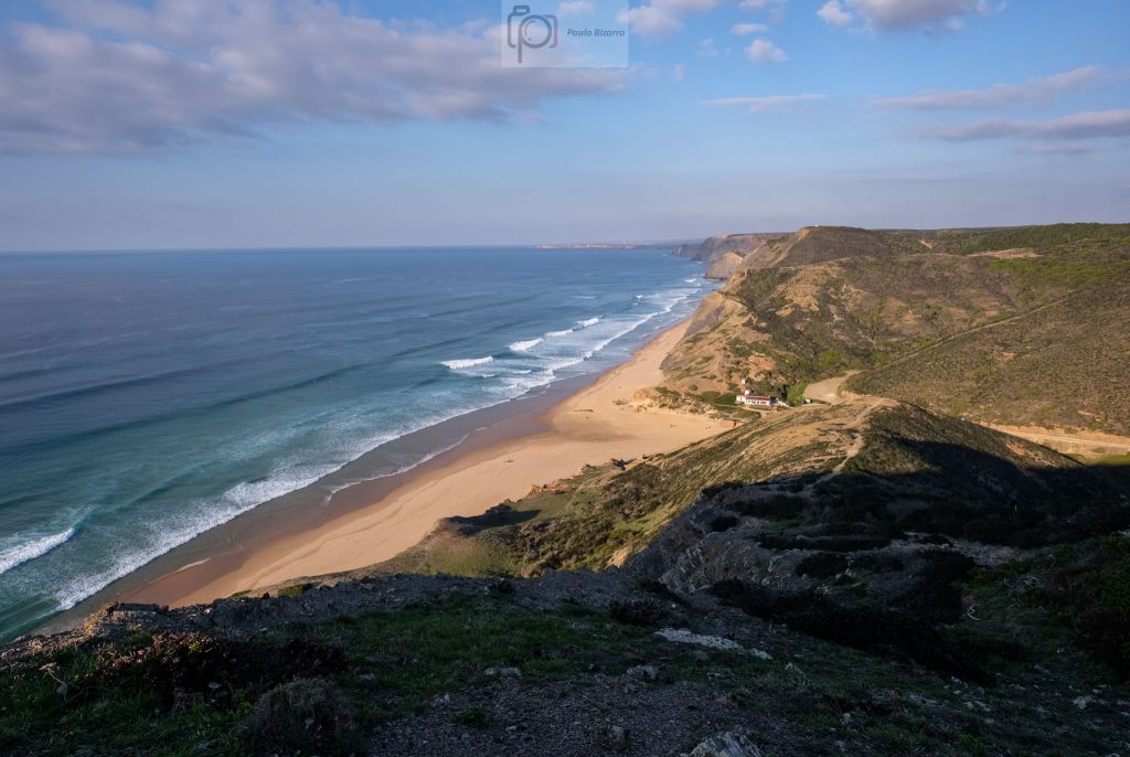
The coastal region between Vila do Bispo and Sagres, to the South of Castelejo beach, continues to be characterized by the same tall cliffs, strong winds and heavy seas. Here and there, small sandy coves hide protected beaches, only accessible by rough roads or by foot. I wanted to visit the area between the beaches of Telheiro and Ponta Ruiva, which are located within a stone’s throw of Cape São Vicente. A general map is provided below for reference.
Location map for the area between Telheiro and Ponta Ruiva beaches. SV – Cape São Vicente/T – Telheiro beach/PR – Ponta Ruiva beach.
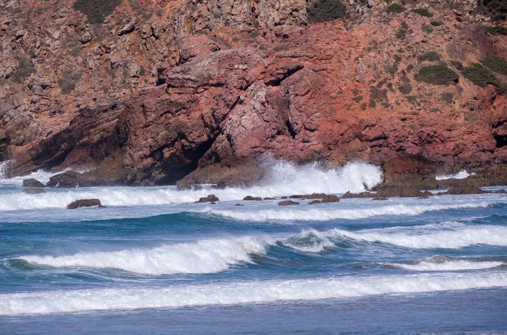
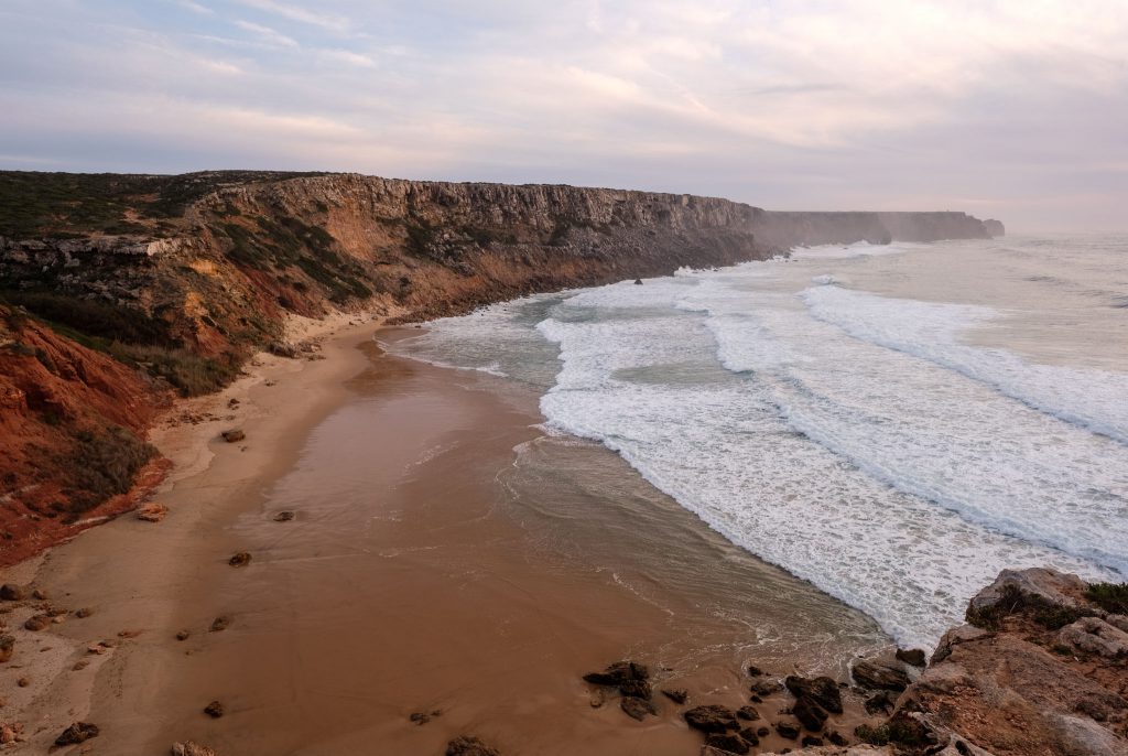
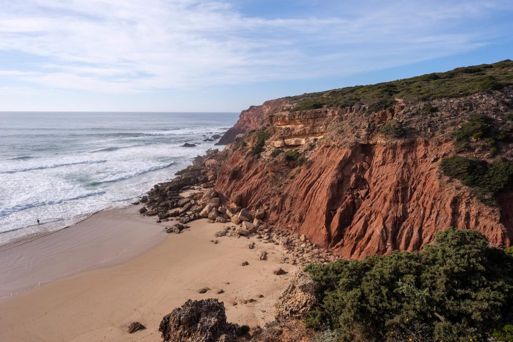
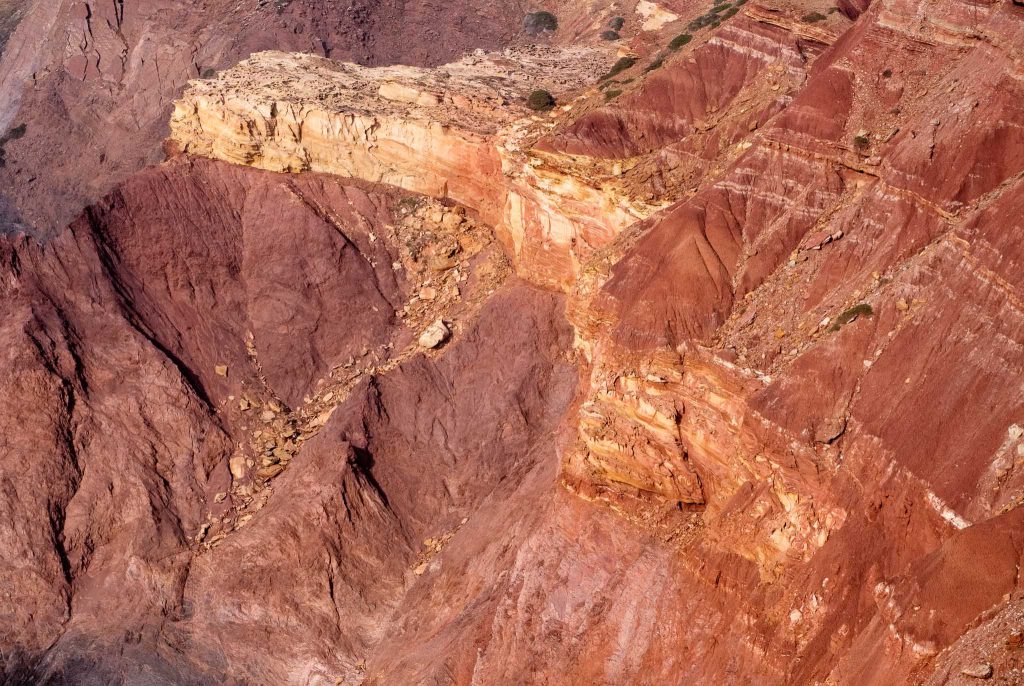
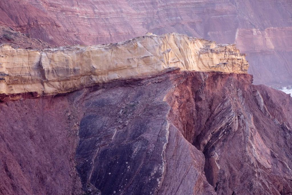
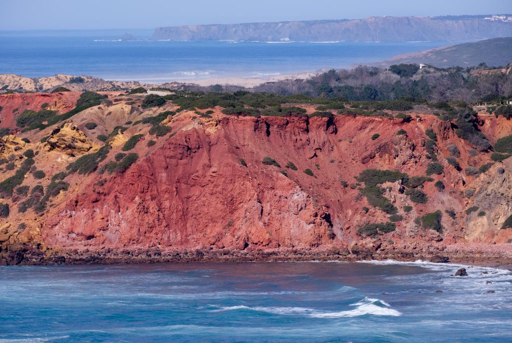
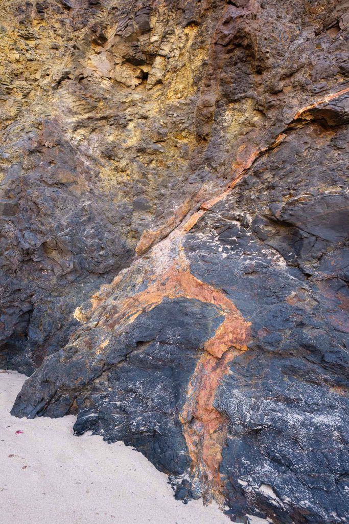
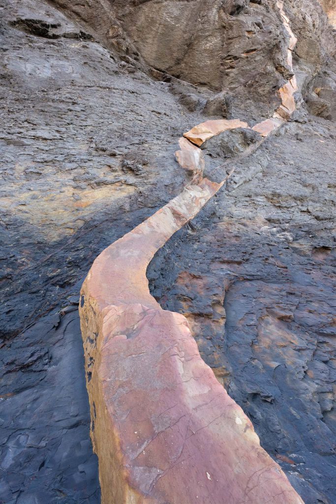
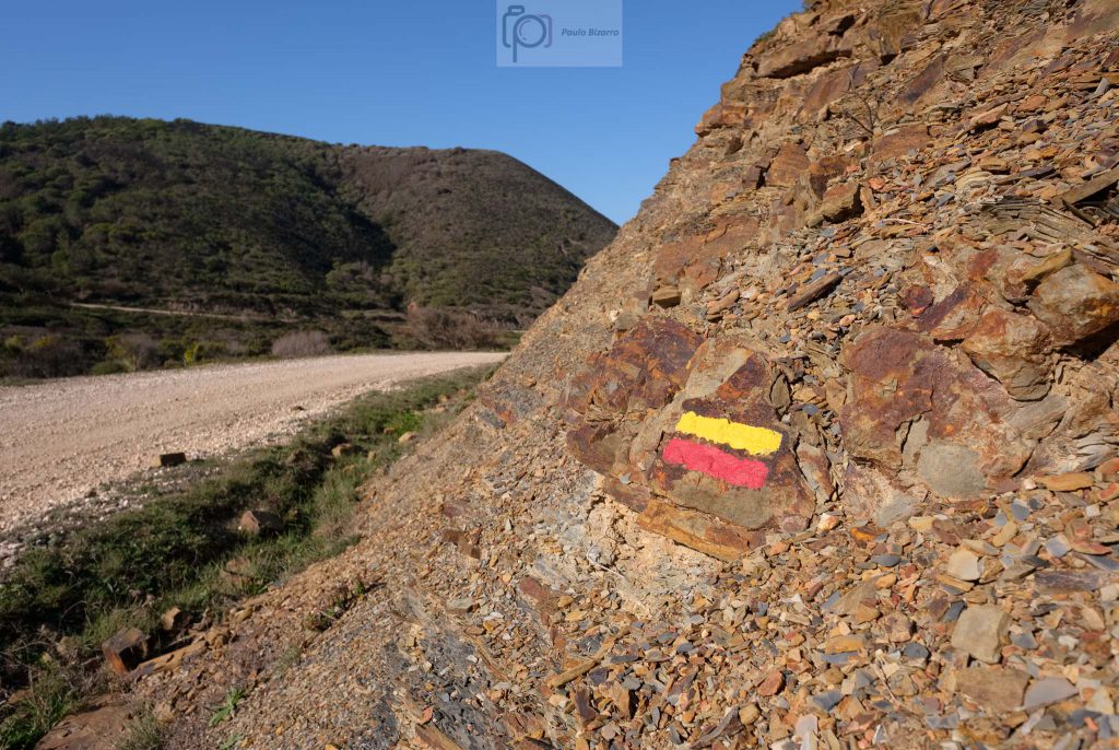
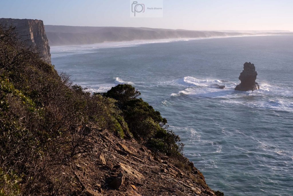
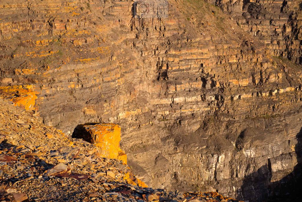
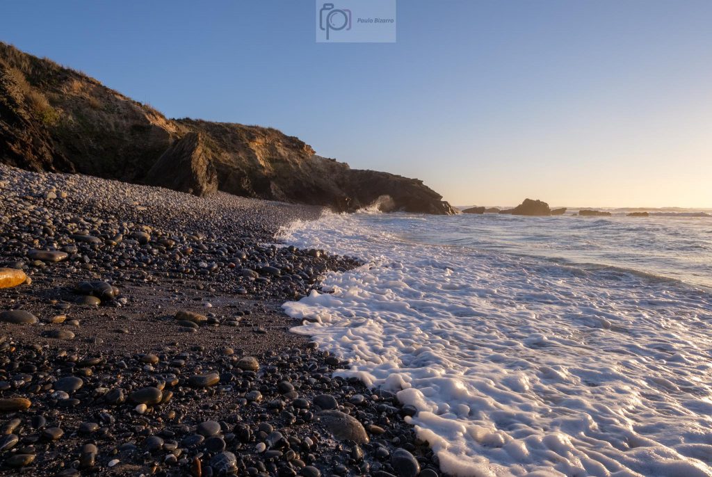
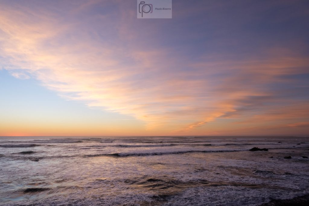
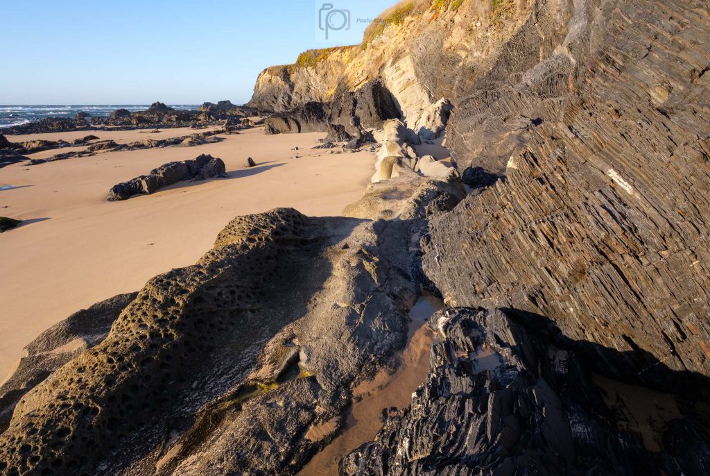
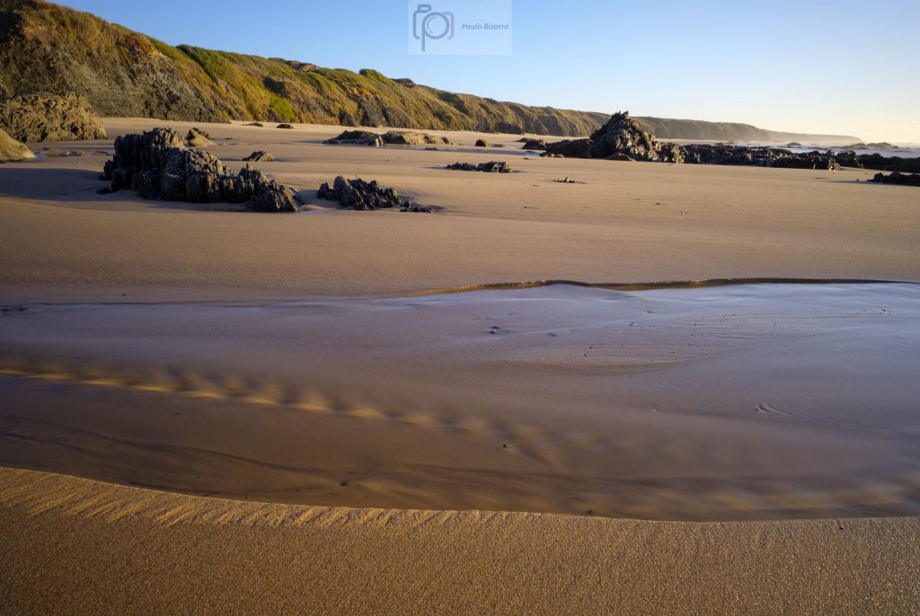
This short stretch of coastline, around 3 km long, holds one of the most famous geomonuments in Portugal. In the Telheiro beach, it is possible to admire a fantastic angular unconformity between the 320 million year old Carboniferous schists and greywackes, and the 200 million year old Triassic red sandstones. The “missing” 120 million years are represented by the unconformity, as the result of the uplift and erosion of an old mountain chain, followed by the deposition of the continental red beds.
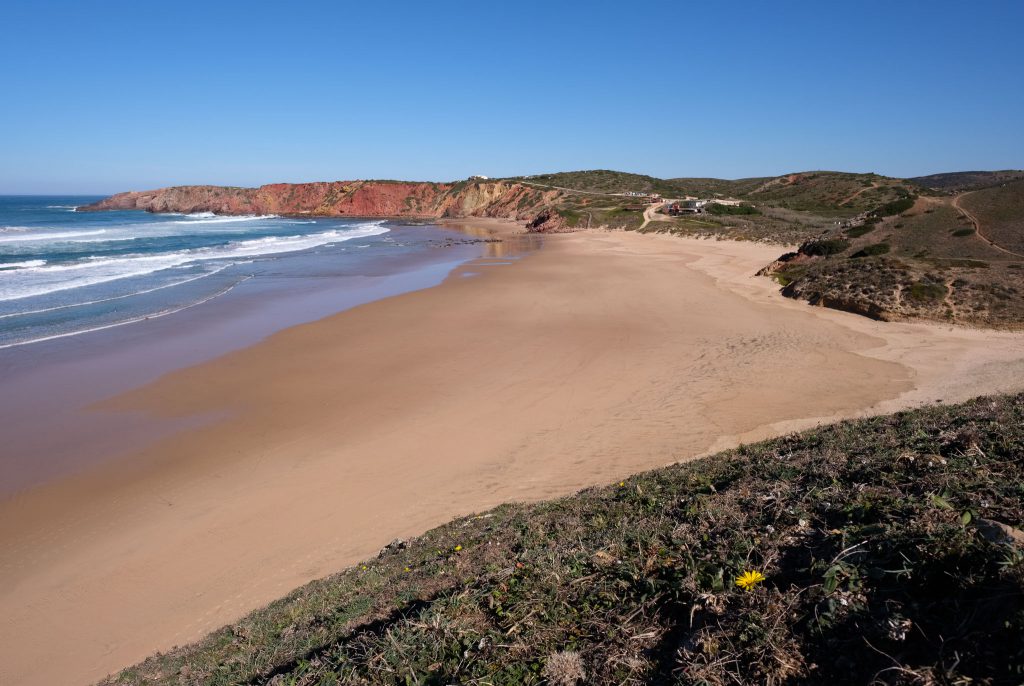
Telheiro beach.
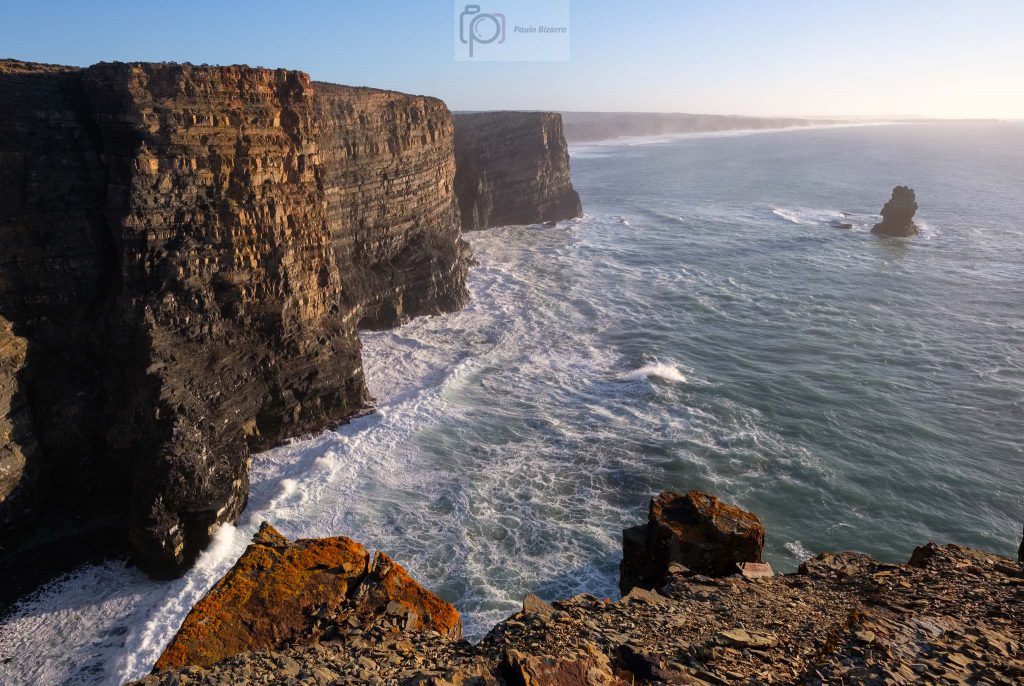
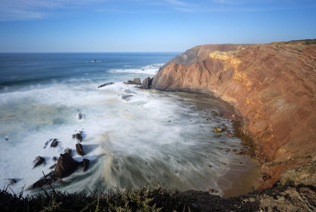
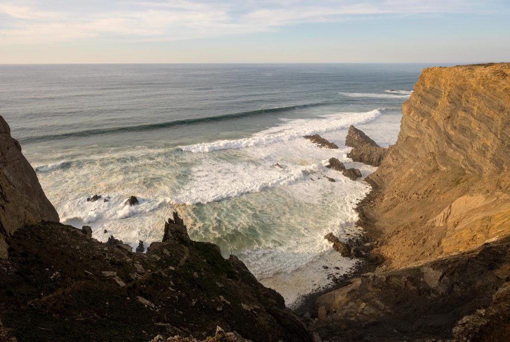
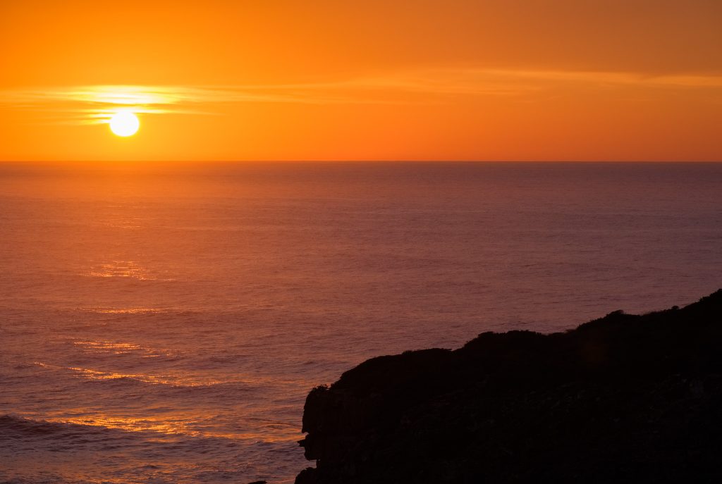
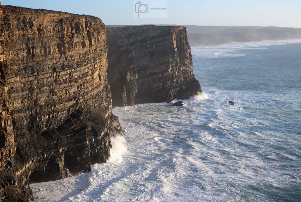
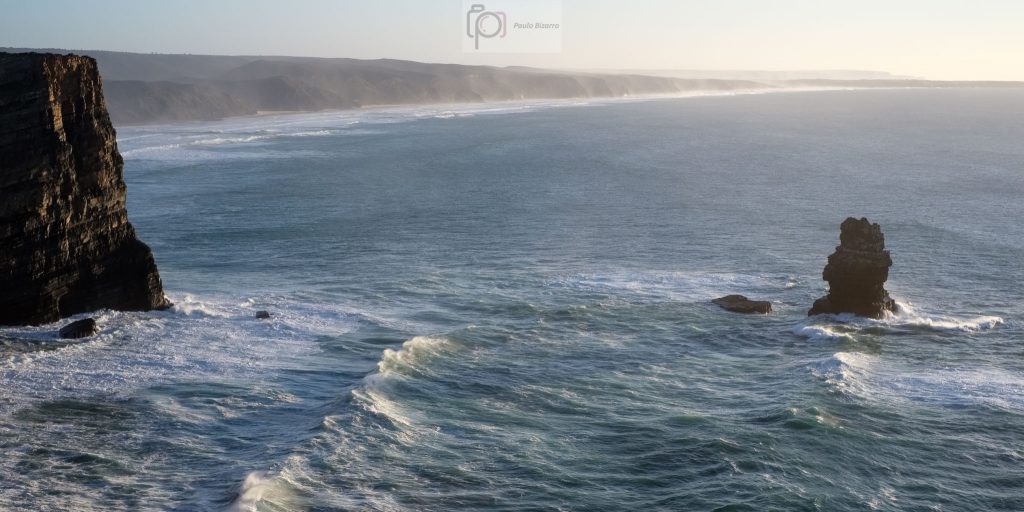
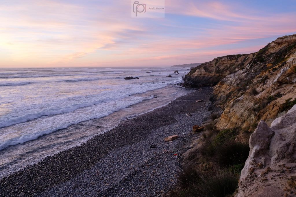
I had around 2 hours before the sunset, so I took my time to explore the area, trying to find some good viewpoints over the rock formations and the coastline. The wind was strong, and the cliffs are about 100 m high, so I had to be careful when approaching their edges. I made a lot of photos, as the views to the North and South were really wonderful.
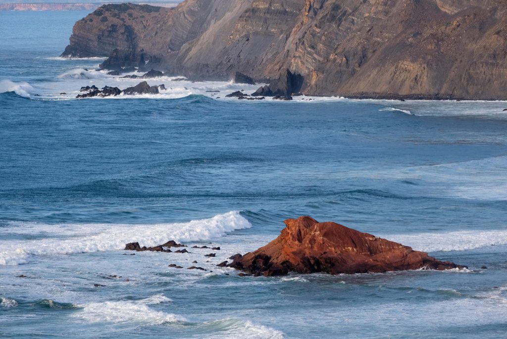
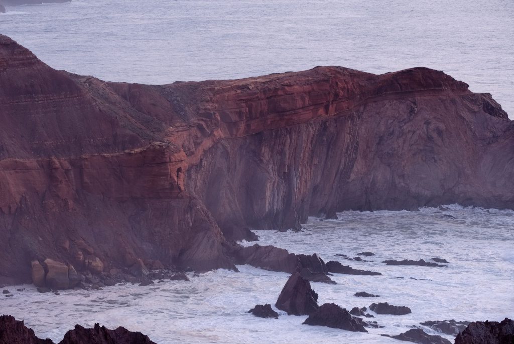
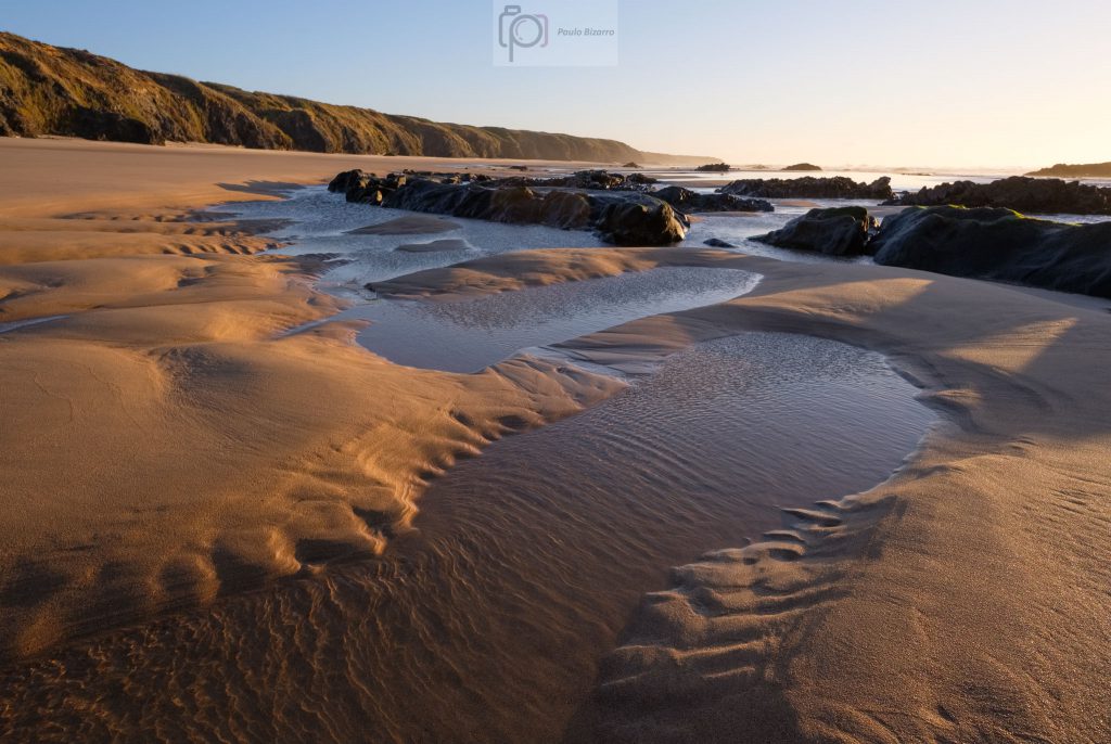
After making a few photos of the unconformity, I walked to Ponta Ruiva beach. The name (Red Point) comes from a peculiar outcrop of red rock, which provides a nice contrast with the surrounding formations. Along the way, there are many interesting view points from where to photograph. With the approaching sunset, the quality of the light was improving, bathing the area with golden hues.
Folded rocks are everywhere.Looking North towards Ponta Ruiva.Ponta Ruiva.Geological coastline with the unconformity.
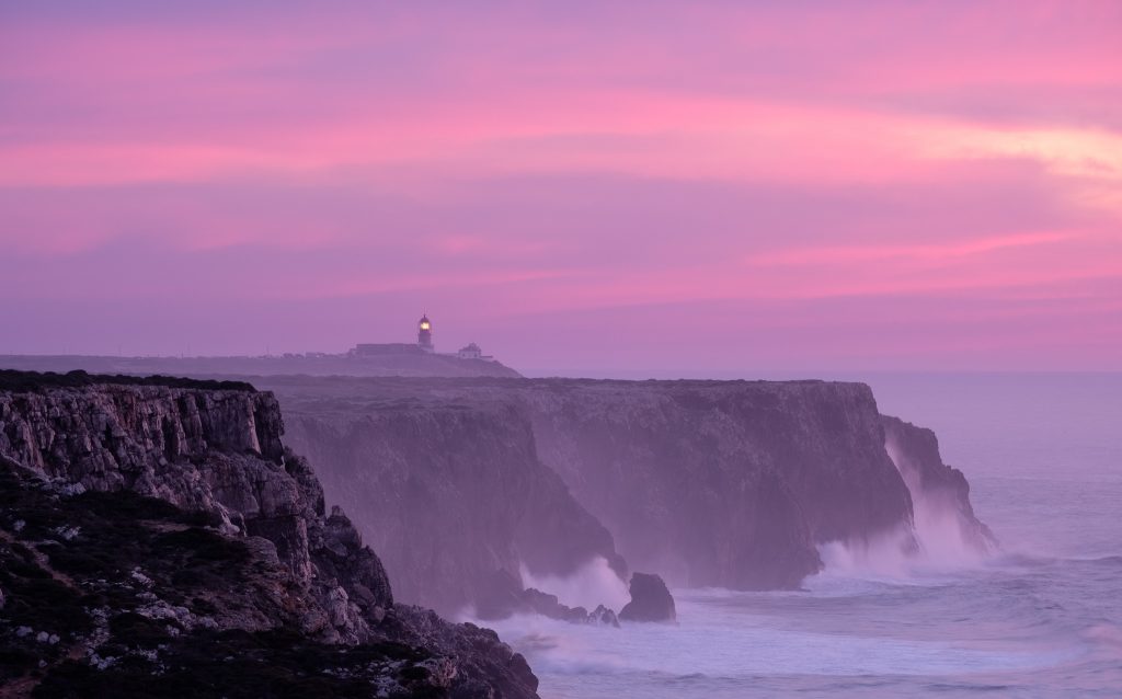
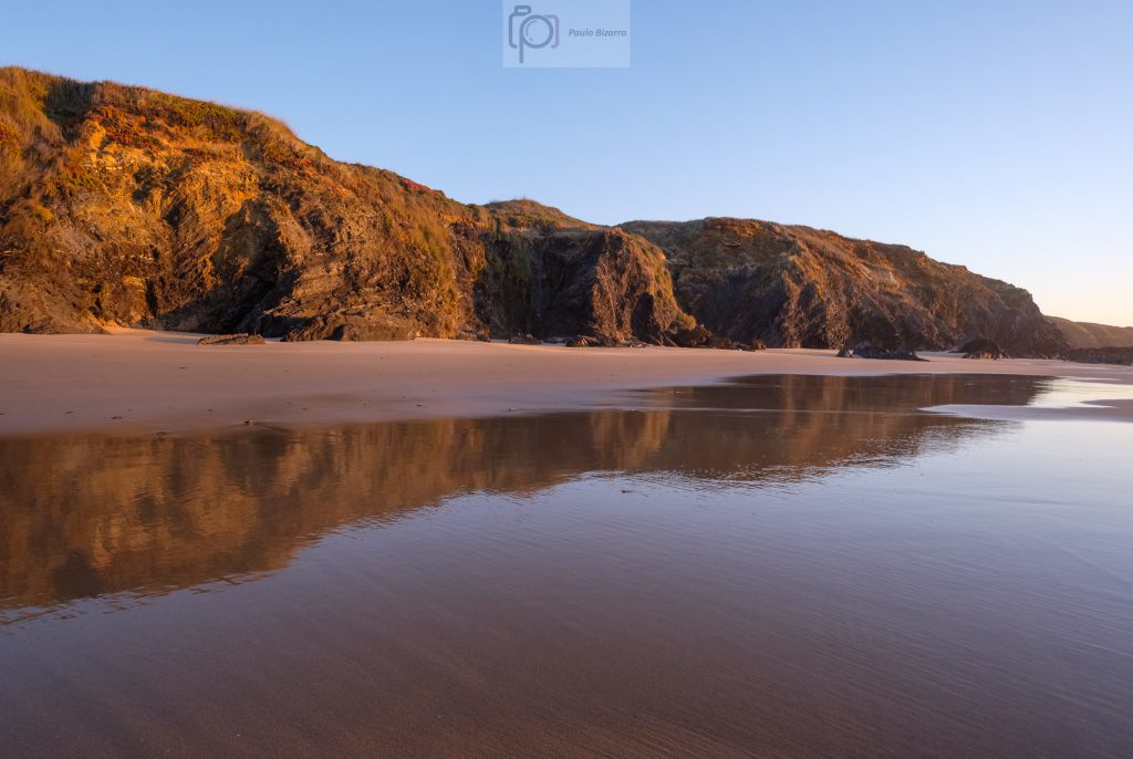
At the end of the day, after returning to Telheiro, I also had the chance to photograph the lighthouse of São Vicente in the distance. Together with the nearby Sagres promontory, this region has a special meaning in Portuguese history and the Age of the Discoveries.
It was a very nice way to finish the day, admiring the incessant waves crashing against this majestic coastline. In terms of photo gear, I used mostly the Fuji 14mm wide-angle and the Fuji 70-300mm telephoto lenses. They provide a lot of flexibility, covering both the wide vistas and the close-ups of the distant details.
This walking trail connects the beaches of Amado and Murração in the Vicentina coast of southwest Portugal, just south of Carrapateira beach. It is a short circular route, but it crosses some of the most beautiful and characteristic zones of this region, including steep terrain, deeply cut valleys, and wild beaches. A location map is shown below.
Location map for route 23 of Rota Vicentina (in blue).
After parking the car in Amado, the trail crosses the beach in a southward direction. This is a very popular beach with surfers, who frequent it all year round. The beach is large, and has some very colorful red and yellow rocks on its northern cliffs. As a side note, besides the natural beauty of the scenery, there are many interesting geological features to observe along this walk.
Amado beach.Colors in Amado beach.
The day was sunny, but with strong winds that are typical of this coast. Leaving Amado behind, the trail starts to climb into the surrounding hills. These have a rounded topography and are covered by short vegetation that clings to the rocky soil. Even though it is wintertime, rainfall has been very scarce, so everything looks a bit dry. In fact, this has been one of the driest winters in Portugal since there are records.
Amado beach from the top of the hill.
After a few kilometers, the path meanders up and down through steep terrain, crossing a couple of deeply cut valleys and ravines. Even though we are very close to the sea, the sound of the waves does not carry inland. Before arriving at Murração beach, there is a steep ascent up a narrow footpath, at the end of which lies an abandoned house.
The hills around Murração.Old house on the trail.
From here it is an easy walk down a rural road to the beach, but I recommend getting off the track for a while, and make your way to the top of the cliff that overlooks Murração. The view over the coast is wonderful, including Murração, Amado, and Carrapateira.
Murração beach.Murração beach.
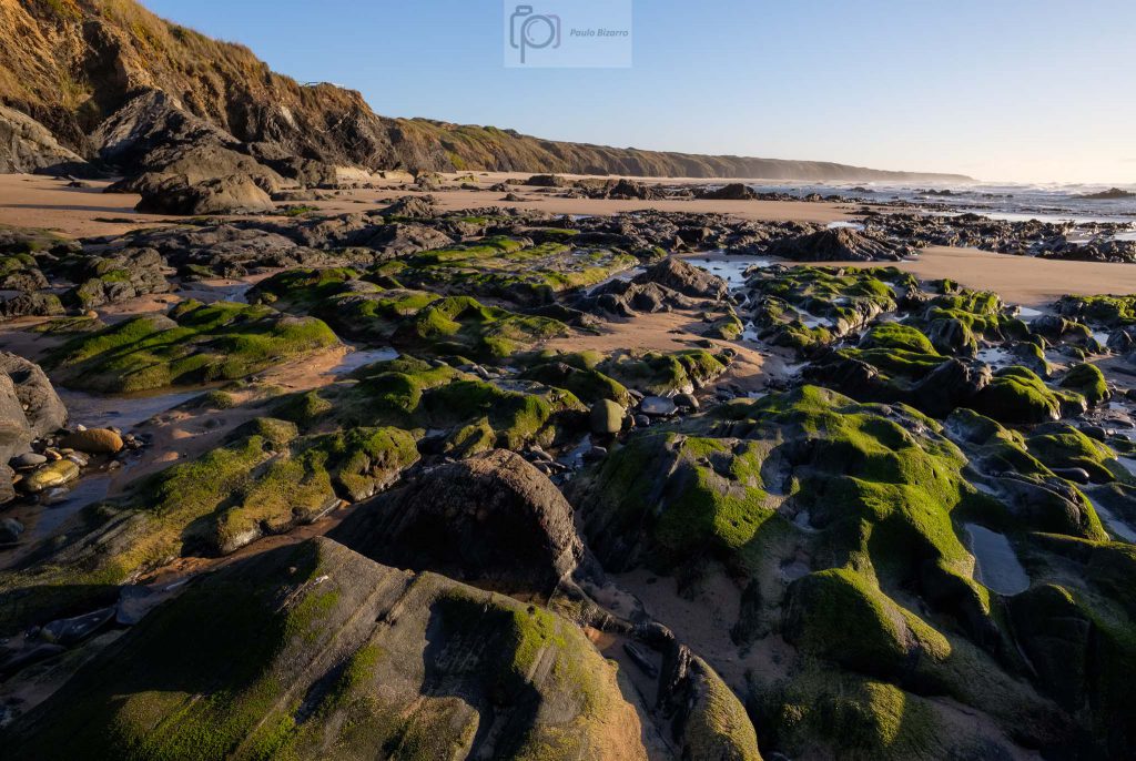
As I mentioned before, there are many interesting geological features in the area, especially in Murração. If you can, spend some time in the beach looking at these dark Carboniferous rock formations, that have been folded and compressed about 300 million years ago. Also noteworthy are the abundant volcanic dykes that have intruded these host rocks, and provided an interesting color contrast along the cliffs.
Volcanic dyke.Volcanic dyke.Folded and stretched.
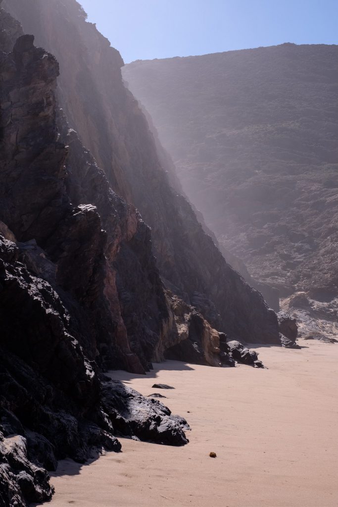
This beach is also an excellent spot for a picnic lunch. A few people were also around, even risking a dive in the cold and rough sea. As I was lying down resting for a while, the Sun started to illuminate the vertical cliffs, adding a nice effect of hazy light and local mist.
Braving the ocean.Misty light from above.Murração beach.
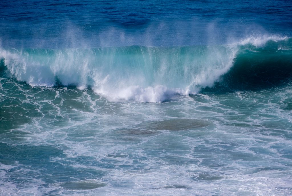
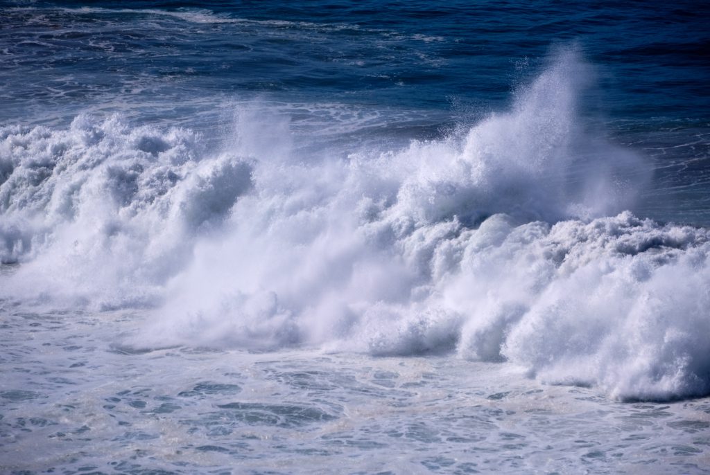
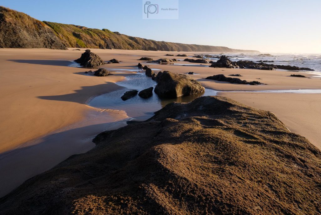
From here on, it is an easy walk back to Amado, with more opportunities for photos along the way. The sea was rough with some nice waves, so I spend some time trying to catch some in camera. The view looking southward is also very scenic, with the tall black cliffs adding a lot of mystery.
Murração beach.Waves.Waves.Murração beach.
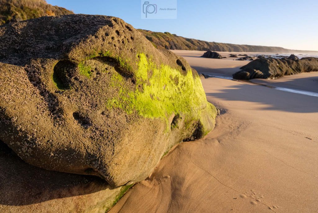
After a while, I was back at Amado beach, where I made a few more photos. On the southern part of the beach there are some interesting sand dunes. You do need to pay attention to the tide if you want to venture closer to the cliffs and tidal pools.
Amado beach.Amado beach and incoming tide.Amado beach.
This is another wonderful trail walk that crosses beautiful hilly and coastal regions, that are so typical of the Vicentina coast. It is a short distance, but there are plenty of interesting things to see and photograph. Speaking of photography, for this walk I carried more than my usual Fujifilm kit: 3 cameras and 3 lenses, from wide-angle (14mm) and standard (35mm) to a telephoto zoom (70-300mm). This was because I knew I would use them all, given the variety of subjects. Still, all the gear fitted nicely in the bottom compartment of my backpack, leaving the top compartment for food and drinks.
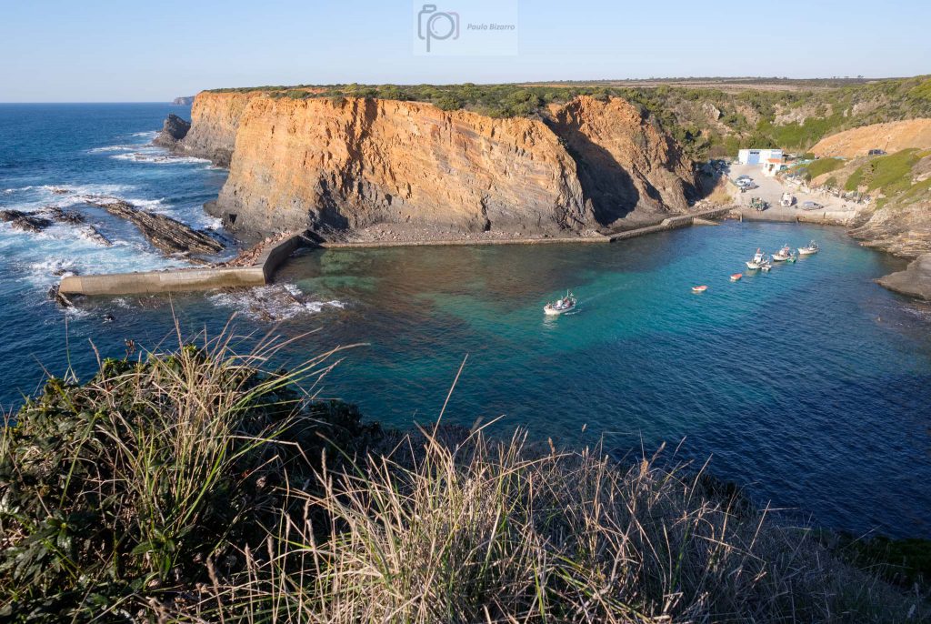
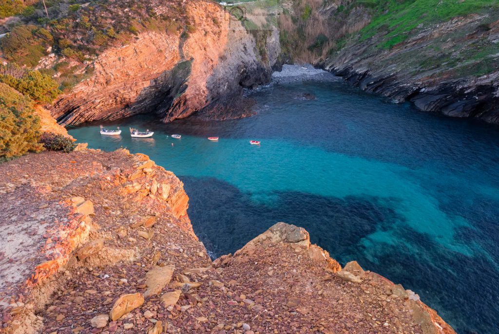
Along the southwest coast of Alentejo, in Portugal, there are several small fishing harbors that are still used today by local fishermen. The livelihood of this region is still based on two main activities: farming and fishing. These harbors provide shelter for the small boats that venture in the coastal areas when the weather conditions permit. On a recent sunny afternoon I visited the Entrada da Barca harbor, which is located close to the town of Zambujeira do Mar.
This is a very picturesque location, with nice views from the top of the cliffs. After making a few photos, I walked all the way down to the water, exploring the little bay. There were a few boats in the water, plus other ones on the concrete landing. I had with me a new lens, the Fujinon 70-300mm f/4 – f/5.6 zoom, which I wanted to try out. My preference when photographing in the area is for wide – angle and standard lenses, but a telephoto zoom is also very useful to photograph details and subjects that are far away. After this initial tryout, my conclusion is that the lens is very good and will be a valuable addition to my kit.
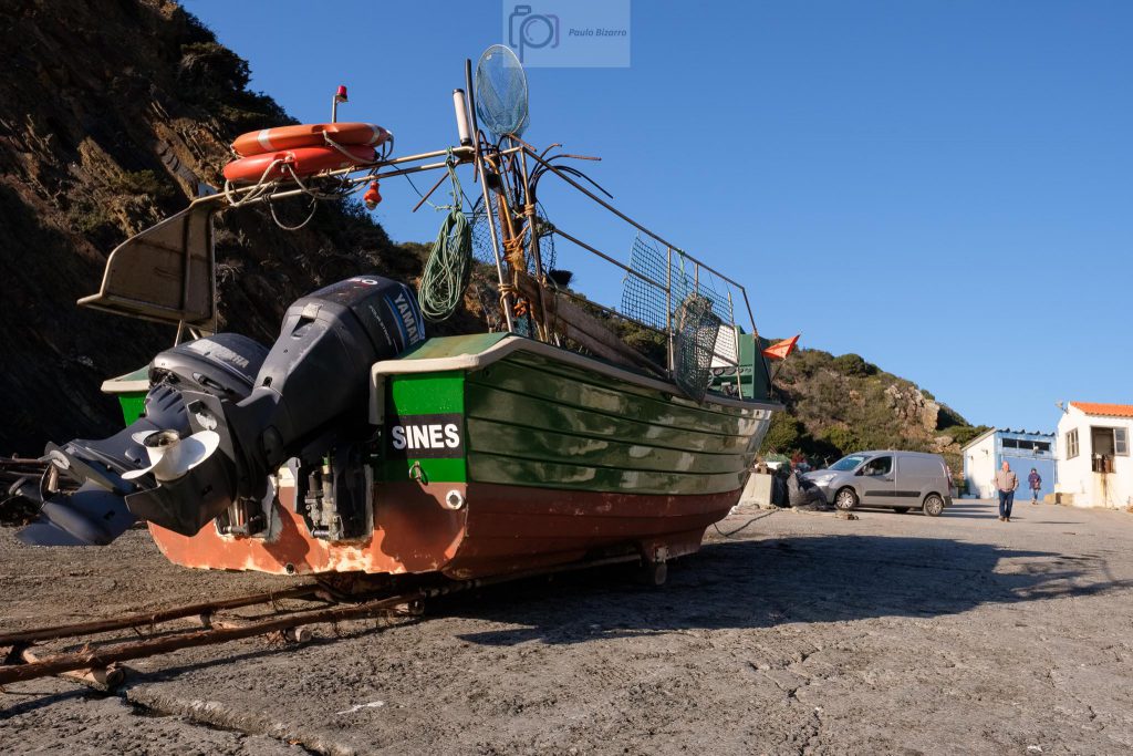
General overview of the fishing harbor of Entrada da Barca.Fishing boat.
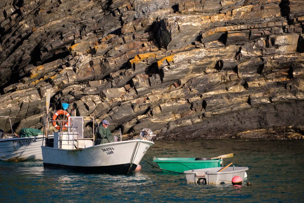
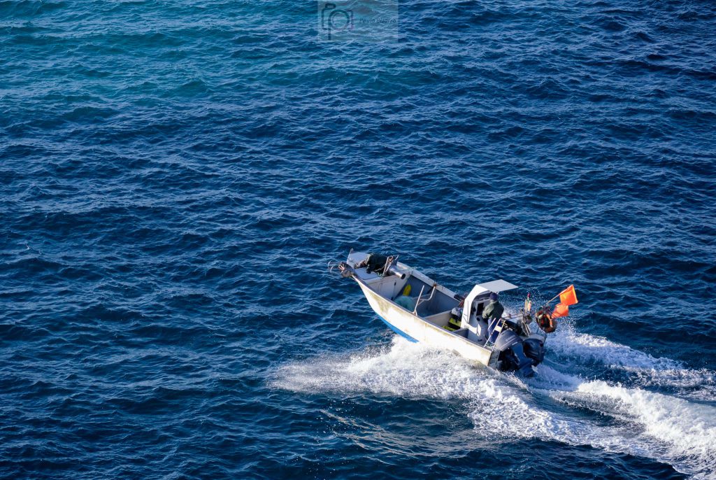
I walked along the concrete pier that was built to protect the harbor from the sea. Once you reach the end of it, you can appreciate the transition between the sheltered area and the open water. I admire the fishermen that regularly go out into the ocean in these tiny boats.
Getting ready.Going out.
After a while I left the harbor and walked along the coastal path, which climbs the northern face of the small bay. This path belongs to the Rota Vicentina trail section that connects the towns of Zambujeira do Mar and Almograve, about 20 km away. The weather was clear and sunset time was approaching, bathing the coastal cliffs with a golden light. It is interesting to see the succession of small coves formed by the erosion of the rocks.
Looking south towards Zambujeira do Mar.
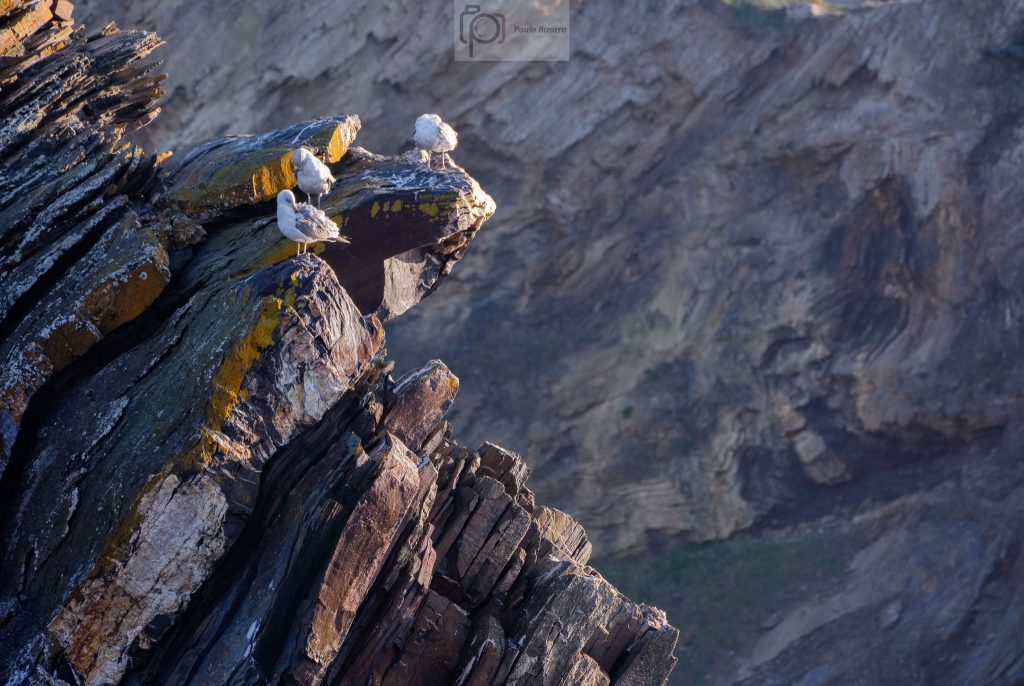
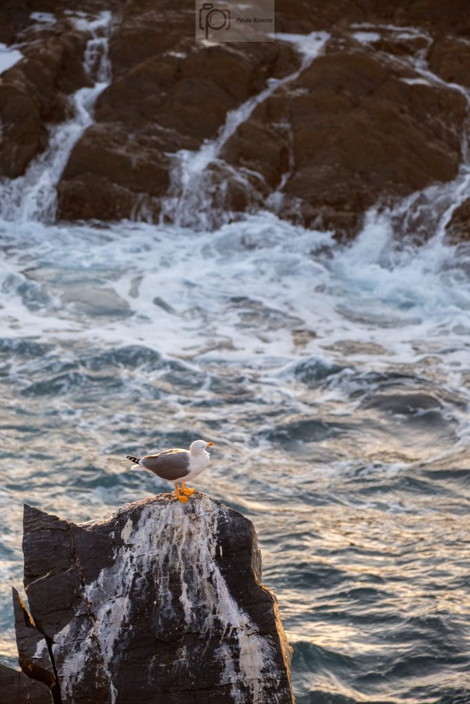
Walking along the trail, I chose a few spots that provided views over the coast, set up the tripod, and took a few more photos. The silence was only disturbed by the seagulls and the waves below. I use the telephoto zoom to photograph the distant bird nests, and also some of the cliffs, to highlight the layered nature of the rocks.
Seagulls.Seagull.Coastal cliffs.Looking north along the coastal trail.The harbor at sunset.
At the end of the day, enjoying the sunset, I was happy with this small walk in the area, where there are so many interesting aspects to explore. If you want, you can even stay longer and have a nice dinner in the typical restaurants near the harbor, where you can taste the fresh fish that was probably captured in the waters below.
The Vicentina coast in southwest Portugal is considered one of the remaining “wild coasts” in Europe. Together with the Alentejo coast to the north, it is part of a Natural Park. I wrote about it before, for example in this previous post from April 2021:
This coastal region is famous, amongst other things, for its beaches (many of them only accessible by footpaths or 4WD vehicles), the majestic tall cliffs dropping into the ocean, and the many species of birds. It is also very popular with surfers, who visit the area all year round. There are several walking paths that belong to the Rota Vicentina network, which are one of the best ways to explore the region. I have recently walked along route 24, a circular trail path the connects the town of Vila do Bispo to the coast and back. Along the way, it is possible to visit some of the most beautiful beaches in the area, like Barriga, Cordoama, and Castelejo. The distance is 15.5 km, which takes around 5 hours to walk at a normal pace.
Map showing trail number 24 of the Rota Vicentina (in orange color).
I normally do not carry much photo gear in these walks, but this time it was different. I knew I was going to need a wide-angle lens, besides my normal standard lens. I also wanted a tripod, for some late afternoon shots. So I packed my Fujinon 14mm and 35mm lenses, plus the Fujifilm X-PRO3 and X-T30 cameras. Still, the whole gear was still pretty light and fitted in my trekking backpack nicely.
The landscape in this coastal area is characterized by a large plateau at around 120 m above sea level. However, this flat terrain is a bit misleading, because there are several creeks that have, through time, cut deep and narrow valleys in the topography. The first few kilometres of the trail cross this plateau, along rural countryside, and where the vegetation is short. The winds are strong here, so the trees do not grow very tall. Pine trees and shrubs are common.
The countryside, and the sea in the distance.
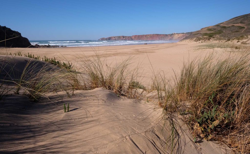
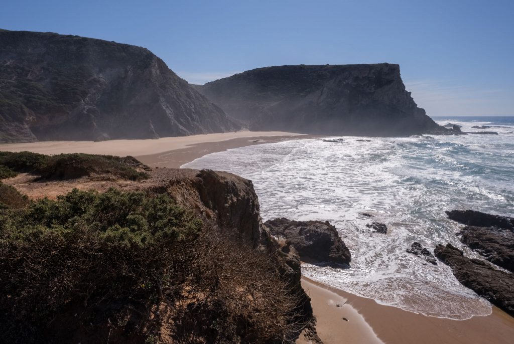
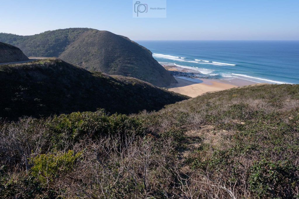
After a while, the path turns westwards, towards the sea, before arriving at Barriga beach. This part of the walk is wonderful, as the coastal plateau abruptly descends to the beach. The vertical cliffs are made of black Paleozoic rocks, in strong contrast with the light colored sand and the deep blue of the ocean water.
View of Barriga beach.Along the trail.On the Barriga beach.
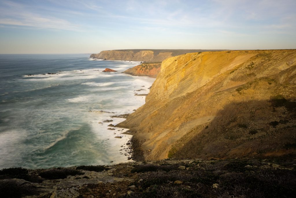
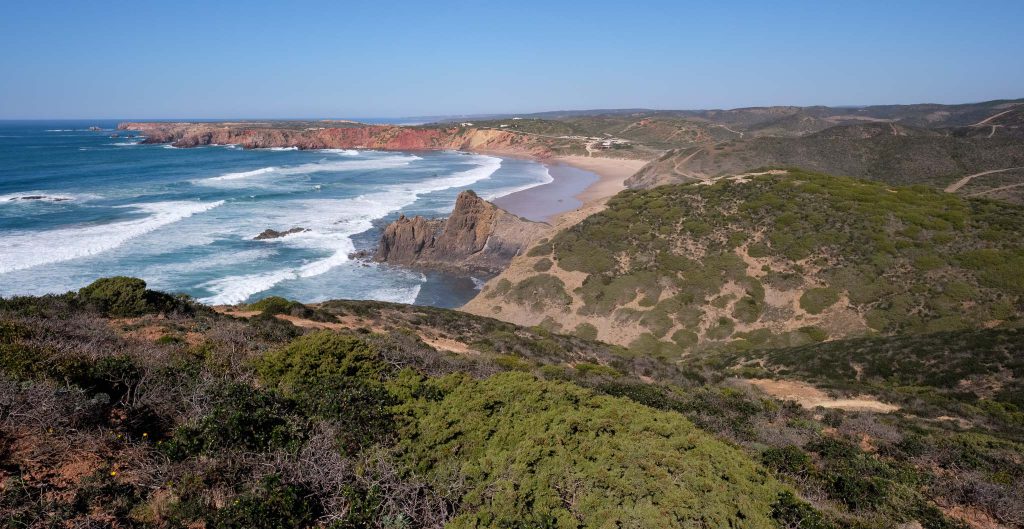
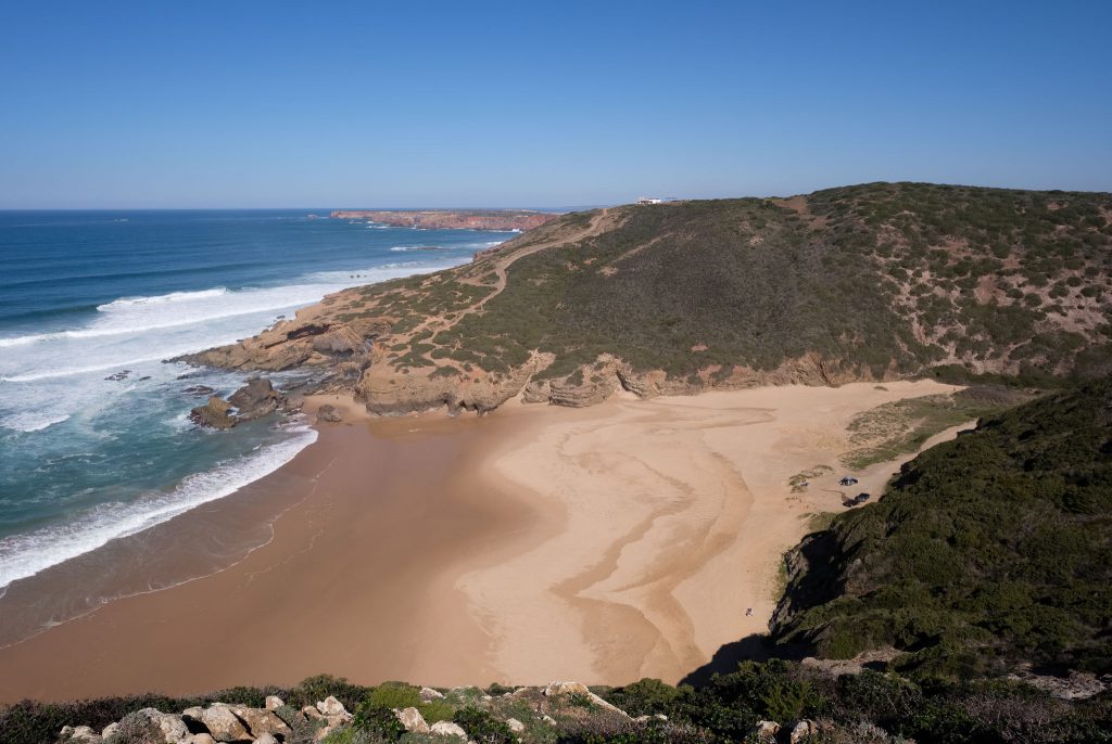
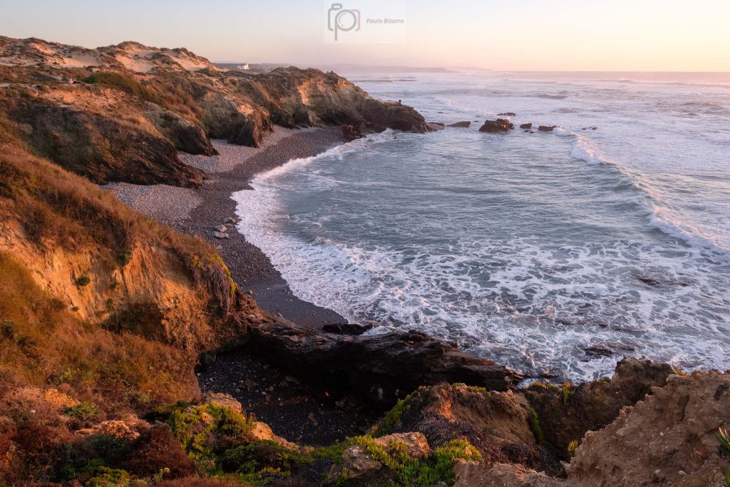
When the tide is low, it is possible to walk from Barriga to Cordoama, as the beaches are connected. But today I wanted to keep to the trail, so after visiting Barriga, I turned back inland. This was the first steep ascent in the walk, going back to the top of the plateau, but the view is wonderful. One of the highlights of this route is when the path reaches the coast again, affording a fantastic view of Cordoama and Castelejo beaches to the south, and the Carrapateira headland to the north.
Trail marker at the top of the Cordoama cliff.View of Cordoama beach from the top of the cliff.The trail reaches the coast at Cordoama.Tall cliffs, small people.
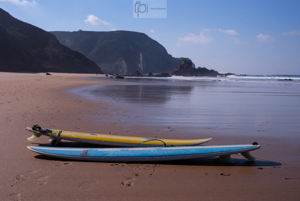
The beach is a good place to rest and have a picnic lunch. A few surfers are around, trying the waves. This is a long stretch of connected beaches, which in the past was only accessible by dirt roads. Today, there are narrow tarmac roads that start in Vila do Bispo and come to Cordoama and Castelejo.
Surfboards.
From here, the trail goes up again to the top of the cliff, in a steep ascent. There are some rough parts with loose rocks, so be careful. Once in the top, you will be in the Cordoama viewpoint, where there is a small car park. My plan was to complete the trail and come back at sunset for a few more photos. From this point onwards, the walk is easy, leaving the tarmac road a few hundred meters away, to cross the Castelejo pine forest. This part of the trail is also nice, because this forest is a preserved area, with relevant local fauna and flora species.
The town of Vila do Bispo at the end of the route.
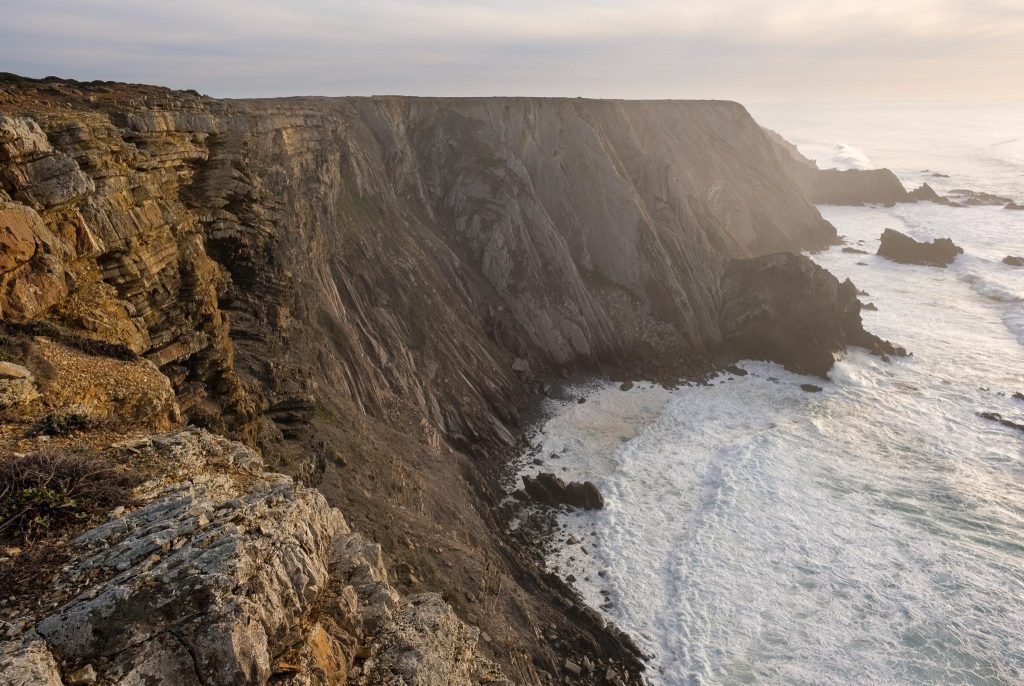
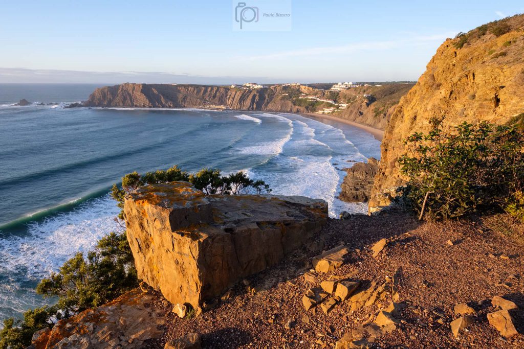
Returning to Vila do Bispo, I rested a few minutes in the nice café near the market. If you are hungry I can recommend a local delicious pie, made with three regional ingredients: carob, figs, and almonds. After this resting stop, I drove to another local landmark, Torre da Aspa, the highest place of the Algarve coast, at 140 m above sea level. You need to drive along a dirt road, which may not be in a very good condition, so after a while I parked and decided to walk. It is an easy walk, so soon I was again looking at the ocean below. There is also a curious abandoned house, which belonged to the coastal police a few years ago. I explored the area for some time, being careful when approaching the edge of the cliffs. In several places, there is a sheer vertical drop into the sea.
Coastal cliffs neat Torre da Aspa.Coastal cliffs near Torre da Aspa.
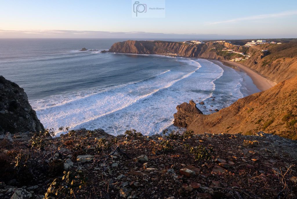
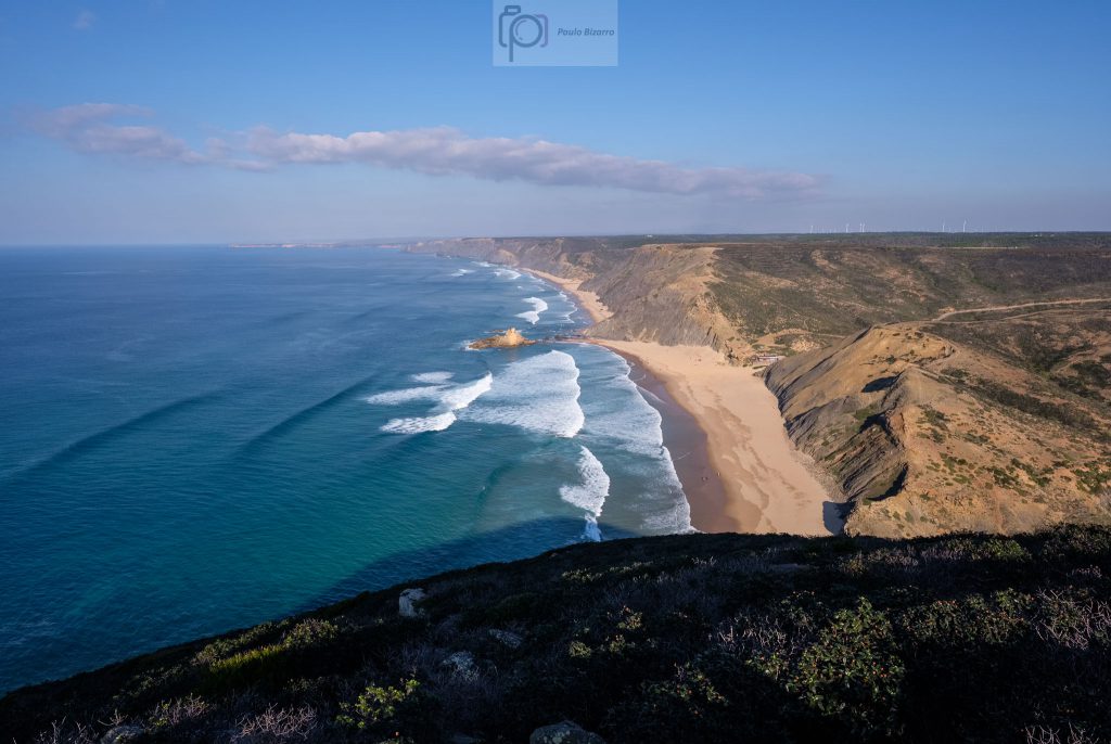
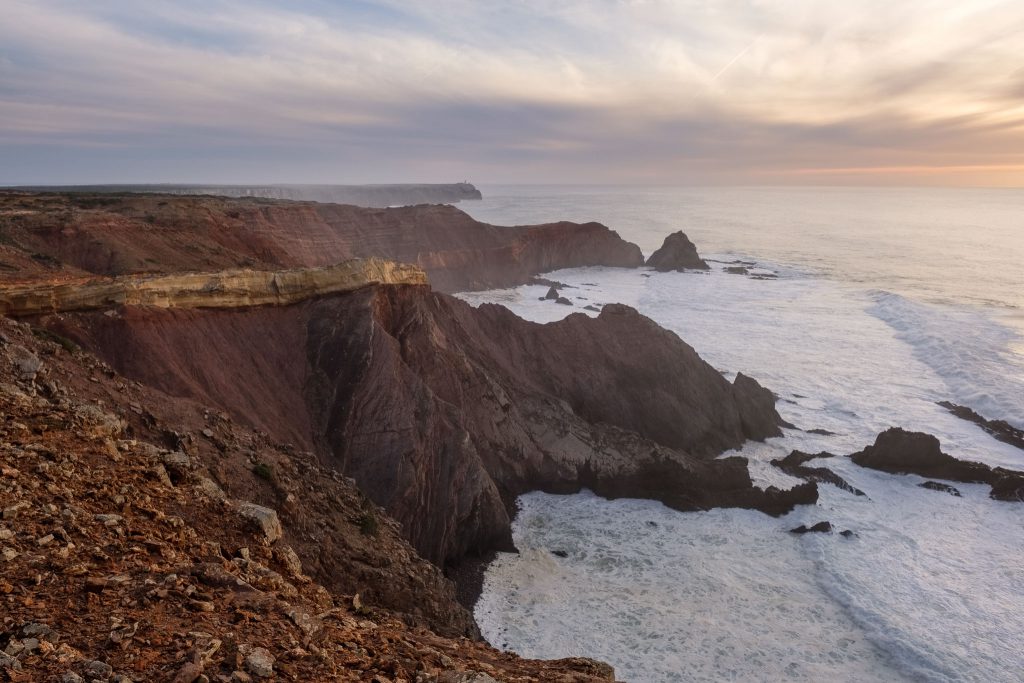
From this location, if you look south, you will see the Sagres headland, with the lighthouse of Cabo São Vicente, and the Sagres fort. From here, facing the endless ocean, Henry the Navigator coordinated the beginning of the Age of Discoveries many centuries ago. Looking north, I saw below the better part of the iconic Vicentina coast. It is a wonderful place to spend some time enjoying the view, and to use your binoculars if you have them. You will even be able to see the Arrifana beach about 30 km to the north. It was funny to realize that I was above the cliffs that I had crossed earlier, during the trail. In fact, it was possible to see the entire area that I had walked earlier.
View of Cordoama beach from Torre da Aspa, the highest point in the Algarve coast.
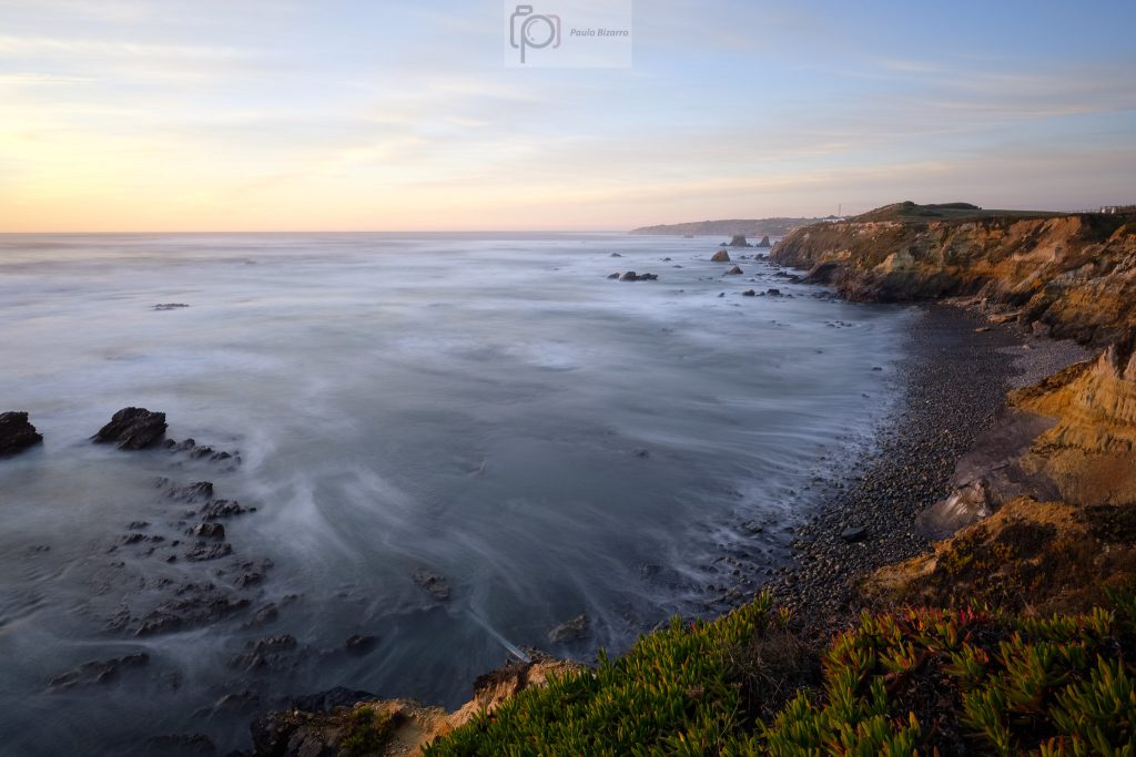
I still wanted to catch the sunset at the Cordoama viewpoint, so I returned to the car and drove back there. During the last couple of hours, a few clouds had appeared, which added interest to the sky in the photos. At the end of the day, I was happy to have visited this region again, and for sure I will be back to walk a few more trail routes.
The Arrifana beach, located in the municipality of Aljezur in Portugal’s southwest coast, is one of my favorite places to visit and photograph. Over the years, I have returned many times, during all seasons. The beach, located in a large bay surrounded by tall dark cliffs, is really beautiful. As many other beaches along this coast, it is popular with surfers all year round, thanks to its waves.
During a recent visit, I wanted to photograph the beach from the top of its southern cliff, which can only be reached via some narrow dirt trails that diverge from the main Rota Vicentina route that passes nearby, connecting the towns of Aljezur and Vila do Bispo. After leaving this route, I explored the area in the top of the cliffs overlooking the ocean, trying to find some nice view points. The weather was good, with blue sky and some clouds.
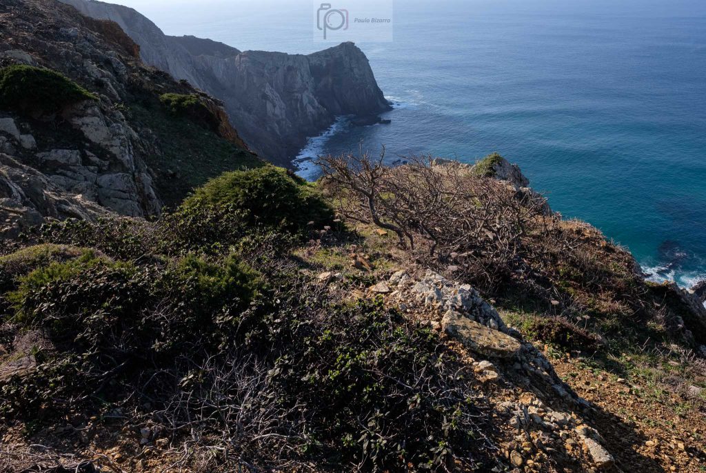
After walking up a steep hill, I was rewarded with wonderful views not only towards Arrifana to the north, but also towards the south. This costal region is part of a Natural Park, with the tall rocky cliffs dropping vertically into the ocean below. There are some good locations to enjoy the view and make a few photos, but some care is required under windy conditions.
The Vicentina coast south of Arrifana.Wild coast.
It is simply magical to admire Nature’s work, and imagine the tectonic forces that have squeezed these Paleozoic rocks into such complex folded domains. Today, the erosive forces of the sea, the wind, and the rain, keep pounding these rocks.
Cliffs and waves.Endless view. There are several beaches along the coast (like Vale Figueira and Carrapateira), some only accessible by dirt road.Boulder and layers.
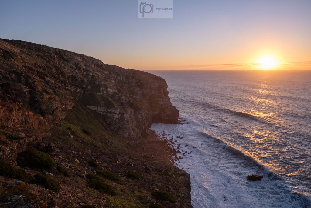
As the sunset was approaching fast, I walked back towards the look out point over Arrifana. I had with me two lenses, one wide angle and one standard, and I used both. Facing north, the wind was stronger, so I had to make sure my tripod was firmly set. It is possible to walk along the top of the cliff, exploring several ledges that offer good view points to the north over the beach.
Arrifana beach.Boulder, cliffs, and beach.Sunset time.Sunset.
This was an excellent afternoon walk in this beautiful area, at the heart of the Vicentina coast.
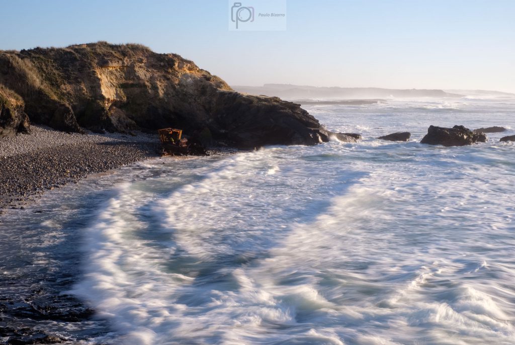
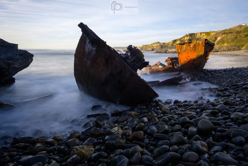
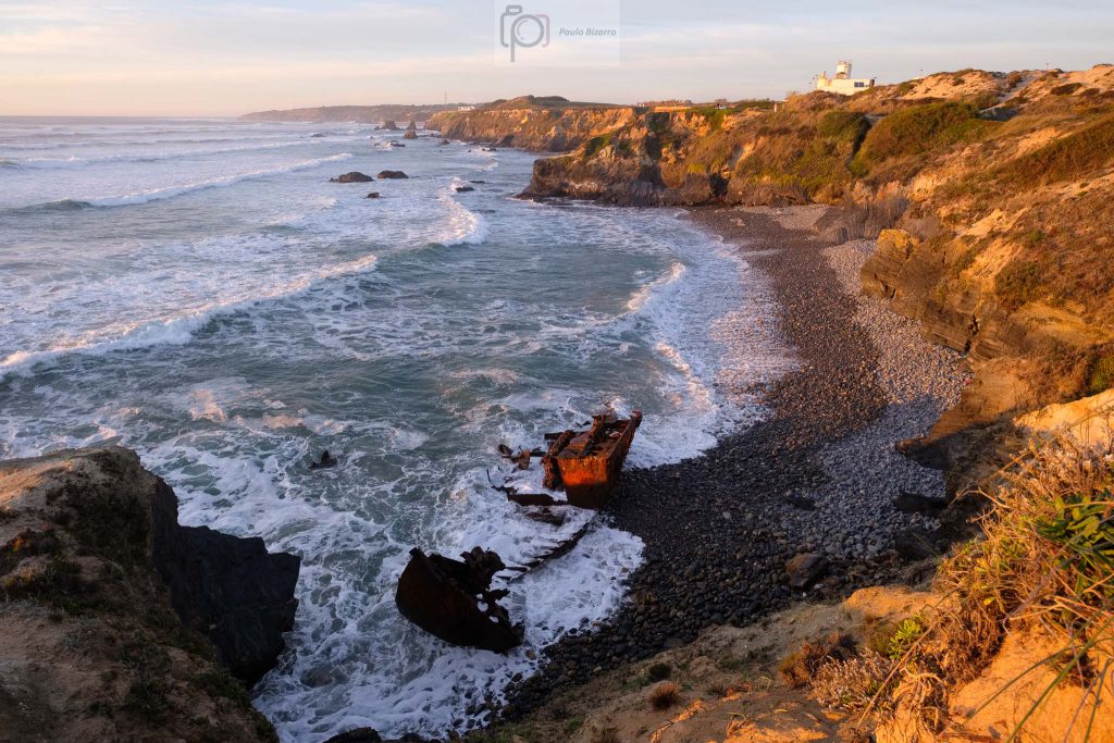
In December 1996, the Dutch boat Klemens got stranded in a small beach near Vila Nova de Milfontes, in the southwest coast of Portugal. This is a strange story, and to this day no one really knows why the boat ended up on the beach. Also, no one has reclaimed or salvaged the ship, so today the Klemens is a sort of tourist attraction. I had not visited this beach for several years, so I recently returned to see how the rusty boat remnants were faring.
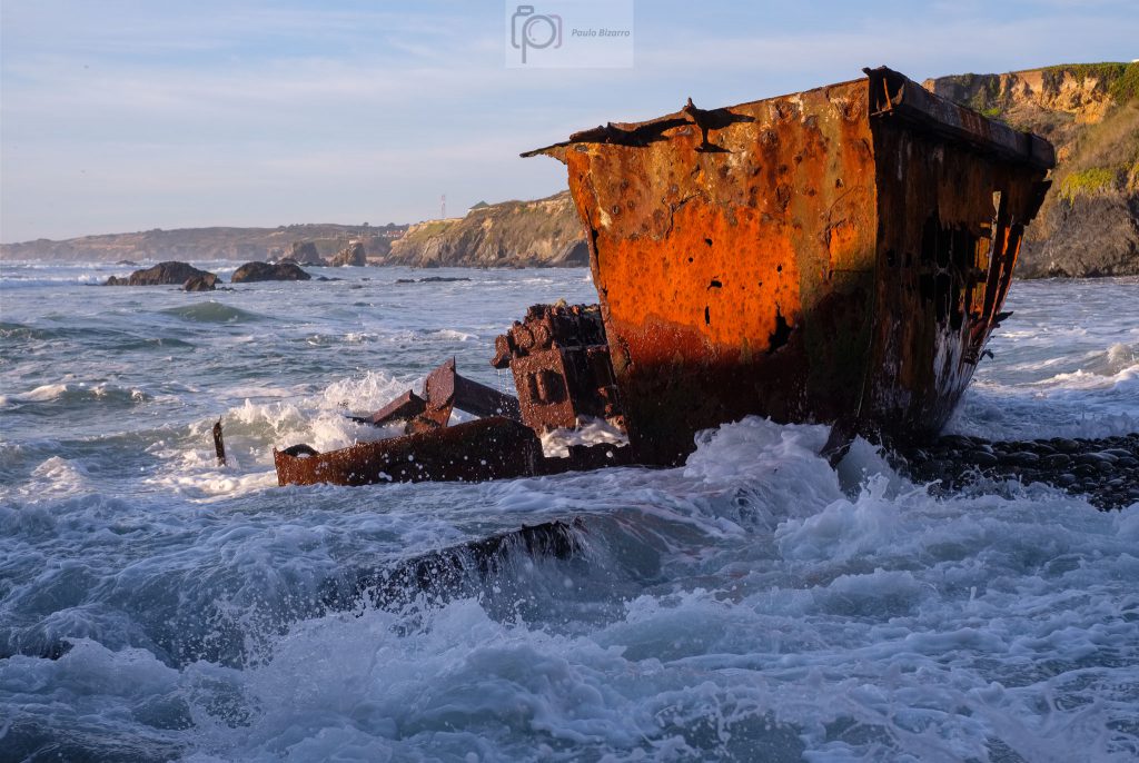
A few years later, the ship’s hull has been broken in two, and the rusty remains continue to be battered by the sea.
The Klemens’ final resting place, in the Patacho beach near Milfontes.
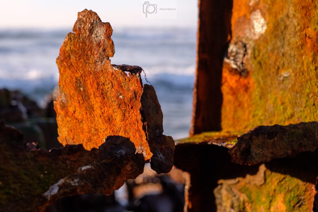
When the tide is low, it is possible to go down to the beach to get a really close look. I made several photos, while trying to dodge the waves. Still, I could not avoid getting my feet wet. The rusty color under the near sunset light was quite strong.
Rusting away.Crashing waves.Detail.Rising tide.
With the rising tide, I left the beach, to make a few more photos from the top of the cliffs. Then I simply sat on the ground and enjoyed the sunset.
From above.Overview.Sunset quiet.Colorful clouds at sunset.At day’s end.
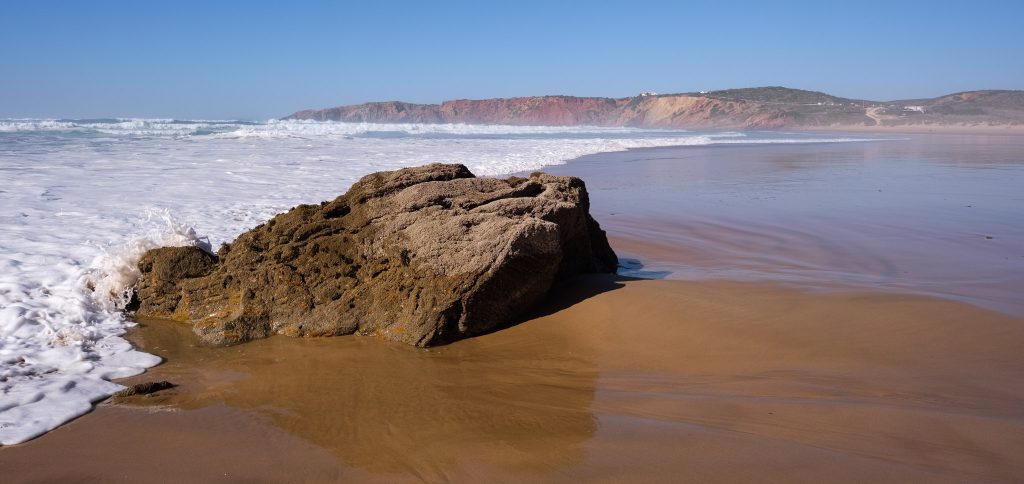
I have visited the Brejo Largo beach, near Almograve (in southwest Portugal), so many times, that I have lost count. I still remember my first visit, around 40 years ago, as a teenager; back then, the beaches along this coastline were basically empty of people. Not so today, of course, but they have not lost their beauty and uniqueness.
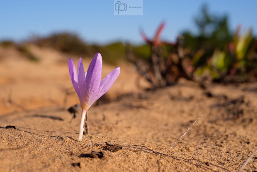
Brejo Largo can be reached by foot, or driving along a dirt track that is sometimes challenging. Me, I still prefer to walk there from the village of Longueira, because the countryside is nice, with some farmland and pasture hugging the coastal sand dunes. One other reason for walking is that sometimes there are surprises along the way. Like the small pink flower that I found growing in the dune.
Dune flower.
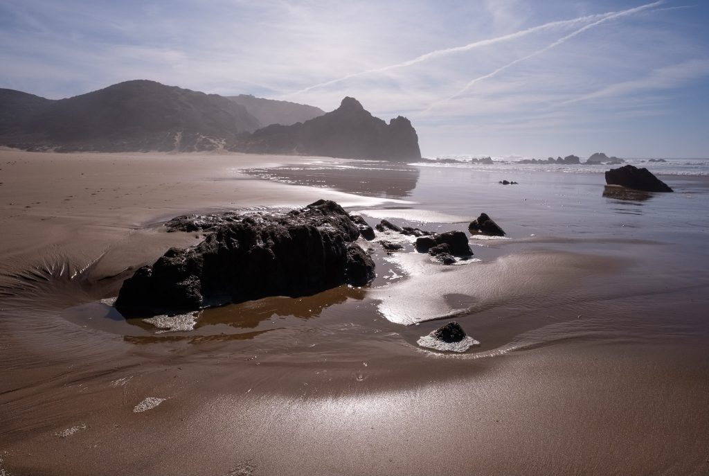
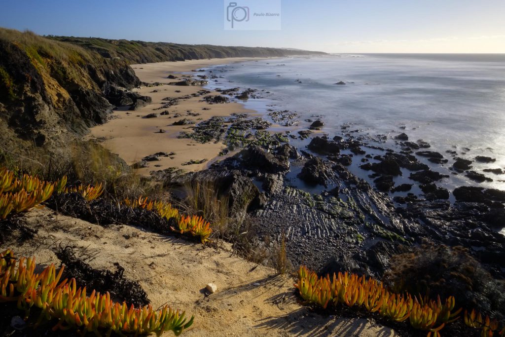
My favourite time of the year to visit is probably Autumn and Winter, when the sunset is early and the light is softer. This time I arrived a couple of hours before sunset, and given that the tide was low, there were plenty of little rocky coves and tidal pools to explore. The low tide also exposed a few interesting volcanic lodes that have been intruded in the schist during the opening of the Atlantic ocean.
Overview of Brejo Largo beach, looking south.Volcanic lode intruded in rocks.
In the last few years, this coastal area has seen a lot of sand being accumulated, creating different beach profiles and burying many of the previously outcropping rocks. Still, there are many rocks that still poke through the sand, creating the possibility of interesting foreground to background compositions. This means I was busy putting my Fujinon 14mm lens to good use.
Low tide.Exposed.Following the volcanic intrusion.
Walking along the beach, I made a few photos of the small tidal water rivulets running in the wet sand. Sometimes the soft wet sand played some tricks and my feet would be buried in it, but it was a small price to pay.
Flowing.Tidal pools.
This time, the sky was clear, with no clouds, which makes it less interesting. Still, it was a nice blue colour and crisp, so I ended up including a sliver of it in my photos. As the sunset approached, the light became warmer, bathing the cliffs and the sand in wonderful golden tones.
Reflected cliffs.Low tide sunset.
The only other person I saw was a fisherman, who ended up appearing in one of my sunset photos.
Fisherman at sunset.
Once the sun was gone, I slowly made my way back up the cliff. The wind was picking up and was cooling rapidly, but I had time for a few extra photos, especially from the long grasses blowing on the top of the dune.
Wind on coastal grass.
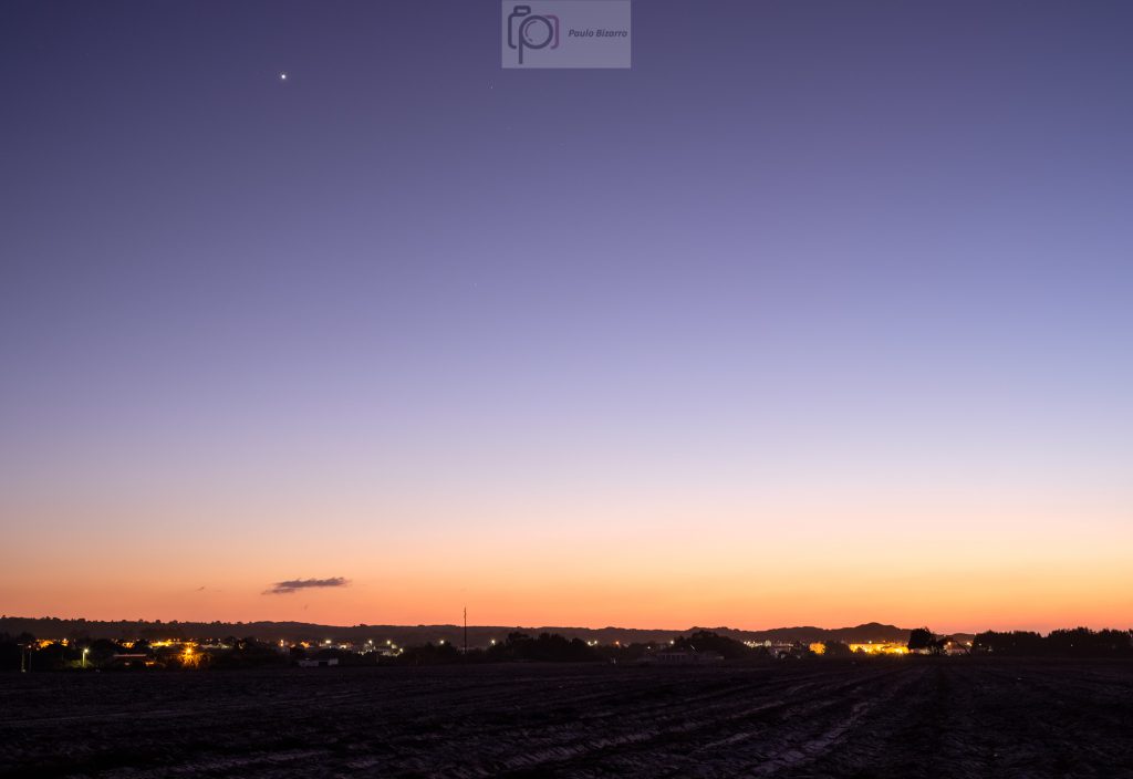
It is difficult to stop photographing in this place, because new things are always drawing the attention. At dusk, I was already close to Longueira, when I stopped again to photograph the lights above (Venus) and below (Almograve village). I know that I will return to this beach many times more, probably making similar photos to the ones I have made before; but that is fine to me, because the important thing is to experience the nature and the beauty of the place.
This article is about another trail that I have walked recently, and that belongs to the Vicentina route network. It is (circular) route number 14, and starts in the village of Odeceixe (see map below).
Map of trail number 14 of the Vicentina route, in southwest Portugal.
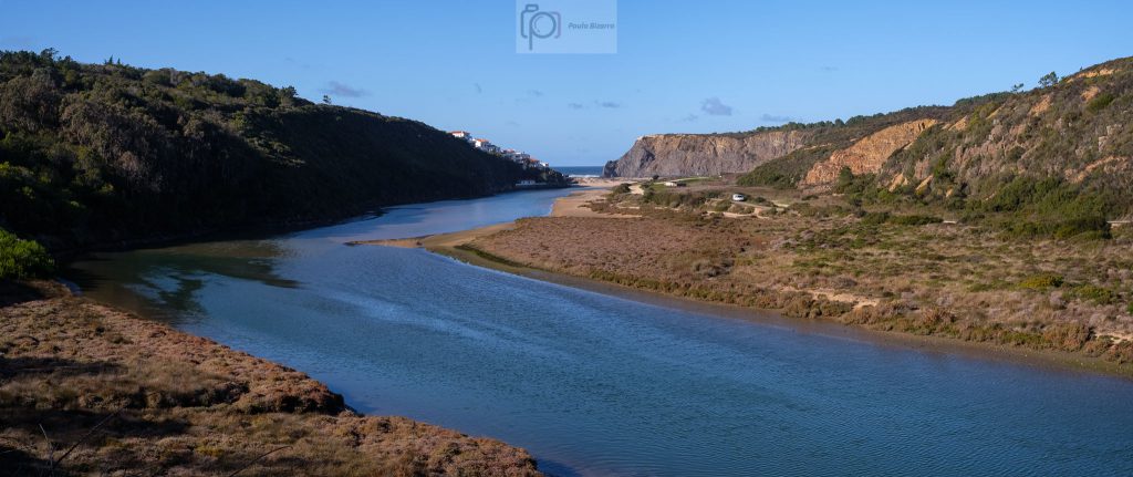
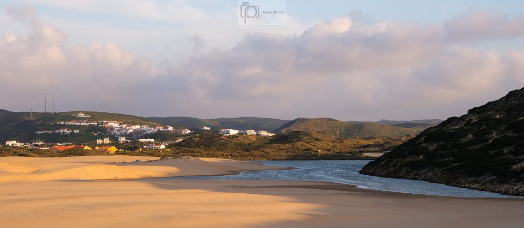
The path goes through diversified landscapes, mixing in rural and coastal scenery. Odeceixe overlooks the valley of the river Seixe, whose source lies in the Algarve foothills. Only a few kilometres to the west, the river reaches the Atlantic ocean in the famous beach of Odeceixe. The interaction between the land and the sea gives rise to unique ecosystems and to a way of life that combines farming and fishing.
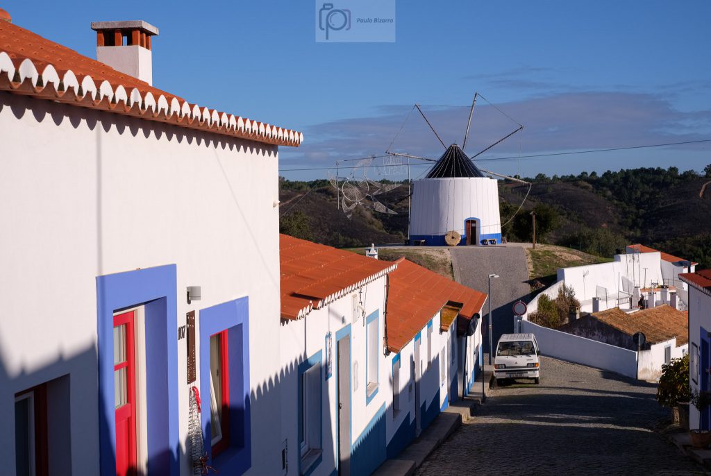
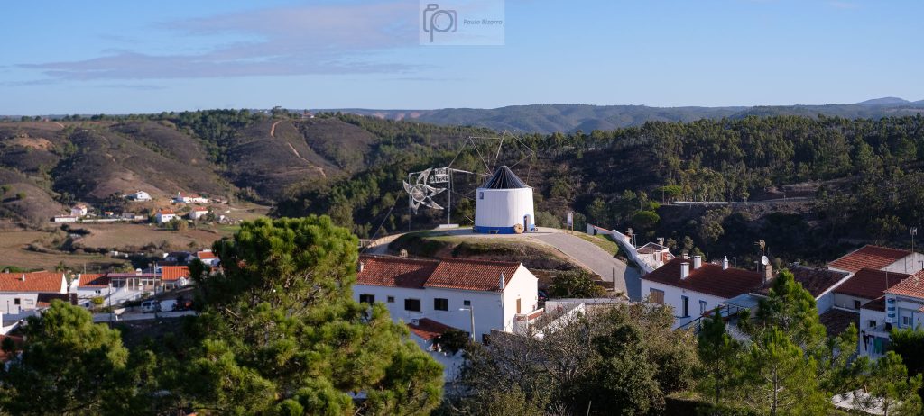
The first few hundreds metres of the trail cross the village, leading all the way up to the windmill. The narrow streets and typical houses have their own charm. From here, the view opens up over the valley. It is worth taking some time to admire the scenery.
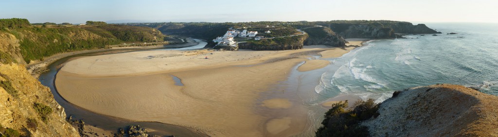
Typical Odeceixe street.Panorama of the Seixe river valley, assembled from several photos.Panorama of Odeceixe village, with the windmill on top of the hill. Assembled from several photos.
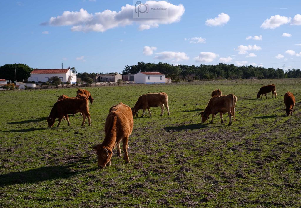
Leaving the village behind, the next leg of the trail crosses some pine forests and farms. Here and there, a few cows are grazing in the fields. Making a living from the land and the sea is difficult, and the local economy is increasingly dependent on tourism.
Grazing cows along the trail.Small farm.
The trail is well sign posted, but pay attention not to miss the 90 degree turn to the right, that leads to the coast. From here, the path follows a narrow tarmac municipal road that crosses a land that becomes more influenced by the sea, with increasing coastal sand dunes and small trees that are bent by the wind. After reaching the coast, the trail becomes a simple sandy footpath, but it is easy to follow. The seascape is typical of the Vicentina coast, with tall dark cliffs and heavy seas.
Looking south along the coast, when the trail reaches the sea.
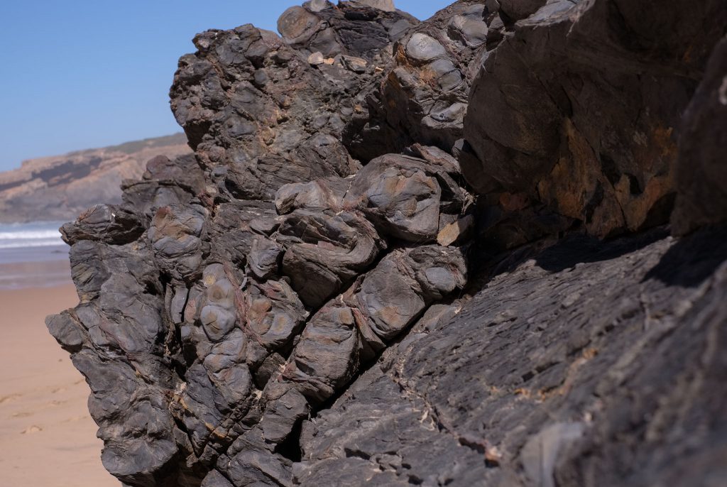
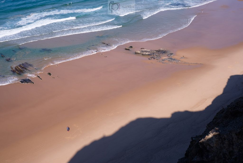
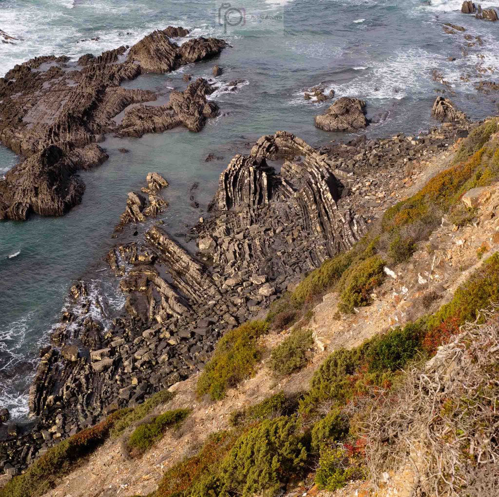
This section of the trail affords wonderful views of the cliffs and the sea, with the waves crashing against the rocks. These are very old rocks, that have been subjected to incredible tectonic forces and upheavals. It is worth spending some time admiring the numerous folded outcrops, especially if the tide is low.
Folded layers of rock.
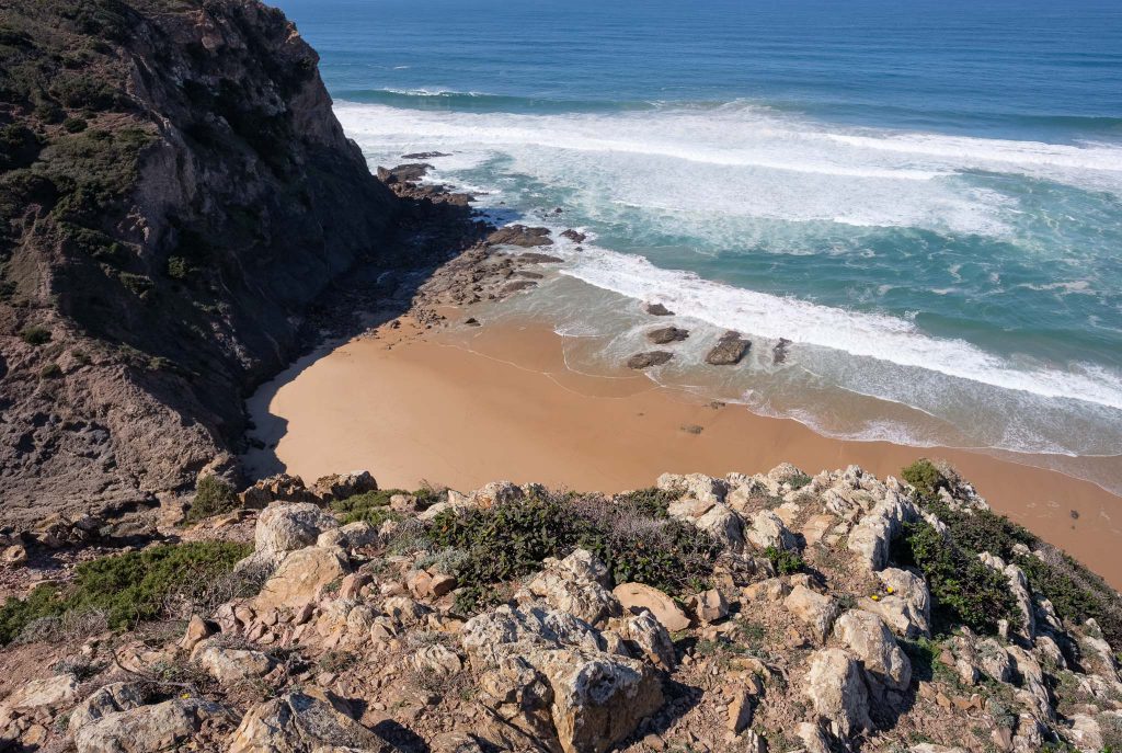
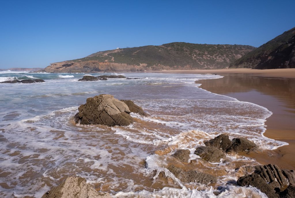
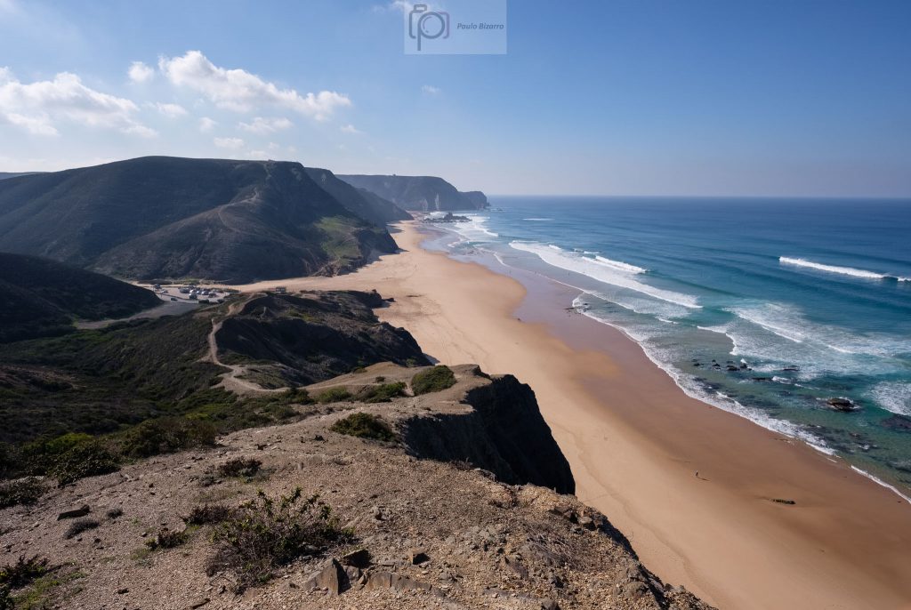
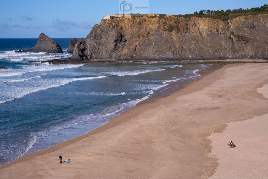
The Odeceixe beach is always busy in the summer months, but in early December not so much. The view from the top is incredible, with the large area of golden sand ensconced between the cliffs. To the north, the mouth of river Seixe creates a small estuary.
Odeceixe beach.
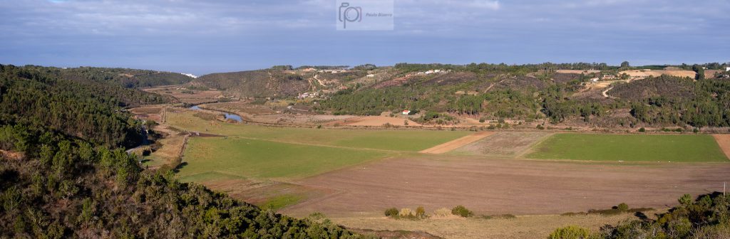
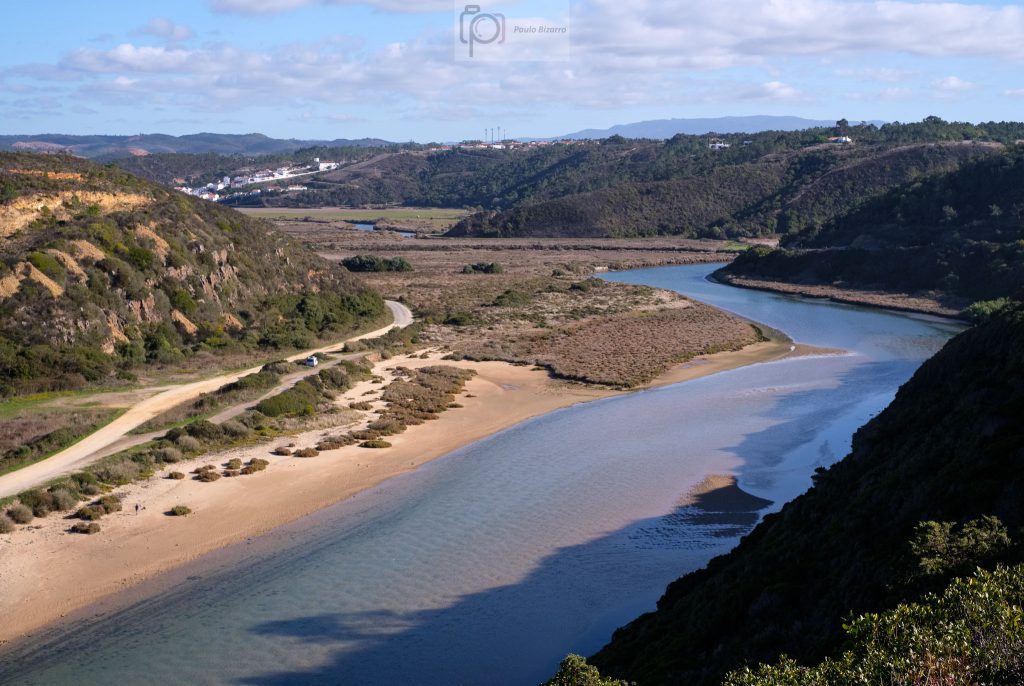
From the beach the trail follows the valley, returning to the village. This is another wonderful walk that permits a close contact with one of the iconic areas of the Southwest Alentejo and Vicentina Coast natural park.
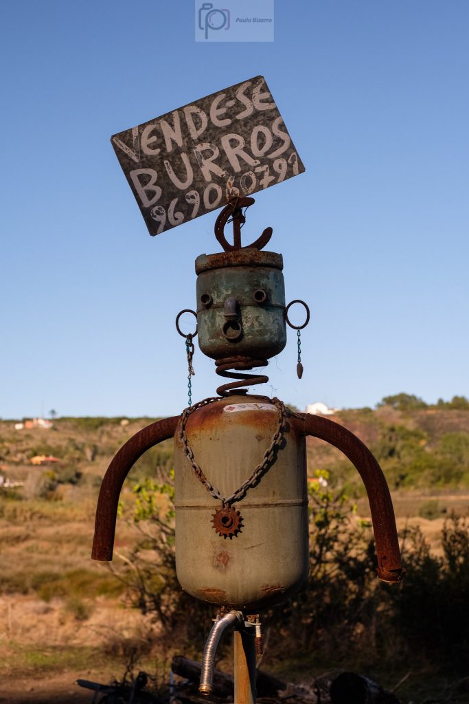
Looking along the Seixe river valley, with the Odeceixe village in the distance.An inventive add for selling donkeys.Panorama of the river Seixe looking towards the sea, assembled from several photos.
Regarding photography, I always like to keep it simple on the trail. I only carried my Fujifilm X-Pro3 and Fujinon 35mm f/1.4 lens. When the scene required a wider angle of view, I took enough photos for later panorama assembly.